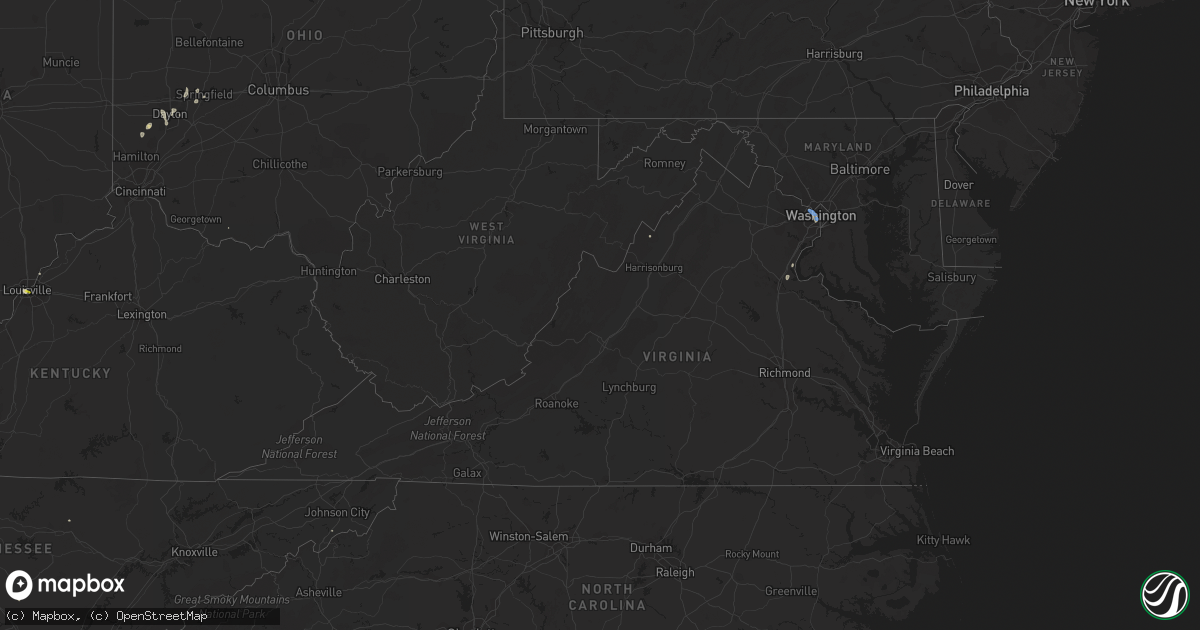
Hail Map in Virginia on August 26, 2021
Get this storm
August 26 map
$229
one time, instant access
Download today. No call, no setup
Keep the $229
Bought the map and want the full workflow? Apply the entire $229 to a subscription within 7 days. None of it is wasted.
Every map, not just this one
This buys you this map. Subscription and you get every map we run, in the markets you choose from a few cities to whole states to nationwide. Plus real-time alerts the moment a storm fires.
Contact data
Name, contact info, occupancy, even credit band for addresses in the footprint. You go from where it hit to who to call.
Become the source they trust
Unlimited branding weather history reports on demand. You already have the documented answer ready for the property owner, and you are the one who showed up with it.
Property data and RoofTrace estimates
Pull up any address you have got, its value and the exact code rules for that jurisdiction, straight from One Click Code. Then RoofTrace estimates the squares, pitch, and roof value, priced the way you price.
Storm reports in Virginia
Virginia
| Date | Description |
|---|---|
| 08/26/20216:44 PM CDT | 2 cherry trees uprooted and 2 trees snapped near the intersection of hunsper lane and enchanting drive |
| 08/26/20213:17 PM CDT | Trees down on southbound george washington parkway at va-123 dolley madison boulevard/chain bridge road. |
| 08/26/20213:05 PM CDT | Trees down on i-66 custis memorial parkway near mile marker 73. |
| 08/26/20213:05 PM CDT | Two to three dozen reports of trees and wires down in arlington. |
| 08/26/20212:43 PM CDT | Multiple trees down near the intersection of 14th street and south pollard street |
| 08/26/20212:34 PM CDT | Tree down on the 1900 block of south howard street |
| 08/26/20211:40 PM CDT | Tree down on northbound va-627 forbes street near thomas jefferson place. |
| 08/26/20211:40 PM CDT | Trees down in the 2100 block of va-608 brooke road... And near the intersection of va-608 brooke road and va-628 eskimo hill road. |
| 08/26/20211:40 PM CDT | Tree down in the 100 block of pine view drive. |
| 08/26/20211:30 PM CDT | Trees down near the intersection of us-1 jefferson davis highway and shady hill lane. |
| 08/26/202112:50 PM CDT | Tree down on power lines in the 100 block of va-635 decatur road. |
| 08/26/202112:48 PM CDT | Tree down on northbound us-1 jefferson davis highway near va-637 telegraph road. |
| 08/26/202112:43 PM CDT | Tree down on route 1 near the intersection with joplin road |
| 08/25/202110:20 PM CDT | At 320 PM EDT, a severe thunderstorm was located 10 miles west of Rough Run, moving east at 10 mph. HAZARD...60 mph wind gusts and quarter size hail. SOURCE...Radar indicated. IMPACT...Damaging winds will cause some trees and large branches to fall. This could injure those outdoors, as well as damage homes and vehicles. Roadways may become blocked by downed trees. Localized power outages are possible. Unsecured light objects may become projectiles. Locations impacted include... Petersburg, Rough Run, Masonville, Milam, Welton, Cabins, Landes, Hopeville, Dorcas, Brushy Run, Brake and Seneca Rocks. |
| 08/25/20219:20 PM CDT | At 220 PM EDT, a severe thunderstorm was located over Stafford, and is nearly stationary. HAZARD...60 mph wind gusts. SOURCE...Radar indicated. IMPACT...Damaging winds will cause some trees and large branches to fall. This could injure those outdoors, as well as damage homes and vehicles. Roadways may become blocked by downed trees. Localized power outages are possible. Unsecured light objects may become projectiles. Locations impacted include... Stafford, Aquia Creek, Falmouth, Brooke, Stones Corner, Leeland, White Oak, Brookfield and Spring Valley. |
| 08/25/20218:25 PM CDT | At 125 PM EDT, a severe thunderstorm was located just southwest of Quantico, and is nearly stationary. HAZARD...60 mph wind gusts. SOURCE...Radar indicated. IMPACT...Damaging winds will cause some trees and large branches to fall. This could injure those outdoors, as well as damage homes and vehicles. Roadways may become blocked by downed trees. Localized power outages are possible. Unsecured light objects may become projectiles. Locations impacted include... Quantico, Triangle, Cherry Hill, Widewater, Aquia and Arkendale. |
All States Impacted by Hail Map on August 26, 2021
Cities Impacted by Hail Map on August 26, 2021
- Malta, MT
- Litchfield, NE
- Loup City, NE
- Montezuma, IA
- Draper, SD
- Vona, CO
- Seibert, CO
- Pittsville, WI
- Monticello, UT
- Rutherfordton, NC
- Canton, SD
- Saint Paul, NE
- Dannebrog, NE
- Raymond, SD
- Newport, NE
- Anthon, IA
- Correctionville, IA
- Lodge Grass, MT
- Atkinson, NE
- Stuart, NE
- Clark, SD
- Frankfort, SD
- Doland, SD
- Pipestone, MN
- Holland, MN
- Flagler, CO
- Peever, SD
- Hemingford, NE
- Ainsworth, NE
- Bassett, NE
- Gray, IA
- Manning, IA
- Audubon, IA
- Page, NE
- Inwood, IA
- Rock Valley, IA
- Concord, IL
- Jacksonville, IL
- Arenzville, IL
- Chapin, IL
- Chester, IA
- Le Roy, MN
- Sigourney, IA
- Hedrick, IA
- Keswick, IA
- Fairfield, IA
- Ollie, IA
- Richland, IA
- What Cheer, IA
- Harper, IA
- Webster, IA
- Packwood, IA
- Winner, SD
- Ideal, SD
- California, MO
- Winnett, MT
- Sand Springs, MT
- Mosby, MT
- Brusett, MT
- Ord, NE
- Johnston, IA
- Arcadia, NE
- Fulks Run, VA
- Moulton, IA
- Unionville, IA
- Colome, SD
- Dallas, SD
- Saint Xavier, MT
- Pawnee, IL
- Doon, IA
- Trimont, MN
- Odin, MN
- Charles City, IA
- Sumner, IA
- Westgate, IA
- Goodland, KS
- Edson, KS
- Mexico, MO
- Elgin, NE
- Meadow Grove, NE
- Battle Creek, NE
- Norfolk, NE
- Oakdale, NE
- Tilden, NE
- Petersburg, NE
- Ogden, IA
- Bloomfield, IA
- Windom, MN
- Elsmere, NE
- Johnstown, NE
- Hinton, IA
- Assumption, IL
- Tower Hill, IL
- Pana, IL
- Goodlettsville, TN
- Greenbrier, TN
- Nora Springs, IA
- Floyd, IA
- Rudd, IA
- Osage, IA
- Springview, NE
- Garryowen, MT
- Shelbyville, IL
- McDonald, KS
- Beresford, SD
- Guthrie Center, IA
- Panora, IA
- Stuart, IA
- Gibson, IA
- Nashville, TN
- Pierre, SD
- North Loup, NE
- Albion, NE
- Spalding, NE
- Greeley, NE
- Scotia, NE
- Sherburn, MN
- Greenfield, IL
- Hettick, IL
- Ellsworth, NE
- Hay Springs, NE
- Alliance, NE
- Rushville, NE
- Sells, AZ
- Milmine, IL
- Bingham Lake, MN
- White Hall, IL
- Wrights, IL
- Carrollton, IL
- Roodhouse, IL
- Bird City, KS
- Lake Wilson, MN
- Slayton, MN
- Ashland City, TN
- Mulberry Grove, IL
- Smithboro, IL
- Greenville, IL
- Donnellson, IL
- Cushing, IA
- New Sharon, IA
- Oskaloosa, IA
- Medway, OH
- New Carlisle, OH
- Palmyra, IL
- Onida, SD
- Cresco, IA
- Bingham, NE
- Hamlin, IA
- Exira, IA
- Westerville, NE
- Comstock, NE
- Hayes Center, NE
- Wallingford, IA
- Graettinger, IA
- Ringsted, IA
- Terril, IA
- Estherville, IA
- Ruthven, IA
- Wood, SD
- Murdo, SD
- Luana, IA
- Waukon, IA
- Quincy, IL
- Woodbine, IA
- Lakefield, MN
- Mills, NE
- Sharon Springs, KS
- Weskan, KS
- Lovington, IL
- Arthur, IL
- Atwood, IL
- Bruce, SD
- McIntire, IA
- Taopi, MN
- Kensett, IA
- Orchard, IA
- Carpenter, IA
- Saint Ansgar, IA
- Plymouth, IA
- Mason City, IA
- Glenville, MN
- Northwood, IA
- Grafton, IA
- Kit Carson, CO
- Lone Rock, IA
- Pisgah, IA
- Tekamah, NE
- Little Sioux, IA
- Mondamin, IA
- Butler, IL
- Litchfield, IL
- Ortley, SD
- Waubay, SD
- Spirit Lake, IA
- Lakota, IA
- Buffalo Center, IA
- Akron, OH
- Center, MO
- New London, MO
- Monroe City, MO
- Redfield, SD
- Rockham, SD
- Round Lake, MN
- Worthington, MN
- Okabena, MN
- Murrayville, IL
- Franklin, IL
- Mount Vernon, SD
- Pocahontas, IL
- Musselshell, MT
- Morrisonville, IL
- Farmersville, IL
- Waggoner, IL
- Harvel, IL
- Girard, IL
- Virden, IL
- Downing, MO
- Rose Hill, IA
- Delta, IA
- Bighorn, MT
- Heron Lake, MN
- Hugo, CO
- Karval, CO
- Erwin, TN
- Fennimore, WI
- Mount Hope, WI
- Woodman, WI
- Green River, UT
- Dexter, IA
- Hilger, MT
- Hayes, SD
- Fort Pierre, SD
- Irene, SD
- Viborg, SD
- Burwell, NE
- Mission, SD
- Babcock, WI
- Black River Falls, WI
- Warrens, WI
- Neillsville, WI
- Hanksville, UT
- Denison, IA
- Nicholson, PA
- Hop Bottom, PA
- Highmore, SD
- George, IA
- Irwin, IA
- Manilla, IA
- Adair, IA
- Drakesville, IA
- Milton, IA
- Floris, IA
- Douds, IA
- Springfield, OH
- Utica, SD
- Valentine, NE
- Lawton, IA
- Dixon, MO
- Waucoma, IA
- Hawkeye, IA
- Hudson, SD
- Crofton, NE
- North Platte, NE
- Bethany, IL
- Owaneco, IL
- Nokomis, IL
- Findlay, IL
- Taylorville, IL
- Ohlman, IL
- Rosamond, IL
- Lakewood, IL
- Fremont, IA
- White River, SD
- Forsyth, MT
- Leighton, IA
- Defiance, OH
- Continental, OH
- Metamora, IN
- Laurel, IN
- Pleasant Hill, IL
- Pierce, NE
- Stacyville, IA
- Ostrander, MN
- Riceville, IA
- Alvord, IA
- Holstein, IA
- River Falls, WI
- Beldenville, WI
- Boone, IA
- Dayton, OH
- Odin, IL
- Sandoval, IL
- Kingsley, IA
- Menno, SD
- Lesterville, SD
- Fredericksburg, IA
- Monona, IA
- Butterfield, MN
- Jackson, MN
- Alpha, MN
- Forest Grove, MT
- Mehoopany, PA
- Harrold, SD
- Holabird, SD
- Marthasville, MO
- Wood Lake, NE
- Batavia, IA
- Ottumwa, IA
- Agency, IA
- Dalton City, IL
- Moweaqua, IL
- Mt Zion, IL
- Belgrade, MN
- Atlanta, IN
- Arcadia, IN
- Oneill, NE
- Inman, NE
- Chambers, NE
- Clearwater, NE
- Earlham, IA
- Farmersville, OH
- Germantown, OH
- Creston, NC
- Lansing, NC
- Malcom, IA
- Grinnell, IA
- Searsboro, IA
- Barnes City, IA
- Huron, SD
- Cavour, SD
- Artesian, SD
- Vail, IA
- Ida Grove, IA
- Battle Creek, IA
- Whites Creek, TN
- Grenville, SD
- Merriman, NE
- Hull, IA
- South English, IA
- Oto, IA
- Waverly, IL
- Bancroft, IA
- Hays, MT
- Jamestown, MO
- Louisville, KY
- Johnson City, TX
- Bristol, VT
- Kirkman, IA
- Dunlap, IA
- Sullivan, MO
- Louisiana, MO
- Clarksville, MO
- Wright City, MO
- Defiance, MO
- Augusta, MO
- Odebolt, IA
- Blanco, TX
- Hye, TX
- Stonewall, TX
- Brookville, IN
- Lewistown, MT
- Livingston, TX
- Chester, TX
- Browns Valley, MN
- Summit, SD
- Sisseton, SD
- Morrison, TN
- Gackle, ND
- Streeter, ND
- Dunnell, MN
- Mountain Lake, MN
- Sedgwick, CO
- Postville, IA
- Bartley, NE
- Washington, DC
- Gays, IL
- Windsor, IL
- Burt, IA
- Titonka, IA
- Saint Louis, MO
- Columbia, MO
- Rickman, TN
- Monterey, TN
- Onalaska, TX
- Algona, IA
- Fredericksburg, VA
- Stafford, VA
- Hot Springs, NC
- Wesley, IA
- Winchester, IL
- Winnebago, MN
- Plainview, NE
- Pulaski, IA
- Leasburg, MO
- Mapleton, MN
- Wyola, MT
- Mission Hill, SD
- Centerville, SD
- Champaign, IL
- Oelwein, IA
- Maynard, IA
- Fairbank, IA
- Charter Oak, IA
- Hawk Point, MO
- Troy, MO
- Warrenton, MO
- Owensville, MO
- Balaton, MN
- Ruthton, MN
- Ewing, NE
- Stoutsville, MO
- Arlington, VA
- McLean, VA
- Castell, TX
- Llano, TX
- Flatonia, TX
- Indianola, IL
- Fowler, IL
- Grass Range, MT
- Silex, MO
- Fenton, IA
- Cylinder, IA
- Dickens, IA
- Hillview, IL
- Ellendale, ND
- Laddonia, MO
- Rush Hill, MO
- Springfield, TN
- Rockwood, PA
- Lancaster, WI
- Prairie Du Chien, WI
- Maryland Heights, MO
- Moorhead, IA
- Saint Francis, KS
- Grand Junction, IA
- Dana, IA
- Missouri Valley, IA
- Logan, IA
- Blair, NE
- Herman, NE
- Argenta, IL
- Decatur, IL
- Perry, MO
- Shelbyville, TX
- Ashton, NE
- Neligh, NE
- Harman, WV
- Martinsburg, IA
- Cedar, IA
- New Albany, IN
- Granite Falls, MN
- Sacred Heart, MN
- Raymond, IL
- Irving, IL
- Lu Verne, IA
- Mode, IL
- Beecher City, IL
- Miller, SD
- Casey, IA
- Galva, IA
- Schaller, IA
- Arthur, IA
- Coleridge, NE
- Laurel, NE
- Belden, NE
- Stratton, NE
- Bluffs, IL
- Meredosia, IL
- Sioux City, IA
- Santa Fe, MO
- Steuben, WI
- Wauzeka, WI
- Corrigan, TX
- Divernon, IL
- Glenarm, IL
- Menlo, IA
- Redfield, IA
- Brunswick, NE
- Ivesdale, IL
- Modale, IA
- Aspinwall, IA
- Rock Springs, WY
- Deep River, IA
- Verdigre, NE
- Strasburg, IL
- Hancock, VT
- Junction, TX
- Busby, MT
- Sauk Rapids, MN
- Saint Cloud, MN
- Diboll, TX
- Hudson, IA
- Blakesburg, IA
- Webster, SD
- Woonsocket, SD
- Penfield, IL
- Potomac, IL
- Spring Valley, WI
- Morganton, NC
- Pittsfield, IL
- Pearl, IL
- Ridgeway, IA
- Calmar, IA
- Sulphur, LA
- Fairview, SD
- Danville, IL
- Lapel, IN
- Anderson, IN
- Prospect, KY
- Bourbon, MO
- Armstrong, IA
- Milford, IA
- Rake, IA
- Emmetsburg, IA
- Swea City, IA
- Mountain Home, TX
- Somerville, OH
- Middletown, OH
- Camden, OH
- Mathias, WV
- Baker, WV
- Lost City, WV
- Nashua, IA
- Cicero, IN
- Noblesville, IN
- Smithville, TX
- West Union, OH
- Carlinville, IL
- Forest City, IA
- Fort Myer, VA
- Alexandria, VA
- Osmond, NE
- Bastrop, TX
- Red Rock, TX
- Hawarden, IA
- Sioux Center, IA
- Florence, SD
- Orient, SD
- Garden City, SD
- Gary, SD
- Faulkton, SD
- Strandburg, SD
- Watertown, SD
- Revillo, SD
- Canby, MN
- Clear Lake, SD
- Henry, SD
- Turton, SD
- Northville, SD
- Ashton, SD
- Goodwin, SD
- Marietta, MN
- Kranzburg, SD
- Cresbard, SD
- Beardsley, MN
- Wilmot, SD
- Brandt, SD
- Estelline, SD
- Hayti, SD
- Bryant, SD
- Hazel, SD
- Vienna, SD
- Astoria, SD
- Willow Lake, SD
- Castlewood, SD
- Lake Norden, SD
- Toronto, SD
- Lake Preston, SD
- Erwin, SD
- Iroquois, SD
- De Smet, SD
- Arlington, SD
- Matlock, IA
- Alton, IA
- Sheldon, IA
- Maurice, IA
- Archer, IA
- Hospers, IA
- Orange City, IA
- Ireton, IA
- Wakonda, SD
- Granville, IA
- Alcester, SD
- Ashton, IA
- Boyden, IA
- Midland, SD
- Blunt, SD
- Marcus, IA
- Washta, IA
- Moville, IA
- Pierson, IA
- Cleghorn, IA
- Le Mars, IA
- Remsen, IA
- Danvers, MN
- Benson, MN
- Glenwood, MN
- Eden Prairie, MN
- Hopkins, MN
- Minneapolis, MN
- Shakopee, MN
- Saint Paul, MN
- Lakeville, MN
- Rosemount, MN
- Burnsville, MN
- Inver Grove Heights, MN
- Savage, MN
- Prior Lake, MN
- Newport, MN
- South Saint Paul, MN
- Auburn, IA
- Wall Lake, IA
- Lohrville, IA
- Lake View, IA
- Sac City, IA
- Lytton, IA
- Early, IA
- Lake City, IA
- Rockwell City, IA
- Jefferson, IA
- Glidden, IA
- Ralston, IA
- Coon Rapids, IA
- Carroll, IA
- Lidderdale, IA
- Scranton, IA
- Keota, IA
- Hayesville, IA
- Brighton, IA
- Colby, KS
- Herndon, KS
- Danbury, NE
- Oberlin, KS
- Atwood, KS
- McCook, NE
- Indianola, NE
- Ludell, KS
- Culbertson, NE
- Kanorado, KS
- Rapid City, SD
- Box Elder, SD
- Caputa, SD
- Hill City, SD
- New Underwood, SD
- Hermosa, SD


