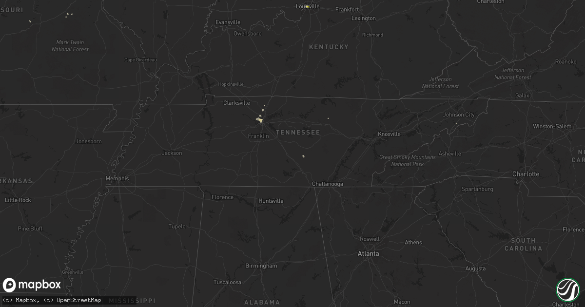
Hail Map in Tennessee on August 26, 2021
Get this storm
August 26 map
$229
one time, instant access
Download today. No call, no setup
Keep the $229
Bought the map and want the full workflow? Apply the entire $229 to a subscription within 7 days. None of it is wasted.
Every map, not just this one
This buys you this map. Subscription and you get every map we run, in the markets you choose from a few cities to whole states to nationwide. Plus real-time alerts the moment a storm fires.
Contact data
Name, contact info, occupancy, even credit band for addresses in the footprint. You go from where it hit to who to call.
Become the source they trust
Unlimited branding weather history reports on demand. You already have the documented answer ready for the property owner, and you are the one who showed up with it.
Property data and RoofTrace estimates
Pull up any address you have got, its value and the exact code rules for that jurisdiction, straight from One Click Code. Then RoofTrace estimates the squares, pitch, and roof value, priced the way you price.
Storm reports in Tennessee
Tennessee
| Date | Description |
|---|---|
| 08/26/20216:13 PM CDT | Trees and power lines were reported down on herbert shannon road and maxie jones road |
| 08/26/20215:47 PM CDT | Large tree fell on a truck. |
| 08/26/20211:59 AM CDT | At 659 PM CDT, a severe thunderstorm was located over Nashville, and is nearly stationary. HAZARD...60 mph wind gusts. SOURCE...Radar indicated. IMPACT...Expect damage to roofs, siding, and trees. Locations impacted include... Nashville, Forest Hills, Belle Meade, Joelton, Berry Hill, Beaman Park, Bells Bend and Whites Creek.This includes the following highways... Interstate 40 between mile markers 201 and 212. Interstate 65 between mile markers 81 and 93. Interstate 24 between mile markers 35 and 49. |
| 08/25/202111:50 PM CDT | At 449 PM EDT, a severe thunderstorm was located 7 miles south of Newport, moving southeast at 10 mph. HAZARD...60 mph wind gusts and quarter size hail. SOURCE...Radar indicated. IMPACT...Hail damage to vehicles is expected. Expect wind damage to roofs, siding, and trees. Locations impacted include... Newport, Cosby, Hartford, Max Patch and Waterville. This includes Interstate 40 in Tennessee between mile markers 435 and451. |
| 08/25/20217:10 PM CDT | A tree was blown down on kings lane in bordeaux. Power lines were reported down in north nashville. |
All States Impacted by Hail Map on August 26, 2021
Cities Impacted by Hail Map on August 26, 2021
- Malta, MT
- Litchfield, NE
- Loup City, NE
- Montezuma, IA
- Draper, SD
- Vona, CO
- Seibert, CO
- Pittsville, WI
- Monticello, UT
- Rutherfordton, NC
- Canton, SD
- Saint Paul, NE
- Dannebrog, NE
- Raymond, SD
- Newport, NE
- Anthon, IA
- Correctionville, IA
- Lodge Grass, MT
- Atkinson, NE
- Stuart, NE
- Clark, SD
- Frankfort, SD
- Doland, SD
- Pipestone, MN
- Holland, MN
- Flagler, CO
- Peever, SD
- Hemingford, NE
- Ainsworth, NE
- Bassett, NE
- Gray, IA
- Manning, IA
- Audubon, IA
- Page, NE
- Inwood, IA
- Rock Valley, IA
- Concord, IL
- Jacksonville, IL
- Arenzville, IL
- Chapin, IL
- Chester, IA
- Le Roy, MN
- Sigourney, IA
- Hedrick, IA
- Keswick, IA
- Fairfield, IA
- Ollie, IA
- Richland, IA
- What Cheer, IA
- Harper, IA
- Webster, IA
- Packwood, IA
- Winner, SD
- Ideal, SD
- California, MO
- Winnett, MT
- Sand Springs, MT
- Mosby, MT
- Brusett, MT
- Ord, NE
- Johnston, IA
- Arcadia, NE
- Fulks Run, VA
- Moulton, IA
- Unionville, IA
- Colome, SD
- Dallas, SD
- Saint Xavier, MT
- Pawnee, IL
- Doon, IA
- Trimont, MN
- Odin, MN
- Charles City, IA
- Sumner, IA
- Westgate, IA
- Goodland, KS
- Edson, KS
- Mexico, MO
- Elgin, NE
- Meadow Grove, NE
- Battle Creek, NE
- Norfolk, NE
- Oakdale, NE
- Tilden, NE
- Petersburg, NE
- Ogden, IA
- Bloomfield, IA
- Windom, MN
- Elsmere, NE
- Johnstown, NE
- Hinton, IA
- Assumption, IL
- Tower Hill, IL
- Pana, IL
- Goodlettsville, TN
- Greenbrier, TN
- Nora Springs, IA
- Floyd, IA
- Rudd, IA
- Osage, IA
- Springview, NE
- Garryowen, MT
- Shelbyville, IL
- McDonald, KS
- Beresford, SD
- Guthrie Center, IA
- Panora, IA
- Stuart, IA
- Gibson, IA
- Nashville, TN
- Pierre, SD
- North Loup, NE
- Albion, NE
- Spalding, NE
- Greeley, NE
- Scotia, NE
- Sherburn, MN
- Greenfield, IL
- Hettick, IL
- Ellsworth, NE
- Hay Springs, NE
- Alliance, NE
- Rushville, NE
- Sells, AZ
- Milmine, IL
- Bingham Lake, MN
- White Hall, IL
- Wrights, IL
- Carrollton, IL
- Roodhouse, IL
- Bird City, KS
- Lake Wilson, MN
- Slayton, MN
- Ashland City, TN
- Mulberry Grove, IL
- Smithboro, IL
- Greenville, IL
- Donnellson, IL
- Cushing, IA
- New Sharon, IA
- Oskaloosa, IA
- Medway, OH
- New Carlisle, OH
- Palmyra, IL
- Onida, SD
- Cresco, IA
- Bingham, NE
- Hamlin, IA
- Exira, IA
- Westerville, NE
- Comstock, NE
- Hayes Center, NE
- Wallingford, IA
- Graettinger, IA
- Ringsted, IA
- Terril, IA
- Estherville, IA
- Ruthven, IA
- Wood, SD
- Murdo, SD
- Luana, IA
- Waukon, IA
- Quincy, IL
- Woodbine, IA
- Lakefield, MN
- Mills, NE
- Sharon Springs, KS
- Weskan, KS
- Lovington, IL
- Arthur, IL
- Atwood, IL
- Bruce, SD
- McIntire, IA
- Taopi, MN
- Kensett, IA
- Orchard, IA
- Carpenter, IA
- Saint Ansgar, IA
- Plymouth, IA
- Mason City, IA
- Glenville, MN
- Northwood, IA
- Grafton, IA
- Kit Carson, CO
- Lone Rock, IA
- Pisgah, IA
- Tekamah, NE
- Little Sioux, IA
- Mondamin, IA
- Butler, IL
- Litchfield, IL
- Ortley, SD
- Waubay, SD
- Spirit Lake, IA
- Lakota, IA
- Buffalo Center, IA
- Akron, OH
- Center, MO
- New London, MO
- Monroe City, MO
- Redfield, SD
- Rockham, SD
- Round Lake, MN
- Worthington, MN
- Okabena, MN
- Murrayville, IL
- Franklin, IL
- Mount Vernon, SD
- Pocahontas, IL
- Musselshell, MT
- Morrisonville, IL
- Farmersville, IL
- Waggoner, IL
- Harvel, IL
- Girard, IL
- Virden, IL
- Downing, MO
- Rose Hill, IA
- Delta, IA
- Bighorn, MT
- Heron Lake, MN
- Hugo, CO
- Karval, CO
- Erwin, TN
- Fennimore, WI
- Mount Hope, WI
- Woodman, WI
- Green River, UT
- Dexter, IA
- Hilger, MT
- Hayes, SD
- Fort Pierre, SD
- Irene, SD
- Viborg, SD
- Burwell, NE
- Mission, SD
- Babcock, WI
- Black River Falls, WI
- Warrens, WI
- Neillsville, WI
- Hanksville, UT
- Denison, IA
- Nicholson, PA
- Hop Bottom, PA
- Highmore, SD
- George, IA
- Irwin, IA
- Manilla, IA
- Adair, IA
- Drakesville, IA
- Milton, IA
- Floris, IA
- Douds, IA
- Springfield, OH
- Utica, SD
- Valentine, NE
- Lawton, IA
- Dixon, MO
- Waucoma, IA
- Hawkeye, IA
- Hudson, SD
- Crofton, NE
- North Platte, NE
- Bethany, IL
- Owaneco, IL
- Nokomis, IL
- Findlay, IL
- Taylorville, IL
- Ohlman, IL
- Rosamond, IL
- Lakewood, IL
- Fremont, IA
- White River, SD
- Forsyth, MT
- Leighton, IA
- Defiance, OH
- Continental, OH
- Metamora, IN
- Laurel, IN
- Pleasant Hill, IL
- Pierce, NE
- Stacyville, IA
- Ostrander, MN
- Riceville, IA
- Alvord, IA
- Holstein, IA
- River Falls, WI
- Beldenville, WI
- Boone, IA
- Dayton, OH
- Odin, IL
- Sandoval, IL
- Kingsley, IA
- Menno, SD
- Lesterville, SD
- Fredericksburg, IA
- Monona, IA
- Butterfield, MN
- Jackson, MN
- Alpha, MN
- Forest Grove, MT
- Mehoopany, PA
- Harrold, SD
- Holabird, SD
- Marthasville, MO
- Wood Lake, NE
- Batavia, IA
- Ottumwa, IA
- Agency, IA
- Dalton City, IL
- Moweaqua, IL
- Mt Zion, IL
- Belgrade, MN
- Atlanta, IN
- Arcadia, IN
- Oneill, NE
- Inman, NE
- Chambers, NE
- Clearwater, NE
- Earlham, IA
- Farmersville, OH
- Germantown, OH
- Creston, NC
- Lansing, NC
- Malcom, IA
- Grinnell, IA
- Searsboro, IA
- Barnes City, IA
- Huron, SD
- Cavour, SD
- Artesian, SD
- Vail, IA
- Ida Grove, IA
- Battle Creek, IA
- Whites Creek, TN
- Grenville, SD
- Merriman, NE
- Hull, IA
- South English, IA
- Oto, IA
- Waverly, IL
- Bancroft, IA
- Hays, MT
- Jamestown, MO
- Louisville, KY
- Johnson City, TX
- Bristol, VT
- Kirkman, IA
- Dunlap, IA
- Sullivan, MO
- Louisiana, MO
- Clarksville, MO
- Wright City, MO
- Defiance, MO
- Augusta, MO
- Odebolt, IA
- Blanco, TX
- Hye, TX
- Stonewall, TX
- Brookville, IN
- Lewistown, MT
- Livingston, TX
- Chester, TX
- Browns Valley, MN
- Summit, SD
- Sisseton, SD
- Morrison, TN
- Gackle, ND
- Streeter, ND
- Dunnell, MN
- Mountain Lake, MN
- Sedgwick, CO
- Postville, IA
- Bartley, NE
- Washington, DC
- Gays, IL
- Windsor, IL
- Burt, IA
- Titonka, IA
- Saint Louis, MO
- Columbia, MO
- Rickman, TN
- Monterey, TN
- Onalaska, TX
- Algona, IA
- Fredericksburg, VA
- Stafford, VA
- Hot Springs, NC
- Wesley, IA
- Winchester, IL
- Winnebago, MN
- Plainview, NE
- Pulaski, IA
- Leasburg, MO
- Mapleton, MN
- Wyola, MT
- Mission Hill, SD
- Centerville, SD
- Champaign, IL
- Oelwein, IA
- Maynard, IA
- Fairbank, IA
- Charter Oak, IA
- Hawk Point, MO
- Troy, MO
- Warrenton, MO
- Owensville, MO
- Balaton, MN
- Ruthton, MN
- Ewing, NE
- Stoutsville, MO
- Arlington, VA
- McLean, VA
- Castell, TX
- Llano, TX
- Flatonia, TX
- Indianola, IL
- Fowler, IL
- Grass Range, MT
- Silex, MO
- Fenton, IA
- Cylinder, IA
- Dickens, IA
- Hillview, IL
- Ellendale, ND
- Laddonia, MO
- Rush Hill, MO
- Springfield, TN
- Rockwood, PA
- Lancaster, WI
- Prairie Du Chien, WI
- Maryland Heights, MO
- Moorhead, IA
- Saint Francis, KS
- Grand Junction, IA
- Dana, IA
- Missouri Valley, IA
- Logan, IA
- Blair, NE
- Herman, NE
- Argenta, IL
- Decatur, IL
- Perry, MO
- Shelbyville, TX
- Ashton, NE
- Neligh, NE
- Harman, WV
- Martinsburg, IA
- Cedar, IA
- New Albany, IN
- Granite Falls, MN
- Sacred Heart, MN
- Raymond, IL
- Irving, IL
- Lu Verne, IA
- Mode, IL
- Beecher City, IL
- Miller, SD
- Casey, IA
- Galva, IA
- Schaller, IA
- Arthur, IA
- Coleridge, NE
- Laurel, NE
- Belden, NE
- Stratton, NE
- Bluffs, IL
- Meredosia, IL
- Sioux City, IA
- Santa Fe, MO
- Steuben, WI
- Wauzeka, WI
- Corrigan, TX
- Divernon, IL
- Glenarm, IL
- Menlo, IA
- Redfield, IA
- Brunswick, NE
- Ivesdale, IL
- Modale, IA
- Aspinwall, IA
- Rock Springs, WY
- Deep River, IA
- Verdigre, NE
- Strasburg, IL
- Hancock, VT
- Junction, TX
- Busby, MT
- Sauk Rapids, MN
- Saint Cloud, MN
- Diboll, TX
- Hudson, IA
- Blakesburg, IA
- Webster, SD
- Woonsocket, SD
- Penfield, IL
- Potomac, IL
- Spring Valley, WI
- Morganton, NC
- Pittsfield, IL
- Pearl, IL
- Ridgeway, IA
- Calmar, IA
- Sulphur, LA
- Fairview, SD
- Danville, IL
- Lapel, IN
- Anderson, IN
- Prospect, KY
- Bourbon, MO
- Armstrong, IA
- Milford, IA
- Rake, IA
- Emmetsburg, IA
- Swea City, IA
- Mountain Home, TX
- Somerville, OH
- Middletown, OH
- Camden, OH
- Mathias, WV
- Baker, WV
- Lost City, WV
- Nashua, IA
- Cicero, IN
- Noblesville, IN
- Smithville, TX
- West Union, OH
- Carlinville, IL
- Forest City, IA
- Fort Myer, VA
- Alexandria, VA
- Osmond, NE
- Bastrop, TX
- Red Rock, TX
- Hawarden, IA
- Sioux Center, IA
- Florence, SD
- Orient, SD
- Garden City, SD
- Gary, SD
- Faulkton, SD
- Strandburg, SD
- Watertown, SD
- Revillo, SD
- Canby, MN
- Clear Lake, SD
- Henry, SD
- Turton, SD
- Northville, SD
- Ashton, SD
- Goodwin, SD
- Marietta, MN
- Kranzburg, SD
- Cresbard, SD
- Beardsley, MN
- Wilmot, SD
- Brandt, SD
- Estelline, SD
- Hayti, SD
- Bryant, SD
- Hazel, SD
- Vienna, SD
- Astoria, SD
- Willow Lake, SD
- Castlewood, SD
- Lake Norden, SD
- Toronto, SD
- Lake Preston, SD
- Erwin, SD
- Iroquois, SD
- De Smet, SD
- Arlington, SD
- Matlock, IA
- Alton, IA
- Sheldon, IA
- Maurice, IA
- Archer, IA
- Hospers, IA
- Orange City, IA
- Ireton, IA
- Wakonda, SD
- Granville, IA
- Alcester, SD
- Ashton, IA
- Boyden, IA
- Midland, SD
- Blunt, SD
- Marcus, IA
- Washta, IA
- Moville, IA
- Pierson, IA
- Cleghorn, IA
- Le Mars, IA
- Remsen, IA
- Danvers, MN
- Benson, MN
- Glenwood, MN
- Eden Prairie, MN
- Hopkins, MN
- Minneapolis, MN
- Shakopee, MN
- Saint Paul, MN
- Lakeville, MN
- Rosemount, MN
- Burnsville, MN
- Inver Grove Heights, MN
- Savage, MN
- Prior Lake, MN
- Newport, MN
- South Saint Paul, MN
- Auburn, IA
- Wall Lake, IA
- Lohrville, IA
- Lake View, IA
- Sac City, IA
- Lytton, IA
- Early, IA
- Lake City, IA
- Rockwell City, IA
- Jefferson, IA
- Glidden, IA
- Ralston, IA
- Coon Rapids, IA
- Carroll, IA
- Lidderdale, IA
- Scranton, IA
- Keota, IA
- Hayesville, IA
- Brighton, IA
- Colby, KS
- Herndon, KS
- Danbury, NE
- Oberlin, KS
- Atwood, KS
- McCook, NE
- Indianola, NE
- Ludell, KS
- Culbertson, NE
- Kanorado, KS
- Rapid City, SD
- Box Elder, SD
- Caputa, SD
- Hill City, SD
- New Underwood, SD
- Hermosa, SD


