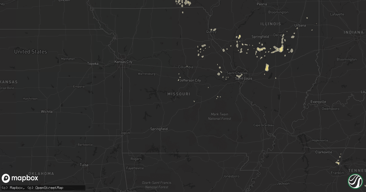
Hail Map in Missouri on August 26, 2021
Get this storm
August 26 map
$229
one time, instant access
Download today. No call, no setup
Keep the $229
Bought the map and want the full workflow? Apply the entire $229 to a subscription within 7 days. None of it is wasted.
Every map, not just this one
This buys you this map. Subscription and you get every map we run, in the markets you choose from a few cities to whole states to nationwide. Plus real-time alerts the moment a storm fires.
Contact data
Name, contact info, occupancy, even credit band for addresses in the footprint. You go from where it hit to who to call.
Become the source they trust
Unlimited branding weather history reports on demand. You already have the documented answer ready for the property owner, and you are the one who showed up with it.
Property data and RoofTrace estimates
Pull up any address you have got, its value and the exact code rules for that jurisdiction, straight from One Click Code. Then RoofTrace estimates the squares, pitch, and roof value, priced the way you price.
Storm reports in Missouri
Missouri
| Date | Description |
|---|---|
| 08/26/20215:30 PM CDT | Medium sized tree snapped off. Via twitter with picture of tree. |
| 08/26/20213:50 PM CDT | Several large trees uprooted. |
| 08/26/20213:17 PM CDT | Multiple small to medium size tree limbs snapped/downed. |
| 08/26/20213:17 PM CDT | Approximately 12 inch diameter tree limb snapped. |
| 08/26/20213:17 PM CDT | Corrects previous tstm wnd dmg report from 2 ese maryland heights. Large tree down near 270 and dorsett road. Time estimated from radar. |
| 08/26/20213:17 AM CDT | Large tree down near 270 and dorsett road. Time estimated from radar. |
| 08/26/202112:34 AM CDT | At 534 PM CDT, a severe thunderstorm was located near Santa Fe, moving southeast at 10 mph. HAZARD...60 mph wind gusts. SOURCE...Radar indicated. IMPACT...Expect damage to roofs, siding, and trees. This severe thunderstorm will remain over mainly rural areas of north central Audrain and southeastern Monroe Counties, including the following locations... Rush Hill. |
| 08/25/202110:46 PM CDT | At 346 PM CDT, a severe thunderstorm was located over Truesdale, moving northeast at 10 mph. HAZARD...60 mph wind gusts. SOURCE...Radar indicated. IMPACT...Expect damage to roofs, siding, and trees. Locations impacted include... Wright City.This includes Interstate 70 in Missouri between exits 193 and 200. |
| 08/25/202110:10 PM CDT | At 310 PM CDT, a severe thunderstorm was located over Creve Coeur, moving southwest at 15 mph. HAZARD...60 mph wind gusts. SOURCE...Radar indicated. IMPACT...Expect damage to roofs, siding, and trees. This severe thunderstorm will be near... Kirkwood and Des Peres around 315 PM CDT. Chesterfield, Town and Country and Country Life Acres around 320 PM CDT.This includes the following highways... Interstate 44 in Missouri near exit 277. Interstate 70 in Missouri near exit 231. |
| 08/25/20219:25 PM CDT | At 224 PM CDT, a severe thunderstorm was located over Ferguson, moving southwest at 15 mph. HAZARD...60 mph wind gusts. SOURCE...Radar indicated. IMPACT...Expect damage to roofs, siding, and trees. This severe thunderstorm will be near... Hazelwood, Berkeley, Normandy, Cool Valley, Kinloch, Pasadena Hills, Pasadena Park and Bellerive around 230 PM CDT. Bel-Ridge, Hillsdale, Wellston, Bel-Nor, Velda City, Velda Village Hills, Greendale, Beverly Hills, Uplands Park and Glen Echo Park around 235 PM CDT. St. Ann, Bridgeton, St. John, Woodson Terrace, Lambert-St. Louis International Airport, Pagedale, Hanley Hills, Charlack and Edmundson around 240 PM CDT.Other locations in the path of this severe thunderstorm includeUniversity City, Breckenridge Hills, Vinita Park, Sycamore Hills,Vinita Terrace, Overland, Clayton, Champ, Maryland Heights andOlivette. |
| 08/25/20219:16 PM CDT | At 216 PM CDT, severe thunderstorms were located along a line extending from 6 miles west of Batavia to 6 miles north of Lancaster, moving east at 20 mph. HAZARD...60 mph wind gusts and quarter size hail. SOURCE...Radar indicated. IMPACT...Hail damage to vehicles is expected. Expect wind damage to roofs, siding, and trees. These severe thunderstorms will remain over mainly rural areas of Davis, southeastern Wapello and southeastern Appanoose Counties, including the following locations... Eldon, Agency, Floris, Pulaski, Drakesville, Bloomfield Municipal Airport, Moulton and Lake Wapello State Park. |
| 08/25/20217:45 PM CDT | Power pole down. |
All States Impacted by Hail Map on August 26, 2021
Cities Impacted by Hail Map on August 26, 2021
- Malta, MT
- Litchfield, NE
- Loup City, NE
- Montezuma, IA
- Draper, SD
- Vona, CO
- Seibert, CO
- Pittsville, WI
- Monticello, UT
- Rutherfordton, NC
- Canton, SD
- Saint Paul, NE
- Dannebrog, NE
- Raymond, SD
- Newport, NE
- Anthon, IA
- Correctionville, IA
- Lodge Grass, MT
- Atkinson, NE
- Stuart, NE
- Clark, SD
- Frankfort, SD
- Doland, SD
- Pipestone, MN
- Holland, MN
- Flagler, CO
- Peever, SD
- Hemingford, NE
- Ainsworth, NE
- Bassett, NE
- Gray, IA
- Manning, IA
- Audubon, IA
- Page, NE
- Inwood, IA
- Rock Valley, IA
- Concord, IL
- Jacksonville, IL
- Arenzville, IL
- Chapin, IL
- Chester, IA
- Le Roy, MN
- Sigourney, IA
- Hedrick, IA
- Keswick, IA
- Fairfield, IA
- Ollie, IA
- Richland, IA
- What Cheer, IA
- Harper, IA
- Webster, IA
- Packwood, IA
- Winner, SD
- Ideal, SD
- California, MO
- Winnett, MT
- Sand Springs, MT
- Mosby, MT
- Brusett, MT
- Ord, NE
- Johnston, IA
- Arcadia, NE
- Fulks Run, VA
- Moulton, IA
- Unionville, IA
- Colome, SD
- Dallas, SD
- Saint Xavier, MT
- Pawnee, IL
- Doon, IA
- Trimont, MN
- Odin, MN
- Charles City, IA
- Sumner, IA
- Westgate, IA
- Goodland, KS
- Edson, KS
- Mexico, MO
- Elgin, NE
- Meadow Grove, NE
- Battle Creek, NE
- Norfolk, NE
- Oakdale, NE
- Tilden, NE
- Petersburg, NE
- Ogden, IA
- Bloomfield, IA
- Windom, MN
- Elsmere, NE
- Johnstown, NE
- Hinton, IA
- Assumption, IL
- Tower Hill, IL
- Pana, IL
- Goodlettsville, TN
- Greenbrier, TN
- Nora Springs, IA
- Floyd, IA
- Rudd, IA
- Osage, IA
- Springview, NE
- Garryowen, MT
- Shelbyville, IL
- McDonald, KS
- Beresford, SD
- Guthrie Center, IA
- Panora, IA
- Stuart, IA
- Gibson, IA
- Nashville, TN
- Pierre, SD
- North Loup, NE
- Albion, NE
- Spalding, NE
- Greeley, NE
- Scotia, NE
- Sherburn, MN
- Greenfield, IL
- Hettick, IL
- Ellsworth, NE
- Hay Springs, NE
- Alliance, NE
- Rushville, NE
- Sells, AZ
- Milmine, IL
- Bingham Lake, MN
- White Hall, IL
- Wrights, IL
- Carrollton, IL
- Roodhouse, IL
- Bird City, KS
- Lake Wilson, MN
- Slayton, MN
- Ashland City, TN
- Mulberry Grove, IL
- Smithboro, IL
- Greenville, IL
- Donnellson, IL
- Cushing, IA
- New Sharon, IA
- Oskaloosa, IA
- Medway, OH
- New Carlisle, OH
- Palmyra, IL
- Onida, SD
- Cresco, IA
- Bingham, NE
- Hamlin, IA
- Exira, IA
- Westerville, NE
- Comstock, NE
- Hayes Center, NE
- Wallingford, IA
- Graettinger, IA
- Ringsted, IA
- Terril, IA
- Estherville, IA
- Ruthven, IA
- Wood, SD
- Murdo, SD
- Luana, IA
- Waukon, IA
- Quincy, IL
- Woodbine, IA
- Lakefield, MN
- Mills, NE
- Sharon Springs, KS
- Weskan, KS
- Lovington, IL
- Arthur, IL
- Atwood, IL
- Bruce, SD
- McIntire, IA
- Taopi, MN
- Kensett, IA
- Orchard, IA
- Carpenter, IA
- Saint Ansgar, IA
- Plymouth, IA
- Mason City, IA
- Glenville, MN
- Northwood, IA
- Grafton, IA
- Kit Carson, CO
- Lone Rock, IA
- Pisgah, IA
- Tekamah, NE
- Little Sioux, IA
- Mondamin, IA
- Butler, IL
- Litchfield, IL
- Ortley, SD
- Waubay, SD
- Spirit Lake, IA
- Lakota, IA
- Buffalo Center, IA
- Akron, OH
- Center, MO
- New London, MO
- Monroe City, MO
- Redfield, SD
- Rockham, SD
- Round Lake, MN
- Worthington, MN
- Okabena, MN
- Murrayville, IL
- Franklin, IL
- Mount Vernon, SD
- Pocahontas, IL
- Musselshell, MT
- Morrisonville, IL
- Farmersville, IL
- Waggoner, IL
- Harvel, IL
- Girard, IL
- Virden, IL
- Downing, MO
- Rose Hill, IA
- Delta, IA
- Bighorn, MT
- Heron Lake, MN
- Hugo, CO
- Karval, CO
- Erwin, TN
- Fennimore, WI
- Mount Hope, WI
- Woodman, WI
- Green River, UT
- Dexter, IA
- Hilger, MT
- Hayes, SD
- Fort Pierre, SD
- Irene, SD
- Viborg, SD
- Burwell, NE
- Mission, SD
- Babcock, WI
- Black River Falls, WI
- Warrens, WI
- Neillsville, WI
- Hanksville, UT
- Denison, IA
- Nicholson, PA
- Hop Bottom, PA
- Highmore, SD
- George, IA
- Irwin, IA
- Manilla, IA
- Adair, IA
- Drakesville, IA
- Milton, IA
- Floris, IA
- Douds, IA
- Springfield, OH
- Utica, SD
- Valentine, NE
- Lawton, IA
- Dixon, MO
- Waucoma, IA
- Hawkeye, IA
- Hudson, SD
- Crofton, NE
- North Platte, NE
- Bethany, IL
- Owaneco, IL
- Nokomis, IL
- Findlay, IL
- Taylorville, IL
- Ohlman, IL
- Rosamond, IL
- Lakewood, IL
- Fremont, IA
- White River, SD
- Forsyth, MT
- Leighton, IA
- Defiance, OH
- Continental, OH
- Metamora, IN
- Laurel, IN
- Pleasant Hill, IL
- Pierce, NE
- Stacyville, IA
- Ostrander, MN
- Riceville, IA
- Alvord, IA
- Holstein, IA
- River Falls, WI
- Beldenville, WI
- Boone, IA
- Dayton, OH
- Odin, IL
- Sandoval, IL
- Kingsley, IA
- Menno, SD
- Lesterville, SD
- Fredericksburg, IA
- Monona, IA
- Butterfield, MN
- Jackson, MN
- Alpha, MN
- Forest Grove, MT
- Mehoopany, PA
- Harrold, SD
- Holabird, SD
- Marthasville, MO
- Wood Lake, NE
- Batavia, IA
- Ottumwa, IA
- Agency, IA
- Dalton City, IL
- Moweaqua, IL
- Mt Zion, IL
- Belgrade, MN
- Atlanta, IN
- Arcadia, IN
- Oneill, NE
- Inman, NE
- Chambers, NE
- Clearwater, NE
- Earlham, IA
- Farmersville, OH
- Germantown, OH
- Creston, NC
- Lansing, NC
- Malcom, IA
- Grinnell, IA
- Searsboro, IA
- Barnes City, IA
- Huron, SD
- Cavour, SD
- Artesian, SD
- Vail, IA
- Ida Grove, IA
- Battle Creek, IA
- Whites Creek, TN
- Grenville, SD
- Merriman, NE
- Hull, IA
- South English, IA
- Oto, IA
- Waverly, IL
- Bancroft, IA
- Hays, MT
- Jamestown, MO
- Louisville, KY
- Johnson City, TX
- Bristol, VT
- Kirkman, IA
- Dunlap, IA
- Sullivan, MO
- Louisiana, MO
- Clarksville, MO
- Wright City, MO
- Defiance, MO
- Augusta, MO
- Odebolt, IA
- Blanco, TX
- Hye, TX
- Stonewall, TX
- Brookville, IN
- Lewistown, MT
- Livingston, TX
- Chester, TX
- Browns Valley, MN
- Summit, SD
- Sisseton, SD
- Morrison, TN
- Gackle, ND
- Streeter, ND
- Dunnell, MN
- Mountain Lake, MN
- Sedgwick, CO
- Postville, IA
- Bartley, NE
- Washington, DC
- Gays, IL
- Windsor, IL
- Burt, IA
- Titonka, IA
- Saint Louis, MO
- Columbia, MO
- Rickman, TN
- Monterey, TN
- Onalaska, TX
- Algona, IA
- Fredericksburg, VA
- Stafford, VA
- Hot Springs, NC
- Wesley, IA
- Winchester, IL
- Winnebago, MN
- Plainview, NE
- Pulaski, IA
- Leasburg, MO
- Mapleton, MN
- Wyola, MT
- Mission Hill, SD
- Centerville, SD
- Champaign, IL
- Oelwein, IA
- Maynard, IA
- Fairbank, IA
- Charter Oak, IA
- Hawk Point, MO
- Troy, MO
- Warrenton, MO
- Owensville, MO
- Balaton, MN
- Ruthton, MN
- Ewing, NE
- Stoutsville, MO
- Arlington, VA
- McLean, VA
- Castell, TX
- Llano, TX
- Flatonia, TX
- Indianola, IL
- Fowler, IL
- Grass Range, MT
- Silex, MO
- Fenton, IA
- Cylinder, IA
- Dickens, IA
- Hillview, IL
- Ellendale, ND
- Laddonia, MO
- Rush Hill, MO
- Springfield, TN
- Rockwood, PA
- Lancaster, WI
- Prairie Du Chien, WI
- Maryland Heights, MO
- Moorhead, IA
- Saint Francis, KS
- Grand Junction, IA
- Dana, IA
- Missouri Valley, IA
- Logan, IA
- Blair, NE
- Herman, NE
- Argenta, IL
- Decatur, IL
- Perry, MO
- Shelbyville, TX
- Ashton, NE
- Neligh, NE
- Harman, WV
- Martinsburg, IA
- Cedar, IA
- New Albany, IN
- Granite Falls, MN
- Sacred Heart, MN
- Raymond, IL
- Irving, IL
- Lu Verne, IA
- Mode, IL
- Beecher City, IL
- Miller, SD
- Casey, IA
- Galva, IA
- Schaller, IA
- Arthur, IA
- Coleridge, NE
- Laurel, NE
- Belden, NE
- Stratton, NE
- Bluffs, IL
- Meredosia, IL
- Sioux City, IA
- Santa Fe, MO
- Steuben, WI
- Wauzeka, WI
- Corrigan, TX
- Divernon, IL
- Glenarm, IL
- Menlo, IA
- Redfield, IA
- Brunswick, NE
- Ivesdale, IL
- Modale, IA
- Aspinwall, IA
- Rock Springs, WY
- Deep River, IA
- Verdigre, NE
- Strasburg, IL
- Hancock, VT
- Junction, TX
- Busby, MT
- Sauk Rapids, MN
- Saint Cloud, MN
- Diboll, TX
- Hudson, IA
- Blakesburg, IA
- Webster, SD
- Woonsocket, SD
- Penfield, IL
- Potomac, IL
- Spring Valley, WI
- Morganton, NC
- Pittsfield, IL
- Pearl, IL
- Ridgeway, IA
- Calmar, IA
- Sulphur, LA
- Fairview, SD
- Danville, IL
- Lapel, IN
- Anderson, IN
- Prospect, KY
- Bourbon, MO
- Armstrong, IA
- Milford, IA
- Rake, IA
- Emmetsburg, IA
- Swea City, IA
- Mountain Home, TX
- Somerville, OH
- Middletown, OH
- Camden, OH
- Mathias, WV
- Baker, WV
- Lost City, WV
- Nashua, IA
- Cicero, IN
- Noblesville, IN
- Smithville, TX
- West Union, OH
- Carlinville, IL
- Forest City, IA
- Fort Myer, VA
- Alexandria, VA
- Osmond, NE
- Bastrop, TX
- Red Rock, TX
- Hawarden, IA
- Sioux Center, IA
- Florence, SD
- Orient, SD
- Garden City, SD
- Gary, SD
- Faulkton, SD
- Strandburg, SD
- Watertown, SD
- Revillo, SD
- Canby, MN
- Clear Lake, SD
- Henry, SD
- Turton, SD
- Northville, SD
- Ashton, SD
- Goodwin, SD
- Marietta, MN
- Kranzburg, SD
- Cresbard, SD
- Beardsley, MN
- Wilmot, SD
- Brandt, SD
- Estelline, SD
- Hayti, SD
- Bryant, SD
- Hazel, SD
- Vienna, SD
- Astoria, SD
- Willow Lake, SD
- Castlewood, SD
- Lake Norden, SD
- Toronto, SD
- Lake Preston, SD
- Erwin, SD
- Iroquois, SD
- De Smet, SD
- Arlington, SD
- Matlock, IA
- Alton, IA
- Sheldon, IA
- Maurice, IA
- Archer, IA
- Hospers, IA
- Orange City, IA
- Ireton, IA
- Wakonda, SD
- Granville, IA
- Alcester, SD
- Ashton, IA
- Boyden, IA
- Midland, SD
- Blunt, SD
- Marcus, IA
- Washta, IA
- Moville, IA
- Pierson, IA
- Cleghorn, IA
- Le Mars, IA
- Remsen, IA
- Danvers, MN
- Benson, MN
- Glenwood, MN
- Eden Prairie, MN
- Hopkins, MN
- Minneapolis, MN
- Shakopee, MN
- Saint Paul, MN
- Lakeville, MN
- Rosemount, MN
- Burnsville, MN
- Inver Grove Heights, MN
- Savage, MN
- Prior Lake, MN
- Newport, MN
- South Saint Paul, MN
- Auburn, IA
- Wall Lake, IA
- Lohrville, IA
- Lake View, IA
- Sac City, IA
- Lytton, IA
- Early, IA
- Lake City, IA
- Rockwell City, IA
- Jefferson, IA
- Glidden, IA
- Ralston, IA
- Coon Rapids, IA
- Carroll, IA
- Lidderdale, IA
- Scranton, IA
- Keota, IA
- Hayesville, IA
- Brighton, IA
- Colby, KS
- Herndon, KS
- Danbury, NE
- Oberlin, KS
- Atwood, KS
- McCook, NE
- Indianola, NE
- Ludell, KS
- Culbertson, NE
- Kanorado, KS
- Rapid City, SD
- Box Elder, SD
- Caputa, SD
- Hill City, SD
- New Underwood, SD
- Hermosa, SD


