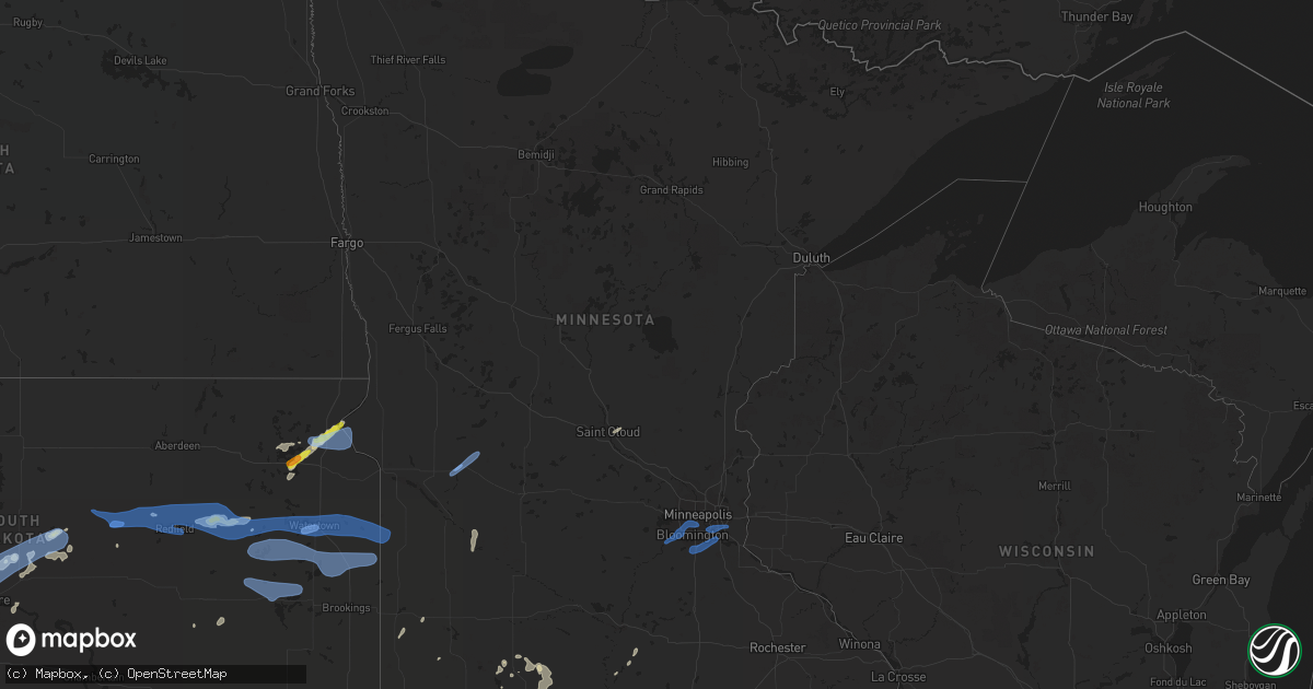
Hail Map in Minnesota on August 26, 2021
Get this storm
August 26 map
$229
one time, instant access
Download today. No call, no setup
Keep the $229
Bought the map and want the full workflow? Apply the entire $229 to a subscription within 7 days. None of it is wasted.
Every map, not just this one
This buys you this map. Subscription and you get every map we run, in the markets you choose from a few cities to whole states to nationwide. Plus real-time alerts the moment a storm fires.
Contact data
Name, contact info, occupancy, even credit band for addresses in the footprint. You go from where it hit to who to call.
Become the source they trust
Unlimited branding weather history reports on demand. You already have the documented answer ready for the property owner, and you are the one who showed up with it.
Property data and RoofTrace estimates
Pull up any address you have got, its value and the exact code rules for that jurisdiction, straight from One Click Code. Then RoofTrace estimates the squares, pitch, and roof value, priced the way you price.
Storm reports in Minnesota
Minnesota
| Date | Description |
|---|---|
| 08/26/20212:31 PM CDT | Report from mping: 1-inch tree limbs broken; shingles blown off. |
| 08/26/20212:28 PM CDT | Large tree uprooted in eastern richfield... Picture via twitter. |
| 08/26/20212:25 PM CDT | Several 1/2 to 1 inch tree branches down. |
| 08/26/20212:24 PM CDT | 65mph gust recorded on handheld weather sensor. |
| 08/26/20212:20 PM CDT | A local report indicates 63 MPH wind near 1 ENE EDEN PRAIRIE |
| 08/26/20212:17 PM CDT | Report from mping: 1-inch tree limbs broken; shingles blown off. |
| 08/26/20212:10 PM CDT | 3 to 6 inch branch down on county road 19 in tonka bay near city hall. |
| 08/26/20212:06 PM CDT | Report from mping: 1-inch tree limbs broken; shingles blown off. |
| 08/26/20212:00 PM CDT | Facebook picture of 2ft diameter tree snapped near chanhassen library. Time estimated by radar. |
| 08/26/20212:00 PM CDT | A local report indicates 63 MPH wind near 1 WSW SHAKOPEE |
| 08/26/20212:00 PM CDT | Several 3 inch branches down. |
| 08/26/20211:53 PM CDT | 12 inch diameter tree snapped at base. |
| 08/26/20211:38 PM CDT | 3 inch branch down in waconia. Time estimated by radar. |
| 08/26/20211:04 PM CDT | Three to four 6 inch branches down in glencoe... One 16 inch diameter branch down on top of house. Time estimated by radar. |
| 08/26/202112:52 PM CDT | Branch down over roadway... Unknown size. |
| 08/26/202111:36 AM CDT | Awos station kbbb benson ap. |
| 08/26/202111:19 AM CDT | A local report indicates 58 MPH wind near 2 W MARSHALL |
| 08/26/202111:15 AM CDT | Large... Rotted tree down over sidewalk. Picture via twitter. Time estimated by radar. |
| 08/26/202111:15 AM CDT | Tree trunk split and large branches down. Picture via twitter... Time estimated by radar. |
| 08/26/202111:15 AM CDT | Medium to large rotted tree down... Picture via twitter. |
| 08/26/202111:10 AM CDT | Tree branch down over power line. Time estimated by radar. |
| 08/26/202110:57 AM CDT | Spotter reports trees down in ivanhoe. |
| 08/26/20216:37 AM CDT | At 1135 AM CDT, severe thunderstorms were located along a line extending from near Lake Hassel to 5 miles southwest of Murdock to near Maynard, moving east at 50 mph. Benson, MN recently reported a gust of 78 MPH. HAZARD...70 mph wind gusts and penny size hail. SOURCE...Radar indicated. IMPACT...Expect considerable tree damage. Damage is likely to mobile homes, roofs, and outbuildings. Severe thunderstorms will be near... Murdock around 1140 AM CDT. Kerkhoven around 1145 AM CDT. Raymond around 1150 AM CDT. Willmar around 1155 AM CDT. |
| 08/26/20216:05 AM CDT | At 1105 AM CDT, a severe thunderstorm was located near Appleton, or 19 miles northwest of Montevideo, moving east at 35 mph. HAZARD...60 mph wind gusts and quarter size hail. SOURCE...Radar indicated. IMPACT...Hail damage to vehicles is expected. Expect wind damage to roofs, siding, and trees. Locations impacted include... Benson, Appleton, Milan, Watson, Hagen, Danvers, Holloway, Benson Airport and Big Bend City. |
| 08/26/20215:39 AM CDT | At 1038 AM CDT, a severe thunderstorm was located 7 miles north of Gary, or 16 miles northeast of Clear Lake, moving east at 45 mph. HAZARD...60 mph wind gusts and quarter size hail. SOURCE...Radar indicated. IMPACT...Hail damage to vehicles is expected. Expect wind damage to roofs, siding, and trees. Locations impacted include... Canby, Madison, Dawson, Clarkfield, Porter, Boyd, Bellingham, Marietta, Cerro Gordo, Providence, Spring Creek and Nassau. |
| 08/26/20215:39 AM CDT | At 1038 AM CDT, severe thunderstorms were located along a line extending from near Brandt to near White to near Brookings, moving east at 50 mph. HAZARD...70 mph wind gusts. SOURCE...Law enforcement reported trees down in Arlington. IMPACT...Expect considerable tree damage. Damage is likely to mobile homes, roofs, and outbuildings. Severe thunderstorms will be near... Hendricks around 1050 AM CDT.Other locations in the path of these severe thunderstorms includeElkton, Ivanhoe, Arco, Lake Benton, Taunton, Minneota, Tyler, Ghent,Camden State Park, Marshall, Florence, Cottonwood and Russell. |
| 08/26/20215:01 AM CDT | At 1000 AM CDT, severe thunderstorms were located along a line extending from near Watertown to near Badger to 9 miles south of Lake Thompson State Recreation Area, moving east at 45 mph. HAZARD...60 mph wind gusts. SOURCE...Radar indicated. IMPACT...Expect damage to roofs, siding, and trees. Severe thunderstorms will be near... Badger around 1005 AM CDT. Ramona and Oakwood State Park around 1020 AM CDT.Other locations in the path of these severe thunderstorms includeBruce, Nunda and White. |
| 08/26/20215:00 AM CDT | At 1000 AM CDT, a severe thunderstorm was located near Watertown, moving east at 40 mph. HAZARD...60 mph wind gusts. SOURCE...Radar indicated. IMPACT...Expect damage to roofs, siding, and trees. This severe thunderstorm will be near... Kranzburg around 1010 AM CDT. Goodwin, School Lake and Bullhead Lake around 1020 AM CDT.Other locations in the path of this severe thunderstorm include ClearLake, Altamont, Tunerville, Lake Alice, Moritz and Gary. |
| 08/26/20214:58 AM CDT | At 956 AM CDT, a severe thunderstorm was located near Hamlin Education Center, or 17 miles west of Estelline, moving east at 45 mph. HAZARD...60 mph wind gusts and nickel size hail. SOURCE...Public. At 940 am cdt, 60 MPH winds was reported at Mayfield Colony in Clark County. IMPACT...Expect damage to roofs, siding, and trees. This severe thunderstorm will be near... Lake Norden and Hayti around 1000 AM CDT. Lake Albert around 1005 AM CDT. Stone Bridge and Lake Poinsett around 1010 AM CDT.Other locations in the path of this severe thunderstorm includeEstelline, Dempster, Poinsett Colony, Claremont Colony, Toronto,Brandt, Astoria and Lake Cochrane Rec Area. |
| 08/25/20219:44 PM CDT | At 243 PM CDT, a severe thunderstorm was located near Cottage Grove, or 12 miles west of River Falls, moving east at 40 mph. HAZARD...60 mph wind gusts. SOURCE...Radar indicated. IMPACT...Expect damage to roofs, siding, and trees. Locations impacted include... River Falls, Woodbury, Maplewood, Cottage Grove, Inver Grove Heights, Oakdale, Hastings, Rosemount, South St. Paul, Hudson, Lake Elmo and St. Paul Park. |
| 08/25/20219:14 PM CDT | At 213 PM CDT, severe thunderstorms were located along a line extending from Plymouth to Hopkins to Edina, moving northeast at 35 mph. HAZARD...60 mph wind gusts. SOURCE...Radar indicated. IMPACT...Expect damage to roofs, siding, and trees. Locations impacted include... Minneapolis, St. Paul, Bloomington, Brooklyn Park, Plymouth, Eden Prairie, Blaine, Minnetonka, Edina, St. Louis Park, Maplewood and Richfield. |
| 08/25/20219:05 PM CDT | At 204 PM CDT, a severe thunderstorm was located over Prior Lake, or 17 miles southwest of Minneapolis, moving east at 45 mph. Trained spotter reported 63 mph gust west of Shakopee, MN. HAZARD...60 mph wind gusts. SOURCE...Trained weather spotters. IMPACT...Expect damage to roofs, siding, and trees. This severe thunderstorm will be near... Burnsville around 210 PM CDT. Lakeville around 215 PM CDT. Bloomington and Apple Valley around 220 PM CDT.Other locations in the path of this severe thunderstorm includeEagan, Rosemount, Inver Grove Heights, Cottage Grove, St. Paul Parkand Hastings. |
| 08/25/20218:47 PM CDT | At 147 PM CDT, severe thunderstorms were located along a line extending from Independence to near Mound to near Chaska, moving east at 40 mph. HAZARD...60 mph wind gusts. SOURCE...Radar indicated. IMPACT...Expect damage to roofs, siding, and trees. Locations impacted include... Minneapolis, Bloomington, Plymouth, Eden Prairie, Minnetonka, Edina, St. Louis Park, Richfield, Brooklyn Center, Chaska, Chanhassen and Golden Valley. |
All States Impacted by Hail Map on August 26, 2021
Cities Impacted by Hail Map on August 26, 2021
- Malta, MT
- Litchfield, NE
- Loup City, NE
- Montezuma, IA
- Draper, SD
- Vona, CO
- Seibert, CO
- Pittsville, WI
- Monticello, UT
- Rutherfordton, NC
- Canton, SD
- Saint Paul, NE
- Dannebrog, NE
- Raymond, SD
- Newport, NE
- Anthon, IA
- Correctionville, IA
- Lodge Grass, MT
- Atkinson, NE
- Stuart, NE
- Clark, SD
- Frankfort, SD
- Doland, SD
- Pipestone, MN
- Holland, MN
- Flagler, CO
- Peever, SD
- Hemingford, NE
- Ainsworth, NE
- Bassett, NE
- Gray, IA
- Manning, IA
- Audubon, IA
- Page, NE
- Inwood, IA
- Rock Valley, IA
- Concord, IL
- Jacksonville, IL
- Arenzville, IL
- Chapin, IL
- Chester, IA
- Le Roy, MN
- Sigourney, IA
- Hedrick, IA
- Keswick, IA
- Fairfield, IA
- Ollie, IA
- Richland, IA
- What Cheer, IA
- Harper, IA
- Webster, IA
- Packwood, IA
- Winner, SD
- Ideal, SD
- California, MO
- Winnett, MT
- Sand Springs, MT
- Mosby, MT
- Brusett, MT
- Ord, NE
- Johnston, IA
- Arcadia, NE
- Fulks Run, VA
- Moulton, IA
- Unionville, IA
- Colome, SD
- Dallas, SD
- Saint Xavier, MT
- Pawnee, IL
- Doon, IA
- Trimont, MN
- Odin, MN
- Charles City, IA
- Sumner, IA
- Westgate, IA
- Goodland, KS
- Edson, KS
- Mexico, MO
- Elgin, NE
- Meadow Grove, NE
- Battle Creek, NE
- Norfolk, NE
- Oakdale, NE
- Tilden, NE
- Petersburg, NE
- Ogden, IA
- Bloomfield, IA
- Windom, MN
- Elsmere, NE
- Johnstown, NE
- Hinton, IA
- Assumption, IL
- Tower Hill, IL
- Pana, IL
- Goodlettsville, TN
- Greenbrier, TN
- Nora Springs, IA
- Floyd, IA
- Rudd, IA
- Osage, IA
- Springview, NE
- Garryowen, MT
- Shelbyville, IL
- McDonald, KS
- Beresford, SD
- Guthrie Center, IA
- Panora, IA
- Stuart, IA
- Gibson, IA
- Nashville, TN
- Pierre, SD
- North Loup, NE
- Albion, NE
- Spalding, NE
- Greeley, NE
- Scotia, NE
- Sherburn, MN
- Greenfield, IL
- Hettick, IL
- Ellsworth, NE
- Hay Springs, NE
- Alliance, NE
- Rushville, NE
- Sells, AZ
- Milmine, IL
- Bingham Lake, MN
- White Hall, IL
- Wrights, IL
- Carrollton, IL
- Roodhouse, IL
- Bird City, KS
- Lake Wilson, MN
- Slayton, MN
- Ashland City, TN
- Mulberry Grove, IL
- Smithboro, IL
- Greenville, IL
- Donnellson, IL
- Cushing, IA
- New Sharon, IA
- Oskaloosa, IA
- Medway, OH
- New Carlisle, OH
- Palmyra, IL
- Onida, SD
- Cresco, IA
- Bingham, NE
- Hamlin, IA
- Exira, IA
- Westerville, NE
- Comstock, NE
- Hayes Center, NE
- Wallingford, IA
- Graettinger, IA
- Ringsted, IA
- Terril, IA
- Estherville, IA
- Ruthven, IA
- Wood, SD
- Murdo, SD
- Luana, IA
- Waukon, IA
- Quincy, IL
- Woodbine, IA
- Lakefield, MN
- Mills, NE
- Sharon Springs, KS
- Weskan, KS
- Lovington, IL
- Arthur, IL
- Atwood, IL
- Bruce, SD
- McIntire, IA
- Taopi, MN
- Kensett, IA
- Orchard, IA
- Carpenter, IA
- Saint Ansgar, IA
- Plymouth, IA
- Mason City, IA
- Glenville, MN
- Northwood, IA
- Grafton, IA
- Kit Carson, CO
- Lone Rock, IA
- Pisgah, IA
- Tekamah, NE
- Little Sioux, IA
- Mondamin, IA
- Butler, IL
- Litchfield, IL
- Ortley, SD
- Waubay, SD
- Spirit Lake, IA
- Lakota, IA
- Buffalo Center, IA
- Akron, OH
- Center, MO
- New London, MO
- Monroe City, MO
- Redfield, SD
- Rockham, SD
- Round Lake, MN
- Worthington, MN
- Okabena, MN
- Murrayville, IL
- Franklin, IL
- Mount Vernon, SD
- Pocahontas, IL
- Musselshell, MT
- Morrisonville, IL
- Farmersville, IL
- Waggoner, IL
- Harvel, IL
- Girard, IL
- Virden, IL
- Downing, MO
- Rose Hill, IA
- Delta, IA
- Bighorn, MT
- Heron Lake, MN
- Hugo, CO
- Karval, CO
- Erwin, TN
- Fennimore, WI
- Mount Hope, WI
- Woodman, WI
- Green River, UT
- Dexter, IA
- Hilger, MT
- Hayes, SD
- Fort Pierre, SD
- Irene, SD
- Viborg, SD
- Burwell, NE
- Mission, SD
- Babcock, WI
- Black River Falls, WI
- Warrens, WI
- Neillsville, WI
- Hanksville, UT
- Denison, IA
- Nicholson, PA
- Hop Bottom, PA
- Highmore, SD
- George, IA
- Irwin, IA
- Manilla, IA
- Adair, IA
- Drakesville, IA
- Milton, IA
- Floris, IA
- Douds, IA
- Springfield, OH
- Utica, SD
- Valentine, NE
- Lawton, IA
- Dixon, MO
- Waucoma, IA
- Hawkeye, IA
- Hudson, SD
- Crofton, NE
- North Platte, NE
- Bethany, IL
- Owaneco, IL
- Nokomis, IL
- Findlay, IL
- Taylorville, IL
- Ohlman, IL
- Rosamond, IL
- Lakewood, IL
- Fremont, IA
- White River, SD
- Forsyth, MT
- Leighton, IA
- Defiance, OH
- Continental, OH
- Metamora, IN
- Laurel, IN
- Pleasant Hill, IL
- Pierce, NE
- Stacyville, IA
- Ostrander, MN
- Riceville, IA
- Alvord, IA
- Holstein, IA
- River Falls, WI
- Beldenville, WI
- Boone, IA
- Dayton, OH
- Odin, IL
- Sandoval, IL
- Kingsley, IA
- Menno, SD
- Lesterville, SD
- Fredericksburg, IA
- Monona, IA
- Butterfield, MN
- Jackson, MN
- Alpha, MN
- Forest Grove, MT
- Mehoopany, PA
- Harrold, SD
- Holabird, SD
- Marthasville, MO
- Wood Lake, NE
- Batavia, IA
- Ottumwa, IA
- Agency, IA
- Dalton City, IL
- Moweaqua, IL
- Mt Zion, IL
- Belgrade, MN
- Atlanta, IN
- Arcadia, IN
- Oneill, NE
- Inman, NE
- Chambers, NE
- Clearwater, NE
- Earlham, IA
- Farmersville, OH
- Germantown, OH
- Creston, NC
- Lansing, NC
- Malcom, IA
- Grinnell, IA
- Searsboro, IA
- Barnes City, IA
- Huron, SD
- Cavour, SD
- Artesian, SD
- Vail, IA
- Ida Grove, IA
- Battle Creek, IA
- Whites Creek, TN
- Grenville, SD
- Merriman, NE
- Hull, IA
- South English, IA
- Oto, IA
- Waverly, IL
- Bancroft, IA
- Hays, MT
- Jamestown, MO
- Louisville, KY
- Johnson City, TX
- Bristol, VT
- Kirkman, IA
- Dunlap, IA
- Sullivan, MO
- Louisiana, MO
- Clarksville, MO
- Wright City, MO
- Defiance, MO
- Augusta, MO
- Odebolt, IA
- Blanco, TX
- Hye, TX
- Stonewall, TX
- Brookville, IN
- Lewistown, MT
- Livingston, TX
- Chester, TX
- Browns Valley, MN
- Summit, SD
- Sisseton, SD
- Morrison, TN
- Gackle, ND
- Streeter, ND
- Dunnell, MN
- Mountain Lake, MN
- Sedgwick, CO
- Postville, IA
- Bartley, NE
- Washington, DC
- Gays, IL
- Windsor, IL
- Burt, IA
- Titonka, IA
- Saint Louis, MO
- Columbia, MO
- Rickman, TN
- Monterey, TN
- Onalaska, TX
- Algona, IA
- Fredericksburg, VA
- Stafford, VA
- Hot Springs, NC
- Wesley, IA
- Winchester, IL
- Winnebago, MN
- Plainview, NE
- Pulaski, IA
- Leasburg, MO
- Mapleton, MN
- Wyola, MT
- Mission Hill, SD
- Centerville, SD
- Champaign, IL
- Oelwein, IA
- Maynard, IA
- Fairbank, IA
- Charter Oak, IA
- Hawk Point, MO
- Troy, MO
- Warrenton, MO
- Owensville, MO
- Balaton, MN
- Ruthton, MN
- Ewing, NE
- Stoutsville, MO
- Arlington, VA
- McLean, VA
- Castell, TX
- Llano, TX
- Flatonia, TX
- Indianola, IL
- Fowler, IL
- Grass Range, MT
- Silex, MO
- Fenton, IA
- Cylinder, IA
- Dickens, IA
- Hillview, IL
- Ellendale, ND
- Laddonia, MO
- Rush Hill, MO
- Springfield, TN
- Rockwood, PA
- Lancaster, WI
- Prairie Du Chien, WI
- Maryland Heights, MO
- Moorhead, IA
- Saint Francis, KS
- Grand Junction, IA
- Dana, IA
- Missouri Valley, IA
- Logan, IA
- Blair, NE
- Herman, NE
- Argenta, IL
- Decatur, IL
- Perry, MO
- Shelbyville, TX
- Ashton, NE
- Neligh, NE
- Harman, WV
- Martinsburg, IA
- Cedar, IA
- New Albany, IN
- Granite Falls, MN
- Sacred Heart, MN
- Raymond, IL
- Irving, IL
- Lu Verne, IA
- Mode, IL
- Beecher City, IL
- Miller, SD
- Casey, IA
- Galva, IA
- Schaller, IA
- Arthur, IA
- Coleridge, NE
- Laurel, NE
- Belden, NE
- Stratton, NE
- Bluffs, IL
- Meredosia, IL
- Sioux City, IA
- Santa Fe, MO
- Steuben, WI
- Wauzeka, WI
- Corrigan, TX
- Divernon, IL
- Glenarm, IL
- Menlo, IA
- Redfield, IA
- Brunswick, NE
- Ivesdale, IL
- Modale, IA
- Aspinwall, IA
- Rock Springs, WY
- Deep River, IA
- Verdigre, NE
- Strasburg, IL
- Hancock, VT
- Junction, TX
- Busby, MT
- Sauk Rapids, MN
- Saint Cloud, MN
- Diboll, TX
- Hudson, IA
- Blakesburg, IA
- Webster, SD
- Woonsocket, SD
- Penfield, IL
- Potomac, IL
- Spring Valley, WI
- Morganton, NC
- Pittsfield, IL
- Pearl, IL
- Ridgeway, IA
- Calmar, IA
- Sulphur, LA
- Fairview, SD
- Danville, IL
- Lapel, IN
- Anderson, IN
- Prospect, KY
- Bourbon, MO
- Armstrong, IA
- Milford, IA
- Rake, IA
- Emmetsburg, IA
- Swea City, IA
- Mountain Home, TX
- Somerville, OH
- Middletown, OH
- Camden, OH
- Mathias, WV
- Baker, WV
- Lost City, WV
- Nashua, IA
- Cicero, IN
- Noblesville, IN
- Smithville, TX
- West Union, OH
- Carlinville, IL
- Forest City, IA
- Fort Myer, VA
- Alexandria, VA
- Osmond, NE
- Bastrop, TX
- Red Rock, TX
- Hawarden, IA
- Sioux Center, IA
- Florence, SD
- Orient, SD
- Garden City, SD
- Gary, SD
- Faulkton, SD
- Strandburg, SD
- Watertown, SD
- Revillo, SD
- Canby, MN
- Clear Lake, SD
- Henry, SD
- Turton, SD
- Northville, SD
- Ashton, SD
- Goodwin, SD
- Marietta, MN
- Kranzburg, SD
- Cresbard, SD
- Beardsley, MN
- Wilmot, SD
- Brandt, SD
- Estelline, SD
- Hayti, SD
- Bryant, SD
- Hazel, SD
- Vienna, SD
- Astoria, SD
- Willow Lake, SD
- Castlewood, SD
- Lake Norden, SD
- Toronto, SD
- Lake Preston, SD
- Erwin, SD
- Iroquois, SD
- De Smet, SD
- Arlington, SD
- Matlock, IA
- Alton, IA
- Sheldon, IA
- Maurice, IA
- Archer, IA
- Hospers, IA
- Orange City, IA
- Ireton, IA
- Wakonda, SD
- Granville, IA
- Alcester, SD
- Ashton, IA
- Boyden, IA
- Midland, SD
- Blunt, SD
- Marcus, IA
- Washta, IA
- Moville, IA
- Pierson, IA
- Cleghorn, IA
- Le Mars, IA
- Remsen, IA
- Danvers, MN
- Benson, MN
- Glenwood, MN
- Eden Prairie, MN
- Hopkins, MN
- Minneapolis, MN
- Shakopee, MN
- Saint Paul, MN
- Lakeville, MN
- Rosemount, MN
- Burnsville, MN
- Inver Grove Heights, MN
- Savage, MN
- Prior Lake, MN
- Newport, MN
- South Saint Paul, MN
- Auburn, IA
- Wall Lake, IA
- Lohrville, IA
- Lake View, IA
- Sac City, IA
- Lytton, IA
- Early, IA
- Lake City, IA
- Rockwell City, IA
- Jefferson, IA
- Glidden, IA
- Ralston, IA
- Coon Rapids, IA
- Carroll, IA
- Lidderdale, IA
- Scranton, IA
- Keota, IA
- Hayesville, IA
- Brighton, IA
- Colby, KS
- Herndon, KS
- Danbury, NE
- Oberlin, KS
- Atwood, KS
- McCook, NE
- Indianola, NE
- Ludell, KS
- Culbertson, NE
- Kanorado, KS
- Rapid City, SD
- Box Elder, SD
- Caputa, SD
- Hill City, SD
- New Underwood, SD
- Hermosa, SD


