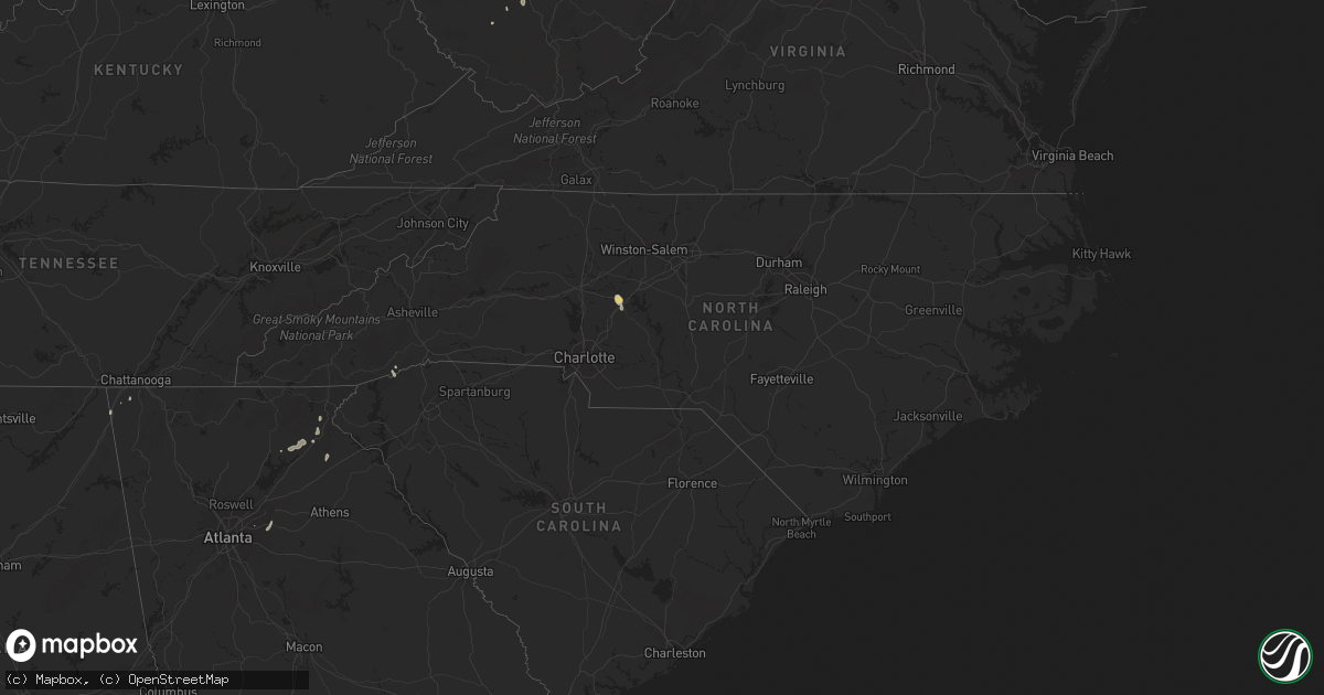
Hail Map in North Carolina on August 24, 2023
Get this storm
August 24 map
$229
one time, instant access
Download today. No call, no setup
Keep the $229
Bought the map and want the full workflow? Apply the entire $229 to a subscription within 7 days. None of it is wasted.
Every map, not just this one
This buys you this map. Subscription and you get every map we run, in the markets you choose from a few cities to whole states to nationwide. Plus real-time alerts the moment a storm fires.
Contact data
Name, contact info, occupancy, even credit band for addresses in the footprint. You go from where it hit to who to call.
Become the source they trust
Unlimited branding weather history reports on demand. You already have the documented answer ready for the property owner, and you are the one who showed up with it.
Property data and RoofTrace estimates
Pull up any address you have got, its value and the exact code rules for that jurisdiction, straight from One Click Code. Then RoofTrace estimates the squares, pitch, and roof value, priced the way you price.
Storm reports in North Carolina
North Carolina
| Date | Description |
|---|---|
| 08/24/20236:35 PM CDT | Social media report of a tree down on a vehicle. |
| 08/24/20236:31 PM CDT | Multiple trees down in the vicinity of becks church road and e old us highway 64 in lexington. Time estimate by radar. |
| 08/24/20236:25 PM CDT | 2 large trees snapped. Parts may be on a house. Trees down throughout the city. |
| 08/24/20236:25 PM CDT | Corrects previous tstm wnd dmg report from salisbury. 2 large trees snapped. Parts are on a house and car. Multiple other trees down throughout the city along with repo |
| 08/24/20236:24 PM CDT | Multiple trees down in the vicinity of tussey road and beaver creek road. Time estimated by radar. |
| 08/24/20236:13 PM CDT | Multiple trees down in the vicinity of yadkin college road and west oaks ln. Time estimated by radar. |
| 08/24/20236:05 PM CDT | Observed at salisbury hs. |
| 08/24/20236:00 PM CDT | Tree down blocking road. |
| 08/24/20235:50 PM CDT | Multiple trees down at the 6700 block of idols rd. |
| 08/24/20235:41 PM CDT | Trees and power lines down at the 7500 block of lasater rd. |
| 08/24/20235:28 PM CDT | Tree down at lakeway dr near sonata dr. |
| 08/24/20231:27 PM CDT | A report of a power line down and a tree down across blue ridge road. |
| 08/23/20238:44 PM CDT | Report from mping: 3-inch tree limbs broken. |
| 08/23/20238:03 PM CDT | Tree down across old charlotte road. |
| 08/23/20237:55 PM CDT | At least 20 trees down between mount pleasant and concord. |
All States Impacted by Hail Map on August 24, 2023
Cities Impacted by Hail Map on August 24, 2023
- Williamstown, KY
- Dry Ridge, KY
- Lancaster, KY
- Stanford, KY
- Bottineau, ND
- Norwich, ND
- Surrey, ND
- Deering, ND
- Granville, ND
- Bantry, ND
- Killdeer, ND
- Halliday, ND
- Dunn Center, ND
- Garrison, ND
- Beulah, ND
- Towner, ND
- Piedmont, SD
- Black Hawk, SD
- Franklin, WI
- Oak Creek, WI
- Rapid City, SD
- Caledonia, WI
- Franksville, WI
- Racine, WI
- Lake Mills, WI
- Jefferson, WI
- Plaucheville, LA
- Simmesport, LA
- Murrayville, GA
- Chickamauga, GA
- Flintstone, GA
- Saint Francisville, LA
- Centreville, MS
- Trenton, GA
- Vinton, LA
- Sulphur, LA
- Mountain Rest, SC
- Clarkesville, GA
- Mount Airy, GA
- Sturgis, SD
- Reeves, LA
- Glenburn, ND
- Nemo, SD
- Cornelia, GA
- Rising Fawn, GA
- Flat Rock, AL
- Westminster, SC
- Walhalla, SC
- New Town, ND
- Parshall, ND
- Merriman, NE
- Muskego, WI
- Minot, ND
- Natchez, MS
- Woodville, MS
- Baldwin, GA
- Homer, GA
- Carnesville, GA
- Rocky Mount, VA
- Kramer, ND
- Souris, ND
- Reeseville, WI
- Waterloo, WI
- Columbus, WI
- Sun Prairie, WI
- Deforest, WI
- Ragley, LA
- Longville, LA
- Willow City, ND
- Upham, ND
- Brevard, NC
- Urbana, MO
- Pickens, SC
- Hattieville, AR
- Solgohachia, AR
- Cleveland, AR
- Center Ridge, AR
- Batchelor, LA
- Lettsworth, LA
- Melville, LA
- Berthold, ND
- Milwaukee, WI
- New Berlin, WI
- Cleveland, GA
- Clermont, GA
- Lula, GA
- Hazen, ND
- New Salem, ND
- Glen Ullin, ND
- Stanton, ND
- Center, ND
- Fort Atkinson, WI
- Whitewater, WI
- Mandan, ND
- Gordon, NE
- Bismarck, ND
- Baldwin, ND
- Coopersville, MI
- Marne, MI
- Grand Rapids, MI
- Comstock Park, MI
- Belmont, MI
- Ada, MI
- Rockford, MI
- Belding, MI
- Lowell, MI
- Greenville, MI
- Clarksville, MI
- Saranac, MI
- Lake Odessa, MI
- Ionia, MI
- Cody, NE
- Birch Run, MI
- Clio, MI
- Montrose, MI
- Burt, MI
- Mount Morris, MI
- Flushing, MI
- Flint, MI
- Burton, MI
- Portland, MI
- Sunfield, MI
- Lyons, MI
- Mulliken, MI
- Vermontville, MI
- Charlotte, MI
- Lansing, MI
- Grand Ledge, MI
- Eagle, MI
- Potterville, MI
- Dimondale, MI
- Dewitt, MI
- Westphalia, MI
- Bath, MI
- Muir, MI
- Pewamo, MI
- Saint Johns, MI
- Fowler, MI
- Eaton Rapids, MI
- Holt, MI
- Fowlerville, MI
- Okemos, MI
- Haslett, MI
- Mason, MI
- Webberville, MI
- Williamston, MI
- Dansville, MI
- East Lansing, MI
- Grand Blanc, MI
- Elsie, MI
- Owosso, MI
- Henderson, MI
- Ovid, MI
- Laingsburg, MI
- Morrice, MI
- Perry, MI
- Bancroft, MI
- Vernon, MI
- Lennon, MI
- Corunna, MI
- Durand, MI
- Byron, MI
- Howell, MI
- Linden, MI
- Swartz Creek, MI
- Gaines, MI
- Springport, MI
- Onondaga, MI
- Leslie, MI
- Jackson, MI
- Albion, MI
- Rives Junction, MI
- Parma, MI
- Gregory, MI
- Pleasant Lake, MI
- Munith, MI
- Stockbridge, MI
- Fenton, MI
- Pinckney, MI
- Hartland, MI
- Davisburg, MI
- Holly, MI
- Grass Lake, MI
- Brighton, MI
- Dexter, MI
- Chelsea, MI
- Highland, MI
- South Lyon, MI
- Milford, MI
- Michigan Center, MI
- Hamburg, MI
- Ann Arbor, MI
- Whitmore Lake, MI
- Clarkston, MI
- New Hudson, MI
- Ortonville, MI
- White Lake, MI
- Walled Lake, MI
- Wixom, MI
- Plymouth, MI
- Northville, MI
- Commerce Township, MI
- Novi, MI
- Waterford, MI
- West Bloomfield, MI
- Farmington, MI
- Keego Harbor, MI
- Bloomfield Hills, MI
- Pontiac, MI
- Auburn Hills, MI
- Berkley, MI
- Birmingham, MI
- Livonia, MI
- Redford, MI
- Oak Park, MI
- Franklin, MI
- Southfield, MI
- Canton, MI
- Detroit, MI
- Westland, MI
- Ferndale, MI
- Dearborn Heights, MI
- Highland Park, MI
- Inkster, MI
- Hamtramck, MI
- Dearborn, MI
- Garden City, MI
- Taylor, MI
- Belleville, MI
- Allen Park, MI
- Wayne, MI
- Romulus, MI
- Melvindale, MI
- Brooklyn, MI
- Manchester, MI
- Norvell, MI
- Clinton, MI
- Napoleon, MI
- Saline, MI
- Tecumseh, MI
- Maybee, MI
- Carleton, MI
- Britton, MI
- Newport, MI
- Milan, MI
- Willis, MI
- Ypsilanti, MI
- River Rouge, MI
- Trenton, MI
- Riverview, MI
- Wyandotte, MI
- Tipton, MI
- Flat Rock, MI
- Southgate, MI
- Lincoln Park, MI
- Ecorse, MI
- New Boston, MI
- Madison Heights, MI
- Hazel Park, MI
- Warren, MI
- Royal Oak, MI
- Pleasant Ridge, MI
- Huntington Woods, MI
- Dundee, MI
- Temperance, MI
- Deerfield, MI
- Petersburg, MI
- South Rockwood, MI
- Grosse Ile, MI
- Rockwood, MI
- Ida, MI
- Monroe, MI
- Ottawa Lake, MI
- Erie, MI
- Luna Pier, MI
- Lambertville, MI
- Riga, MI
- La Salle, MI
- Toledo, OH
- Blissfield, MI
- Rossford, OH
- Sylvania, OH
- Oregon, OH
- Curtice, OH
- Northwood, OH
- Harbor View, OH
- Clay Center, OH
- Walbridge, OH
- Graytown, OH
- Millbury, OH
- Williston, OH
- Lindsey, OH
- Martin, OH
- Fremont, OH
- Elmore, OH
- Genoa, OH
- Rocky Ridge, OH
- Oak Harbor, OH
- Port Clinton, OH
- Lacarne, OH
- Woodville, OH
- Put In Bay, OH
- Middle Bass, OH
- Isle Saint George, OH
- Sandusky, OH
- Kelleys Island, OH
- Vickery, OH
- Castalia, OH
- Clyde, OH
- Lakeside Marblehead, OH
- Bellevue, OH
- Milan, OH
- Norwalk, OH
- Monroeville, OH
- Gibsonburg, OH
- Perrysburg, OH
- Huron, OH
- Lorain, OH
- Vermilion, OH
- Collins, OH
- Berlin Heights, OH
- Amherst, OH
- Sheffield Lake, OH
- Wakeman, OH
- Oberlin, OH
- Avon Lake, OH
- Elyria, OH
- Berea, OH
- Lakewood, OH
- Grand River, OH
- Eastlake, OH
- Painesville, OH
- Independence, OH
- Strongsville, OH
- Beachwood, OH
- Perry, OH
- Columbia Station, OH
- North Olmsted, OH
- Westlake, OH
- Chesterland, OH
- Gates Mills, OH
- Euclid, OH
- North Ridgeville, OH
- Willoughby, OH
- Mentor, OH
- Bay Village, OH
- Avon, OH
- Brookpark, OH
- Cleveland, OH
- Wickliffe, OH
- Olmsted Falls, OH
- Rocky River, OH
- Grafton, OH
- North Royalton, OH
- Brunswick, OH
- Chardon, OH
- Broadview Heights, OH
- Akron, MI
- Grant, MI
- Twin Lake, MI
- Linwood, MI
- Pinconning, MI
- Atkins, AR
- Bailey, MI
- Fremont, MI
- Allen, SD
- Eunice, LA
- Basile, LA
- Iota, LA
- Harvey, ND
- North Branch, MI
- Imlay City, MI
- Brown City, MI
- Newaygo, MI
- Delavan, WI
- Yale, MI
- Whitman, NE
- Valentine, NE
- Walworth, WI
- Shepherd, MI
- Salisbury, NC
- Raymond, MS
- Terry, MS
- White Cloud, MI
- Deckerville, MI
- Casnovia, MI
- Kent City, MI
- Prairie City, SD
- Reva, SD
- Esmond, ND
- Maddock, ND
- Milton, WI
- Hot Springs National Park, AR
- Interior, SD
- Wanblee, SD
- Devils Lake, ND
- Saint Michael, ND
- Oberon, ND
- Decatur, MI
- Grayson, GA
- Snellville, GA
- Loganville, GA
- Watertown, WI
- Bridgeport, MI
- Saginaw, MI
- Kountze, TX
- Nunica, MI
- Silsbee, TX
- Lodgepole, SD
- Conklin, MI
- New Haven, MI
- Richmond, MI
- Roxie, MS
- Big Bend, WI
- Martin, SD
- Harrison, MI
- Utica, MS
- Port Gibson, MS
- Newell, SD
- Fontana, WI
- Darien, WI
- Beaverton, MI
- Lake, MI
- Clare, MI
- Gladwin, MI
- Farwell, MI
- Menomonee Falls, WI
- Emmett, MI
- Capac, MI
- Memphis, MI
- Allenton, MI
- Sparta, MI
- Ravenna, MI
- Clifford, MI
- Silverwood, MI
- Mayville, MI
- Midland, MI
- Batesland, SD
- Dequincy, LA
- Mukwonago, WI
- Saint Louis, MI
- Breckenridge, MI
- Alma, MI
- Ithaca, MI
- Muskegon, MI
- Allendale, MI
- Woodland, MI
- Alto, MI
- Freeland, MI
- Hope, MI
- Auburn, MI
- Marshall, WI
- Silva, MO
- Sturtevant, WI
- Kenosha, WI
- Avalon, WI
- Sanford, MI
- Coleman, MI
- Lilburn, GA
- Stone Mountain, GA
- Brecksville, OH
- Solon, OH
- Northfield, OH
- Richfield, OH
- Bedford, OH
- Maple Heights, OH
- Chagrin Falls, OH
- Medina, OH
- Hinckley, OH
- Valley City, OH
- Hudson, OH
- Macedonia, OH
- Peninsula, OH
- Novelty, OH
- Twinsburg, OH
- Akron, OH
- Newbury, OH
- Huntsburg, OH
- Thompson, OH
- Windsor, OH
- North Bloomfield, OH
- Orwell, OH
- Middlefield, OH
- Montville, OH
- Mantua, OH
- Burton, OH
- Aurora, OH
- Hiram, OH
- Madison, OH
- Cuyahoga Falls, OH
- Munroe Falls, OH
- Barberton, OH
- Streetsboro, OH
- Garrettsville, OH
- Kent, OH
- Ravenna, OH
- Stow, OH
- Atwater, OH
- Mogadore, OH
- Hartville, OH
- West Farmington, OH
- Southington, OH
- Louisville, OH
- Canton, OH
- Tallmadge, OH
- Bristolville, OH
- Deerfield, OH
- Windham, OH
- Uniontown, OH
- Limaville, OH
- Alliance, OH
- Diamond, OH
- Newton Falls, OH
- Rootstown, OH
- Lakemore, OH
- Sebring, OH
- Paris, OH
- Leavittsburg, OH
- Damascus, OH
- Warren, OH
- Berlin Center, OH
- Homeworth, OH
- North Jackson, OH
- Canfield, OH
- Lake Milton, OH
- Salem, OH
- North Benton, OH
- Beloit, OH
- Rugby, ND
- Morenci, MI
- Sand Creek, MI
- Clayton, MI
- East Rochester, OH
- Kensington, OH
- Rochester, MI
- Pittsburgh, PA
- Glenshaw, PA
- Allison Park, PA
- Elizabeth, PA
- Bunola, PA
- Monongahela, PA
- Elrama, PA
- Clairton, PA
- Finleyville, PA
- Lowber, PA
- Belle Vernon, PA
- Buena Vista, PA
- West Newton, PA
- Sutersville, PA
- Herminie, PA
- Irwin, PA
- Philippi, WV
- Moatsville, WV
- Montrose, WV
- Tidioute, PA
- Mount Pleasant, PA
- Acme, PA
- Flemington, WV
- Cheswick, PA
- Oxford, MI
- Paden City, WV
- Brookville, PA
- Sistersville, WV
- Middlebourne, WV
- Zanesville, OH
- Norwich, OH
- Adamsville, OH
- New Concord, OH
- Ruffs Dale, PA
- Sardis, OH
- Clarington, OH
- Mount Clare, WV
- Caldwell, OH
- Dexter City, OH
- Lower Salem, OH
- Greendale, WI
- Alliance, NE
- Mount Blanchard, OH
- Carey, OH
- Wharton, OH
- Lost Creek, WV
- Buckhannon, WV
- Lake Orion, MI
- Marienville, PA
- Erie, PA
- Waterford, PA
- Donegal, PA
- Stahlstown, PA
- Scottdale, PA
- White, PA
- Cecil, PA
- McDonald, PA
- Canonsburg, PA
- Summerfield, OH
- Bridgeport, WV
- Clarksburg, WV
- New Baltimore, MI
- Casco, MI
- Minerva, OH
- Muse, PA
- Houston, PA
- Smithfield, PA
- Clothier, WV
- Hamlin, WV
- Kenna, WV
- Liberty, WV
- Charleston, WV
- Given, WV
- Poca, WV
- Charleroi, PA
- Belmont, WV
- Saint Marys, WV
- Newport, OH
- New Martinsville, WV
- Normalville, PA
- Connellsville, PA
- Everson, PA
- Gallipolis, OH
- Point Pleasant, WV
- Hernshaw, WV
- Winifrede, WV
- Belle, WV
- Cabin Creek, WV
- Le Roy, WV
- Syracuse, OH
- New Haven, WV
- Mason, WV
- Letart, WV
- Hartford, WV
- West Columbia, WV
- Racine, OH
- Woodsfield, OH
- Sycamore, OH
- Nevada, OH
- Chloe, WV
- Newton, WV
- Looneyville, WV
- Masontown, PA
- Martin, PA
- Greensboro, PA
- Leon, WV
- Reader, WV
- Hannibal, OH
- Gallipolis Ferry, WV
- Buffalo, WV
- Apple Grove, WV
- Southside, WV
- Henderson, WV
- Marion, OH
- Dixie, WV
- Lizemores, WV
- Washington, WV
- Gandeeville, WV
- Elkview, WV
- Walton, WV
- Advent, WV
- Greensburg, PA
- Yukon, PA
- New Stanton, PA
- Madison, PA
- Hunker, PA
- Youngwood, PA
- Darragh, PA
- Arnoldsburg, WV
- Orma, WV
- Walkersville, WV
- Ivydale, WV
- Maysel, WV
- Amma, WV
- Wallback, WV
- Clay, WV
- Left Hand, WV
- Clendenin, WV
- Procious, WV
- Reno, OH
- Marietta, OH
- Marengo, OH
- Fredericktown, OH
- Cardington, OH
- Mount Vernon, OH
- Coolville, OH
- Smithton, PA
- Champion, PA
- Alverton, PA
- Jones Mills, PA
- Dickerson Run, PA
- Indian Head, PA
- Melcroft, PA
- Perryopolis, PA
- Dawson, PA
- Vanderbilt, PA
- Dunbar, PA
- Tarrs, PA
- Somerset, PA
- Lemont Furnace, PA
- Wyano, PA
- Smock, PA
- Uniontown, PA
- Mount Braddock, PA
- Hopwood, PA
- Wickhaven, PA
- Star Junction, PA
- Mill Run, PA
- Griffithsville, WV
- Hurricane, WV
- Ripley, WV
- Pond Gap, WV
- Pomeroy, OH
- Lewisville, OH
- Vincent, OH
- Belpre, OH
- Rockport, WV
- Ravenswood, WV
- Sandyville, WV
- Elizabeth, WV
- Cardale, PA
- New Salem, PA
- Brownsville, PA
- Merrittstown, PA
- Allison, PA
- Republic, PA
- Grindstone, PA
- Cottageville, WV
- Mount Alto, WV
- Millwood, WV
- Monessen, PA
- Spencer, WV
- Saint Albans, WV
- Eleanor, WV
- Milton, WV
- Winfield, WV
- Red House, WV
- Sod, WV
- West Hamlin, WV
- Fraziers Bottom, WV
- Culloden, WV
- Myra, WV
- Scott Depot, WV
- Branchland, WV
- Elco, PA
- Newell, PA
- Fayette City, PA
- Roscoe, PA
- Carmichaels, PA
- Albany, OH
- Upper Sandusky, OH
- Millstone, WV
- Confluence, PA
- Markleysburg, PA
- Albright, WV
- Bruceton Mills, WV
- Belleville, WV
- Mineral Wells, WV
- Williamstown, WV
- Whipple, OH
- Ranger, WV
- Duck, WV
- Morral, OH
- Reedy, WV
- Gay, WV
- Reedsville, OH
- Long Bottom, OH
- Belington, WV
- Utica, OH
- Morgantown, WV
- Lowell, OH
- Evans, WV
- Newark, OH
- Saint Louisville, OH
- Independence, IA
- Jesup, IA
- New Matamoras, OH
- Seth, WV
- Eskdale, WV
- Blount, WV
- Comfort, WV
- Tornado, WV
- Lagrange, OH
- Spencer, OH


