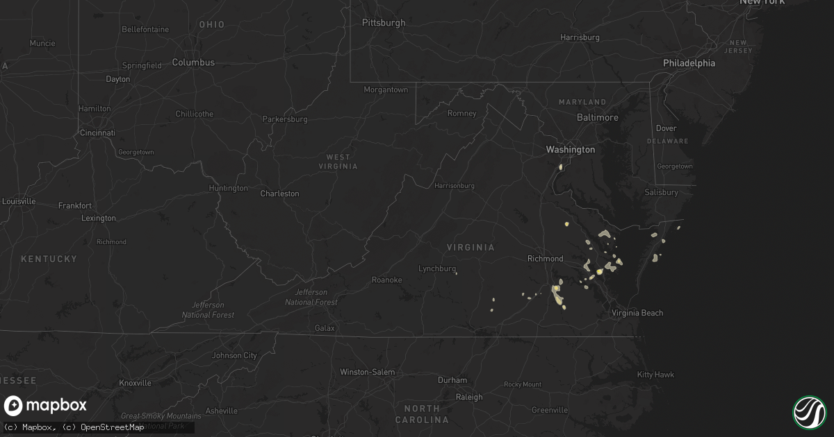
Hail Map in Virginia on August 22, 2021
Get this storm
August 22 map
$229
one time, instant access
Download today. No call, no setup
Keep the $229
Bought the map and want the full workflow? Apply the entire $229 to a subscription within 7 days. None of it is wasted.
Every map, not just this one
This buys you this map. Subscription and you get every map we run, in the markets you choose from a few cities to whole states to nationwide. Plus real-time alerts the moment a storm fires.
Contact data
Name, contact info, occupancy, even credit band for addresses in the footprint. You go from where it hit to who to call.
Become the source they trust
Unlimited branding weather history reports on demand. You already have the documented answer ready for the property owner, and you are the one who showed up with it.
Property data and RoofTrace estimates
Pull up any address you have got, its value and the exact code rules for that jurisdiction, straight from One Click Code. Then RoofTrace estimates the squares, pitch, and roof value, priced the way you price.
Storm reports in Virginia
Virginia
| Date | Description |
|---|---|
| 08/22/20214:45 PM CDT | Several trees down. Time estimated. |
| 08/22/20214:12 PM CDT | Seven trees down in mason neck state park. |
| 08/22/20214:05 PM CDT | 3-4 inch diameter tree branches down. |
| 08/22/20213:55 PM CDT | Numerous power outages |
| 08/22/20213:55 PM CDT | Tree down on the pohick bay golf course. |
| 08/22/20213:45 PM CDT | Wires down near the intersection of old colchester rd. And stewart rd. |
| 08/22/20213:43 PM CDT | Numerous trees down near us 460 east of prince george drive. |
| 08/22/20213:40 PM CDT | Tree down. Time estimated from radar. |
| 08/22/20212:06 PM CDT | Report from hickory fork rd and clay bank rd of quarter to half dollar size hail. |
| 08/22/20212:00 PM CDT | Trees down on browns store road. Time estimated. |
| 08/22/20214:22 AM CDT | At 922 PM EDT, a severe thunderstorm was located near Spring Mills, or near Appomattox, moving south at 30 mph. HAZARD...60 mph wind gusts and quarter size hail. SOURCE...Radar indicated. IMPACT...Hail damage to vehicles is expected. Expect wind damage to roofs, siding, and trees. Locations impacted include... Appomattox... Brookneal... Keysville... Charlotte Court House... Phenix... Red House... and Concord. |
| 08/22/202112:12 AM CDT | At 511 PM EDT, severe thunderstorms were located along a line extending from near Disputanta to Sussex, moving southeast at 15 mph. HAZARD...60 mph wind gusts and penny size hail. SOURCE...Radar indicated. IMPACT...Expect damage to trees and powerlines. Severe thunderstorms will be near... Sussex around 515 PM EDT. Homeville around 525 PM EDT. Waverly around 545 PM EDT. Courtland and Wakefield around 600 PM EDT.Other locations impacted by these severe thunderstorms includeVicksville, Dory, Newville, Booker, Lumberton, Sebrell, Manry andLittleton.# # |
| 08/21/202111:31 PM CDT | At 430 PM EDT, a severe thunderstorm was located over Prince George, or near Fort Lee, moving west at 10 mph. HAZARD...60 mph wind gusts and quarter size hail. SOURCE...Radar indicated. IMPACT...Minor damage to vehicles is possible. Expect wind damage to trees and powerlines. Locations impacted include... Petersburg, Hopewell, Colonial Heights, Virginia State University, Disputanta, Fort Lee, Prince George, Matoaca, Ettrick, Burgess, Birchett Estate, Addison, Reams, Petersburg National Battlefield, New Bohemia, Petersburg Airport, Richard Bland College, Templeton and Prince George Golf.# # |
| 08/21/20219:53 PM CDT | At 253 PM EDT, a severe thunderstorm was located near Heathsville, or near Robley, moving southeast at 10 mph. HAZARD...60 mph wind gusts and quarter size hail. SOURCE...Radar indicated. IMPACT...Minor damage to vehicles is possible. Expect wind damage to trees and powerlines. This severe thunderstorm will be near... Lancaster around 335 PM EDT. Kilmarnock, Fair Port and Wicomico Church around 345 PM EDT.Other locations impacted by this severe thunderstorm include Lara,Byrdton, Browns Store, Somers, Weems, Regina, Mollusk, Alfonso, BrookVale and Nuttsville.# # |
| 08/21/20219:47 PM CDT | At 247 PM EDT, a severe thunderstorm was located over Hayes, or near Gloucester Courthouse, moving southeast at 10 mph. HAZARD...60 mph wind gusts and quarter size hail. SOURCE...Radar indicated. IMPACT...Minor damage to vehicles is possible. Expect wind damage to trees and powerlines. This severe thunderstorm will be near... Hayes around 255 PM EDT. Gloucester Point and Wicomico around 320 PM EDT. Virginia Institute For Marine Sciences, Seaford and Achilles around 330 PM EDT.Other locations impacted by this severe thunderstorm includeOrdinary, Belroi, Lackey, Beulah, Glass, Naxera, Maryus, Severn,Selden and Ware Neck.# # |
| 08/21/20219:41 PM CDT | At 241 PM EDT, a severe thunderstorm was located over Victoria, moving southeast at 10 mph. HAZARD...60 mph wind gusts and quarter size hail. SOURCE...Radar indicated. IMPACT...Minor damage to vehicles is possible. Expect wind damage to trees and powerlines. Locations impacted include... Victoria, Kenbridge, Lunenburg, Dundas, Gary, Irby, Wilburn, Loves Mill, Arvins Store, Murdocks, Nutbush, The Falls, Lafoon Corner, Oral Oaks and Rubermount.# # |
| 08/21/20219:22 PM CDT | At 222 PM EDT, a severe thunderstorm was located over Jamestown, or near College Of William And Mary, and is nearly stationary. HAZARD...60 mph wind gusts and quarter size hail. SOURCE...Radar indicated. IMPACT...Minor damage to vehicles is possible. Expect wind damage to trees and powerlines. Locations impacted include... Newport News, Williamsburg, Surry, College Of William And Mary, Busch Gardens, Scotland, Grove, Kings Point, Jamestown, Fort Eustis, Chippokes State Park, Governors Land, Hog Island Game Reserve, Alliance, Williamsburg Airport and Rushmere.# # |
| 08/21/20218:28 PM CDT | Tree reported down at the intersection of double bridges road and salem road. |
| 08/21/20218:28 PM CDT | A tree down on a powerline along the 4300 block of promise land road. |
| 08/21/20218:19 PM CDT | One tree reported down along county road 727 near appomattox high school. |
All States Impacted by Hail Map on August 22, 2021
Cities Impacted by Hail Map on August 22, 2021
- Drake, ND
- Balfour, ND
- Groton, SD
- Columbia, SD
- Roscoe, SD
- Plankinton, SD
- Letcher, SD
- Wessington Springs, SD
- Leola, SD
- Ellendale, ND
- Long Lake, SD
- Ashley, ND
- Forbes, ND
- Stamford, NE
- Beaver City, NE
- Hendley, NE
- Oberlin, KS
- McCook, NE
- Danbury, NE
- Wilsonville, NE
- Lebanon, NE
- Amherst, NE
- Mansfield, SD
- Warner, SD
- Mellette, SD
- Stratford, SD
- Conde, SD
- Sykeston, ND
- Bowdon, ND
- Star City, AR
- Elida, NM
- Hannaford, ND
- Glenfield, ND
- Sutton, ND
- Courtenay, ND
- Cooperstown, ND
- Wimbledon, ND
- Atlanta, NE
- Agra, KS
- Phillipsburg, KS
- Alexandria, SD
- Mitchell, SD
- Fulton, SD
- Gloucester, VA
- Bladen, NE
- Clemons, IA
- Mountain Lake, MN
- Parkersburg, IA
- New Hartford, IA
- Miller, NE
- Pleasanton, NE
- Ipswich, SD
- Jefferson, IA
- Hudson, IA
- Traer, IA
- Buckingham, IA
- Worthington, MN
- Reading, MN
- Lake Crystal, MN
- Garden City, MN
- Chamberlain, SD
- Tolna, ND
- Pekin, ND
- Mankato, MN
- Magdalena, NM
- Dimock, SD
- Franklin, NE
- Riverton, NE
- Campbell, NE
- Jasper, MN
- Pipestone, MN
- Webster, SD
- Waverly, VA
- Park, KS
- Grainfield, KS
- Canby, MN
- Brandt, SD
- Astoria, SD
- Belvidere, SD
- Okaton, SD
- Ogden, IA
- Boone, IA
- Pilot Mound, IA
- Northville, SD
- Aberdeen, SD
- New Rockford, ND
- Carrington, ND
- Stickney, SD
- Parkston, SD
- Corsica, SD
- Ethan, SD
- Mount Vernon, SD
- Republican City, NE
- Long Island, KS
- Naponee, NE
- Alma, NE
- Almena, KS
- Smith Center, KS
- Bloomington, NE
- Orleans, NE
- Norton, KS
- Red Cloud, NE
- Edison, NE
- Oxford, NE
- Indianola, NE
- Arapahoe, NE
- Inavale, NE
- Holbrook, NE
- Lebanon, KS
- Esbon, KS
- Milford, VA
- Tappahannock, VA
- Howard, SD
- Harvey, ND
- Reinbeck, IA
- Sumner, NE
- Warren, AR
- Hudgins, VA
- Gwynn, VA
- Allison, IA
- Clarksville, IA
- Lorton, VA
- Deshler, NE
- Hardy, NE
- Republic, KS
- Byron, NE
- Oacoma, SD
- Boelus, NE
- Saint Paul, NE
- Dannebrog, NE
- Santa Rosa, NM
- Mchenry, ND
- Heron Lake, MN
- Windom, MN
- Pukwana, SD
- Loup City, NE
- Rockville, NE
- Brewster, MN
- Ravenna, NE
- Kensal, ND
- Martin, ND
- Binford, ND
- Ivanhoe, MN
- Mankato, KS
- Edgeley, ND
- Bristol, SD
- Burr Oak, KS
- Van Horne, IA
- Topping, VA
- Claremont, SD
- Bath, SD
- Williamsburg, VA
- Ashton, NE
- Rutland, SD
- Madison, SD
- Goodrich, ND
- Good Thunder, MN
- Dana, IA
- Elba, NE
- Westport, SD
- Langford, SD
- Lower Brule, SD
- Reliance, SD
- Magnolia, MN
- Kanaranzi, MN
- Adrian, MN
- Parksley, VA
- Esmond, ND
- Upland, NE
- Toledo, IA
- Clutier, IA
- Victoria, VA
- Aneta, ND
- Petersburg, ND
- Niagara, ND
- Mcville, ND
- Holdrege, NE
- Cresbard, SD
- Faulkton, SD
- Eagle Lake, MN
- Kimball, SD
- Gann Valley, SD
- Dysart, IA
- Litchfield, NE
- Hazard, NE
- Ackley, IA
- Aplington, IA
- Kesley, IA
- Champlain, VA
- Hopewell, VA
- Prince George, VA
- Bertrand, NE
- Smithfield, NE
- Hardwick, MN
- Edgerton, MN
- Deltaville, VA
- Kilmarnock, VA
- Disputanta, VA
- Petersburg, VA
- Webber, KS
- Norcatur, KS
- Formoso, KS
- Blue Hill, NE
- Superior, NE
- Cambridge, NE
- Guide Rock, NE
- Berlin, ND
- Elwood, NE
- Gary, SD
- Clear Lake, SD
- Sunbury, NC
- Belvidere, NC
- Hobbsville, NC
- Saint Anthony, IA
- Steen, MN
- Madison, MN
- Woonsocket, SD
- White Lake, SD
- Perryville, AR
- Trent, SD
- Flandreau, SD
- Egan, SD
- Bohannon, VA
- Cardinal, VA
- Dutton, VA
- North, VA
- Foster, VA
- Mathews, VA
- Port Haywood, VA
- Montevideo, MN
- Hickory, MS
- Chunky, MS
- Hildreth, NE
- Newark, MD
- Ramona, SD
- Wentworth, SD
- Nunda, SD
- Winfred, SD
- Oldham, SD
- Shacklefords, VA
- Toano, VA
- Mattaponi, VA
- Barhamsville, VA
- Holcomb, KS
- Lamoure, ND
- Marion, ND
- Dickey, ND
- White, SD
- Toronto, SD
- Perry, OK
- Morrison, OK
- Overton, NE
- Lancaster, VA
- Weems, VA
- Larimore, ND
- Saint Peter, MN
- Nicollet, MN
- Roswell, NM
- Andover, SD
- Minden, NE
- Ellsworth, MN
- Luverne, MN
- Madison Lake, MN
- Madelia, MN
- Waverly, IA
- Shell Rock, IA
- Dike, IA
- Grundy Center, IA
- Kenbridge, VA
- Lunenburg, VA
- Colman, SD
- Carthage, SD
- Arlington, SD
- Chester, NE
- Chester, SD
- Appomattox, VA
- Dawson, MN
- Farnham, VA
- Heathsville, VA
- Rushmore, MN
- Farwell, NE
- Malvern, AR
- Poyen, AR
- Cleveland, MN
- Kasota, MN
- Houston, AR
- Dinwiddie, VA
- Garrison, IA
- Ferney, SD
- Laneview, VA
- Center Cross, VA
- Mascot, VA
- Little Plymouth, VA
- Fairfax, IA
- Atkins, IA
- Paton, IA
- Loomis, NE
- Stratford, IA
- Dayton, IA
- Hoxie, KS
- Surry, VA
- Wilcox, NE
- Bridgewater, SD
- Canistota, SD
- Spencer, SD
- Dewitt, VA
- McKenney, VA
- Maddock, ND
- South Shore, SD
- Fullerton, ND
- Holstein, NE
- Chincoteague Island, VA
- Hills, MN
- Rose Hill, MS
- Grinnell, KS
- Deerfield, KS
- Garden City, KS
- Fort Belvoir, VA
- Bloxom, VA
- Hayes, VA
- Montrose, SD
- Oakley, KS
- Melfa, VA
- Painter, VA
- Wilsons, VA
- Boynton, OK
- Morris, OK
- Accomac, VA
- Cathay, ND
- Grace City, ND
- Hosmer, SD
- Wallace, SD
- Brentford, SD
- Bradley, SD
- Emery, SD
- Canova, SD
- Fedora, SD
- Artesian, SD
- Eden, SD
- Britton, SD
- Houghton, SD
- Roslyn, SD
- Amherst, SD
- Pierpont, SD
- Block Island, RI
- Carolina, RI
- Kingston, RI
- Little Compton, RI
- Middletown, RI
- Rockville, RI
- Wakefield, RI
- Wood River Junction, RI
- Tiverton, RI
- Jamestown, RI
- Exeter, RI
- Wyoming, RI
- Hope Valley, RI
- Ashaway, RI
- Narragansett, RI
- Newport, RI
- Shannock, RI
- North Kingstown, RI
- Bradford, RI
- Hopkinton, RI
- Prudence Island, RI
- Portsmouth, RI
- Saunderstown, RI
- Voluntown, CT
- Kenyon, RI
- West Kingston, RI
- Charlestown, RI
- North Stonington, CT
- Kensington, KS


