Hail Map in Mississippi on August 16, 2022
Get this storm
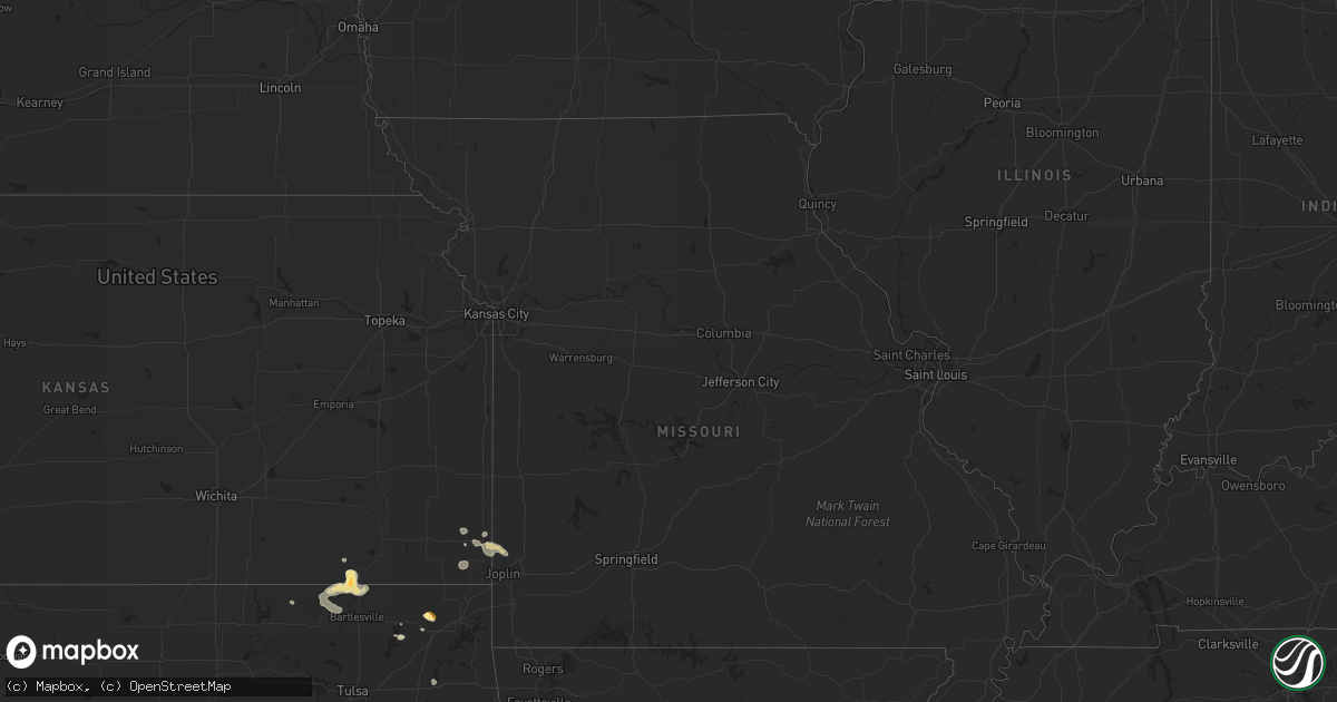
August 16 map
$229
one time, instant access
Download today. No call, no setup
Keep the $229
Bought the map and want the full workflow? Apply the entire $229 to a subscription within 7 days. None of it is wasted.
Every map, not just this one
This buys you this map. Subscription and you get every map we run, in the markets you choose from a few cities to whole states to nationwide. Plus real-time alerts the moment a storm fires.
Contact data
Name, contact info, occupancy, even credit band for addresses in the footprint. You go from where it hit to who to call.
Become the source they trust
Unlimited branding weather history reports on demand. You already have the documented answer ready for the property owner, and you are the one who showed up with it.
Property data and RoofTrace estimates
Pull up any address you have got, its value and the exact code rules for that jurisdiction, straight from One Click Code. Then RoofTrace estimates the squares, pitch, and roof value, priced the way you price.
Storm reports in Mississippi
Mississippi
| Date | Description |
|---|---|
| 08/16/20226:05 PM CDT | Tree downed along howard st in belhaven. |
| 08/16/20225:51 PM CDT | Tree downed onto utility equipment. |
| 08/16/20223:40 PM CDT | Strong wind gusts and downed trees resulting in utility damage. |
| 08/16/20223:29 PM CDT | Trees downed in the toomsuba area... With power lines downed along northshore dr. Reports via social media. |
| 08/16/20221:40 AM CDT | At 640 PM CDT, a severe thunderstorm was located over Brandon, moving southeast at 20 mph. HAZARD...60 mph wind gusts and quarter size hail. SOURCE...Radar indicated. IMPACT...Hail damage to vehicles is expected. Expect wind damage to roofs, siding, and trees. Locations impacted include... Jackson, Brandon and Monterey. |
| 08/16/202212:35 AM CDT | At 535 PM CDT, a severe thunderstorm was located near Myrick, or 10 miles east of Laurel, and is nearly stationary. HAZARD...60 mph wind gusts and quarter size hail. SOURCE...Radar indicated. IMPACT...Hail damage to vehicles is expected. Expect wind damage to roofs, siding, and trees. Locations impacted include... Mill Creek. |
| 08/15/202211:00 PM CDT | At 400 PM CDT, a severe thunderstorm was located 5 miles north of Citronelle, moving south at 25 mph. HAZARD...60 mph wind gusts and quarter size hail. SOURCE...Radar indicated. IMPACT...Hail damage to vehicles is expected. Expect wind damage to roofs, siding, and trees. Locations impacted include... Saraland, Satsuma, Citronelle, Chunchula, Gulfcrest and Deer Park. |
| 08/15/202210:23 PM CDT | At 323 PM CDT, severe thunderstorms were located along a line extending from near Marion to Toomsuba, moving southeast at 20 mph. HAZARD...60 mph wind gusts and nickel size hail. SOURCE...Radar indicated. IMPACT...Expect damage to roofs, siding, and trees. Locations impacted include... Lauderdale, Meridian, Meridian Station, Marion, Alamucha, Toomsuba and Kewanee. |
| 08/15/202210:21 PM CDT | At 321 PM CDT, severe thunderstorms were located along a line extending from near Thomastown to Dowdville, moving southeast at 15 mph. HAZARD...60 mph wind gusts and nickel size hail. SOURCE...Radar indicated. IMPACT...Expect damage to roofs, siding, and trees. Locations impacted include... Carthage, Prospect, Dowdville, Tuscola, Madden, Dixon, Walnut Grove, Sebastopol, Lena, Redwater and Standing Pine. |
All States Impacted by Hail Map on August 16, 2022
Cities Impacted by Hail Map on August 16, 2022
- Ozark, AR
- Victor, NY
- Monticello, AR
- Hollandale, MS
- Perkins, OK
- Cato, NY
- Freeport, FL
- Lonsdale, AR
- Benton, AR
- Cochise, AZ
- Alden, NY
- Attica, NY
- Vinita, OK
- Carthage, MS
- Kosciusko, MS
- Sallis, MS
- Show Low, AZ
- Saint David, AZ
- Collinsville, MS
- Tchula, MS
- Toomsuba, MS
- Las Animas, CO
- Gallup, NM
- Wheatland, ND
- Meridian, MS
- Louin, MS
- Branson, CO
- Enderlin, ND
- Star City, AR
- Mary Esther, FL
- Eglin Afb, FL
- Braxton, MS
- Parishville, NY
- Stanley, NY
- Canandaigua, NY
- Fingal, ND
- Mendenhall, MS
- Brandon, MS
- Sayre, OK
- Elk City, OK
- Mount Vernon, AL
- Walnut Grove, MS
- Philadelphia, MS
- Benson, AZ
- Camden, MS
- Mulberry, AR
- Alma, AR
- Mountainburg, AR
- Wagarville, AL
- Jackson, AL
- Soso, MS
- Taylorsville, MS
- Roulette, PA
- Sedan, KS
- Wimbledon, ND
- Pensacola, FL
- El Reno, OK
- Calumet, OK
- Chipley, FL
- Yazoo City, MS
- Pittsburg, KS
- Belzoni, MS
- Laurel, MS
- Bay Springs, MS
- Waynesboro, MS
- Rohwer, AR
- Ganado, AZ
- Darien Center, NY
- Two Buttes, CO
- Cuba, AL
- Cherokee, KS
- Pennington, MN
- Cass Lake, MN
- Deer River, MN
- Lancaster, NY
- Akron, NY
- Conehatta, MS
- Clifton Springs, NY
- Shidler, OK
- Millry, AL
- Monroeville, AL
- Frisco City, AL
- Carl Junction, MO
- Scammon, KS
- Asbury, MO
- Oronogo, MO
- Webb City, MO
- Weir, KS
- Tucson, AZ
- Springerville, AZ
- Isola, MS
- Saint Johns, AZ
- Union, MS
- Bay Minette, AL
- Nowata, OK
- Silas, AL
- Bluejacket, OK
- Gulf Breeze, FL
- Caney, KS
- Copan, OK
- Niotaze, KS
- Peru, KS
- Pawhuska, OK
- Havana, KS
- Chelsea, OK
- Tombstone, AZ
- Lauderdale, MS
- Locust Grove, OK
- Federal Dam, MN
- Girard, KS
- Toxey, AL
- Gilbertown, AL
- Bartlesville, OK
- Wann, OK
- Navarre, FL
- Florence, MS
- Sugar City, CO
- Heber, AZ
- Pearl, MS
- Stockton, AL
- Cecil, AR
- Vernon, AZ
- Corfu, NY
- Taylor, AZ
- Columbus, KS
- Huachuca City, AZ
- Tibbie, AL
- Deer Park, AL
- Vernon, FL
- Bonifay, FL


