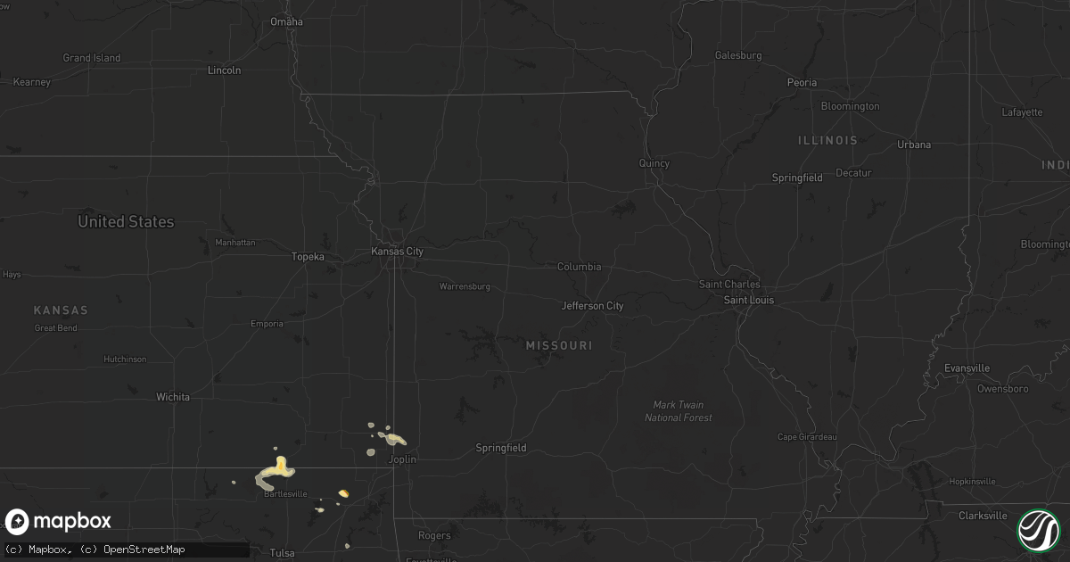
Hail Map in Florida on August 16, 2022
Get this storm
August 16 map
$229
one time, instant access
Download today. No call, no setup
Keep the $229
Bought the map and want the full workflow? Apply the entire $229 to a subscription within 7 days. None of it is wasted.
Every map, not just this one
This buys you this map. Subscription and you get every map we run, in the markets you choose from a few cities to whole states to nationwide. Plus real-time alerts the moment a storm fires.
Contact data
Name, contact info, occupancy, even credit band for addresses in the footprint. You go from where it hit to who to call.
Become the source they trust
Unlimited branding weather history reports on demand. You already have the documented answer ready for the property owner, and you are the one who showed up with it.
Property data and RoofTrace estimates
Pull up any address you have got, its value and the exact code rules for that jurisdiction, straight from One Click Code. Then RoofTrace estimates the squares, pitch, and roof value, priced the way you price.
Storm reports in Florida
Florida
| Date | Description |
|---|---|
| 08/16/202212:50 PM CDT | Spotter reported trees down on 8000 block of hickory grove rd. |
| 08/16/202212:40 PM CDT | Spotter reported downed trees on hwy-145 just south of dusty miller ave. |
| 08/16/202212:15 PM CDT | Media reported a downed tree on fontaine drive between piedmont dr and live oak plantation rd. |
| 08/16/202212:12 PM CDT | Tree on eastbound land of centerville road near pimlico drive. |
| 08/15/202210:47 PM CDT | At 347 PM CDT, a severe thunderstorm was located 5 miles northeast of Navarre Beach, or 7 miles west of Mary Esther, moving southeast at 10 mph. HAZARD...60 mph wind gusts and quarter size hail. SOURCE...Radar indicated. IMPACT...Hail damage to vehicles is expected. Expect wind damage to roofs, siding, and trees. Locations impacted include... Navarre Beach. |
| 08/15/202210:31 PM CDT | At 330 PM CDT, severe thunderstorms were located along a line extending from Eglin Air Force Base to 11 miles northwest of Panama City Beach, moving south at 15 mph. HAZARD...60 mph wind gusts and penny size hail. SOURCE...Radar indicated. IMPACT...Expect damage to roofs, siding, and trees. Locations impacted include... Santa Rosa Beach, Eglin Air Force Base, Freeport, Inlet Beach, Portland, Port Washington, Blue Mountain Beach, Seaside, Gulf Pines, New Home, Bunker, Grayton Beach, Seagrove Beach, Sandestin and Four Mile Village. |
| 08/15/20229:38 PM CDT | At 238 PM CDT, a severe thunderstorm was located 12 miles southeast of De Funiak Springs, moving southeast at 10 mph. HAZARD...60 mph wind gusts and penny size hail. SOURCE...Radar indicated. IMPACT...Expect damage to roofs, siding, and trees. Locations impacted include... Eucheeanna, Knox Hill and Red Bay. |
| 08/15/20229:06 PM CDT | At 206 PM EDT, severe thunderstorms were located along a line extending from 13 miles southwest of Monticello to 10 miles east of Woodville, moving east at 25 mph. HAZARD...60 mph wind gusts. SOURCE...Radar indicated. IMPACT...Expect damage to roofs, siding, and trees. Locations impacted include... Woodville, Cody, Goose Pasture, Hells Half Acre, Fanlew, Wacissa, Wacissa Springs, Natural Bridge, Cabbage Grove, Thomas City and Econfina. |
| 08/15/20228:59 PM CDT | At 159 PM CDT, a severe thunderstorm was located near Bonifay, moving southeast at 10 mph. HAZARD...60 mph wind gusts and penny size hail. SOURCE...Radar indicated. IMPACT...Expect damage to roofs, siding, and trees. Locations impacted include... Vernon, Chipley, Bradford, Wausau, Brock Crossroad, Chipley Municipal Airport, Orange Hill, Whitehead Crossroads, Five Points, Smyrna, Spring Hollow, Sunny Hills, Poplar Head, Sylvania and Johnson Crossroads. |
All States Impacted by Hail Map on August 16, 2022
Cities Impacted by Hail Map on August 16, 2022
- Ozark, AR
- Victor, NY
- Monticello, AR
- Hollandale, MS
- Perkins, OK
- Cato, NY
- Freeport, FL
- Lonsdale, AR
- Benton, AR
- Cochise, AZ
- Alden, NY
- Attica, NY
- Vinita, OK
- Carthage, MS
- Kosciusko, MS
- Sallis, MS
- Show Low, AZ
- Saint David, AZ
- Collinsville, MS
- Tchula, MS
- Toomsuba, MS
- Las Animas, CO
- Gallup, NM
- Wheatland, ND
- Meridian, MS
- Louin, MS
- Branson, CO
- Enderlin, ND
- Star City, AR
- Mary Esther, FL
- Eglin Afb, FL
- Braxton, MS
- Parishville, NY
- Stanley, NY
- Canandaigua, NY
- Fingal, ND
- Mendenhall, MS
- Brandon, MS
- Sayre, OK
- Elk City, OK
- Mount Vernon, AL
- Walnut Grove, MS
- Philadelphia, MS
- Benson, AZ
- Camden, MS
- Mulberry, AR
- Alma, AR
- Mountainburg, AR
- Wagarville, AL
- Jackson, AL
- Soso, MS
- Taylorsville, MS
- Roulette, PA
- Sedan, KS
- Wimbledon, ND
- Pensacola, FL
- El Reno, OK
- Calumet, OK
- Chipley, FL
- Yazoo City, MS
- Pittsburg, KS
- Belzoni, MS
- Laurel, MS
- Bay Springs, MS
- Waynesboro, MS
- Rohwer, AR
- Ganado, AZ
- Darien Center, NY
- Two Buttes, CO
- Cuba, AL
- Cherokee, KS
- Pennington, MN
- Cass Lake, MN
- Deer River, MN
- Lancaster, NY
- Akron, NY
- Conehatta, MS
- Clifton Springs, NY
- Shidler, OK
- Millry, AL
- Monroeville, AL
- Frisco City, AL
- Carl Junction, MO
- Scammon, KS
- Asbury, MO
- Oronogo, MO
- Webb City, MO
- Weir, KS
- Tucson, AZ
- Springerville, AZ
- Isola, MS
- Saint Johns, AZ
- Union, MS
- Bay Minette, AL
- Nowata, OK
- Silas, AL
- Bluejacket, OK
- Gulf Breeze, FL
- Caney, KS
- Copan, OK
- Niotaze, KS
- Peru, KS
- Pawhuska, OK
- Havana, KS
- Chelsea, OK
- Tombstone, AZ
- Lauderdale, MS
- Locust Grove, OK
- Federal Dam, MN
- Girard, KS
- Toxey, AL
- Gilbertown, AL
- Bartlesville, OK
- Wann, OK
- Navarre, FL
- Florence, MS
- Sugar City, CO
- Heber, AZ
- Pearl, MS
- Stockton, AL
- Cecil, AR
- Vernon, AZ
- Corfu, NY
- Taylor, AZ
- Columbus, KS
- Huachuca City, AZ
- Tibbie, AL
- Deer Park, AL
- Vernon, FL
- Bonifay, FL


