Hail Map in Arizona on August 16, 2022
Get this storm
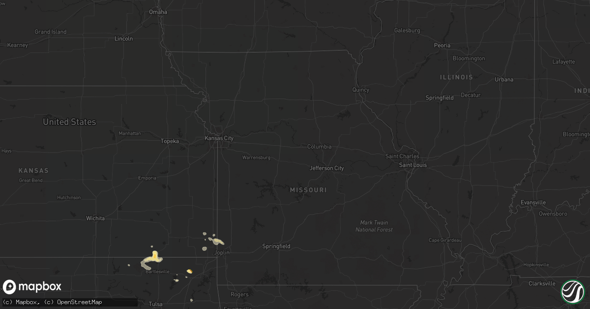
August 16 map
$229
one time, instant access
Download today. No call, no setup
Keep the $229
Bought the map and want the full workflow? Apply the entire $229 to a subscription within 7 days. None of it is wasted.
Every map, not just this one
This buys you this map. Subscription and you get every map we run, in the markets you choose from a few cities to whole states to nationwide. Plus real-time alerts the moment a storm fires.
Contact data
Name, contact info, occupancy, even credit band for addresses in the footprint. You go from where it hit to who to call.
Become the source they trust
Unlimited branding weather history reports on demand. You already have the documented answer ready for the property owner, and you are the one who showed up with it.
Property data and RoofTrace estimates
Pull up any address you have got, its value and the exact code rules for that jurisdiction, straight from One Click Code. Then RoofTrace estimates the squares, pitch, and roof value, priced the way you price.
Storm reports in Arizona
Arizona
| Date | Description |
|---|---|
| 08/16/20226:54 AM CDT | At 1153 AM MST, a severe thunderstorm was located over Vernon, or 21 miles east of Show Low, moving northwest at 10 mph. HAZARD...Quarter size hail. SOURCE...Radar indicated. IMPACT...Damage to vehicles is expected. Locations impacted include... Vernon. |
| 08/16/20224:40 AM CDT | At 939 PM MST, a severe thunderstorm was located near Kartchner Caverns State Park, or 9 miles southwest of Benson, moving southwest at 25 mph. HAZARD...60 mph wind gusts and quarter size hail. SOURCE...Radar indicated. IMPACT...Hail damage to vehicles is expected. Expect wind damage to roofs, siding, and trees. Locations impacted include... Kartchner Caverns State Park. |
| 08/16/20221:29 AM CDT | At 628 PM MST, a severe thunderstorm was located over Casas Adobes, or near Oro Valley, and is nearly stationary. HAZARD...60 mph wind gusts, quarter size hail and brief heavy rain. SOURCE...Radar indicated. IMPACT...Hail damage to vehicles is expected. Expect wind damage to roofs, siding, and trees. Locations impacted include... Oro Valley, Marana, Casas Adobes, Flowing Wells and Tortolita. |
| 08/16/20221:14 AM CDT | At 613 PM MST, a severe thunderstorm was located 9 miles west of Benson, moving west at 5 mph. HAZARD...60 mph wind gusts, quarter size hail and brief heavy rain. SOURCE...Radar indicated. IMPACT...Hail damage to vehicles is expected. Expect wind damage to roofs, siding, and trees. Locations impacted include... Mescal. |
| 08/16/202212:42 AM CDT | At 542 PM MST, severe thunderstorms were located along a line extending from near Kinter to near Ligurta to 13 miles southeast of Fortuna Foothills, and are nearly stationary. HAZARD...60 mph wind gusts. SOURCE...Radar indicated. IMPACT...Expect damage to roofs, siding, and trees. Locations impacted include... Fortuna Foothills, Wellton, Blaisdell, Ligurta and Kinter. This includes the following highways...AZ Interstate 8 between mile markers 11 and 29.AZ Route 95 between mile markers 33 and 44. |
| 08/15/202210:55 PM CDT | At 354 PM MST, a severe thunderstorm was located over Window Rock, moving northwest at 15 mph. HAZARD...60 mph wind gusts and quarter size hail. SOURCE...Radar indicated. IMPACT...Hail damage to vehicles is expected. Expect wind damage to roofs, siding, and trees. Locations impacted include... Fort Defiance, Window Rock and St. Michaels. |
| 08/15/202210:23 PM CDT | At 322 PM MST, a severe thunderstorm was located 13 miles southwest of Woodruff, or 32 miles north of Show Low, moving northeast at 15 mph. HAZARD...Quarter size hail. SOURCE...Radar indicated. IMPACT...Damage to vehicles is expected. This severe thunderstorm will remain over mainly rural areas of Navajo County. |
| 08/15/202210:22 PM CDT | At 322 PM MST, a severe thunderstorm was located 13 miles southwest of Woodruff, or 32 miles north of Show Low, moving northeast at 15 mph. HAZARD...Quarter size hail. SOURCE...Radar indicated. IMPACT...Damage to vehicles is expected. This severe thunderstorm will remain over mainly rural areas of Navajo County. |
| 08/15/20228:37 PM CDT | Major tree limbs down and flooding. |
All States Impacted by Hail Map on August 16, 2022
Cities Impacted by Hail Map on August 16, 2022
- Ozark, AR
- Victor, NY
- Monticello, AR
- Hollandale, MS
- Perkins, OK
- Cato, NY
- Freeport, FL
- Lonsdale, AR
- Benton, AR
- Cochise, AZ
- Alden, NY
- Attica, NY
- Vinita, OK
- Carthage, MS
- Kosciusko, MS
- Sallis, MS
- Show Low, AZ
- Saint David, AZ
- Collinsville, MS
- Tchula, MS
- Toomsuba, MS
- Las Animas, CO
- Gallup, NM
- Wheatland, ND
- Meridian, MS
- Louin, MS
- Branson, CO
- Enderlin, ND
- Star City, AR
- Mary Esther, FL
- Eglin Afb, FL
- Braxton, MS
- Parishville, NY
- Stanley, NY
- Canandaigua, NY
- Fingal, ND
- Mendenhall, MS
- Brandon, MS
- Sayre, OK
- Elk City, OK
- Mount Vernon, AL
- Walnut Grove, MS
- Philadelphia, MS
- Benson, AZ
- Camden, MS
- Mulberry, AR
- Alma, AR
- Mountainburg, AR
- Wagarville, AL
- Jackson, AL
- Soso, MS
- Taylorsville, MS
- Roulette, PA
- Sedan, KS
- Wimbledon, ND
- Pensacola, FL
- El Reno, OK
- Calumet, OK
- Chipley, FL
- Yazoo City, MS
- Pittsburg, KS
- Belzoni, MS
- Laurel, MS
- Bay Springs, MS
- Waynesboro, MS
- Rohwer, AR
- Ganado, AZ
- Darien Center, NY
- Two Buttes, CO
- Cuba, AL
- Cherokee, KS
- Pennington, MN
- Cass Lake, MN
- Deer River, MN
- Lancaster, NY
- Akron, NY
- Conehatta, MS
- Clifton Springs, NY
- Shidler, OK
- Millry, AL
- Monroeville, AL
- Frisco City, AL
- Carl Junction, MO
- Scammon, KS
- Asbury, MO
- Oronogo, MO
- Webb City, MO
- Weir, KS
- Tucson, AZ
- Springerville, AZ
- Isola, MS
- Saint Johns, AZ
- Union, MS
- Bay Minette, AL
- Nowata, OK
- Silas, AL
- Bluejacket, OK
- Gulf Breeze, FL
- Caney, KS
- Copan, OK
- Niotaze, KS
- Peru, KS
- Pawhuska, OK
- Havana, KS
- Chelsea, OK
- Tombstone, AZ
- Lauderdale, MS
- Locust Grove, OK
- Federal Dam, MN
- Girard, KS
- Toxey, AL
- Gilbertown, AL
- Bartlesville, OK
- Wann, OK
- Navarre, FL
- Florence, MS
- Sugar City, CO
- Heber, AZ
- Pearl, MS
- Stockton, AL
- Cecil, AR
- Vernon, AZ
- Corfu, NY
- Taylor, AZ
- Columbus, KS
- Huachuca City, AZ
- Tibbie, AL
- Deer Park, AL
- Vernon, FL
- Bonifay, FL


