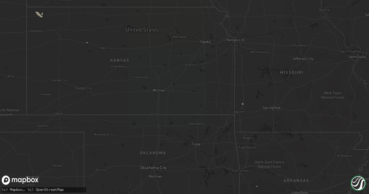
Hail Map on August 15, 2022
Get this storm
August 15 map
$229
one time, instant access
Download today. No call, no setup
Keep the $229
Bought the map and want the full workflow? Apply the entire $229 to a subscription within 7 days. None of it is wasted.
Every map, not just this one
This buys you this map. Subscription and you get every map we run, in the markets you choose from a few cities to whole states to nationwide. Plus real-time alerts the moment a storm fires.
Contact data
Name, contact info, occupancy, even credit band for addresses in the footprint. You go from where it hit to who to call.
Become the source they trust
Unlimited branding weather history reports on demand. You already have the documented answer ready for the property owner, and you are the one who showed up with it.
Property data and RoofTrace estimates
Pull up any address you have got, its value and the exact code rules for that jurisdiction, straight from One Click Code. Then RoofTrace estimates the squares, pitch, and roof value, priced the way you price.
States Impacted by Hail Map on August 15, 2022
Storm reports
Colorado
| Date | Description |
|---|---|
| 08/15/20225:32 PM CDT | A local report indicates 1.00 inch wind near 8 ENE FONDIS |
| 08/15/20225:25 PM CDT | A local report indicates 1.00 inch wind near 4 WNW PEYTON |
| 08/15/20225:05 PM CDT | A local report indicates 58 MPH wind near 10 ESE ARAPAHOE PARK |
| 08/15/20224:27 PM CDT | A local report indicates 62 MPH wind near 2 NE LONE TREE |
| 08/14/202211:29 PM CDT | At 428 PM MDT, a severe thunderstorm was located 11 miles north of Ramah, or 28 miles west of Limon, and is nearly stationary. HAZARD...60 mph wind gusts and quarter size hail. SOURCE...Radar indicated. IMPACT...Expect damage to roofs, siding, and trees. Hail damage to vehicles is expected. This severe thunderstorm will remain over mainly rural areas of central Elbert County. |
| 08/14/202210:56 PM CDT | At 356 PM MDT, a severe thunderstorm was located near Peyton, or 21 miles northeast of Colorado Springs, moving north at 10 mph. HAZARD...60 mph wind gusts and half dollar size hail. SOURCE...Radar indicated. IMPACT...Hail damage to vehicles is expected. Expect wind damage to roofs, siding, and trees. Locations impacted include... Peyton. |
| 08/14/202210:50 PM CDT | At 350 PM MDT, a severe thunderstorm was located 6 miles east of Arapahoe Park, or 21 miles east of Denver, moving northeast at 30 mph. HAZARD...70 mph wind gusts and nickel size hail. SOURCE...Radar indicated. IMPACT...Expect considerable tree damage. Damage is likely to mobile homes, roofs, and outbuildings. This severe thunderstorm will be near... Watkins around 400 PM MDT. Manila Village around 405 PM MDT.Other locations in the path of this severe thunderstorm includeBennett. |
| 08/14/202210:27 PM CDT | At 327 PM MDT, a severe thunderstorm was located near The Pinery, or 19 miles south of Denver, moving northeast at 20 mph. HAZARD...60 mph wind gusts and quarter size hail. SOURCE...Radar indicated. IMPACT...Expect damage to roofs, siding, and trees. Hail damage to vehicles is expected. This severe thunderstorm will be near... The Pinery around 335 PM MDT. Lone Tree around 340 PM MDT. Eastern Centennial and Parker around 345 PM MDT.Other locations in the path of this severe thunderstorm includesouthwestern Aurora, Arapahoe Park and Buckley AFB. |
Kansas
| Date | Description |
|---|---|
| 08/15/20225:58 PM CDT | Report from mping: 1-inch tree limbs broken; shingles blown off. |
California
| Date | Description |
|---|---|
| 08/14/202211:51 PM CDT | At 451 PM PDT, a severe thunderstorm was located 7 miles southwest of Desert Center, and is nearly stationary. HAZARD...60 mph wind gusts and penny size hail. SOURCE...Radar indicated. IMPACT...Expect damage to roofs, siding, and trees. Locations impacted include... Desert Center.This includes the following highways...CA Interstate 10 between mile markers 90 and 106.CA Route 177 near mile marker 1. |
| 08/14/20229:45 PM CDT | At 245 PM PDT, a severe thunderstorm was located 14 miles north of Indio, and is nearly stationary. HAZARD...60 mph wind gusts and quarter size hail. SOURCE...Radar indicated. IMPACT...Hail damage to vehicles is expected. Expect wind damage to roofs, siding, and trees. Locations impacted include... Lost Horse-Keys Village. |
South Carolina
| Date | Description |
|---|---|
| 08/15/20225:40 PM CDT | 911 call center reported powerlines down on tillman territory |
| 08/15/20225:40 PM CDT | 911 call center reported powerlines down on tillman territory rd |
| 08/15/20225:17 PM CDT | Numerous trees down across the city of greenwood as well as power outages. |
| 08/15/20224:05 PM CDT | A section of the us post office roof was blown off. The post office is located on main st. |
| 08/15/20224:05 PM CDT | Several trees and some power poles down along east gibson ave. |
| 08/15/20223:40 PM CDT | Tree down in roadway sc 38 |
| 08/15/20221:37 AM CDT | At 636 PM EDT, severe thunderstorms were located along a line extending from 25 miles south of Laurens to 7 miles southeast of Greenwood to near Abbeville, moving southeast at 35 mph. |
| 08/15/20221:06 AM CDT | At 606 PM EDT, a severe thunderstorm was located 4 miles north of Greenwood, or near Cokesbury, moving southeast at 25 mph. HAZARD...60 mph wind gusts and quarter size hail. SOURCE...Radar indicated. IMPACT...Minor hail damage to vehicles is expected. Expect wind damage to trees and power lines. Locations impacted include... Greenwood, Ninety Six, Cokesbury, Hodges, Lake Greenwood State Park, Lake Greenwood, Greenwood State Park, Ninety Six Historic Site, Coronaca and Kirksey. |
| 08/14/202211:43 PM CDT | At 443 PM EDT, a severe thunderstorm was located near Mccoll, or near Bennettsville, moving southeast at 20 mph. HAZARD...70 mph wind gusts and ping pong ball size hail. SOURCE...Radar indicated. IMPACT...People and animals outdoors will be injured. Expect hail damage to roofs, siding, windows, and vehicles. Expect considerable tree damage. Wind damage is also likely to mobile homes, roofs, and outbuildings. Locations impacted include... Bennettsville, Mccoll, Clio, Raemon, Dunbar, Minturn, Gibson and Tatum. |
| 08/14/202211:39 PM CDT | At 439 PM EDT, a severe thunderstorm was located 8 miles north of Shelby, or over Lawndale, moving southeast at 20 mph. HAZARD...60 mph wind gusts and quarter size hail. SOURCE...Radar indicated. IMPACT...Minor hail damage to vehicles is expected. Expect wind damage to trees and power lines. Locations impacted include... Lincolnton, Kings Mountain, Cherryville, Bessemer City, Dallas, Belwood, High Shoals, Lawndale, Fallston and Polkville. |
| 08/14/202211:02 PM CDT | At 402 PM EDT, a severe thunderstorm was located near Hamlet, or 7 miles south of Rockingham, moving southeast at 25 mph. HAZARD...60 mph wind gusts and quarter size hail. SOURCE...Radar indicated. IMPACT...Hail damage to vehicles is expected. Expect wind damage to roofs, siding, and trees. Locations impacted include... Laurinburg, Rockingham, Hamlet, Dobbins Heights, Gibson, East Laurinburg, East Rockingham, Diggs and Laurel Hill. |
| 08/14/202211:00 PM CDT | At 359 PM EDT, a severe thunderstorm was located near Rockingham, moving southeast at 25 mph. HAZARD...60 mph wind gusts and quarter size hail. SOURCE...Radar indicated. IMPACT...Minor hail damage to vehicles is possible. Expect wind damage to trees and power lines. Locations impacted include... Bennettsville, Mccoll, Clio, Chavistown, Gibson and Tatum. |
| 08/14/20227:55 PM CDT | Local broadcast media reported golf ball sized hail near the intersection of highway 66 and long horne ranch drive. Time estimated by radar. |
Alabama
| Date | Description |
|---|---|
| 08/15/20225:21 PM CDT | Tree down and blocking the road/405. Time estimated from radar. |
| 08/15/20225:17 PM CDT | Trees were blown down at highway 77 in kingdom crossroads. |
| 08/15/20225:08 PM CDT | A large tree was blown on e college st. |
| 08/15/20224:55 PM CDT | Trees reported down at james circle and hwy 26. |
| 08/15/20224:08 PM CDT | The roof was damaged at the fire department in ragland. This corrects the report of roof damage in ashville. |
| 08/15/20224:08 PM CDT | T |
| 08/15/20224:00 PM CDT | A few trees were blown down. Some were blocking roadways. |
| 08/15/20223:58 PM CDT | Multiple trees and power lines down in boaz. Time estimated from radar. |
| 08/15/20223:58 PM CDT | Tin roofing partially blown off a store near downtown boaz. Time estimated from radar. |
| 08/15/20223:57 PM CDT | A few trees were blown down in ashville. |
| 08/15/20223:57 PM CDT | Numerous trees and power lines were blown down around ashville. One has landed on a manufactured home. |
| 08/15/20223:51 PM CDT | The ashville police department has suffered roof damage from high wind. |
| 08/15/202212:26 AM CDT | At 526 PM CDT, a severe thunderstorm was located over Talladega Springs, moving east at 20 mph. HAZARD...60 mph wind gusts. SOURCE...Radar indicated. IMPACT...Expect damage to roofs, siding, and trees. Locations impacted include... Sylacauga, Talladega Springs, Weogufka, Stewartville, Hanover, Fayetteville, Strickland Crossroads, Bentleyville, Unity, Marble Valley, Lay Lake, Overbrook, Cedar Creek, Gantts Quarry, Shelby Shores and Alabama 4H Center. |
| 08/15/202212:24 AM CDT | At 524 PM CDT, a severe thunderstorm was located 4 miles northwest of Myrtle Grove, or 5 miles northwest of West Pensacola, moving southeast at 5 mph. HAZARD...60 mph wind gusts and nickel size hail. SOURCE...Radar indicated. IMPACT...Expect damage to roofs, siding, and trees. Locations impacted include... Pensacola, Brent, West Pensacola, Ensley, Warrington, Goulding and Myrtle Grove. |
| 08/14/202211:55 PM CDT | At 455 PM CDT, a severe thunderstorm was located near Columbiana, moving southeast at 20 mph. HAZARD...60 mph wind gusts. SOURCE...Radar indicated. IMPACT...Expect damage to roofs, siding, and trees. Locations impacted include... Calera, Columbiana, Wilsonville, Lay Lake, Shelby, Bounds Lake, Beeswax Creek Park, Alabama 4H Center, Shelby Shores, Highway 145 and CR 46, Spring Creek and Kelley Branch. |
| 08/14/202211:14 PM CDT | At 414 PM CDT, a severe thunderstorm was located over Ashbank, or near Lynn, moving southeast at 20 mph. HAZARD...60 mph wind gusts and nickel size hail. SOURCE...Radar indicated. IMPACT...Expect damage to roofs, siding, and trees. Locations impacted include... Lynn, Nauvoo, Poplar Springs, Camp McDowell, Ashbank, Smith Lake, Coon Creek, Clear Creek, Lupton, Seymour Branch and Black Pond. |
| 08/14/202210:43 PM CDT | At 343 PM CDT, a severe thunderstorm was located near Ashville, or 7 miles northeast of Springville, moving southeast at 20 mph. HAZARD...60 mph wind gusts and quarter size hail. SOURCE...Radar indicated. IMPACT...Hail damage to vehicles is expected. Expect wind damage to roofs, siding, and trees. Locations impacted include... Springville, Ashville, Riverside, Ragland, Neely Henry Lake, Logan Martin Lake, Whitney Junction, St. Clair Springs, Wattsville, Neely Henry Dam, Caldwell and I 59 Rest Areas At Oneonta. |
| 08/14/202210:31 PM CDT | At 331 PM CDT, a severe thunderstorm was located near Poplar Springs, or 8 miles east of Lynn, moving southeast at 20 mph. HAZARD...60 mph wind gusts and nickel size hail. SOURCE...Radar indicated. IMPACT...Expect damage to roofs, siding, and trees. Locations impacted include... Jasper, Arley, Double Springs, Curry, Houston Recreational Area, Camp McDowell, Smith Lake, Poplar Springs, Corinth Rec Area, Falls City, Maple Branch, Hullett Branch, Clear Creek, Winston County Airport, Cane Creek, Little Dismal Creek, Yellow Creek, Coon Creek, Rockhouse Creek and Battle Branch. |
Virginia
| Date | Description |
|---|---|
| 08/15/20224:38 PM CDT | Tree down on bertha st. Time estimated from radar. |
| 08/15/20227:13 AM CDT | At 1212 AM EDT, a severe thunderstorm was located over Bristol Tn, moving southeast at 20 mph. HAZARD...60 mph wind gusts and penny size hail. SOURCE...Radar indicated. IMPACT...Expect damage to roofs, siding, and trees. Locations impacted include... Bristol Tn, Bristol Va, Mountain City, Walnut Hill, Bluff City, Hunter, Morril's Cave, Blountville, Sadie and Elk Mills.This includes the following highways... Interstate 81 in Tennessee between mile markers 68 and 75. Interstate 81 in Virginia between mile markers 1 and 7. |
| 08/14/202211:57 PM CDT | At 457 PM EDT, a severe thunderstorm was located over Wytheville, moving east at 25 mph. HAZARD...60 mph wind gusts and quarter size hail. SOURCE...Radar indicated. IMPACT...Hail damage to vehicles is expected. Expect wind damage to roofs, siding, and trees. Locations impacted include... Pulaski... Wytheville... Dublin... Max Meadows... Patterson... Allisonia... and Indian Valley. |
North Dakota
| Date | Description |
|---|---|
| 08/15/20225:50 PM CDT | Public report of another tornado on the ground. |
| 08/15/20225:35 PM CDT | Tornado touchdown and then lifted within a few minutes. |
| 08/15/20225:25 PM CDT | Public report of a tornado touchdown. |
| 08/15/20228:12 AM CDT | 40 to 50 mph wind gusts with the hail. |
| 08/15/20223:05 AM CDT | At 805 PM CDT, a severe thunderstorm was located 6 miles east of New Salem, or 18 miles west of Mandan, moving south at 15 mph. HAZARD...Half dollar size hail. SOURCE...Radar indicated. IMPACT...Damage to vehicles is expected. This severe thunderstorm will be near... Fish Creek Dam around 835 PM CDT.Other locations impacted by this severe thunderstorm include SweetBriar Lake and Judson. |
| 08/15/20222:59 AM CDT | At 759 AM CDT, a severe thunderstorm was located over Lake Metigoshe State Park, or 13 miles northeast of Bottineau, moving east at 30 mph. HAZARD...Ping pong ball size hail and 60 mph wind gusts. SOURCE...Radar indicated. IMPACT...People and animals outdoors will be injured. Expect hail damage to roofs, siding, windows, and vehicles. Expect wind damage to roofs, siding, and trees. This severe thunderstorm will be near... International Peace Garden around 815 AM CDT. St. John and Belcourt around 850 AM CDT. Rolla around 900 AM CDT.Other locations impacted by this severe thunderstorm include ShellValley. |
Arkansas
| Date | Description |
|---|---|
| 08/15/20224:36 PM CDT | Multiple trees damaged with some damage also occurring to a roof... Shed... And fence. Report relayed via social media. |
| 08/15/20222:39 AM CDT | At 739 PM CDT, a severe thunderstorm was located 3 miles east of Cedarville, moving northeast at 10 mph. HAZARD...60 mph wind gusts and penny size hail. SOURCE...Radar indicated. IMPACT...Expect damage to roofs, siding, and trees. Locations in or near the path include... Cedarville... Mountainburg... Chester... Rudy... Lee Creek... Furry...This includes Interstate 49 between mile markers 22 and 32. |
| 08/15/202212:00 AM CDT | At 500 PM CDT, a severe thunderstorm was located near Mimosa, or 11 miles southwest of Mount Ida, and is nearly stationary. HAZARD...60 mph wind gusts and quarter size hail. SOURCE...Radar indicated. IMPACT...Hail damage to vehicles is expected. Expect wind damage to roofs, siding, and trees. Locations impacted include... Mimosa... |
| 08/14/202211:16 PM CDT | At 416 PM CDT, a severe thunderstorm was located over Hot Springs National Park, or near Hot Springs, and is nearly stationary. HAZARD...60 mph wind gusts and quarter size hail. SOURCE...Radar indicated. IMPACT...Hail damage to vehicles is expected. Expect wind damage to roofs, siding, and trees. Locations impacted include... Hot Springs... Hot Springs National Park... Red Oak... Oaklawn Racetrack... Gulpha Gorge... |
| 08/14/202210:43 PM CDT | At 343 PM CDT, a severe thunderstorm was located 7 miles northwest of Holman, or 9 miles northeast of Clarksville, and is nearly stationary. HAZARD...60 mph wind gusts and quarter size hail. SOURCE...Radar indicated. IMPACT...Hail damage to vehicles is expected. Expect wind damage to roofs, siding, and trees. Locations impacted include... Holman... Ozone... Hillcrest in Johnson County... |
| 08/14/202210:27 PM CDT | At 327 PM CDT, severe thunderstorms were located along a line extending from near Cardiff to 9 miles north of Oden, and are nearly stationary. HAZARD...60 mph wind gusts and quarter size hail. SOURCE...Radar indicated. IMPACT...Hail damage to vehicles is expected. Expect wind damage to roofs, siding, and trees. Locations impacted include... Cardiff... Harvey... Union Hill... Parks... Olio... Cedar Creek... |
Texas
| Date | Description |
|---|---|
| 08/15/20226:30 PM CDT | A local laredo news station reported video of gas station roof damage due to strong thunderstorm winds. Time estimated by radar. |
| 08/15/202212:57 AM CDT | At 557 PM CDT, severe thunderstorms were located along a line extending from 8 miles south of Ranchitos Las Lomas to 8 miles southeast of Rio Bravo, moving north at 25 mph. HAZARD...60 mph wind gusts. SOURCE...Radar indicated. IMPACT...Expect damage to roofs, siding, and trees. Locations impacted include... Laredo, Rio Bravo, Texas A&M, Laredo International Airport, St Augustine High School South Laredo, Doctors Hospital Of Laredo, Laredo Country Club, Laredo Community College, United South High School and Ranchitos Las Lomas.This includes the following highways... Interstate 35 between mile markers 1 and 5. US Highway 59 between mile markers 812 and 824. US Highway 83 between mile markers 718 and 730. |
Nevada
| Date | Description |
|---|---|
| 08/14/20228:18 PM CDT | At 117 PM PDT, a severe thunderstorm was located 11 miles northeast of Beatty, moving southwest at 10 mph. HAZARD...60 mph wind gusts. SOURCE...Radar indicated. IMPACT...Expect damage to roofs and trees. Locations impacted include... Beatty and Lathrop Wells. |
Montana
| Date | Description |
|---|---|
| 08/14/202210:36 PM CDT | Asos station kjdn jordan. Likely outflow from dying storm to the west. |
Georgia
| Date | Description |
|---|---|
| 08/15/20226:03 PM CDT | Multiple trees with powerlines down along sunrise rd near the intersections of bunkham rd and fallin rd. |
| 08/15/20225:55 PM CDT | Downed tree blocking both lanes of hwy 74 west of thomaston near baker britt rd and potato creek |
| 08/15/20224:45 AM CDT | At 944 PM CDT, a severe thunderstorm was located over Barbour County Public Lake Dam, or 9 miles southeast of Midway, moving southeast at 25 mph. HAZARD...60 mph wind gusts. SOURCE...Radar indicated. IMPACT...Expect damage to roofs, siding, and trees. Locations impacted include... Clayton, Osco, Gaino, Richards Crossroads, White Oak, Barbour County Public Lake Dam, Millers Ford, Baker Hill, Clayton Municipal Airport and Mount Andrew. |
| 08/15/20221:54 AM CDT | At 654 PM EDT, a severe thunderstorm was located near Big Lazer Creek Wma, or 8 miles southwest of Thomaston, moving southeast at 25 mph. HAZARD...60 mph wind gusts. SOURCE...Radar indicated. IMPACT...Expect damage to roofs, siding, and trees. Locations impacted include... Thomaston, Woodland, Sunset Village, Lincoln Park, Baldwinville, Po Biddy Crossroads, Sprewell Bluff State Park, Pleasant Hill, Howard, Sunnyside, Salem, Prattsburg, Big Lazer Creek Wma, Carsonville, Wesley Church and Fickling Mill. |
Arizona
| Date | Description |
|---|---|
| 08/15/20227:34 AM CDT | At 1233 PM MST, a severe thunderstorm was located over Parker Canyon Lake, or 14 miles west of Sierra Vista, moving northwest at 10 mph. HAZARD...60 mph wind gusts and nickel size hail. SOURCE...Radar indicated. IMPACT...Expect damage to roofs, siding, and trees. Locations impacted include... Elgin, Parker Canyon Lake, Fort Huachuca and Canelo. |
| 08/14/20229:11 PM CDT | At 210 PM MST, a severe thunderstorm was located 14 miles northeast of Pearce-Sunsites, or 18 miles southeast of Willcox, moving northwest at 5 to 10 mph. HAZARD...60 mph wind gusts and penny size hail. SOURCE...Radar indicated. IMPACT...Expect damage to roofs, siding, and trees. Locations impacted include... Kansas Settlement. |
| 08/14/20228:36 PM CDT | At 135 PM MST, a severe thunderstorm was located near and south of Sonoita, or 22 miles east of Tubac, and is nearly stationary. HAZARD...60 mph wind gusts and penny size hail. SOURCE...Radar indicated. IMPACT...Expect damage to roofs, siding, and trees. Locations impacted include... Patagonia, Sonoita. |
Florida
| Date | Description |
|---|---|
| 08/15/20225:33 PM CDT | Reports of quarter size hail west of the bellview community. Report via social media. |
| 08/15/20225:25 PM CDT | Pictures of quarter size hail falling near point baker. Report via social media. |
| 08/15/202212:23 AM CDT | At 522 PM CDT, a severe thunderstorm was located near Point Baker, or 5 miles northwest of Milton, and is nearly stationary. HAZARD...60 mph wind gusts. SOURCE...Radar indicated. IMPACT...Expect damage to roofs, siding, and trees. Locations impacted include... Pace, Milton, Floridatown, Point Baker and Pea Ridge. |
North Carolina
| Date | Description |
|---|---|
| 08/15/20224:35 PM CDT | 911 call center reported trees and powerlines down on forest hills dr and s main st |
| 08/15/20224:35 PM CDT | 911 call center reported trees and powerlines down on old nc hwy |
| 08/15/20224:25 PM CDT | Tree down on pleasant hill church rd. Time estimated from radar. |
| 08/15/20224:10 PM CDT | Tree down on broyhill rd. Time estimated from radar. |
| 08/15/20224:00 PM CDT | Powerlines in roadway near hwy 150 at curve view rd. Time estimated from radar. |
| 08/15/20223:45 PM CDT | Trees down in vicinity of love memorial school rd and hwy 150 near crouse. |
| 08/15/20223:40 PM CDT | Tree downed along hwy 182. |
| 08/15/20223:40 PM CDT | Trees down blocking hwy 27 near intersection with indian creek primitive church rd. Fire dept dispatched. |
| 08/15/20223:40 PM CDT | Trees downed along charlie elliott rd. |
| 08/15/20223:30 PM CDT | Two trees down across the roadway in 800 block of warlick rd near lawndale |
| 08/15/20223:21 PM CDT | Public report of ping pong sized hail. Time estimated by radar. |
| 08/15/20223:05 PM CDT | A local report indicates 1.25 inch wind near 4 S EAST ROCKINGHAM |
| 08/15/20222:42 PM CDT | Two trees down near intersection of hayes water rd and conley rd |
| 08/15/20223:45 AM CDT | At 844 PM EDT, a severe thunderstorm was located over Tabor City, or 14 miles southwest of Whiteville, moving southeast at 20 mph. HAZARD...60 mph wind gusts and quarter size hail. SOURCE...Radar indicated. IMPACT...Minor hail damage to vehicles is possible. Expect wind damage to trees and power lines. Locations impacted include... Red Hill, Iredell, Tabor City, Loris, Bethel, Hickory Grove, Freeland, Horry Georgetown Technical College Conway Campus, Adrian, Nakina, Bughill, Longwood, Nixonville, Williams, Ash, Goretown, Old Dock, Mollie, Sidney and Hand. |
| 08/15/202212:36 AM CDT | At 536 PM EDT, a severe thunderstorm was located near Lillington, moving east at 25 mph. HAZARD...60 mph wind gusts and quarter size hail, and heavy rainfall. SOURCE...Radar indicated. IMPACT...Hail damage to vehicles is expected. Expect wind damage to roofs, siding, and trees. Locations impacted include... Smithfield, Lillington, Dunn, Benson, Godwin, Erwin, Coats, Four Oaks, Newton Grove and Linden. |
| 08/15/202212:33 AM CDT | At 533 PM EDT, severe thunderstorms were located along a line extending from near Rutherfordton to 9 miles west of Forest City to near Columbus, moving southeast at 20 mph. HAZARD...60 mph wind gusts and quarter size hail. SOURCE...Radar indicated. IMPACT...Minor hail damage to vehicles is expected. Expect wind damage to trees and power lines. Locations impacted include... Forest City, Columbus, Boiling Springs SC, Landrum, Cowpens, Inman, Mayo, Chesnee, Campobello and Bostic. |
| 08/15/202212:12 AM CDT | At 512 PM EDT, severe thunderstorms were located along a line extending from near Lincolnton to 18 miles west of Huntersville to 3 miles northwest of Gastonia, moving southeast at 15 mph. HAZARD...60 mph wind gusts and quarter size hail. SOURCE...Radar indicated. IMPACT...Minor hail damage to vehicles is expected. Expect wind damage to trees and power lines. Locations impacted include... Gastonia, Huntersville, Northwest Charlotte, Cornelius, Mt Holly, Belmont, Dallas, Maiden, Stanley and Cramerton. |
| 08/14/202211:58 PM CDT | At 457 PM EDT, a severe thunderstorm was located 6 miles northwest of Rutherfordton, moving southeast at 20 mph. HAZARD...60 mph wind gusts and quarter size hail. SOURCE...Radar indicated. IMPACT...Minor hail damage to vehicles is expected. Expect wind damage to trees and power lines. Locations impacted include... Forest City, Rutherfordton, Spindale, Ellenboro, Mooresboro, Bostic, Kingstown, Cliffside, Green Hill and Thermal City. |
| 08/14/202211:24 PM CDT | At 423 PM EDT, a severe thunderstorm was located near Southern Pines, moving east at 30 mph. HAZARD...60 mph wind gusts and quarter size hail. SOURCE...Radar indicated. IMPACT...Hail damage to vehicles is expected. Expect wind damage to roofs, siding, and trees. Locations impacted include... Fayetteville, Southern Pines, Fort Bragg, Pinehurst, Aberdeen, Pope AFB, Spring Lake, Whispering Pines, Taylortown and Vass. |
| 08/14/202210:36 PM CDT | At 336 PM EDT, severe thunderstorms were located along a line extending from 11 miles west of Hickory to 6 miles west of Morganton to 5 miles south of Marion, moving southeast at 20 mph. HAZARD...60 mph wind gusts and quarter size hail. SOURCE...Radar indicated. IMPACT...Minor hail damage to vehicles is expected. Expect wind damage to trees and power lines. Locations impacted include... Morganton, Marion, Rutherfordton, Longview, Valdese, Spindale, Maiden, Icard, Drexel and Hildebran. |
| 08/14/20227:48 PM CDT | Numerous trees reported down along will inman road southeast of tabor city. |
Cities Impacted by Hail Map on August 15, 2022
- Dunseith, ND
- Bottineau, ND
- Coleharbor, ND
- North Platte, NE
- Glenwood, AR
- Calhan, CO
- Peyton, CO
- Calera, AL
- Alabaster, AL
- Hugo, CO
- Troy, SC
- McCormick, SC
- Bradley, SC
- Carthage, MO
- Jasper, MO
- Montpelier, ND
- Ruso, ND
- Baldwinsville, NY
- Syracuse, NY
- Brooksville, MS
- Limon, CO
- Sedalia, CO
- Goehner, NE
- Beaver Crossing, NE
- Utica, NE
- Waco, NE
- Seward, NE
- Steele, AL
- Altoona, AL
- Gallant, AL
- Oneonta, AL
- Conifer, CO
- Loris, SC
- Tabor City, NC
- Ponsford, MN
- Bird City, KS
- New Salem, ND
- Double Springs, AL
- Salol, MN
- Elbert, CO
- Colorado Springs, CO
- Turtle Lake, ND
- Ashville, AL
- Springville, AL
- Roseau, MN
- Elgin, AZ
- McColl, SC
- Rockingham, NC
- Bennettsville, SC
- Wallace, SC
- Clio, SC
- Hamlet, NC
- Talbotton, GA
- Crawford, MS
- Ramah, CO
- Columbiana, AL
- Badger, MN
- Greenbush, MN
- Lancaster, MN
- Northport, AL
- Tuscaloosa, AL
- Roggen, CO
- Green Sea, SC
- Clarendon, NC
- Saint Francis, KS
- Longs, SC
- Candor, NC
- Eagle Springs, NC
- Biscoe, NC
- Divide, CO
- Laurel Hill, NC
- Mount Gilead, NC
- Cando, ND
- Englewood, CO
- Brookwood, AL
- Laurinburg, NC
- Daviston, AL
- Ogallala, NE
- Waldron, AR
- Nauvoo, AL
- Lynn, AL
- Strathcona, MN
- Sulligent, AL
- Greenwood, SC
- Hodges, SC
- Haleyville, AL
- Laurel Hill, FL
- Defuniak Springs, FL
- Warroad, MN
- Kiowa, CO
- Pensacola, FL
- Champion, NE
- Elizabeth, CO
- Franktown, CO
- Middle River, MN
- Cerro Gordo, NC
- Harvard, NE
- Trumbull, NE
- Berry, AL
- Littleton, CO
- Wellfleet, NE
- Woodland, GA
- Wakeeney, KS
- Warners, NY
- Milton, FL
- Aurora, CO
- Shelby, AL
- Boaz, AL
- Wannaska, MN
- Hot Springs National Park, AR
- Strandquist, MN
- Rolla, ND
- Lordsburg, NM
- Castle Rock, CO
- Rolette, ND
- Kelliher, MN
- Detroit, AL
- Lone Tree, CO
- Watkins, CO
- Parker, CO
- Sylacauga, AL