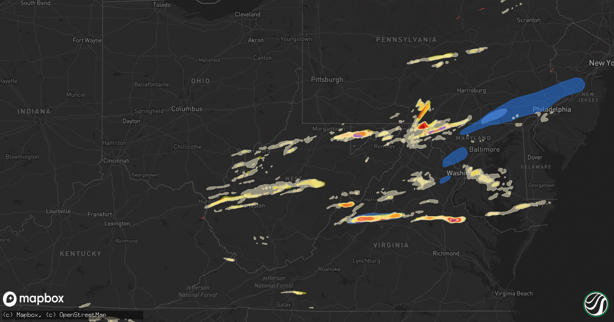
Hail Map in West Virginia on August 7, 2023
Get this storm
August 7 map
$229
one time, instant access
Download today. No call, no setup
Keep the $229
Bought the map and want the full workflow? Apply the entire $229 to a subscription within 7 days. None of it is wasted.
Every map, not just this one
This buys you this map. Subscription and you get every map we run, in the markets you choose from a few cities to whole states to nationwide. Plus real-time alerts the moment a storm fires.
Contact data
Name, contact info, occupancy, even credit band for addresses in the footprint. You go from where it hit to who to call.
Become the source they trust
Unlimited branding weather history reports on demand. You already have the documented answer ready for the property owner, and you are the one who showed up with it.
Property data and RoofTrace estimates
Pull up any address you have got, its value and the exact code rules for that jurisdiction, straight from One Click Code. Then RoofTrace estimates the squares, pitch, and roof value, priced the way you price.
Storm reports in West Virginia
West Virginia
| Date | Description |
|---|---|
| 08/07/20235:28 PM CDT | Corrects previous tstm wnd dmg report from 2 wnw gap mills. Multiple trees were blown down by thunderstorm winds along doss shaver road. |
| 08/07/20235:23 PM CDT | Multiple trees were blown down by thunderstorm winds along doss shaver road. |
| 08/07/20235:21 PM CDT | A 75 foot tree was blown down... Landing on an 8 by 10 trailer... Carport and vehicle. Time estimated from radar. |
| 08/07/20235:21 PM CDT | A few trees were blown down by thunderstorm winds in the hillsdale area. |
| 08/07/20235:11 PM CDT | Few trees downed by thunderstorm winds near monroe/summers county line in western monroe county. |
| 08/07/20235:10 PM CDT | A large tree fell across davis street in alderson... Partially landing on a house. |
| 08/07/20235:03 PM CDT | Thunderstorm winds blew at least ten trees down at residence of spotter. |
| 08/07/20235:02 PM CDT | Thunderstorm winds blew one wrist-size branch and other smaller branches down. |
| 08/07/20235:00 PM CDT | Multiple trees were blown down by thunderstorm winds near the intersection of highway 3 and highway 12. |
| 08/07/20234:56 PM CDT | Trees and limbs down. Powerline snapped on beech run road near hinton. |
| 08/07/20234:55 PM CDT | Multiple trees were blown down in the community of bellepoint by thunderstorm winds. |
| 08/07/20234:50 PM CDT | Multiple trees were blown down in the community of jumping branch by thunderstorm winds. Some of the trees were blown down along highway 3. |
| 08/07/20234:42 PM CDT | Tree down on lines. Time estimated from radar. |
| 08/07/20234:36 PM CDT | Tree across saye lane. Power lines are down. Time estimated from radar. |
| 08/07/20234:36 PM CDT | Tree down along power lines. Power out in the area. |
| 08/07/20234:36 PM CDT | Tree limb fell and knocked a power line down across the roadway. Power pole is slanted... And another pole is on the ground. Time estimated from radar. |
| 08/07/20234:33 PM CDT | Numerous trees down on all roads exiting franklin. |
| 08/07/20234:21 PM CDT | Tree down in the roadway. |
| 08/07/20233:45 PM CDT | Tree reported down near the town of cleveland. |
| 08/07/20233:30 PM CDT | Power pole fell along steward street in bim. |
| 08/07/20233:16 PM CDT | Tree down. |
| 08/07/20233:07 PM CDT | Power lines reported down on the 600 block of gosling marsh road. |
| 08/07/20233:04 PM CDT | Powers line reported down on the 800 block of froniier drive. |
| 08/07/20233:03 PM CDT | Tree and power lines reported down on runnymeade road near torytown road. |
| 08/07/20233:01 PM CDT | Power lines reported down on virginia ave near bowers street. |
| 08/07/20233:01 PM CDT | Power lines reported down on the 2600 block of goldmiller road. |
| 08/07/20233:00 PM CDT | Tree reported down on the 200 block of centre street. |
| 08/07/20232:58 PM CDT | Tree reported down on the 600 block of s queen streat. |
| 08/07/20232:58 PM CDT | Tree reported down. |
| 08/07/20232:58 PM CDT | Power outage caused by tree damage reported by utility company. |
| 08/07/20232:52 PM CDT | Tree reported down. |
| 08/07/20232:51 PM CDT | Tree reported down. |
| 08/07/20232:50 PM CDT | Power lines down in the roadway along 7th avenue in charleston. |
| 08/07/20232:49 PM CDT | Tree reported down on the 600 block of back creek valley road. |
| 08/07/20232:48 PM CDT | Tree down along falls road near capon bridge |
| 08/07/20232:44 PM CDT | 2 power lines touching and trees across hinkle ridge road. |
| 08/07/20232:43 PM CDT | Dozens of trees down in delray. Multiple wires down and power poles down as well. |
| 08/07/20232:42 PM CDT | Photos sent of tree damage. |
| 08/07/20232:40 PM CDT | Tree down reported. |
| 08/07/20232:35 PM CDT | Utility company reports power outages caused by tree damage along buck fork road. |
| 08/07/20232:35 PM CDT | Multiple trees down from lost creek to salem. |
| 08/07/20232:25 PM CDT | Tree down along reynolds gap road |
| 08/07/20232:20 PM CDT | Report received via social media picture. |
| 08/07/20232:19 PM CDT | Trees down across from welton park. |
| 08/07/20232:15 PM CDT | Wind gust of 53 knots measured at petersburg airport. |
| 08/07/20232:15 PM CDT | Multiple trees down on fort gay road. |
| 08/07/20232:11 PM CDT | A couple trees down in elk garden. |
| 08/07/20232:06 PM CDT | A couple trees down on different parts of welton orchard road near the grant and hardy county lines. |
| 08/07/20232:00 PM CDT | Utility company reports power outages due to tree damage. |
| 08/07/20231:55 PM CDT | Report received via social media picture. |
| 08/07/20231:54 PM CDT | Tree reported down. |
| 08/07/20231:53 PM CDT | Tree down 3 miles south of franklin. |
| 08/07/20231:50 PM CDT | Numerous trees down in franklin. |
| 08/07/20231:50 PM CDT | Tree down on alison road. |
| 08/07/20231:49 PM CDT | Tree reported down on the 1000 block of jacobs road. |
| 08/07/20231:48 PM CDT | Multiple trees down in harman. |
| 08/07/20231:47 PM CDT | Public reports hail up to quarter size near fort ashby. Time estimated from radar. |
| 08/07/20231:45 PM CDT | Several public reports of quarter to dollar sized hail in falling waters... Wv. Time estimated from radar. |
| 08/07/20231:43 PM CDT | Trees down north of north fork highway in cabins resulting in closed roads. |
| 08/07/20231:40 PM CDT | Tree down on dewitt road. |
| 08/07/20231:39 PM CDT | Tree down along cumberland road near springfield |
| 08/07/20231:39 PM CDT | County em reporting multiple trees and wires down in the harper area. |
| 08/07/20231:39 PM CDT | Tree down. |
| 08/07/20231:37 PM CDT | A local report indicates 1.00 inch wind near 2 S Bancroft |
| 08/07/20231:37 PM CDT | A local report indicates 1.00 inch wind near 2 S Bancroft |
| 08/07/20231:36 PM CDT | Tree down on power line on manilla creek road. |
| 08/07/20231:35 PM CDT | Tree reported down near the intersection of tuscarora pike and delmar orchard road. |
| 08/07/20231:35 PM CDT | Trees down in roadway in the area |
| 08/07/20231:34 PM CDT | A couple trees and lines down in fort ashby. |
| 08/07/20231:27 PM CDT | Multiple roads closed in short gap due to downed trees and power lines. |
| 08/07/20231:24 PM CDT | Trees down in area of valley bend. |
| 08/07/20231:23 PM CDT | A local report indicates 1.00 inch wind near 1 S Johnsontown |
| 08/07/20231:21 PM CDT | Tree down across point pleasant road. |
| 08/07/20231:20 PM CDT | Tree down. |
| 08/07/20231:19 PM CDT | Tree reported down on vehicle. Power lines down as well. |
| 08/07/20231:15 PM CDT | Trees reported down along sr 219. Time estimated from radar. |
| 08/07/20231:12 PM CDT | Tree down on gladesville road. Public report remarks time of event. |
| 08/07/20231:08 PM CDT | A local report indicates 1.50 inch wind near 4 ENE Barboursville |
| 08/07/20231:06 PM CDT | Tree down along union road. Time estimated from radar. |
| 08/07/20231:06 PM CDT | A local report indicates 1.25 inch wind near 1 NNW Barboursville |
| 08/07/20231:05 PM CDT | Doh reports quarter sized hail. |
| 08/07/20231:00 PM CDT | Trained spotter reported 1.5 inch hail. |
| 08/07/202312:59 PM CDT | Trees reported down blocking shelbyville road. |
| 08/07/202312:55 PM CDT | Tree down near intersection of alexander rd. And reger run rd. |
| 08/07/202312:54 PM CDT | Photos show snapped and uprooted trees in the area. Time estimated based on radar. |
| 08/07/202312:50 PM CDT | Numerous trees down on all roads exiting franklin. |
| 08/07/202312:47 PM CDT | Power line down. |
| 08/07/202312:45 PM CDT | Trees down blocking both directions of bens run road. |
| 08/07/202312:40 PM CDT | Several trees down with biggest concentration around centerville area. |
| 08/07/202312:36 PM CDT | Trees reported down on chapel rd. |
| 08/07/202312:30 PM CDT | Hail reported on scott cramer road. |
| 08/07/202312:25 PM CDT | A local report indicates 1.75 inch wind near Lenox |
| 08/07/202312:24 PM CDT | A local report indicates 1.75 inch wind near 2 S Lenox |
| 08/07/202312:24 PM CDT | Corn crop damaged significantly by hail of at least golf ball size. |
| 08/07/202312:24 PM CDT | Broken windows along dixon drive due to hail. Vegetation was significantly impacted. |
| 08/07/202312:24 PM CDT | Pictures provided. |
| 08/07/202312:23 PM CDT | At least 2 inch hail along coal lick road. Video provided. |
| 08/07/202312:23 PM CDT | Tree reported down. |
| 08/07/202312:23 PM CDT | Windows and vehicles damged by hail along coal lick road. Pictures provided. |
| 08/07/202312:22 PM CDT | Pictures provided. |
| 08/07/202312:22 PM CDT | 1 inch hail observed in gassaway. |
| 08/07/202312:22 PM CDT | Tree down obstructing roadway. |
| 08/07/202312:20 PM CDT | Photo of quarter size hail. |
| 08/07/202312:20 PM CDT | Multiple trees down. |
| 08/07/202312:18 PM CDT | Photos show downed trees that also caused minor roof damage to home near kingwood. Time estimated based on radar. |
| 08/07/202312:18 PM CDT | Trees down |
| 08/07/202312:18 PM CDT | A local report indicates 1.50 inch wind near Albright |
| 08/07/202312:17 PM CDT | Tree down obstructing roadway. |
| 08/07/202312:15 PM CDT | Tree down obstructing roadway. |
| 08/07/202312:15 PM CDT | A local report indicates 1.00 inch wind near 3 W Kingwood |
| 08/07/202312:11 PM CDT | Trees down on gladesville road |
| 08/07/202312:11 PM CDT | Multiple trees down |
| 08/07/202312:10 PM CDT | A local report indicates 1.00 inch wind near 1 NNE Smith Crossroads |
| 08/07/202312:10 PM CDT | Multiple trees down |
| 08/07/202312:09 PM CDT | Trees down |
| 08/07/202312:07 PM CDT | Tree fell and hit power lines on dogtown road. |
| 08/07/202312:07 PM CDT | Tree and power lines donw on q road and m road. |
| 08/07/202312:02 PM CDT | Trees down |
| 08/07/202311:48 AM CDT | Several trees down |
| 08/07/202311:47 AM CDT | Several trees down |
| 08/07/202311:46 AM CDT | Trees down on fairmont rd |
| 08/07/202311:45 AM CDT | Tree down on vineyard ridge road. |
| 08/07/202311:42 AM CDT | Trees down and power out. |
| 08/07/202311:35 AM CDT | Tree down on barrcut road. |
| 08/07/202311:17 AM CDT | Tree down. |
| 08/07/202310:40 AM CDT | Tree on power lines. |
| 08/07/202310:15 AM CDT | Multiple trees and downed power lines reported in the vienna area. |
All States Impacted by Hail Map on August 7, 2023
Cities Impacted by Hail Map on August 7, 2023
- Whiteville, TN
- Somerville, TN
- Bolivar, TN
- Hickory Valley, TN
- Saulsbury, TN
- Middleton, TN
- Hornsby, TN
- Bethel Springs, TN
- Selmer, TN
- Pocahontas, TN
- Ramer, TN
- Guys, TN
- Lutts, TN
- Counce, TN
- Adamsville, TN
- Savannah, TN
- Shiloh, TN
- Michie, TN
- Stantonville, TN
- Collinwood, TN
- Olivehill, TN
- Crump, TN
- Cypress Inn, TN
- Waynesboro, TN
- Coolville, OH
- Little Hocking, OH
- Shelbyville, KY
- Midway, KY
- Frankfort, KY
- Bagdad, KY
- Stamping Ground, KY
- Georgetown, KY
- Shelbyville, TN
- Unionville, TN
- Bell Buckle, TN
- Beechgrove, TN
- Wartrace, TN
- Manchester, TN
- Morrison, TN
- Mcminnville, TN
- Rock Island, TN
- Pikeville, TN
- Spencer, TN
- Dunlap, TN
- Reedsville, WV
- Arthurdale, WV
- Kingwood, WV
- Albright, WV
- Independence, WV
- Bruceton Mills, WV
- Terra Alta, WV
- Duck, WV
- Frametown, WV
- Gassaway, WV
- Mineral Wells, WV
- Walker, WV
- Elizabeth, WV
- Big Pool, MD
- Clear Spring, MD
- Huntington, WV
- Barboursville, WV
- Rock Cave, WV
- French Creek, WV
- Pickens, WV
- Helvetia, WV
- Hazel Green, AL
- New Market, AL
- Estillfork, AL
- Scottsboro, AL
- Stevenson, AL
- Sherwood, TN
- South Pittsburg, TN
- Bridgeport, AL
- Bryant, AL
- Flat Rock, AL
- Guild, TN
- Chattanooga, TN
- Wildwood, GA
- Jasper, TN
- Trenton, GA
- Whitwell, TN
- Higdon, AL
- Dayton, TN
- Rockwood, TN
- Grandview, TN
- Spring City, TN
- Evensville, TN
- Crossville, TN
- Crab Orchard, TN
- Woodbury, TN
- Bradyville, TN
- Doyle, TN
- Quebeck, TN
- Sparta, TN
- Walling, TN
- Smithville, TN
- Christiana, TN
- Athens, TN
- Niota, TN
- Sweetwater, TN
- Ten Mile, TN
- Madisonville, TN
- Kingston, TN
- Decatur, TN
- Philadelphia, TN
- Loudon, TN
- Greenback, TN
- Oak Ridge, TN
- Harriman, TN
- Knoxville, TN
- Lenoir City, TN
- Louisville, TN
- Vonore, TN
- Farragut, TN
- Friendsville, TN
- Mill Creek, WV
- McHenry, MD
- Oakland, MD
- Friendsville, MD
- Accident, MD
- Grantsville, MD
- Swanton, MD
- Barton, MD
- Newport, TN
- White Pine, TN
- Bybee, TN
- Morristown, TN
- Mohawk, TN
- Greeneville, TN
- Ona, WV
- Milton, WV
- Culloden, WV
- Maryville, TN
- Mercersburg, PA
- Parrottsville, TN
- Hancock, MD
- Rockport, WV
- West Union, WV
- Morgantown, WV
- Drummonds, TN
- Grand Junction, TN
- Oakdale, TN
- Rienzi, MS
- Heidrick, KY
- Flat Lick, KY
- Cannon, KY
- Bimble, KY
- Gray, KY
- Barbourville, KY
- La Follette, TN
- Jacksboro, TN
- Berkeley Springs, WV
- Fairmont, WV
- Rocky Top, TN
- Andersonville, TN
- Salyersville, KY
- Arjay, KY
- Luttrell, TN
- Powder Springs, TN
- Blaine, TN
- Maynardville, TN
- Leon, WV
- Tyrone, PA
- Warriors Mark, PA
- Walton, WV
- Jamestown, TN
- Proctorville, OH
- Lavalette, WV
- Kenova, WV
- Thurman, OH
- Vinton, OH
- Oak Hill, OH
- Portland, OH
- Racine, OH
- Long Bottom, OH
- Parkersburg, WV
- Davisville, WV
- Medon, TN
- Ravenswood, WV
- Millwood, WV
- Wallace, WV
- Lumberport, WV
- Saint Albans, WV
- Poca, WV
- Winfield, WV
- Charleston, WV
- Nitro, WV
- Seaman, OH
- Winchester, OH
- Chloe, WV
- Nebo, WV
- Newton, WV
- Slanesville, WV
- Paw Paw, WV
- Hedgesville, WV
- Hillsboro, OH
- Hohenwald, TN
- Centerville, TN
- Linden, TN
- Albany, KY
- Cherokee, AL
- Salem, WV
- New Milton, WV
- Lobelville, TN
- Fisher, AR
- Heiskell, TN
- Prichard, WV
- Catlettsburg, KY
- Lavaca, AR
- Bloomery, WV
- Amma, WV
- Left Hand, WV
- Looneyville, WV
- Alma, WV
- Lexington, TN
- Darden, TN
- Huron, TN
- Beech Bluff, TN
- Newburg, WV
- Bidwell, OH
- Moscow, TN
- Stoney Fork, KY
- Hinkle, KY
- Corbin, KY
- Scalf, KY
- Walker, KY
- Belleville, WV
- Syracuse, OH
- Sandyville, WV
- Letart, WV
- Hartford, WV
- West Columbia, WV
- Mason, WV
- New Haven, WV
- Glenwood, WV
- Robbins, TN
- Big Cove Tannery, PA
- Millington, TN
- Amagon, AR
- Norris, TN
- McCrory, AR
- Cherry Valley, AR
- Hickory Ridge, AR
- Newport, AR
- Earle, AR
- Harrisburg, AR
- Weiner, AR
- Marked Tree, AR
- Cross Junction, VA
- Parsons, TN
- Lucasville, OH
- Minford, OH
- Clendenin, WV
- Gandeeville, WV
- Spencer, WV
- Charleston, AR
- Jackson, TN
- Corryton, TN
- Midway, TN
- Mannington, WV
- Iuka, MS
- Advent, WV
- Kenna, WV
- New Albany, MS
- Rutledge, TN
- Briceville, TN
- Clinton, TN
- Pioneer, TN
- Strawberry Plains, TN
- Caryville, TN
- Mascot, TN
- Sharps Chapel, TN
- Brighton, TN
- Mason, TN
- Arlington, TN
- Stanton, TN
- Olive Branch, MS
- Pennsboro, WV
- Middlebourne, WV
- Abbeville, MS
- Saint Marys, WV
- Oxford, MS
- Williamsburg, KY
- Rockholds, KY
- Woodbine, KY
- Patriot, OH
- Gallipolis, OH
- Byrdstown, TN
- Henderson, TN
- Jacksonburg, WV
- Center Point, WV
- Cairo, WV
- Pullman, WV
- Ellenboro, WV
- De Valls Bluff, AR
- Shade, OH
- Guysville, OH
- Washington, WV
- Worthington, WV
- Shinnston, WV
- Helenwood, TN
- Florence, AL
- Waverly, WV
- Toone, TN
- Holly Springs, MS
- Byhalia, MS
- Allardt, TN
- Huntsville, TN
- Huntsville, AL
- Madison, AL
- Pinson, TN
- Celina, TN
- Selbyville, WV
- Kanawha Head, WV
- Crawford, WV
- Ireland, WV
- Heaters, WV
- Hacker Valley, WV
- Sutton, WV
- Flatwoods, WV
- Napier, WV
- Orma, WV
- Memphis, TN
- Rosedale, WV
- Shock, WV
- South Webster, OH
- Oakland, TN
- Atoka, TN
- Crawfordsville, AR
- Covington, TN
- Rossville, TN
- Marion, AR
- Eads, TN
- Collierville, TN
- Turrell, AR
- Chesapeake, OH
- South Point, OH
- Lesage, WV
- Crown City, OH
- Cottageville, WV
- Tishomingo, MS
- Scotts Hill, TN
- Bath Springs, TN
- Hagerstown, MD
- Maugansville, MD
- Rossville, GA
- Chickamauga, GA
- Rising Fawn, GA
- Lookout Mountain, TN
- Ringgold, GA
- Rock Spring, GA
- Fort Oglethorpe, GA
- Lookout Mountain, GA
- Flintstone, GA
- Blue Springs, MS
- Tupelo, MS
- Saltillo, MS
- Guntown, MS
- Mooreville, MS
- Rocky Face, GA
- Tunnel Hill, GA
- Cohutta, GA
- Apison, TN
- Ooltewah, TN
- New Market, TN
- Alcoa, TN
- Rockford, TN
- Powell, TN
- Walland, TN
- Seymour, TN
- Kodak, TN
- Flag Pond, TN
- Erwin, TN
- Mars Hill, NC
- Burnsville, NC
- Green Mountain, NC
- Sevierville, TN
- Dandridge, TN
- Jefferson City, TN
- Talbott, TN
- Chatsworth, GA
- Dalton, GA
- Crandall, GA
- Cisco, GA
- Hurricane, WV
- Scott Depot, WV
- Red House, WV
- Boalsburg, PA
- Centre Hall, PA
- Spring Mills, PA
- Coburn, PA
- Mosheim, TN
- Lonaconing, MD
- Waynesboro, PA
- State Line, PA
- Greencastle, PA
- Martinsburg, WV
- Falling Waters, WV
- Williamsport, MD
- Fairplay, MD
- Boonsboro, MD
- Funkstown, MD
- Smithsburg, MD
- Trout Run, PA
- Hamlin, WV
- Tornado, WV
- Sod, WV
- Marshall, NC
- Weaverville, NC
- Del Rio, TN
- Hot Springs, NC
- Chuckey, TN
- Unicoi, TN
- Afton, TN
- Barnardsville, NC
- Bakersville, NC
- Spruce Pine, NC
- Newland, NC
- Woodward, PA
- Milroy, PA
- Millmont, PA
- Epworth, GA
- Blue Ridge, GA
- Dugspur, VA
- Indian Valley, VA
- Willis, VA
- Hillsville, VA
- Hiawassee, GA
- Hayesville, NC
- Clayton, GA
- Tiger, GA
- Rabun Gap, GA
- Franklin, NC
- Otto, NC
- Dillard, GA
- Craigsville, VA
- Swoope, VA
- West Augusta, VA
- Sabillasville, MD
- Emmitsburg, MD
- Cascade, MD
- Thurmont, MD
- Taneytown, MD
- Shunk, PA
- Scaly Mountain, NC
- Highlands, NC
- Cheyenne, WY
- Burns, WY
- Albin, WY
- Staunton, VA
- Middlebrook, VA
- Fort Defiance, VA
- Verona, VA
- Churchville, VA
- Grottoes, VA
- Crimora, VA
- Briggsdale, CO
- Waynesboro, VA
- New Raymer, CO
- Grover, CO
- Stoneham, CO
- Fishersville, VA
- Alum Creek, WV
- South Charleston, WV
- Fort Huachuca, AZ
- Hereford, AZ
- Sierra Vista, AZ
- Mountain Rest, SC
- Cashiers, NC
- Salem, SC
- Brevard, NC
- Sapphire, NC
- Taylors, SC
- Greenville, SC
- Greer, SC
- Duncan, SC
- Moore, SC
- Woodruff, SC
- Wellford, SC
- Spartanburg, SC
- Littlestown, PA
- Gettysburg, PA
- Westminster, MD
- Hanover, PA
- Merino, CO
- Haigler, NE
- Parks, NE
- Atlanta, GA
- Norcross, GA
- Lilburn, GA
- Tucker, GA
- Bird City, KS
- Saint Francis, KS
- Benkelman, NE
- Max, NE
- Stratton, NE
- Palisade, NE
- Heflin, AL
- Fruithurst, AL
- Muscadine, AL
- Buchanan, GA
- Tallapoosa, GA
- Bremen, GA
- Bowdon, GA
- Ranburne, AL
- Waco, GA
- Carrollton, GA
- Pauline, SC
- Roebuck, SC
- Pacolet, SC
- Jonesville, SC
- Granite Falls, NC
- Lenoir, NC
- Valdese, NC
- Morganton, NC
- Drexel, NC
- Hudson, NC
- Lawndale, NC
- Connelly Springs, NC
- Hildebran, NC
- Hickory, NC
- Newton, NC
- Vale, NC
- Claremont, NC
- Conover, NC
- Sherrills Ford, NC
- Maiden, NC
- Catawba, NC
- Denver, NC
- Lincolnton, NC
- Iron Station, NC
- Taylorsville, NC
- Hiddenite, NC
- Stony Point, NC
- Crozet, VA
- Free Union, VA
- Earlysville, VA
- Dyke, VA
- Barboursville, VA
- Ruckersville, VA
- Charlottesville, VA
- McDonald, KS
- Culbertson, NE
- Hayes Center, NE
- Stanardsville, VA
- Louisa, VA
- Atwood, KS
- Gordonsville, VA
- Manchester, MD
- Hampstead, MD
- Otis, CO
- Akron, CO
- Yuma, CO
- Glen Rock, PA
- Freeland, MD
- New Freedom, PA
- Burlington, CO
- Parkton, MD
- Shrewsbury, PA
- Stewartstown, PA
- New Park, PA
- White Hall, MD
- Airville, PA
- Felton, PA
- Brogue, PA
- Pequea, PA
- Fawn Grove, PA
- Holtwood, PA
- Drumore, PA
- Delta, PA
- New Providence, PA
- Willow Street, PA
- Conestoga, PA
- Strasburg, PA
- Quarryville, PA
- Kirkwood, PA
- Pylesville, MD
- Rising Sun, MD
- Nottingham, PA
- Peach Bottom, PA
- Whiteford, MD
- Conowingo, MD
- Oxford, PA
- Paradise, PA
- Ronks, PA
- Christiana, PA
- West Grove, PA
- Lincoln University, PA
- Atglen, PA
- Parkesburg, PA
- Cochranville, PA
- Kinzers, PA
- Gap, PA
- Yoder, WY
- Hawk Springs, WY
- Orange, VA
- Germantown, MD
- Sterling, VA
- Ashburn, VA
- Poolesville, MD
- Great Falls, VA
- Potomac, MD
- Dickerson, MD
- Beallsville, MD
- Leesburg, VA
- Gaithersburg, MD
- Huddleston, VA
- Wingina, VA
- Howardsville, VA
- Lynchburg, VA
- Evington, VA
- Stuart, VA
- Rustburg, VA
- Martinsville, VA
- Troy, VA
- Lawsonville, NC
- Sandy Level, VA
- Scottsville, VA
- Palmyra, VA
- Critz, VA
- Rocky Mount, VA
- Lynch Station, VA
- Patrick Springs, VA
- Gladstone, VA
- Appomattox, VA
- Glade Hill, VA
- Penhook, VA
- Concord, VA
- Bassett, VA
- Buckingham, VA
- Rockville, MD
- Boyds, MD
- Damascus, MD
- Sandy Spring, MD
- Clarksburg, MD
- Woodbine, MD
- Montgomery Village, MD
- Derwood, MD
- Silver Spring, MD
- Brookeville, MD
- Olney, MD
- Washington Grove, MD
- Mount Airy, MD
- Glenelg, MD
- Ashton, MD
- West Friendship, MD
- Cooksville, MD
- Clarksville, MD
- Dayton, MD
- Ellicott City, MD
- Highland, MD
- Brinklow, MD
- Glenwood, MD
- Clifton, VA
- Centreville, VA
- Bristow, VA
- Nokesville, VA
- Manassas, VA
- Fairfax Station, VA
- Fairfax, VA
- Railroad, PA
- Lancaster, PA
- Millersville, PA
- Gordonville, PA
- Lagrange, WY
- Coatesville, PA
- Chester Springs, PA
- Honey Brook, PA
- Glenmoore, PA
- West Chester, PA
- Avondale, PA
- Kennett Square, PA
- Bird In Hand, PA
- Elverson, PA
- Intercourse, PA
- Exton, PA
- New Holland, PA
- Downingtown, PA
- Thorndale, PA
- East Earl, PA
- Narvon, PA
- Morgantown, PA
- Idalia, CO
- Colby, KS
- Kanorado, KS
- Chadds Ford, PA
- Toughkenamon, PA
- Glen Mills, PA
- Cheyney, PA
- Thornton, PA
- Maywood, NE
- McCook, NE
- Media, PA
- Springfield, PA
- Newtown Square, PA
- Immaculata, PA
- Malvern, PA
- Wayne, PA
- King Of Prussia, PA
- Collegeville, PA
- Berwyn, PA
- Oaks, PA
- Pottstown, PA
- Paoli, PA
- Broomall, PA
- Phoenixville, PA
- Royersford, PA
- Mont Clare, PA
- Norristown, PA
- Devon, PA
- Spring City, PA
- Villanova, PA
- Indianola, NE
- Curtis, NE
- Lansdale, PA
- Havertown, PA
- Haverford, PA
- Skippack, PA
- Schwenksville, PA
- Conshohocken, PA
- Bridgeport, PA
- Harleysville, PA
- Blue Bell, PA
- Bryn Mawr, PA
- Souderton, PA
- Hatfield, PA
- Plymouth Meeting, PA
- Wynnewood, PA
- Drexel Hill, PA
- Narberth, PA
- Ardmore, PA
- Upper Darby, PA
- Gladwyne, PA
- Bala Cynwyd, PA
- Lafayette Hill, PA
- North Wales, PA
- Philadelphia, PA
- Merion Station, PA
- Levant, KS
- Wray, CO
- Spring House, PA
- Oreland, PA
- Line Lexington, PA
- Doylestown, PA
- Ambler, PA
- Horsham, PA
- Chalfont, PA
- Warrington, PA
- Colmar, PA
- Fort Washington, PA
- Flourtown, PA
- Montgomeryville, PA
- Glenside, PA
- Gwynedd, PA
- Hatboro, PA
- Willow Grove, PA
- Elkins Park, PA
- Bryn Athyn, PA
- Wyncote, PA
- Richboro, PA
- Dresher, PA
- Feasterville Trevose, PA
- Warminster, PA
- Furlong, PA
- Huntingdon Valley, PA
- Jamison, PA
- Abington, PA
- Cheltenham, PA
- Bensalem, PA
- Southampton, PA
- Jenkintown, PA
- Spotsylvania, VA
- Partlow, VA
- Alliance, NE
- Ellsworth, NE
- Hay Springs, NE
- Oshkosh, NE
- Ashby, NE
- Hyannis, NE
- Gem, KS
- Woodford, VA
- Fredericksburg, VA
- Ruther Glen, VA
- Edson, KS
- Goodland, KS
- Rexford, KS
- Levittown, PA
- Langhorne, PA
- Newtown, PA
- Morrisville, PA
- Fairless Hills, PA
- New Hope, PA
- Washington Crossing, PA
- Trenton, NJ
- Titusville, NJ
- Lambertville, NJ
- Danbury, NE
- Bartley, NE
- Lebanon, NE
- Wilsonville, NE
- Port Royal, VA
- Bowling Green, VA
- Lakeside, NE
- Caret, VA
- Lewellen, NE
- Harrisburg, NE
- Loretto, VA
- Colonial Beach, VA
- Hightstown, NJ
- Lawrence Township, NJ
- Windsor, NJ
- Robbinsville, NJ
- Pennington, NJ
- Hopewell, NJ
- Skillman, NJ
- Princeton Junction, NJ
- Ringoes, NJ
- Princeton, NJ
- Gaffney, SC
- Union, SC
- Sharon, SC
- Hickory Grove, SC
- McConnells, SC
- York, SC
- Rock Hill, SC
- Chester, SC
- Edgemoor, SC
- Orviston, PA
- McConnellsburg, PA
- Collinsville, AL
- Danielsville, GA
- Horton, AL
- Blountsville, AL
- Kim, CO
- Brilliant, AL
- Hamilton, AL
- Guin, AL
- Tennille, GA
- Upper Marlboro, MD
- Capitol Heights, MD
- Hyattsville, MD
- Wheatland, WY
- Greenbelt, MD
- Bladensburg, MD
- College Park, MD
- Mount Rainier, MD
- Lanham, MD
- Brentwood, MD
- Riverdale, MD
- Washington, DC
- Bingham, NE
- Ganado, AZ
- Ault, CO
- Amissville, VA
- Flint Hill, VA
- Marshall, VA
- Warrenton, VA
- Hume, VA
- Decatur, GA
- Chevy Chase, MD
- Takoma Park, MD
- Elkview, WV
- West Hamlin, WV
- Dunbar, WV
- Branchland, WV
- Millport, AL
- Mineral, VA
- Belden, MS
- Points, WV
- Augusta, WV
- Romney, WV
- Maysville, WV
- Petersburg, WV
- Lahmansville, WV
- Le Roy, WV
- Smithville, MS
- Snellville, GA
- Winslow, AZ
- Happy Jack, AZ
- Sedona, AZ
- Fort Payne, AL
- The Plains, VA
- Doe Hill, VA
- Monterey, VA
- McDowell, VA
- Phyllis, KY
- Kimper, KY
- Raccoon, KY
- Pikeville, KY
- Russellville, AL
- Shepherdstown, WV
- Eldridge, AL
- Dawsonville, GA
- Sugar Grove, WV
- Warfordsburg, PA
- Clearville, PA
- Artemas, PA
- Belleville, PA
- Reedsville, PA
- Huntingdon, PA
- Lewistown, PA
- Yeagertown, PA
- Jasper, AL
- Nauvoo, AL
- Carbon Hill, AL
- Sardis, TN
- Saltillo, TN
- Boaz, AL
- Gerrardstown, WV
- Bunker Hill, WV
- Hurley, VA
- Grundy, VA
- East Lynn, WV
- Wayne, WV
- Little Birch, WV
- Cowen, WV
- Elkton, VA
- Shenandoah, VA
- Harrisonburg, VA
- Keezletown, VA
- Fulton, MS
- Anderson, SC
- Pendleton, SC
- Farmington, WV
- Carolina, WV
- Enterprise, WV
- Vernon, AL
- Ivydale, WV
- Wallback, WV
- Fairfield, PA
- Fort Loudon, PA
- Deerfield, VA
- Fairburn, GA
- Spruce Pine, AL
- Hodges, AL
- Phil Campbell, AL
- Adger, AL
- Oakman, AL
- Bessemer, AL
- Detroit, AL
- Green Spring, WV
- Springfield, WV
- Lula, GA
- West Liberty, KY
- Kannapolis, NC
- Cornelius, NC
- Huntersville, NC
- Concord, NC
- Mooresville, NC
- Davidson, NC
- Cartersville, GA
- Inwood, WV
- Glengary, WV
- White, GA
- Graysville, AL
- Mount Olive, AL
- Quinton, AL
- Northport, AL
- Palestine, WV
- Huntly, VA
- Jeffersonton, VA
- Washington, VA
- Winfield, PA
- Selinsgrove, PA
- Northumberland, PA
- Mifflinburg, PA
- Lewisburg, PA
- New Berlin, PA
- Riverside, PA
- Danville, PA
- Sunbury, PA
- Jacksonville, AL
- Mount Solon, VA
- Seven Valleys, PA
- Nettleton, MS
- Amory, MS
- Shannon, MS
- Plantersville, MS
- Delaplane, VA
- Trenton, NE
- Blaine, KY
- Flatgap, KY
- Louisa, KY
- Dunmore, WV
- Head Waters, VA
- Marlinton, WV
- Millboro, VA
- Saint Thomas, PA
- Chambersburg, PA
- Upperstrasburg, PA
- Toomsboro, GA
- San Simon, AZ
- Mount Sterling, KY
- Owingsville, KY
- Olympia, KY
- Frenchburg, KY
- Wellington, KY
- Salt Lick, KY
- Morehead, KY
- Englewood, TN
- McClure, PA
- Beaver Springs, PA
- Keyser, WV
- Fort Ashby, WV
- Procious, WV
- Red Bay, AL
- Bowie, AZ
- Aragon, NM
- Bethlehem, GA
- Cedarbluff, MS
- West Point, MS
- Tremont, MS
- Warrior, AL
- Hayden, AL
- Ridgeley, WV
- Cumberland, MD
- Oldtown, MD
- Reserve, NM
- Mehoopany, PA
- Hartwell, GA
- Bowersville, GA
- River, KY
- Stambaugh, KY
- Paintsville, KY
- Tutor Key, KY
- Le Raysville, PA
- Laceyville, PA
- Wyalusing, PA
- Montrose, PA
- Lawton, PA
- Stevensville, PA
- Temple, GA
- Crossville, AL
- Willow Wood, OH
- Scottown, OH
- Little Orleans, MD
- Lithia Springs, GA
- Gainesville, GA
- Clermont, GA
- Canton, GA
- Ripley, WV
- Adamsville, AL
- Mulga, AL
- Townville, SC
- Seneca, SC
- Durbin, WV
- Fannettsburg, PA
- Irwinton, GA
- McIntyre, GA
- Keaton, KY
- Marietta, SC
- Franklin, WV
- Brandywine, WV
- Elfrida, AZ
- Dora, AL
- Fraziers Bottom, WV
- Buffalo, WV
- Petroleum, WV
- Dallas, GA
- Morganton, GA
- Blairsville, GA
- Pickens, SC
- Rutherfordton, NC
- Forest City, NC
- Piedmont, SC
- Liberty, SC
- Williamston, SC
- Phelps, KY
- Bloomington, MD
- Westernport, MD
- Comer, GA
- Hull, GA
- Pennsylvania Furnace, PA
- Cornelia, GA
- Alto, GA
- Belmont, MS
- Dennis, MS
- Rocky Ridge, MD
- Myersville, MD
- Sharpsburg, MD
- Mill Spring, NC
- Columbus, NC
- Tryon, NC
- Mooresboro, NC
- Ellenboro, NC
- Sulligent, AL
- Waterloo, OH
- Dawson, AL
- Douglasville, GA
- Warm Springs, VA
- Hot Springs, VA
- Linville, VA
- Fence Lake, NM
- Timberville, VA
- Broadway, VA
- Frostburg, MD
- Goshen, VA
- Everett, PA
- Elberton, GA
- Needmore, PA
- Ware Shoals, SC
- Honea Path, SC
- Donalds, SC
- Evans, WV
- Cubero, NM
- Laguna, NM
- Kearneysville, WV
- Limestone, TN
- Hustontown, PA
- Harrisonville, PA
- Tuscumbia, AL
- Big Bend, WV
- Brohard, WV
- Woodsboro, MD
- Keymar, MD
- Hiwassee, VA
- Sykesville, MD
- Owings Mills, MD
- Reisterstown, MD
- Laramie, WY
- Great Cacapon, WV
- Rawlings, MD
- Flintstone, MD
- Tunnelton, WV
- Levels, WV
- Newnan, GA
- Moreland, GA
- Grantville, GA
- Tombstone, AZ
- Port Matilda, PA
- Wharton, WV
- Naoma, WV
- Oceana, WV
- Arnoldsburg, WV
- Millstone, WV
- Smyrna, GA
- Rixeyville, VA
- Bentonville, VA
- Rileyville, VA
- Front Royal, VA
- Catlett, VA
- Markham, VA
- Chester Gap, VA
- Linden, VA
- Pie Town, NM
- Haleyville, AL
- Sunset, SC
- Ranger, GA
- Fairmount, GA
- Calhoun, GA
- Bushnell, NE
- Max Meadows, VA
- Austinville, VA
- Barren Springs, VA
- Pontotoc, MS
- Houlka, MS
- Logan, AL
- Cullman, AL
- Sophia, WV
- Lester, WV
- Slab Fork, WV
- Ravencliff, WV
- Glen Fork, WV
- Keedysville, MD
- Wittensville, KY
- Staffordsville, KY
- Oil Springs, KY
- Sitka, KY
- Harold, KY
- Parrish, AL
- Douglas, WY
- Beckley, WV
- Stanley, VA
- Hamilton, MS
- Wartburg, TN
- Oliver Springs, TN
- Lancing, TN
- Folsom, WV
- New Market, VA
- Luray, VA
- Flowery Branch, GA
- Albertville, AL
- Addison, AL
- Houston, AL
- Fairdale, WV
- Glen Daniel, WV
- Arnett, WV
- Saxon, WV
- Pelzer, SC
- Belton, SC
- Starr, SC
- Greenwood Springs, MS
- Rouzerville, PA
- Winchester, VA
- Blue Ridge Summit, PA
- Charles Town, WV
- Burnt Cabins, PA
- Ranson, WV
- Fort Littleton, PA
- Spring Grove, PA
- Clear Brook, VA
- Three Springs, PA
- Southside, WV
- Thaxton, MS
- Ecru, MS
- Suitland, MD
- Andrews Air Force Base, MD
- District Heights, MD
- Bowie, MD
- Temple Hills, MD
- Lothian, MD
- Easley, SC
- Loganville, GA
- Oxford, GA
- Baldwyn, MS
- Marietta, MS
- New Site, MS
- Booneville, MS
- Beaverton, AL
- Jackson, KY
- Double Springs, AL
- Martin, GA
- Monroe, GA
- Dacula, GA
- Dewy Rose, GA
- Bowman, GA
- Conyers, GA
- Kennedy, AL
- Sunbright, TN
- Fayette, AL
- Columbus, MS
- Caledonia, MS
- Okolona, MS
- Ashton, WV
- Piedmont, AL
- Fountain Inn, SC
- Gray Court, SC
- Middletown, MD
- Frederick, MD
- Rohrersville, MD
- Alpine, TN
- Magdalena, NM
- Jonesborough, TN
- Telford, TN
- Birmingham, AL
- Docena, AL
- Quemado, NM
- Reedy, WV
- Beavertown, PA
- State College, PA
- Kitts Hill, OH
- Pedro, OH
- Lawrenceville, GA
- Lithonia, GA
- Creston, WV
- Castleton, VA
- Davisboro, GA
- Sandersville, GA
- Harrison, GA
- Gay, WV
- Given, WV
- Clearfield, KY
- Hagerhill, KY
- Anniston, AL
- Apple Grove, WV
- Gallipolis Ferry, WV
- Villa Rica, GA
- Eaton, NY
- Exchange, WV
- Liberty, WV
- Diana, WV
- Burnsville, WV
- Tallmansville, WV
- Decaturville, TN
- Morrisville, NY
- Munnsville, NY
- Whitman, NE
- Arthur, NE
- Susquehanna, PA
- Brewster, KS
- Oakley, KS
- Hoxie, KS
- Grinnell, KS
- Monument, KS
- Deposit, NY
- Franklin Park, NJ
- North Brunswick, NJ
- Belle Mead, NJ
- Hillsborough, NJ
- Rocky Hill, NJ
- Somerset, NJ
- Cranbury, NJ
- Kingston, NJ
- Monroe Township, NJ
- Kendall Park, NJ
- Monmouth Junction, NJ
- Dayton, NJ
- Plainsboro, NJ
- Richburg, SC
- Fort Lawn, SC
- Catawba, SC
- Turin, NY
- Grainfield, KS
- Sharon Springs, KS
- West Leyden, NY
- Gove, KS
- Roopville, GA
- Winston, GA
- Whitesburg, GA
- Pine Ridge, SD
- Rushville, NE
- Chadron, NE
- Wallace, KS
- Winona, KS
- Weskan, KS
- Park, KS
- Boise City, OK
- Kenton, OK
- Shoshoni, WY
- Quinter, KS
- Leoti, KS
- Healy, KS
- Dighton, KS
- Tribune, KS
- Keyes, OK
- Ellis, KS
- Ogallah, KS
- McCracken, KS
- Hays, KS
- Schoenchen, KS
- Elsie, NE
- Wallace, NE
- Marienthal, KS
- Deerfield, KS
- Liebenthal, KS
- La Crosse, KS
- Otis, KS
- Bison, KS
- Olmitz, KS
- Albert, KS
- Rush Center, KS
- Hoisington, KS
- Great Bend, KS
- Lakin, KS
- Holcomb, KS
- Garden City, KS
- Sublette, KS
- Copeland, KS
- Seymour, TX
- Marsland, NE
- Glenrock, WY
- Afton, VA
- Lovington, NM
- Hobbs, NM
- Delmar, DE
- Genoa, CO
- Limon, CO
- Landenberg, PA
- North East, MD
- Elkton, MD
- Great Mills, MD
- Drayden, MD
- Lexington Park, MD
- Leonardtown, MD
- Callaway, MD
- Park Hall, MD
- Valley Lee, MD
- Nicholson, PA
- Hanceville, AL
- Milledgeville, GA
- Tilghman, MD
- Sherwood, MD
- Neavitt, MD
- Yemassee, SC
- Walterboro, SC
- Whitney, NE
- Crawford, NE
- Singers Glen, VA
- Holyoke, CO
- Marion, SC
- Florence, SC
- Pamplico, SC
- Effingham, SC
- Plains, TX
- North Platte, NE
- Keystone, NE
- Paxton, NE
- Ogallala, NE
- Culpeper, VA
- Lignum, VA
- Richardsville, VA
- Goldvein, VA
- Sumerduck, VA
- Elkwood, VA
- Stevensburg, VA
- Pine Bluffs, WY
- Torrington, WY
- Harrison, NE
- Clifton, AZ
- Queenstown, MD
- Chester, MD
- Grasonville, MD
- Easton, MD
- Royal Oak, MD
- Pinewood, SC
- Sparta, GA
- Fort Valley, GA
- Safford, AZ
- Brookhaven, PA
- Aston, PA
- Trappe, MD
- Cambridge, MD
- Flagler, CO
- Hugo, CO
- Kit Carson, CO
- Churchton, MD
- Dunkirk, MD
- Harwood, MD
- Deale, MD
- Tracys Landing, MD
- West River, MD
- Gordon, GA
- Wellfleet, NE
- Pritchett, CO
- Monetta, SC
- Batesburg, SC
- Merriman, NE
- Animas, NM
- Warne, NC
- Brasstown, NC
- Pinon, NM
- Dell City, TX
- Eckley, CO
- Portales, NM
- Muleshoe, TX
- Norcatur, KS
- Bozman, MD
- Franklin, GA
- Bishopville, SC
- Camden, SC
- Cassatt, SC
- Covington, GA
- East Dublin, GA
- Rio, WV
- Laurens, SC
- Broadway, NC
- Bedford, PA
- Ellerbe, NC
- McCormick, SC
- Rapidan, VA
- Unionville, VA
- Sudan, TX
- Seminole, TX
- Aiken, SC
- Orangeburg, SC
- North, SC
- Saint Matthews, SC
- Forsyth, GA
- Musella, GA
- Macon, GA
- Johnston, SC
- Tyaskin, MD
- Quantico, MD
- Bivalve, MD
- Brownfield, TX
- Oconto, NE
- Hartsville, SC
- Patrick, SC
- Nanticoke, MD
- Vienna, MD
- Eden, MD
- Hebron, MD
- Salisbury, MD
- Mickleton, NJ
- Latta, SC
- Sellers, SC
- Somerset, VA
- Willcox, AZ
- Finksburg, MD
- Tryon, NE
- Mount Royal, NJ
- Thorofare, NJ
- Woodbury, NJ
- Woodbury Heights, NJ
- Wenonah, NJ
- Mantua, NJ
- Sewell, NJ
- Blackwood, NJ
- Lake Bronson, MN
- Winder, GA
- Hop Bottom, PA
- Dadeville, AL
- Norway, SC
- Goodwater, AL
- Trenton, SC
- Walkersville, MD
- Eads, CO
- Sylvania, GA
- Rocky Ford, GA
- Syria, VA
- Wedgefield, SC
- Tunkhannock, PA
- Bamberg, SC
- Pinon, AZ
- Wilmington, DE
- Fuquay Varina, NC
- Angier, NC
- Taylorsville, GA
- Akron, AL
- Owings, MD
- North Beach, MD
- Shady Side, MD
- Galesville, MD
- Davidsonville, MD
- Friendship, MD
- Lusby, MD
- Saint Leonard, MD
- Oxford, MD
- Tall Timbers, MD
- Millen, GA
- Perkins, GA
- Culloden, GA
- Talbotton, GA
- Lineville, AL
- Hampton, SC
- Varnville, SC
- Gilbert, SC
- Pelion, SC
- Leesville, SC
- Lutherville Timonium, MD
- Lizella, GA
- Bethune, CO
- Stratton, CO
- Meriden, WY
- Eatonton, GA
- Arbovale, WV
- Sanford, NC
- Madison, MD
- Woolford, MD
- Gray, GA
- Bumpass, VA
- Hustle, VA
- King George, VA
- Byron, GA
- Warner Robins, GA
- Vernon, CO
- Cass, WV
- Attalla, AL
- Chester Heights, PA
- Marcus Hook, PA
- Arriba, CO
- Sutherland, NE
- Stone Mountain, GA
- Avondale Estates, GA
- Denmark, SC
- Broad Run, VA
- Gainesville, VA
- Delmar, MD
- North Augusta, SC
- Monticello, GA
- Bovina, TX
- West Point, GA
- Lagrange, GA
- Wrightsville, GA
- Scott City, KS
- Kirk, CO
- Mableton, GA
- Stevenson, MD
- Oxon Hill, MD
- Mcdaniel, MD
- Stevensville, MD
- Saint Michaels, MD
- Huntingtown, MD
- Fort Washington, MD
- Claiborne, MD
- Chesapeake Beach, MD
- Auburn, GA
- Blue Grass, VA
- Camden, NJ
- Gloucester City, NJ
- Greensboro, AL
- Marion, AL
- Smyrna, SC
- Roberta, GA
- Ridge Spring, SC
- Carthage, NC
- Daviston, AL
- Wadley, AL
- Cope, SC
- Carlsbad, NM
- Calhoun Falls, SC
- Shenandoah Junction, WV
- Smithfield, NC
- Four Oaks, NC
- Selma, NC
- Edgefield, SC
- Valley, AL
- Norwood, PA
- Ridley Park, PA
- Swedesboro, NJ
- Bridgeport, NJ
- Mullica Hill, NJ
- Prospect Park, PA
- Gibbstown, NJ
- Folcroft, PA
- Essington, PA
- Crum Lynne, PA
- Laurel, DE
- Knoxville, MD
- Mena, AR
- Muse, OK
- Hodgen, OK
- Wister, OK
- Heavener, OK
- Smithville, OK
- Nash, OK
- Enid, OK
- Pond Creek, OK
- Kremlin, OK
- Garber, OK
- Fairmont, OK
- Covington, OK
- Douglas, OK
- Umpire, AR
- Caddo Gap, AR
- Langley, AR
- Perry, OK
- Kirby, AR
- Glenwood, AR
- Hatfield, AR
- Marshall, OK
- Crescent, OK
- Orlando, OK
- Guthrie, OK
- Hennessey, OK
- Dover, OK
- Mulhall, OK
- Lucien, OK
- Edmond, OK
- Oklahoma City, OK
- Bonnerdale, AR
- Rock Creek, WV
- Camden, AR
- Chidester, AR
- Fort Supply, OK
- Buffalo, OK
- Sparks, OK
- Prague, OK
- Meeker, OK
- Hemingford, NE
- Hampton, AR
- Patagonia, AZ
- Montezuma, KS
- Parsonsburg, MD
- Checotah, OK
- Council Hill, OK
- Porum, OK
- Amity, AR
- Okolona, AR
- Murfreesboro, AR
- Arkadelphia, AR
- Gurdon, AR
- Lewis, KS
- Belpre, KS
- Garfield, KS
- Kinsley, KS
- Grace, ID
- Montpelier, ID
- Lava Hot Springs, ID
- Downey, ID
- Soda Springs, ID
- Arimo, ID
- Okmulgee, OK
- Seminole, OK
- Boley, OK
- Paden, OK
- Earlsboro, OK
- Shawnee, OK
- Okemah, OK
- Ensign, KS
- Calumet, OK
- El Reno, OK
- Luther, OK
- Harrah, OK
- Wellston, OK
- Jones, OK
- Mcalester, OK
- Dustin, OK
- Hanna, OK
- Indianola, OK
- Eufaula, OK
- Woodward, OK
- Mooreland, OK
- Ingalls, KS
- Cimarron, KS
- Waldron, AR
- Boles, AR
- Cushing, OK
- Choctaw, OK
- Mcloud, OK
- Arcadia, OK
- Chandler, OK
- Fowler, KS
- Henryetta, OK
- Shady Point, OK
- Bokoshe, OK
- Poteau, OK
- Isabella, OK
- Fairview, OK
- Weleetka, OK
- Wetumka, OK
- Holdenville, OK
- Wewoka, OK
- Newhope, AR
- Vandervoort, AR
- Red Oak, OK
- Delight, AR
- Mccurtain, OK
- Kinta, OK
- Cove, AR
- Fruitland, MD
- Whaleyville, MD
- Berlin, MD
- Willards, MD
- Pittsville, MD
- Crocheron, MD
- Toddville, MD
- Keota, OK
- Stigler, OK
- Norman, AR
- Dickens, NE
- Geary, OK
- Greenfield, OK
- Watonga, OK
- Ness City, KS
- Perkins, OK
- Stillwater, OK
- Coyle, OK
- Chester, OK
- Moscow, KS
- Hanston, KS
- Okarche, OK
- Cherokee, OK
- Fairfax, OK
- Utica, KS
- Royston, GA
- Waynoka, OK
- Oden, AR
- Knoxville, GA
- Ralston, OK
- Bishopville, MD
- Showell, MD
- Longdale, OK
- Okeene, OK
- Loving, NM
- Mitchells, VA
- Plains, KS
- Carrier, OK
- Jet, OK
- Minneola, KS
- Howe, OK
- Kingfisher, OK
- Rydal, GA
- Agra, OK
- Ripley, OK
- Bristow, OK
- Depew, OK
- Pierceville, KS
- Parks, AR
- Krebs, OK
- Hartshorne, OK
- Bancroft, ID
- Piedmont, OK
- Mount Ida, AR
- Hot Springs National Park, AR
- Sparkman, AR
- Cashion, OK
- Clayton, OK
- Lamar, OK
- Quinton, OK
- Crowder, OK
- Wilburton, OK
- Canadian, OK
- Haileyville, OK
- Tuskahoma, OK
- Pearcy, AR
- Bismarck, AR
- Tryon, OK
- Wilmar, AR
- Monticello, AR
- Hominy, OK
- Syracuse, KS
- Pencil Bluff, AR
- Story, AR
- Watson, OK
- Beggs, OK
- Greenville, MS
- Floyd, VA
- Orrstown, PA
- Upperco, MD
- New Windsor, MD
- Union Bridge, MD
- Lake Village, AR
- Eudora, AR
- Orbisonia, PA
- Willow Hill, PA
- Hollandale, MS
- Isola, MS
- Belzoni, MS
- Marion, NC
- Troutman, NC
- Landis, NC
- China Grove, NC
- Fort Gay, WV
- Paoli, IN
- French Lick, IN
- Dubois, IN
- Salem, IN
- Constableville, NY
- Dryden, NY
- Cortland, NY
- Marathon, NY
- Milford, NJ
- Bloomsbury, NJ
- Vernon Center, NY
- Vernon, NY
- Pawnee, IL
- Edinburg, IL
- Taylorville, IL
- Ursa, IL
- Mendon, IL
- Baring, MO
- Malta Bend, MO
- Richmond, MO
- Hardin, MO
- Canon, GA


