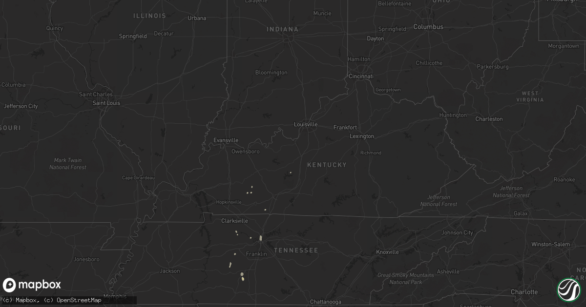
Hail Map in Kentucky on August 7, 2022
Get this storm
August 7 map
$229
one time, instant access
Download today. No call, no setup
Keep the $229
Bought the map and want the full workflow? Apply the entire $229 to a subscription within 7 days. None of it is wasted.
Every map, not just this one
This buys you this map. Subscription and you get every map we run, in the markets you choose from a few cities to whole states to nationwide. Plus real-time alerts the moment a storm fires.
Contact data
Name, contact info, occupancy, even credit band for addresses in the footprint. You go from where it hit to who to call.
Become the source they trust
Unlimited branding weather history reports on demand. You already have the documented answer ready for the property owner, and you are the one who showed up with it.
Property data and RoofTrace estimates
Pull up any address you have got, its value and the exact code rules for that jurisdiction, straight from One Click Code. Then RoofTrace estimates the squares, pitch, and roof value, priced the way you price.
Storm reports in Kentucky
Kentucky
| Date | Description |
|---|---|
| 08/07/20222:30 PM CDT | More than 20 trees down across jim roberts community park. Power lines were reported down in the area. A barn was destroyed just north of the park along ditmore ford ro |
| 08/06/202210:05 PM CDT | At 304 PM CDT, a severe thunderstorm was located near Morgantown, moving northeast at 15 mph. HAZARD...60 mph wind gusts and penny size hail. SOURCE...Radar indicated. IMPACT...Expect damage to roofs, siding, and trees. Locations impacted include... Morgantown, Woodbury, Monford, Aberdeen, Leetown, Benleo, Rockland, Guy, Huldeville, and Hadley. |
All States Impacted by Hail Map on August 7, 2022
Cities Impacted by Hail Map on August 7, 2022
- Ute, IA
- Southside, TN
- Arab, AL
- Florence, CO
- Coal Creek, CO
- Sharon Springs, KS
- Las Animas, CO
- Walsenburg, CO
- Tombstone, AZ
- Cochise, AZ
- Pearce, AZ
- Casey, IA
- Guthrie Center, IA
- Hasty, CO
- La Junta, CO
- Prescott, AZ
- San Simon, AZ
- Lumber City, GA
- Quitman, MS
- Melvin, AL
- Sugar City, CO
- Ordway, CO
- Arlington, CO
- West Des Moines, IA
- Des Moines, IA
- Windsor Heights, IA
- Trinidad, CO
- Lamar, CO
- Maplesville, AL
- Plantersville, AL
- Elfrida, AZ
- Winterset, IA
- Benson, AZ
- Surprise, AZ
- Model, CO
- Fort Huachuca, AZ
- Hereford, AZ
- Sierra Vista, AZ
- Longmont, CO
- Williams, AZ
- Mount Pleasant, TN
- Huachuca City, AZ
- Elgin, AZ
- Penrose, CO
- Lewisburg, KY
- Montgomery, AL
- Wetumpka, AL
- Lynnville, TN
- Culleoka, TN
- Holbrook, AZ
- Dexter, IA
- Earlham, IA
- Camilla, GA
- Tribune, KS
- Talladega, AL
- Livermore, CO
- Bisbee, AZ
- Monroe, IA
- Patagonia, AZ
- Lyons, CO
- Berthoud, CO
- Manzanola, CO
- Commerce City, CO
- Kit Carson, CO
- Rockford, AL
- Willcox, AZ
- Columbia, TN
- Decatur, AL
- Somerville, AL
- Mayer, AZ
- Hartselle, AL
- Saint James, LA
- Santa Fe, NM
- Denver, CO
- Audubon, IA
- Irwin, IA
- Kimballton, IA
- Kirkman, IA
- Hamlin, IA
- Exira, IA
- Chino Valley, AZ
- Kim, CO
- Pueblo, CO
- Des Arc, MO
- Annapolis, MO
- Franklin, KY
- Elk Horn, IA
- Brayton, IA
- Harlan, IA
- Aurora, CO
- Westminster, CO
- Chambers, AZ
- Adair, IA
- Anita, IA
- Dunmor, KY
- Johnston, IA
- Clive, IA
- Urbandale, IA
- Alexander City, AL
- Prairie City, IA
- Vinemont, AL
- Cullman, AL
- Ashland City, TN
- Nashville, TN
- Starkville, MS
- Crown King, AZ
- Animas, NM
- Winslow, AZ
- Clio, SC
- Sulligent, AL
- Gattman, MS
- Morris, GA
- Leoti, KS
- Lyles, TN
- Andalusia, AL
- Mapleton, IA
- Soldier, IA
- Dadeville, AL
- Eutaw, AL
- Florissant, CO
- Kirkland, AZ
- Van Meter, IA
- Adel, IA
- Booneville, IA
- Cumming, IA
- De Soto, IA
- Norwalk, IA
- Madison, TN
- Kellyton, AL
- Ganado, AZ
- Madison, NH
- Equality, AL
- Munford, AL
- Canon City, CO
- Boulder, CO
- Lafayette, CO
- Clarkson, KY
- Rodeo, NM
- Weskan, KS
- Tuscaloosa, AL
- Northport, AL
- Mitchellville, IA
- Runnells, IA
- Crescent, IA
- Danville, AL
- Wallace, KS
- Paulden, AZ
- Centerville, TN
- Lincoln, AL
- Eastaboga, AL
- Cumberland Furnace, TN
- Charlotte, TN
- Clanton, AL
- Billingsley, AL
- Trinchera, CO
- Gilman, IA
- Tama, IA
- Malcom, IA
- Laurel, IA
- Grinnell, IA
- Chelsea, IA
- Colfax, IA
- Newton, IA


