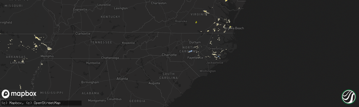
Hail Map in North Carolina on August 7, 2019
The weather event in North Carolina on August 7, 2019 includes Hail, Wind, and Tornado maps. 32 states and 948 cities were impacted and suffered possible damage. The total estimated number of properties impacted is 0.
Want more than just the map?
Turn this storm into a full workflow.
- Owner + property data so you know who to knock
- OnDemand branded weather history reports to win the "did we even have hail?" argument
- RoofTrace estimate so reps stop guessing numbers at the door
Bought this map? Upgrade within 7 days and we'll credit the $230. (10-15 min setup call)
Hail
Wind
Tornado
0
Estimated number of impacted properties by a 1.00" hail or larger0
Estimated number of impacted properties by a 1.75" hail or larger0
Estimated number of impacted properties by a 2.50" hail or largerStorm reports in North Carolina
North Carolina
| Date | Description |
|---|---|
| 08/07/20194:55 PM CDT | Trees fell along e parker rd and bethel rd including one on a vehicle. |
| 08/07/20193:25 PM CDT | Trees down near gates. |
| 08/07/20192:45 PM CDT | Multiple videos and nws storm survey indicate a brief tornado touchdown occurred on the east side of hwy 17 in a wooded area... And caused minor tree damage. Estimated |
| 08/07/20192:45 PM CDT | Large tree down. Tree on fire either due to lightning or entanglement of power pole and lines. |
| 08/07/20192:41 PM CDT | Large tree down across hwy. Took down multiple power lines/poles. |
| 08/07/201911:56 AM CDT | 1 tree down. |
| 08/07/201911:45 AM CDT | Thunderstorm winds downed a tree along gibsonville ossipee road. Time estimated via radar. |
| 08/07/201911:43 AM CDT | 1 tree down. |
| 08/07/20197:45 AM CDT | At 1245 PM EDT, severe thunderstorms were located along a line extending from near Burlington to 11 miles southwest of Asheboro, moving east at 20 mph. HAZARD...60 mph wind gusts. SOURCE...Radar indicated. IMPACT...Expect damage to roofs, siding, and trees. Locations impacted include... Greensboro, Chapel Hill, Burlington, Asheboro, Graham, Hillsborough, Randleman, Pittsboro, Siler City and North Carolina Zoo. |
| 08/07/20196:43 AM CDT | At 1142 PM EDT, a severe thunderstorm was located 7 miles southwest of Sanford, moving east at 40 mph. HAZARD...60 mph wind gusts. SOURCE...Radar indicated. IMPACT...Expect damage to roofs, siding, and trees. Locations impacted include... Cary, Sanford, Lillington, Fuquay-Varina, Angier, Apex, Holly Springs, Coats, Broadway and Lemon Springs. |
| 08/07/20196:23 AM CDT | At 1123 PM EDT, a severe thunderstorm was located 12 miles south of Godwin, or 13 miles east of Fayetteville, moving east at 25 mph. HAZARD...60 mph wind gusts. SOURCE...Radar indicated. IMPACT...Expect damage to roofs, siding, and trees. Locations impacted include... Clinton, Eastover, Roseboro, Stedman, Salemburg, Turkey, Autryville, Hobbton and Vander. |
| 08/07/20196:00 AM CDT | At 1100 PM EDT, a severe thunderstorm was located near Carthage, moving east at 25 mph. HAZARD...60 mph wind gusts. SOURCE...Radar indicated. IMPACT...Expect damage to roofs, siding, and trees. Locations impacted include... Sanford, Carthage, Whispering Pines, Broadway, Robbins, Vass, Cameron, Lemon Springs, Gum Springs and Olivia. |
| 08/07/20194:01 AM CDT | At 901 PM EDT, a severe thunderstorm was located over Tuscarora, or 7 miles west of New Bern, moving east at 20 mph. HAZARD...60 mph wind gusts. SOURCE...Radar indicated. IMPACT...Expect damage to roofs, siding, and trees. Locations impacted include... New Bern, Havelock, James City, Trent Woods, River Bend, Askins, Jasper, Tuscarora, Rhems, Olympia, Grantsboro, Croatan, Riverdale, Neuse Forest, Fairfield Harbour, Coastal Carolina Regional Airport, Bayboro, Alliance, Arapahoe and Bridgeton. |
| 08/07/20193:29 AM CDT | At 829 PM EDT, a severe thunderstorm was located 9 miles east of High Rock Lake, or 9 miles southeast of Lexington, moving east at 25 mph. HAZARD...60 mph wind gusts and quarter size hail. SOURCE...Radar indicated. IMPACT...Hail damage to vehicles is expected. Expect wind damage to roofs, siding, and trees. Locations impacted include... Asheboro, Lexington, Randleman, North Carolina Zoo, Seagrove, Denton, Gordontown, Ulah, High Rock Boat Dock Marina and Randleman Regional Reservoir Marina. |
| 08/07/20193:18 AM CDT | At 818 PM EDT, a severe thunderstorm was located near Linwood, or near Lexington, moving east at 20 mph. HAZARD...60 mph wind gusts and quarter size hail. SOURCE...Radar indicated. IMPACT...Hail damage to vehicles is expected. Expect wind damage to roofs, siding, and trees. Locations impacted include... Asheboro, Lexington, Randleman, North Carolina Zoo, Seagrove, Linwood, Denton, Gordontown, Randleman Regional Reservior Marina and Ulah. |
| 08/07/20191:15 AM CDT | At 615 PM EDT, a severe thunderstorm was located near Sandyfield, or 18 miles northwest of Leland, moving northeast at 15 mph. HAZARD...60 mph wind gusts and quarter size hail. SOURCE...Radar indicated. IMPACT...Minor hail damage to vehicles is possible. Expect wind damage to trees and power lines. Locations impacted include... Rowan, Point Caswell, Currie, Long Creek, The Borough, Montague, Rooks, Malpass Corner, Kelly and Atkinson. |
| 08/07/201912:29 AM CDT | At 529 PM EDT, severe thunderstorms were located along a line extending from Virginia Beach to near Northwest, moving east at 30 mph. HAZARD...60 mph wind gusts and quarter size hail. SOURCE...Radar indicated. IMPACT...Minor damage to vehicles is possible. Expect wind damage to trees and powerlines. Locations impacted include... Virginia Beach, Back Bay, Princess Anne, Rudee Heights, Sigma, Sandbridge Beach, Oceana NAS, Munden, Macons Corner, Pungo, Oceana, Dam Neck, Gallups Corner and London Bridge. |
| 08/07/201912:12 AM CDT | Thunderstorm winds downed a tree on powerlines resulting in a power outage near the intersection of bethlehem road and interstate 87. Time of power outage report. |
| 08/06/201911:55 PM CDT | Thunderstorm winds downed several trees along us-70 between garner and clayton. |
| 08/06/201911:26 PM CDT | At 426 PM EDT, severe thunderstorms were located along a line extending from near Ocean View to near Corapeake, moving east at 20 mph. Numerous wind gusts of 40 to 60 mph have been reported with these storms. HAZARD...60 mph wind gusts and quarter size hail. SOURCE...Radar indicated. IMPACT...Minor damage to vehicles is possible. Expect wind damage to trees and powerlines. Locations impacted include... Virginia Beach, Kempsville, Chesapeake, Back Bay, Princess Anne, Rudee Heights, Princess Anne Plaza, Sigma, Sandbridge Beach, Oceana NAS, Munden, Macons Corner, Pungo, Bayside, Oceana, Dam Neck, North Virginia Beach, Gallups Corner and London Bridge. |
| 08/06/201911:23 PM CDT | Abc 11 reported a tree down at holly springs rd. And lilly atkins rd. |
| 08/06/201911:23 PM CDT | Thunderstorm winds downed a tree along holly springs road near the intersection with birkhaven drive. |
| 08/06/201911:21 PM CDT | Thunderstorm winds downed a small tree along ten ten road near megwood court. |
| 08/06/201911:20 PM CDT | Thunderstorm winds downed a tree onto powerlines along kelly road. |
| 08/06/201911:18 PM CDT | Thunderstorm winds downed three trees along with powerlines near the intersection of kelly road and holland road. |
| 08/06/201911:14 PM CDT | At 414 PM EDT, a severe thunderstorm was located near Comfort, or 12 miles northeast of Half Moon, moving east at 15 mph. HAZARD...60 mph wind gusts and quarter size hail. SOURCE...Radar indicated. IMPACT...Hail damage to vehicles is expected. Expect wind damage to roofs, siding, and trees. Locations impacted include... Comfort, Loco VFD, Pollocksville and Trenton. |
| 08/06/201911:13 PM CDT | At 413 PM EDT, severe thunderstorms were located along a line extending from 8 miles southwest of Lewiston Woodville to 8 miles southwest of Tarboro, moving east at 30 mph. HAZARD...60 mph wind gusts and quarter size hail. SOURCE...Radar indicated. IMPACT...Hail damage to vehicles is expected. Expect wind damage to roofs, siding, and trees. Locations impacted include... Williamston, Bethel, Stokes, Robersonville, Gold Point, Hamilton, Oak City, Parmele, Everetts, Falkland and Hassell. |
| 08/06/201911:11 PM CDT | Wral reported a tree and power lines down at apex barbecue rd. And kelly rd... With both lanes of the latter blocked. |
| 08/06/201911:10 PM CDT | Spectrum news reported a tree down on a home at 113 lucky ribbon ln. In twelve oaks. |
| 08/06/201910:37 PM CDT | At 336 PM EDT, severe thunderstorms were located along a line extending from Scotland Neck to Rocky Mount, moving east at 30 mph. HAZARD...60 mph wind gusts. SOURCE...Radar indicated. IMPACT...Expect damage to roofs, siding, and trees. Locations impacted include... Rocky Mount, Tarboro, Scotland Neck, Dortches, Princeville, Sharpsburg, Pinetops, Whitakers, Hobgood and Conetoe. |
| 08/06/201910:23 PM CDT | Trees were reported down on power lines along holly pond road near villanow drive. |
| 08/06/20199:40 PM CDT | At 239 PM EDT, severe thunderstorms were located along a line extending from Littleton to 12 miles south of Warrenton to Franklinton, moving east at 25 mph. HAZARD...60 mph wind gusts. SOURCE...Radar indicated. IMPACT...Expect damage to roofs, siding, and trees. Locations impacted include... Rocky Mount, Roanoke Rapids, Louisburg, Warrenton, Halifax, Franklinton, Dortches, Littleton, Kittrell and Red Oak. |
| 08/06/20198:54 PM CDT | At 154 PM EDT, a severe thunderstorm was located over Catfish Lake, or 11 miles west of Havelock, moving east at 15 mph. HAZARD...60 mph wind gusts. SOURCE...Radar indicated. IMPACT...Expect damage to roofs, siding, and trees. Locations impacted include... New Bern, Havelock, Morehead City, Harlowe, Janeiro, Croatan, Riverdale, North Harlowe, Catfish Lake, Neuse Forest, Cherry Branch Ferry Terminal, Minnesott Beach Ferry, Arapahoe and Minnesott Beach. |
| 08/06/20198:16 PM CDT | At 115 PM EDT, severe thunderstorms were located along a line extending from near Roxboro to Prospect Hill, moving northeast at 25 mph. HAZARD...60 mph wind gusts. SOURCE...Radar indicated. IMPACT...Expect damage to roofs, siding, and trees. Locations impacted include... Durham, Henderson, Oxford, Roxboro, Creedmoor, Butner, Kittrell, Rougemont, Stem and Stovall. |
| 08/06/20198:13 PM CDT | Many power outages in vcty of trent woods. |
| 08/06/20198:04 PM CDT | At 104 PM EDT, a severe thunderstorm was located over Boydton, or 9 miles south of Chase City, moving northeast at 20 mph. HAZARD...60 mph wind gusts and quarter size hail. SOURCE...Radar indicated. IMPACT...Minor damage to vehicles is possible. Expect wind damage to trees and powerlines. This severe thunderstorm will be near, Boydton around 110 PM EDT. South Hill around 145 PM EDT.Other locations impacted by this severe thunderstorm include RogersCorner, Richardson, Beechwood, John H Kerr Dam, North View, Finchley,Baskerville, Skipwith, Wightman and John H Kerr Reservoir. |
| 08/06/20197:33 PM CDT | This is a correction from the previous hwy 8. Tree down on pine lodge road near hwy 8. |
| 08/06/20197:30 PM CDT | Corrects previous tstm wnd dmg report from 5 ssw lexington. Tree down on junior order home rd. |
| 08/06/20197:30 PM CDT | Tree down pine lodge road near hwy 8. |
| 08/06/20197:28 PM CDT | Tree down on allred rd and jerusalem rd. |
| 08/06/20197:21 PM CDT | A few trees snapped. |
All States Impacted by Hail Map on August 7, 2019
Cities Impacted by Hail Map on August 7, 2019
- Black Creek, WI
- Ballston Spa, NY
- Saratoga Springs, NY
- Greenfield Center, NY
- Rock City Falls, NY
- Gansevoort, NY
- Middle Grove, NY
- Mullica Hill, NJ
- Sewell, NJ
- Mantua, NJ
- Clarksboro, NJ
- Swedesboro, NJ
- Mickleton, NJ
- Woodstown, NJ
- White Hall, MD
- Gloucester, VA
- Wade, NC
- Moulton, AL
- Sturgeon Bay, WI
- Allen, KS
- Emporia, KS
- Crivitz, WI
- Cody, NE
- Wausaukee, WI
- White Lake, WI
- Pickerel, WI
- Elcho, WI
- Crandon, WI
- Pearson, WI
- Natoma, KS
- Plainville, KS
- Rice Lake, WI
- Weyerhaeuser, WI
- Bruce, WI
- Linn Creek, MO
- Stoutland, MO
- Montreal, MO
- Louisa, VA
- Palmyra, VA
- Kents Store, VA
- Goochland, VA
- Columbia, VA
- Matador, TX
- Paragould, AR
- Peach Orchard, AR
- Pocahontas, AR
- Maynard, AR
- Beech Grove, AR
- Biggers, AR
- Delaplaine, AR
- New Franken, WI
- Suamico, WI
- Luxemburg, WI
- Green Bay, WI
- Frederick, MD
- Ijamsville, MD
- Adamstown, MD
- Orchard, NE
- Page, NE
- Hawk Springs, WY
- Shaniko, OR
- Salina, KS
- Brookville, KS
- Baxter Springs, KS
- Quapaw, OK
- Stanton, TN
- Colome, SD
- Winner, SD
- New Egypt, NJ
- Cream Ridge, NJ
- Joffre, PA
- Burgettstown, PA
- Cheyenne Wells, CO
- Arapahoe, CO
- Green Lake, WI
- Ripon, WI
- Berlin, WI
- Naper, NE
- Black River Falls, WI
- Warrens, WI
- Pittsville, WI
- Delavan, WI
- Whitewater, WI
- Burlington, CO
- Disputanta, VA
- Spring Grove, VA
- Waverly, VA
- Courtland, VA
- Capron, VA
- Claude, TX
- Huntsville, AL
- Harvest, AL
- Pocahontas, TN
- Selmer, TN
- Emporia, VA
- Gladstone, NJ
- Califon, NJ
- Far Hills, NJ
- Hazel Green, AL
- Manistique, MI
- Cooks, MI
- Bryant, WI
- Merrillan, WI
- Keiser, AR
- Folkston, GA
- Carpenter, WY
- Hornbeak, TN
- Eureka, KS
- Hamilton, KS
- Fredonia, KS
- Benedict, KS
- Sheridan Lake, CO
- Tribune, KS
- Warm Springs, AR
- Cornersville, TN
- Lynnville, TN
- Culleoka, TN
- Yorktown, VA
- Arnett, OK
- Durham, OK
- Kimberly, WI
- Little Chute, WI
- Combined Locks, WI
- Appleton, WI
- Kaukauna, WI
- Sherwood, MD
- Cordova, MD
- Saint Michaels, MD
- Royal Oak, MD
- Chester, MD
- Tilghman, MD
- Prince Frederick, MD
- Wittman, MD
- Saint Leonard, MD
- Port Republic, MD
- Easton, MD
- Mcdaniel, MD
- Bozman, MD
- Queenstown, MD
- Neavitt, MD
- Stevensville, MD
- Grasonville, MD
- Claiborne, MD
- Wiggins, CO
- Marengo, WI
- Mellen, WI
- Glidden, WI
- Clam Lake, WI
- Seymour, WI
- Hortonville, WI
- New London, WI
- Watervliet, NY
- Albany, NY
- Delmar, NY
- Slingerlands, NY
- Troy, NY
- Roscoe, NY
- Blounts Creek, NC
- Washington, NC
- Bath, NC
- Ward, AR
- Lonoke, AR
- Tescott, KS
- Beverly, KS
- Lincoln, KS
- Grand Junction, TN
- Saulsbury, TN
- Lagrange, WY
- Brodnax, VA
- Paris, AR
- Tigerton, WI
- Henning, TN
- Ripley, TN
- Happy, TX
- Gypsum, KS
- Newport, NE
- Wheatland, WY
- Thayer, KS
- Fall River, KS
- Altoona, KS
- Longton, KS
- Liberty, KS
- Mound Valley, KS
- Dennis, KS
- Cherryvale, KS
- Neodesha, KS
- Independence, KS
- Toronto, KS
- Red House, VA
- Brookneal, VA
- Burke, SD
- Coleman, WI
- Pound, WI
- Brussels, WI
- Lena, WI
- Oconto, WI
- Peshtigo, WI
- Humboldt, KS
- Iola, KS
- Elsmore, KS
- Chanute, KS
- Erie, KS
- Piqua, KS
- Savonburg, KS
- Moran, KS
- Yates Center, KS
- La Harpe, KS
- Mission, SD
- Platte, SD
- Easton, PA
- Cochecton, NY
- Bethel, NY
- Swan Lake, NY
- Narrowsburg, NY
- White Lake, NY
- Edgar, WI
- Mosinee, WI
- Tarboro, NC
- Rocky Mount, NC
- Altus, AR
- Ozark, AR
- Magazine, AR
- New Bern, NC
- Ernul, NC
- Neshkoro, WI
- Brush, CO
- Snyder, CO
- Hillrose, CO
- Spencer, WI
- Brillion, WI
- Potter, WI
- Hilbert, WI
- Chilton, WI
- Blairstown, MO
- Bassett, NE
- Woodston, KS
- Roland, AR
- Short Hills, NJ
- Livingston, NJ
- West Orange, NJ
- Millburn, NJ
- Harrison, SD
- Armour, SD
- Corsica, SD
- Dallas, SD
- Mills, NE
- Gregory, SD
- Assaria, KS
- Lindsborg, KS
- Falun, KS
- Maupin, OR
- Marshall, AR
- Winneconne, WI
- Omro, WI
- Fremont, WI
- Powhatan, VA
- Brandon, WI
- Agate, CO
- Stuart, NE
- Atkinson, NE
- Taylor, WI
- Cherokee, AL
- Marion, KS
- Phillipsburg, NJ
- Bloomsbury, NJ
- Myerstown, PA
- Fredericksburg, PA
- Annville, PA
- Lebanon, PA
- Jonestown, PA
- Paradise, KS
- Oshkosh, WI
- Kilgore, NE
- Nenzel, NE
- Joint Base Mdl, NJ
- Wrightstown, NJ
- Allentown, NJ
- Chesterfield, NJ
- Jonesboro, AR
- Jefferson, WI
- Stover, MO
- Cole Camp, MO
- Dover, AR
- Geddes, SD
- Morrisville, PA
- Florence, NJ
- Bristol, PA
- Reno, NV
- Asbury, NJ
- Stewartsville, NJ
- Matfield Green, KS
- Sunrise Beach, MO
- Halifax, NC
- Belhaven, NC
- Hackett, AR
- Adams, WI
- Grand Marsh, WI
- Oxford, WI
- Westfield, WI
- Lenora, KS
- Clayton, KS
- Chugwater, WY
- Columbus, WI
- Reeseville, WI
- Beaver Dam, WI
- Ellington, MO
- McMillan, MI
- Alcester, SD
- Centerville, KS
- Mound City, KS
- Laona, WI
- Argonne, WI
- Fairwater, WI
- Redgranite, WI
- Fox Lake, WI
- Dresden, KS
- Amagon, AR
- Fisher, AR
- Vinemont, AL
- Falkville, AL
- Crookston, NE
- Valentine, NE
- Sanford, NC
- Summit, NJ
- Springfield, NJ
- Maplewood, NJ
- Grass Valley, OR
- Kent, OR
- Centerview, MO
- Warrensburg, MO
- Drummonds, TN
- Wilson, AR
- Osceola, AR
- Covington, TN
- Burlison, TN
- Quartzsite, AZ
- Springview, NE
- Le Roy, KS
- Colony, KS
- Waverly, KS
- Burlington, KS
- Neosho Falls, KS
- Westphalia, KS
- Lebo, KS
- Newport, AR
- Palatine Bridge, NY
- Fort Plain, NY
- Canajoharie, NY
- Dundee, MS
- Tunica, MS
- Elkhorn, WI
- Coldwater, KS
- Tyndall, SD
- Dinwiddie, VA
- Petersburg, VA
- Utica, SD
- Menno, SD
- Jarrettsville, MD
- Street, MD
- Raleigh, NC
- Cary, NC
- Apex, NC
- Virgil, KS
- Arriba, CO
- Admire, KS
- Reading, KS
- Americus, KS
- Watkinsville, GA
- Inman, KS
- Pocomoke City, MD
- Oberlin, KS
- Selden, KS
- Protection, KS
- Tampa, KS
- Durham, KS
- Irene, SD
- Lesterville, SD
- Nevada, MO
- Richards, MO
- Howard, KS
- Toney, AL
- Leola, PA
- Ronks, PA
- Bird In Hand, PA
- Waldo, KS
- Luray, KS
- Barnard, KS
- Sylvan Grove, KS
- Lucas, KS
- Alton, KS
- Hunter, KS
- Sterling, VA
- Potomac, MD
- Poolesville, MD
- Gaithersburg, MD
- Germantown, MD
- Haven, KS
- Hutchinson, KS
- Friendship, WI
- Coloma, WI
- Reedsville, WI
- Cheyenne, WY
- Fort Morgan, CO
- Everton, AR
- Saint Joe, AR
- Snow Hill, NC
- Hookerton, NC
- Limon, CO
- Pleasanton, KS
- Columbus, KS
- Galena, KS
- Riverton, KS
- Crossett, AR
- Lebanon, MO
- Richland, MO
- Brumley, MO
- Whitelaw, WI
- Maribel, WI
- Wray, CO
- Bogue, KS
- Blue Mound, KS
- Tuthill, SD
- Martin, SD
- Cedar Point, KS
- Sun Prairie, WI
- Cambria, WI
- Randolph, WI
- Walker, MO
- Sulphur Rock, AR
- Bloomfield, NE
- Witten, SD
- Obion, TN
- Troy, TN
- Canyon, TX
- Mount Calvary, WI
- Malone, WI
- Fond Du Lac, WI
- Seaford, VA
- Albertson, NC
- Pink Hill, NC
- Kinston, NC
- Trenton, NC
- Dover, NC
- Menasha, WI
- Preston, MD
- Sparks, NV
- Genoa, CO
- Windsor, VA
- Smithfield, VA
- Springfield, SD
- Avon, SD
- Tripp, SD
- Niobrara, NE
- Marianna, AR
- Marion, WI
- Clintonville, WI
- Mountain View, AR
- Carlisle, AR
- Taft, TN
- Fayetteville, TN
- Briggsdale, CO
- Neal, KS
- Algoma, WI
- Casco, WI
- Columbia, TN
- Needles, CA
- Coffeyville, KS
- Cassoday, KS
- Stratford, WI
- Jarratt, VA
- Sedley, VA
- Wabeno, WI
- Vona, CO
- Licking, MO
- Williamsburg, VA
- Emmet, NE
- Oneill, NE
- Athelstane, WI
- Shiocton, WI
- Chili, WI
- Marshfield, WI
- Hillsboro, WI
- Eldred, NY
- La Cygne, KS
- Godwin, NC
- Saint Francis, SD
- Pemberton, NJ
- Jackson, NJ
- Jobstown, NJ
- Columbus, NJ
- Manawa, WI
- Kanorado, KS
- Babcock, WI
- Byers, CO
- Suffolk, VA
- Clayton, NC
- Manchester, TN
- Ellinwood, KS
- Cherry Valley, AR
- Bernardsville, NJ
- Basking Ridge, NJ
- Germfask, MI
- Eleva, WI
- Bluffton, SC
- Lyndon, KS
- Clinton, MO
- Batesville, AR
- Lillington, NC
- Bloomfield, NJ
- Dickerson, MD
- Monrovia, MD
- Bluejacket, OK
- Okatie, SC
- Athens, WI
- Mullinville, KS
- Delmont, SD
- Iuka, MS
- Burnsville, MS
- Fort Leavenworth, KS
- Weiner, AR
- Witts Springs, AR
- Hector, AR
- Toone, TN
- Whiteville, TN
- Bolivar, TN
- Austin, AR
- Bulger, PA
- Buhler, KS
- Autryville, NC
- Roseboro, NC
- Salemburg, NC
- Junction City, WI
- De Pere, WI
- Newark, NJ
- Warren, NJ
- Martinsville, NJ
- Bridgewater, NJ
- Somerville, NJ
- Centerville, TN
- Glen, MS
- Russellville, AL
- Larsen, WI
- Oil Trough, AR
- Dellrose, TN
- Quakertown, PA
- Kintnersville, PA
- Cash, AR
- Rogersville, AL
- Anderson, AL
- Elkmont, AL
- Athens, AL
- Atwood, KS
- Gravois Mills, MO
- Manassas, VA
- Centreville, VA
- Loyal, WI
- Granton, WI
- Neillsville, WI
- Cedar Grove, TN
- Parmelee, SD
- Millington, TN
- Pleasant Grove, AR
- Marcella, AR
- Sedgwick, KS
- Madison, AL
- Aulander, NC
- Windsor, NC
- Norfolk, VA
- Alta Vista, KS
- Eskridge, KS
- Alma, KS
- Bear Creek, WI
- Des Arc, AR
- Hebron, IL
- Harvard, IL
- Virginia Beach, VA
- Chesapeake, VA
- Portsmouth, VA
- Lake Geneva, WI
- Genoa City, WI
- Westerville, OH
- Galena, OH
- Garnet Valley, PA
- Wilmington, DE
- Chadds Ford, PA
- Goodman, MO
- Seneca, MO
- Neosho, MO
- Newark, AR
- Lowland, NC
- Waterloo, AL
- Townsend, WI
- Lakewood, WI
- Pollocksville, NC
- Gleason, WI
- Yoder, WY
- Lawrenceville, VA
- La Crosse, VA
- White Plains, VA
- Ebony, VA
- Little Rock, AR
- Fontana, KS
- Edna, KS
- Elk City, KS
- Buffalo, KS
- Caroline, WI
- Dyer, TN
- Manila, AR
- Osseo, WI
- Fort Atkinson, WI
- Marlboro, NJ
- Morganville, NJ
- Englishtown, NJ
- Front Royal, VA
- Fort Valley, VA
- Bentonville, VA
- Bellvue, CO
- Loveland, CO
- Maysville, NC
- Woodville, AL
- Paint Rock, AL
- Kimball, SD
- Saint Paul, KS
- Aurora, NC
- Parkston, SD
- New Holland, SD
- Greenwood, WI
- Markesan, WI
- Princeton, WI
- Catharine, KS
- Leavenworth, KS
- Kansas City, KS
- Enid, OK
- Defuniak Springs, FL
- Daufuskie Island, SC
- Greenville, WI
- Doniphan, MO
- Fremont, MO
- Long Valley, NJ
- Lebanon, NJ
- Ettrick, WI
- Eads, CO
- Wautoma, WI
- Uniontown, KS
- Williamsport, TN
- Rhinelander, WI
- Amherst Junction, WI
- Scandinavia, WI
- Iola, WI
- Ogdensburg, WI
- Cockeysville, MD
- Phoenix, MD
- Broomall, PA
- Media, PA
- Newtown Square, PA
- Springfield, PA
- Battleboro, NC
- Nichols, WI
- Pulaski, WI
- Bonduel, WI
- Florence, AL
- Plymouth, WI
- Waldo, WI
- Sheboygan Falls, WI
- Minneola, KS
- Drewryville, VA
- Florham Park, NJ
- South Orange, NJ
- Chatham, NJ
- Union, NJ
- Vauxhall, NJ
- Forestville, WI
- Crum Lynne, PA
- Woodlyn, PA
- Ridley Park, PA
- Deer Trail, CO
- Prescott, KS
- Morristown, NJ
- Chester, NJ
- New Vernon, NJ
- Peapack, NJ
- Mauston, WI
- Reedsburg, WI
- Baraboo, WI
- Perkasie, PA
- Howard, OH
- Walhonding, OH
- Cottonwood Falls, KS
- Cove City, NC
- Waterloo, WI
- Lake Mills, WI
- Lake City, AR
- Brookland, AR
- Mountain, WI
- Langhorne, PA
- Levittown, PA
- Fairless Hills, PA
- Mason, TN
- Arlington, TN
- Edgerton, WI
- Dendron, VA
- Welch, OK
- Bartlett, KS
- Valley Springs, AR
- Yellville, AR
- Duck River, TN
- Sharon, CT
- Fuquay Varina, NC
- Pachuta, MS
- Burrton, KS
- Kit Carson, CO
- Belle Plaine, KS
- Wellington, KS
- Altamont, KS
- Oswego, KS
- Charles City, VA
- Providence Forge, VA
- Hixton, WI
- Alma Center, WI
- Abilene, KS
- Paola, KS
- Alicia, AR
- Hoxie, AR
- Grifton, NC
- Memphis, TN
- Kansas City, MO
- Riegelsville, PA
- Milford, NJ
- Washington, NJ
- Arpin, WI
- Necedah, WI
- Boydton, VA
- Denmark, WI
- Kewaunee, WI
- Stone Ridge, NY
- Accord, NY
- New Park, PA
- Felton, PA
- Airville, PA
- Locust Grove, AR
- Thorp, WI
- Kiel, WI
- New Holstein, WI
- Hermitage, AR
- Saint Francis, KS
- Shawano, WI
- Lake Ozark, MO
- Holly, CO
- Dunn, NC
- Hardeeville, SC
- Burlington, NC
- Haw River, NC
- Arcadia, WI
- Mount Olive, NC
- Mongaup Valley, NY
- Knobel, AR
- Lafe, AR
- Stickney, SD
- Manitowoc, WI
- Chetopa, KS
- Windsor, NJ
- Hightstown, NJ
- Robbinsville, NJ
- Bordentown, NJ
- Mount Holly, NJ
- Beverly, NJ
- Lakehurst, NJ
- Trenton, NJ
- Bensalem, PA
- Browns Mills, NJ
- Vincentown, NJ
- Cookstown, NJ
- Burlington, NJ
- Croydon, PA
- Parsons, KS
- McCune, KS
- Carthage, NC
- Van Dyne, WI
- Gatewood, MO
- Butte, NE
- Pittstown, NJ
- Annandale, NJ
- Helena, AR
- Weldona, CO
- Saint Paul, AR
- New Hill, NC
- Hartington, NE
- Scotland, SD
- Wausa, NE
- Wagner, SD
- Waupun, WI
- Pleasant City, OH
- Kent, OH
- Oviedo, FL
- Ono, PA
- Shell Knob, MO
- Berryville, AR
- Sandy Hook, VA
- Maidens, VA
- Windsor, MO
- Wetmore, MI
- Rapid River, MI
- Feura Bush, NY
- Amissville, VA
- Marshall, VA
- Rosalia, KS
- Severy, KS
- Piedmont, KS
- Brownsville, TN
- Oakland, TN
- Rossville, TN
- Old Bridge, NJ
- Matawan, NJ
- Hudson, SD
- Huntingtown, MD
- Valley Center, KS
- Pelican Lake, WI
- Halstead, KS
- Okreek, SD
- Wood, SD
- Oconto Falls, WI
- Suring, WI
- Lewisburg, TN
- Walnut Ridge, AR
- Ayden, NC
- Princeton, NJ
- Monmouth Junction, NJ
- Kingston, NJ
- Monette, AR
- Wittenberg, WI
- Madison, KS
- Tanner, AL
- Rosebud, SD
- Norris, SD
- Conestoga, PA
- Elkhart Lake, WI
- Saint Cloud, WI
- Mount Judea, AR
- Mason, WI
- Mays Landing, NJ
- Hayes, VA
- Faison, NC
- Stokes, NC
- Greenville, NC
- Hilliard, FL
- Oneida, WI
- Rosendale, WI
- Eldorado, WI
- Pickett, WI
- Senecaville, OH
- Spring Hill, TN
- Waynesville, MO
- Coats, NC
- Hattiesburg, MS
- Penokee, KS
- Cleveland, WI
- Newton, WI
- Savannah, GA
- Morland, KS
- Green Village, NJ
- Eland, WI
- Goodland, KS
- Annapolis, MD
- Crosbyton, TX
- Ottsville, PA
- Upper Black Eddy, PA
- Bethlehem, PA
- Bedminster, NJ
- High Bridge, NJ
- Frenchtown, NJ
- Hampton, NJ
- Clinton, NJ
- Hellertown, PA
- Mendham, NJ
- Conway, NC
- Murfreesboro, NC
- Vossburg, MS
- Conrath, WI
- Glen Arm, MD
- Nottingham, MD
- Perry Hall, MD
- Parkville, MD
- Boyds, MD
- Clarksburg, MD
- Barnesville, MD
- Cedarburg, WI
- Lansdowne, PA
- Cordova, TN
- Mount Pleasant, SC
- Phenix, VA
- Willard, WI
- Lawrence Township, NJ
- Glen Mills, PA
- Spotsylvania, VA
- Stedman, NC
- East Brunswick, NJ
- Lewiston Woodville, NC
- Kelford, NC
- Oostburg, WI
- Cedar Grove, WI
- Knob Noster, MO
- Ionia, MO
- Hartford, KS
- Stony Creek, VA
- Flintville, TN
- Marshall, WI
- Rector, AR
- Munising, MI
- Arkdale, WI
- Valders, WI
- Hopewell, VA
- Cumberland, OH
- Susan, VA
- Willow Spring, NC
- Guion, AR
- Melbourne, AR
- New Market, AL
- Appomattox, VA
- Clarendon, TX
- Unity, WI
- Hewitt, WI
- Richmond, IL
- Twin Lakes, WI
- Burlington, WI
- Spring Grove, IL
- Williams Bay, WI
- Bryn Athyn, PA
- Bala Cynwyd, PA
- Huntingdon Valley, PA
- Elkins Park, PA
- Jenkintown, PA
- Abington, PA
- Cheltenham, PA
- Philadelphia, PA
- Wyncote, PA
- Glenside, PA
- Easthampton, MA
- Southampton, MA
- Howell, NJ
- Freehold, NJ
- Farmingdale, NJ
- Lakewood, NJ
- Sykesville, MD
- Mount Airy, MD
- New Market, MD
- Crofton, NE
- Tabor, SD
- Rensselaer, NY


