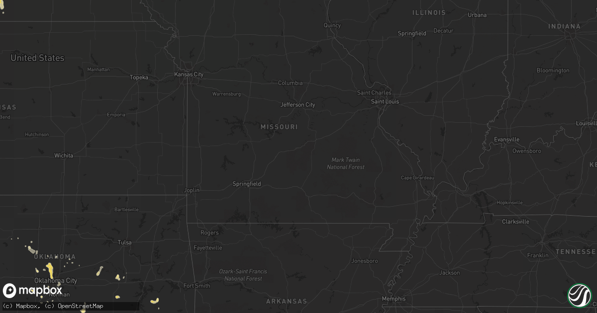
Hail Map in Nebraska on August 7, 2012
Get this storm
August 7 map
$229
one time, instant access
Download today. No call, no setup
Keep the $229
Bought the map and want the full workflow? Apply the entire $229 to a subscription within 7 days. None of it is wasted.
Every map, not just this one
This buys you this map. Subscription and you get every map we run, in the markets you choose from a few cities to whole states to nationwide. Plus real-time alerts the moment a storm fires.
Contact data
Name, contact info, occupancy, even credit band for addresses in the footprint. You go from where it hit to who to call.
Become the source they trust
Unlimited branding weather history reports on demand. You already have the documented answer ready for the property owner, and you are the one who showed up with it.
Property data and RoofTrace estimates
Pull up any address you have got, its value and the exact code rules for that jurisdiction, straight from One Click Code. Then RoofTrace estimates the squares, pitch, and roof value, priced the way you price.
Storm reports in Nebraska
Nebraska
| Date | Description |
|---|---|
| 08/07/20126:38 PM CDT | Quarter size hail slowly got smaller. Ground was white. 0.75 of an inch of rainfall reported. |
| 08/07/20126:26 PM CDT | Corrected time. |
| 08/07/20126:15 PM CDT | Hail up the size of ping pong was reported. |
| 08/07/20126:05 PM CDT | Estimated 50 to 60 mph wind gusts as thunderstorm passed through imperial. |
| 08/07/20126:01 PM CDT | Golf ball sized shattered windshield 3 nw of wolbach. |
| 08/07/20126:00 PM CDT | Hail up to the size of quarters started near 6 pm and fell for 10 to 15 minutes. |
| 08/07/20126:00 PM CDT | Power pole broken in half in imperial. Power outage continues for the city of imperial. Power was also knocked out at the automated surface observing station at the imp |
| 08/07/20125:56 PM CDT | A local report indicates 1.00 inch wind near ST. EDWARD |
| 08/07/20125:47 PM CDT | Quarter size hail currently falling. Ground is completely covered and visibility is poor due to hail. |
| 08/07/20125:41 PM CDT | A local report indicates 1.75 inch wind near 1 E WOLBACH |
| 08/07/20125:20 PM CDT | Hail up to the size of quarters started falling around 520 pm...and was still falling. |
| 08/06/20129:30 PM CDT | 4 power poles blown down. Crops flatten. Delayed report |
| 08/06/20127:52 PM CDT | Winds estimated up to 60 mph. |
| 08/06/20127:48 PM CDT | Tree limbs breaking. No size indicated. |
| 08/06/20127:24 PM CDT | Pea size hail also. |
| 08/06/20127:00 PM CDT | Mostly small hail reported...but there were a few quarter size hail stones. |
| 08/06/20127:00 PM CDT | Hail up to the size of golf balls started near 7 pm and was still ongoing. |
All States Impacted by Hail Map on August 7, 2012
Cities Impacted by Hail Map on August 7, 2012
- Wolbach, NE
- Scotia, NE
- Elba, NE
- Saint Paul, NE
- Greeley, NE
- Earling, IA
- Kinta, OK
- Snow, OK
- Clayton, OK
- Nashoba, OK
- Hennessey, OK
- Cedar Creek, NE
- Springfield, NE
- Plattsmouth, NE
- Papillion, NE
- Louisville, NE
- Doland, SD
- Truro, IA
- Okarche, OK
- Midway, GA
- Fleming, GA
- Katy, TX
- Eckley, CO
- Yuma, CO
- Clarksville, TX
- Deport, TX
- Bogata, TX
- Bagwell, TX
- Detroit, TX
- Blossom, TX
- Mullinville, KS
- Greensburg, KS
- Lake Preston, SD
- Creston, NE
- Madison, NE
- Platte Center, NE
- Humphrey, NE
- Columbus, NE
- Agra, KS
- Lufkin, TX
- Bellwood, NE
- Clovis, NM
- Lancaster, TX
- Dallas, TX
- Wilmer, TX
- Hutchins, TX
- North Bend, NE
- Scribner, NE
- Elgin, OK
- Guthrie, OK
- Manning, IA
- Geraldine, AL
- Dawson, AL
- Batesland, SD
- Haxtun, CO
- Okmulgee, OK
- Henryetta, OK
- Dunlap, IA
- Panama, IA
- Westphalia, IA
- Harlan, IA
- Woodbine, IA
- Defiance, IA
- Ryan, OK
- Waurika, OK
- Blair, NE
- Kiowa, OK
- Manilla, IA
- Emerson, IA
- Benkelman, NE
- Venango, NE
- Imperial, NE
- Enders, NE
- Champion, NE
- Exira, IA
- Hamlin, IA
- Audubon, IA
- Peru, IA
- Hayes Center, NE
- Oklahoma City, OK
- Oviedo, FL
- Winter Springs, FL
- Great Bend, KS
- Nacogdoches, TX
- Akron, CO
- Bastrop, LA
- Campbell, NE
- Bladen, NE
- Farragut, IA
- Riverton, IA
- Mobeetie, TX
- West Bend, WI
- Many, LA
- Woodward, IA
- West Point, NE
- Walters, OK
- Stratton, CO
- Kit Carson, CO
- Campbellsport, WI
- Kewaskum, WI
- Stratford, OK
- Byars, OK
- Ada, OK
- Asher, OK
- Bison, SD
- Lodgepole, SD
- Caney, OK
- Irwin, IA
- Kimballton, IA
- Kirkman, IA
- Crook, CO
- Lorimor, IA
- Macksburg, IA
- Robeline, LA
- Natchitoches, LA
- Coushatta, LA
- Saline, LA
- Goldonna, LA
- Campti, LA
- Simms, TX
- New Boston, TX
- Baskin, LA
- Winnsboro, LA
- Smithville, OK
- Milburn, OK
- Tishomingo, OK
- Maryville, MO
- Mooreland, OK
- Carson, IA
- Macedonia, IA
- Prairie City, IA
- Colfax, IA
- Perryton, TX
- Brownsboro, TX
- Chandler, TX
- Ben Wheeler, TX
- Wiergate, TX
- Burkeville, TX
- Anacoco, LA
- Hemphill, TX
- Leigh, NE
- Northport, AL
- Willow, OK
- Lamar, OK
- Holdenville, OK
- Dustin, OK
- Piedmont, OK
- Edmond, OK
- Cashion, OK
- Ovid, CO
- Massena, IA
- Tupelo, OK
- Atlantic, IA
- Anita, IA
- Wiota, IA
- Rayville, LA
- Dodd City, TX
- Tekamah, NE
- Lyons, KS
- Chase, KS
- Watson, OK
- Cove, AR
- Konawa, OK
- Fremont, NE
- Nickerson, NE
- Arlington, NE
- Scenic, SD
- Genoa, NE
- Saint Edward, NE
- Lindsay, NE
- Dodge, NE
- Shenandoah, IA
- Coin, IA
- Northboro, IA
- Hamburg, IA
- Timpson, TX
- Tuttle, OK
- Amber, OK
- Byers, TX
- Eads, CO
- Seagoville, TX
- Forney, TX
- Mesquite, TX
- Cheyenne Wells, CO
- Hartford, SD
- Humboldt, SD
- Clarendon, TX
- Mclean, TX
- Bloomingdale, GA
- Adel, IA
- Lebanon, KS
- Holly, CO
- Isabella, OK
- Holyoke, CO
- Angora, NE
- Paden, OK
- Bridgewater, IA
- Kellerton, IA
- Faxon, OK
- Lawton, OK
- Broken Bow, OK
- Brayton, IA
- Mound City, MO
- Maitland, MO
- Seymour, TX
- Omaha, NE
- Fort Calhoun, NE
- Crescent, IA
- Syracuse, KS
- Clark, SD
- Atlanta, TX
- De Kalb, TX
- Smith Center, KS
- Blanchard, OK
- Parks, NE
- Palmer, NE
- Belgrade, NE
- Avoca, IA
- Muse, OK
- Whitesboro, OK
- Talihina, OK
- Carthage, TX
- Wolsey, SD
- Inavale, NE
- Collins, GA
- Cobbtown, GA
- Claxton, GA
- Roff, OK
- Bellevue, NE
- Terrell, TX
- Craig, NE
- Lyons, NE
- Decatur, NE
- Dubach, LA
- Hodgen, OK
- Collinsville, TX
- Watertown, WI
- Ixonia, WI
- Ellabell, GA
- Fullerton, NE
- Monroe, NE
- Waskom, TX
- Missouri Valley, IA
- Red Oak, IA
- Okemah, OK
- Fyffe, AL
- Claflin, KS
- Lenox, IA
- Wilburton, OK
- Dover, OK
- Richmond Hill, GA
- Cache, OK
- Herman, NE
- Boaz, AL
- Garrison, TX
- Wellston, OK
- Forgan, OK
- Pembroke, GA
- Weleetka, OK
- Caddo, OK
- Offutt Afb, NE
- Henrietta, TX
- De Smet, SD
- Stringtown, OK
- Riverton, NE
- Wauneta, NE
- Blockton, IA
- Redding, IA
- Red Oak, OK
- Henderson, IA
- Fairview, OK
- Tuskahoma, OK
- Fontanelle, IA
- Lumber City, GA
- Fletcher, OK
- Wessington, SD
- Saint Lawrence, SD
- Burlington, CO
- Mondamin, IA
- Logan, IA
- Rural Retreat, VA
- De Berry, TX
- Bethany, LA
- Keithville, LA
- Greenwood, LA
- Nogales, AZ
- Tumacacori, AZ
- Randolph, IA
- Mayville, WI
- Theresa, WI
- Minco, OK
- Neola, IA
- Persia, IA
- Crescent, OK
- Quinton, OK
- Sharon, OK
- Hatfield, AR
- Depew, OK
- Stroud, OK
- Holstein, NE
- Murdock, NE
- Marlow, OK
- Arcadia, OK
- Houston, TX
- Modale, IA
- Hooper, NE
- Brooksville, FL
- Bennington, OK
- Albertville, AL
- Meridian, OK
- Chandler, OK
- Stonewall, OK
- Clarkson, NE
- Slinger, WI
- Moorhead, IA
- Huron, SD
- Elk Horn, IA
- Otis, CO
- West Monroe, LA
- Woodward, OK
- Geneva, FL
- Harlem, GA
- Skidmore, MO
- Vona, CO
- Gretna, VA
- Moundville, AL
- Mutual, OK
- Oakland, NE
- Amity, AR
- Custer, SD
- Belleview, FL
- Ocala, FL
- Hitchcock, SD
- Esbon, KS
- Council Bluffs, IA
- McClelland, IA
- Bouton, IA
- Marthaville, LA
- Belmont, LA
- Tyler, TX
- Fayette, AL
- Morse Bluff, NE
- Vienna, SD
- Turpin, OK
- El Reno, OK
- Mount Hope, AL
- Walnut, IA
- Rodessa, LA
- Ida, LA
- Doddridge, AR
- Grovetown, GA
- Mangham, LA
- Ellston, IA
- Mustang, OK
- Lockesburg, AR
- Chickasha, OK
- Pittsburg, OK
- Atoka, OK
- Rockwall, TX
- Prescott, IA
- Carthage, SD
- Kingfisher, OK
- South Pittsburg, TN
- Templeton, IA
- Bivins, TX
- Bloomburg, TX
- Crossville, AL
- Vermillion, KS
- Frankfort, KS
- Uvalda, GA
- Howells, NE
- Magnolia, IA
- Oshkosh, NE
- Cypress, TX
- Mill Creek, OK
- Cavour, SD
- Iroquois, SD
- Yale, SD
- Kingston, OK
- Diagonal, IA
- Tuscaloosa, AL
- Seibert, CO
- Bethel, OK
- Pearson, GA
- Bay City, MI
- Ivanhoe, TX
- Telephone, TX
- Merriman, NE
- Mankato, KS
- Canadian, TX
- Newcastle, OK
- Delhi, LA
- Lyons, GA
- Oxford, FL
- Hinesville, GA
- Spearville, KS
- Fort Pierce, FL
- Windom, TX
- Cawker City, KS
- Dearing, GA


