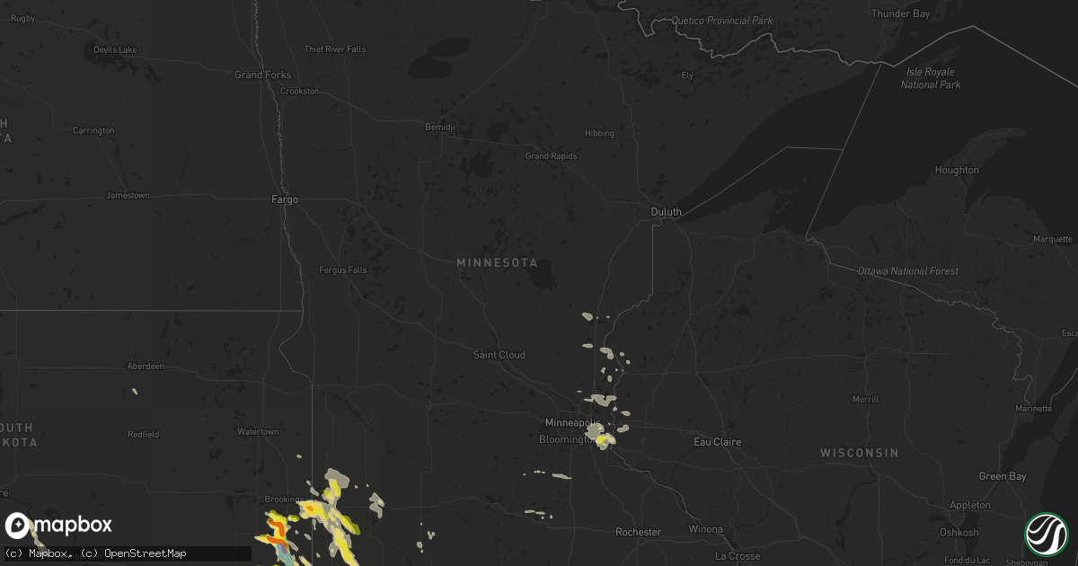
Hail Map in Minnesota on August 5, 2021
Get this storm
August 5 map
$229
one time, instant access
Download today. No call, no setup
Keep the $229
Bought the map and want the full workflow? Apply the entire $229 to a subscription within 7 days. None of it is wasted.
Every map, not just this one
This buys you this map. Subscription and you get every map we run, in the markets you choose from a few cities to whole states to nationwide. Plus real-time alerts the moment a storm fires.
Contact data
Name, contact info, occupancy, even credit band for addresses in the footprint. You go from where it hit to who to call.
Become the source they trust
Unlimited branding weather history reports on demand. You already have the documented answer ready for the property owner, and you are the one who showed up with it.
Property data and RoofTrace estimates
Pull up any address you have got, its value and the exact code rules for that jurisdiction, straight from One Click Code. Then RoofTrace estimates the squares, pitch, and roof value, priced the way you price.
Storm reports in Minnesota
Minnesota
| Date | Description |
|---|---|
| 08/05/20215:30 PM CDT | Report from mping: quarter |
| 08/05/20214:42 PM CDT | 8 inch diameter branch down. |
| 08/05/20213:24 AM CDT | At 824 PM CDT, a severe thunderstorm was located near Dell Rapids, or 18 miles north of Sioux Falls, moving south at 20 mph. HAZARD...Golf ball size hail and 70 mph wind gusts. SOURCE...Radar indicated. IMPACT...People and animals outdoors will be injured. Expect hail damage to roofs, siding, windows, and vehicles. Expect considerable tree damage. Wind damage is also likely to mobile homes, roofs, and outbuildings. This severe thunderstorm will be near... Baltic around 835 PM CDT.Other locations in the path of this severe thunderstorm includeCrooks, Sioux Falls and Brandon. |
| 08/05/20212:53 AM CDT | At 753 PM CDT, severe thunderstorms were located along a line extending from near Chandler to near Hardwick, moving southeast at 15 mph. HAZARD...70 mph wind gusts. SOURCE...Radar indicated. IMPACT...Expect considerable tree damage. Damage is likely to mobile homes, roofs, and outbuildings. Severe thunderstorms will be near... Leota around 800 PM CDT.Other locations in the path of these severe thunderstorms includeLuverne, Wilmont and Lismore. |
| 08/05/20212:44 AM CDT | At 743 PM CDT, a severe thunderstorm was located near Colman, or 14 miles east of Madison, moving southeast at 25 mph. HAZARD...Ping pong ball size hail. SOURCE...Trained weather spotters. IMPACT...People and animals outdoors will be injured. Expect damage to roofs, siding, windows, and vehicles. Locations impacted include... Flandreau, Egan and Trent. |
| 08/05/20212:12 AM CDT | At 712 PM CDT, severe thunderstorms were located along a line extending from near Current Lake to near Pipestone, moving southeast at 20 mph. HAZARD...60 mph wind gusts and quarter size hail. SOURCE...Radar indicated. IMPACT...Hail damage to vehicles is expected. Expect wind damage to roofs, siding, and trees.Other locations in the path of these severe thunderstorms includeLake Wilson, Edgerton and Chandler.PRECAUTIONARY/PREPAREDNESS ACTIONS...For your protection move to an interior room on the lowest floor of abuilding.Large hail and damaging winds and continuous cloud to groundlightning is occurring with these storms. Move indoors immediately.Lightning is one of nature's leading killers. Remember, if you canhear thunder, you are close enough to be struck by lightning. |
| 08/05/20211:51 AM CDT | At 651 PM CDT, a severe thunderstorm was located near Lake Benton, or 17 miles north of Pipestone, moving southeast at 25 mph. HAZARD...Half dollar size hail. SOURCE...Radar indicated. IMPACT...Damage to vehicles is expected.PRECAUTIONARY/PREPAREDNESS ACTIONS...For your protection move to an interior room on the lowest floor of abuilding.Large hail and damaging winds and continuous cloud to groundlightning is occurring with this storm. Move indoors immediately.Lightning is one of nature's leading killers. Remember, if you canhear thunder, you are close enough to be struck by lightning. |
| 08/05/20211:25 AM CDT | At 625 PM CDT, a severe thunderstorm was located over Ruthton, or 15 miles northeast of Pipestone, moving southeast at 15 mph. HAZARD...Quarter size hail. SOURCE...Radar indicated. IMPACT...Damage to vehicles is expected.Other locations in the path of this severe thunderstorm includeWoodstock.PRECAUTIONARY/PREPAREDNESS ACTIONS...For your protection move to an interior room on the lowest floor of abuilding.Large hail and damaging winds and continuous cloud to groundlightning is occurring with this storm. Move indoors immediately.Lightning is one of nature's leading killers. Remember, if you canhear thunder, you are close enough to be struck by lightning. |
| 08/05/202112:10 AM CDT | At 510 PM CDT, a severe thunderstorm was located near Arco, or 15 miles west of Marshall, moving southeast at 15 mph. HAZARD...60 mph wind gusts and half dollar size hail. SOURCE...Radar indicated. IMPACT...Hail damage to vehicles is expected. Expect wind damage to roofs, siding, and trees. This severe thunderstorm will be near... Tyler around 530 PM CDT.Other locations in the path of this severe thunderstorm includeCamden State Park and Russell. |
| 08/04/202111:38 PM CDT | A local report indicates 1.00 inch wind near 2 NE COTTAGE GROVE |
| 08/04/202111:32 PM CDT | At 431 PM CDT, severe thunderstorms were located along a line extending from near Ghent to near Ivanhoe, moving southeast at 25 mph. HAZARD...60 mph wind gusts and nickel size hail. SOURCE...Radar indicated. IMPACT...Expect damage to roofs, siding, and trees. Severe thunderstorms will be near... Marshall around 450 PM CDT.Other locations in the path of these severe thunderstorms includeRussell and Camden State Park. |
| 08/04/202110:45 PM CDT | Pontoon boat flipped and docks damaged on lake minnewashta. Several large trees down. Time estimated from radar. |
| 08/04/202110:30 PM CDT | At 330 PM CDT, a severe thunderstorm was located near Lake Cochrane Rec Area, or 8 miles southeast of Clear Lake, moving east at 15 mph. HAZARD...60 mph wind gusts and quarter size hail. SOURCE...Radar indicated. IMPACT...Hail damage to vehicles is expected. Expect wind damage to roofs, siding, and trees. This severe thunderstorm will be near... Lake Cochrane Rec Area around 335 PM CDT. |
| 08/04/20218:37 PM CDT | Strong thunderstorm winds approximately 2 miles south of lismore mn resulted in multiple fields of flattened corn. In addition... Wind damage was noted to surrounding b |
| 08/04/20218:00 PM CDT | Strong winds in and around leota... Mn. Resulted in a few large trees toppled and multiple large limbs were broken. |
| 08/04/20217:55 PM CDT | Via social media. Time estimated via radar. |
| 08/04/20217:12 PM CDT | Farmer reported flattened corn in a field about 1.5 miles south of holland. Time estimated from radar. |
All States Impacted by Hail Map on August 5, 2021
Cities Impacted by Hail Map on August 5, 2021
- Custer City, OK
- Taloga, OK
- Baltic, SD
- Wentworth, SD
- Crooks, SD
- Larchwood, IA
- Rock Rapids, IA
- Renner, SD
- Colton, SD
- Canton, SD
- Fairview, SD
- Ireton, IA
- Hartford, SD
- Garretson, SD
- Worthing, SD
- Chester, SD
- Flandreau, SD
- Brandon, SD
- Montrose, SD
- Rock Valley, IA
- Dell Rapids, SD
- Hills, MN
- Hudson, SD
- Trent, SD
- Sioux Falls, SD
- Madison, SD
- Valley Springs, SD
- Humboldt, SD
- Rutland, SD
- Hull, IA
- Volga, SD
- Sioux Center, IA
- Inwood, IA
- Alcester, SD
- Alvord, IA
- Nunda, SD
- Doon, IA
- Colman, SD
- Harrisburg, SD
- Egan, SD
- Hawarden, IA
- Sparks, NE
- Valentine, NE
- Hastings, MN
- Rueter, MO
- Kissee Mills, MO
- Ruthton, MN
- Holland, MN
- Sells, AZ
- Woodstock, MN
- Centerville, SD
- Lennox, SD
- Davis, SD
- Beresford, SD
- Cascade, ID
- Donnelly, ID
- Lake Benton, MN
- Aurora, SD
- Pipestone, MN
- Elkton, SD
- Lower Brule, SD
- Kennebec, SD
- Springview, NE
- Newport, NE
- Bassett, NE
- Chancellor, SD
- Council Grove, KS
- Madison Lake, MN
- Purdum, NE
- Amherst, NE
- Pleasanton, NE
- Miller, NE
- Mason City, NE
- Johnstown, NE
- Stuart, NE
- Garrison, MT
- Ainsworth, NE
- Mission, SD
- Haines, OR
- Cambridge, ID
- Midvale, ID
- Moran, WY
- Cottage Grove, MN
- Lindstrom, MN
- Center City, MN
- Edgerton, MN
- Kenneth, MN
- Adrian, MN
- Lismore, MN
- Wilmont, MN
- Chandler, MN
- Leota, MN
- Le Mars, IA
- Orange City, IA
- Alton, IA
- Remsen, IA
- Waseca, MN
- Maurice, IA
- Kingsley, IA
- Marcus, IA
- Pilot Rock, OR
- Afton, MN
- River Falls, WI
- Arco, MN
- Tyler, MN
- Ivanhoe, MN
- Reliance, SD
- Elgin, OR
- Elysian, MN
- Janesville, MN
- Waterville, MN
- Clinton, OK
- Butler, OK
- Pine City, MN
- Elk Point, SD
- Union, OR
- Minneota, MN
- Hardwick, MN
- Lynd, MN
- Rushmore, MN
- Porter, MN
- Lake Wilson, MN
- Allen, KS
- Edinburg, TX
- Henderson, MN
- New Prague, MN
- Isabella, OK
- Okeene, OK
- Luverne, MN
- Jasper, MN
- Beaver Creek, MN
- Nogales, AZ
- Grasston, MN
- Brook Park, MN
- Prairie City, OR
- La Grande, OR
- Moore, ID
- Howe, ID
- Canistota, SD
- Parker, SD
- Saint Paul, MN
- Wallowa, OR
- Hudson, WI
- Roberts, WI
- Sumpter, OR
- Baker City, OR
- Jeffers, MN
- Tracy, MN
- Wakonda, SD
- Irene, SD
- Vermillion, SD
- Volin, SD
- Jackson, NE
- Tea, SD
- Viborg, SD
- Saint Paul Park, MN
- Chisago City, MN
- Brandt, SD
- Chamberlain, SD
- Platte, SD
- Mountain Lake, MN
- Somerset, WI
- Houlton, WI
- Hendricks, MN
- White, SD
- Admire, KS
- Garvin, MN
- Rio Grande City, TX
- New Richmond, WI
- Lostine, OR
- Andover, MN
- Centuria, WI
- Stillwater, MN
- Northfield, MN
- Webster, MN
- Lonsdale, MN
- Marshall, MN
- Belle Plaine, MN
- Windom, MN
- Sheldon, IA
- Taneyville, MO
- Shafer, MN
- Taylors Falls, MN
- New Meadows, ID
- Inver Grove Heights, MN
- Lake Elmo, MN
- Newport, MN
- Prescott, WI
- South Saint Paul, MN
- Stanchfield, MN
- Rush City, MN
- Harris, MN
- Mansfield, SD
- Ponca, NE
- Saint Croix Falls, WI
- Cushing, WI
- Hugo, MN
- Osceola, WI
- Marine On Saint Croix, MN
- Forest Lake, MN
- Circle Pines, MN
- Foss, OK
- Bingham Lake, MN
- Currie, MN
- Grantsburg, WI
- North Branch, MN
- Mills, NE
- Arapaho, OK
- Atkinson, NE
- Brookings, SD
- Balaton, MN
- Lyons, SD


