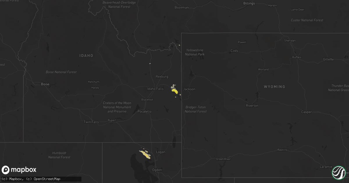
Hail Map on August 2, 2022
Get this storm
August 2 map
$229
one time, instant access
Download today. No call, no setup
Keep the $229
Bought the map and want the full workflow? Apply the entire $229 to a subscription within 7 days. None of it is wasted.
Every map, not just this one
This buys you this map. Subscription and you get every map we run, in the markets you choose from a few cities to whole states to nationwide. Plus real-time alerts the moment a storm fires.
Contact data
Name, contact info, occupancy, even credit band for addresses in the footprint. You go from where it hit to who to call.
Become the source they trust
Unlimited branding weather history reports on demand. You already have the documented answer ready for the property owner, and you are the one who showed up with it.
Property data and RoofTrace estimates
Pull up any address you have got, its value and the exact code rules for that jurisdiction, straight from One Click Code. Then RoofTrace estimates the squares, pitch, and roof value, priced the way you price.
States Impacted by Hail Map on August 2, 2022
Storm reports
North Carolina
| Date | Description |
|---|---|
| 08/02/20225:52 PM CDT | Trees down on roadway. |
| 08/02/20225:05 PM CDT | Tree down across interstate 85 southbound near exit 5. |
| 08/02/20223:25 PM CDT | Tree down on house. |
| 08/02/20223:25 PM CDT | Trees down on roadway. |
Wyoming
| Date | Description |
|---|---|
| 08/02/20224:30 PM CDT | Upr mesonet station lndbrg |
| 08/02/20224:16 PM CDT | Wydot mesonet station gun barrell |
| 08/01/202210:22 PM CDT | At 321 PM MDT, a severe thunderstorm was located near Meriden Rest Area, or 34 miles northwest of Kimball, moving east at 30 mph. HAZARD...60 mph wind gusts and penny size hail. SOURCE...Radar indicated. IMPACT...Expect damage to roofs, siding, and trees. Locations impacted include... La Grange, Albin and Meriden Rest Area. |
Minnesota
| Date | Description |
|---|---|
| 08/02/20224:00 PM CDT | Report from mping: ping pong ball |
| 08/02/20223:59 PM CDT | Report from mping: ping pong ball |
| 08/02/20223:30 PM CDT | Report via social media with picture. |
| 08/02/20223:30 PM CDT | Report via social media. Time estimated from radar. |
| 08/02/20223:22 PM CDT | Report via social media. |
| 08/02/20223:16 PM CDT | Report via social media with picture. |
| 08/02/20223:15 PM CDT | A local report indicates 1.00 inch wind near 4 SSE MCKINLEY |
| 08/02/20223:06 PM CDT | Report from mping: golf ball |
| 08/02/20223:00 PM CDT | A local report indicates 1.75 inch wind near MAKINEN |
| 08/02/20223:00 PM CDT | Report via social media with picture. |
| 08/02/20227:09 AM CDT | At 1208 PM CDT, a severe thunderstorm was located 7 miles south of Days High Landing, or 12 miles southwest of Grand Rapids, moving east at 25 mph. HAZARD...Half dollar size hail. SOURCE...Radar indicated. IMPACT...Damage to vehicles is expected. This severe thunderstorm will be near... Pokegama Lake around 1225 PM CDT. Cohasset and Pokegama Dam around 1230 PM CDT. Gunn around 1240 PM CDT. Warba around 105 PM CDT. Swan River around 110 PM CDT.Other locations impacted by this severe thunderstorm includeBlackberry, Hart Lake, Calumet, Swan Lake, Bovey, Wawina, Goodland,Marble, Split Hand Lake and Schoolcraft State Park. |
| 08/02/20226:52 AM CDT | At 1152 PM CDT, a severe thunderstorm was located over Victoria, or 19 miles southwest of Minneapolis, moving east at 60 mph. HAZARD...60 mph wind gusts. SOURCE...Radar indicated. IMPACT...Expect damage to roofs, siding, and trees. This severe thunderstorm will be near... Chanhassen and Excelsior around 1155 PM CDT. Eden Prairie, Shakopee and Prior Lake around 1200 AM CDT. Burnsville, Minnetonka, St. Louis Park, Savage and Hopkins around 1205 AM CDT. Edina, Richfield and MSP International Airport around 1210 AM CDT.Other locations in the path of this severe thunderstorm includeBloomington, St. Paul, Eagan, Inver Grove Heights, South St. Paul andWest St. Paul. |
| 08/02/20226:41 AM CDT | At 1141 PM CDT, a severe thunderstorm was located over Ellis, or near Sioux Falls, moving east at 40 mph. HAZARD...60 mph wind gusts and quarter size hail. SOURCE...Radar indicated. IMPACT...Hail damage to vehicles is expected. Expect wind damage to roofs, siding, and trees. This severe thunderstorm will be near... Sioux Falls around 1145 PM CDT. Harrisburg, Crooks and Renner around 1150 PM CDT. Baltic around 1155 PM CDT. Brandon, Corson and Rowena around 1200 AM CDT.Other locations in the path of this severe thunderstorm includePalisades State Park, Garretson and Valley Springs. |
| 08/02/20226:32 AM CDT | At 1131 AM CDT, a severe thunderstorm was located over Boy River, or 22 miles east of Walker, moving northeast at 20 mph. HAZARD...Half dollar size hail. SOURCE...Radar indicated. IMPACT...Damage to vehicles is expected. Locations impacted include... Deer River, Zemple and Days High Landing. |
| 08/02/20226:27 AM CDT | At 1125 PM CDT, a severe thunderstorm was located near Glencoe, or 11 miles southeast of Hutchinson, moving east at 75 mph. THIS IS A DESTRUCTIVE STORM FOR EASTERN MCLEOD AND CARVER COUNTIES. HAZARD...80 mph wind gusts. SOURCE...Radar indicated. Wind gusts as high as 80 mph have occurred with this storm. IMPACT...Flying debris will be dangerous to those caught without shelter. Mobile homes will be heavily damaged. Expect considerable damage to roofs, windows, and vehicles. Extensive tree damage and power outages are likely. This severe thunderstorm will be near... Lester Prairie around 1130 PM CDT. Norwood Young America around 1135 PM CDT. Waconia, Watertown, Mayer and Cologne around 1140 PM CDT. Carver and St. Bonifacius around 1145 PM CDT. Chaska, Chanhassen, Mound, Orono and Victoria around 1150 PM CDT.Other locations impacted by this severe thunderstorm include Loretto,Hollywood, Greenwood, Shorewood, Lake Waconia, Long Lake, Plato, NewGermany, Hamburg and Glencoe Airport. |
| 08/02/20225:53 AM CDT | At 1053 PM CDT, severe thunderstorms were located along a line extending from 5 miles southeast of Prinsburg to near Bird Island to Morton, moving east at 70 mph. HAZARD...70 mph wind gusts. SOURCE...Radar indicated. IMPACT...Expect considerable tree damage. Damage is likely to mobile homes, roofs, and outbuildings. Severe thunderstorms will be near... Fairfax and Hector around 1105 PM CDT. Buffalo Lake and Cosmos around 1110 PM CDT.Other locations in the path of these severe thunderstorms includeGibbon, Stewart, Winthrop, Brownton, Hutchinson, Glencoe, Gaylord andSilver Lake. |
| 08/02/20225:13 AM CDT | At 1012 PM CDT, severe thunderstorms were located along a line extending from near Boyd to 6 miles northeast of Ghent to 7 miles northwest of Tracy, moving east at 60 mph. HAZARD...70 mph wind gusts. A 74 mph gust was reported at Marshall Airport. SOURCE...Radar indicated. IMPACT...Expect considerable tree damage. Damage is likely to mobile homes, roofs, and outbuildings. Severe thunderstorms will be near... Clarkfield around 1020 PM CDT. Montevideo, Wood Lake and Hanley Falls around 1025 PM CDT. Granite Falls and Echo around 1030 PM CDT. Wabasso, Sacred Heart and Maynard around 1035 PM CDT. Clara City around 1040 PM CDT. Redwood Falls and Renville around 1045 PM CDT. |
| 08/02/20224:24 AM CDT | At 923 PM CDT, a severe thunderstorm was located over Brandt, or 8 miles south of Clear Lake, moving east at 50 mph. HAZARD...60 mph wind gusts. SOURCE...Radar indicated. IMPACT...Expect damage to roofs, siding, and trees. Locations impacted include... Canby and Porter. |
| 08/02/20224:18 AM CDT | At 917 PM CDT, a severe thunderstorm was located over Stone Bridge, or 8 miles west of Estelline, moving east at 45 mph. HAZARD...60 mph wind gusts. SOURCE...Radar indicated. IMPACT...Expect damage to roofs, siding, and trees. This severe thunderstorm will be near... Dempster around 925 PM CDT. Estelline and Poinsett Colony around 930 PM CDT.Other locations in the path of this severe thunderstorm include ClearLake, Toronto, Astoria, Brandt, Gary and Lake Cochrane Rec Area. |
| 08/02/20224:13 AM CDT | At 911 PM CDT, severe thunderstorms were located along a line extending from near Bruce to near Aurora to near Trent, moving east at 50 mph. HAZARD...60 mph wind gusts. Strong gusts are also occurring with the outflow ahead of the rainfall and lightning. SOURCE...Radar indicated. IMPACT...Expect damage to roofs, siding, and trees. Severe thunderstorms will be near... Flandreau, Aurora, Egan and Trent around 915 PM CDT. Elkton, White and Ward around 925 PM CDT. Jasper around 930 PM CDT. Pipestone, Lake Benton and Pipestone National Monument around 935 PM CDT. Hendricks, Holland and Trosky around 940 PM CDT. Edgerton, Tyler and Ruthton around 945 PM CDT. Ivanhoe, Woodstock and Florence around 950 PM CDT. Leota, Russell, Arco, Current Lake and Camden State Park around 955 PM CDT.Other locations impacted by these severe thunderstorms include Ihlen,Flandreau Santee Sioux Tribal Nation, Bushnell, Hatfield, Lynd andHadley. |
| 08/02/20223:45 AM CDT | At 844 PM CDT, a severe thunderstorm was located near Webb Lake Wisconsin, or 12 miles northwest of Spooner, moving southeast at 30 mph. HAZARD...60 mph wind gusts and half dollar size hail. SOURCE...Radar indicated. IMPACT...Hail damage to vehicles is expected. Expect wind damage to roofs, siding, and trees. Locations impacted include... Trego, Spooner, Shell Lake and Birchwood. |
| 08/02/20223:05 AM CDT | At 804 PM CDT, a severe thunderstorm was located over Mille Lacs Band Lena Lake Area, or 21 miles east of Hinckley, moving southeast at 40 mph. HAZARD...60 mph wind gusts and quarter size hail. SOURCE...Radar indicated. IMPACT...Hail damage to vehicles is expected. Expect wind damage to roofs, siding, and trees. This severe thunderstorm will be near... Danbury around 815 PM CDT. Webster around 820 PM CDT.Other locations in the path of this severe thunderstorm include WebbLake Wisconsin and Spooner. |
| 08/02/202212:45 AM CDT | Mndot wind sensor near red wing. |
| 08/02/202212:33 AM CDT | Trees and tree branches down. Time estimated. |
| 08/02/202212:31 AM CDT | Some tree damage in the daytons bluff area. Time estimated. |
| 08/02/202212:30 AM CDT | Trees down in a mobile home park. Time estimated. |
| 08/02/202212:23 AM CDT | Asos station kmsp minneapolis-st. Paul ap. |
| 08/02/202212:20 AM CDT | Tree branches down on hennepin ave in uptown minneapolis. Time estimated. |
| 08/02/202212:20 AM CDT | A local report indicates 67 MPH wind near 1 SSW BLOOMINGTON |
| 08/02/202212:15 AM CDT | 10-12 inch diameter trees snapped. Time estimated. |
| 08/02/202212:10 AM CDT | 8 inch branch down. Time estimated by radar. |
| 08/02/202212:08 AM CDT | Several 3 to 5 inch in diameter branches down along rowland rd and the regional trail. Time estimated from radar. |
| 08/01/202211:57 PM CDT | Large tree branches down. |
| 08/01/202211:53 PM CDT | Full size trees down reported on social media in norwood young america. |
| 08/01/202211:45 PM CDT | Numerous large trees down around olivia... Billboard knocked over. Time estimated. |
| 08/01/202211:30 PM CDT | 20in or more diameter/large trees down in hutchinson on houses... In yards... And in the streets. |
| 08/01/202211:25 PM CDT | Trained spotter reported several tree branches larger than 6 inches diameter down. |
| 08/01/202211:20 PM CDT | Photos on social media of medium to large limbs down on roadway. Time estimated by radar. |
| 08/01/202211:19 PM CDT | Khcd - hutchinson airport. |
| 08/01/202211:12 PM CDT | Private weather station. |
| 08/01/202211:10 PM CDT | Hector airport. |
| 08/01/202211:02 PM CDT | Mndot wind sensor west of hector. |
| 08/01/202211:00 PM CDT | At 400 PM CDT, a severe thunderstorm was located over Whyte, or 33 miles south of Ely, moving east at 30 mph. HAZARD...60 mph wind gusts and half dollar size hail. SOURCE...Radar indicated. IMPACT...Hail damage to vehicles is expected. Expect wind damage to roofs, siding, and trees. Locations impacted include... Isabella, Finland, Dumbbell Lake and Clear Lake. |
| 08/01/202210:55 PM CDT | At 355 PM CDT, a severe thunderstorm was located 7 miles northwest of Mountain Iron, or 17 miles northeast of Hibbing, moving east at 45 mph. HAZARD...60 mph wind gusts and quarter size hail. SOURCE...Radar indicated. IMPACT...Hail damage to vehicles is expected. Expect wind damage to roofs, siding, and trees. This severe thunderstorm will be near... Virginia and Mountain Iron around 405 PM CDT. Gilbert around 415 PM CDT.Other locations in the path of this severe thunderstorm includeBiwabik, Aurora, Embarrass and Hoyt Lakes. |
| 08/01/202210:53 PM CDT | Kovl airport. |
| 08/01/202210:53 PM CDT | Asos station krwf redwood falls ap. |
| 08/01/202210:51 PM CDT | Krwf airport. |
| 08/01/202210:37 PM CDT | 60 to 62 mph wind gusts for the last 10 mins at the mndot site near lucan. |
| 08/01/202210:35 PM CDT | Awos station kgdb granite falls ap. |
| 08/01/202210:23 PM CDT | A local report indicates 59 MPH wind near 3 N MILROY |
| 08/01/202210:19 PM CDT | At 319 PM CDT, a severe thunderstorm was located 9 miles south of Togo, or 22 miles northwest of Hibbing, moving east at 45 mph. HAZARD...60 mph wind gusts and half dollar size hail. SOURCE...Radar indicated. IMPACT...Hail damage to vehicles is expected. Expect wind damage to roofs, siding, and trees. Locations impacted include... Mountain Iron. |
| 08/01/202210:14 PM CDT | At 312 PM CDT, severe thunderstorms were located along a line extending from near Aurora, to 7 miles southeast of Hoyt Lakes, to near Wolf Lake, moving northeast at 25 mph. HAZARD...Golf ball size hail and 60 mph wind gusts. SOURCE...Trained weather spotter reported golf ball sized hail near Markham Lake. IMPACT...People and animals outdoors will be injured. Expect hail damage to roofs, siding, windows, and vehicles. Expect wind damage to roofs, siding, and trees. Severe thunderstorms will be near... Fairbanks, Wolf Lake and Brimson around 320 PM CDT.Other locations in the path of these severe thunderstorms includeHoyt Lakes, Babbitt and Whyte. |
| 08/01/202210:10 PM CDT | Badly damaged storage shed at the marshall mn school district cte center. Report via twitter. |
| 08/01/202210:08 PM CDT | Awos station kmml marshall municipal airport. |
| 08/01/202210:06 PM CDT | Medium to large branches reported down in minneota via facebook post. Time estimated via radar. |
| 08/01/202210:05 PM CDT | A local report indicates 65 MPH wind near MINNEOTA |
| 08/01/20229:42 PM CDT | At 241 PM CDT, a severe thunderstorm was located 7 miles southwest of Oaks Corner, or 45 miles southeast of Roseau, moving east at 30 mph. HAZARD...Half dollar size hail. SOURCE...Radar indicated. IMPACT...Damage to vehicles is expected. This severe thunderstorm will be near... Oaks Corner around 250 PM CDT. |
| 08/01/20229:37 PM CDT | At 237 PM CDT, a severe thunderstorm was located 8 miles northeast of Cotton, or 27 miles east of Hibbing, moving east at 25 mph. HAZARD...60 mph wind gusts and quarter size hail. SOURCE...Radar indicated. IMPACT...Hail damage to vehicles is expected. Expect wind damage to roofs, siding, and trees. Locations impacted include... Whiteface Reservoir. |
| 08/01/20229:24 PM CDT | At 224 PM CDT, a severe thunderstorm was located near Effie, moving east at 30 mph. HAZARD...Quarter size hail. SOURCE...Radar indicated. IMPACT...Damage to vehicles is expected. Locations impacted include... Togo. |
| 08/01/20229:04 PM CDT | At 204 PM CDT, a severe thunderstorm was located near Gates Corner, or 33 miles southeast of Roseau, moving east at 30 mph. HAZARD...Ping pong ball size hail. SOURCE...Radar indicated. IMPACT...People and animals outdoors will be injured. Expect damage to roofs, siding, windows, and vehicles. This severe thunderstorm will be near... Gates Corner and Malcolm around 210 PM CDT.Other locations in the path of this severe thunderstorm include OaksCorner. |
Michigan
| Date | Description |
|---|---|
| 08/02/20226:00 AM CDT | Local tv meteorologist shared video of large branch falling off of tree from wind on marquette eastside. From twitter. |
| 08/02/20225:59 AM CDT | Lost power due to winds at the time. |
| 08/02/20225:59 AM CDT | Power line down at the corner of college and lincoln aves. In the dance zone parking lot. Lots of branches down in the neighborhood. |
| 08/02/20225:55 AM CDT | Large diameter maple tree snapped near the trunk. Tree damaged a cedar privacy fence at location. |
| 08/02/20225:54 AM CDT | Asos station kimt kingsford. |
| 08/02/20225:07 AM CDT | Corrects time in previous tstm wnd gst report from asos station kimt kingsford station elevation: 1128 ft. |
| 08/02/20224:45 AM CDT | Lost power due to big trees falling down. Has not had power restored yet as of 1122 am edt. From facebook. |
| 08/02/20224:31 AM CDT | At 931 PM EDT/831 PM CDT/, a severe thunderstorm was located near U.S. 141 between Covington and Amasa, or 20 miles north of Crystal Falls, moving east at 45 mph. HAZARD...60 mph wind gusts and quarter size hail. SOURCE...Radar indicated. IMPACT...Hail damage to vehicles is expected. Expect wind damage to roofs, siding, and trees. This severe thunderstorm will remain over mainly rural areas of northeastern Iron and south central Baraga Counties, including the following locations... Ned Lake and Bone Lake. |
| 08/02/20224:26 AM CDT | At 925 PM EDT, a severe thunderstorm was located over Lake Michigamme, or 16 miles west of Ishpeming, moving east at 35 mph. HAZARD...60 mph wind gusts and quarter size hail. SOURCE...Radar indicated. IMPACT...Hail damage to vehicles is expected. Expect wind damage to roofs, siding, and trees. This severe thunderstorm will be near... West Ishpeming around 945 PM EDT. Ishpeming around 950 PM EDT. Negaunee around 955 PM EDT. Marquette and Trowbridge Park around 1010 PM EDT.Other locations impacted by this severe thunderstorm include Palmer,Diorite, Van Riper State Park, Humboldt, National Mine, Big Bass Lakeand Republic. |
| 08/02/20224:01 AM CDT | At 901 PM EDT, a severe thunderstorm was located near Sidnaw, or 20 miles southwest of Baraga, moving east at 35 mph. HAZARD...60 mph wind gusts and quarter size hail. SOURCE...Radar indicated. IMPACT...Hail damage to vehicles is expected. Expect wind damage to roofs, siding, and trees. This severe thunderstorm will be near... Sidnaw around 905 PM EDT. U.S. 141 between Covington and Amasa around 820 PM CDT. Covington around 920 PM EDT. Alberta around 925 PM EDT. Three Lakes around 945 PM EDT.Other locations impacted by this severe thunderstorm include CanyonFalls, Craig Lake State Park, Watton, Echo Lake, Ned Lake and KingLake. |
| 08/02/20223:45 AM CDT | At 844 PM EDT, a severe thunderstorm was located near Covington, or 18 miles south of L'anse, moving east at 35 mph. HAZARD...60 mph wind gusts and quarter size hail. SOURCE...Radar indicated. IMPACT...Hail damage to vehicles is expected. Expect wind damage to roofs, siding, and trees. Locations impacted include... Three Lakes, Michigamme and Lake Michigamme. |
| 08/02/20222:06 AM CDT | At 705 PM EDT/605 PM CDT/, a severe thunderstorm was located near Porcupine Mountains State Park, moving east at 40 mph. HAZARD...60 mph wind gusts and quarter size hail. SOURCE...Radar indicated. IMPACT...Hail damage to vehicles is expected. Expect wind damage to roofs, siding, and trees. This severe thunderstorm will be near... Porcupine Mountains State Park around 710 PM EDT. Silver City around 725 PM EDT.Other locations in the path of this severe thunderstorm includeRockland. |
| 08/01/202210:20 PM CDT | Multiple power outages reported in southern delta county. Main area of outage is from the gladstone area eastward along u.s.41 and u.s.2 to nahma junction. Multiple lig |
| 08/01/20229:10 PM CDT | Multiple power outages are reported in forsyth and richmond townships in marquette county. Event time based on radar. |
| 08/01/20229:06 PM CDT | Marquette county law enforcement dispatch reports large trees and downed wires suspended on other wires around the princeton area west of gwinn along m-35 in forsyth to |
| 08/01/20229:06 PM CDT | Law enforcement dispatch reports a power line down across m-35 between chipmunk field and the cataract basin drive west of princeton. Time based on radar. |
| 08/01/20229:05 PM CDT | Law enforcement reports downed power lines on shag lake drive in forsyth township. Time is estimated from mqt radar. |
| 08/01/20229:00 PM CDT | Report from mping: trees uprooted or snapped. Event time based off mqt radar. |
| 08/01/20229:00 PM CDT | Report from mping: trees uprooted or snapped. Event time based off mqt radar. |
| 08/01/20228:55 PM CDT | Tree down and damaged the power mast of the roof on the northside of west bass lake. Report relayed from wjmntv3 meteorologist. |
| 08/01/20228:11 PM CDT | Michigan dot reports eastbound and westbound lanes of m-28 are closed in kenton due to a downed tree on the highway. Relayed report via social media. |
South Dakota
| Date | Description |
|---|---|
| 08/02/20226:59 PM CDT | A local report indicates 63 MPH wind near 11 SW PARMELEE |
| 08/02/20226:57 PM CDT | Time estimated using radar. Reported 67 mph on neighbors personal weather station about 7 pm. Several large cottonwood trees down around town... And a few other reports |
| 08/02/20226:45 PM CDT | Mesonet station ocms2 oacoma 2w |
| 08/02/20226:42 PM CDT | Reported heavy rain... Branches down approximately 3 inches. Screen door ripped off porch. Large dead tree toppled across road... Approximately 20 inches in diameter. |
| 08/02/20226:32 PM CDT | Mesonet station 54 reliance |
| 08/02/20226:10 PM CDT | A local report indicates 64 MPH wind near 4 SSE WITTEN |
| 08/02/20225:57 PM CDT | A local report indicates 72 MPH wind near 1 NE WINNER |
| 08/02/20226:08 AM CDT | At 1108 PM CDT, a severe thunderstorm was located over Dolton, or 11 miles southwest of Lake Vermillion State Recreation Area, moving east at 60 mph. HAZARD...60 mph wind gusts and quarter size hail. SOURCE...Radar indicated. IMPACT...Hail damage to vehicles is expected. Expect wind damage to roofs, siding, and trees. This severe thunderstorm will be near... Monroe around 1115 PM CDT. Parker and Lake Vermillion State Recreation Area around 1120 PM CDT. Humboldt around 1125 PM CDT. Hartford and Wall Lake around 1130 PM CDT. Tea around 1135 PM CDT. |
| 08/02/20224:56 AM CDT | At 955 PM CDT, severe thunderstorms were located along a line extending from near Taunton to near Russell to near Leota, moving east at 60 mph. HAZARD...60 mph wind gusts. Strong gusts are also occurring with the outflow ahead of the rainfall and lightning. SOURCE...Radar indicated. IMPACT...Expect damage to roofs, siding, and trees. Severe thunderstorms will be near... Marshall and Balaton around 1000 PM CDT. Ghent around 1005 PM CDT. Slayton and Tracy around 1010 PM CDT. Fulda, Cottonwood, Currie and Lake Shetek State Park around 1015 PM CDT. Dovray around 1020 PM CDT. Westbrook around 1030 PM CDT. Storden around 1035 PM CDT. Windom and Jeffers around 1040 PM CDT.Other locations impacted by these severe thunderstorms include Ihlen,Avoca, Delft, Lynd, Hadley, Garvin, Iona and Hatfield. |
| 08/02/20223:40 AM CDT | At 840 PM CDT, severe thunderstorms were located along a line extending from near Bryant to Ramona to near Lake Herman State Park, moving east at 60 mph. HAZARD...60 mph wind gusts. The strongest winds are likely occurring ahead of the rain and lightning! SOURCE...Radar indicated. IMPACT...Expect damage to roofs, siding, and trees. Severe thunderstorms will be near... Madison, Lake Herman State Park, Ramona and Orland around 845 PM CDT. Wentworth, Sinai and Nunda around 850 PM CDT. Volga, Arlington, Badger, Chester and Hetland around 855 PM CDT. Brookings, Colman and Lake Poinsett around 900 PM CDT. Aurora, Egan, Trent and Oakwood State Park around 905 PM CDT. Flandreau and Bruce around 910 PM CDT. Elkton, White and Ward around 915 PM CDT.Other locations impacted by these severe thunderstorms includeBancroft, Flandreau Santee Sioux Tribal Nation, Erwin and Bushnell. |
| 08/02/20223:34 AM CDT | At 834 PM CDT, severe thunderstorms were located along a line extending from 9 miles north of Fulton to near Alexandria to 8 miles north of Delmont, moving east at 60 mph. HAZARD...60 mph wind gusts. The strongest winds may be occurring ahead of the rainfall. SOURCE...Radar indicated. IMPACT...Expect damage to roofs, siding, and trees. Severe thunderstorms will be near... Alexandria, Fulton and Farmer around 840 PM CDT. Emery and Spencer In McCook County around 845 PM CDT. Bridgewater, Milltown and Canova around 850 PM CDT. Salem around 855 PM CDT. Lake Vermillion State Recreation Area, Lake Herman State Park, Freeman, Canistota, Montrose, Orland, Clayton and Dolton around 900 PM CDT. |
| 08/02/20222:59 AM CDT | At 759 PM CDT, severe thunderstorms were located along a line extending from 6 miles northwest of Aurora Center to near New Holland to 6 miles northeast of Geddes, moving northeast at 45 mph. HAZARD...60 mph wind gusts. SOURCE...Radar indicated. IMPACT...Expect damage to roofs, siding, and trees. Severe thunderstorms will be near... Plankinton, Armour, Corsica and Stickney around 815 PM CDT. Mount Vernon around 825 PM CDT. Mitchell, Parkston and Loomis around 840 PM CDT. Ethan and Dimock around 845 PM CDT. |
| 08/02/20222:56 AM CDT | At 754 PM CDT, severe thunderstorms were located along a line extending from near Loomis to 10 miles north of Forestburg to near Wolsey, moving northeast at 65 mph. HAZARD...60 mph wind gusts. The strongest winds may be occurring ahead of the rainfall. SOURCE...Radar indicated. IMPACT...Expect damage to roofs, siding, and trees. Severe thunderstorms will be near... Cavour around 805 PM CDT. Huron, Carthage and Yale around 810 PM CDT. Iroquois and Artesian around 815 PM CDT. Fedora and Roswell around 820 PM CDT. Lake Thompson State Recreation Area, De Smet and Vilas around 825 PM CDT. Howard and Lake Preston around 830 PM CDT.Other locations impacted by these severe thunderstorms includeBancroft, Broadland and Erwin. |
| 08/02/20222:23 AM CDT | At 723 PM CDT, severe thunderstorms were located along a line extending from 10 miles northeast of Gann Valley to 13 miles southwest of Wessington Springs to 6 miles south of White Lake, moving northeast at 40 mph. HAZARD...60 mph wind gusts. The strongest winds may be occurring ahead of the rainfall. SOURCE...Radar indicated. IMPACT...Expect damage to roofs, siding, and trees. Severe thunderstorms will be near... Wessington Springs around 740 PM CDT. Plankinton around 745 PM CDT. Lane around 750 PM CDT. Alpena around 755 PM CDT. Woonsocket, Mount Vernon, Virgil and Storla around 800 PM CDT. |
| 08/02/20222:00 AM CDT | At 700 PM CDT, a severe thunderstorm was located over Gann Valley, or 19 miles north of Kimball, moving east at 55 mph. HAZARD...60 mph wind gusts. SOURCE...Radar indicated. IMPACT...Expect damage to roofs, siding, and trees. This severe thunderstorm will remain over mainly rural areas of eastern Buffalo County. |
| 08/02/20221:56 AM CDT | At 655 PM CDT, a severe thunderstorm was located 9 miles east of Chamberlain, moving northeast at 35 mph. HAZARD...60 mph wind gusts. SOURCE...Radar indicated. IMPACT...Expect damage to roofs, siding, and trees. This severe thunderstorm will be near... Grass Ranch Colony around 705 PM CDT. Kimball around 710 PM CDT. White Lake around 725 PM CDT.Other locations impacted by this severe thunderstorm include Pukwana. |
| 08/02/20221:19 AM CDT | At 619 PM CDT, a severe thunderstorm was located 7 miles north of Hamill, or 18 miles west of Chamberlain, moving northeast at 35 mph. HAZARD...60 mph wind gusts. SOURCE...Radar indicated. IMPACT...Expect damage to roofs, siding, and trees. This severe thunderstorm will be near... Lake Francis Case around 635 PM CDT. Chamberlain around 650 PM CDT.Other locations impacted by this severe thunderstorm include Dixon InGregory County and Pukwana. |
| 08/02/20221:17 AM CDT | At 617 PM CDT, severe thunderstorms were located along a line extending from near Medicine Butte to 9 miles southwest of Iona, moving northeast at 35 mph. HAZARD...60 mph wind gusts. SOURCE...Radar indicated. IMPACT...Expect damage to roofs, siding, and trees. Severe thunderstorms will be near... Medicine Butte around 625 PM CDT. Iona around 630 PM CDT. Counselor Creek Boat Access Area around 635 PM CDT.Other locations in the path of these severe thunderstorms includeLake Sharpe, Tailrace Rec Area, Fort Thompson and Lees Corner. |
| 08/01/20229:54 PM CDT | Reported 66 mph gust at 854 pm. |
| 08/01/20229:29 PM CDT | Mesonet station 47 brandt |
| 08/01/20229:15 PM CDT | Mesonet station fw0832 estelline. |
| 08/01/20229:13 PM CDT | A local report indicates 60 MPH wind near 2 SSE STONE BRIDGE |
| 08/01/20229:03 PM CDT | Winds estimated to 60 mph took down numerous tree branches up to 1 to 2 inches in diameter. |
| 08/01/20228:50 PM CDT | A local report indicates 66 MPH wind near 5 N OLDHAM |
| 08/01/20228:20 PM CDT | A local report indicates 70 MPH wind near 1 W HOWARD |
| 08/01/20228:09 PM CDT | Corsica rwis reported 64 mph gust at 8:04 and 8:09. |
| 08/01/20228:05 PM CDT | 6 inch diameter branch down. |
| 08/01/20228:04 PM CDT | Rwis at forrestburg reported 76 mph gusts at 804 and 809 pm. |
| 08/01/20228:00 PM CDT | Reported rain and strong winds. Winds ripped ceiling panels off pourch. |
| 08/01/20228:00 PM CDT | Reported downed power lines and multiple branches... One 2 ft diameter |
| 08/01/20227:10 PM CDT | Time estimated by radar. Reported large dead trees downed... And larger branches... 3-4 inches. |
Tennessee
| Date | Description |
|---|---|
| 08/01/20228:43 PM CDT | At 143 AM CDT, severe thunderstorms were located along a line extending from near Hopkinsville to 6 miles west of Pembroke to near Fort Campbell, moving southeast at 105 mph. HAZARD...60 mph wind gusts and quarter size hail. SOURCE...Radar indicated. IMPACT...Hail damage to vehicles is expected. Expect wind damage to roofs, siding, and trees. These severe thunderstorms will remain over mainly rural areas of Christian and eastern Trigg Counties, including the following locations... Lafayette, Hawkins and Herndon.This includes the following highways... Interstate 24 in Kentucky between Mile Markers 64 and 92. Pennyrile Parkway between Mile Markers 1 and 28. |
California
| Date | Description |
|---|---|
| 08/02/20222:38 AM CDT | At 738 PM PDT, a severe thunderstorm was located over Tree Of Heaven Campground, or near Yreka, moving northeast at 10 mph. HAZARD...Quarter size hail. SOURCE...Radar indicated. IMPACT...Damage to vehicles is expected. Locations impacted include... Yreka, Montague and Tree Of Heaven Campground. |
| 08/02/20222:21 AM CDT | At 720 PM PDT, a severe thunderstorm was located near Tree Of Heaven Campground, or near Yreka, moving northeast at 10 mph. HAZARD...Quarter size hail. SOURCE...Radar indicated. IMPACT...Damage to vehicles is expected. Locations impacted include... Yreka, Montague and Tree Of Heaven Campground. |
| 08/02/202212:42 AM CDT | At 541 PM PDT, a severe thunderstorm was located near Grenada, or 9 miles south of Yreka, moving northeast at 10 mph. HAZARD...Quarter size hail. SOURCE...Radar indicated. IMPACT...Damage to vehicles is expected. Torrential rainfall is also occurring with this storm and may lead to localized flooding. Do not drive your vehicle through flooded roadways. Locations impacted include... Montague, Gazelle and Grenada. |
Oregon
| Date | Description |
|---|---|
| 08/02/202211:15 AM CDT | 6 inch diameter tree branch and limbs fallen from thunderstorm winds...occurred around 4 am. |
| 08/02/20222:27 AM CDT | At 726 PM PDT, a severe thunderstorm was located over Dodge Bridge Jackson County Park, or 11 miles north of Medford, and is nearly stationary. HAZARD...Quarter size hail. SOURCE...Radar indicated. IMPACT...Damage to vehicles is expected. Locations impacted include... Eagle Point, Dodge Bridge Jackson County Park and Upper Table Rock Trailhead. |
| 08/02/20221:58 AM CDT | At 658 PM PDT, a severe thunderstorm was located over Dodge Bridge Jackson County Park, or 12 miles north of Medford, moving northeast at 10 mph. HAZARD...Quarter size hail. SOURCE...Radar indicated. IMPACT...Damage to vehicles is expected. Locations impacted include... Eagle Point, Dodge Bridge Jackson County Park and Upper Table Rock Trailhead. |
| 08/01/202210:26 PM CDT | At 325 PM PDT, a severe thunderstorm was located over Midland, or 8 miles southwest of Klamath Falls, moving east at 25 mph. HAZARD...60 mph wind gusts and quarter size hail. SOURCE...Radar indicated. IMPACT...Hail damage to vehicles is expected. Expect wind damage to roofs, siding, and trees. Locations impacted include... Klamath Falls, Miller Island Klamath Wildlife Area, Midland, Moore Park, Worden, Keno and Altamont. |
Arizona
| Date | Description |
|---|---|
| 08/02/20227:05 AM CDT | At 1205 PM MST, a severe thunderstorm was located near Elgin, or 20 miles southwest of Benson, moving northwest at 10 mph. HAZARD...60 mph wind gusts and quarter size hail. SOURCE...Radar indicated. IMPACT...Hail damage to vehicles is expected. Expect wind damage to roofs, siding, and trees. Locations impacted include... Whetstone, Huachuca City, Sonoita, Elgin and Fort Huachuca. |
| 08/01/202210:06 PM CDT | At 306 PM MST, a severe thunderstorm was located 9 miles southwest of Morenci, or 10 miles southwest of Clifton, moving southwest at 15 mph. HAZARD...60 mph wind gusts and quarter size hail. SOURCE...Radar indicated. IMPACT...Hail damage to vehicles is expected. Expect wind damage to roofs, siding, and trees. Locations impacted include... Safford, Thatcher, Solomon and Safford Regional Airport. |
Illinois
| Date | Description |
|---|---|
| 08/02/202212:02 PM CDT | A local report indicates 1.00 inch wind near CANTON |
| 08/02/202211:15 AM CDT | Multiple trees down in the city. Light pole down at the baseball field. |
| 08/02/20229:55 AM CDT | A local report indicates 1.00 inch wind near SULLIVAN |
| 08/02/20229:55 AM CDT | Corrects previous tstm wnd dmg report from sullivan. Trees uprooted and large branches snapped. Power lines downed. |
| 08/02/20229:30 AM CDT | Multiple tree limbs down. |
| 08/02/20229:30 AM CDT | Updates previous thunderstorm wind damage report from bethany. Multiple tree limbs down through town. Several power poles blown down as well. |
| 08/02/20229:20 AM CDT | Power lines blown down. |
| 08/02/20229:10 AM CDT | Large tree broken on east mound rd. Near highway 48. |
| 08/02/20229:05 AM CDT | Power lines blown down. |
| 08/02/20229:05 AM CDT | Power lines downed from high winds. |
| 08/02/20228:35 AM CDT | Power lines downed from high winds. |
| 08/02/20228:35 AM CDT | Power lines downed from high winds. |
| 08/02/20228:35 AM CDT | Power lines downed from high winds. |
| 08/02/20228:05 AM CDT | Large area of corn flattened. Time estimated by radar. |
| 08/02/20227:50 AM CDT | At 1249 AM CDT, a severe thunderstorm was located over Xenia, or 10 miles west of Flora, moving east at 10 mph. HAZARD...60 mph wind gusts and quarter size hail. SOURCE...Radar indicated. IMPACT...Hail damage to vehicles is expected. Expect wind damage to roofs, siding, and trees. Locations impacted include... Flora, Louisville, Xenia, Iola and Oskaloosa. |
| 08/02/20227:34 AM CDT | At 1233 AM CDT, a severe thunderstorm was located near Xenia, or 8 miles southwest of Flora, moving southeast at 20 mph. HAZARD...60 mph wind gusts and quarter size hail. SOURCE...Radar indicated. IMPACT...Hail damage to vehicles is expected. Expect wind damage to roofs, siding, and trees. This severe thunderstorm will be near... Cisne around 1245 AM CDT.Other locations in the path of this severe thunderstorm includeFairfield. |
| 08/02/20227:25 AM CDT | Large tree limb blown down. Relayed via wmbd-tv. |
| 08/02/20224:53 AM CDT | At 952 AM CDT, a severe thunderstorm was located near Findlay, or 7 miles southwest of Sullivan, moving southeast at 45 mph. HAZARD...60 mph wind gusts. SOURCE...Radar indicated. IMPACT...Expect damage to roofs, siding, and trees. Locations impacted include... Mattoon, Effingham, Shelbyville, Toledo, Neoga, Teutopolis, Greenup, Windsor, Stewardson, Cowden, Tower Hill, Beecher City, Jewett, Shumway, Montrose, Allenville, Coles, Paradise, Woodbury and Moccasin.This includes the following highways... Interstate 57 between mile markers 157 and 184. Interstate 70 between mile markers 88 and 116. |
| 08/02/20223:50 AM CDT | At 849 AM CDT, a severe thunderstorm was located near Chestnut, or 10 miles southwest of Clinton, moving southeast at 60 mph. HAZARD...60 mph wind gusts. SOURCE...Radar indicated. IMPACT...Expect damage to roofs, siding, and trees. Locations impacted include... Decatur, Clinton, Monticello, Mount Zion, Forsyth, Maroa, Bement, Cerro Gordo, Harristown, Long Creek, Warrensburg, Blue Mound, Macon, Argenta, Oreana, Niantic, Dalton City, Hammond, Weldon and Latham.This includes Interstate 72 between mile markers 125 and 166. |
| 08/02/20223:46 AM CDT | At 846 AM CDT, a severe thunderstorm was located near Athens, or 14 miles north of Springfield, moving south at 40 mph. HAZARD...60 mph wind gusts. SOURCE...Radar indicated. IMPACT...Expect damage to roofs, siding, and trees. Locations impacted include... Springfield, Chatham, Sherman, Rochester, Riverton, Athens, Williamsville, New Berlin, Illiopolis, Pleasant Plains, Loami, Mechanicsburg, Tallula, Mount Auburn, Cornland, Jerome, Southern View, Leland Grove, Grandview and Spaulding.This includes the following highways... Interstate 55 between mile markers 87 and 111. Interstate 72 between mile markers 82 and 124. |
| 08/02/20223:12 AM CDT | At 812 AM CDT, a severe thunderstorm was located over Hopedale, or 13 miles southeast of Pekin, moving southeast at 55 mph. HAZARD...60 mph wind gusts. SOURCE...Radar indicated. IMPACT...Expect damage to roofs, siding, and trees. Locations impacted include... Bloomington, Lincoln, Clinton, Eureka, Havana, Mason City, Normal, Le Roy, Heyworth, El Paso, Petersburg, Lexington, Farmer City, Athens, Mackinaw, Hudson, Chenoa, Atlanta, Delavan and Mount Pulaski.This includes the following highways... Interstate 155 between mile markers 0 and 18. Interstate 39 between mile markers 0 and 14. Interstate 55 between mile markers 112 and 186. Interstate 74 between mile markers 108 and 157. |
| 08/02/20222:36 AM CDT | At 735 AM CDT, a severe thunderstorm was located near Trivoli, or 7 miles northeast of Canton, moving southeast at 55 mph. HAZARD...60 mph wind gusts. SOURCE...Radar indicated. IMPACT...Expect damage to roofs, siding, and trees. Locations impacted include... Peoria, Pekin, Canton, Eureka, Havana, Lewistown, Mason City, East Peoria, Morton, Washington, Bartonville, Creve Coeur, West Peoria, Metamora, Germantown Hills, Marquette Heights, El Paso, Tremont, Roanoke and Bellevue.This includes the following highways... Interstate 155 between mile markers 4 and 31. Interstate 39 between mile markers 9 and 21. Interstate 474 between mile markers 0 and 14. Interstate 74 between mile markers 78 and 125. |
| 08/02/20221:42 AM CDT | At 642 AM CDT, a severe thunderstorm was located over Hopedale, or 16 miles southeast of Pekin, moving southeast at 30 mph. HAZARD...60 mph wind gusts and quarter size hail. SOURCE...Radar indicated. IMPACT...Hail damage to vehicles is expected. Expect wind damage to roofs, siding, and trees. Locations impacted include... Atlanta, Minier, Hopedale, McLean and Armington. This includes the following highways... Interstate 155 between mile markers 13 and 16. Interstate 55 between mile markers 138 and 150. |
| 08/02/202212:11 AM CDT | At 511 AM CDT, a severe thunderstorm was located over West Liberty, or near West Branch, moving southeast at 45 mph. HAZARD...60 mph wind gusts. SOURCE...Radar indicated. IMPACT...Expect damage to roofs, siding, and trees. Locations impacted include... Muscatine, West Branch, Durant, West Liberty, Wilton, Fruitland, Nichols, Atalissa, Montpelier, Rochester, Fairport, Stockton, Clark's Ferry Recreation Area, Muscatine County Fairgrounds, New Era, Pleasant Prairie, Moscow, Saulsbury Bridge Campground, Ardon and Muscatine Municipal Airport. |
| 08/01/202210:58 PM CDT | At 358 AM CDT, a severe thunderstorm was located near Westervelt, or 11 miles northwest of Shelbyville, moving southeast at 35 mph. HAZARD...60 mph wind gusts and nickel size hail. SOURCE...Radar indicated. IMPACT...Expect damage to roofs, siding, and trees. Locations impacted include... Shelbyville, Assumption, Windsor, Findlay, Tower Hill, Westervelt, Clarksburg, Wolf Creek State Park and Eagle Creek State Park. |
| 08/01/202210:08 PM CDT | At 308 AM CDT, a severe thunderstorm was located over Riverton, or 9 miles northeast of Springfield, moving southeast at 20 mph. HAZARD...60 mph wind gusts and quarter size hail. SOURCE...Radar indicated. IMPACT...Hail damage to vehicles is expected. Expect wind damage to roofs, siding, and trees. Locations impacted include... Sherman, Riverton, Mechanicsburg, Spaulding, Dawson, Buffalo and Roby.This includes the following highways... Interstate 55 near mile marker 102. Interstate 72 between mile markers 107 and 123. |
| 08/01/20229:28 PM CDT | At 228 AM CDT, a severe thunderstorm was located over Williamsville, or 12 miles north of Springfield, moving southeast at 15 mph. HAZARD...60 mph wind gusts and quarter size hail. SOURCE...Radar indicated. IMPACT...Hail damage to vehicles is expected. Expect wind damage to roofs, siding, and trees. Locations impacted include... Sherman, Riverton, Williamsville, Spaulding and Dawson. This includes the following highways... Interstate 55 between mile markers 104 and 111. Interstate 72 between mile markers 110 and 112. |
| 08/01/20228:16 PM CDT | At 116 AM CDT, a severe thunderstorm was located near Xenia, or near Flora, moving east at 10 mph. HAZARD...60 mph wind gusts and quarter size hail. SOURCE...Radar indicated. IMPACT...Hail damage to vehicles is expected. Expect wind damage to roofs, siding, and trees. Locations impacted include... Flora and Xenia. |
| 08/01/20228:13 PM CDT | At 112 AM CDT, a severe thunderstorm was located over Wheeler, or 9 miles west of Newton, moving southeast at 15 mph. HAZARD...60 mph wind gusts and quarter size hail. SOURCE...Radar indicated. IMPACT...Hail damage to vehicles is expected. Expect wind damage to roofs, siding, and trees. Locations impacted include... Newton, Dieterich, Wheeler, Bogota, Newton Lake, Elliotstown and Latona. |
Iowa
| Date | Description |
|---|---|
| 08/02/20227:16 AM CDT | At 1216 AM CDT, a severe thunderstorm was located 13 miles southwest of Webster City, moving east at 25 mph. HAZARD...60 mph wind gusts and half dollar size hail. SOURCE...Radar indicated. IMPACT...Hail damage to vehicles is expected. Expect wind damage to roofs, siding, and trees. Locations impacted include... Jewell Junction, Dayton, Stratford, Otho, Stanhope, Lehigh, Brushy Creek St Recreation Area and Dolliver Memorial State Park. |
| 08/02/20226:30 AM CDT | Mesonet station eryi4 early - iowa rwis. Outflow from thunderstorm to the north. |
| 08/02/20226:19 AM CDT | Kslb awos station. |
| 08/02/20223:55 AM CDT | At 854 PM CDT, severe thunderstorms were located along a line extending from near Orland to Canistota to near Clayton, moving east at 60 mph. HAZARD...60 mph wind gusts. Strong gusts are also occurring with the outflow ahead of the rainfall and lightning. SOURCE...Radar indicated. IMPACT...Expect damage to roofs, siding, and trees. Severe thunderstorms will be near... Lake Vermillion State Recreation Area, Colton, Montrose and Monroe around 900 PM CDT. Humboldt and Lyons around 905 PM CDT. Hartford and Wall Lake around 910 PM CDT. Baltic and Dell Rapids around 915 PM CDT. Sioux Falls, Parker, Crooks and Ellis around 920 PM CDT. Harrisburg, Garretson, Hurley, Sherman and Renner around 925 PM CDT. Brandon, Tea, Lennox, Worthing, Valley Springs, Chancellor, Corson, Rowena, Palisades State Park and Lake Alvin State Recreation Area around 930 PM CDT. |
| 08/02/20221:38 AM CDT | At 638 AM CDT, a severe thunderstorm was located over Mediapolis, or 11 miles south of Wapello, moving east at 45 mph. HAZARD...Quarter size hail. SOURCE...Radar indicated. IMPACT...Damage to vehicles is expected. Locations impacted include... Oquawka, Mediapolis, Gladstone, Rozetta, Kossuth, Bald Bluff, 4th Pumping Station Campground, Kingston, Big River State Forest, Sperry, Big Hollow Recreation Area, Pleasant Grove, Dodgeville, Delabar State Park, Northfield and Garland. |
| 08/01/202210:59 PM CDT | At 359 AM CDT, a severe thunderstorm was located over Luzerne, or 9 miles northwest of Marengo, moving east at 35 mph. HAZARD...60 mph wind gusts and quarter size hail. SOURCE...Radar indicated. IMPACT...Hail damage to vehicles is expected. Expect wind damage to roofs, siding, and trees. Locations impacted include... Marengo, Belle Plaine, Atkins, Walford, Newhall, Blairstown, Van Horne, Keystone, Norway, Luzerne, Amana, Middle Amana, South Amana, Homestead, West Amana, East Amana, Hannen Lake Park, Watkins, Koszta and High Amana. |
Florida
| Date | Description |
|---|---|
| 08/02/20225:15 PM CDT | A screened porch/patio extension area had cover damage. Estimated winds from nearby reports were around 40 mph. |
| 08/02/20223:55 PM CDT | Courtesy of weatherstem at gulf county salinas park. |
| 08/02/20225:35 AM CDT | At 1035 PM EDT, a severe thunderstorm was located near Palm Coast, moving south at 15 mph. HAZARD...60 mph wind gusts. SOURCE...Radar indicated. IMPACT...Expect damage to roofs, siding, and trees. Locations impacted include... Palm Coast, Flagler Beach, Bunnell and Beverly Beach. |
| 08/02/20221:40 AM CDT | At 640 PM EDT, severe thunderstorms were located along a line extending from near Four Corners to Champions Gate, moving north at 5 mph. HAZARD...Quarter size hail. SOURCE...Radar indicated. IMPACT...Damage to vehicles is expected. Locations impacted include... Loughman. |
| 08/02/20221:31 AM CDT | At 630 PM EDT, a severe thunderstorm was located near Bay Lake, moving northeast at 10 mph. HAZARD...60 mph wind gusts and quarter size hail. SOURCE...Radar indicated. IMPACT...Hail damage to vehicles is expected. Expect wind damage to roofs, siding, and trees. Locations impacted include... Bay Lake, Celebration, Intercession City, Four Corners and Champions Gate. |
| 08/02/20221:14 AM CDT | At 613 PM EDT, severe thunderstorms were located along a line extending from near Babcock Webb Wma to 7 miles northeast of Palmona Park, moving west at 15 mph. HAZARD...Quarter size hail. SOURCE...Radar indicated. IMPACT...Damage to vehicles is expected. Locations impacted include... Cape Coral, Fort Myers, Punta Gorda, Burnt Store Marina, Fort Myers Shores, North Fort Myers, Tropical Gulf Acres, Babcock Ranch, Suncoast Estates and Harbour Heights. |
| 08/01/202211:55 PM CDT | At 454 PM EDT, a severe thunderstorm was located 10 miles southeast of Bartow, moving south at 10 mph. HAZARD...60 mph wind gusts and quarter size hail. SOURCE...Radar indicated. IMPACT...Hail damage to vehicles is expected. Expect wind damage to roofs, siding, and trees. Locations impacted include... Fort Meade and Homeland. |
| 08/01/202210:32 PM CDT | At 331 PM EDT, a severe thunderstorm was located near Geneva, and is nearly stationary. HAZARD...60 mph wind gusts and quarter size hail. SOURCE...Radar indicated. IMPACT...Hail damage to vehicles is expected. Expect wind damage to roofs, siding, and trees. Locations impacted include... Geneva, Lake Harney, Farmton and Mullet Lake Park. |
Wisconsin
| Date | Description |
|---|---|
| 08/02/20225:40 PM CDT | Peak gust measured at devils island observation site. |
| 08/02/20224:35 PM CDT | Two trees down across east trail on raspberry island. Time estimated by radar. |
| 08/02/20223:45 PM CDT | Tied and weighted down nps canopy tent was thrown and mangled. Time estimated from radar. |
| 08/02/20223:45 PM CDT | Corrects location from previous tstm wnd dmg report from 5 ne cornucopia. Tied and weighted down nps canopy tent was thrown and mangled. Time estimated from radar. |
| 08/02/20226:13 AM CDT | At 1113 PM CDT, severe thunderstorms were located along a line extending from near Rainbow Flowage to Woodboro to near Birch Trails Girl Scout Camp to 11 miles southwest of New Wood Wildlife Area, moving southeast at 45 mph. HAZARD...70 mph wind gusts and penny size hail. SOURCE...Radar indicated. IMPACT...Expect considerable tree damage. Damage is likely to mobile homes, roofs, and outbuildings. Severe thunderstorms will be near... Rhinelander, Merrill and Harrison around 1120 PM CDT. Dutch Corners around 1125 PM CDT. Parrish around 1130 PM CDT.Other locations in the path of these severe thunderstorms includeWausau, Rib Mountain, Veterans Memorial County Park and Antigo. |
| 08/02/20225:30 AM CDT | At 1029 PM CDT, severe thunderstorms were located along a line extending from 7 miles north of Willow Lake to near Prentice to 11 miles south of Catawba, moving southeast at 55 mph. HAZARD...70 mph wind gusts and nickel size hail. SOURCE...Radar indicated. IMPACT...Expect considerable tree damage. Damage is likely to mobile homes, roofs, and outbuildings. Locations impacted include... Rhinelander, Merrill, Tomahawk, Newbold, Harrison, Woodboro, Gilbert, Council Grounds State Park, Tripoli and Dutch Corners. |
| 08/02/20225:20 AM CDT | At 1020 PM CDT, severe thunderstorms were located along a line extending from near Phillips to near Hawkins to 7 miles east of Ladysmith, moving southeast at 40 mph. HAZARD...60 mph wind gusts. SOURCE...Radar indicated. IMPACT...Expect damage to roofs, siding, and trees. Severe thunderstorms will be near... Chelsea and Westboro around 1050 PM CDT. Rib Lake around 1100 PM CDT. Medford around 1115 PM CDT.Other locations impacted by these severe thunderstorms include WoodLake, North Twin Lake, The Mondeaux Flowage, Highway 13 And CountyRoad M, County Roads D And N, Highway M And Joe Martin Road andEsadore Lake. |
| 08/02/20225:11 AM CDT | At 1011 PM CDT, a severe thunderstorm was located 8 miles north of Catawba, or 20 miles south of Park Falls, moving southeast at 40 mph. HAZARD...60 mph wind gusts and penny size hail. SOURCE...Radar indicated. IMPACT...Expect damage to roofs, siding, and trees. This severe thunderstorm will be near... Phillips around 1020 PM CDT. Catawba around 1025 PM CDT.Other locations in the path of this severe thunderstorm includePrentice, Ogema and Spirit. |
| 08/02/20225:09 AM CDT | At 1009 PM CDT, a severe thunderstorm was located near Hawkins, or 14 miles east of Ladysmith, moving southeast at 25 mph. HAZARD...60 mph wind gusts and nickel size hail. SOURCE...Radar indicated. IMPACT...Expect damage to roofs, siding, and trees. This severe thunderstorm will be near... Hawkins around 1015 PM CDT. |
| 08/02/20224:57 AM CDT | At 957 PM CDT, a severe thunderstorm was located near Hertel, or 14 miles southwest of Spooner, moving southeast at 20 mph. HAZARD...Ping pong ball size hail and 60 mph wind gusts. SOURCE...Radar indicated. IMPACT...People and animals outdoors will be injured. Expect hail damage to roofs, siding, windows, and vehicles. Expect wind damage to roofs, siding, and trees. This severe thunderstorm will remain over mainly rural areas of southwestern Washburn and southeastern Burnett Counties, including the following locations... Sarona and Big Sand Lake. |
| 08/02/20224:47 AM CDT | At 947 PM CDT, severe thunderstorms were located along a line extending from 6 miles east of Frederic to 5 miles northeast of Cumberland to 7 miles southeast of Exeland, moving southeast at 25 mph. HAZARD...60 mph wind gusts and quarter size hail. SOURCE...Radar indicated. IMPACT...Hail damage to vehicles is expected. Expect wind damage to roofs, siding, and trees. Severe thunderstorms will be near... Ladysmith around 1005 PM CDT.Other locations in the path of these severe thunderstorms includeRice Lake, Barron, Cameron, Chetek, Turtle Lake and Almena. |
| 08/02/20224:32 AM CDT | At 932 PM CDT, a severe thunderstorm was located near Chippewa Flowage East, moving southeast at 40 mph. HAZARD...70 mph wind gusts and quarter size hail. SOURCE...Radar indicated. IMPACT...Hail damage to vehicles is expected. Expect considerable tree damage. Wind damage is also likely to mobile homes, roofs, and outbuildings. This severe thunderstorm will be near... Winter around 940 PM CDT. |
| 08/02/20223:50 AM CDT | Sheriffs office reports tree down over roadway. Time estimated from radar. |
| 08/02/20223:50 AM CDT | Corrects previous tstm wnd dmg report. Sheriffs office reports tree down over roadway. Time estimated from radar. |
| 08/02/20223:35 AM CDT | Trees down in merrill. |
| 08/02/20223:33 AM CDT | At 832 PM CDT, a severe thunderstorm was located 8 miles west of Cable, or 15 miles north of Hayward, moving southeast at 15 mph. HAZARD...60 mph wind gusts and quarter size hail. SOURCE...Radar indicated. IMPACT...Hail damage to vehicles is expected. Expect wind damage to roofs, siding, and trees. Locations impacted include... Cable, Seeley and Round Lake. |
| 08/02/20223:30 AM CDT | Multiple trees down in the chequamegon national forest across roads. Time estimated from radar. |
| 08/02/20223:25 AM CDT | Tree down over roadway and on power lines. Time estimated from radar. |
| 08/02/20222:55 AM CDT | 60 to 70 foot tall tree 2 feet in diameter snapped off at base. Time estimated via radar. |
| 08/02/20222:55 AM CDT | Trees down across roads and powerlines in hayward. Time estimated from radar. |
| 08/02/20222:30 AM CDT | Time estimated from radar... Officially reported at 8 am with estimated time of occurrence around 3 am. Several reports from across the town. Several trees snapped and |
| 08/02/20222:30 AM CDT | 15 inch diameter tree down in north eau claire. Other downed trees of various size. Time estimated. |
| 08/02/20222:05 AM CDT | Trees down. Time estimated. |
| 08/02/20221:35 AM CDT | Awos station klum menomonie ap. |
| 08/01/202211:35 PM CDT | Trees and power lines down in the city. |
| 08/01/202211:29 PM CDT | At 429 PM CDT, a severe thunderstorm was located near Devils Island, moving east at 35 mph. HAZARD...Ping pong ball size hail and 60 mph wind gusts. SOURCE...Radar indicated. IMPACT...People and animals outdoors will be injured. Expect hail damage to roofs, siding, windows, and vehicles. Expect wind damage to roofs, siding, and trees. This severe thunderstorm will remain over mainly rural areas of northeastern Bayfield and north central Ashland Counties, including the following locations... Stockton Island, Apostle Islands National Lake Shore, Red Cliff Reservation and Outer Island. |
| 08/01/202211:11 PM CDT | 1 tree down in tomahawk. |
| 08/01/202211:11 PM CDT | 1 tree down in tomahawk |
| 08/01/202210:25 PM CDT | Sheriffs department reports tree down over road and powerlines. Time estimated from radar. |
| 08/01/20229:53 PM CDT | Trees across roads and powerlines. Power out. Time estimated from radar. |
| 08/01/20229:45 PM CDT | Poplar tree down across driveway. Time estimated from radar. |
| 08/01/20229:45 PM CDT | Medium size pine tree snapped and fallen on house. Picture submitted on social media. Time estimated from radar. |
| 08/01/20229:42 PM CDT | Report from mping: quarter |
| 08/01/20229:35 PM CDT | Trees across roads throughout the chippewa flowage. Power out. Time estimated from radar. |
| 08/01/20229:15 PM CDT | Numerous tree limbs and trees down. Several trees up to 12 inches in diameter. Time estimated by observer. |
| 08/01/20229:10 PM CDT | 20 inch diameter white pine limb down. Several other limbs down in the area. Power outages as well. Time estimated by radar. |
| 08/01/20229:10 PM CDT | Corrects previous flash flood report from stone lake. Large oak trees uprooted. Report relayed by social media. Time estimated by radar. |
| 08/01/20229:00 PM CDT | Report via social media with picture. |
| 08/01/20228:52 PM CDT | A local report indicates 1.50 inch wind near 5 SW WEBB LAKE |
| 08/01/20228:37 PM CDT | 4 large trees across road. Time estimated from radar. |
| 08/01/20228:30 PM CDT | Time estimated by radar. |
| 08/01/20228:20 PM CDT | Numerous trees down or snapped. Estimates 80 plus trees down on 90 acre property. Neighbors have damage to houses from trees falling on them. Time estimated from radar. |
| 08/01/20228:20 PM CDT | Time estimated from radar. Numerous small to medium sized trees down. Snapped at base and about 20 feet up. Observer reports a narrow swath of damage about 1000 feet wi |
Utah
| Date | Description |
|---|---|
| 08/02/20221:07 AM CDT | At 606 PM MDT, a severe thunderstorm was located 10 miles west of Bear River City, or 11 miles southwest of Tremonton, moving southeast at 25 mph. HAZARD...60 mph wind gusts and quarter size hail. SOURCE...Radar indicated. IMPACT...Hail damage to vehicles is expected. Expect wind damage to roofs, siding, and trees. Locations impacted include... Brigham City, Tremonton, Perry, Willard, Bear River City, Corinne, Garland, Honeyville, Elwood, Deweyville, Penrose, Bothwell, Bear River and Thatcher.This includes the following highways... Interstate 15 between mile markers 364 and 383. Interstate 84 between mile markers 36 and 42. |
Delaware
| Date | Description |
|---|---|
| 08/01/20228:19 PM CDT | At 119 AM EDT, a severe thunderstorm was located near Rock Hall, or 7 miles northwest of Centerville, moving east at 35 mph. HAZARD...60 mph wind gusts. SOURCE...Radar indicated. IMPACT...Damage to roofs, siding, trees, and power lines is possible. Locations impacted include... Centerville, Centreville, Oakland, Rock Hall, Church Hill, Sudlersville, Goldsboro, Old Town, Langford, Overton, Starkey Corner, Carville, Hope, Henderson, Marydel, Templeville, Barclay and Kingstown. |
Idaho
| Date | Description |
|---|---|
| 08/02/20226:06 PM CDT | A local report indicates 1.00 inch wind near 1 S IRWIN |
| 08/02/20226:00 PM CDT | Second report of quarter size hail in irwin... With photos submitted to nws pocatello via social media. Time estimated based on radar. |
| 08/02/20225:50 PM CDT | Trees down at teton county courthouse on the west side of driggs. One tree also took down a light pole. Report and photo from the public via nws pocatello facebook page |
| 08/02/202212:09 AM CDT | At 509 PM MDT, a severe thunderstorm was located near Irwin, or 9 miles east of Swan Valley, moving east at 20 mph. HAZARD...Quarter size hail. SOURCE...Radar indicated. IMPACT...Damage to vehicles is expected. Locations impacted include... Palisades Reservoir, Irwin and Alpine Airport. |
| 08/01/202211:46 PM CDT | At 446 PM MDT, a severe thunderstorm was located near Swan Valley, moving east at 35 mph. HAZARD...Quarter size hail. SOURCE...Radar indicated. IMPACT...Damage to vehicles is expected. Locations impacted include... Victor, Irwin and Pine Creek Pass. |
Missouri
| Date | Description |
|---|---|
| 08/02/20224:00 PM CDT | Delayed report. Limbs down in the competition area. |
| 08/02/20223:30 PM CDT | 1 inch diameter hail near linn. |
| 08/02/20223:27 PM CDT | Report from mping: half dollar size hail near loose creek. |
| 08/02/20223:20 PM CDT | Several large tree limbs down... With the largest being 10-12 inches in diameter. Hail was increasing in size... With the largest being just under an inch in diameter. |
| 08/02/20223:20 PM CDT | Images from a trained spotter show several trees and large branches snapped and one tree uprooted along county road 602 south of highway 50. Also... The roof of a parti |
| 08/02/20223:00 PM CDT | Trees down in iberia. Power out. |
| 08/01/202211:29 PM CDT | At 429 PM CDT, a severe thunderstorm was located 8 miles north of Richland, or 15 miles southeast of Osage Beach, and is nearly stationary. HAZARD...60 mph wind gusts and penny size hail. SOURCE...Radar indicated. IMPACT...Expect damage to roofs, siding, and trees. Locations impacted include... Richland... Crocker... Swedeborg... |
| 08/01/202210:51 PM CDT | At 350 PM CDT, a severe thunderstorm was located 10 miles southwest of Iberia, or 12 miles southeast of Osage Beach, and is nearly stationary. HAZARD...60 mph wind gusts. SOURCE...Radar indicated. IMPACT...Expect damage to roofs, siding, and trees. Locations impacted include... Lake of The Ozarks State Park... Brumley... |
| 08/01/202210:38 PM CDT | At 338 PM CDT, a severe thunderstorm was located 15 miles southeast of Lebanon, and is nearly stationary. HAZARD...60 mph wind gusts. SOURCE...Radar indicated. IMPACT...Expect damage to roofs, siding, and trees. Locations impacted include... Twin Bridges... Competition... |
| 08/01/202210:28 PM CDT | At 327 PM CDT, a severe thunderstorm was located near Linn, and is nearly stationary. HAZARD...60 mph wind gusts and half dollar size hail. SOURCE...Trained weather spotters. IMPACT...Hail damage to vehicles is expected. Expect wind damage to roofs, siding, and trees. Locations impacted include... Westphalia. |
| 08/01/202210:12 PM CDT | At 311 PM CDT, a severe thunderstorm was located over Iberia, or 17 miles north of Waynesville, moving southeast at 5 mph. HAZARD...60 mph wind gusts. SOURCE...Radar indicated. IMPACT...Expect damage to roofs, siding, and trees. Locations impacted include... Iberia... |
| 08/01/202210:03 PM CDT | At 303 PM CDT, a severe thunderstorm was located over Linn, moving northeast at 5 mph. HAZARD...60 mph wind gusts. SOURCE...Radar indicated. IMPACT...Expect damage to roofs, siding, and trees. Locations impacted include... Linn and Rich Fountain. |
| 08/01/20229:55 PM CDT | At 254 PM CDT, a severe thunderstorm was located 16 miles north of Hartville, or 18 miles southeast of Lebanon, and is nearly stationary. HAZARD...60 mph wind gusts. SOURCE...Radar indicated. IMPACT...Expect damage to roofs, siding, and trees. Locations impacted include... Competition... |
| 08/01/20229:49 PM CDT | At 248 PM CDT, a severe thunderstorm was located over Iberia, or 17 miles east of Osage Beach, and is nearly stationary. HAZARD...60 mph wind gusts. SOURCE...Radar indicated. IMPACT...Expect damage to roofs, siding, and trees. Locations impacted include... Iberia... |
| 08/01/20229:46 PM CDT | At 244 PM CDT, a severe thunderstorm was located 8 miles southeast of St. Thomas, or 21 miles south of Jefferson City, and is nearly stationary. HAZARD...60 mph wind gusts. SOURCE...Radar indicated. IMPACT...Expect damage to roofs, siding, and trees. This severe thunderstorm will remain over mainly rural areas of northwestern Maries County. |
| 08/01/20229:14 PM CDT | At 214 PM CDT, a severe thunderstorm was located 7 miles south of Bell City, or 9 miles east of Bloomfield, and is moving slowly southeast. HAZARD...60 mph wind gusts and quarter size hail. SOURCE...Radar indicated. IMPACT...Hail damage to vehicles is expected. Expect wind damage to roofs, siding, and trees. This severe thunderstorm will remain over mainly rural areas of east central Stoddard County. |
Kentucky
| Date | Description |
|---|---|
| 08/02/20227:11 AM CDT | At 1210 AM CDT, a severe thunderstorm was located over Dawson Springs, moving southeast at 20 mph. HAZARD...60 mph wind gusts and quarter size hail. SOURCE...Radar indicated. IMPACT...Hail damage to vehicles is expected. Expect wind damage to roofs, siding, and trees. This severe thunderstorm will be near... Dawson Springs around 1215 AM CDT.Other locations in the path of this severe thunderstorm includeCrofton.This includes the following highways... Interstate 69 in Kentucky between Mile Markers 84 and 102. Pennyrile Parkway between Mile Markers 24 and 29. |
Maine
| Date | Description |
|---|---|
| 08/01/202211:54 PM CDT | At 454 PM EDT, a severe thunderstorm was located 11 miles southeast of Bingham, or 13 miles north of Skowhegan, moving east at 35 mph. HAZARD...60 mph wind gusts and nickel size hail. SOURCE...Radar indicated. IMPACT...Expect damage to roofs, siding, and trees. Locations impacted include... Madison, Bingham, Hartland, Cornville, Athens, Harmony, Brighton Plantation, Saint Albans, Ripley, Solon and Palmyra. |
| 08/01/202210:30 PM CDT | At 330 PM EDT, severe thunderstorms were located along a line extending from Katahdin Woods and Waters National Monument to 8 miles northeast of Mount Katahdin to 9 miles northwest of Millinocket, moving east at 30 mph. HAZARD...60 mph wind gusts and nickel size hail. SOURCE...Radar indicated. IMPACT...Expect damage to trees and power lines. Locations impacted include... Millinocket, Patten, East Millinocket, Medway, Sherman, Island Falls, Smyrna, Mount Chase, Sherman Station, Shin Pond, Smyrna Mills, Katahdin Woods and Waters National Monument, Dudley Township, Reed Plantation, Baxter State Park, Oakfield, Stacyville, Merrill, Crystal and Dyer Brook. |
| 08/01/20229:32 PM CDT | At 232 PM EDT, a severe thunderstorm was located over Moosehorn Crossing, or 29 miles northwest of Patten, moving northeast at 20 mph. HAZARD...60 mph wind gusts and nickel size hail. SOURCE...Radar indicated. IMPACT...Expect damage to trees and power lines. Locations impacted include... Masardis, Oxbow, Moosehorn Crossing, Grand Lake Seboeis and Garfield. |
Nebraska
| Date | Description |
|---|---|
| 08/01/202210:55 PM CDT | At 355 PM MDT, severe thunderstorms were located along a line extending from near Wildcat Hills Campground to near Oliver Reservoir, moving east at 30 mph. HAZARD...60 mph wind gusts. SOURCE...Radar indicated. IMPACT...Expect damage to roofs, siding, and trees. Locations impacted include... Scottsbluff, Kimball, Gering, Terrytown, Minatare, Dix, Oliver Campground, Wildcat Hills State Recreation Area, Wildcat Hills Campground, Scotts Bluff National Monument, Oliver Reservoir, Kimball Airport, Harrisburg, Scottsbluff Airport, Bushnell and Melbeta.This includes Interstate 80 in Nebraska between mile markers 9 and33. |
Arkansas
| Date | Description |
|---|---|
| 08/02/20224:04 PM CDT | Quarter-sized hail reported in the city of greenbrier... Ar. |
| 08/02/20224:04 PM CDT | Quarter sized hail reported in the city of wooster... Ar. |
| 08/02/20222:54 PM CDT | Multiple trees were blown down near the intersection of brabec road... Arroyo lane... And highway 28. |
| 08/02/202212:26 AM CDT | At 526 PM CDT, a severe thunderstorm was located 10 miles north of Opal, or 12 miles northeast of Mena, moving south at 10 mph. HAZARD...Ping pong ball size hail and 60 mph wind gusts. SOURCE...Radar indicated. IMPACT...People and animals outdoors will be injured. Expect hail damage to roofs, siding, windows, and vehicles. Expect wind damage to roofs, siding, and trees. Locations impacted include... Mena... Opal... Mena Intermountain Airport... Big Fork... Board Camp... Nunley... Cherry Hill in Polk County... Ink... Dallas... |
| 08/02/202212:00 AM CDT | At 500 PM CDT, a severe thunderstorm was located 11 miles north of Opal, or 13 miles northeast of Mena, moving south at 15 mph. HAZARD...60 mph wind gusts and quarter size hail. SOURCE...Radar indicated. IMPACT...Hail damage to vehicles is expected. Expect wind damage to roofs, siding, and trees. Locations impacted include... Mena... Opal... Mena Intermountain Airport... Big Fork... Y City... Board Camp... Nunley... Cherry Hill in Polk County... Ink... Dallas... Pine Ridge... |
| 08/01/202211:18 PM CDT | At 417 PM CDT, a severe thunderstorm was located 12 miles northwest of Oden, or 13 miles southeast of Waldron, moving east at 10 mph. HAZARD...60 mph wind gusts and quarter size hail. SOURCE...Radar indicated. IMPACT...Hail damage to vehicles is expected. Expect wind damage to roofs, siding, and trees. Locations impacted include... Parks... Cedar Creek... |
| 08/01/202210:47 PM CDT | At 347 PM CDT, a severe thunderstorm was located near Wooster, or near Conway, moving northeast at 25 mph. HAZARD...60 mph wind gusts and quarter size hail. SOURCE...Radar indicated. IMPACT...Hail damage to vehicles is expected. Expect wind damage to roofs, siding, and trees. Locations impacted include... Conway... Greenbrier... Wooster... Quitman... Enola... Menifee... Mount Vernon... Pickles Gap... Springhill... Woolly Hollow State Park... Holland... Barney... Mt Olive in Conway County... Enders... |
| 08/01/20229:47 PM CDT | At 247 PM CDT, a severe thunderstorm was located near Dardanelle, or near Russellville, moving northeast at 30 mph. HAZARD...60 mph wind gusts and quarter size hail. SOURCE...Radar indicated. IMPACT...Hail damage to vehicles is expected. Expect wind damage to roofs, siding, and trees. Locations impacted include... Russellville... Dardanelle... Atkins... Pottsville... Carden Bottoms... Galla Creek WMA... Lake Dardanelle... Lakeview in Yell County... Gum Log... Holla Bend... Moreland... Oak Grove in Pope County... |
| 08/01/20229:34 PM CDT | At 233 PM CDT, a severe thunderstorm was located over Hot Springs Village, moving northeast at 5 mph. HAZARD...60 mph wind gusts and quarter size hail. SOURCE...Radar indicated. IMPACT...Hail damage to vehicles is expected. Expect wind damage to roofs, siding, and trees. Locations impacted include... Hot Springs Village... Owensville... |
Cities Impacted by Hail Map on August 2, 2022
- Hayward, WI
- Eveleth, MN
- Gilbert, MN
- Aurora, MN
- Hibbing, MN
- Iron, MN
- Forbes, MN
- Brimson, MN
- Northome, MN
- Prentice, WI
- Channing, MI
- Cable, WI
- Two Harbors, MN
- Winter, WI
- Grand Marais, MI
- Effie, MN
- Sarona, WI
- Spooner, WI
- Pengilly, MN
- Bovey, MN
- Goodland, MN
- Holcombe, WI
- Gilman, WI
- Phillips, WI
- Shevlin, MN
- Thompsonville, MI
- Harrietta, MI
- Bear Lake, MI
- Benzonia, MI
- Frankfort, MI
- Kaleva, MI
- Mesick, MI
- Arcadia, MI
- Beulah, MI
- Brethren, MI
- Onekama, MI
- Copemish, MI
- Blooming Prairie, MN
- Greenwood, WI
- Cook, MN
- Side Lake, MN
- Bigfork, MN
- Chisholm, MN
- Britt, MN
- Nashwauk, MN
- Mountain Iron, MN
- Leroy, MI
- Tustin, MI
- Waltham, MN
- Brownsdale, MN
- Lansing, MN
- Austin, MN
- Fremont, MI
- Sparta, WI
- Ontonagon, MI
- Bessemer, MI
- Wakefield, MI
- Trego, WI
- Minong, WI
- Elmwood, WI
- Ellsworth, WI
- Spring Valley, WI
- Beldenville, WI
- Willow River, MN
- Askov, MN
- Crystal Falls, MI
- Warrens, WI
- Camp Douglas, WI
- Arkdale, WI
- Necedah, WI
- Glidden, WI
- Bayfield, WI
- Westboro, WI
- Rib Lake, WI
- Fall Creek, WI
- Augusta, WI
- Colfax, WI
- Shakopee, MN
- Boyd, MN
- Clarkfield, MN
- Conover, WI
- Cornell, WI
- Thorp, WI
- Withee, WI
- Hoyt Lakes, MN
- Embarrass, MN
- Canyon, MN
- Cotton, MN
- Meadowlands, MN
- Makinen, MN
- Isabella, MN
- Remer, MN
- Deer River, MN
- Rosemount, MN
- Inver Grove Heights, MN
- Ojibwa, WI
- Hampton, MN
- Farmington, MN
- Hastings, MN
- Solon Springs, WI
- Foster City, MI
- Champion, MI
- Aurelia, IA
- Alta, IA
- San Simon, AZ
- Weyerhaeuser, WI
- Chetek, WI
- Fremont, WI
- Poy Sippi, WI
- Winneconne, WI
- Pine River, WI
- Woonsocket, SD
- Big Falls, MN
- Virginia, MN
- Park Falls, WI
- Duluth, MN
- Grygla, MN
- Ivanhoe, MN
- Brandt, SD
- Irwin, ID
- Ririe, ID
- Swan Valley, ID
- West Yellowstone, MT
- Peoria, IL
- Shell Lake, WI
- Frederic, WI
- Hinckley, MN
- Rice Lake, WI
- Barronett, WI
- Webster, WI
- Danbury, WI
- Bruno, MN
- Siren, WI
- Hertel, WI
- Sandstone, MN
- Mondovi, WI
- Eau Claire, WI
- Medford, WI
- Gordon, WI
- Woodruff, WI
- Manton, MI
- Buckley, MI
- Merrill, WI
- Howell, UT
- Lake City, MI
- Fulda, MN
- Owen, WI
- Fife Lake, MI
- East Prairie, MO
- Iona, MN
- Slayton, MN
- Grenada, MS
- Big Rapids, MI
- Stanwood, MI
- White Cloud, MI
- Prescott, WI
- Yreka, CA
- Metamora, IL
- East Peoria, IL
- Osseo, WI
- Crandon, WI
- Pickerel, WI
- Pearson, WI
- Vilonia, AR
- Lovington, IL
- Sullivan, IL
- Bethany, IL
- Dalton City, IL
- Stanley, WI
- Dunlap, IL
- Edelstein, IL
- Chillicothe, IL
- Edgar, WI
- Marathon, WI
- Irons, MI
- Boon, MI
- Cadillac, MI
- Chase, MI
- Reed City, MI
- Wellston, MI
- Luther, MI
- Moweaqua, IL
- Boody, IL
- Decatur, IL
- Macon, IL
- Blue Mound, IL
- Ashburn, GA
- Falcon, MO
- Storm Lake, IA
- Stewart, MS
- Dawson, GA
- Bainbridge, GA
- Neoga, IL
- Strasburg, IL
- Windsor, IL
- Stewardson, IL
- Sigel, IL
- Webster, FL
- Center Hill, FL
- Lake Placid, FL
- Cordele, GA
- Bartow, FL
- Donalsonville, GA
- Carrabelle, FL
- Clermont, FL
- Kissimmee, FL
- Davenport, FL
- Winter Garden, FL
- Snowville, UT
- Tremonton, UT
- Arcadia, FL
- Conrath, WI
- Sheldon, WI
- Kathleen, FL
- Lakeland, FL
- Dade City, FL
- Gays, IL
- Shumway, IL
- Edwards, IL
- Elmwood, IL
- Princeville, IL
- Dahinda, IL
- Williamsfield, IL
- Brimfield, IL
- Laura, IL
- Yates City, IL
- Plumerville, AR
- Bonnots Mill, MO
- Green Valley, IL
- Marble Hill, MO
- Westphalia, MO
- Loose Creek, MO
- Linn, MO
- Moore Haven, FL
- Rockland, MI
- Opelika, AL
- Geneva, FL
- Myakka City, FL
- Jakin, GA
- Central Point, OR
- White City, OR
- Greenview, IL
- Athens, IL
- Eufaula, AL
- Belle, MO
- New Harmony, IN
- Corinne, UT
- Watton, MI
- Mulberry, FL
- Port Saint Lucie, FL
- Mena, AR
- Republic, MI
- Iron River, MI
- Pelkie, MI
- Sidnaw, MI
- Ishpeming, MI
- Michigamme, MI
- Trout Creek, MI
- Covington, MI
- Butternut, WI
- Effingham, IL
- Jackson, TN
- Platte, SD
- New Holland, SD
- Harrison, SD
- Corsica, SD
- Geddes, SD
- White Lake, SD
- Essex, MO
- Bloomfield, MO
- Mattoon, IL
- Millport, AL
- Kennedy, AL
- Vernon, AL
- New Prague, MN
- Le Sueur, MN
- Le Center, MN
- Bruce Crossing, MI
- Mass City, MI
- Clifton, AZ
- Naples, FL
- Pekin, IL
- Randolph, MN
- Cannon Falls, MN
- Dorchester, WI
- Curtiss, WI
- Abbotsford, WI
- El Paso, AR
- Oneida, IL
- Victoria, IL
- Conway, AR
- Jacksonville, IL
- Greensboro, AL
- Charlevoix, MI
- Beaver Island, MI
- Idlewild, MI
- Bitely, MI
- Paris, MI
- Bolivar, TN
- Hoboken, GA
- Meta, MO
- Fort Meade, FL
- Racine, MN
- Dexter, MN
- Stewartville, MN
- Grand Meadow, MN
- Chatfield, MN
- Wykoff, MN
- Spring Valley, MN
- Midway, AL
- Havana, IL
- Lewistown, IL
- Ipava, IL
- Bear Creek, AL
- Haleyville, AL
- Hackleburg, AL
- Canton, IL
- Liverpool, IL
- Saint David, IL
- Topeka, IL
- Cameron, IL
- Gilson, IL
- Galesburg, IL
- Abingdon, IL
- Maquon, IL
- Shorterville, AL
- Abbeville, AL
- Manistee, MI
- Dubois, ID
- Athens, WI
- Franklin, TN
- Northport, AL
- Morton, IL
- Washington, IL
- Deer Creek, IL
- Roseville, IL
- Tony, WI
- Bruce, WI
- Glen Flora, WI
- Ladysmith, WI
- Labelle, FL
- Brandon, FL
- Seffner, FL
- Keno, OR
- Klamath Falls, OR
- Ghent, MN
- Marshall, MN
- Cottonwood, MN
- Heron Lake, MN
- Artesian, SD
- Notasulga, AL
- Gleason, WI
- Irma, WI
- Tomahawk, WI
- Chestnut, IL
- Illiopolis, IL
- Niantic, IL
- Warrensburg, IL
- Kenney, IL
- Beason, IL
- Maroa, IL
- Latham, IL
- Mount Pulaski, IL
- Elgin, AZ
- Tampa, FL
- New Holland, IL
- Hartsburg, IL
- San Jose, IL
- Emden, IL
- Manito, IL
- Altamont, IL
- Tower Hill, IL
- Beecher City, IL
- Mode, IL
- Shelbyville, IL
- Lakewood, IL
- Mason City, IL
- Alva, FL
- Groveland, FL
- Saint Augustine, FL
- Palm Coast, FL
- Winter Haven, FL
- Lake Hamilton, FL
- Haines City, FL
- Dundee, FL
- Boyne City, MI
- Nekoosa, WI
- Eagle Point, OR
- Menomonie, WI
- Colby, WI
- Macomb, IL
- Cuba, IL
- Crocker, MO
- Brumley, MO
- Richland, MO
- Iberia, MO
- Stoutland, MO
- Clewiston, FL
- Black River Falls, WI
- Wheeler, WI
- Bloomer, WI
- Ridgeland, WI
- New Auburn, WI
- Boyd, WI
- Kimball, SD
- Parkston, SD
- Emery, SD
- Boles, AR
- Fayette, AL
- Columbia, AL
- Crawford, MS
- Watson, IL
- Delavan, IL
- Atlanta, IL
- Lincoln, IL
- Hopedale, IL
- Armington, IL
- Minier, IL
- McLean, IL
- Tremont, IL
- Lawndale, IL
- Whigham, GA
- Climax, GA
- Huachuca City, AZ
- Toulon, IL
- La Fayette, IL
- Nebo, NC
- Union Mills, NC
- Punta Gorda, FL
- North Fort Myers, FL
- Charleston, MO
- Vienna, MO
- Owensville, MO
- Bland, MO
- Summerville, GA
- Lincoln, NE
- Davey, NE
- Raymond, NE
- Easton, IL
- Walnut Grove, MN
- Prior Lake, MN
- Eden Prairie, MN
- Minneapolis, MN
- Burnsville, MN
- Savage, MN
- Saint Paul, MN
- Weldon, IA
- Martinsville, MO
- Denver, MO
- Estelline, SD
- Toronto, SD
- Hills, MN
- Hot Springs National Park, AR
- Sonoita, AZ
- Taunton, MN
- Minneota, MN
- Silver Springs, FL
- Bridgewater, SD
- Freeman, SD
- Bowling Green, FL
- Mills, NE
- Stetsonville, WI
- Chippewa Falls, WI
- Fort McCoy, FL
- Citra, FL
- Groveland, IL
- Creve Coeur, IL
- Hanna City, IL
- Mapleton, IL
- Forest City, IL
- Williamsville, IL
- Buffalo, IL
- Kingston Mines, IL
- Middletown, IL
- Farmington, IL
- Bryant, IL
- Elkhart, IL
- Trivoli, IL
- Mount Auburn, IL
- Glasford, IL
- Petersburg, IL
- Riverton, IL
- Fairview, IL
- Omaha, IL
- Cowden, IL
- Orlando, FL
- Polk City, FL
- Fifield, WI
- Jacksonville, OR
- Silver Bay, MN
- Wentworth, SD
- Mendota, MN
- Cologne, MN
- Renville, MN
- Baldwin, WI
- Wabasso, MN
- Marietta, MN
- Belle Plaine, MN
- Bay City, WI
- Lynd, MN
- Waconia, MN
- Ramona, SD
- Redwood Falls, MN
- Winner, SD
- Seaforth, MN
- Arkansaw, WI
- Madison, MN
- Hutchinson, MN
- Hendricks, MN
- Elkton, SD
- Iroquois, SD
- Echo, MN
- Sinai, SD
- Milroy, MN
- Altoona, WI
- Arlington, SD
- Knapp, WI
- Bruce, SD
- Astoria, SD
- Elk Mound, WI
- Carthage, SD
- Aurora, SD
- Badger, SD
- New Auburn, MN
- Danube, MN
- Letcher, SD
- Mound, MN
- Welch, MN
- Cadott, WI
- Saint Bonifacius, MN
- Dallas, SD
- Alpena, SD
- Madison, SD
- Glencoe, MN
- Brownton, MN
- Hamburg, MN
- Lower Brule, SD
- Jim Falls, WI
- Colman, SD
- Chanhassen, MN
- Fort Thompson, SD
- Wessington Springs, SD
- Gregory, SD
- Minnetonka, MN
- Gaylord, MN
- Hamill, SD
- Bird Island, MN
- Hector, MN
- Green Isle, MN
- Young America, MN
- Stewart, MN
- Woodville, WI
- Clements, MN
- Vermillion, MN
- Canova, SD
- Victoria, MN
- Hager City, WI
- Morgan, MN
- Carver, MN
- De Smet, SD
- Fedora, SD
- Norwood Young America, MN
- Pukwana, SD
- Buffalo Lake, MN
- Hanley Falls, MN
- Porter, MN
- Plankinton, SD
- Brookings, SD
- Plato, MN
- Afton, MN
- Oldham, SD
- Huron, SD
- Fairfax, MN
- Reliance, SD
- Presho, SD
- Tracy, MN
- Winthrop, MN
- Wilson, WI
- Cottage Grove, MN
- Oacoma, SD
- Lester Prairie, MN
- Clear Lake, SD
- Silver Lake, MN
- Canby, MN
- Mayer, MN
- Morton, MN
- Durand, WI
- Castlewood, SD
- Dawson, MN
- Rutland, SD
- Henderson, MN
- Belview, MN
- Cavour, SD
- Olivia, MN
- Franklin, MN
- Sacred Heart, MN
- Newport, MN
- South Saint Paul, MN
- Eau Galle, WI
- New Germany, MN
- Lakeville, MN
- Hopkins, MN
- Nunda, SD
- Granite Falls, MN
- Witten, SD
- Wood Lake, MN
- Volga, SD
- Gann Valley, SD
- Mount Vernon, SD
- Gary, SD
- Maiden Rock, WI
- Watertown, MN
- Lake Norden, SD
- White, SD
- Chamberlain, SD
- Excelsior, MN
- Gibbon, MN
- Kennebec, SD
- Plum City, WI
- Lake Preston, SD
- Vesta, MN
- Jordan, MN
- Wayzata, MN
- Chaska, MN
- Burke, SD
- Arlington, MN
- Ideal, SD
- Lucan, MN
- Howard, SD
- Flandreau, SD
- Hammond, WI
- Winfred, SD
- River Falls, WI
- Saint Paul Park, MN
- South Pekin, IL
- Dawson, IL
- Findlay, IL
- Mechanicsburg, IL
- Assumption, IL
- Cerro Gordo, IL
- Oreana, IL
- Mt Zion, IL
- Forsyth, IL
- Clinton, IL
- La Place, IL
- Argenta, IL
- Hammond, IL
- Cisco, IL