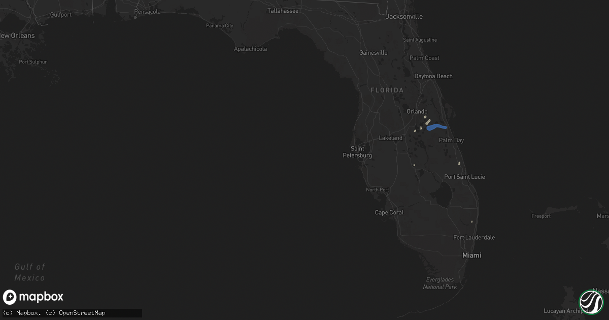
Hail Map in Florida on August 2, 2021
Get this storm
August 2 map
$229
one time, instant access
Download today. No call, no setup
Keep the $229
Bought the map and want the full workflow? Apply the entire $229 to a subscription within 7 days. None of it is wasted.
Every map, not just this one
This buys you this map. Subscription and you get every map we run, in the markets you choose from a few cities to whole states to nationwide. Plus real-time alerts the moment a storm fires.
Contact data
Name, contact info, occupancy, even credit band for addresses in the footprint. You go from where it hit to who to call.
Become the source they trust
Unlimited branding weather history reports on demand. You already have the documented answer ready for the property owner, and you are the one who showed up with it.
Property data and RoofTrace estimates
Pull up any address you have got, its value and the exact code rules for that jurisdiction, straight from One Click Code. Then RoofTrace estimates the squares, pitch, and roof value, priced the way you price.
Storm reports in Florida
Florida
| Date | Description |
|---|---|
| 08/02/20213:00 PM CDT | Member of the public sent pictures on social media of large tree branches snapped on atlantic ave just east of the florida turnpike. |
| 08/02/20211:40 PM CDT | Volusia county sheriff office reported a tornado around 240 pm about one mile north of the new smyrna beach airport. The tornado moved to the southeast... Becoming a wa |
| 08/01/202110:56 PM CDT | At 356 PM EDT, a severe thunderstorm was located near Taylor, or 22 miles north of Raiford, moving east at 15 mph. HAZARD...60 mph wind gusts. SOURCE...Radar indicated. IMPACT...Expect damage to roofs, siding, and trees. Locations impacted include... Taylor, Macclenny and Glen St. Mary. |
| 08/01/202110:30 PM CDT | At 329 PM EDT, a severe thunderstorm was located near Rockledge, moving east at 20 mph. HAZARD...60 mph wind gusts. SOURCE...Radar indicated. IMPACT...Expect damage to roofs, siding, and trees. Locations impacted include... Melbourne, Rockledge, Cocoa, Cocoa Beach and Satellite Beach. |
| 08/01/202110:26 PM CDT | At 326 PM EDT, severe thunderstorms were located along a line extending from near Whisper Walk to Lauderdale Lakes, moving north at 15 mph. HAZARD...60 mph wind gusts and penny size hail. SOURCE...Radar indicated. IMPACT...Expect damage to roofs, siding, and trees. Locations impacted include... Fort Lauderdale, Coral Springs, Pompano Beach, Sunrise and Boca Raton. |
| 08/01/202110:14 PM CDT | At 313 PM EDT, a severe thunderstorm was located near Lone Cabbage Fish Camp, moving east at 20 mph. HAZARD...60 mph wind gusts. SOURCE...Radar indicated. IMPACT...Expect damage to roofs, siding, and trees. Locations impacted include... Rockledge, Cocoa, Lone Cabbage Fish Camp, Sharpes and Port Saint John. |
| 08/01/202110:01 PM CDT | At 300 PM EDT, a severe thunderstorm was located near Harmony, or 7 miles southeast of Narcoossee, moving east at 20 mph. HAZARD...60 mph wind gusts. SOURCE...Radar indicated. IMPACT...Expect damage to roofs, siding, and trees. Locations impacted include... Holopaw, Harmony, Alligator Lake and Pine Grove. |
| 08/01/20219:30 PM CDT | At 229 PM EDT, a severe thunderstorm was located near Avalon Park, moving east at 15 mph. HAZARD...60 mph wind gusts and penny size hail. SOURCE...Radar indicated. IMPACT...Expect damage to roofs, siding, and trees. Locations impacted include... Wedgefield, Avalon Park, Christmas and Bithlo. |
All States Impacted by Hail Map on August 2, 2021
Cities Impacted by Hail Map on August 2, 2021
- Vail, AZ
- Tifton, GA
- Teasdale, UT
- Picabo, ID
- Bellevue, ID
- Richfield, ID
- Union Springs, AL
- Orlando, FL
- Tucson, AZ
- Snowville, UT
- Three Rivers, TX
- Naco, AZ
- Bisbee, AZ
- McRae Helena, GA
- Kissimmee, FL
- Warren, TX
- Waycross, GA
- Manor, GA
- Prineville, OR
- Hanksville, UT
- Summerville, SC
- Hayneville, AL
- Leesburg, GA
- Century, FL
- Jennings, LA
- Kinder, LA
- Elton, LA
- Flomaton, AL
- Brewton, AL
- Douglas, AZ
- Pirtleville, AZ
- Rochelle, GA
- Fort Pierce, FL
- Vero Beach, FL
- Thoreau, NM
- Mobile, AL
- Avon Park, FL
- Sebring, FL
- Saint Cloud, FL
- Laguna, NM
- Blanding, UT
- Animas, NM
- Ridgeville, SC
- Banks, AL
- Midway, AL
- Lowndesboro, AL
- Montgomery, AL
- Prattville, AL
- Brunswick, GA
- Dragoon, AZ
- Glenwood, GA
- Oakfield, GA
- Hahira, GA
- Cottageville, SC
- Round O, SC
- Delray Beach, FL
- Boca Raton, FL
- Pike Road, AL
- Bend, OR
- Melbourne, FL
- Rockledge, FL
- Lordsburg, NM


