Hail Map on August 2, 2021
Get this storm
August 2 map
$229
one time, instant access
Download today. No call, no setup
Keep the $229
Bought the map and want the full workflow? Apply the entire $229 to a subscription within 7 days. None of it is wasted.
Every map, not just this one
This buys you this map. Subscription and you get every map we run, in the markets you choose from a few cities to whole states to nationwide. Plus real-time alerts the moment a storm fires.
Contact data
Name, contact info, occupancy, even credit band for addresses in the footprint. You go from where it hit to who to call.
Become the source they trust
Unlimited branding weather history reports on demand. You already have the documented answer ready for the property owner, and you are the one who showed up with it.
Property data and RoofTrace estimates
Pull up any address you have got, its value and the exact code rules for that jurisdiction, straight from One Click Code. Then RoofTrace estimates the squares, pitch, and roof value, priced the way you price.
States Impacted by Hail Map on August 2, 2021
Storm reports
South Carolina
| Date | Description |
|---|---|
| 08/02/20215:30 PM CDT | A tree was reported to be across a home on grayson street. Time estimated by radar. |
| 08/02/20213:25 AM CDT | At 825 PM EDT, a severe thunderstorm was located near Canadys, moving northwest at 5 mph. HAZARD...60 mph wind gusts and quarter size hail. SOURCE...Radar indicated. IMPACT...Minor hail damage to vehicles is possible. Expect wind damage to trees and powerlines. Locations impacted include... Colleton, Smoaks, Lodge, Williams, Round O, Ruffin, Padgetts and Canadys.This warning includes I-95 in South Carolina between mile markers 61and 73. |
| 08/01/20217:31 PM CDT | South carolina highway patrol reports a tree down near the intersection of augusta highway and byrd farm road. Time estimated based on radar. |
| 08/01/20217:00 PM CDT | A tree was reported down on wesley grove road near chance lane. |
Oregon
| Date | Description |
|---|---|
| 08/02/20213:40 PM CDT | Spotter reported quarter sized hail... With damage to aluminum siding. Ponding due heavy rain. |
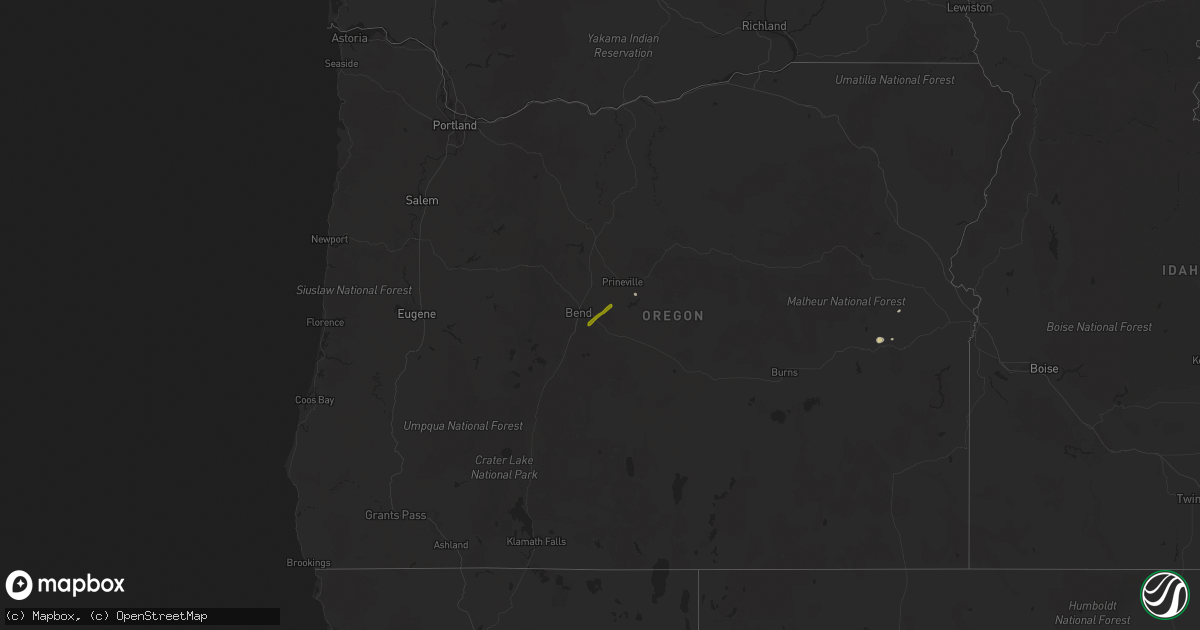
| 08/02/20212:55 PM CDT | Report relayed by tv of hail slightly larger than an inch 8.5 miles se of bend |
| 08/01/20218:45 PM CDT | At 145 PM PDT, a severe thunderstorm was located 7 miles northeast of Alfalfa, or 12 miles south of Prineville, moving northeast at 10 mph. HAZARD...Quarter size hail. SOURCE...Public. IMPACT...Damage to vehicles is expected. Locations impacted include... Prineville and Post. |
| 08/01/20218:21 PM CDT | At 120 PM PDT, a severe thunderstorm was located near Alfalfa, or 14 miles south of Prineville, moving northeast at 10 mph. HAZARD...Quarter size hail. SOURCE...Radar indicated. IMPACT...Damage to vehicles is expected. Locations impacted include... Prineville and Powell Butte. |
Utah
| Date | Description |
|---|---|
| 08/01/202110:24 PM CDT | At 323 PM MDT, a severe thunderstorm was located 19 miles east of Boulder, or 19 miles south of Fruita, moving southeast at 15 mph. HAZARD...Ping pong ball size hail and 60 mph wind gusts. SOURCE...Radar indicated. IMPACT...People and animals outdoors will be injured. Expect hail damage to roofs, siding, windows, and vehicles. Expect wind damage to roofs, siding, and trees. This severe thunderstorm will impact the Waterpocket Fold district of Capitol Reef National Park including Notom Road and the Burr Trail. |
Idaho
| Date | Description |
|---|---|
| 08/02/20211:54 AM CDT | At 654 PM MDT, a severe thunderstorm was located over Pocatello Airport, or near Pocatello, moving southeast at 55 mph. HAZARD...60 mph wind gusts. SOURCE...Radar indicated. IMPACT...Expect damage to roofs, siding, and trees. Locations impacted include... Pocatello, Blackfoot, American Falls, American Falls Reservoir, Chubbuck, Firth, Fort Hall Buffalo Lodge, Rose, Fort Hall Eagle Lodge, Fort Hall Lincoln Creek Lodge, Fort Hall Townsite, Fort Hall Bannock Creek Lodge, Pocatello Airport, Fort Hall Putnam Lodge, Groveland, Wapello and Trail Creek Campground. |
| 08/01/20218:47 PM CDT | Fallen tree limbs sustaining damage to a house with branches in roadways. |
| 08/01/20218:03 PM CDT | A local report indicates 60 MPH wind near POCATELLO |
Alabama
| Date | Description |
|---|---|
| 08/02/20213:15 PM CDT | Several large trees snapped and small trees down. Wind caused doors to bow in and allow water and leaves to blow into the house. |
| 08/01/202110:29 PM CDT | At 329 PM CDT, a severe thunderstorm was located over eastern Montgomery, moving east at 30 mph. HAZARD...60 mph wind gusts and penny size hail. SOURCE...Radar indicated. IMPACT...Expect damage to roofs, siding, and trees. Locations impacted include... Eastern Montgomery, Tuskegee, Tallassee, Notasulga, Milstead, Pike Road, Shorter, Franklin, Auburn University In Montgomery, Lake Tuskegee, Davisville, Waugh, Lagoon Park, Liverpool, Hardaway, Mount Meigs, Eastdale Mall, Tysonville, Victoryland and Mitylene. |
Arizona
| Date | Description |
|---|---|
| 08/02/20213:13 AM CDT | At 812 PM MST, a severe thunderstorm was located near East Tucson down to Rita Ranch. Vail, moving south at 15 mph. HAZARD...70 mph wind gusts. SOURCE...Radar indicated. IMPACT...Expect considerable tree damage. Damage is likely to mobile homes, roofs, and outbuildings. Locations impacted include... Tucson, Davis-Monthan Air Force Base, Tanque Verde, Vail, East Sahuarita, Corona De Tucson, Saguaro National Park East and Rita Ranch.This includes the following highways... Interstate 10 between mile markers 269 and 288. Route 83 between mile markers 51 and 58. |
| 08/02/20212:31 AM CDT | At 731 PM MST, a severe thunderstorm was located near Tanque Verde, or 12 miles northeast of Davis-Monthan Air Force Base, moving south at 15 mph. HAZARD...60 mph wind gusts. SOURCE...Radar indicated. IMPACT...Expect damage to roofs, siding, and trees. Locations impacted include... Tucson, Tanque Verde, Saguaro National Park East, Rita Ranch and Seven Falls. |
| 08/02/20211:37 AM CDT | At 636 PM MST, a severe thunderstorm was located near Vail, or 18 miles west of Benson, moving southwest at 10 mph. HAZARD...60 mph wind gusts and quarter size hail. SOURCE...Radar indicated. IMPACT...Hail damage to vehicles is expected. Expect wind damage to roofs, siding, and trees. Locations impacted include... Vail.This includes the following highways... Interstate 10 between mile markers 282 and 293. Route 83 between mile markers 43 and 58. |
| 08/01/20219:55 PM CDT | Large trees blocking portions of houghton rd just north of old spanish trail. |
| 08/01/20219:50 PM CDT | At 249 PM MST, a severe thunderstorm was located near Texas Canyon at I-10, or 13 miles east of Benson, moving southeast at 10 mph. HAZARD...60 mph wind gusts and quarter size hail. SOURCE...Radar indicated. IMPACT...Hail damage to vehicles is expected. Expect wind damage to roofs, siding, and trees. Locations impacted include... Dragoon, Pearce-Sunsites and Texas Canyon. This includes the following highways... Interstate 10 between mile markers 312 and 324. Route 80 near mile marker 311. |
| 08/01/20219:44 PM CDT | At 244 PM MST, a severe thunderstorm was located near Turkey Creek, or 33 miles south of Show Low, moving southeast at 15 mph. HAZARD...60 mph wind gusts and half dollar size hail. SOURCE...Radar indicated. IMPACT...Hail damage to vehicles is expected. Expect wind damage to roofs, siding, and trees. Locations impacted include... Turkey Creek, Seven Mile, Fort Apache, Whiteriver and East Fork. |
| 08/01/20219:23 PM CDT | At 222 PM MST, a severe thunderstorm was located near White River moving southeast at 20 mph. HAZARD...60 mph wind gusts and half dollar size hail. SOURCE...Radar indicated. IMPACT...Hail damage to vehicles is expected. Expect wind damage to roofs, siding, and trees. Locations impacted include... Whiteriver, Turkey Creek, Seven Mile, Rainbow City, Fort Apache Reservation and East Fork. |
| 08/01/20218:42 PM CDT | Measured wind gust from pima county weather station on kemx radar. |
Georgia
| Date | Description |
|---|---|
| 08/02/202112:11 AM CDT | At 511 PM EDT, severe thunderstorms were located along a line extending from St. Catherines Island to near Harris Neck, moving east at 15 mph. HAZARD...60 mph wind gusts. SOURCE...Radar indicated. IMPACT...Expect damage to trees and powerlines. Locations impacted include... Blackbeard Island and St. Catherines Island. |
Florida
| Date | Description |
|---|---|
| 08/02/20213:00 PM CDT | Member of the public sent pictures on social media of large tree branches snapped on atlantic ave just east of the florida turnpike. |
| 08/02/20211:40 PM CDT | Volusia county sheriff office reported a tornado around 240 pm about one mile north of the new smyrna beach airport. The tornado moved to the southeast... Becoming a wa |
| 08/01/202110:56 PM CDT | At 356 PM EDT, a severe thunderstorm was located near Taylor, or 22 miles north of Raiford, moving east at 15 mph. HAZARD...60 mph wind gusts. SOURCE...Radar indicated. IMPACT...Expect damage to roofs, siding, and trees. Locations impacted include... Taylor, Macclenny and Glen St. Mary. |
| 08/01/202110:30 PM CDT | At 329 PM EDT, a severe thunderstorm was located near Rockledge, moving east at 20 mph. HAZARD...60 mph wind gusts. SOURCE...Radar indicated. IMPACT...Expect damage to roofs, siding, and trees. Locations impacted include... Melbourne, Rockledge, Cocoa, Cocoa Beach and Satellite Beach. |
| 08/01/202110:26 PM CDT | At 326 PM EDT, severe thunderstorms were located along a line extending from near Whisper Walk to Lauderdale Lakes, moving north at 15 mph. HAZARD...60 mph wind gusts and penny size hail. SOURCE...Radar indicated. IMPACT...Expect damage to roofs, siding, and trees. Locations impacted include... Fort Lauderdale, Coral Springs, Pompano Beach, Sunrise and Boca Raton. |
| 08/01/202110:14 PM CDT | At 313 PM EDT, a severe thunderstorm was located near Lone Cabbage Fish Camp, moving east at 20 mph. HAZARD...60 mph wind gusts. SOURCE...Radar indicated. IMPACT...Expect damage to roofs, siding, and trees. Locations impacted include... Rockledge, Cocoa, Lone Cabbage Fish Camp, Sharpes and Port Saint John. |
| 08/01/202110:01 PM CDT | At 300 PM EDT, a severe thunderstorm was located near Harmony, or 7 miles southeast of Narcoossee, moving east at 20 mph. HAZARD...60 mph wind gusts. SOURCE...Radar indicated. IMPACT...Expect damage to roofs, siding, and trees. Locations impacted include... Holopaw, Harmony, Alligator Lake and Pine Grove. |
| 08/01/20219:30 PM CDT | At 229 PM EDT, a severe thunderstorm was located near Avalon Park, moving east at 15 mph. HAZARD...60 mph wind gusts and penny size hail. SOURCE...Radar indicated. IMPACT...Expect damage to roofs, siding, and trees. Locations impacted include... Wedgefield, Avalon Park, Christmas and Bithlo. |
New Mexico
| Date | Description |
|---|---|
| 08/02/20216:35 PM CDT | Mesonet station nm007 lordsburg playa i10 mp13 |
| 08/02/20211:30 AM CDT | At 630 PM MDT, a severe thunderstorm was located 6 miles north of Animas, moving southeast at 10 mph. HAZARD...60 mph wind gusts and half dollar size hail. SOURCE...Radar indicated. IMPACT...Hail damage to vehicles is expected. Expect wind damage to roofs, siding, and trees. Locations impacted include... Cotton City, Animas and Windmill. |
| 08/02/202112:42 AM CDT | At 541 PM MDT, a severe thunderstorm was located near Lordsburg, moving east at 10 mph. Blowing dust from outflow winds is reducing visibility to less than a mile. HAZARD...60 mph wind gusts and blowing dust. SOURCE...Radar indicated. IMPACT...Expect damage to roofs, siding, and trees. Locations impacted include... Steins, Lordsburg, Road Forks, Lordsburg Playa and Shakespeare. This includes Interstate 10 in New Mexico between mile markers 2 and27. |
| 08/01/202111:12 PM CDT | At 411 PM MDT, severe thunderstorms were located along a line extending from 9 miles east of Quemado Lake to Old Horse Springs, and are nearly stationary. HAZARD...60 mph wind gusts and quarter size hail. SOURCE...Radar indicated. IMPACT...Hail damage to vehicles is expected. Expect wind damage to roofs, siding, and trees. Locations impacted include... Old Horse Springs. |
Cities Impacted by Hail Map on August 2, 2021
- Vail, AZ
- Tifton, GA
- Teasdale, UT
- Picabo, ID
- Bellevue, ID
- Richfield, ID
- Union Springs, AL
- Orlando, FL
- Tucson, AZ
- Snowville, UT
- Three Rivers, TX
- Naco, AZ
- Bisbee, AZ
- McRae Helena, GA
- Kissimmee, FL
- Warren, TX
- Waycross, GA
- Manor, GA
- Prineville, OR
- Hanksville, UT
- Summerville, SC
- Hayneville, AL
- Leesburg, GA
- Century, FL
- Jennings, LA
- Kinder, LA
- Elton, LA
- Flomaton, AL
- Brewton, AL
- Douglas, AZ
- Pirtleville, AZ
- Rochelle, GA
- Fort Pierce, FL
- Vero Beach, FL
- Thoreau, NM
- Mobile, AL
- Avon Park, FL
- Sebring, FL
- Saint Cloud, FL
- Laguna, NM
- Blanding, UT
- Animas, NM
- Ridgeville, SC
- Banks, AL
- Midway, AL
- Lowndesboro, AL
- Montgomery, AL
- Prattville, AL
- Brunswick, GA
- Dragoon, AZ
- Glenwood, GA
- Oakfield, GA
- Hahira, GA
- Cottageville, SC
- Round O, SC
- Delray Beach, FL
- Boca Raton, FL
- Pike Road, AL
- Bend, OR
- Melbourne, FL
- Rockledge, FL
- Lordsburg, NM