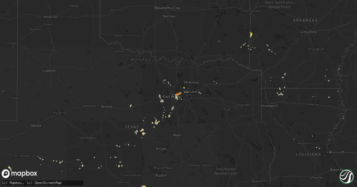
Hail Map on August 1, 2021
Get this storm
August 1 map
$229
one time, instant access
Download today. No call, no setup
Keep the $229
Bought the map and want the full workflow? Apply the entire $229 to a subscription within 7 days. None of it is wasted.
Every map, not just this one
This buys you this map. Subscription and you get every map we run, in the markets you choose from a few cities to whole states to nationwide. Plus real-time alerts the moment a storm fires.
Contact data
Name, contact info, occupancy, even credit band for addresses in the footprint. You go from where it hit to who to call.
Become the source they trust
Unlimited branding weather history reports on demand. You already have the documented answer ready for the property owner, and you are the one who showed up with it.
Property data and RoofTrace estimates
Pull up any address you have got, its value and the exact code rules for that jurisdiction, straight from One Click Code. Then RoofTrace estimates the squares, pitch, and roof value, priced the way you price.
States Impacted by Hail Map on August 1, 2021
Storm reports
Alabama
| Date | Description |
|---|---|
| 08/01/20217:11 AM CDT | At 1210 AM CDT, severe thunderstorms were located along a line extending from near Manchester to near Tims Ford Lake to near Huntland, moving southeast at 50 mph. HAZARD...60 mph wind gusts. SOURCE...Radar indicated. IMPACT...Expect damage to roofs, siding, and trees. Locations impacted include... Scottsboro, Winchester, Bridgeport, Decherd, Estill Springs, Stevenson, Cowan, Hollywood, Huntland and Skyline. |
| 08/01/20214:51 AM CDT | At 951 PM CDT, a severe thunderstorm was located 7 miles northwest of Camden, moving east at 20 mph. HAZARD...60 mph wind gusts. SOURCE...Radar indicated. IMPACT...Expect damage to roofs, siding, and trees. Locations impacted include... Camden. |
| 08/01/20214:18 AM CDT | At 918 PM CDT, a severe thunderstorm was located 6 miles northwest of Evergreen, moving southeast at 10 mph. HAZARD...60 mph wind gusts. SOURCE...Radar indicated. IMPACT...Expect damage to roofs, siding, and trees. Locations impacted include... Evergreen and I65 And US 84. |
| 08/01/20214:11 AM CDT | At 910 PM CDT, severe thunderstorms were located along a line extending from Myrtlewood to Consul, moving south at 10 mph. HAZARD...60 mph wind gusts. SOURCE...Radar indicated. IMPACT...Expect damage to roofs, siding, and trees. Locations impacted include... Linden, Thomaston, Sweet Water, Myrtlewood, Freddie Jones Field, Miller, Consul, Magnolia, Calvary, Half Acre and Octagon. |
| 08/01/20211:14 AM CDT | At 614 PM CDT, a severe thunderstorm was located over Satsuma, moving southeast at 5 mph. HAZARD...60 mph wind gusts. SOURCE...Radar indicated. IMPACT...Expect damage to roofs, siding, and trees. This severe thunderstorm will remain over mainly rural areas of east central Mobile and west central Baldwin Counties. |
Arizona
| Date | Description |
|---|---|
| 08/01/202112:38 AM CDT | At 537 PM Navajo Nation time, a severe thunderstorm was located 12 miles south of Greasewood Springs, or 38 miles southeast of Keams Canyon, moving northwest at 10 mph. HAZARD...60 mph wind gusts and quarter size hail. SOURCE...Radar indicated. IMPACT...Hail damage to vehicles is expected. Expect wind damage to roofs, siding, and trees. Locations impacted include... Greasewood Springs and Greasewood. |
| 08/01/202112:11 AM CDT | At 510 PM MST, a severe thunderstorm was located 9 miles east of Hondah, or 19 miles southeast of Show Low. HAZARD...60 mph wind gusts and quarter size hail. SOURCE...Radar indicated. IMPACT...Hail damage to vehicles is expected. Expect wind damage to roofs, siding, and trees. Locations impacted include... Fort Apache Reservation, Carrizo, Cedar Creek and White Mountain Apache Reservation. |
Utah
| Date | Description |
|---|---|
| 08/01/20215:00 PM CDT | Photos from social media. |
| 08/01/20214:55 PM CDT | A local report indicates 63 MPH wind near 25 SSW DUGWAY |
| 08/01/20212:25 AM CDT | At 724 PM MDT, a severe thunderstorm was located near South Weber, or near Layton, moving northeast at 35 mph. HAZARD...60 mph wind gusts. SOURCE...Radar indicated. IMPACT...Expect damage to roofs, siding, and trees. Locations impacted include... Salt Lake City, Layton, Bountiful, Farmington, Hill Air Force Base, Roy, Clearfield, Kaysville, Syracuse, Clinton, North Salt Lake, Centerville, Woods Cross, Riverdale, South Weber, West Bountiful, Uintah, Salt Lake City International Airport, Magna and Emigration Canyon.This includes the following highways... Interstate 15 between mile markers 308 and 338. Interstate 84 between mile markers 85 and 86. Interstate 80 in Utah between mile markers 105 and 119. |
| 08/01/20211:47 AM CDT | At 646 PM MDT, a severe thunderstorm was located 9 miles northwest of Salt Lake City International Airport, or 13 miles northwest of West Valley City, moving northeast at 35 mph. HAZARD...60 mph wind gusts. SOURCE...Radar indicated. IMPACT...Expect damage to roofs, siding, and trees. Locations impacted include... Salt Lake City, West Valley City, Layton, Bountiful, Farmington, Hill Air Force Base, Roy, Clearfield, Kaysville, Syracuse, Clinton, North Salt Lake, Centerville, Woods Cross, Riverdale, South Weber, West Bountiful, Uintah, Salt Lake City International Airport and Magna.This includes the following highways... Interstate 15 between mile markers 307 and 338. Interstate 84 between mile markers 85 and 86. Interstate 80 in Utah between mile markers 97 and 119. |
| 08/01/20211:09 AM CDT | At 608 PM MDT, severe thunderstorms were located along a line extending from 26 miles south of Park Valley to 24 miles west of Great Salt Lake North of the Causeway to Utah Test and Training Range North, moving northeast at 25 mph. HAZARD...60 mph wind gusts and penny size hail. SOURCE...Radar indicated. IMPACT...Expect damage to roofs, siding, and trees. Locations impacted include... Utah Test and Training Range North, Great Salt Lake North of the Causeway, Gunnison Island and Lakeside. |
| 08/01/202112:30 AM CDT | At 529 PM MDT, a severe thunderstorm was located 25 miles west of Utah Test and Training Range North, or 26 miles southeast of Montello, moving east at 15 mph. HAZARD...60 mph wind gusts. SOURCE...Radar indicated. IMPACT...Expect damage to roofs, siding, and trees. This severe thunderstorm will remain over mainly rural areas of southwestern Box Elder County. |
| 07/31/202111:11 PM CDT | At 409 PM MDT, a severe thunderstorm was located 22 miles east of Fish Springs Wildlife Refuge, or 25 miles southwest of Dugway English Village, moving north at 10 mph. HAZARD...60 mph wind gusts and penny size hail. SOURCE...Radar indicated. IMPACT...Expect damage to roofs, siding, and trees. Locations impacted include... Dugway Proving Ground Test Range. |
| 07/31/20219:52 PM CDT | At 251 PM MDT, a severe thunderstorm was located 14 miles southwest of Fish Springs Wildlife Refuge, or 56 miles east of Schellbourne, moving northeast at 20 mph. HAZARD...Quarter size hail. SOURCE...Radar indicated. IMPACT...Damage to vehicles is expected. Locations impacted include... Fish Springs Wildlife Refuge. |
| 07/31/20217:50 PM CDT | A local report indicates 62 MPH wind near 4 NNE LAKE PT |
| 07/31/20217:35 PM CDT | A local report indicates 60 MPH wind near 2 W ERDA |
| 07/31/20217:30 PM CDT | Over 3000 people without power in the city of enoch. |
New York
| Date | Description |
|---|---|
| 08/01/20213:02 PM CDT | A couple reports of trees down between westford and decatur. Time estimated from radar. |
| 08/01/20212:38 PM CDT | Tree down. Time estimated based on radar |
| 08/01/202112:10 PM CDT | Dispatch reports tree down on cr80 near risley road. Time estimated. |
| 08/01/202111:45 AM CDT | Large tree down blocking roadway. |
| 08/01/202111:39 AM CDT | Large tree down across road on clinton street in mcgraw. |
| 08/01/20217:45 AM CDT | At 1245 PM EDT, a severe thunderstorm was located over Monterey, or 8 miles southwest of Montour Falls, moving northeast at 25 mph. HAZARD...60 mph wind gusts and quarter size hail. SOURCE...Radar indicated. IMPACT...Hail damage to vehicles is expected. Expect wind damage to roofs, siding, and trees. Locations impacted include... Enfield, Watkins Glen, Catharine, Montour Falls, Hornby, Odessa, Cayuta, Burdett, Millport and Reynoldsville. |
| 08/01/20217:29 AM CDT | At 1228 PM EDT, a severe thunderstorm was located over Homer, or over Cortland, moving east at 30 mph. HAZARD...60 mph wind gusts and penny size hail. SOURCE...Radar indicated. IMPACT...Expect damage to roofs, siding, and trees. Locations impacted include... Cortland, Homer, Virgil, Groton, Preble, Scott, Truxton, Solon, Cincinnatus and McGraw. |
| 07/31/202111:00 PM CDT | At 400 PM EDT, a severe thunderstorm was located near Middlefield, or 11 miles west of Cobleskill, moving east at 45 mph. HAZARD...60 mph wind gusts and penny size hail. SOURCE...Radar indicated. IMPACT...Expect damage to roofs, siding, and trees. Locations impacted include... Worcester, Middlefield, Westford, Cherry Valley, Elk Creek, Betty And Wilbur Davis State Park, Glimmerglass State Park and East Springfield. |
| 07/31/202110:38 PM CDT | At 337 PM EDT, a severe thunderstorm was located over Gloversville, moving northeast at 25 mph. HAZARD...60 mph wind gusts. SOURCE...Radar indicated. IMPACT...Expect damage to roofs, siding, and trees. Locations impacted include... Gloversville, Johnstown, Broadalbin, Edinburg, Northville, Mayfield, Cranberry Creek, Caroga Lake Public Campground, Day Center, Northampton Beach Public Campground, Kings, Mount Pleasant, Berkshire, Bleecker, Meco, West Perth, Munsonville, Tenantville, Sweets Crossing and Shaw Corners. |
| 07/31/20218:14 PM CDT | At 113 PM EDT, a severe thunderstorm was located near De Ruyter, or 14 miles southwest of Hamilton, moving east at 30 mph. HAZARD...60 mph wind gusts and penny size hail. SOURCE...Radar indicated. IMPACT...Expect damage to roofs, siding, and trees. Locations impacted include... Eaton, Hamilton, Morrisville, Plymouth, North Norwich, Sherburne, Lebanon, Otselic, New Berlin and Cuyler. |
| 07/31/20218:05 PM CDT | At 104 PM EDT, a severe thunderstorm was located over Whitesville, or 11 miles east of Wellsville, moving east at 35 mph. HAZARD...60 mph wind gusts and penny size hail. SOURCE...Radar indicated. IMPACT...Expect damage to roofs, siding, and trees. Locations impacted include... Campbell, Lindley, Addison, Woodhull, Jasper, Thurston, Troupsburg, Cameron, Savona and Greenwood. |
Oklahoma
| Date | Description |
|---|---|
| 07/31/20219:12 PM CDT | At 211 PM CDT, a severe thunderstorm was located near Mountain Fork, or 10 miles west of Mena, moving northeast at 5 mph. HAZARD...60 mph wind gusts and quarter size hail. SOURCE...Radar indicated. IMPACT...Hail damage to vehicles is expected. Expect wind damage to roofs, siding, and trees. Locations impacted include... Queen Wilhelmina State Park... Mountain Fork... Rich Mountain... Rocky... Black Fork Mountain Wilderness... Potter... Camp Pioneer... Eagleton... Shady Grove... |
| 07/31/20218:19 PM CDT | At 119 PM CDT, severe thunderstorms were located along a line extending from 2 miles north of Stanley to 2 miles east of Kellond, moving southeast at 20 mph. HAZARD...60 mph wind gusts and quarter size hail. SOURCE...Radar indicated. IMPACT...Hail damage to vehicles is expected. Expect wind damage to roofs, siding, and trees. Locations in or near the path include... Antlers... Clayton... Rattan... Clayton Lake State Park... Snow... Tuskahoma... Stanley... Moyers... Nashoba... Kosoma... Kellond... Dunbar... Oleta... Cloudy... Eubanks... Apple... Dela... Finley... |
Pennsylvania
| Date | Description |
|---|---|
| 08/01/20215:35 PM CDT | Tree down across dividing ridge rd. |
| 08/01/20215:00 PM CDT | Tree down on center street. Time estimated from radar. |
| 08/01/20214:56 PM CDT | Trees down on mullholland drive in conyngham township. Time estimated from radar. |
| 08/01/20214:55 PM CDT | Tree down on shickshinny valley road. Time estimated from radar. |
| 08/01/20214:31 PM CDT | Tree blocking wb i-80 at mm 234. |
| 08/01/20217:42 AM CDT | At 1242 PM EDT, a severe thunderstorm was located 7 miles southwest of Wellsville, moving east at 30 mph. HAZARD...60 mph wind gusts and penny size hail. SOURCE...Radar indicated. IMPACT...Expect damage to trees and power lines. Locations impacted include... Wellsville, Whitesville, Bolivar, Andover, Alma, Richburg, Stannards, Paynesville, and Little Genesee. |
| 08/01/20211:27 AM CDT | At 627 PM EDT, severe thunderstorms were located along a line extending from near Leck Kill to near New Buffalo to Shermansdale, moving southeast at 35 mph. HAZARD...60 mph wind gusts and penny size hail. SOURCE...Radar indicated. IMPACT...Expect damage to roofs, siding, and trees. Locations impacted include... Harrisburg, Lower Allen, Pottsville, Hershey, Colonial Park, Progress, Mechanicsburg, Camp Hill, Palmyra, New Cumberland, Linglestown, Enola, Steelton, Schuylkill Haven, Annville, Lemoyne, Hummelstown, Minersville, Paxtonia and Rutherford.This includes the following Interstates... The Pennsylvania Turnpike between mile markers 234 and 238. Interstate 78 from mile markers 0 to 8. Interstate 81 from mile markers 53 to 116. Interstate 83 from mile markers 41 to 50. Interstate 283 from mile markers 0 to 2. |
| 08/01/20211:19 AM CDT | At 618 PM EDT, a severe thunderstorm was located over Bear Creek Village, or 7 miles southeast of Wilkes-Barre, moving east at 40 mph. HAZARD...60 mph wind gusts and quarter size hail. SOURCE...Radar indicated. IMPACT...Minor damage to vehicles is possible. Wind damage to roofs, siding, trees, and power lines is possible. Locations impacted include... Mount Pocono, Tobyhanna, Stormville, Henryville, Brodheadsville, Pocono Pines, Pocono Raceway, Lake Harmony, Skytop, Tannersville, Mountainhome, Alpine Mountain, Long Pond, Albrightsville, Sun Valley, Arrowhead Lake, Jonas, Meckesville, Reeders and Analomink.This includes the following highways... Northeast Extension between mile markers 87 and 97. Interstate 80 in Pennsylvania between mile markers 278 and 309. Interstate 380 in Pennsylvania between mile markers 0 and 12. |
| 08/01/202112:50 AM CDT | At 550 PM EDT, a severe thunderstorm was located over Sweet Valley, or 12 miles west of Wilkes-Barre, moving east at 50 mph. HAZARD...60 mph wind gusts and nickel size hail. SOURCE...Radar indicated. IMPACT...Expect damage to roofs, siding, and trees. Locations impacted include... Scranton, Wilkes-Barre, Muhlenberg, Dunmore, Kingston, Nanticoke, Plains, Old Forge, Pittston and Taylor. |
| 07/31/20218:50 PM CDT | At 150 PM EDT, a severe thunderstorm was located near Tionesta, or 13 miles northeast of Knox, moving east at 45 mph. HAZARD...Quarter-size hail. SOURCE...Radar. IMPACT...Minor damage to vehicles is possible. Locations impacted include... Marienville... Tionesta... Sigel... Fryburg... Fisher... Leeper... Clarington... Clear Creek State Park... Cook Forest State Park... |
Texas
| Date | Description |
|---|---|
| 08/01/20214:18 PM CDT | Emergency manager reported quarter size hail near highway 183 and brown trail. |
| 08/01/20214:15 PM CDT | Golf ball size hail was reported near forest ridge drive and highway 183. |
| 08/01/20214:14 PM CDT | Corrects previous report. Trained spotter reported trash cans blowing around in a parking lot... A chain link fence gate blown off of its hinge... And flying debris two |
| 08/01/20214:05 PM CDT | Quarter size hail was reported near bedford road and highway 121. |
| 08/01/20214:05 PM CDT | An emergency manager reported golf ball size hail near highway 183 and main street in euless. |
| 08/01/20214:03 PM CDT | An nws employee relayed a report of golf ball size hail at the faa artcc. Time estimated via radar. |
| 08/01/202112:55 AM CDT | At 555 PM CDT, a severe thunderstorm was located near New Fairview, or 12 miles northeast of Briar, moving northwest at 5 mph. HAZARD...60 mph wind gusts. SOURCE...Radar indicated. IMPACT...Expect damage to roofs, siding, and trees. Locations impacted include... Justin, Northlake and New Fairview. |
| 08/01/202112:47 AM CDT | At 547 PM CDT, a severe thunderstorm was located over Spring Branch, or 10 miles west of Canyon Lake Dam, moving south at 5 mph. HAZARD...Ping pong ball size hail. SOURCE...Radar indicated. IMPACT...People and animals outdoors will be injured. Expect damage to roofs, siding, windows, and vehicles. Locations impacted include... Canyon Lake Dam, Canyon Lake, Bulverde, Spring Branch, Smithson Valley, Fischer, Guadalupe River State Park, Timberwood Park, Anhalt, Honey Creek State Natural Area, Startzville and Specht Store. |
| 08/01/202112:02 AM CDT | At 502 PM CDT, a severe thunderstorm was located over Plano, moving southwest at 15 mph. HAZARD...60 mph wind gusts and nickel size hail. SOURCE...Radar indicated. IMPACT...Expect damage to roofs, siding, and trees. Locations impacted include... Dallas, Plano, Garland, Irving, Carrollton, Frisco, Richardson, Lewisville, Euless, Coppell, The Colony, Farmers Branch, University Park, Addison, Highland Park, Murphy, Parker, Hebron and Buckingham.This includes the following highways... Interstate 35E between mile markers 426 and 447. Interstate 30 between mile markers 43 and 49. Interstate 45 between mile markers 283 and 284. |
| 07/31/202110:50 PM CDT | At 350 PM CDT, a severe thunderstorm was located over Irving, moving west at 15 mph. HAZARD...60 mph wind gusts and penny size hail. SOURCE...Radar indicated. IMPACT...Expect damage to roofs, siding, and trees. Locations impacted include... Dallas, Fort Worth, Arlington, Irving, Grand Prairie, Carrollton, Euless, Bedford, Grapevine, Keller, Coppell, Hurst, Farmers Branch, Southlake, Colleyville, Richland Hills, North Richland Hills and Westlake.This includes the following highways... Interstate 35E between mile markers 435 and 440. Interstate 30 between mile markers 36 and 38. |
| 07/31/202110:34 PM CDT | At 334 PM CDT, a severe thunderstorm was located over Blum, or 14 miles south of Cleburne, moving north at 10 mph. HAZARD...60 mph wind gusts and quarter size hail. SOURCE...Radar indicated. IMPACT...Hail damage to vehicles is expected. Expect wind damage to roofs, siding, and trees. Locations impacted include... Cleburne, Grandview, Blum, Covington and Rio Vista. This includes Interstate 35W between mile markers 16 and 19. |
| 07/31/202110:27 PM CDT | At 327 PM CDT, a severe thunderstorm was located over Sansom Park, moving northeast at 10 mph. HAZARD...60 mph wind gusts and penny size hail. SOURCE...Radar indicated. IMPACT...Expect damage to roofs, siding, and trees. Locations impacted include... Fort Worth, Bedford, Haltom City, Keller, Hurst, Watauga, Colleyville, Benbrook, Saginaw, White Settlement, Richland Hills, River Oaks, Sansom Park, Lake Worth, Eagle Mountain, North Richland Hills, Westworth Village, Blue Mound, Haslet and Westover Hills.This includes the following highways... Interstate 35W between mile markers 48 and 64. Interstate 20 between mile markers 432 and 434. Interstate 30 between mile markers 5 and 18. |
| 07/31/202110:23 PM CDT | At 322 AM CDT, a severe thunderstorm was located over O'donnell, or 13 miles south of Tahoka, and is nearly stationary. HAZARD...60 mph wind gusts. At 315 AM, a wind gust of 62 mph was measured at the West Texas Mesonet 1 mile north of O'Donnell. SOURCE...West Texas Mesonet. IMPACT...Expect damage to roofs, siding, and trees. Locations impacted include... O'donnell. |
Georgia
| Date | Description |
|---|---|
| 08/01/20216:20 PM CDT | Report of a tree downed onto wires at 4440 hwy 230 |
| 08/01/20216:03 PM CDT | A tree was reported down at hwy 329 and mims rd |
| 08/01/20216:03 PM CDT | A tree was reported down near the intersection of kersey rd and s hwy 41 near elko... Ga |
| 08/01/20216:03 PM CDT | A tree was reported down near the intersection of kersey rd and s hwy 41 near elko... Ga |
| 08/01/20215:55 PM CDT | A tree was reported down on the 500 block of toomer rd |
| 08/01/20214:30 PM CDT | Residence on hampton court in paddleford plantation had some roof shingles blown off and damage to two pear trees. |
| 08/01/20214:25 PM CDT | A tree fell through a window of a home on exley loop. On dogwood drive... A tree fell on a carport crushing a car... And another tree fell on a home. Damage was also do |
| 08/01/20214:04 PM CDT | Corrects time on previous tstm wnd dmg report from 2 sw climax. Several reports of trees and powerlines down in decatur county. |
| 08/01/20213:56 PM CDT | Several reports of trees and powerlines down in decatur county. |
| 08/01/20213:45 PM CDT | Fallen tree in cairo. |
| 08/01/20212:30 PM CDT | Trees down on highway 112 and reports of roof damage. Time estimated by radar. |
| 08/01/20214:46 AM CDT | At 946 PM EDT, severe thunderstorms were located along a line extending from 7 miles west of Cordele to 7 miles southwest of Leslie to 6 miles south of Plains, moving southeast at 20 mph. HAZARD...60 mph wind gusts and penny size hail. SOURCE...Radar indicated. IMPACT...Expect damage to roofs, siding, and trees. Locations impacted include... Leesburg, Albany, Smithville, Warwick, Starksville, Scrutchins, Chokee, Neyami, Philema, Mossy Dell, Oakfield and Stocks. |
| 08/01/20211:54 AM CDT | At 654 PM EDT, a severe thunderstorm was located near Montezuma, or near Oglethorpe, moving southeast at 25 mph. HAZARD...60 mph wind gusts and penny size hail. SOURCE...Radar indicated. IMPACT...Expect damage to roofs, siding, and trees. Locations impacted include... Unadilla, Montezuma, Byromville, Pinehurst, Dooling, Winchester and Henderson. |
| 08/01/202112:01 AM CDT | At 500 PM EDT, a severe thunderstorm was located 8 miles southeast of Bainbridge, moving southeast at 20 mph. HAZARD...60 mph wind gusts. SOURCE...Radar indicated. IMPACT...Expect damage to roofs, siding, and trees. Locations impacted include... Bainbridge, Havana, Whigham, Attapulgus, Climax, Freemont, Darsey, Florence, Concord, Jamieson, Rocky Hill, Laingkat, Calvary, Shady Rest, Reno, Fowlstown, Princes Still, Amsterdam, Branchville and Nickleville. |
Virginia
| Date | Description |
|---|---|
| 08/01/20215:27 AM CDT | At 1027 AM EDT, severe thunderstorms were located along a line extending from near Northwest to near Morgans Corner to near Hobbsville, moving east at 15 mph. HAZARD...60 mph wind gusts. SOURCE...Radar indicated. IMPACT...Expect damage to trees and powerlines. Severe thunderstorms will be near, Morgans Corner around 1040 AM EDT. South Mills and Moyock around 1045 AM EDT. Elizabeth City around 1130 AM EDT.Other locations impacted by these severe thunderstorms includeBelcross, Burnt Mills, Lynchs Corner, Snowden, Pierceville, Peach,Tar Corner, Nicanor, Gregory and Sharon. |
| 08/01/20211:44 AM CDT | At 644 AM EDT, a severe thunderstorm was located near Homeville, or 9 miles south of Waverly, moving east at 30 mph. HAZARD...60 mph wind gusts and penny size hail. SOURCE...Radar indicated. IMPACT...Expect damage to trees and powerlines. This severe thunderstorm will be near, Wakefield around 700 AM EDT. Ivor around 710 AM EDT. Zuni around 720 AM EDT. Windsor around 730 AM EDT.Other locations impacted by this severe thunderstorm includeVicksville, Booth Fork, Pons, Berlin, Bethel Church, Lumberton, EllisFork, Manry, Littleton and Central Hill. |
Arkansas
| Date | Description |
|---|---|
| 08/01/20212:33 PM CDT | Quarter sized hail fell near black fork. |
| 07/31/20218:08 PM CDT | At 108 PM CDT, a severe thunderstorm was located over Daisy State Park, or 9 miles north of Murfreesboro, moving southeast at 10 mph. HAZARD...60 mph wind gusts and quarter size hail. SOURCE...Radar indicated. IMPACT...Hail damage to vehicles is expected. Expect wind damage to roofs, siding, and trees. Locations impacted include... Murfreesboro... Daisy... Narrows Dam... Daisy State Park... Crater Of Diamonds State Park... Bear Creek Public Use Area... Kirby... Shawmut... Pike City... Salem in Pike County... |
Mississippi
| Date | Description |
|---|---|
| 08/01/20216:16 AM CDT | At 1116 AM CDT, a severe thunderstorm was located near Starkville, moving southeast at 30 mph. HAZARD...60 mph wind gusts and quarter size hail. SOURCE...Radar indicated. IMPACT...Hail damage to vehicles is expected. Expect wind damage to roofs, siding, and trees. This severe thunderstorm will be near... Starkville and Muldrow around 1120 AM CDT. Sessums around 1135 AM CDT. Oktoc around 1145 AM CDT. Crawford around 1200 PM CDT.Other locations impacted by this severe thunderstorm include Artesia. |
| 08/01/20213:39 AM CDT | At 839 PM CDT, a severe thunderstorm was located 5 miles east of Snell, or 12 miles northwest of Butler, moving southeast at 15 mph. HAZARD...60 mph wind gusts. SOURCE...Radar indicated. IMPACT...Expect damage to roofs, siding, and trees. Locations impacted include... Butler and Lisman. |
| 08/01/20213:27 AM CDT | At 827 PM CDT, a severe thunderstorm was located near Duffee, or 13 miles northeast of Newton, moving southeast at 20 mph. HAZARD...60 mph wind gusts and nickel size hail. SOURCE...Radar indicated. IMPACT...Expect damage to roofs, siding, and trees. This severe thunderstorm will be near... Suqualena around 850 PM CDT. Meehan around 900 PM CDT. Meridian and Nellieburg around 905 PM CDT.Other locations impacted by this severe thunderstorm include Chunkyand Hickory. |
| 08/01/202112:28 AM CDT | At 527 PM CDT, a severe thunderstorm was located near Darnell, or 15 miles west of Transylvania, moving southeast at 20 mph. HAZARD...60 mph wind gusts and nickel size hail. SOURCE...Radar indicated. IMPACT...Expect damage to roofs, siding, and trees. This severe thunderstorm will be near... Monticello around 550 PM CDT. Transylvania, Alsatia and Sondheimer around 615 PM CDT.Other locations impacted by this severe thunderstorm include Pioneerand Forest. |
| 07/31/202111:26 PM CDT | At 426 PM CDT, a severe thunderstorm was located 12 miles northeast of Wiggins, moving south at 20 mph. HAZARD...60 mph wind gusts. SOURCE...Radar indicated. IMPACT...Expect damage to roofs, siding, and trees. This severe thunderstorm will remain over mainly rural areas of west central George, southeastern Perry and northeastern Stone Counties. |
Tennessee
| Date | Description |
|---|---|
| 08/01/20217:10 AM CDT | At 1209 AM CDT, severe thunderstorms were located along a line extending from near McMinnville to near Tims Ford Lake, moving east at 40 mph. HAZARD...60 mph wind gusts. SOURCE...Radar indicated. IMPACT...Expect damage to roofs, siding, and trees. Locations impacted include... Dunlap, Jasper, Pikeville, Signal Mountain, South Pittsburg, Whitwell, Kimball, Monteagle, Fairmount and Powells Crossroads. |
Nevada
| Date | Description |
|---|---|
| 08/01/20215:59 AM CDT | At 1059 AM PDT, a severe thunderstorm was located near Searchlight, moving southeast at 10 mph. HAZARD...60 mph wind gusts. SOURCE...Radar indicated. IMPACT...Expect damage to roofs and trees. Locations impacted include... Searchlight and Cal-Nev-Ari. |
| 08/01/20212:30 AM CDT | At 730 PM PDT, a severe thunderstorm was located 18 miles south of Gerlach-Empire, or 21 miles south of Gerlach, moving east at 10 mph. HAZARD...Quarter size hail. SOURCE...Radar indicated. IMPACT...Damage to vehicles is expected. Locations impacted include... Kumiva Peak. |
| 08/01/20212:03 AM CDT | At 702 PM PDT, a severe thunderstorm was located 15 miles south of Gerlach-Empire, or 18 miles south of Gerlach, moving north at 15 mph. HAZARD...Quarter size hail. SOURCE...Radar indicated. IMPACT...Damage to vehicles is expected. Locations impacted include... Gerlach-Empire, Empire Airport, Kumiva Peak and Empire. |
South Carolina
| Date | Description |
|---|---|
| 08/01/20214:15 PM CDT | Trees down in northern horry county |
| 08/01/20213:40 PM CDT | Many large trees down on pee dee church rd |
| 07/31/202111:05 PM CDT | At 405 PM EDT, a severe thunderstorm was located near Raemon, or 12 miles north of Dillon, moving east at 40 mph. HAZARD...60 mph wind gusts and penny size hail. SOURCE...Radar indicated. IMPACT...Expect wind damage to trees and power lines. Locations impacted include... Lumberton, Fairmont, Rowland, Raemon, South Of The Border, Purvis, Elrod, Mcdonald, Raynham and Southeastern Regional Medical Center. |
| 07/31/202110:18 PM CDT | At 318 PM EDT, a severe thunderstorm was located near Rockingham, moving southeast at 40 mph. HAZARD...60 mph wind gusts and quarter size hail. SOURCE...Radar indicated. IMPACT...Hail damage to vehicles is expected. Expect wind damage to roofs, siding, and trees. Locations impacted include... Laurinburg, Rockingham, Raeford, Hamlet, Maxton, Hoffman, Dobbins Heights, Wagram, Gibson and East Laurinburg. |
North Carolina
| Date | Description |
|---|---|
| 08/01/20213:57 PM CDT | 54 knot gust reported by weatherflow mesonet station. |
| 08/01/20213:55 PM CDT | Several trees down on horris rd and shepard rd |
| 08/01/20213:25 PM CDT | Multiple trees down |
| 08/01/20212:29 PM CDT | Tree reported down on richmond road. |
| 08/01/20212:23 PM CDT | Multiple trees down blocking roadway on hwy 1 south near hamer mill road. |
| 08/01/20212:05 PM CDT | Trained spotter reported debris and construction material blown across rd. |
| 08/01/20211:52 PM CDT | Report of a full tree down roughly 2 ft. In diameter. Other 12 inch diameter branches down along road as well. |
| 08/01/20211:50 PM CDT | 911 call center reports numerous trees down with some on vehicles and houses east of asheboro and south of ramseur. Time estimated by radar. |
| 08/01/20211:46 PM CDT | Broadcast media shows picture of ping pong sized hail east of asheboro along foxfire road. Time estimated by radar. |
| 08/01/20211:45 PM CDT | Lenoir county emergency management reported trees down along john green smith rd in deep run. Time based on radar. |
| 08/01/20211:25 PM CDT | Trained spotter from fire dept reported multiple trees down on seven pines rd. |
| 08/01/20211:15 PM CDT | Reported large tree down. |
| 08/01/202112:48 PM CDT | Tree down near piney grove church road and eastfork road. Time estimated by radar. |
| 08/01/202112:41 PM CDT | Tree down near panther branch road and grimsley store road. Time estimated by radar. |
| 08/01/202112:41 PM CDT | Duke electric reports down tree damaging equipment near hobbton highway and maple leaf lane. Time estimated by radar. |
| 08/01/202112:29 PM CDT | Powerline down near the speedway on ward boulevard. Time estimated by radar. |
| 08/01/202112:25 PM CDT | Public personal weather station gusted to 68 mph. |
| 08/01/202112:23 PM CDT | Trees limbs blown down. Estimated winds 60 mph. |
| 08/01/202112:07 PM CDT | Over 50 power outages due to storm just to the north of powells point. Time estimated from radar. |
| 08/01/202111:19 AM CDT | Several trees down in corolla near a residence. Report relayed by nws binghamton... Ny. |
| 08/01/202111:15 AM CDT | Damage reported at the currituck club. |
| 08/01/202110:55 AM CDT | Tree blocking part of waterlilly road. Time estimated. |
| 08/01/202110:55 AM CDT | Corrects previous tstm wnd dmg report from 1 e taylors beach. Several large trees uprooted and large limbs snapped near shiloh. |
| 08/01/202110:35 AM CDT | Tree down on nc highway 561 east near harrellsville. Time estimated from radar. |
| 08/01/202110:00 AM CDT | Multiple power outages due to storm just north of the intersection of caratoke hwy and beechwood shores drive. Time estimated from radar data. |
| 08/01/20217:16 AM CDT | At 1215 PM EDT, severe thunderstorms were located along a line extending from near Corolla to 6 miles southwest of Grandy, moving east at 25 mph. HAZARD...60 mph wind gusts and penny size hail. SOURCE...Radar indicated. IMPACT...Expect damage to roofs, siding, and trees. Locations impacted include... Kill Devil Hills, Southern Shores, Sanderling, Duck Coe Pier, Wright Brothers National Monument and Avalon Pier. |
| 08/01/20217:11 AM CDT | At 1211 PM EDT, severe thunderstorms were located along a line extending from Chapanoke to near Hertford to near Cape Colony, moving east at 35 mph. HAZARD...60 mph wind gusts and quarter size hail. SOURCE...Radar indicated. IMPACT...Minor damage to vehicles is possible. Expect wind damage to trees and powerlines. Severe thunderstorms will be near, Chapanoke around 1215 PM EDT. Burgess, Nixonton and Snug Harbor around 1220 PM EDT. Weeksville around 1230 PM EDT.Other locations impacted by these severe thunderstorms include BobWhite Fork, Holiday Island, Rabbit Corner, Drummond Point, SymondsCreek, Listers Corner, Saint Johns, Woodville, Parkville and Hancock. |
| 08/01/20217:09 AM CDT | At 1209 PM EDT, severe thunderstorms were located along a line extending from near Corolla to near Grandy to 9 miles south of Old Trap, moving east at 35 mph. HAZARD...60 mph wind gusts and quarter size hail. SOURCE...Radar indicated. IMPACT...Minor damage to vehicles is possible. Expect wind damage to trees and powerlines. Severe thunderstorms will be near, Point Harbor around 1235 PM EDT.Other locations impacted by these severe thunderstorms include PoplarBranch, Spot, Aydlett, Listers Corner, Glen Cove, Harbinger,Jarvisburg, Frog Island, Powells Point and Texas. |
| 08/01/20216:17 AM CDT | At 1117 AM EDT, a severe thunderstorm was located near Ahoskie, moving east at 25 mph. HAZARD...60 mph wind gusts. SOURCE...Radar indicated. IMPACT...Expect damage to trees and powerlines. This severe thunderstorm will be near, Ahoskie, Winton and Cofield around 1130 AM EDT. Powellsville around 1135 AM EDT. Harrellsville around 1150 AM EDT. Colerain around 1200 PM EDT.Other locations impacted by this severe thunderstorm include GoosePond, Tunis, Earleys, Menola, Newsome Store, Arrowhead Beach, ChowanBeach, Mapleton, Trap and Mount Gould. |
| 08/01/20216:07 AM CDT | At 1107 AM EDT, severe thunderstorms were located along a line extending from near Knotts Island to near Camden to near Belvidere, moving east at 25 mph. HAZARD...60 mph wind gusts and quarter size hail. SOURCE...Radar indicated. IMPACT...Minor damage to vehicles is possible. Expect wind damage to trees and powerlines. Severe thunderstorms will be near, Knotts Island around 1115 AM EDT. Indiantown around 1120 AM EDT. Currituck and Morgans Corner around 1130 AM EDT. Elizabeth City around 1140 AM EDT. Elizabeth City State University around 1150 AM EDT. Camden and Corolla around 1155 AM EDT. Whitehall Shores and Shiloh around 1200 PM EDT.Other locations impacted by these severe thunderstorms includeBelcross, Burnt Mills, Snowden, Aydlett, Peach, Whiteston, Nicanor,Gregory, Barco and Coinjock. |
| 08/01/20212:10 AM CDT | At 710 AM EDT, a severe thunderstorm was located near Burlington, moving east at 40 mph. HAZARD...60 mph wind gusts. SOURCE...Radar indicated. IMPACT...Expect damage to roofs, siding, and trees. Locations impacted include... Durham, Chapel Hill, Burlington, Graham, Hillsborough, Carrboro, Mebane, Elon, Gibsonville and Haw River. |
| 08/01/202112:51 AM CDT | At 550 AM EDT, severe thunderstorms were located along a line extending from near Winston-Salem to near Mocksville, moving east at 25 mph. HAZARD...60 mph wind gusts and quarter size hail. SOURCE...Radar indicated. IMPACT...Hail damage to vehicles is expected. Expect wind damage to roofs, siding, and trees. Locations impacted include... Greensboro, Winston-Salem, High Point, Lexington, Thomasville, Kernersville, Clemmons, Archdale, Trinity and Jamestown. |
| 08/01/202112:14 AM CDT | At 514 AM EDT, a severe thunderstorm was located 10 miles southwest of Yadkinville, or near Harmony, moving east at 25 mph. HAZARD...60 mph wind gusts and quarter size hail. SOURCE...Radar indicated. IMPACT...Minor hail damage to vehicles is expected. Expect wind damage to trees and power lines. Locations impacted include... Mocksville, Bermuda Run, Harmony, Fork Church, Advance, Turnersburg, Sheffield, Farmington and Olin. |
| 07/31/202111:59 PM CDT | At 459 PM EDT, severe thunderstorms were located along a line extending from Evergreen to near Gapway, moving east at 55 mph. HAZARD...60 mph wind gusts. SOURCE...Radar indicated. IMPACT...Expect wind damage to trees and power lines. Locations impacted include... Whiteville, Tabor City, Loris, Chadbourn, Bethel, Lake Waccamaw, Fair Bluff, Nakina, Redbug, Bughill, Southeastern Community College, Williams, Goretown, Galivants Ferry, Cherry Grove, Old Dock, Mollie, Sidney, Clarendon and Pireway. |
| 07/31/202111:51 PM CDT | At 451 PM EDT, a severe thunderstorm was located near Bladenboro, or 11 miles northwest of Whiteville, moving east at 55 mph. HAZARD...60 mph wind gusts and penny size hail. SOURCE...Radar indicated. IMPACT...Expect wind damage to trees and power lines. Locations impacted include... Whiteville, Rowan, Bladenboro, Lake Waccamaw, Sandyfield, Carvers, Hallsboro, Abbottsburg, Lisbon, Lagoon, Elkton, Emerson, Council, Kelly, Freeman, Evergreen, Butters, Clarkton, Bolton and East Arcadia. |
| 07/31/202111:31 PM CDT | At 431 AM EDT, a severe thunderstorm was located 13 miles south of Ronda, or 4 miles northeast of Love Valley, moving east at 20 mph. HAZARD...60 mph wind gusts and penny size hail. SOURCE...Radar indicated. IMPACT...Expect damage to trees and power lines. Locations impacted include... Bermuda Run, Harmony, Love Valley, Olin, Sheffield, Union Grove and Farmington. |
| 07/31/202111:29 PM CDT | At 429 PM EDT, severe thunderstorms were located along a line extending from near Pembroke to near Blue Brick, moving east at 50 mph. HAZARD...60 mph wind gusts. SOURCE...Radar indicated. IMPACT...Expect wind damage to trees and power lines. Locations impacted include... Florence, Lumberton, Marion, Dillon, Mullins, Fairmont, Latta, Rowland, Fair Bluff, Quinby, Lake View, Sellers, Boardman, Fork, Blue Brick, Zion, Hamer, Mars Bluff, South Of The Border and Hestertown. |
| 07/31/202110:57 PM CDT | At 356 PM EDT, a severe thunderstorm was located near Minnesott Beach Ferry, or 9 miles north of Havelock, moving east at 45 mph. HAZARD...60 mph wind gusts and penny size hail. SOURCE...Radar indicated. IMPACT...Expect damage to roofs, siding, and trees. Locations impacted include... New Bern, Havelock, Cedar Island, James City, Trent Woods, River Bend, South River, Merrimon, Atlantic, Rhems, Janeiro, Great Neck, Riverdale, Whortonsville, Croatan, Nc Pamlico, Merritt, Catfish Lake, Neuse Forest and Cedar Island Ferry Terminal. |
| 07/31/202110:55 PM CDT | Several large trees uprooted and large limbs snapped near shiloh. |
| 07/31/202110:46 PM CDT | At 346 PM EDT, a severe thunderstorm was located near Rex, or 10 miles northeast of Red Springs, moving east at 25 mph. HAZARD...60 mph wind gusts. SOURCE...Radar indicated. IMPACT...Expect wind damage to trees and power lines. Locations impacted include... Rex, Shannon, Parkton, Rennert and Lumber Bridge. |
| 07/31/202110:21 PM CDT | At 320 PM EDT, severe thunderstorms were located along a line extending from near Scuppernong to near Winsteadville, moving east at 45 mph. HAZARD...60 mph wind gusts and nickel size hail. SOURCE...Radar indicated. IMPACT...Expect damage to roofs, siding, and trees. Locations impacted include... Belhaven, Killkenny, Ponzer, Swindell Fork, Scranton, Alligator, Gum Neck, Kilkenny, Fairfield, Pungo, New Holland, Columbia, East Lake, Woodley, Nebraska, Rose Bay, Wenona, Pike Road, Leechville and Lake Landing. |
| 07/31/202110:15 PM CDT | At 314 PM EDT, severe thunderstorms were located along a line extending from near Ransomville to near Phillips Crossroads, moving east at 40 mph. HAZARD...60 mph wind gusts and nickel size hail. SOURCE...Radar indicated. IMPACT...Expect damage to roofs, siding, and trees. Locations impacted include... New Bern, James City, Trent Woods, River Bend, Phillips Crossroads, Swindell Fork, Sladesville, Ransomville, Gull Rock, Blounts Creek, Pamlico Beach, Vanceboro, Askins, Lowland, Cayton, Florence, Tuscarora, Jasper, Rhems and Bonnerton. |
| 07/31/20219:42 PM CDT | At 242 PM EDT, a severe thunderstorm was located near Asheboro, moving southeast at 35 mph. HAZARD...60 mph wind gusts and quarter size hail. SOURCE...Radar indicated. IMPACT...Hail damage to vehicles is expected. Expect wind damage to roofs, siding, and trees. Locations impacted include... Asheboro, Pittsboro, Siler City, North Carolina Zoo, Goldston, Ramseur, Franklinville, Staley, Harpers Crossroads and Coleridge. |
| 07/31/20219:41 PM CDT | At 240 PM EDT, a severe thunderstorm was located near Old Ford, or near Washington, moving east at 30 mph. HAZARD...60 mph wind gusts and quarter size hail. SOURCE...Radar indicated. IMPACT...Hail damage to vehicles is expected. Expect wind damage to roofs, siding, and trees. Locations impacted include... Washington, River Road, Belhaven, Pinetown, Ransomville, Pungo, Pamlico Beach, Bunyan, Pike Road, Winsteadville, Bayview, Sidney Crossroads, Terra Ceia, Yeatesville, Old Ford, Goose Creek State Park, Bayview Ferry Terminal, Chocowinity, Long Acre VFD and Washington Park. |
| 07/31/20219:26 PM CDT | At 225 PM EDT, a severe thunderstorm was located 7 miles south of Walnut Creek, or 9 miles southwest of La Grange, moving east at 30 mph. HAZARD...60 mph wind gusts and quarter size hail. SOURCE...Radar indicated. IMPACT...Hail damage to vehicles is expected. Expect wind damage to roofs, siding, and trees. Locations impacted include... New Bern, Kinston, River Bend, Phillips Crossroads, Deep Run, Comfort, Tuscarora, Rhems, Pleasant Hill, Wyse Fork, Albertson, Dover, Sandy Bottom, Cove City, Pollocksville and Trenton. |
| 07/31/20219:15 PM CDT | At 215 PM EDT, a severe thunderstorm was located near Mount Olive, moving east at 25 mph. HAZARD...60 mph wind gusts and penny size hail. SOURCE...Radar indicated. IMPACT...Expect damage to roofs, siding, and trees. Locations impacted include... Goldsboro, Mount Olive, Walnut Creek, Seven Springs, Mar-Mac, Brogden, Cliffs Of The Neuse State Park and Elroy. |
| 07/31/20219:10 PM CDT | At 210 AM EDT, a severe thunderstorm was located near Sweetwater, moving east at 30 mph. HAZARD...60 mph wind gusts and penny size hail. SOURCE...Radar indicated. IMPACT...Expect damage to roofs, siding, and trees. Locations impacted include... Sweetwater, Loudon, Madisonville, Smoky Mountains-Twentymile Creek, Smoky Mountains-Fontana Area, Vonore, Greenback, Philadelphia, Townsend and Fort Loudon State Park.This includes Interstate 75 in Tennessee between mile markers 61 and72. |
| 07/31/20219:02 PM CDT | At 202 PM EDT, a severe thunderstorm was located over Bruce, or near Farmville, moving east at 25 mph. HAZARD...60 mph wind gusts and quarter size hail. SOURCE...Radar indicated. IMPACT...Hail damage to vehicles is expected. Expect wind damage to roofs, siding, and trees. Locations impacted include... Greenville, Washington, Farmville, River Road, Stokes, Bell Arthur, Pinetown, Pactolus, House, Black Jack, Bruce, Bayview, Bunyan, Core Point, Terra Ceia, Yeatesville, Old Ford, Pitt Greenville Airport, Dowdy Ficklen Stadium and Goose Creek State Park. |
| 07/31/20219:00 PM CDT | At 200 PM EDT, severe thunderstorms were located along a line extending from 6 miles northwest of Bruce to near Fremont to near Benson, moving southeast at 25 mph. HAZARD...60 mph wind gusts and penny size hail. SOURCE...Radar indicated. IMPACT...Expect damage to roofs, siding, and trees. Locations impacted include... Goldsboro, Smithfield, Fremont, Micro, Selma, Four Oaks, Pine Level, Kenly, Princeton and Stantonsburg. |
| 07/31/20218:31 PM CDT | At 130 PM EDT, a severe thunderstorm was located 12 miles southeast of Benson, or 17 miles south of Smithfield, moving east at 25 mph. HAZARD...60 mph wind gusts and quarter size hail. SOURCE...Radar indicated. IMPACT...Hail damage to vehicles is expected. Expect wind damage to roofs, siding, and trees. Locations impacted include... Goldsboro, Mount Olive, Walnut Creek, Newton Grove, Seven Springs, Hobbton, Mar-Mac, Brogden, Cliffs Of The Neuse State Park and Elroy. |
| 07/31/20218:22 PM CDT | At 121 PM EDT, severe thunderstorms were located along a line extending from Elm City to near Angier, moving east at 30 mph. HAZARD...60 mph wind gusts and penny size hail. SOURCE...Radar indicated. IMPACT...Expect damage to roofs, siding, and trees. Locations impacted include... Rocky Mount, Tarboro, Smithfield, Wilson, Fuquay-Varina, Clayton, Elm City, Fremont, Bailey and Micro. |
| 07/31/20218:05 PM CDT | At 104 PM EDT, a severe thunderstorm was located over Point Harbor, or 9 miles south of Grandy, moving east at 35 mph. HAZARD...60 mph wind gusts. SOURCE...Radar indicated. IMPACT...Expect damage to trees and powerlines. This severe thunderstorm will remain over mainly rural areas of southeastern Currituck County, including the following locations... Harbinger, Powells Point, Spot and Mamie. |
| 07/31/20218:03 PM CDT | At 103 PM EDT, severe thunderstorms were located along a line extending from Point Harbor to near Mashoes to near East Lake, moving east at 40 mph. HAZARD...60 mph wind gusts. SOURCE...Radar indicated. IMPACT...Expect damage to roofs, siding, and trees. Locations impacted include... Kill Devil Hills, Southern Shores, Manns Harbor, Nags Head, Mashoes, Manteo, Colington, Whalebone, Duck Coe Pier, Jockeys Ridge State Park, Roanoke Island Festival Park, Wright Brothers National Monument, Nags Head Fishing Pier, Avalon Pier, Wanchese, Bodie Island Lighthouse and Outer Banks Fishing Pier. |
Cities Impacted by Hail Map on August 1, 2021
- Orrum, NC
- Lumberton, NC
- Conway, SC
- Aynor, SC
- Catherine, AL
- Camden, AL
- McNeil, AR
- Waldo, AR
- Magnolia, AR
- Decatur, MS
- Little Rock, MS
- Ahoskie, NC
- Ramseur, NC
- Randleman, NC
- Asheboro, NC
- Bedford, TX
- Hurst, TX
- Arlington, TX
- Fort Worth, TX
- Euless, TX
- Dallas, TX
- Montezuma, GA
- Stephens, AR
- Cedar City, UT
- Climax, GA
- Bainbridge, GA
- Whigham, GA
- Moyock, NC
- Shawboro, NC
- South Mills, NC
- Elizabeth City, NC
- Camden, NC
- Sunbury, NC
- Jachin, AL
- Ward, AL
- Lisman, AL
- Mena, AR
- Edenton, NC
- Tyner, NC
- Thomaston, GA
- Thomaston, AL
- Spring Branch, TX
- Canyon Lake, TX
- Mantee, MS
- Woodland, MS
- Decatur, TX
- Weatherford, TX
- Cresson, TX
- Irving, TX
- Medford, OR
- Shiloh, GA
- Manchester, GA
- Pioneer, LA
- Sallis, MS
- Kosciusko, MS
- Langley, AR
- Edison, GA
- Morgan, GA
- Grand Prairie, TX
- Union, MS
- Marathon, TX
- Eastland, TX
- Barco, NC
- Maple, NC
- Covington, LA
- Goldthwaite, TX
- Hamilton, TX
- Moundville, AL
- Shongaloo, LA
- Emerson, AR
- Sopchoppy, FL
- Hertford, NC
- Colerain, NC
- Harrellsville, NC
- Kinston, NC
- Deep Run, NC
- Mount Olive, NC
- Seven Springs, NC
- Wrightsville, GA
- Jacksonville, OR
- Cotton Valley, LA
- Sarepta, LA
- Eldorado, TX
- Junction, TX
- Terrell, TX
- Royse City, TX
- Gold Hill, OR
- Aledo, TX
- West Point, MS
- Uvalde, TX
- Butler, AL
- Meridian, MS
- Watson, OK
- Broken Bow, OK
- Linden, AL
- Priddy, TX
- Comanche, TX
- Mullin, TX
- Wendover, UT
- Kopperl, TX
- Cleburne, TX
- Iredell, TX
- Hico, TX
- Minden, LA
- Homer, LA
- Haynesville, LA
- Meigs, GA
- Ochlocknee, GA
- Pelham, GA
- Selma, AL
- Sonora, TX
- Grannis, AR
- Rio Vista, TX
- Fountain, NC
- Glenwood, AR
- Rincon, GA
- Guyton, GA
- Wilson, NC
- Bailey, NC
- Enterprise, UT
- Cofield, NC
- Aulander, NC
- Woodland, NC
- Macclesfield, NC
- Greenville, NC
- Duck Hill, MS
- Winona, MS
- Marksville, LA
- Franklinville, NC
- Roanoke, AL
- Montgomery, AL
- Pollocksville, NC
- New Bern, NC
- Grantsboro, NC
- Arapahoe, NC
- Shiloh, NC
- Sophia, NC
- Latta, SC
- Cairo, GA
- Mason, TX
- Lewisville, AR
- Mauk, GA
- Buena Vista, GA
- Box Springs, GA
- Gustine, TX
- Clay Springs, AZ
- La Grange, NC
- Dudley, NC
- Albertson, NC
- Summit, MS
- Mccomb, MS
- Myrtle Beach, SC
- Brackettville, TX
- Beryl, UT
- Kiln, MS
- Newton Grove, NC
- Dunn, NC
- Tallahassee, FL
- Angier, NC
- Benson, NC
- Blum, TX
- Homerville, GA
- Lena, LA
- Sterlington, LA
- Pine Apple, AL
- Sulphur Springs, TX
- Vanceboro, NC
- Blounts Creek, NC
- Aurora, NC
- Edward, NC
- Sycamore, GA
- Evergreen, AL
- Stockton, UT
- Haltom City, TX
- Dublin, TX
- Minter, AL
- Ashburn, GA
- Panama City, FL
- Tooele, UT
- Laughlin, NV
- Orrville, AL
- Staley, NC
- Alberta, AL
- Leslie, GA
- Granbury, TX
- San Saba, TX
- The Colony, TX
- Carrollton, TX
- Eupora, MS
- Plano, TX
- Hobbsville, NC
- Belvidere, NC
- Rochelle, GA
- Adrian, GA
- Soperton, GA
- Rockwall, TX
- Dillon, SC
- Marion, SC
- Mullins, SC
- Pearson, GA
- Murfreesboro, AR
- Alvarado, TX
- Justin, TX
- Portland, AR
- Montrose, AR
- Centreville, MS
- Americus, GA
- Fort Stockton, TX
- Georgiana, AL
- Jena, LA
- Nemo, TX
- Woodville, MS
- Saint Francisville, LA
- Menard, TX
- Safford, AL
- Smithville, GA
- Rhome, TX
- East Dublin, GA
- Demopolis, AL
- York, AL
- Sweet Water, AL
- Andersonville, GA
- Morgan, TX
- Waycross, GA
- Cedarbluff, MS
- Louin, MS
- Bay Springs, MS
- Boerne, TX
- Pheba, MS
- Ozona, TX
- Rochelle, TX
- Brady, TX
- Rebecca, GA
- Port Gibson, MS
- Ernul, NC
- Grifton, NC
- Stonewall, MS
- Enterprise, MS
- Mansfield, TX
- Lohn, TX
- Darlington, SC
- Florence, SC
- McCool, MS
- Keene, TX
- Brinson, GA
- Richland Springs, TX
- Grantsville, UT
- Sellers, SC
- Nichols, SC
- Nakina, NC
- Clarendon, NC
- Chadbourn, NC
- Fair Bluff, NC
- Green Sea, SC
- Cerro Gordo, NC
- Whiteville, NC
- Lake View, SC
- Fairmont, NC
- Tabor City, NC
- Fork, SC
- Coinjock, NC
- Aydlett, NC
- Poplar Branch, NC
- Corolla, NC
- Grandy, NC
- Washington, NC
- Grimesland, NC
- Dover, NC
- Trenton, NC
- Rowland, NC
- Maxton, NC
- Rodanthe, NC
- Salvo, NC
- Waves, NC