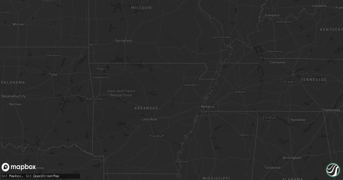
Hail Map in West Virginia on July 28, 2023
Get this storm
July 28 map
$229
one time, instant access
Download today. No call, no setup
Keep the $229
Bought the map and want the full workflow? Apply the entire $229 to a subscription within 7 days. None of it is wasted.
Every map, not just this one
This buys you this map. Subscription and you get every map we run, in the markets you choose from a few cities to whole states to nationwide. Plus real-time alerts the moment a storm fires.
Contact data
Name, contact info, occupancy, even credit band for addresses in the footprint. You go from where it hit to who to call.
Become the source they trust
Unlimited branding weather history reports on demand. You already have the documented answer ready for the property owner, and you are the one who showed up with it.
Property data and RoofTrace estimates
Pull up any address you have got, its value and the exact code rules for that jurisdiction, straight from One Click Code. Then RoofTrace estimates the squares, pitch, and roof value, priced the way you price.
Storm reports in West Virginia
West Virginia
| Date | Description |
|---|---|
| 07/28/20235:10 PM CDT | Several trees and wires blew down near brandywine... Including along cr-21/2 fultz gap road. |
| 07/28/20234:32 PM CDT | Trees blew down along wv-230 shepherdstown pike in the 5300 block. |
| 07/28/20234:27 PM CDT | Tree down along pocahontas trail. |
| 07/28/20234:25 PM CDT | Tree damage was reported in inwood... Including in the 1900 block of cr-51/5 henshaw road. |
| 07/28/20234:22 PM CDT | Large tree limbs down blocking road near intersection of hatchery road and winchester avenue. |
| 07/28/20234:15 PM CDT | Numerous trees blew down in southwestern jefferson county. |
| 07/28/20234:08 PM CDT | Half dollar size hail was reported in inwood. |
| 07/28/20234:06 PM CDT | Multiple trees downed by thunderstorm winds in ronceverte. |
| 07/28/20233:52 PM CDT | County 911 reports a tree down across hackers creek road and on the power lines. |
| 07/28/20233:50 PM CDT | Tree down on point mountain road... State route 15... East of webster springs. |
| 07/28/20233:45 PM CDT | Tree down on bingham road. |
| 07/28/20233:45 PM CDT | At least 10 trees down along with damage to barn and crops. |
| 07/28/20233:44 PM CDT | Tree on the lines and its smoking. |
| 07/28/20233:44 PM CDT | 911 center reports tree down across leatherwood run road... Blocking all access up the valley. |
| 07/28/20233:44 PM CDT | Large tree down across pine grove road. |
| 07/28/20233:40 PM CDT | Power pole to house is down. |
| 07/28/20233:40 PM CDT | Large oak tree blocking school house hollow rd. |
| 07/28/20233:40 PM CDT | Just before epperly rd. Adv tree down in live power lines. No flames or sparks seen. Power is out. Tree is blocking most of rdway. Lines not down. |
| 07/28/20233:39 PM CDT | Two trees down... Power lines down too. |
| 07/28/20233:37 PM CDT | Tree down near northfork fire department. Blocking 1 lane and part of another. Going toward town past fd. No lines down. |
| 07/28/20233:35 PM CDT | Numerous trees and power poles down in bramwell. |
| 07/28/20233:30 PM CDT | Tree and powerlines down on route 52 in coaldale. |
| 07/28/20233:20 PM CDT | County 911 reports tree down... Approx 18 inches in diameter... Along bush run rd in french creek. |
| 07/28/20233:20 PM CDT | Multiple trees down in clarksburg including davisson run road... Tiffany terrace... Arthur avenue... And crooked run road. |
| 07/28/20233:20 PM CDT | Corrects time of previous tstm wnd dmg report from 1 s anawalt. Two trees down... Power lines down too. |
| 07/28/20233:18 PM CDT | Mcdowell county 911 center reported a tree down in the curve around the 800 block of cherokee road in the town of northfork. Time estimated from radar. |
| 07/28/20233:16 PM CDT | Tree down and the tree is smoking. Lines involved. |
| 07/28/20233:15 PM CDT | Corrects time of previous tstm wnd dmg report from 1 ssw coal city. Just before epperly rd. Adv tree down in live power lines. No flames or sparks seen. Power is out. T |
| 07/28/20233:15 PM CDT | Corrects time of previous tstm wnd dmg report from keystone. Tree down near northfork fire department. Blocking 1 lane and part of another. Going toward town past fd. N |
| 07/28/20233:12 PM CDT | The joint 911 center for gilmer and lewis counties sent us a report near jane lew... Wv. There is a tree down blocking one lane of travel on us highway 19 n at the inte |
| 07/28/20233:10 PM CDT | Power pole and lines down in the 100 block of dewey road in the town of slab fork. Report received via raleigh county 911. Time estimated from radar. |
| 07/28/20233:10 PM CDT | Tree down on the power line. Not in the roadway... Its in the alley. No power. |
| 07/28/20233:09 PM CDT | Report came in from mcdowell county 911 center of a tree blocking one lane in the 26400 block of coal heritage road near kimball. Time estimated via radar. |
| 07/28/20233:08 PM CDT | Raleigh county 911 center reports power pole blown over in the 100 block of walker street in the town of sophia. Time estimated via radar. |
| 07/28/20233:07 PM CDT | Power line down live in the roadway. |
| 07/28/20233:05 PM CDT | Corrects time of previous tstm wnd dmg report from 1 ene crab orchard. Tree on the lines and its smoking. |
| 07/28/20233:04 PM CDT | Raleigh county 911 center reported there are live power lines down in the 3100 block of robert c byrd drive near piney avenue. Time estimated from radar. |
| 07/28/20233:00 PM CDT | Trees reported down county wide. |
| 07/28/20232:58 PM CDT | Wires down. |
| 07/28/20232:54 PM CDT | Multiple trees and lines down in the area of toler run rd & dusk camp run rd in sand fork. Lightning also struck a power pole and damaged a transformer. This report cam |
| 07/28/20232:50 PM CDT | Tree down in the roadway. |
| 07/28/20232:45 PM CDT | Multiple trees down mainly north of west union. |
| 07/28/20232:41 PM CDT | Corrects previous non-tstm wnd gst report from 3 ne charleston. Asos station kcrw charleston airport. |
| 07/28/20232:39 PM CDT | Tree down. |
| 07/28/20232:38 PM CDT | Metro 911 reports tree down on indian creek road in bream. |
| 07/28/20232:38 PM CDT | Power lines are down and in the trees. |
| 07/28/20232:36 PM CDT | Tree down. |
| 07/28/20232:36 PM CDT | Tree down. |
| 07/28/20232:35 PM CDT | The joint 911 center for gilmer and lewis counties reported a tree down in the 7600 block of alice road near the town of coxs mills. Time estimated via radar. |
| 07/28/20232:32 PM CDT | Tree down. |
| 07/28/20232:32 PM CDT | Metro 911 relays multiple reports of trees down in kanawha city area of charleston. |
| 07/28/20232:30 PM CDT | Metro 911 relays reports of trees down in the downtown area of charleston. |
| 07/28/20232:30 PM CDT | Metro 911 relays multiple reports of trees down in the south hills area of charleston. |
| 07/28/20232:30 PM CDT | Approx. 7 trees down... Blocking roadway. In rocky mount. One was on a power line. |
| 07/28/20232:30 PM CDT | Tree down. |
| 07/28/20232:30 PM CDT | Approx. 7 trees down... Blocking roadway. |
| 07/28/20232:30 PM CDT | Wires down. |
| 07/28/20232:27 PM CDT | Tree down. |
| 07/28/20232:27 PM CDT | Tree down. |
| 07/28/20232:27 PM CDT | Wires down. |
| 07/28/20232:25 PM CDT | Several trees down with the most concentrated area between harrisville and pleasants county line. |
| 07/28/20232:25 PM CDT | Tree down... Blocking roadway. |
| 07/28/20232:25 PM CDT | Metro 911 report of trees down at phillips street and valley drive. |
| 07/28/20232:25 PM CDT | Metro 911 report of trees down at in the trace fork shopping center. |
| 07/28/20232:24 PM CDT | The emergency manager in boone county sent two pictures of part of a roof and walls blown off of a trailer around the 40 block of peaceful dr in madison. Time estimate |
| 07/28/20232:20 PM CDT | Large tree down across the front porch of a residence. |
| 07/28/20232:20 PM CDT | One tree across the roadway. |
| 07/28/20232:20 PM CDT | Metro 911 reports tree down on blake rd in nitro. |
| 07/28/20232:20 PM CDT | Metro 911 report of trees down at chestnut street and wilson avenue in saint albans. |
| 07/28/20232:16 PM CDT | Tree down at scott teays elementary school. |
| 07/28/20232:15 PM CDT | Tree down. |
| 07/28/20232:15 PM CDT | Received a report from the public of several trees down along route 34 n between teays valley and winfield. Time estimated from radar. |
| 07/28/20232:13 PM CDT | Tree down. |
| 07/28/20232:13 PM CDT | Tree down. |
| 07/28/20232:11 PM CDT | Tree down. |
| 07/28/20232:09 PM CDT | Charleston rd/midway hollow rd. Tree down across both lanes of traffic. |
| 07/28/20232:05 PM CDT | Trees and lines down. |
| 07/28/20232:05 PM CDT | Multiple trees down including horseneck road. |
| 07/28/20232:01 PM CDT | Corrects time of previous tstm wnd dmg report from 7 sse hurricane. Power lines are down and in the trees. |
| 07/28/20232:00 PM CDT | Trees and lines down. |
| 07/28/20231:55 PM CDT | Multiple trees and power lines down from williamstown down to parkersburg. |
| 07/28/20231:50 PM CDT | Trees down. |
| 07/28/20231:42 PM CDT | Corrects time of previous tstm wnd dmg report from 6 nnw harts. Trees and lines down. |
| 07/28/202311:30 AM CDT | Corrects previous non-tstm wnd gst report from 2 wnw beckley. Mesonet station gw2752 beckley |
All States Impacted by Hail Map on July 28, 2023
Cities Impacted by Hail Map on July 28, 2023
- Homestead, FL
- Miami, FL
- Jeffersonville, KY
- Mount Sterling, KY
- Augusta, KY
- Brooksville, KY
- Morehead, KY
- Van Buren, IN
- Marion, IN
- Sharpsburg, KY
- Owingsville, KY
- Bloomingburg, OH
- Marathon, WI
- Jeffersonville, OH
- West Liberty, KY
- Georgetown, OH
- Maysville, KY
- Dover, KY
- Sugar Grove, OH
- Mount Orab, OH
- La Fontaine, IN
- Kokomo, IN
- Ewing, KY
- Flemingsburg, KY
- Hillsboro, KY
- Wallingford, KY
- Hamersville, OH
- Bethel, OH
- Germantown, KY
- Midland, OH
- Blanchester, OH
- Sidney, OH
- Pemberton, OH
- Port Jefferson, OH
- Waynesville, OH
- Oregonia, OH
- Morrow, OH
- Wilmington, OH
- Clarksville, OH
- Cory, IN
- Jackson Center, OH
- Lewistown, OH
- Quincy, OH
- London, OH
- Mount Sterling, OH
- South Solon, OH
- Washington Court House, OH
- Salt Lick, KY
- Goshen, OH
- Loveland, OH
- Cincinnati, OH
- Williamsburg, OH
- Fayetteville, OH
- Batavia, OH
- Gadsden, AL
- Foster, KY
- Rapid City, SD
- Cheyenne, WY
- Fe Warren Afb, WY
- Carr, CO
- Nunn, CO
- Superior, NE
- Nelson, NE
- Hardy, NE
- Ault, CO
- Ruskin, NE
- Saint Paul, MN
- Republic, KS
- Mankato, KS
- Webber, KS
- Sterling, VA
- Ashburn, VA
- Poolesville, MD
- Belleville, KS
- Courtland, KS
- Nickerson, NE
- Hooper, NE
- Fremont, NE
- Arlington, NE
- Hampton, MN
- Hastings, MN
- Valley, NE
- Scandia, KS
- Chapman, NE
- Grand Island, NE
- Phillips, NE
- Aurora, NE
- Bennington, NE
- Elkhorn, NE
- Alden, IA
- Dows, IA
- Galt, IA
- Omaha, NE
- New Auburn, WI
- Bloomer, WI
- Cannon Falls, MN
- Boys Town, NE
- Marquette, NE
- Giltner, NE
- Sutton, NE
- Harvard, NE
- Saronville, NE
- Beloit, KS
- Jewell, KS
- Belgrade, MT
- Bozeman, MT
- Wilsall, MT
- White Sulphur Springs, MT
- Boulder, CO
- Longmont, CO
- Lagrange, WY
- Iowa Falls, IA
- Geneva, NE
- Ong, NE
- Edgar, NE
- Shickley, NE
- Geneva, IA
- Hampton, IA
- Bradford, IA
- Ackley, IA
- Aplington, IA
- Wellsburg, IA
- Holland, IA
- Parkersburg, IA
- Steamboat Rock, IA
- Grundy Center, IA
- Northport, AL
- Sandy Hook, KY
- Butte, MT
- Selma, AL
- Waverly, WV
- Williamstown, WV
- Parkersburg, WV
- Woodland Park, CO
- Ripley, WV
- Hamden, OH
- Burns, WY
- Medford, WI
- Concord, PA
- Doylesburg, PA
- Southside, WV
- Leon, WV
- Haddam, KS
- Little River, AL
- Elbert, CO
- Gay, WV
- Foreston, MN
- Milaca, MN
- Scandinavia, WI
- Iola, WI
- Amherst Junction, WI
- Prescott, AZ
- Foley, MN
- Pierz, MN
- Rice, MN
- Royalton, MN
- Waynesboro, MS
- Winchester, VA
- Clear Brook, VA
- Tuscaloosa, AL
- Duncanville, AL
- Greenwood, WI
- Loyal, WI
- Vermillion, MN
- Cleveland, GA
- Thomasville, AL
- Mapleton Depot, PA
- Seligman, AZ
- Ogdensburg, WI
- Nelsonville, WI
- Winfield, AL
- Wirtz, VA
- Boones Mill, VA
- Stevens Point, WI
- Custer, WI
- Manawa, WI
- Jamestown, KS
- Norway, KS
- Sweet Water, AL
- Elkfork, KY
- Glen Elder, KS
- Camden, AL
- Pine Apple, AL
- Little Hocking, OH
- Coolville, OH
- Cutler, OH
- Quitman, MS
- Adamsville, AL
- Hurricane, WV
- Scott Depot, WV
- Bunker Hill, WV
- Kearneysville, WV
- Inwood, WV
- Hillsdale, WY
- Sautee Nacoochee, GA
- Ferrum, VA
- Henry, VA
- Flat Rock, MI
- Kiowa, CO
- Henderson, NE
- Martha, KY
- Jackson, AL
- Saint Paul Park, MN
- Minneapolis, MN
- Burnsville, MN
- Farmington, MN
- Cottage Grove, MN
- Inver Grove Heights, MN
- Rosemount, MN
- New Straitsville, OH
- Junction City, OH
- Logan, OH
- Alderson, WV
- Summersville, WV
- Great Falls, VA
- Potomac, MD
- Germantown, MD
- Leesburg, VA
- Herndon, VA
- Isonville, KY
- Cairo, WV
- Cottondale, AL
- Biglerville, PA
- Gettysburg, PA
- Aspers, PA
- Campton, KY
- Beattyville, KY
- Big Springs, WV
- Big Bend, WV
- Purlear, NC
- West Jefferson, NC
- Millers Creek, NC
- Sunburg, MN
- Murray City, OH
- Glouster, OH
- Milton, WV
- Ona, WV
- Vienna, WV
- Marietta, OH
- Belpre, OH
- Memphis, MI
- Allenton, MI
- Winslow, NE
- Shippensburg, PA
- Waynesboro, PA
- Chambersburg, PA
- Fayetteville, PA
- Jachin, AL
- Ward, AL
- Keaton, KY
- Flatgap, KY
- Rockhill Furnace, PA
- Shirleysburg, PA
- Orbisonia, PA
- Shenandoah Junction, WV
- Shepherdstown, WV
- Harpers Ferry, WV
- Petroleum, WV
- Agenda, KS
- Gainesville, GA
- Murrayville, GA
- Malta, OH
- Saint Marys, WV
- Newport, OH
- Oak, NE
- Williamsburg, PA
- Dawsonville, GA
- Cotopaxi, CO
- Jackson, KY
- Pine Ridge, KY
- Rogers, KY
- Ranson, WV
- Charles Town, WV
- Washington, VA
- Bentonville, VA
- Ponderosa, NM
- Attalla, AL
- Fleming, OH
- Waterford, OH
- White Post, VA
- Boyce, VA
- Hayden, AL
- Cleveland, AL
- Whitehall, MT
- Central City, CO
- Black Hawk, CO
- Northfork, WV
- Switchback, WV
- Elkhorn, WV
- Glen Fork, WV
- Ravencliff, WV
- Harrisville, WV
- Berea, WV
- Auburn, WV
- Pounding Mill, VA
- Nederland, CO
- Mount Nebo, WV
- Tryon, NC
- Easley, SC
- Pickens, SC
- Vincent, OH
- Burr Oak, KS
- Concordia, KS
- Dickerson, MD
- Barnesville, MD
- Ijamsville, MD
- Damascus, MD
- Clarksburg, MD
- Mount Airy, MD
- Monrovia, MD
- Beallsville, MD
- Boyds, MD
- Wellston, OH
- Stockport, OH
- Helen, GA
- Golden, CO
- Rollinsville, CO
- Clanton, AL
- Jemison, AL
- New Milton, WV
- Troy, WV
- Coxs Mills, WV
- Jefferson, NC
- Woodville, VA
- Castleton, VA
- Clermont, GA
- Ames, NE
- New Baltimore, MI
- Macomb, MI
- McIntosh, AL
- Tibbie, AL
- Gainestown, AL
- Hico, WV
- Newland, NC
- Pennock, MN
- Murdock, MN
- Amherst, WI
- Oak Park, MN
- Waverly, IA
- Tripoli, IA
- Readlyn, IA
- Denver, IA
- Fennimore, WI
- Stitzer, WI
- Stetsonville, WI
- Athens, WI
- Livingston, WI
- Platteville, WI
- Belmont, WI
- Rewey, WI
- Mineral Point, WI
- Strang, NE
- Bruning, NE
- Carleton, NE
- Davenport, NE
- Simpson, KS
- Glasco, KS
- Barnard, KS
- Lincoln, NE
- Darlington, WI
- Roca, NE
- Arcadia, WI
- Cochrane, WI
- Fountain City, WI
- Bennet, NE
- Panama, NE
- Hickman, NE
- Douglas, NE
- Adams, NE
- Palmyra, NE
- Dodge, WI
- Trempealeau, WI
- Galesville, WI
- Ettrick, WI
- Lincoln, KS
- Holmen, WI
- Onalaska, WI
- Warrenville, IL
- Naperville, IL
- West Salem, WI
- Wheaton, IL
- Mindoro, WI
- Winfield, IL
- Carol Stream, IL
- West Chicago, IL
- Hazel Green, WI
- Dubuque, IA
- Gladbrook, IA
- Reinbeck, IA
- La Crosse, WI
- Bangor, WI
- Morrison, IA
- Rockland, WI
- Cashton, WI
- Sparta, WI
- Glendale Heights, IL
- Glen Ellyn, IL
- Riley, KS
- Manhattan, KS
- Leonardville, KS
- Ogden, KS
- Junction City, KS
- Fort Riley, KS
- Saint George, KS
- Paradise, KS
- Natoma, KS
- Waldo, KS
- Mountain, WI
- Mukwonago, WI
- East Troy, WI
- Suring, WI
- Alburnett, IA
- Marion, IA
- Shellsburg, IA
- Hiawatha, IA
- Robins, IA
- Center Point, IA
- Palo, IA
- Cedar Rapids, IA
- Vinton, IA
- Urbana, IA
- Toddville, IA
- Walker, IA
- Coggon, IA
- Prairieburg, IA
- La Porte City, IA
- Independence, IA
- Monticello, IA
- Quasqueton, IA
- Anamosa, IA
- Fairfax, IA
- Atkins, IA
- Jesup, IA
- Rowley, IA
- Mount Auburn, IA
- Dunkerton, IA
- Fairbank, IA
- Ryan, IA
- Masonville, IA
- Brandon, IA
- Springville, IA
- Central City, IA
- Waterloo, IA
- Winthrop, IA
- Epworth, IA
- Delhi, IA
- Peosta, IA
- Worthington, IA
- Durango, IA
- Manchester, IA
- Dyersville, IA
- Cascade, IA
- Earlville, IA
- Langworthy, IA
- Farley, IA
- Hopkinton, IA
- Bernard, IA
- Delaware, IA
- Waterford, WI
- Zwingle, IA
- East Dubuque, IL
- La Motte, IA
- Gillett, WI
- Lena, WI
- Toledo, IA
- Tama, IA
- Oconto Falls, WI
- Burlington, WI
- Union, IA
- Conrad, IA
- Eldora, IA
- Whitten, IA
- Edgar, WI
- Clemons, IA
- Marshalltown, IA
- State Center, IA
- Albion, IA
- Liscomb, IA
- Beaman, IA
- New Providence, IA
- Haverhill, IA
- Laurel, IA
- Melbourne, IA
- Garwin, IA
- Ferguson, IA
- Gilman, IA
- Montour, IA
- Le Grand, IA
- Westby, WI
- La Farge, WI
- Hillsboro, WI
- Ontario, WI
- Osborne, KS
- Elroy, WI
- Mauston, WI
- Lyndon Station, WI
- Wamego, KS
- Tecumseh, NE
- Cook, NE
- Burr, NE
- Sterling, NE
- Tipton, KS
- La Valle, WI
- Reedsburg, WI
- Wakeeney, KS
- Bellevue, IA
- Onslow, IA
- Baldwin, IA
- Center Junction, IA
- Oxford Junction, IA
- Olin, IA
- Ely, IA
- Maquoketa, IA
- Martelle, IA
- Mount Vernon, IA
- Lisbon, IA
- Morley, IA
- Wyoming, IA
- Monmouth, IA
- Stanwood, IA
- Mechanicsville, IA
- Iowa City, IA
- Lost Nation, IA
- Clarence, IA
- North Liberty, IA
- Swisher, IA
- West Branch, IA
- Tipton, IA
- Solon, IA
- Grand Mound, IA
- Durant, IA
- New Liberty, IA
- Delmar, IA
- Lowden, IA
- West Liberty, IA
- Bennett, IA
- Dixon, IA
- Atalissa, IA
- Calamus, IA
- Moscow, IA
- Muscatine, IA
- Wheatland, IA
- Wilton, IA
- Stockton, IA
- Camp Douglas, WI
- Warrens, WI
- Tomah, WI
- Kendall, WI
- Hustler, WI
- New Lisbon, WI
- Necedah, WI
- Nekoosa, WI
- Adams, WI
- Arkdale, WI
- Friendship, WI
- Hancock, WI
- Coloma, WI
- Wilton, WI
- Wonewoc, WI
- North Freedom, WI
- Grand Marsh, WI
- Baraboo, WI
- Westfield, WI
- Rock Springs, WI
- Oxford, WI
- Wisconsin Dells, WI
- Redgranite, WI
- Wautoma, WI
- Endeavor, WI
- Montello, WI
- Briggsville, WI
- Bancroft, WI
- Neshkoro, WI
- Wild Rose, WI
- Plainfield, WI
- Almond, WI
- Pine River, WI
- Plain, WI
- Cazenovia, WI
- Packwaukee, WI
- Hillpoint, WI
- Loganville, WI
- Portage, WI
- Prairie Du Sac, WI
- Spring Green, WI
- Sauk City, WI
- Preston, IA
- Spragueville, IA
- Taylor Ridge, IL
- Andalusia, IL
- Welton, IA
- Moline, IL
- Davenport, IA
- Milan, IL
- De Witt, IA
- Blue Grass, IA
- Eldridge, IA
- Montpelier, IA
- Rock Island, IL
- Walcott, IA
- Buffalo, IA
- Coal Valley, IL
- Long Grove, IA
- Donahue, IA
- Pleasant Valley, IA
- Charlotte, IA
- Bryant, IA
- Low Moor, IA
- Goose Lake, IA
- Sabula, IA
- Camanche, IA
- Teeds Grove, IA
- Bettendorf, IA
- East Moline, IL
- Le Claire, IA
- Miles, IA
- McCausland, IA
- Princeton, IA
- Clinton, IA
- Gratiot, WI
- Elizabeth, IL
- Galena, IL
- Benton, WI
- Cuba City, WI
- Scales Mound, IL
- Hanover, IL
- Apple River, IL
- Shullsburg, WI
- Stockton, IL
- Warren, IL
- Lena, IL
- Nora, IL
- Kent, IL
- Winslow, IL
- Pearl City, IL
- South Wayne, WI
- Browntown, WI
- McConnell, IL
- Shannon, IL
- Freeport, IL
- Orangeville, IL
- Monroe, WI
- Davis, IL
- Dakota, IL
- Rock City, IL
- Cedarville, IL
- Baileyville, IL
- Ridott, IL
- Forreston, IL
- Mount Morris, IL
- Pecatonica, IL
- German Valley, IL
- Leaf River, IL
- Winnebago, IL
- Byron, IL
- Durand, IL
- Rockford, IL
- Dalton, WI
- Merrimac, WI
- Cambria, WI
- Pardeeville, WI
- Poynette, WI
- Wyocena, WI
- Rio, WI
- Lime Ridge, WI
- Lone Rock, WI
- Richland Center, WI
- Avoca, WI
- Mazomanie, WI
- Dodgeville, WI
- Arena, WI
- Lodi, WI
- Markesan, WI
- Randolph, WI
- Friesland, WI
- Fall River, WI
- Doylestown, WI
- Ridgeway, WI
- Waunakee, WI
- Dane, WI
- Deforest, WI
- Black Earth, WI
- Barneveld, WI
- Columbus, WI
- Cross Plains, WI
- Madison, WI
- Mount Horeb, WI
- Blue Mounds, WI
- Highland, WI
- Arlington, WI
- Middleton, WI
- Morrisonville, WI
- Verona, WI
- Carbon Cliff, IL
- Colona, IL
- Silvis, IL
- Orion, IL
- Cordova, IL
- Port Byron, IL
- Rapids City, IL
- Hampton, IL
- Osco, IL
- Fulton, IL
- Cambridge, IL
- Albany, IL
- Geneseo, IL
- Hillsdale, IL
- Erie, IL
- Thomson, IL
- Mount Carroll, IL
- Lyndon, IL
- Savanna, IL
- Rock Falls, IL
- Morrison, IL
- Prophetstown, IL
- Sterling, IL
- Chadwick, IL
- Atkinson, IL
- Tampico, IL
- Fenton, IL
- Dixon, IL
- Beaver Dam, WI
- Fox Lake, WI
- Kingston, WI
- Juneau, WI
- Linden, WI
- Holton, KS
- Netawaka, KS
- Wetmore, KS
- Whiting, KS
- Muscotah, KS
- Powhattan, KS
- Horton, KS
- Hiawatha, KS
- Everest, KS
- Fairview, KS
- Windsor, WI
- Hollandale, WI
- Sun Prairie, WI
- Marshall, WI
- Oregon, WI
- Belleville, WI
- New Glarus, WI
- Reeseville, WI
- Cottage Grove, WI
- Deerfield, WI
- Blanchardville, WI
- Mcfarland, WI
- Stoughton, WI
- Waterloo, WI
- Albany, WI
- Brooklyn, WI
- Lowell, WI
- Watertown, WI
- Evansville, WI
- Cambridge, WI
- Johnson Creek, WI
- Lake Mills, WI
- Sheffield, IL
- Deer Grove, IL
- Harmon, IL
- Annawan, IL
- Hooppole, IL
- Walnut, IL
- Mineral, IL
- Milledgeville, IL
- Tucson, AZ
- Albion, IN
- Ligonier, IN
- Cope, CO
- Joes, CO
- Akron, CO
- Yuma, CO
- Edgerton, WI
- Fort Atkinson, WI
- Jefferson, WI
- Marengo, IL
- Garden Prairie, IL
- Belvidere, IL
- Genoa, IL
- Huntley, IL
- Elgin, IL
- Algonquin, IL
- Hampshire, IL
- Gilberts, IL
- Lake In The Hills, IL
- Carpentersville, IL
- Union, IL
- Dundee, IL
- Oskaloosa, IA
- Eddyville, IA
- Bussey, IA
- Ottumwa, IA
- Chillicothe, IA
- Kirkville, IA
- Minooka, IL
- Morris, IL
- Shorewood, IL
- Channahon, IL
- Elwood, IL
- Joliet, IL
- Wilmington, IL
- Helenville, WI
- Whitewater, WI
- Elkhorn, WI
- Palmyra, WI
- Eagle, WI
- Sullivan, WI
- Dousman, WI
- Rochester, WI
- Kansasville, WI
- Union Grove, WI
- Franksville, WI
- Hales Corners, WI
- Waukesha, WI
- Muskego, WI
- New Berlin, WI
- Oconomowoc, WI
- North Prairie, WI
- Franklin, WI
- Big Bend, WI
- Knoxville, IA
- Tracy, IA
- Harvey, IA
- Agency, IA
- Quinter, KS
- Park, KS
- Gove, KS
- Oakley, KS
- Montpelier, IN
- Keystone, IN
- Hartford City, IN
- Kinsman, IL
- Verona, IL
- Seneca, IL
- Mazon, IL
- Dwight, IL
- Gardner, IL
- Ransom, IL
- Winona, KS
- Gillette, WY
- Weston, WY
- Moorcroft, WY
- Devils Tower, WY
- Hot Springs, SD
- Edgemont, SD
- Custer, SD
- Merrill, WI
- Lee, IL
- Tomahawk, WI
- Roberts, MT
- Red Lodge, MT
- Dekalb, IL
- Rolling Prairie, IN
- La Porte, IN
- Cherry Valley, IL
- Monroe Center, IL
- Harrison, NE
- Hixton, WI
- Taylor, WI
- Westminster, MD
- Fredericksburg, IA
- Sumner, IA
- Clutier, IA
- Cartersville, GA
- Hudson, IA
- Buckingham, IA
- Wilber, NE
- Hallam, NE
- Black River Falls, WI
- Sheffield, IA
- Kirkland, AZ
- Etna Green, IN
- Warsaw, IN
- Garrison, IA
- Dysart, IA
- Clarkston, GA
- Atlanta, GA
- Decatur, GA
- Scottdale, GA
- Stone Mountain, GA
- Tucker, GA
- Beverly Shores, IN
- Chesterton, IN
- Michigan City, IN
- Hubbard, IA
- Ogema, WI
- Westboro, WI
- Monkton, MD
- White Hall, MD
- Sparks Glencoe, MD
- Parkton, MD
- Alma, WI
- Cedar Falls, IA
- Syracuse, IN
- Randolph, KS
- Olsburg, KS
- Watkins, IA
- Blairstown, IA
- Holtwood, PA
- Airville, PA
- Madison, AL
- Downers Grove, IL
- Clarendon Hills, IL
- Westmont, IL
- Oak Brook, IL
- Prospect Heights, IL
- Arlington Heights, IL
- Palatine, IL
- Mount Prospect, IL
- Rolling Meadows, IL
- Kingsford Heights, IN
- Hamlet, IN
- Walkerton, IN
- Union Mills, IN
- Townsend, WI
- White Lake, WI
- Wanatah, IN
- Otter Lake, MI
- Columbiaville, MI
- Melrose, WI
- Ohiowa, NE
- Milligan, NE
- Crown King, AZ
- Osseo, WI
- Strum, WI
- Traer, IA
- Hawkeye, IA
- Rochester, IN
- Macy, IN
- Roscoe, MT
- Millersburg, IN
- Topeka, IN
- Rixeyville, VA
- Loves Park, IL
- Roselle, IL
- Waukegan, IL
- Zion, IL
- Martinsdale, MT
- Elburn, IL
- Meservey, IA
- Belmond, IA
- Goodell, IA
- Sherrill, IA
- Potosi, WI
- Dunlap, IA
- Moorhead, IA
- Woodbine, IA
- Monroeville, IN
- Hoagland, IN
- Saginaw, MI
- Berne, IN
- Saint Charles, IL
- Geneva, IL
- Wayne, IL
- Bartlett, IL
- Kirkland, IL
- Esmond, IL
- Lindenwood, IL
- Clay Center, KS
- North Webster, IN
- Cromwell, IN
- Kimmell, IN
- Larwill, IN
- Pierceton, IN
- Columbia City, IN
- Poplar Grove, IL
- Portsmouth, IA
- Wabash, IN
- Peru, IN
- New Hampton, IA
- Newton, IA
- Logan, IA
- Persia, IA
- Shelby, IA
- Janesville, IA
- Shell Rock, IA
- Drummond, MT
- Gold Creek, MT
- Helmville, MT
- Hazleton, IA
- Church Hill, TN
- Pima, AZ
- Vassar, MI
- Marion, WI
- Virginia, NE
- Beatrice, NE
- Blue Springs, NE
- Mount Lemmon, AZ
- Colfax, WI
- South Amana, IA
- Homestead, IA
- Mayville, MI
- Caro, MI
- Knox, IN
- Kewanna, IN
- Windsor Mill, MD
- Davey, NE
- Argos, IN
- Leesburg, IN
- Milford, IN
- West Union, IA
- Milwaukee, WI
- Saint Francis, WI
- Cudahy, WI
- Keystone, IA
- Pylesville, MD
- Street, MD
- New Park, PA
- Jarrettsville, MD
- Stewartstown, PA
- Frankenmuth, MI
- Culver, IN
- Grovertown, IN
- Clatonia, NE
- Hebron, NE
- Belvidere, NE
- Alexandria, NE
- Deer Trail, CO
- Van Horne, IA
- Rosholt, WI
- Hoffman Estates, IL
- Barrington, IL
- Victor, IA
- Brooklyn, IA
- Filley, NE
- Pickrell, NE
- Vail, AZ
- Boscobel, WI
- Harvard, IL
- Capron, IL
- Goshen, IN
- Jackson, MS
- Martell, NE
- Ladysmith, WI
- Libertyville, IL
- Gurnee, IL
- Lake Zurich, IL
- Vernon Hills, IL
- Mundelein, IL
- Amissville, VA
- Wood Dale, IL
- Itasca, IL
- Lombard, IL
- Bloomingdale, IL
- Medinah, IL
- Elk Grove Village, IL
- Addison, IL
- Tippecanoe, IN
- New Oxford, PA
- York Springs, PA
- Norwalk, WI
- Sykesville, MD
- Stockholm, WI
- Nelson, WI
- Wabasha, MN
- Reads Landing, MN
- Kellogg, MN
- Coon Valley, WI
- Pepin, WI
- Lake City, MN
- Clinton, WI
- South Beloit, IL
- Beloit, WI
- Withee, WI
- Rockford, IA
- Rockwell, IA
- Elberon, IA
- Belle Plaine, IA
- Vining, IA
- Chelsea, IA
- Marengo, IA
- Bourbon, IN
- Sabetha, KS
- Liberty, NE
- Lewiston, NE
- Burchard, NE
- Albin, WY
- Rhodes, IA
- Lookout, WV
- Bay City, MI
- Reese, MI
- Munger, MI
- Denver, IN
- South Elgin, IL
- Hanover Park, IL
- Rudd, IA
- Westmoreland, KS
- Bowdon, GA
- Graham, AL
- Rutherfordton, NC
- Columbus, NC
- Mill Spring, NC
- Grinnell, IA
- Malcom, IA
- Latimer, IA
- Coulter, IA
- Somerset, WI
- Hudson, WI
- Sylvan Grove, KS
- Hunter, KS
- Exeter, NE
- Woodbine, MD
- Gaithersburg, MD
- Reston, VA
- Wiggins, CO
- Oak Creek, WI
- Caledonia, WI
- Greendale, WI
- South Milwaukee, WI
- Alpharetta, GA
- Pine Bluffs, WY
- Mason City, IA
- Nappanee, IN
- Rockville, MD
- Firth, NE
- Randolph, MN
- Hanna, IN
- Corunna, IN
- Kendallville, IN
- Swaledale, IA
- Clear Lake, IA
- Mount Hope, WI
- Lancaster, WI
- Nora Springs, IA
- Twelve Mile, IN
- Clay Center, NE
- Grafton, NE
- Elrod, AL
- Middlebury, IN
- North Branch, MI
- Attica, MI
- Fostoria, MI
- Lapeer, MI
- Warren, IN
- Lineville, AL
- Hanover, PA
- Glenwood, WV
- Noxapater, MS
- Philadelphia, MS
- Skull Valley, AZ
- Monterey, IN
- Plymouth, IN
- Ora, IN
- North Judson, IN
- Benson, AZ
- Baltimore, MD
- Wausau, WI
- Brokaw, WI
- Axtell, KS
- New Hartford, IA
- New Richmond, WI
- Lucas, KS
- Hayden, AZ
- Kearny, AZ
- Woodstock, GA
- Brookfield, WI
- Orrtanna, PA
- East Berlin, PA
- Madison, VA
- Sperryville, VA
- Kellogg, IA
- Bolton, MS
- Dewar, IA
- Evansdale, IA
- Mayetta, KS
- Norway, IA
- Newhall, IA
- Elgin, IA
- Quarryville, PA
- Drumore, PA
- New Providence, PA
- Armstrong, IL
- New Windsor, MD
- Union Bridge, MD
- Brush, CO
- Bowersville, GA
- Akron, IN
- Kingston, IL
- Reisterstown, MD
- Upperco, MD
- Centerville, PA
- Titusville, PA
- Saint David, AZ
- Potomac, IL
- Rossville, IL
- Henning, IL
- Woodstock, IL
- Wonder Lake, IL
- Batavia, IL
- Deerfield, IL
- Northbrook, IL
- Highland Park, IL
- Sturtevant, WI
- Kenosha, WI
- Millington, MI
- Decorah, IA
- Cary, IL
- Wauconda, IL
- Lucerne, IN
- Dougherty, IA
- Marble Rock, IA
- Charles City, IA
- Torrington, WY
- Floyd, IA
- Wadley, AL
- Davis Junction, IL
- Dover, PA
- Thomasville, PA
- Fort Jennings, OH
- Cloverdale, OH
- Columbus Grove, OH
- Bailey, MS
- De Kalb, MS
- Landrum, SC
- Felton, PA
- Finksburg, MD
- Fallston, MD
- Fawn Grove, PA
- Phoenix, MD
- Hampstead, MD
- Emmett, KS
- Brogue, PA
- Red Lion, PA
- Jeffersonton, VA
- Warrenton, VA
- Cooksville, MD
- Triangle, VA
- Johnstown, CO
- Baxter, IA
- Alexander, IA
- Rowan, IA
- Clifton, KS
- Radcliffe, IA
- Decatur, IN
- Craigville, IN
- Lisle, IL
- Wasco, IL
- Edgewater, MD
- Luray, KS
- Rockton, IL
- Morrowville, KS
- Linn, KS
- Kingsville, MD
- White Marsh, MD
- Perry Hall, MD
- Delavan, WI
- Clermont, IA
- Burlington, IL
- Maple Park, IL
- Sycamore, IL
- Crystal Lake, IL
- Muscoda, WI
- Cortland, NE
- Oxford, IA
- Gordo, AL
- New Paris, IN
- Winamac, IN
- Shabbona, IL
- Hinckley, IL
- Clare, IL
- Malta, IL
- Waterman, IL
- Rochelle, IL
- Mentone, IN
- Smithwick, SD
- Oelrichs, SD
- Sundance, WY
- Walton, IN
- Miami, IN
- Bunker Hill, IN
- Galveston, IN
- Grissom Arb, IN
- Converse, IN
- Amboy, IN
- Swayzee, IN
- Greentown, IN
- Pine Ridge, SD
- Butler, IN
- Leo, IN
- Auburn, IN
- Grabill, IN
- Saint Joe, IN
- Spencerville, IN
- Garrett, IN
- Hicksville, OH
- Sherwood, OH
- Edgerton, OH
- Mark Center, OH
- Ney, OH
- Stryker, OH
- Defiance, OH
- Evansport, OH
- Bryan, OH
- Napoleon, OH
- Wauseon, OH
- Liberty Center, OH
- Ridgeville Corners, OH
- Archbold, OH
- Harlan, IN
- Cecil, OH
- Antwerp, OH
- Holgate, OH
- Huntertown, IN
- Malinta, OH
- McClure, OH
- Weston, OH
- Grelton, OH
- Grand Rapids, OH
- Portland, IN
- Pennville, IN
- Bryant, IN
- Monroe, IN
- Geneva, IN
- Bluffton, IN
- Willshire, OH
- Spencerville, OH
- Mendon, OH
- Ohio City, OH
- Coldwater, OH
- Fort Recovery, OH
- Celina, OH
- Rockford, OH
- Saint Marys, OH
- Salamonia, IN
- Ridgeville, IN
- New Bremen, OH
- Montezuma, OH
- Saint Henry, OH
- Maria Stein, OH
- Chickasaw, OH
- Minster, OH
- New Weston, OH
- Burkettsville, OH
- Union City, OH
- Rossburg, OH
- Union City, IN
- Petroleum, IN
- Redkey, IN
- Dunkirk, IN
- Dunning, NE
- Arnold, NE
- Stapleton, NE
- Purdum, NE
- Thedford, NE
- Halsey, NE
- Brewster, NE
- Taylor, NE
- Anselmo, NE
- Burwell, NE
- Sargent, NE
- Merna, NE
- Comstock, NE
- Broken Bow, NE
- Elyria, NE
- Ord, NE
- Greeley, NE
- North Loup, NE
- Scotia, NE
- Ashton, NE
- Miller, NE
- Lexington, NE
- Oconto, NE
- Westerville, NE
- Callaway, NE
- Litchfield, NE
- Ansley, NE
- Cozad, NE
- Overton, NE
- Sumner, NE
- Mason City, NE
- Eddyville, NE
- Brady, NE
- Arcadia, NE
- Loup City, NE
- Gothenburg, NE
- Seneca, NE
- Sherrard, IL
- Millersburg, OH
- Chadron, NE
- Hay Springs, NE
- Coshocton, OH
- Kimbolton, OH
- Newcomerstown, OH
- Parnell, IA
- North English, IA
- Ludlow, IL
- Rankin, IL
- Elliott, IL
- Melvin, IL
- Gibson City, IL
- Loda, IL
- Paxton, IL
- Chariton, IA
- Stonington, IL
- Taylorville, IL
- Glendo, WY
- Jay Em, WY
- Hill City, KS
- Denver, MO
- Worth, MO
- Fremont, IA
- Dewey, IL
- Rantoul, IL
- Johnstown, NE
- Danville, IL
- Valentine, NE
- Avilla, IN
- South Haven, MI
- Winnett, MT
- Macomb, IL
- Gotham, WI
- Pioneer, OH
- Montpelier, OH
- Edon, OH
- Upland, IN
- Baroda, MI
- Alvordton, OH
- Waterloo, IN
- Hamilton, IN
- Camden, MI
- Elkhart, IN
- Albia, IA
- Lovilia, IA
- West Unity, OH
- Morenci, MI
- Fayette, OH
- Lovington, IL
- Elm Grove, WI
- Thorntown, IN
- Park Ridge, IL
- Des Plaines, IL
- Streamwood, IL
- Bridger, MT
- Cortland, IL
- Somonauk, IL
- Steward, IL
- Conesville, OH
- Dresden, OH
- Bird City, KS
- Kouts, IN
- Valparaiso, IN
- Bingham, NE
- Ashby, NE
- Ellsworth, NE
- Lemont, IL
- Willowbrook, IL
- Ashland, OH
- Perrysville, OH
- Schaumburg, IL
- Fithian, IL
- Ogden, IL
- Rexford, KS
- Colby, KS
- Bassett, NE
- Canton, IL
- Laotto, IN
- Herndon, KS
- West Lafayette, IN
- Lafayette, IN
- Martin, SD
- Wanblee, SD
- Collyer, KS
- Blue River, WI
- Norwich, OH
- Zanesville, OH
- Adamsville, OH
- Fostoria, OH
- Bensenville, IL
- Monument, KS
- Yarmouth, IA
- Morning Sun, IA
- Liberty Center, IN
- Dalton City, IL
- Argenta, IL
- Leighton, IA
- Cedar, IA
- South Bend, IN
- North Liberty, IN
- Lusk, WY
- Lakeville, IN
- Shelby, OH
- Crestline, OH
- Galion, OH
- Mansfield, OH
- Plano, IA
- Mystic, IA
- Huntington, IN
- Williamsburg, IA
- La Place, IL
- Hammond, IL
- Earl Park, IN
- Farmersburg, IA
- Garnavillo, IA
- Lagro, IN
- Pella, IA
- Brook, IN
- Kentland, IN
- Goodland, IN
- Stephenson, VA
- Sand Creek, MI
- Jasper, MI
- Amboy, IL
- Franklin Grove, IL
- West Brooklyn, IL
- Westpoint, IN
- Roann, IN
- Waldron, MI
- Sugarcreek, OH
- Loudonville, OH
- Lucas, OH
- New Carlisle, IN
- Galien, MI
- Hudson, MI
- New Richmond, IN
- Romney, IN
- Denton, KS
- Monroe, IA
- Otley, IA
- Urbana, IL
- Oakwood, IL
- Muncie, IL
- Saint Joseph, IL
- Swanton, OH
- Delta, OH
- Colfax, IN
- Darlington, IN
- Willard, OH
- Eau Claire, MI
- San Jose, IL
- Emden, IL
- Linkwood, MD
- Cambridge, MD
- Tuscola, IL
- Denton, MD
- Harrington, DE
- Montgomery, MI
- Bainbridge, IN
- Roachdale, IN
- Downing, MO
- Lancaster, MO
- Gordon, NE
- Westville, IN
- Mayer, AZ
- Manteno, IL
- Mishawaka, IN
- Fort Wayne, IN
- Schererville, IN
- Dyer, IN
- Saint John, IN
- New Virginia, IA
- New Buffalo, MI
- Mill Creek, IN
- Rome City, IN
- Atwood, IN
- Winona Lake, IN
- Churubusco, IN
- Burket, IN
- Wawaka, IN
- Claypool, IN
- Ainsworth, IA
- Crawfordsville, IA
- Washington, IA
- Mchenry, IL
- Sheldon, IL
- Bloomfield, IA
- Cantril, IA
- Milton, IA
- Pulaski, IA
- Wellman, IA
- South English, IA
- Ladora, IA
- Willow Springs, IL
- Bismarck, IL
- State Line, IN
- Alvin, IL
- West Lebanon, IN
- Covington, IN
- Williamsport, IN
- Vona, CO
- Crawfordsville, IN
- Ladoga, IN
- Whitehouse, OH
- Maumee, OH
- Waterville, OH
- Monclova, OH
- Stockton, MO
- Humansville, MO
- Berrien Springs, MI
- Saint Joseph, MI
- Wakarusa, IN
- Bremen, IN
- Saint Francis, KS
- Brookfield, IL
- Riverside, IL
- Moravia, IA
- Palco, KS
- Lanark, IL
- Luray, MO
- Keosauqua, IA
- Mount Sterling, IA
- Arbela, MO
- Hamilton, IA
- Greencastle, IN
- Brazil, IN
- Cornville, AZ
- Godfrey, IL
- Sciota, IL
- Blandinsville, IL
- Ellis, KS
- Deep River, IA
- Millersburg, IA
- Keota, IA
- Guernsey, IA
- Church Creek, MD
- Collison, IL
- Poneto, IN
- Holmesville, OH
- Sugar Grove, IL
- Montgomery, IL
- Plainfield, IL
- Bolingbrook, IL
- Oswego, IL
- Romeoville, IL
- Bristol, IL
- Aurora, IL
- Oral, SD
- Sussex, WI
- Pewaukee, WI
- Wheeling, IL
- Ainsworth, NE
- Prairie City, IA
- Runnells, IA
- Compton, IL
- La Harpe, IL
- Dallas City, IL
- Winkelman, AZ
- Cincinnati, IA
- Exline, IA
- Centerville, IA
- Lebanon, IN
- Cissna Park, IL
- Gas City, IN
- Hartsburg, IL
- Healy, KS
- Viola, WI
- Amelia, NE
- Wood Lake, NE
- Lynnville, IA
- Killduff, IA
- Sully, IA
- Paw Paw, MI
- Lawton, MI
- Mediapolis, IA
- East New Market, MD
- Rhodesdale, MD
- Vienna, MD
- Truro, IA
- Hazard, NE
- Amherst, NE
- Pleasanton, NE
- Wolbach, NE
- Elba, NE
- Ravenna, NE
- Farwell, NE
- Rockville, NE
- Saint Paul, NE
- Riverdale, NE
- Odessa, NE
- Elm Creek, NE
- Kearney, NE
- Gibbon, NE
- Dannebrog, NE
- Boelus, NE
- Cairo, NE
- Wilcox, NE
- Funk, NE
- Holdrege, NE
- Loomis, NE
- Shelton, NE
- Axtell, NE
- Bertrand, NE
- Minden, NE
- Alma, NE
- Saint Libory, NE
- Heartwell, NE
- Palmer, NE
- Wood River, NE
- Alda, NE
- Doniphan, NE
- Hildreth, NE
- Kenesaw, NE
- Fullerton, NE
- Archer, NE
- Clarks, NE
- Central City, NE
- Juniata, NE
- Holstein, NE
- Republican City, NE
- Hastings, NE
- Trumbull, NE
- Campbell, NE
- Upland, NE
- Ayr, NE
- Glenvil, NE
- Bladen, NE
- Roseland, NE
- Naponee, NE
- Franklin, NE
- Riverton, NE
- Bloomington, NE
- Red Cloud, NE
- Inavale, NE
- Blue Hill, NE
- Orleans, NE
- Atlanta, NE
- Inland, NE
- Hampton, NE
- Bradshaw, NE
- Stromsburg, NE
- Guide Rock, NE
- Hordville, NE
- Lawrence, NE
- Polk, NE
- Fairfield, NE
- Deweese, NE
- Benedict, NE
- York, NE
- Tiffin, OH
- Rib Lake, WI
- Bluford, IL
- Opdyke, IL
- Hinsdale, IL
- Maxwell, NE
- Clay City, IN
- Centerpoint, IN
- Demorest, GA
- Bucyrus, OH
- Alton, IL
- Bethalto, IL
- Whitehall, WI
- Jim Falls, WI
- Cornell, WI
- Oakdale, IL
- Darien, IL
- Woodridge, IL
- Sandusky, OH
- Donovan, IL
- Exeland, WI
- Waucoma, IA
- Granton, WI
- Neillsville, WI
- Wharton, OH
- Fairchild, WI
- Augusta, WI
- Crete, IL
- New Philadelphia, OH
- Stone Creek, OH
- Baltic, OH
- Brookville, IN
- Bland, MO
- Chippewa Falls, WI
- Addieville, IL
- Okawville, IL
- Nashville, IL
- Moorefield, NE
- Mason City, IL
- Eustis, NE
- Big Rock, IL
- Sandwich, IL
- Paw Paw, IL
- Avon Lake, OH
- Avon, OH
- Lyons, OH
- Prentice, WI
- Tiro, OH
- New Washington, OH
- Oldenburg, IN
- Batesville, IN
- Shelbyville, IL
- Beecher City, IL
- Lakewood, IL
- Cowden, IL
- Stewardson, IL
- Mode, IL
- Grainfield, KS
- Camargo, IL
- Villa Grove, IL
- Mondovi, WI
- Upper Sandusky, OH
- Woodman, WI
- Elmore, OH
- Fairmont, NE
- Independence, WI
- Eleva, WI
- Oberlin, KS
- Kansas, OH
- Maplewood, OH
- Hines, IL
- La Grange Park, IL
- Broadview, IL
- Maywood, IL
- Westchester, IL
- Toledo, OH
- Eau Claire, WI
- Hebron, IN
- Crown Point, IN
- Republic, OH
- Baldwin, IL
- Ossian, IA
- Sabina, OH
- Jamestown, OH
- Decatur, IL
- Blair, WI
- Brighton, IL
- Ogallah, KS
- Villa Park, IL
- Tower Hill, IL
- Oconee, IL
- Lebanon, IL
- O'Fallon, IL
- Mount Vernon, IL
- Norwalk, OH
- Cambridge, NE
- Russellville, IN
- Irvine, KY
- Crookston, NE
- Bellevue, OH
- Monroeville, OH
- Bellville, OH
- McGregor, IA
- Atwood, IL
- De Graff, OH
- Trenton, IL
- Metamora, IN
- Couderay, WI
- Radisson, WI
- Shipshewana, IN
- Montfort, WI
- Attica, OH
- Sumner, MI
- Momence, IL
- Kankakee, IL
- Bradley, IL
- Lockport, IL
- Crest Hill, IL
- Manhattan, IL
- New Lenox, IL
- Frankfort, IL
- Monee, IL
- Peotone, IL
- Beecher, IL
- Grant Park, IL
- Bourbonnais, IL
- Coal City, IL
- Pembroke Township, IL
- Saint Anne, IL
- Aroma Park, IL
- Bonfield, IL
- South Holland, IL
- Dolton, IL
- Thornton, IL
- Riverdale, IL
- Hammond, IN
- Harvey, IL
- Whiting, IN
- Calumet City, IL
- Chicago, IL
- East Chicago, IN
- Munster, IN
- Lansing, IL
- Gary, IN
- Highland, IN
- Griffith, IN
- Merrillville, IN
- Hobart, IN
- Chicago Heights, IL
- Glenwood, IL
- Blue Island, IL
- Lake Station, IN
- Newark, IL
- Yorkville, IL
- Millbrook, IL
- Plano, IL
- Sheridan, IL
- Millington, IL
- Leland, IL
- Auburn, IA
- Baring, MO
- Ursa, IL
- Mendon, IL
- Pawnee, IL
- Edinburg, IL
- Argonne, WI


