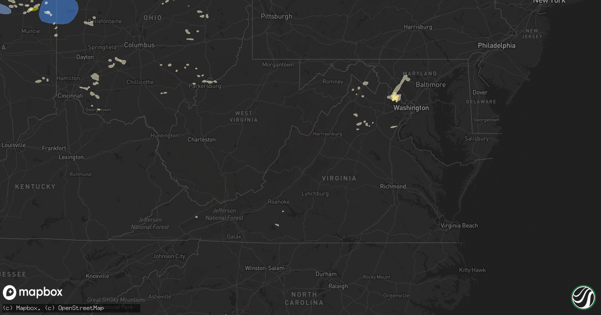
Hail Map in Virginia on July 28, 2023
Get this storm
July 28 map
$229
one time, instant access
Download today. No call, no setup
Keep the $229
Bought the map and want the full workflow? Apply the entire $229 to a subscription within 7 days. None of it is wasted.
Every map, not just this one
This buys you this map. Subscription and you get every map we run, in the markets you choose from a few cities to whole states to nationwide. Plus real-time alerts the moment a storm fires.
Contact data
Name, contact info, occupancy, even credit band for addresses in the footprint. You go from where it hit to who to call.
Become the source they trust
Unlimited branding weather history reports on demand. You already have the documented answer ready for the property owner, and you are the one who showed up with it.
Property data and RoofTrace estimates
Pull up any address you have got, its value and the exact code rules for that jurisdiction, straight from One Click Code. Then RoofTrace estimates the squares, pitch, and roof value, priced the way you price.
Storm reports in Virginia
Virginia
| Date | Description |
|---|---|
| 07/28/20236:47 PM CDT | Multiple trees down in the city of charlottesville per 911 center. |
| 07/28/20236:30 PM CDT | There were several calls for trees... Branches... And wires down across stafford county. |
| 07/28/20236:29 PM CDT | Multiple trees down in free union. Roads closed. |
| 07/28/20236:28 PM CDT | Trees blew down near the intersection of va-234 dumfries road and brentsville road. |
| 07/28/20236:27 PM CDT | Several roads closed in crozet due to downed trees. |
| 07/28/20236:26 PM CDT | Corrects previous tstm wnd dmg report from 3 nne appomattox. One tree down on patteson school road. |
| 07/28/20236:24 PM CDT | A couple trees down near white hall per 911 center. |
| 07/28/20236:21 PM CDT | One tree down on spring grove road. |
| 07/28/20236:18 PM CDT | One tree down on clover road in hurt. |
| 07/28/20236:15 PM CDT | Multiple roads closed west of lovingstown toward wintergreen due to downed trees. |
| 07/28/20236:11 PM CDT | Corrects previous tstm wnd dmg report from 3 sse south boston. Tree down near 1041 ponderosa road. |
| 07/28/20236:06 PM CDT | At least 6 trees down in the arrington area. |
| 07/28/20236:05 PM CDT | Large tree down across izaak walton road. |
| 07/28/20236:02 PM CDT | Trees blew down in sumerduck. |
| 07/28/20236:00 PM CDT | Large tree down on forest brook road. |
| 07/28/20235:56 PM CDT | One tree down on amherst highway. |
| 07/28/20235:50 PM CDT | Several trees down along river road and ashton hall road. |
| 07/28/20235:45 PM CDT | Tree down on spencer preston road. |
| 07/28/20235:41 PM CDT | Several trees down in ferrum. |
| 07/28/20235:38 PM CDT | 5 large trees down on long hallow road. |
| 07/28/20235:37 PM CDT | One tree down on river road. |
| 07/28/20235:35 PM CDT | At least 6 trees down in mt solon area. |
| 07/28/20235:35 PM CDT | Several trees and wires blew down around warrenton. |
| 07/28/20235:30 PM CDT | Multiple calls of trees down in the churchville area. |
| 07/28/20235:30 PM CDT | Multiple trees down in lexington area. |
| 07/28/20235:26 PM CDT | One tree down on patteson school road. |
| 07/28/20235:23 PM CDT | Trees blew down on va-229 rixeyville road near va-611 waterford road. |
| 07/28/20235:20 PM CDT | Multiple trees down on booker t washington highway near burnt chimney. |
| 07/28/20235:17 PM CDT | Large tree was snapped and blown down. |
| 07/28/20235:15 PM CDT | Trees blew down between rock mills and massanova... Including along rock mills road and va-729 richmond road. |
| 07/28/20235:11 PM CDT | Frederick county 911 reported a couple trees... Numerous branches... And wires down in the vicinity of albin. |
| 07/28/20235:10 PM CDT | Numerous trees blew down along us-522 sperryville pike... Including at least one onto a car. |
| 07/28/20235:07 PM CDT | Several snapped trees and trucks off the road due to high thunderstorm winds on interstate 81 near woodstock. Dozens of trees blew down in the area. |
| 07/28/20235:07 PM CDT | Several snapped trees and trucks off the road due to high thunderstorm winds on interstate 81 near woodstock. |
| 07/28/20235:01 PM CDT | Tree down route 220 in eagle rock. |
| 07/28/20234:59 PM CDT | A local report indicates 65 MPH wind near 1 ESE Check |
| 07/28/20234:58 PM CDT | Large tree down on pine street. |
| 07/28/20234:55 PM CDT | Large limb was blown down by thunderstorm winds on rocky road near the intersection of bent mountain road. |
| 07/28/20234:55 PM CDT | Large tree limb down on a power line at grayson highlands base camp. |
| 07/28/20234:55 PM CDT | Tree down near newby lane. |
| 07/28/20234:55 PM CDT | A local report indicates 1.00 inch wind near Sterling Park |
| 07/28/20234:53 PM CDT | Quarter size hail was reported in sterling. |
| 07/28/20234:53 PM CDT | Half dollar size hail was reported in countryside. |
| 07/28/20234:52 PM CDT | A local report indicates 58 MPH wind near Roanoke Airport |
| 07/28/20234:50 PM CDT | Trees blew down in countryside... Including along va-1582 algonkian parkway near spotswood road. |
| 07/28/20234:50 PM CDT | Tree down at lafayette road and roanoke road. |
| 07/28/20234:50 PM CDT | Trees blew down in the 1400 block of us-220 jackson river road. |
| 07/28/20234:49 PM CDT | Multiple trees down on rudasill mill road. |
| 07/28/20234:49 PM CDT | A couple trees down in rock mills and laurel mills. |
| 07/28/20234:45 PM CDT | Trees blew down in the 3500 block of va-84 mill gap road. |
| 07/28/20234:40 PM CDT | Tree down at south franklin and mulberry lane. |
| 07/28/20234:40 PM CDT | Tree down in clear water park. |
| 07/28/20234:40 PM CDT | Tree down in the catawba area. |
| 07/28/20234:40 PM CDT | Tree down on the 2600 block of den hill road. |
| 07/28/20234:35 PM CDT | Tree down on agee street. |
| 07/28/20234:35 PM CDT | Tree down and blocking the road. |
| 07/28/20234:35 PM CDT | Trees blown down. |
| 07/28/20234:30 PM CDT | Tree fell on a car at woodland drive and prices fork road. |
| 07/28/20234:30 PM CDT | Tree down in the nws parking lot. |
| 07/28/20234:30 PM CDT | Tree down at the intersection of pruitt mountain lane and carter hill lane. |
| 07/28/20234:30 PM CDT | One live tree snapped and one large limb down. |
| 07/28/20234:29 PM CDT | Tree uprooted on long bridge hollow. |
| 07/28/20234:27 PM CDT | Multiple limbs down across the virginia tech campus. |
| 07/28/20234:25 PM CDT | Corrects previous tstm wnd dmg report from 1 ssw castlewood. Reports of trees down. |
| 07/28/20234:24 PM CDT | Tree down at the intersection of big ridge road and longtail road. |
| 07/28/20234:12 PM CDT | Reports of trees down. |
| 07/28/20234:10 PM CDT | Two trees down in callands. |
| 07/28/20234:10 PM CDT | Tree down on maybrook road. |
| 07/28/20234:04 PM CDT | Multiple trees down in flint hill on zachary taylor highway and fodderstack road. |
| 07/28/20234:02 PM CDT | Trees and wires blew down along us-522 zachary taylor highway near ben venue road. |
| 07/28/20233:53 PM CDT | Tree down on old wolf creek road. |
| 07/28/20233:48 PM CDT | Trees reported down in narrows. |
| 07/28/20233:47 PM CDT | Several trees and wires blew down north of briggs... Including near the intersection of va-657 senseny road and va-632 triple j road. |
| 07/28/20233:26 PM CDT | *** 1 inj *** several dozen trees and wires blew down in the boyce area of clarke county... Including several onto vehicles. One tree blew down onto a car in the 11800 |
| 07/28/20233:26 PM CDT | *** 1 inj *** several dozen trees and wires blew down in the boyce area of clarke county... Including several onto vehicles. One tree blew down onto a car in the 11800 |
| 07/28/20233:20 PM CDT | Widespread trees down county-wide. |
| 07/28/20233:20 PM CDT | Two trees down in rocky mount. One was on a power line. |
| 07/28/20233:20 PM CDT | Two trees down pa 3991 7749 numerous trees down on wires east of fayetteville. |
| 07/28/20233:20 PM CDT | There were several reports of trees and wires blown down in southern warren county... Including in browntown and bentonville... And along va-607 rocky lane. |
| 07/27/20238:13 PM CDT | A couple trees down in woodbridge east of i-95. |
| 07/27/20238:12 PM CDT | Tree down on power lines and roadway in the 14000 block of telegraph road |
| 07/27/20238:10 PM CDT | Wind gusts of up to 54 knots |
| 07/27/20237:25 PM CDT | Reports of multiple trees down across northern louisa county. |
| 07/27/20237:15 PM CDT | Tree down near 1041 ponderosa road. |
| 07/27/20237:09 PM CDT | Multiple reports of trees down in northeast madison county near brightwood... Fordsville... And oakpark. |
| 07/27/20237:06 PM CDT | Tree down on patteson school road. |
| 07/27/20237:00 PM CDT | Several trees down in south boston along main street. |
All States Impacted by Hail Map on July 28, 2023
Cities Impacted by Hail Map on July 28, 2023
- Homestead, FL
- Miami, FL
- Jeffersonville, KY
- Mount Sterling, KY
- Augusta, KY
- Brooksville, KY
- Morehead, KY
- Van Buren, IN
- Marion, IN
- Sharpsburg, KY
- Owingsville, KY
- Bloomingburg, OH
- Marathon, WI
- Jeffersonville, OH
- West Liberty, KY
- Georgetown, OH
- Maysville, KY
- Dover, KY
- Sugar Grove, OH
- Mount Orab, OH
- La Fontaine, IN
- Kokomo, IN
- Ewing, KY
- Flemingsburg, KY
- Hillsboro, KY
- Wallingford, KY
- Hamersville, OH
- Bethel, OH
- Germantown, KY
- Midland, OH
- Blanchester, OH
- Sidney, OH
- Pemberton, OH
- Port Jefferson, OH
- Waynesville, OH
- Oregonia, OH
- Morrow, OH
- Wilmington, OH
- Clarksville, OH
- Cory, IN
- Jackson Center, OH
- Lewistown, OH
- Quincy, OH
- London, OH
- Mount Sterling, OH
- South Solon, OH
- Washington Court House, OH
- Salt Lick, KY
- Goshen, OH
- Loveland, OH
- Cincinnati, OH
- Williamsburg, OH
- Fayetteville, OH
- Batavia, OH
- Gadsden, AL
- Foster, KY
- Rapid City, SD
- Cheyenne, WY
- Fe Warren Afb, WY
- Carr, CO
- Nunn, CO
- Superior, NE
- Nelson, NE
- Hardy, NE
- Ault, CO
- Ruskin, NE
- Saint Paul, MN
- Republic, KS
- Mankato, KS
- Webber, KS
- Sterling, VA
- Ashburn, VA
- Poolesville, MD
- Belleville, KS
- Courtland, KS
- Nickerson, NE
- Hooper, NE
- Fremont, NE
- Arlington, NE
- Hampton, MN
- Hastings, MN
- Valley, NE
- Scandia, KS
- Chapman, NE
- Grand Island, NE
- Phillips, NE
- Aurora, NE
- Bennington, NE
- Elkhorn, NE
- Alden, IA
- Dows, IA
- Galt, IA
- Omaha, NE
- New Auburn, WI
- Bloomer, WI
- Cannon Falls, MN
- Boys Town, NE
- Marquette, NE
- Giltner, NE
- Sutton, NE
- Harvard, NE
- Saronville, NE
- Beloit, KS
- Jewell, KS
- Belgrade, MT
- Bozeman, MT
- Wilsall, MT
- White Sulphur Springs, MT
- Boulder, CO
- Longmont, CO
- Lagrange, WY
- Iowa Falls, IA
- Geneva, NE
- Ong, NE
- Edgar, NE
- Shickley, NE
- Geneva, IA
- Hampton, IA
- Bradford, IA
- Ackley, IA
- Aplington, IA
- Wellsburg, IA
- Holland, IA
- Parkersburg, IA
- Steamboat Rock, IA
- Grundy Center, IA
- Northport, AL
- Sandy Hook, KY
- Butte, MT
- Selma, AL
- Waverly, WV
- Williamstown, WV
- Parkersburg, WV
- Woodland Park, CO
- Ripley, WV
- Hamden, OH
- Burns, WY
- Medford, WI
- Concord, PA
- Doylesburg, PA
- Southside, WV
- Leon, WV
- Haddam, KS
- Little River, AL
- Elbert, CO
- Gay, WV
- Foreston, MN
- Milaca, MN
- Scandinavia, WI
- Iola, WI
- Amherst Junction, WI
- Prescott, AZ
- Foley, MN
- Pierz, MN
- Rice, MN
- Royalton, MN
- Waynesboro, MS
- Winchester, VA
- Clear Brook, VA
- Tuscaloosa, AL
- Duncanville, AL
- Greenwood, WI
- Loyal, WI
- Vermillion, MN
- Cleveland, GA
- Thomasville, AL
- Mapleton Depot, PA
- Seligman, AZ
- Ogdensburg, WI
- Nelsonville, WI
- Winfield, AL
- Wirtz, VA
- Boones Mill, VA
- Stevens Point, WI
- Custer, WI
- Manawa, WI
- Jamestown, KS
- Norway, KS
- Sweet Water, AL
- Elkfork, KY
- Glen Elder, KS
- Camden, AL
- Pine Apple, AL
- Little Hocking, OH
- Coolville, OH
- Cutler, OH
- Quitman, MS
- Adamsville, AL
- Hurricane, WV
- Scott Depot, WV
- Bunker Hill, WV
- Kearneysville, WV
- Inwood, WV
- Hillsdale, WY
- Sautee Nacoochee, GA
- Ferrum, VA
- Henry, VA
- Flat Rock, MI
- Kiowa, CO
- Henderson, NE
- Martha, KY
- Jackson, AL
- Saint Paul Park, MN
- Minneapolis, MN
- Burnsville, MN
- Farmington, MN
- Cottage Grove, MN
- Inver Grove Heights, MN
- Rosemount, MN
- New Straitsville, OH
- Junction City, OH
- Logan, OH
- Alderson, WV
- Summersville, WV
- Great Falls, VA
- Potomac, MD
- Germantown, MD
- Leesburg, VA
- Herndon, VA
- Isonville, KY
- Cairo, WV
- Cottondale, AL
- Biglerville, PA
- Gettysburg, PA
- Aspers, PA
- Campton, KY
- Beattyville, KY
- Big Springs, WV
- Big Bend, WV
- Purlear, NC
- West Jefferson, NC
- Millers Creek, NC
- Sunburg, MN
- Murray City, OH
- Glouster, OH
- Milton, WV
- Ona, WV
- Vienna, WV
- Marietta, OH
- Belpre, OH
- Memphis, MI
- Allenton, MI
- Winslow, NE
- Shippensburg, PA
- Waynesboro, PA
- Chambersburg, PA
- Fayetteville, PA
- Jachin, AL
- Ward, AL
- Keaton, KY
- Flatgap, KY
- Rockhill Furnace, PA
- Shirleysburg, PA
- Orbisonia, PA
- Shenandoah Junction, WV
- Shepherdstown, WV
- Harpers Ferry, WV
- Petroleum, WV
- Agenda, KS
- Gainesville, GA
- Murrayville, GA
- Malta, OH
- Saint Marys, WV
- Newport, OH
- Oak, NE
- Williamsburg, PA
- Dawsonville, GA
- Cotopaxi, CO
- Jackson, KY
- Pine Ridge, KY
- Rogers, KY
- Ranson, WV
- Charles Town, WV
- Washington, VA
- Bentonville, VA
- Ponderosa, NM
- Attalla, AL
- Fleming, OH
- Waterford, OH
- White Post, VA
- Boyce, VA
- Hayden, AL
- Cleveland, AL
- Whitehall, MT
- Central City, CO
- Black Hawk, CO
- Northfork, WV
- Switchback, WV
- Elkhorn, WV
- Glen Fork, WV
- Ravencliff, WV
- Harrisville, WV
- Berea, WV
- Auburn, WV
- Pounding Mill, VA
- Nederland, CO
- Mount Nebo, WV
- Tryon, NC
- Easley, SC
- Pickens, SC
- Vincent, OH
- Burr Oak, KS
- Concordia, KS
- Dickerson, MD
- Barnesville, MD
- Ijamsville, MD
- Damascus, MD
- Clarksburg, MD
- Mount Airy, MD
- Monrovia, MD
- Beallsville, MD
- Boyds, MD
- Wellston, OH
- Stockport, OH
- Helen, GA
- Golden, CO
- Rollinsville, CO
- Clanton, AL
- Jemison, AL
- New Milton, WV
- Troy, WV
- Coxs Mills, WV
- Jefferson, NC
- Woodville, VA
- Castleton, VA
- Clermont, GA
- Ames, NE
- New Baltimore, MI
- Macomb, MI
- McIntosh, AL
- Tibbie, AL
- Gainestown, AL
- Hico, WV
- Newland, NC
- Pennock, MN
- Murdock, MN
- Amherst, WI
- Oak Park, MN
- Waverly, IA
- Tripoli, IA
- Readlyn, IA
- Denver, IA
- Fennimore, WI
- Stitzer, WI
- Stetsonville, WI
- Athens, WI
- Livingston, WI
- Platteville, WI
- Belmont, WI
- Rewey, WI
- Mineral Point, WI
- Strang, NE
- Bruning, NE
- Carleton, NE
- Davenport, NE
- Simpson, KS
- Glasco, KS
- Barnard, KS
- Lincoln, NE
- Darlington, WI
- Roca, NE
- Arcadia, WI
- Cochrane, WI
- Fountain City, WI
- Bennet, NE
- Panama, NE
- Hickman, NE
- Douglas, NE
- Adams, NE
- Palmyra, NE
- Dodge, WI
- Trempealeau, WI
- Galesville, WI
- Ettrick, WI
- Lincoln, KS
- Holmen, WI
- Onalaska, WI
- Warrenville, IL
- Naperville, IL
- West Salem, WI
- Wheaton, IL
- Mindoro, WI
- Winfield, IL
- Carol Stream, IL
- West Chicago, IL
- Hazel Green, WI
- Dubuque, IA
- Gladbrook, IA
- Reinbeck, IA
- La Crosse, WI
- Bangor, WI
- Morrison, IA
- Rockland, WI
- Cashton, WI
- Sparta, WI
- Glendale Heights, IL
- Glen Ellyn, IL
- Riley, KS
- Manhattan, KS
- Leonardville, KS
- Ogden, KS
- Junction City, KS
- Fort Riley, KS
- Saint George, KS
- Paradise, KS
- Natoma, KS
- Waldo, KS
- Mountain, WI
- Mukwonago, WI
- East Troy, WI
- Suring, WI
- Alburnett, IA
- Marion, IA
- Shellsburg, IA
- Hiawatha, IA
- Robins, IA
- Center Point, IA
- Palo, IA
- Cedar Rapids, IA
- Vinton, IA
- Urbana, IA
- Toddville, IA
- Walker, IA
- Coggon, IA
- Prairieburg, IA
- La Porte City, IA
- Independence, IA
- Monticello, IA
- Quasqueton, IA
- Anamosa, IA
- Fairfax, IA
- Atkins, IA
- Jesup, IA
- Rowley, IA
- Mount Auburn, IA
- Dunkerton, IA
- Fairbank, IA
- Ryan, IA
- Masonville, IA
- Brandon, IA
- Springville, IA
- Central City, IA
- Waterloo, IA
- Winthrop, IA
- Epworth, IA
- Delhi, IA
- Peosta, IA
- Worthington, IA
- Durango, IA
- Manchester, IA
- Dyersville, IA
- Cascade, IA
- Earlville, IA
- Langworthy, IA
- Farley, IA
- Hopkinton, IA
- Bernard, IA
- Delaware, IA
- Waterford, WI
- Zwingle, IA
- East Dubuque, IL
- La Motte, IA
- Gillett, WI
- Lena, WI
- Toledo, IA
- Tama, IA
- Oconto Falls, WI
- Burlington, WI
- Union, IA
- Conrad, IA
- Eldora, IA
- Whitten, IA
- Edgar, WI
- Clemons, IA
- Marshalltown, IA
- State Center, IA
- Albion, IA
- Liscomb, IA
- Beaman, IA
- New Providence, IA
- Haverhill, IA
- Laurel, IA
- Melbourne, IA
- Garwin, IA
- Ferguson, IA
- Gilman, IA
- Montour, IA
- Le Grand, IA
- Westby, WI
- La Farge, WI
- Hillsboro, WI
- Ontario, WI
- Osborne, KS
- Elroy, WI
- Mauston, WI
- Lyndon Station, WI
- Wamego, KS
- Tecumseh, NE
- Cook, NE
- Burr, NE
- Sterling, NE
- Tipton, KS
- La Valle, WI
- Reedsburg, WI
- Wakeeney, KS
- Bellevue, IA
- Onslow, IA
- Baldwin, IA
- Center Junction, IA
- Oxford Junction, IA
- Olin, IA
- Ely, IA
- Maquoketa, IA
- Martelle, IA
- Mount Vernon, IA
- Lisbon, IA
- Morley, IA
- Wyoming, IA
- Monmouth, IA
- Stanwood, IA
- Mechanicsville, IA
- Iowa City, IA
- Lost Nation, IA
- Clarence, IA
- North Liberty, IA
- Swisher, IA
- West Branch, IA
- Tipton, IA
- Solon, IA
- Grand Mound, IA
- Durant, IA
- New Liberty, IA
- Delmar, IA
- Lowden, IA
- West Liberty, IA
- Bennett, IA
- Dixon, IA
- Atalissa, IA
- Calamus, IA
- Moscow, IA
- Muscatine, IA
- Wheatland, IA
- Wilton, IA
- Stockton, IA
- Camp Douglas, WI
- Warrens, WI
- Tomah, WI
- Kendall, WI
- Hustler, WI
- New Lisbon, WI
- Necedah, WI
- Nekoosa, WI
- Adams, WI
- Arkdale, WI
- Friendship, WI
- Hancock, WI
- Coloma, WI
- Wilton, WI
- Wonewoc, WI
- North Freedom, WI
- Grand Marsh, WI
- Baraboo, WI
- Westfield, WI
- Rock Springs, WI
- Oxford, WI
- Wisconsin Dells, WI
- Redgranite, WI
- Wautoma, WI
- Endeavor, WI
- Montello, WI
- Briggsville, WI
- Bancroft, WI
- Neshkoro, WI
- Wild Rose, WI
- Plainfield, WI
- Almond, WI
- Pine River, WI
- Plain, WI
- Cazenovia, WI
- Packwaukee, WI
- Hillpoint, WI
- Loganville, WI
- Portage, WI
- Prairie Du Sac, WI
- Spring Green, WI
- Sauk City, WI
- Preston, IA
- Spragueville, IA
- Taylor Ridge, IL
- Andalusia, IL
- Welton, IA
- Moline, IL
- Davenport, IA
- Milan, IL
- De Witt, IA
- Blue Grass, IA
- Eldridge, IA
- Montpelier, IA
- Rock Island, IL
- Walcott, IA
- Buffalo, IA
- Coal Valley, IL
- Long Grove, IA
- Donahue, IA
- Pleasant Valley, IA
- Charlotte, IA
- Bryant, IA
- Low Moor, IA
- Goose Lake, IA
- Sabula, IA
- Camanche, IA
- Teeds Grove, IA
- Bettendorf, IA
- East Moline, IL
- Le Claire, IA
- Miles, IA
- McCausland, IA
- Princeton, IA
- Clinton, IA
- Gratiot, WI
- Elizabeth, IL
- Galena, IL
- Benton, WI
- Cuba City, WI
- Scales Mound, IL
- Hanover, IL
- Apple River, IL
- Shullsburg, WI
- Stockton, IL
- Warren, IL
- Lena, IL
- Nora, IL
- Kent, IL
- Winslow, IL
- Pearl City, IL
- South Wayne, WI
- Browntown, WI
- McConnell, IL
- Shannon, IL
- Freeport, IL
- Orangeville, IL
- Monroe, WI
- Davis, IL
- Dakota, IL
- Rock City, IL
- Cedarville, IL
- Baileyville, IL
- Ridott, IL
- Forreston, IL
- Mount Morris, IL
- Pecatonica, IL
- German Valley, IL
- Leaf River, IL
- Winnebago, IL
- Byron, IL
- Durand, IL
- Rockford, IL
- Dalton, WI
- Merrimac, WI
- Cambria, WI
- Pardeeville, WI
- Poynette, WI
- Wyocena, WI
- Rio, WI
- Lime Ridge, WI
- Lone Rock, WI
- Richland Center, WI
- Avoca, WI
- Mazomanie, WI
- Dodgeville, WI
- Arena, WI
- Lodi, WI
- Markesan, WI
- Randolph, WI
- Friesland, WI
- Fall River, WI
- Doylestown, WI
- Ridgeway, WI
- Waunakee, WI
- Dane, WI
- Deforest, WI
- Black Earth, WI
- Barneveld, WI
- Columbus, WI
- Cross Plains, WI
- Madison, WI
- Mount Horeb, WI
- Blue Mounds, WI
- Highland, WI
- Arlington, WI
- Middleton, WI
- Morrisonville, WI
- Verona, WI
- Carbon Cliff, IL
- Colona, IL
- Silvis, IL
- Orion, IL
- Cordova, IL
- Port Byron, IL
- Rapids City, IL
- Hampton, IL
- Osco, IL
- Fulton, IL
- Cambridge, IL
- Albany, IL
- Geneseo, IL
- Hillsdale, IL
- Erie, IL
- Thomson, IL
- Mount Carroll, IL
- Lyndon, IL
- Savanna, IL
- Rock Falls, IL
- Morrison, IL
- Prophetstown, IL
- Sterling, IL
- Chadwick, IL
- Atkinson, IL
- Tampico, IL
- Fenton, IL
- Dixon, IL
- Beaver Dam, WI
- Fox Lake, WI
- Kingston, WI
- Juneau, WI
- Linden, WI
- Holton, KS
- Netawaka, KS
- Wetmore, KS
- Whiting, KS
- Muscotah, KS
- Powhattan, KS
- Horton, KS
- Hiawatha, KS
- Everest, KS
- Fairview, KS
- Windsor, WI
- Hollandale, WI
- Sun Prairie, WI
- Marshall, WI
- Oregon, WI
- Belleville, WI
- New Glarus, WI
- Reeseville, WI
- Cottage Grove, WI
- Deerfield, WI
- Blanchardville, WI
- Mcfarland, WI
- Stoughton, WI
- Waterloo, WI
- Albany, WI
- Brooklyn, WI
- Lowell, WI
- Watertown, WI
- Evansville, WI
- Cambridge, WI
- Johnson Creek, WI
- Lake Mills, WI
- Sheffield, IL
- Deer Grove, IL
- Harmon, IL
- Annawan, IL
- Hooppole, IL
- Walnut, IL
- Mineral, IL
- Milledgeville, IL
- Tucson, AZ
- Albion, IN
- Ligonier, IN
- Cope, CO
- Joes, CO
- Akron, CO
- Yuma, CO
- Edgerton, WI
- Fort Atkinson, WI
- Jefferson, WI
- Marengo, IL
- Garden Prairie, IL
- Belvidere, IL
- Genoa, IL
- Huntley, IL
- Elgin, IL
- Algonquin, IL
- Hampshire, IL
- Gilberts, IL
- Lake In The Hills, IL
- Carpentersville, IL
- Union, IL
- Dundee, IL
- Oskaloosa, IA
- Eddyville, IA
- Bussey, IA
- Ottumwa, IA
- Chillicothe, IA
- Kirkville, IA
- Minooka, IL
- Morris, IL
- Shorewood, IL
- Channahon, IL
- Elwood, IL
- Joliet, IL
- Wilmington, IL
- Helenville, WI
- Whitewater, WI
- Elkhorn, WI
- Palmyra, WI
- Eagle, WI
- Sullivan, WI
- Dousman, WI
- Rochester, WI
- Kansasville, WI
- Union Grove, WI
- Franksville, WI
- Hales Corners, WI
- Waukesha, WI
- Muskego, WI
- New Berlin, WI
- Oconomowoc, WI
- North Prairie, WI
- Franklin, WI
- Big Bend, WI
- Knoxville, IA
- Tracy, IA
- Harvey, IA
- Agency, IA
- Quinter, KS
- Park, KS
- Gove, KS
- Oakley, KS
- Montpelier, IN
- Keystone, IN
- Hartford City, IN
- Kinsman, IL
- Verona, IL
- Seneca, IL
- Mazon, IL
- Dwight, IL
- Gardner, IL
- Ransom, IL
- Winona, KS
- Gillette, WY
- Weston, WY
- Moorcroft, WY
- Devils Tower, WY
- Hot Springs, SD
- Edgemont, SD
- Custer, SD
- Merrill, WI
- Lee, IL
- Tomahawk, WI
- Roberts, MT
- Red Lodge, MT
- Dekalb, IL
- Rolling Prairie, IN
- La Porte, IN
- Cherry Valley, IL
- Monroe Center, IL
- Harrison, NE
- Hixton, WI
- Taylor, WI
- Westminster, MD
- Fredericksburg, IA
- Sumner, IA
- Clutier, IA
- Cartersville, GA
- Hudson, IA
- Buckingham, IA
- Wilber, NE
- Hallam, NE
- Black River Falls, WI
- Sheffield, IA
- Kirkland, AZ
- Etna Green, IN
- Warsaw, IN
- Garrison, IA
- Dysart, IA
- Clarkston, GA
- Atlanta, GA
- Decatur, GA
- Scottdale, GA
- Stone Mountain, GA
- Tucker, GA
- Beverly Shores, IN
- Chesterton, IN
- Michigan City, IN
- Hubbard, IA
- Ogema, WI
- Westboro, WI
- Monkton, MD
- White Hall, MD
- Sparks Glencoe, MD
- Parkton, MD
- Alma, WI
- Cedar Falls, IA
- Syracuse, IN
- Randolph, KS
- Olsburg, KS
- Watkins, IA
- Blairstown, IA
- Holtwood, PA
- Airville, PA
- Madison, AL
- Downers Grove, IL
- Clarendon Hills, IL
- Westmont, IL
- Oak Brook, IL
- Prospect Heights, IL
- Arlington Heights, IL
- Palatine, IL
- Mount Prospect, IL
- Rolling Meadows, IL
- Kingsford Heights, IN
- Hamlet, IN
- Walkerton, IN
- Union Mills, IN
- Townsend, WI
- White Lake, WI
- Wanatah, IN
- Otter Lake, MI
- Columbiaville, MI
- Melrose, WI
- Ohiowa, NE
- Milligan, NE
- Crown King, AZ
- Osseo, WI
- Strum, WI
- Traer, IA
- Hawkeye, IA
- Rochester, IN
- Macy, IN
- Roscoe, MT
- Millersburg, IN
- Topeka, IN
- Rixeyville, VA
- Loves Park, IL
- Roselle, IL
- Waukegan, IL
- Zion, IL
- Martinsdale, MT
- Elburn, IL
- Meservey, IA
- Belmond, IA
- Goodell, IA
- Sherrill, IA
- Potosi, WI
- Dunlap, IA
- Moorhead, IA
- Woodbine, IA
- Monroeville, IN
- Hoagland, IN
- Saginaw, MI
- Berne, IN
- Saint Charles, IL
- Geneva, IL
- Wayne, IL
- Bartlett, IL
- Kirkland, IL
- Esmond, IL
- Lindenwood, IL
- Clay Center, KS
- North Webster, IN
- Cromwell, IN
- Kimmell, IN
- Larwill, IN
- Pierceton, IN
- Columbia City, IN
- Poplar Grove, IL
- Portsmouth, IA
- Wabash, IN
- Peru, IN
- New Hampton, IA
- Newton, IA
- Logan, IA
- Persia, IA
- Shelby, IA
- Janesville, IA
- Shell Rock, IA
- Drummond, MT
- Gold Creek, MT
- Helmville, MT
- Hazleton, IA
- Church Hill, TN
- Pima, AZ
- Vassar, MI
- Marion, WI
- Virginia, NE
- Beatrice, NE
- Blue Springs, NE
- Mount Lemmon, AZ
- Colfax, WI
- South Amana, IA
- Homestead, IA
- Mayville, MI
- Caro, MI
- Knox, IN
- Kewanna, IN
- Windsor Mill, MD
- Davey, NE
- Argos, IN
- Leesburg, IN
- Milford, IN
- West Union, IA
- Milwaukee, WI
- Saint Francis, WI
- Cudahy, WI
- Keystone, IA
- Pylesville, MD
- Street, MD
- New Park, PA
- Jarrettsville, MD
- Stewartstown, PA
- Frankenmuth, MI
- Culver, IN
- Grovertown, IN
- Clatonia, NE
- Hebron, NE
- Belvidere, NE
- Alexandria, NE
- Deer Trail, CO
- Van Horne, IA
- Rosholt, WI
- Hoffman Estates, IL
- Barrington, IL
- Victor, IA
- Brooklyn, IA
- Filley, NE
- Pickrell, NE
- Vail, AZ
- Boscobel, WI
- Harvard, IL
- Capron, IL
- Goshen, IN
- Jackson, MS
- Martell, NE
- Ladysmith, WI
- Libertyville, IL
- Gurnee, IL
- Lake Zurich, IL
- Vernon Hills, IL
- Mundelein, IL
- Amissville, VA
- Wood Dale, IL
- Itasca, IL
- Lombard, IL
- Bloomingdale, IL
- Medinah, IL
- Elk Grove Village, IL
- Addison, IL
- Tippecanoe, IN
- New Oxford, PA
- York Springs, PA
- Norwalk, WI
- Sykesville, MD
- Stockholm, WI
- Nelson, WI
- Wabasha, MN
- Reads Landing, MN
- Kellogg, MN
- Coon Valley, WI
- Pepin, WI
- Lake City, MN
- Clinton, WI
- South Beloit, IL
- Beloit, WI
- Withee, WI
- Rockford, IA
- Rockwell, IA
- Elberon, IA
- Belle Plaine, IA
- Vining, IA
- Chelsea, IA
- Marengo, IA
- Bourbon, IN
- Sabetha, KS
- Liberty, NE
- Lewiston, NE
- Burchard, NE
- Albin, WY
- Rhodes, IA
- Lookout, WV
- Bay City, MI
- Reese, MI
- Munger, MI
- Denver, IN
- South Elgin, IL
- Hanover Park, IL
- Rudd, IA
- Westmoreland, KS
- Bowdon, GA
- Graham, AL
- Rutherfordton, NC
- Columbus, NC
- Mill Spring, NC
- Grinnell, IA
- Malcom, IA
- Latimer, IA
- Coulter, IA
- Somerset, WI
- Hudson, WI
- Sylvan Grove, KS
- Hunter, KS
- Exeter, NE
- Woodbine, MD
- Gaithersburg, MD
- Reston, VA
- Wiggins, CO
- Oak Creek, WI
- Caledonia, WI
- Greendale, WI
- South Milwaukee, WI
- Alpharetta, GA
- Pine Bluffs, WY
- Mason City, IA
- Nappanee, IN
- Rockville, MD
- Firth, NE
- Randolph, MN
- Hanna, IN
- Corunna, IN
- Kendallville, IN
- Swaledale, IA
- Clear Lake, IA
- Mount Hope, WI
- Lancaster, WI
- Nora Springs, IA
- Twelve Mile, IN
- Clay Center, NE
- Grafton, NE
- Elrod, AL
- Middlebury, IN
- North Branch, MI
- Attica, MI
- Fostoria, MI
- Lapeer, MI
- Warren, IN
- Lineville, AL
- Hanover, PA
- Glenwood, WV
- Noxapater, MS
- Philadelphia, MS
- Skull Valley, AZ
- Monterey, IN
- Plymouth, IN
- Ora, IN
- North Judson, IN
- Benson, AZ
- Baltimore, MD
- Wausau, WI
- Brokaw, WI
- Axtell, KS
- New Hartford, IA
- New Richmond, WI
- Lucas, KS
- Hayden, AZ
- Kearny, AZ
- Woodstock, GA
- Brookfield, WI
- Orrtanna, PA
- East Berlin, PA
- Madison, VA
- Sperryville, VA
- Kellogg, IA
- Bolton, MS
- Dewar, IA
- Evansdale, IA
- Mayetta, KS
- Norway, IA
- Newhall, IA
- Elgin, IA
- Quarryville, PA
- Drumore, PA
- New Providence, PA
- Armstrong, IL
- New Windsor, MD
- Union Bridge, MD
- Brush, CO
- Bowersville, GA
- Akron, IN
- Kingston, IL
- Reisterstown, MD
- Upperco, MD
- Centerville, PA
- Titusville, PA
- Saint David, AZ
- Potomac, IL
- Rossville, IL
- Henning, IL
- Woodstock, IL
- Wonder Lake, IL
- Batavia, IL
- Deerfield, IL
- Northbrook, IL
- Highland Park, IL
- Sturtevant, WI
- Kenosha, WI
- Millington, MI
- Decorah, IA
- Cary, IL
- Wauconda, IL
- Lucerne, IN
- Dougherty, IA
- Marble Rock, IA
- Charles City, IA
- Torrington, WY
- Floyd, IA
- Wadley, AL
- Davis Junction, IL
- Dover, PA
- Thomasville, PA
- Fort Jennings, OH
- Cloverdale, OH
- Columbus Grove, OH
- Bailey, MS
- De Kalb, MS
- Landrum, SC
- Felton, PA
- Finksburg, MD
- Fallston, MD
- Fawn Grove, PA
- Phoenix, MD
- Hampstead, MD
- Emmett, KS
- Brogue, PA
- Red Lion, PA
- Jeffersonton, VA
- Warrenton, VA
- Cooksville, MD
- Triangle, VA
- Johnstown, CO
- Baxter, IA
- Alexander, IA
- Rowan, IA
- Clifton, KS
- Radcliffe, IA
- Decatur, IN
- Craigville, IN
- Lisle, IL
- Wasco, IL
- Edgewater, MD
- Luray, KS
- Rockton, IL
- Morrowville, KS
- Linn, KS
- Kingsville, MD
- White Marsh, MD
- Perry Hall, MD
- Delavan, WI
- Clermont, IA
- Burlington, IL
- Maple Park, IL
- Sycamore, IL
- Crystal Lake, IL
- Muscoda, WI
- Cortland, NE
- Oxford, IA
- Gordo, AL
- New Paris, IN
- Winamac, IN
- Shabbona, IL
- Hinckley, IL
- Clare, IL
- Malta, IL
- Waterman, IL
- Rochelle, IL
- Mentone, IN
- Smithwick, SD
- Oelrichs, SD
- Sundance, WY
- Walton, IN
- Miami, IN
- Bunker Hill, IN
- Galveston, IN
- Grissom Arb, IN
- Converse, IN
- Amboy, IN
- Swayzee, IN
- Greentown, IN
- Pine Ridge, SD
- Butler, IN
- Leo, IN
- Auburn, IN
- Grabill, IN
- Saint Joe, IN
- Spencerville, IN
- Garrett, IN
- Hicksville, OH
- Sherwood, OH
- Edgerton, OH
- Mark Center, OH
- Ney, OH
- Stryker, OH
- Defiance, OH
- Evansport, OH
- Bryan, OH
- Napoleon, OH
- Wauseon, OH
- Liberty Center, OH
- Ridgeville Corners, OH
- Archbold, OH
- Harlan, IN
- Cecil, OH
- Antwerp, OH
- Holgate, OH
- Huntertown, IN
- Malinta, OH
- McClure, OH
- Weston, OH
- Grelton, OH
- Grand Rapids, OH
- Portland, IN
- Pennville, IN
- Bryant, IN
- Monroe, IN
- Geneva, IN
- Bluffton, IN
- Willshire, OH
- Spencerville, OH
- Mendon, OH
- Ohio City, OH
- Coldwater, OH
- Fort Recovery, OH
- Celina, OH
- Rockford, OH
- Saint Marys, OH
- Salamonia, IN
- Ridgeville, IN
- New Bremen, OH
- Montezuma, OH
- Saint Henry, OH
- Maria Stein, OH
- Chickasaw, OH
- Minster, OH
- New Weston, OH
- Burkettsville, OH
- Union City, OH
- Rossburg, OH
- Union City, IN
- Petroleum, IN
- Redkey, IN
- Dunkirk, IN
- Dunning, NE
- Arnold, NE
- Stapleton, NE
- Purdum, NE
- Thedford, NE
- Halsey, NE
- Brewster, NE
- Taylor, NE
- Anselmo, NE
- Burwell, NE
- Sargent, NE
- Merna, NE
- Comstock, NE
- Broken Bow, NE
- Elyria, NE
- Ord, NE
- Greeley, NE
- North Loup, NE
- Scotia, NE
- Ashton, NE
- Miller, NE
- Lexington, NE
- Oconto, NE
- Westerville, NE
- Callaway, NE
- Litchfield, NE
- Ansley, NE
- Cozad, NE
- Overton, NE
- Sumner, NE
- Mason City, NE
- Eddyville, NE
- Brady, NE
- Arcadia, NE
- Loup City, NE
- Gothenburg, NE
- Seneca, NE
- Sherrard, IL
- Millersburg, OH
- Chadron, NE
- Hay Springs, NE
- Coshocton, OH
- Kimbolton, OH
- Newcomerstown, OH
- Parnell, IA
- North English, IA
- Ludlow, IL
- Rankin, IL
- Elliott, IL
- Melvin, IL
- Gibson City, IL
- Loda, IL
- Paxton, IL
- Chariton, IA
- Stonington, IL
- Taylorville, IL
- Glendo, WY
- Jay Em, WY
- Hill City, KS
- Denver, MO
- Worth, MO
- Fremont, IA
- Dewey, IL
- Rantoul, IL
- Johnstown, NE
- Danville, IL
- Valentine, NE
- Avilla, IN
- South Haven, MI
- Winnett, MT
- Macomb, IL
- Gotham, WI
- Pioneer, OH
- Montpelier, OH
- Edon, OH
- Upland, IN
- Baroda, MI
- Alvordton, OH
- Waterloo, IN
- Hamilton, IN
- Camden, MI
- Elkhart, IN
- Albia, IA
- Lovilia, IA
- West Unity, OH
- Morenci, MI
- Fayette, OH
- Lovington, IL
- Elm Grove, WI
- Thorntown, IN
- Park Ridge, IL
- Des Plaines, IL
- Streamwood, IL
- Bridger, MT
- Cortland, IL
- Somonauk, IL
- Steward, IL
- Conesville, OH
- Dresden, OH
- Bird City, KS
- Kouts, IN
- Valparaiso, IN
- Bingham, NE
- Ashby, NE
- Ellsworth, NE
- Lemont, IL
- Willowbrook, IL
- Ashland, OH
- Perrysville, OH
- Schaumburg, IL
- Fithian, IL
- Ogden, IL
- Rexford, KS
- Colby, KS
- Bassett, NE
- Canton, IL
- Laotto, IN
- Herndon, KS
- West Lafayette, IN
- Lafayette, IN
- Martin, SD
- Wanblee, SD
- Collyer, KS
- Blue River, WI
- Norwich, OH
- Zanesville, OH
- Adamsville, OH
- Fostoria, OH
- Bensenville, IL
- Monument, KS
- Yarmouth, IA
- Morning Sun, IA
- Liberty Center, IN
- Dalton City, IL
- Argenta, IL
- Leighton, IA
- Cedar, IA
- South Bend, IN
- North Liberty, IN
- Lusk, WY
- Lakeville, IN
- Shelby, OH
- Crestline, OH
- Galion, OH
- Mansfield, OH
- Plano, IA
- Mystic, IA
- Huntington, IN
- Williamsburg, IA
- La Place, IL
- Hammond, IL
- Earl Park, IN
- Farmersburg, IA
- Garnavillo, IA
- Lagro, IN
- Pella, IA
- Brook, IN
- Kentland, IN
- Goodland, IN
- Stephenson, VA
- Sand Creek, MI
- Jasper, MI
- Amboy, IL
- Franklin Grove, IL
- West Brooklyn, IL
- Westpoint, IN
- Roann, IN
- Waldron, MI
- Sugarcreek, OH
- Loudonville, OH
- Lucas, OH
- New Carlisle, IN
- Galien, MI
- Hudson, MI
- New Richmond, IN
- Romney, IN
- Denton, KS
- Monroe, IA
- Otley, IA
- Urbana, IL
- Oakwood, IL
- Muncie, IL
- Saint Joseph, IL
- Swanton, OH
- Delta, OH
- Colfax, IN
- Darlington, IN
- Willard, OH
- Eau Claire, MI
- San Jose, IL
- Emden, IL
- Linkwood, MD
- Cambridge, MD
- Tuscola, IL
- Denton, MD
- Harrington, DE
- Montgomery, MI
- Bainbridge, IN
- Roachdale, IN
- Downing, MO
- Lancaster, MO
- Gordon, NE
- Westville, IN
- Mayer, AZ
- Manteno, IL
- Mishawaka, IN
- Fort Wayne, IN
- Schererville, IN
- Dyer, IN
- Saint John, IN
- New Virginia, IA
- New Buffalo, MI
- Mill Creek, IN
- Rome City, IN
- Atwood, IN
- Winona Lake, IN
- Churubusco, IN
- Burket, IN
- Wawaka, IN
- Claypool, IN
- Ainsworth, IA
- Crawfordsville, IA
- Washington, IA
- Mchenry, IL
- Sheldon, IL
- Bloomfield, IA
- Cantril, IA
- Milton, IA
- Pulaski, IA
- Wellman, IA
- South English, IA
- Ladora, IA
- Willow Springs, IL
- Bismarck, IL
- State Line, IN
- Alvin, IL
- West Lebanon, IN
- Covington, IN
- Williamsport, IN
- Vona, CO
- Crawfordsville, IN
- Ladoga, IN
- Whitehouse, OH
- Maumee, OH
- Waterville, OH
- Monclova, OH
- Stockton, MO
- Humansville, MO
- Berrien Springs, MI
- Saint Joseph, MI
- Wakarusa, IN
- Bremen, IN
- Saint Francis, KS
- Brookfield, IL
- Riverside, IL
- Moravia, IA
- Palco, KS
- Lanark, IL
- Luray, MO
- Keosauqua, IA
- Mount Sterling, IA
- Arbela, MO
- Hamilton, IA
- Greencastle, IN
- Brazil, IN
- Cornville, AZ
- Godfrey, IL
- Sciota, IL
- Blandinsville, IL
- Ellis, KS
- Deep River, IA
- Millersburg, IA
- Keota, IA
- Guernsey, IA
- Church Creek, MD
- Collison, IL
- Poneto, IN
- Holmesville, OH
- Sugar Grove, IL
- Montgomery, IL
- Plainfield, IL
- Bolingbrook, IL
- Oswego, IL
- Romeoville, IL
- Bristol, IL
- Aurora, IL
- Oral, SD
- Sussex, WI
- Pewaukee, WI
- Wheeling, IL
- Ainsworth, NE
- Prairie City, IA
- Runnells, IA
- Compton, IL
- La Harpe, IL
- Dallas City, IL
- Winkelman, AZ
- Cincinnati, IA
- Exline, IA
- Centerville, IA
- Lebanon, IN
- Cissna Park, IL
- Gas City, IN
- Hartsburg, IL
- Healy, KS
- Viola, WI
- Amelia, NE
- Wood Lake, NE
- Lynnville, IA
- Killduff, IA
- Sully, IA
- Paw Paw, MI
- Lawton, MI
- Mediapolis, IA
- East New Market, MD
- Rhodesdale, MD
- Vienna, MD
- Truro, IA
- Hazard, NE
- Amherst, NE
- Pleasanton, NE
- Wolbach, NE
- Elba, NE
- Ravenna, NE
- Farwell, NE
- Rockville, NE
- Saint Paul, NE
- Riverdale, NE
- Odessa, NE
- Elm Creek, NE
- Kearney, NE
- Gibbon, NE
- Dannebrog, NE
- Boelus, NE
- Cairo, NE
- Wilcox, NE
- Funk, NE
- Holdrege, NE
- Loomis, NE
- Shelton, NE
- Axtell, NE
- Bertrand, NE
- Minden, NE
- Alma, NE
- Saint Libory, NE
- Heartwell, NE
- Palmer, NE
- Wood River, NE
- Alda, NE
- Doniphan, NE
- Hildreth, NE
- Kenesaw, NE
- Fullerton, NE
- Archer, NE
- Clarks, NE
- Central City, NE
- Juniata, NE
- Holstein, NE
- Republican City, NE
- Hastings, NE
- Trumbull, NE
- Campbell, NE
- Upland, NE
- Ayr, NE
- Glenvil, NE
- Bladen, NE
- Roseland, NE
- Naponee, NE
- Franklin, NE
- Riverton, NE
- Bloomington, NE
- Red Cloud, NE
- Inavale, NE
- Blue Hill, NE
- Orleans, NE
- Atlanta, NE
- Inland, NE
- Hampton, NE
- Bradshaw, NE
- Stromsburg, NE
- Guide Rock, NE
- Hordville, NE
- Lawrence, NE
- Polk, NE
- Fairfield, NE
- Deweese, NE
- Benedict, NE
- York, NE
- Tiffin, OH
- Rib Lake, WI
- Bluford, IL
- Opdyke, IL
- Hinsdale, IL
- Maxwell, NE
- Clay City, IN
- Centerpoint, IN
- Demorest, GA
- Bucyrus, OH
- Alton, IL
- Bethalto, IL
- Whitehall, WI
- Jim Falls, WI
- Cornell, WI
- Oakdale, IL
- Darien, IL
- Woodridge, IL
- Sandusky, OH
- Donovan, IL
- Exeland, WI
- Waucoma, IA
- Granton, WI
- Neillsville, WI
- Wharton, OH
- Fairchild, WI
- Augusta, WI
- Crete, IL
- New Philadelphia, OH
- Stone Creek, OH
- Baltic, OH
- Brookville, IN
- Bland, MO
- Chippewa Falls, WI
- Addieville, IL
- Okawville, IL
- Nashville, IL
- Moorefield, NE
- Mason City, IL
- Eustis, NE
- Big Rock, IL
- Sandwich, IL
- Paw Paw, IL
- Avon Lake, OH
- Avon, OH
- Lyons, OH
- Prentice, WI
- Tiro, OH
- New Washington, OH
- Oldenburg, IN
- Batesville, IN
- Shelbyville, IL
- Beecher City, IL
- Lakewood, IL
- Cowden, IL
- Stewardson, IL
- Mode, IL
- Grainfield, KS
- Camargo, IL
- Villa Grove, IL
- Mondovi, WI
- Upper Sandusky, OH
- Woodman, WI
- Elmore, OH
- Fairmont, NE
- Independence, WI
- Eleva, WI
- Oberlin, KS
- Kansas, OH
- Maplewood, OH
- Hines, IL
- La Grange Park, IL
- Broadview, IL
- Maywood, IL
- Westchester, IL
- Toledo, OH
- Eau Claire, WI
- Hebron, IN
- Crown Point, IN
- Republic, OH
- Baldwin, IL
- Ossian, IA
- Sabina, OH
- Jamestown, OH
- Decatur, IL
- Blair, WI
- Brighton, IL
- Ogallah, KS
- Villa Park, IL
- Tower Hill, IL
- Oconee, IL
- Lebanon, IL
- O'Fallon, IL
- Mount Vernon, IL
- Norwalk, OH
- Cambridge, NE
- Russellville, IN
- Irvine, KY
- Crookston, NE
- Bellevue, OH
- Monroeville, OH
- Bellville, OH
- McGregor, IA
- Atwood, IL
- De Graff, OH
- Trenton, IL
- Metamora, IN
- Couderay, WI
- Radisson, WI
- Shipshewana, IN
- Montfort, WI
- Attica, OH
- Sumner, MI
- Momence, IL
- Kankakee, IL
- Bradley, IL
- Lockport, IL
- Crest Hill, IL
- Manhattan, IL
- New Lenox, IL
- Frankfort, IL
- Monee, IL
- Peotone, IL
- Beecher, IL
- Grant Park, IL
- Bourbonnais, IL
- Coal City, IL
- Pembroke Township, IL
- Saint Anne, IL
- Aroma Park, IL
- Bonfield, IL
- South Holland, IL
- Dolton, IL
- Thornton, IL
- Riverdale, IL
- Hammond, IN
- Harvey, IL
- Whiting, IN
- Calumet City, IL
- Chicago, IL
- East Chicago, IN
- Munster, IN
- Lansing, IL
- Gary, IN
- Highland, IN
- Griffith, IN
- Merrillville, IN
- Hobart, IN
- Chicago Heights, IL
- Glenwood, IL
- Blue Island, IL
- Lake Station, IN
- Newark, IL
- Yorkville, IL
- Millbrook, IL
- Plano, IL
- Sheridan, IL
- Millington, IL
- Leland, IL
- Auburn, IA
- Baring, MO
- Ursa, IL
- Mendon, IL
- Pawnee, IL
- Edinburg, IL
- Argonne, WI


