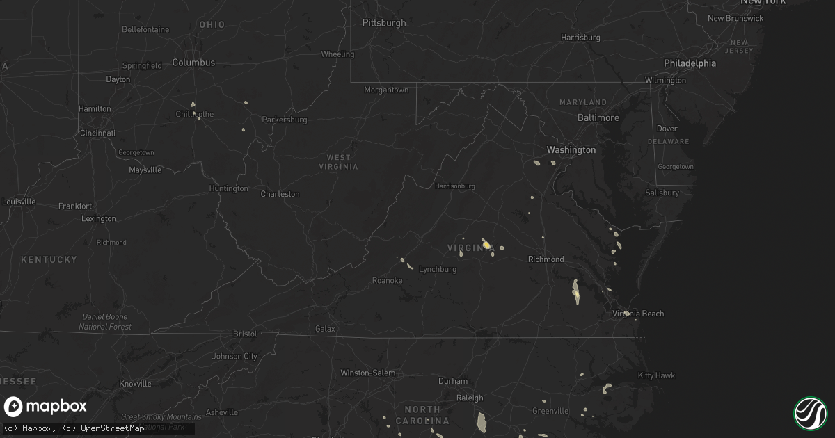
Hail Map in Virginia on July 27, 2025
Get this storm
July 27 map
$229
one time, instant access
Download today. No call, no setup
Keep the $229
Bought the map and want the full workflow? Apply the entire $229 to a subscription within 7 days. None of it is wasted.
Every map, not just this one
This buys you this map. Subscription and you get every map we run, in the markets you choose from a few cities to whole states to nationwide. Plus real-time alerts the moment a storm fires.
Contact data
Name, contact info, occupancy, even credit band for addresses in the footprint. You go from where it hit to who to call.
Become the source they trust
Unlimited branding weather history reports on demand. You already have the documented answer ready for the property owner, and you are the one who showed up with it.
Property data and RoofTrace estimates
Pull up any address you have got, its value and the exact code rules for that jurisdiction, straight from One Click Code. Then RoofTrace estimates the squares, pitch, and roof value, priced the way you price.
Storm reports in Virginia
Virginia
| Date | Description |
|---|---|
| 07/27/20256:54 PM CDT | Tree downed by thunderstorm winds near the intersection of eilliott road and east ferry road... And completely blocked the road. |
| 07/27/20256:45 PM CDT | Tree knocked down along monroe rd near delaware rd resulting in lane closures. Time estimated from radar. |
| 07/27/20256:40 PM CDT | Tree down on head of river rd in chesapeake. Time estimated. |
| 07/27/20256:35 PM CDT | Tree downed by thunderstorm winds on bear creek road... And partially blocked the road. |
| 07/27/20256:30 PM CDT | Tree down near the intersection of indian trail and kings fork rd in suffolk. Time estimated. |
| 07/27/20256:28 PM CDT | Tree down near krantzs corner rd. |
| 07/27/20256:25 PM CDT | Several reports of trees and powerlines down across the county. |
| 07/27/20256:05 PM CDT | Tree down on holly farms rd near dutchtown rd in nottoway county. Time estimated. |
| 07/27/20256:03 PM CDT | Tree knocked down along smith st and rolfe hwy resulting in lane closures. Time estimated from radar. |
| 07/27/20255:57 PM CDT | Tree blown down on partridge creek road blocking entire road. |
| 07/27/20255:57 PM CDT | Tree down on kings road partially blocking it. |
| 07/27/20255:55 PM CDT | Corrects time of damage. Tree down blocking lowe street. |
| 07/27/20255:55 PM CDT | Tree down blocking izaak walton road. |
| 07/27/20255:43 PM CDT | Tree down blocking braxton ridge road. |
| 07/27/20255:30 PM CDT | Tree down on roxbury rd near barnetts rd in charles city county. |
| 07/27/20255:30 PM CDT | Tree down on roxbury rd near barnetts rd in charles city county. (ak |
| 07/27/20255:30 PM CDT | Large tree down on oak lane. Time estimated. |
| 07/27/20255:30 PM CDT | Tree down on cook rd in powhatan county. Time estimated. |
| 07/27/20255:25 PM CDT | Tree downed by thunderstorm winds at the intersection of west james anderson highway and meadow creek road. |
| 07/27/20255:25 PM CDT | Trees down around disputanta. Time estimated. |
| 07/27/20255:15 PM CDT | Tree downed by thunderstorm winds at the intersection of south james river road and meadow creek road. |
| 07/27/20255:15 PM CDT | Tree down in roadway on barnetts road near wayside road. Time estimated. |
| 07/27/20255:06 PM CDT | Tree downed by thunderstorm winds at the intersection of spreading oak road and sharon church road. |
| 07/27/20255:02 PM CDT | Tree downed by thunderstorm winds at the intersection of gravel hill road and north james madison highway. |
| 07/27/20254:41 PM CDT | Tree downed by thunderstorm winds at the intersection of snowden road and south constitution road. |
| 07/27/20254:40 PM CDT | Tree down in the road near intersection of willis rd and ark rd in gloucester county. Time estimated. |
| 07/27/20254:40 PM CDT | Tree down on pemberton road near i-64 in henrico county. |
| 07/27/20254:40 PM CDT | Part of i-295 is blocked due to a tree down in the roadway in henrico county near mm 42. |
| 07/27/20254:40 PM CDT | Portion of the rd blocked on rt 1032 in goochland county due to a tree down. Time estimated. |
| 07/27/20254:37 PM CDT | A tree was reported down around the 1000 block of james river road. |
| 07/27/20254:37 PM CDT | Large tree on a house on the 7700 block of wall grove ct. Time estimated. |
| 07/27/20254:35 PM CDT | A tree was reported down along tillman lane... Not far from rockfish river road. |
| 07/27/20254:35 PM CDT | Tree down on a powerline on james madison hwy in fluvanna county. Time estimated. |
| 07/27/20254:35 PM CDT | Multiple trees down on west river rd in fluvanna county. Time estimated. |
| 07/27/20254:35 PM CDT | Trees and wires blew down in the 2100 block of va-693 salem road causing a fire. |
| 07/27/20254:32 PM CDT | A report of trees down along langhorne road/route 626 near rock castle creek. |
| 07/27/20254:30 PM CDT | Multiple trees down on dobby creek rd and paynes landing rd in fluvanna county. Time estimated. |
| 07/27/20254:30 PM CDT | A tree and powerlines down in the roadway near the intersection of ashland rd and cedar ln in hanover county. Time estimated from radar. |
| 07/27/20254:20 PM CDT | Tree down in the road on us-1 north of doswell. |
| 07/27/20254:15 PM CDT | Multiple large trees down at 14490 new found rd. Time estimated from radar. |
| 07/27/20254:11 PM CDT | Tree down blocking the road on sr 715 near the town of green bay. Time estimated from radar. |
| 07/27/20254:08 PM CDT | Report of trees down along red hill school road/route 760 to the east of taylors gap road. |
| 07/27/20253:58 PM CDT | Tree down in the roadway on va-3 in richmond county. |
| 07/27/20253:30 PM CDT | Multiple trees down in louisa in addition to one downed power line. Time estimated. |
| 07/27/20253:30 PM CDT | Trees blew down along va-632 south roxbury mills road. |
| 07/27/20253:25 PM CDT | Tree blocking havelock rd in richmond county. Time estimated from radar. |
| 07/27/20253:14 PM CDT | Multiple trees down in callao. Time estimated. |
| 07/27/20253:12 PM CDT | Report of trees down along cox mill road and mallorys ford road |
| 07/27/20253:06 PM CDT | Trees blew down near hamilton and hughesville... Including on va-848 holmes mill road. |
| 07/27/20253:00 PM CDT | Tree down on mount holly road. Time estimated. |
| 07/27/20253:00 PM CDT | 911 call center reported trees down along stony point road near burnley station road. Time matched by radar. |
| 07/27/20252:57 PM CDT | Trees reported down on elys ford road near bullock road. |
| 07/27/20252:50 PM CDT | Trees down near the rapidan dam |
| 07/27/20252:50 PM CDT | Scattered tree damage over portions of southern madison county. A bit more concentrated along south blue ridge turnpike. |
| 07/27/20251:38 PM CDT | Trees blew down near the intersection of marie drive and mary jane drive. |
| 07/27/20251:32 PM CDT | Tree reported down on road along route 1 in dumfries |
| 07/27/20251:30 PM CDT | Trees blew down near the intersection of cloverdale road and carson drive. |
| 07/27/20251:22 PM CDT | Microburst damage with trees down in neighborhood on caisson court |
All States Impacted by Hail Map on July 27, 2025
Cities Impacted by Hail Map on July 27, 2025
- Chisholm, MN
- Hibbing, MN
- Forbes, MN
- Mountain Iron, MN
- Buhl, MN
- Iron, MN
- Kinney, MN
- Britt, MN
- Pequot Lakes, MN
- Nisswa, MN
- Motley, MN
- Merrifield, MN
- Crosby, MN
- Pillager, MN
- Aitkin, MN
- Eveleth, MN
- Deerwood, MN
- Milbank, SD
- Marietta, MN
- Big Stone City, SD
- Bellingham, MN
- Odessa, MN
- Madison, MN
- Appleton, MN
- Correll, MN
- Milan, MN
- Clifton, VA
- Fairfax Station, VA
- Dawson, MN
- Watson, MN
- Montevideo, MN
- Alexandria, VA
- Danvers, MN
- Maynard, MN
- Bristow, VA
- Nokesville, VA
- Britton, SD
- Skandia, MI
- Greenville, NC
- Clara City, MN
- Clarkfield, MN
- Boyd, MN
- Eben Junction, MI
- Sacred Heart, MN
- Renville, MN
- Rumely, MI
- Deerton, MI
- Chatham, MI
- Issue, MD
- Newburg, MD
- Manassas, VA
- Jane Lew, WV
- Lost Creek, WV
- Prinsburg, MN
- Raymond, MN
- Trenary, MI
- Munising, MI
- Roper, NC
- Nelsonville, OH
- Buchtel, OH
- Glouster, OH
- Smiley, TX
- Wetmore, MI
- Linton, IN
- Hope Mills, NC
- Creswell, NC
- La Grange, NC
- Seven Springs, NC
- Goldsboro, NC
- Worthington, IN
- Jasonville, IN
- Kinston, NC
- Rochelle, VA
- Chillicothe, OH
- Fredericksburg, VA
- Spotsylvania, VA
- Manistique, MI
- Rapid River, MI
- Windsor, NC
- Flat Rock, IL
- Dover, NC
- Pinetown, NC
- Washington, NC
- Maple Hill, NC
- Pomeroy, OH
- Albany, OH
- Rutland, OH
- Newton, IL
- Mount Olive, NC
- Atkinson, NC
- Trenton, NC
- Albertson, NC
- Burgaw, NC
- Robinson, IL
- Pantego, NC
- Plymouth, NC
- Pink Hill, NC
- Palestine, IL
- Partlow, VA
- Reedville, VA
- Burgess, VA
- Heathsville, VA
- Willard, NC
- Wheaton, MN
- Kenansville, NC
- Faison, NC
- Warsaw, NC
- Hutsonville, IL
- Turkey, NC
- Brookshire, TX
- Norcross, MN
- Herman, MN
- Dumont, MN
- Donnelly, MN
- Wallis, TX
- Washington, IN
- Barry, MN
- Graceville, MN
- Beulaville, NC
- Magnolia, NC
- Kilmarnock, VA
- Beardsley, MN
- Chokio, MN
- Clinton, MN
- Fairbanks, IN
- White Stone, VA
- Wilmot, SD
- Scottsville, VA
- Hoffman, MN
- Barrett, MN
- Morris, MN
- Kensington, MN
- Farwell, MN
- Cyrus, MN
- Alberta, MN
- Arvonia, VA
- Ashland, VA
- Doswell, VA
- Cobbs Creek, VA
- Hallieford, VA
- Ortonville, MN
- Kelly, NC
- Paynesville, MN
- Freeport, MN
- Albany, MN
- New Canton, VA
- Palmyra, VA
- Lowry, MN
- Wilmington, NC
- Starbuck, MN
- Shipman, VA
- Schuyler, VA
- Wingina, VA
- Cartersville, VA
- Leland, NC
- Hancock, MN
- Gladstone, VA
- Cumberland, VA
- Glenwood, MN
- Benson, MN
- Clontarf, MN
- Holloway, MN
- Newport News, VA
- Winnabow, NC
- Pocahontas, AR
- Yorktown, VA
- Poquoson, VA
- Gainesville, VA
- Brooten, MN
- Pennock, MN
- Spicer, MN
- Belgrade, MN
- New London, MN
- Willmar, MN
- Murdock, MN
- Sunburg, MN
- Kerkhoven, MN
- Florence, SD
- Watertown, SD
- Sims, IL
- Geff, IL
- Buchanan, VA
- Virginia Beach, VA
- Spring Grove, VA
- Waverly, VA
- Henry, SD
- Charles City, VA
- Norfolk, VA
- Kandiyohi, MN
- Melrose, MN
- Lake Lillian, MN
- Grove City, MN
- Atwater, MN
- Dendron, VA
- Marvin, SD
- White Sulphur Springs, MT
- Fairfield, IL
- Wakefield, VA
- Corona, SD
- Roscoe, MN
- Eden Valley, MN
- Richmond, MN
- Litchfield, MN
- Watkins, MN
- Elberon, VA
- Twin Brooks, SD
- Bedford, VA
- Alzada, MT
- Belle Fourche, SD
- Cokato, MN
- Annandale, MN
- Kimball, MN
- South Haven, MN
- Dassel, MN
- Darwin, MN
- Howard Lake, MN
- Maple Lake, MN
- Neihart, MT
- Effie, MN
- Cook, MN
- Southern Pines, NC
- Summit, SD
- Ortley, SD
- Cuervo, NM
- South Shore, SD
- Revillo, SD
- Strandburg, SD
- Labolt, SD
- Stockholm, SD
- Orr, MN
- Gary, SD
- Monticello, MN
- Montrose, MN
- Waverly, MN
- Saint Michael, MN
- Buffalo, MN
- Watertown, MN
- Rockford, MN
- Maple Plain, MN
- Loretto, MN
- Delano, MN
- Goodwin, SD
- Kranzburg, SD
- Dutton, MT
- Power, MT
- Troy, NC
- Hitchcock, SD
- Granite City, IL
- Castlewood, SD
- Clear Lake, SD
- Hayti, SD
- Hazel, SD
- Hanover, MN
- Rogers, MN
- Maple Grove, MN
- Hamel, MN
- Minneapolis, MN
- Long Lake, MN
- Mound, MN
- Minnetonka, MN
- Chanhassen, MN
- Excelsior, MN
- Wayzata, MN
- Eden Prairie, MN
- Spring Park, MN
- Denham Springs, LA
- Hutchinson, MN
- Stewart, MN
- Buffalo Lake, MN
- Monroe, NC
- Cosmos, MN
- Valentine, NE
- Star, NC
- Denton, NC
- Mission, SD
- Winner, SD
- Hopkins, MN
- Osseo, MN
- Canby, MN
- Waubay, SD
- Geyser, MT
- Saint Paul, MN
- Glencoe, MN
- Biscoe, NC
- Candor, NC
- Bradenton, FL
- Hector, MN
- Silver Lake, MN
- Brownton, MN
- Minneota, MN
- Granite Falls, MN
- Taunton, MN
- Porter, MN
- Brandt, SD
- Hendricks, MN
- Ivanhoe, MN
- Toronto, SD
- Estelline, SD
- Astoria, SD
- Lake Norden, SD
- Vienna, SD
- Hanley Falls, MN
- Cottonwood, MN
- Colome, SD
- Echo, MN
- Wood Lake, MN
- Marshall, MN
- Geraldine, MT
- Stillwater, MN
- Cut Bank, MT
- Pukwana, SD
- Chamberlain, SD
- Sarasota, FL
- Plato, MN
- Lake Elmo, MN
- Willernie, MN
- South Saint Paul, MN
- Bayport, MN
- Afton, MN
- Lakeland, MN
- Newport, MN
- Belle Plaine, MN
- Norwood Young America, MN
- Henderson, MN
- Two Dot, MT
- Green Isle, MN
- Hamburg, MN
- Wessington Springs, SD
- Sweet Grass, MT
- Yale, SD
- Lester Prairie, MN
- New Auburn, MN
- Blomkest, MN
- Olivia, MN
- Danube, MN
- Somerset, WI
- Marine On Saint Croix, MN
- Hugo, MN
- Houlton, WI
- Bird Island, MN
- Belview, MN
- Redwood Falls, MN
- Lucan, MN
- Morton, MN
- Vesta, MN
- Seaforth, MN
- Milroy, MN
- Wabasso, MN
- Dayton, NV
- Virginia City, NV
- Cologne, MN
- Carver, MN
- Jordan, MN
- Gibbon, MN
- Fairfax, MN
- Franklin, MN
- Arlington, MN
- Winthrop, MN
- Morgan, MN
- Gaylord, MN
- Clements, MN
- Lafayette, MN
- Le Sueur, MN
- Sleepy Eye, MN
- New Ulm, MN
- Nicollet, MN
- Saint Peter, MN
- Marshville, NC
- Adrian, OR
- Judith Gap, MT
- Sunburst, MT
- Fort Thompson, SD
- Oacoma, SD
- Cottage Grove, MN
- Saint Paul Park, MN
- Shelby, MT
- Zortman, MT
- Hays, MT
- Ghent, MN
- Young America, MN
- Waconia, MN
- New Germany, MN
- Mayer, MN
- Chaska, MN
- Victoria, MN
- Shakopee, MN
- New Prague, MN
- Lakeville, MN
- Prior Lake, MN
- Burnsville, MN
- Le Center, MN
- Savage, MN
- Lonsdale, MN
- Elysian, MN
- Madison Lake, MN
- Cleveland, MN
- Waterville, MN
- Janesville, MN
- Elko New Market, MN
- Kilkenny, MN
- Webster, MN
- Montgomery, MN
- Kasota, MN
- Lloyd, MT
- Sanford, NC
- Cameron, NC
- Ryegate, MT
- Lavina, MT
- Garden City, SD
- Pageland, SC
- Moweaqua, IL
- Kershaw, SC
- Woonsocket, SD
- Kimball, SD
- Farmington, MN
- Alpena, SD
- Mount Croghan, SC
- Buffalo, MT
- Lynd, MN
- Lewistown, MT
- Bryant, SD
- Artesian, SD
- Northfield, MN
- Randolph, MN
- Dundas, MN
- Rosemount, MN
- Faribault, MN
- Morristown, MN
- Mankato, MN
- Eagle Lake, MN
- Good Thunder, MN
- Saint Clair, MN
- Mapleton, MN
- Amboy, MN
- Lake Crystal, MN
- Garden City, MN
- Clark, SD
- Letcher, SD
- Currie, MN
- Slayton, MN
- Mount Vernon, SD
- Fulton, SD
- Mitchell, SD
- Waseca, MN
- Chester, MT
- Reno, NV
- Russell, MN
- Bruce, SD
- White, SD
- Westbrook, MN
- Brookings, SD
- Bonaparte, IA
- Farmington, IA
- Donnellson, IA
- Ellendale, MN
- New Richland, MN
- Fedora, SD
- Avoca, MN
- Smithfield, NC
- Clayton, NC
- Owatonna, MN
- Hope, MN
- Blooming Prairie, MN
- Dennison, MN
- Nerstrand, MN
- Warsaw, MN
- Kenyon, MN
- Medford, MN
- Claremont, MN
- Mantorville, MN
- Dodge Center, MN
- West Concord, MN
- Bricelyn, MN
- Delavan, MN
- Elmore, MN
- Wells, MN
- Blue Earth, MN
- Waldorf, MN
- Frost, MN
- Easton, MN
- Winnebago, MN
- Freeborn, MN
- Alden, MN
- Pemberton, MN
- Granada, MN
- Minnesota Lake, MN
- Hartland, MN
- Kasson, MN
- Vernon Center, MN
- Howard, SD
- Alexandria, SD
- Canova, SD
- Salem, SD
- Spencer, SD
- Geneva, MN
- Clarks Grove, MN
- Albert Lea, MN
- Kiester, MN
- Lake Benton, MN
- Four Oaks, NC
- Benson, NC
- Arco, MN
- Waltham, MN
- Austin, MN
- Elkton, SD
- Tyler, MN
- Balaton, MN
- Stickney, SD
- Garvin, MN
- Arlington, SD
- Montrose, SD
- Lake Wilson, MN
- Woodstock, MN
- Edgerton, MN
- Winfred, SD
- Humboldt, SD
- Hartford, SD
- Canistota, SD
- Crooks, SD
- Sioux Falls, SD
- Hayfield, MN
- Pipestone, MN
- Chandler, MN
- Hollandale, MN
- Glenville, MN
- Hayward, MN
- Conger, MN
- Twin Lakes, MN
- Stacyville, IA
- Rose Creek, MN
- Emmons, MN
- Saint Ansgar, IA
- Lyle, MN
- Lone Rock, IA
- Whittemore, IA
- Ledyard, IA
- Carpenter, IA
- Joice, IA
- Leland, IA
- Swea City, IA
- Buffalo Center, IA
- Wesley, IA
- Lake Mills, IA
- Lakota, IA
- Kensett, IA
- Britt, IA
- Forest City, IA
- Rake, IA
- Titonka, IA
- Algona, IA
- Northwood, IA
- Thompson, IA
- West Bend, IA
- Bancroft, IA
- Crystal Lake, IA
- Woden, IA
- Burt, IA
- Scarville, IA
- Hanlontown, IA
- Garner, IA
- Goodell, IA
- Fertile, IA
- Osage, IA
- Klemme, IA
- Kanawha, IA
- Clear Lake, IA
- Manly, IA
- Ventura, IA
- Lu Verne, IA
- Corwith, IA
- Thornton, IA
- Mason City, IA
- Grafton, IA
- Plymouth, IA
- Brandon, SD
- Harrisburg, SD
- Trent, SD
- Dell Rapids, SD
- Flandreau, SD
- Havre, MT
- Kremlin, MT
- Forest Grove, MT
- Chinook, MT
- Cylinder, IA
- Rock Rapids, IA
- Beaver Creek, MN
- Hills, MN
- Larchwood, IA
- Steen, MN
- Luverne, MN
- Martinsdale, MT
- Inwood, IA
- Lester, IA
- Alvord, IA
- Canton, SD
- Hartley, IA
- Sheldon, IA
- Boyden, IA
- Alexander, IA
- Woolstock, IA
- Rock Falls, IA
- Hampton, IA
- Orchard, IA
- Eagle Grove, IA
- Rockford, IA
- Rudd, IA
- Charles City, IA
- Latimer, IA
- Clarion, IA
- Little Cedar, IA
- Galt, IA
- Goldfield, IA
- Ottosen, IA
- Dows, IA
- Marble Rock, IA
- Meservey, IA
- Bode, IA
- Nora Springs, IA
- Williams, IA
- Chapin, IA
- Colwell, IA
- Floyd, IA
- Livermore, IA
- Belmond, IA
- Blairsburg, IA
- Dougherty, IA
- Coulter, IA
- Sheffield, IA
- Rockwell, IA
- Hardy, IA
- Riceville, IA
- Rowan, IA
- Swaledale, IA
- Renwick, IA
- Clarksville, IA
- Dumont, IA
- Bristow, IA
- Aredale, IA
- Greene, IA
- Iowa Falls, IA
- Geneva, IA
- Alden, IA
- Allison, IA
- Rutland, IA
- Badger, IA
- Bradford, IA
- Rolfe, IA
- Gilmore City, IA
- Humboldt, IA
- Vincent, IA
- Dakota City, IA
- Bradgate, IA
- Thor, IA
- Pocahontas, IA
- Fort Dodge, IA
- Popejoy, IA
- Clare, IA
- Duncombe, IA
- Webster City, IA
- Mallard, IA
- Valley Springs, SD
- Adrian, MN
- Rushmore, MN
- Sibley, IA
- Kanaranzi, MN
- Ellsworth, MN
- Little Rock, IA
- Magnolia, MN
- Ocheyedan, IA
- George, IA
- Granville, IA
- Matlock, IA
- Paullina, IA
- Le Mars, IA
- Archer, IA
- Melvin, IA
- Hull, IA
- Doon, IA
- Primghar, IA
- Rock Valley, IA
- Sioux Center, IA
- Hawarden, IA
- Marcus, IA
- Maurice, IA
- Hospers, IA
- Ireton, IA
- Orange City, IA
- Sanborn, IA
- Ashton, IA
- Remsen, IA
- Alton, IA
- Fairview, SD
- Waucoma, IA
- Lawler, IA
- Circle, MT
- Fort Atkinson, IA
- West Union, IA
- Hawkeye, IA
- Merrill, IA
- Dodson, MT
- Malta, MT
- Elgin, IA
- Harris, IA
- Everly, IA
- Arthur, IA
- Holstein, IA
- Peterson, IA
- Galva, IA
- Royal, IA
- Washta, IA
- Larrabee, IA
- Pierson, IA
- Ida Grove, IA
- Kingsley, IA
- Early, IA
- Quimby, IA
- Meriden, IA
- Cleghorn, IA
- Schaller, IA
- Storm Lake, IA
- Battle Creek, IA
- Correctionville, IA
- Odebolt, IA
- Sutherland, IA
- Linn Grove, IA
- Cherokee, IA
- Calumet, IA
- Alta, IA
- Aurelia, IA
- Cushing, IA
- Rembrandt, IA
- Marathon, IA
- Greenville, IA
- Milford, IA
- Truesdale, IA
- Albert City, IA
- Nemaha, IA
- Sioux Rapids, IA
- Spencer, IA
- Webb, IA
- Newell, IA
- Varina, IA
- Fonda, IA
- Wall Lake, IA
- Sac City, IA
- Lytton, IA
- Lake View, IA
- Hinton, IA
- Cohagen, MT
- Dubuque, IA
- Fort Peck, MT
- Zwingle, IA
- Bellevue, IA
- Langsville, OH
- La Motte, IA
- Brockway, MT
- Lindsay, MT
- Bloomfield, MT
- Glendive, MT
- Hillsboro, IA
- Wibaux, MT
- Savage, MT
- Cartwright, ND
- Beach, ND
- Grassy Butte, ND
- Sentinel Butte, ND
- Galata, MT
- Whitlash, MT
- Joplin, MT
- Moville, IA
- Waterloo, IA
- Sumner, IA
- Denver, IA
- Dunkerton, IA
- Waverly, IA
- Cedar Falls, IA
- Tripoli, IA
- Janesville, IA
- Readlyn, IA
- Westgate, IA
- Oran, IA
- Fairbank, IA
- Evansdale, IA
- Dewar, IA
- Ringsted, IA


