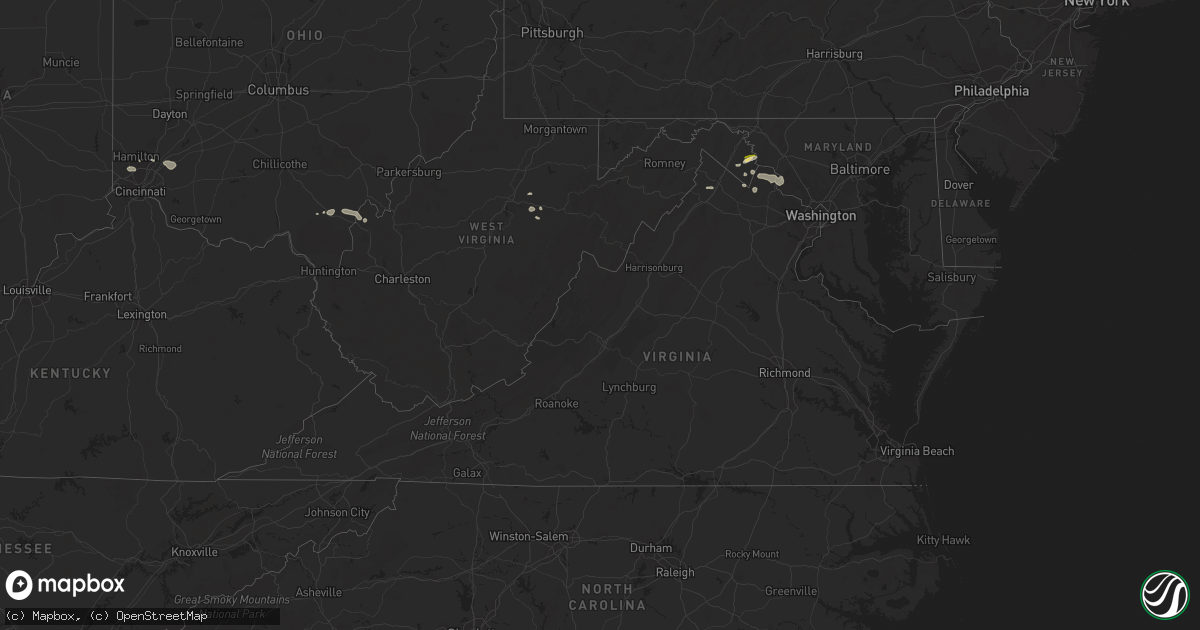
Hail Map in Virginia on July 27, 2023
Get this storm
July 27 map
$229
one time, instant access
Download today. No call, no setup
Keep the $229
Bought the map and want the full workflow? Apply the entire $229 to a subscription within 7 days. None of it is wasted.
Every map, not just this one
This buys you this map. Subscription and you get every map we run, in the markets you choose from a few cities to whole states to nationwide. Plus real-time alerts the moment a storm fires.
Contact data
Name, contact info, occupancy, even credit band for addresses in the footprint. You go from where it hit to who to call.
Become the source they trust
Unlimited branding weather history reports on demand. You already have the documented answer ready for the property owner, and you are the one who showed up with it.
Property data and RoofTrace estimates
Pull up any address you have got, its value and the exact code rules for that jurisdiction, straight from One Click Code. Then RoofTrace estimates the squares, pitch, and roof value, priced the way you price.
Storm reports in Virginia
Virginia
| Date | Description |
|---|---|
| 07/27/20235:31 PM CDT | Trees blew down on east frederick drive near maywood terrace/woodstone terrace. |
| 07/27/20235:18 PM CDT | Trees blew down along va-629 cobb house road. |
| 07/27/20235:15 PM CDT | Photo of multiple trees down in ashburn on gala circle. |
| 07/27/20235:15 PM CDT | Trees and wires blew down in middleburg. |
| 07/27/20235:00 PM CDT | Several trees and wires blew down around leesburg. |
| 07/27/20234:42 PM CDT | Trees blew down near the intersection of va-765 ridgeside road and va-626 foggy bottom road. |
| 07/27/20234:34 PM CDT | Multiple trees down on locks mill road along the shenandoah river. |
| 07/27/20234:34 PM CDT | Trees blew down on us-15 james monroe highway/monroe-madison memorial highway between va-651 hogback mountain road and va-704 harmony church road. |
| 07/27/20234:29 PM CDT | Trees blew down near the intersection of va-848 holmes mill road and va-704 harmony church road. |
| 07/27/20234:17 PM CDT | A wind gust of 60 knots |
| 07/27/20234:14 PM CDT | Several trees blew down in the city of winchester. |
| 07/27/20233:48 PM CDT | Trees blew down near the intersection of va-681 milltown road and va-682 rodeffer road. |
| 07/27/20233:48 PM CDT | Trees blew down near the intersection of va-694 john wolford road/the narrows road and va-681 milltown road. |
All States Impacted by Hail Map on July 27, 2023
Cities Impacted by Hail Map on July 27, 2023
- Mass City, MI
- Hayward, WI
- Breda, IA
- Marenisco, MI
- Saint Croix Falls, WI
- Centuria, WI
- Jefferson, IA
- Grand Junction, IA
- Wall Lake, IA
- Minong, WI
- Gordon, WI
- Perry, IA
- Rippey, IA
- Ogden, IA
- Balsam Lake, WI
- Amery, WI
- Jeffersonville, IN
- Prospect, KY
- Fort Dodge, IA
- Keene, NH
- Swanzey, NH
- Marlborough, NH
- Harrisville, NH
- Dublin, NH
- Peterborough, NH
- Granville, MA
- Sandisfield, MA
- East Otis, MA
- Otis, MA
- Blandford, MA
- Russell, MA
- Southwick, MA
- Feeding Hills, MA
- Westfield, MA
- West Springfield, MA
- Chicopee, MA
- Southampton, MA
- Holyoke, MA
- Indian Orchard, MA
- Springfield, MA
- Ludlow, MA
- South Hadley, MA
- Belchertown, MA
- Wilbraham, MA
- Granby, MA
- Bondsville, MA
- Three Rivers, MA
- Palmer, MA
- Monson, MA
- Thorndike, MA
- Ware, MA
- Brimfield, MA
- West Warren, MA
- Warren, MA
- West Brookfield, MA
- Duluth, MN
- Sturgeon Lake, MN
- McGrath, MN
- Mcgregor, MN
- Finlayson, MN
- Willow River, MN
- Solon Springs, WI
- Cable, WI
- Harris, MN
- North Branch, MN
- Sandstone, MN
- Askov, MN
- Isle, MN
- Agawam, MA
- East Longmeadow, MA
- Longmeadow, MA
- Hampden, MA
- Taylors Falls, MN
- Grantsburg, WI
- Center City, MN
- Lindstrom, MN
- Cushing, WI
- Brule, WI
- Port Wing, WI
- Maple, WI
- Iron River, WI
- Luck, WI
- Danbury, WI
- Rush City, MN
- Milltown, WI
- Bruno, MN
- Kerrick, MN
- Brook Park, MN
- Hinckley, MN
- Mora, MN
- Morgan, MN
- Grace, ID
- Exeland, WI
- Ladysmith, WI
- Tony, WI
- Glen Flora, WI
- Hawkins, WI
- Glidden, WI
- Butternut, WI
- Soda Springs, ID
- Ogema, WI
- Kennan, WI
- Catawba, WI
- Siren, WI
- Franklin, MN
- Fairfax, MN
- Hector, MN
- Carlton, MN
- Barnum, MN
- Couderay, WI
- Boulder, WY
- Auburn, WY
- Grover, WY
- Avon, MT
- Garrison, MT
- Saginaw, MN
- Bancroft, ID
- Fairfield, OH
- Foxboro, WI
- Foreston, MN
- Foley, MN
- Charles Town, WV
- Braham, MN
- Pine City, MN
- Elizaville, NY
- Walsenburg, CO
- Butte, MT
- Boulder, MT
- Lake Nebagamon, WI
- Winchester, VA
- Superior, WI
- Mud Butte, SD
- Shenandoah Junction, WV
- Shepherdstown, WV
- Sharpsburg, MD
- Kearneysville, WV
- Harpers Ferry, WV
- Anaconda, MT
- Keedysville, MD
- Rohrersville, MD
- Knoxville, MD
- Kettle River, MN
- Wahkon, MN
- Clements, MN
- Grasston, MN
- Ogilvie, MN
- Gallipolis, OH
- Bidwell, OH
- Cheshire, OH
- West Chester, OH
- Tallmansville, WV
- Greencastle, IN
- Drummond, WI
- Alborn, MN
- Canyon, MN
- Frederic, WI
- Webster, WI
- Lander, WY
- Moose Lake, MN
- Somers, CT
- Stafford Springs, CT
- Bainbridge, IN
- Mobile, AL
- Penrose, CO
- Wrenshall, MN
- Waterford, VA
- Lovettsville, VA
- Purcellville, VA
- Paeonian Springs, VA
- Dickerson, MD
- Leesburg, VA
- Cincinnati, OH
- High Bridge, WI
- Woodward, IA
- Faith, SD
- Marysville, MT
- Ojibwa, WI
- Loxley, AL
- Oak Hill, OH
- Point Pleasant, WV
- Stapleton, AL
- Shafer, MN
- Trinidad, CO
- Carlisle, KY
- Salome, AZ
- Stanchfield, MN
- Rock Springs, WY
- Buckhannon, WV
- Vinton, OH
- Philipsburg, MT
- Downey, ID
- Morrow, OH
- Loveland, OH
- Goshen, OH
- South Lebanon, OH
- Maineville, OH
- Dresser, WI
- Lava Hot Springs, ID
- Strasburg, IL
- Windsor, IL
- Kim, CO
- Round Hill, VA
- Berryville, VA
- Ellamore, WV
- Thurman, OH
- York, PA
- Wrightsville, PA
- Wausau, WI
- Merrill, WI
- Gilman, WI
- Isanti, MN
- Stacy, MN
- Watkins, MN
- Litchfield, MN
- Kimball, MN
- Annandale, MN
- South Haven, MN
- Grove City, MN
- Schofield, WI
- Ringle, WI
- Hatley, WI
- Cochise, AZ
- Dragoon, AZ
- Benson, AZ
- Hayes, SD
- Fort Pierre, SD
- Dupree, SD
- Eagle Butte, SD
- White River, SD
- Wood, SD
- Blomkest, MN
- Lake Lillian, MN
- Bird Island, MN
- Olivia, MN
- Bruce, SD
- White, SD
- Brookings, SD
- Aurora, SD
- Wallingford, KY
- Flemingsburg, KY
- Hillsboro, KY
- Mount Olivet, KY
- Brooksville, KY
- Milaca, MN
- Riverton, WY
- Medford, WI
- Rib Lake, WI
- Anniston, AL
- Kadoka, SD
- Philip, SD
- Belvidere, SD
- Cambridge, MN
- Bethel, MN
- Waverly, OH
- Poca, WV
- Charleston, WV
- Athens, WI
- Marshall, MN
- Forest Lake, MN
- Ringling, MT
- South Salem, OH
- Winchester, OH
- West Union, OH
- Whitehall, MT
- Willcox, AZ
- Trilla, IL
- Lerna, IL
- Winter, WI
- Patriot, OH
- Kentwood, LA
- Mosinee, WI
- Dassel, MN
- Weyerhaeuser, WI
- Pinedale, WY
- Conrath, WI
- Sheldon, WI
- Holcombe, WI
- Midland, SD
- Okaton, SD
- Marathon, WI
- Danville, PA
- Wheelersburg, OH
- Franklin Furnace, OH
- Bluemont, VA
- Radisson, WI
- Cynthiana, KY
- Toston, MT
- Roscoe, MT
- Roberts, MT
- Red Lodge, MT
- Brokaw, WI
- Owingsville, KY
- Sharpsburg, KY
- Morehead, KY
- Paris, KY
- Mount Sterling, KY
- Salt Lick, KY
- Looneyville, WV
- Owenton, KY
- Cherry Creek, SD
- Walton, WV
- Reedy, WV
- Elkview, WV
- Spencer, WV
- Gandeeville, WV
- Gay, WV
- Advent, WV
- Kenna, WV
- Lancaster, PA
- Washington Boro, PA
- Columbia, PA
- Ripley, WV
- Evans, WV
- Saint David, AZ
- Becker, MN
- Big Lake, MN
- Atwater, MN
- Mountain Top, PA
- Corinth, KY
- Murdo, SD
- Draper, SD
- Rock River, WY
- Cheyenne, WY
- Absarokee, MT
- Fishtail, MT
- Joliet, MT
- Columbus, MT
- Aniwa, WI
- Birnamwood, WI
- Bruce, WI
- Pleasureville, KY
- Bethlehem, KY
- Lockport, KY
- Campbellsburg, KY
- Comstock, WI
- Daniel, WY
- Big Piney, WY
- Patagonia, AZ
- Princeton, MN
- Moorefield, KY
- Ewing, KY
- Jackson, OH
- Eland, WI
- Wittenberg, WI
- Oak Park, MN
- Wyoming, MN
- Elk River, MN
- Cedar, MN
- Saint Francis, MN
- Anoka, MN
- Andover, MN
- Zimmerman, MN
- Warm Springs, MT
- Moatsville, WV
- Osceola, WI
- Conner, MT
- Gallipolis Ferry, WV
- Henderson, WV
- Sauk Rapids, MN
- Somerset, WI
- New Richmond, WI
- Star Prairie, WI
- Cumberland, WI
- Birchwood, WI
- Bridger, MT
- Lodge Grass, MT
- Lumberport, WV
- Leon, WV
- Thorp, WI
- Lublin, WI
- New Auburn, WI
- Boyd, WI
- Stanley, WI
- Westboro, WI
- Cornell, WI
- Withee, WI
- Thayne, WY
- Millersville, PA
- Laramie, WY
- Sula, MT
- Ellington, CT
- Tolland, CT
- Eminence, KY
- Elliston, MT
- Clear Lake, MN
- Holyoke, MN
- Grover, CO
- Chisago City, MN
- Owen, WI
- Frankfort, KY
- Dalbo, MN
- Poplar, WI
- Connersville, IN
- Brookville, IN
- Chillicothe, OH
- Tigerton, WI
- Pryor, MT
- Blue Creek, OH
- Champion, MI
- Barronett, WI
- Arnoldsburg, WV
- Edgar, WI
- French Creek, WV
- Cosmos, MN
- Wellington, AL
- Ohatchee, AL
- Ashton, WV
- Glenwood, WV
- Isabel, SD
- Georgetown, KY
- Sadieville, KY
- Rothschild, WI
- Willington, CT
- Liberty, WV
- Mattoon, IL
- Stetsonville, WI
- Southside, WV
- Covington, MI
- Saint Cloud, MN
- Lucasville, OH
- McDermott, OH
- Rock Cave, WV
- Crawford, WV
- Cleveland, WV
- Henriette, MN
- Turtle Lake, WI
- Grandy, MN
- Portsmouth, OH
- Eastford, CT
- Ashford, CT
- Stewardson, IL
- Boyce, VA
- Apple Grove, WV
- Crown City, OH
- South Shore, KY
- Greenup, KY
- Raymond, MN
- Willmar, MN
- Onamia, MN
- Daphne, AL
- Berry, KY
- Gibbon, MN
- Timber Lake, SD
- Grantsville, WV
- Elkton, SD
- Flandreau, SD
- Parker City, IN
- Selma, IN
- Mankato, MN
- Woodstock, MN
- Shelbyville, IN
- Stillwater, MN
- Janesville, MN
- Waseca, MN
- Pemberton, MN
- New Ulm, MN
- Nicollet, MN
- Fountain, MN
- Newberry, MI
- Paradise, MI
- Townsend, MT
- Garden City, MN
- Lake Crystal, MN
- Madelia, MN
- Cedar Grove, IN
- West Harrison, IN
- Hamilton, OH
- Okeana, OH
- Oxford, OH
- Gridley, IL
- El Paso, IL
- Chenoa, IL
- Rio Rico, AZ
- Tumacacori, AZ
- Tubac, AZ
- Malone, WI
- Lanesboro, MN
- Ruthton, MN
- Holland, MN
- Harrison, OH
- Valders, WI
- Elgin, AZ
- Shawano, WI
- Oostburg, WI
- Sheboygan, WI
- Sheboygan Falls, WI
- Sault Sainte Marie, MI
- Hasty, CO
- Walnut, IL
- Dorchester, WI
- Curtiss, WI
- Abbotsford, WI
- Woodville, WI
- Hammond, WI
- Baldwin, WI
- Fremont, WI
- Larsen, WI
- Winthrop, MN
- Lafayette, MN
- Madison Lake, MN
- Saint Peter, MN
- Courtland, MN
- Kasota, MN
- Chilton, WI
- Kiel, WI
- La Crosse, WI
- Coon Valley, WI
- Stoddard, WI
- Turners Station, KY
- Colby, WI
- Menomonie, WI
- Walnut Grove, MN
- Revere, MN
- Hokah, MN
- La Crescent, MN
- Winfield, WV
- Eagle Lake, MN
- Sleepy Eye, MN
- College Corner, OH
- Metamora, IN
- Williamstown, KY
- Batesville, IN
- Pleasant Plain, OH
- Knapp, WI
- Lafayette, AL
- Plymouth, WI
- Millersburg, KY
- Olympia, KY
- Aitkin, MN
- Mount Carroll, IL
- Peterson, MN
- Dixon, IL
- Covington, IN
- Perrysville, IN
- Kent, IL
- Stockton, IL
- Gary, IN
- Prairie Du Chien, WI
- Wauzeka, WI
- Ashton, IL
- West Brooklyn, IL
- Amboy, IL
- Ohio, IL
- Sublette, IL
- Greensburg, IN
- Lafayette, IN
- Westpoint, IN
- Hillsdale, NY
- Lebanon, IN
- Thorntown, IN
- Newman, IL
- Hume, IL
- Hebron, IN
- Buckley, IL
- Onarga, IL
- Milford, IL
- Cissna Park, IL
- Attica, IN
- Winamac, IN
- Francesville, IN
- Crown Point, IN
- New England, ND
- Preston, MN
- Medora, ND
- Cassopolis, MI
- Hilbert, WI
- Stockbridge, WI
- Seymour, WI
- Towanda, IL
- Lexington, IL
- Merrillville, IN
- Hobart, IN
- Berrien Springs, MI
- Baroda, MI
- Lanark, IL
- Berrien Center, MI
- Dowagiac, MI
- North Judson, IN
- San Pierre, IN
- Franklin Grove, IL
- Woodstock, CT
- Lyndon, IL
- Erie, IL
- Prophetstown, IL
- Rock Falls, IL
- Forreston, IL
- Polo, IL
- Baileyville, IL
- Freeport, IL
- Shannon, IL
- Hoopeston, IL
- Williamsport, IN
- Rossville, IL
- Rushville, IN
- Milroy, IN
- Bloomington, IL
- Normal, IL
- Sterling, IL
- Laurel, IN
- Pipestone, MN
- Reedsville, WI
- Manitowoc, WI
- Morrison, IL
- Mendota, IL
- Utica, IL
- Earlville, IL
- Oldenburg, IN
- Weyauwega, WI
- Hortonville, WI
- Embarrass, WI
- Clintonville, WI
- Lake Benton, MN
- Sabula, IA
- Pearl City, IL
- Valparaiso, IN
- Volga, SD
- Portage, IN
- Schererville, IN
- Highland, IN
- Lake Station, IN
- Griffith, IN
- Wellington, IL
- Thawville, IL
- Savanna, IL
- Thomson, IL
- Union Mills, IN
- Lena, IL
- Winslow, IL
- Lake Norden, SD
- Antigo, WI
- Chadwick, IL
- Milledgeville, IL
- Hartford, MI
- New Bedford, IL
- Deer Grove, IL
- Princeton, IL
- Sheffield, IL
- Tampico, IL
- Eastman, WI
- Elkhart, IN
- Kouts, IN
- Goshen, IN
- Bristol, IN
- Middlebury, IN
- Manilla, IN
- Hammond, IN
- East Chicago, IN
- Ambia, IN
- New London, WI
- South Range, WI


