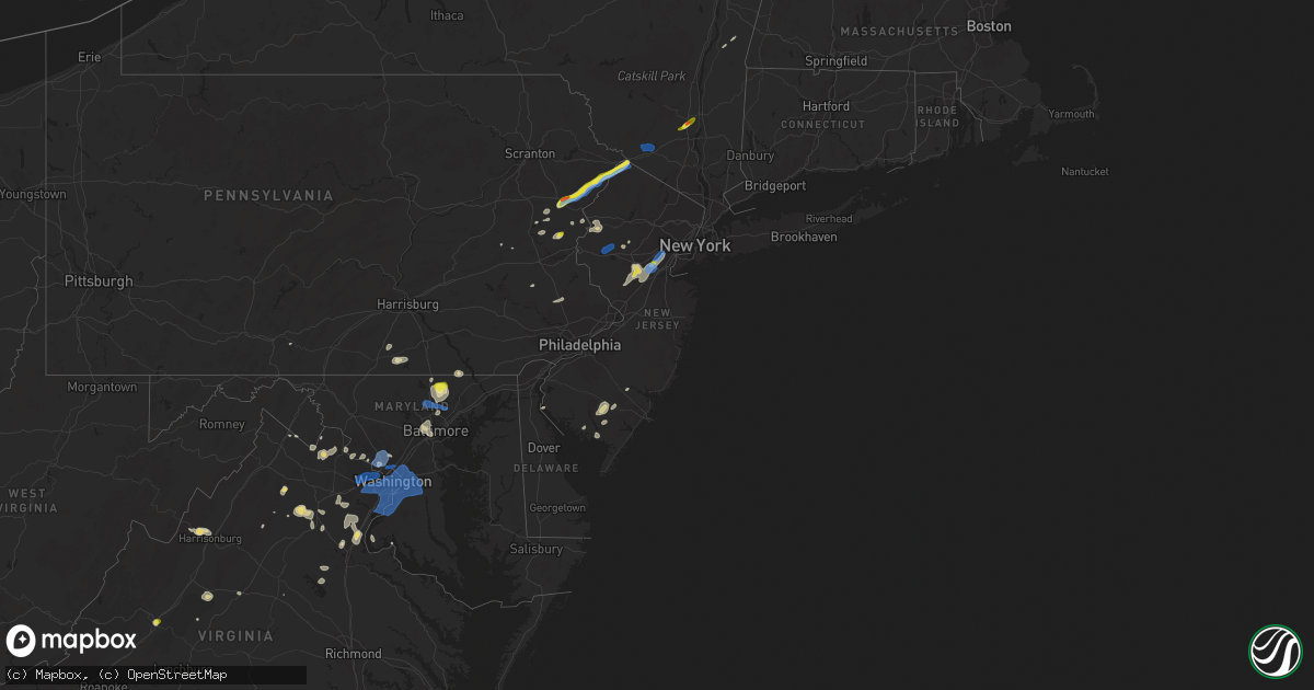
Hail Map in New Jersey on July 22, 2020
Get this storm
July 22 map
$229
one time, instant access
Download today. No call, no setup
Keep the $229
Bought the map and want the full workflow? Apply the entire $229 to a subscription within 7 days. None of it is wasted.
Every map, not just this one
This buys you this map. Subscription and you get every map we run, in the markets you choose from a few cities to whole states to nationwide. Plus real-time alerts the moment a storm fires.
Contact data
Name, contact info, occupancy, even credit band for addresses in the footprint. You go from where it hit to who to call.
Become the source they trust
Unlimited branding weather history reports on demand. You already have the documented answer ready for the property owner, and you are the one who showed up with it.
Property data and RoofTrace estimates
Pull up any address you have got, its value and the exact code rules for that jurisdiction, straight from One Click Code. Then RoofTrace estimates the squares, pitch, and roof value, priced the way you price.
Storm reports in New Jersey
New Jersey
| Date | Description |
|---|---|
| 07/22/20206:47 PM CDT | Several reports of trees and wires down near egg harbor city and port republic. Time estimated from radar. |
| 07/22/20206:46 PM CDT | A 63 mph wind gust was measured at the atlantic city international airport. |
| 07/22/20206:34 PM CDT | Numerous trees down on orange avenue. Time estimated by radar. |
| 07/22/20206:34 PM CDT | Several reports of trees and wires down near mays landing and estell manor. Time estimated from radar. |
| 07/22/20206:24 PM CDT | Numerous trees down on orange avenue. Time estimated by radar. |
| 07/22/20206:01 PM CDT | Down tree on west fairmont ave. Time estimated by radar. |
| 07/22/20205:57 PM CDT | Several reports of wires down between maurice river and millville. Time estimated from radar. |
| 07/22/20205:47 PM CDT | Several reports of power lines down in the milltown area. Time estimated from radar. |
| 07/22/20205:39 PM CDT | Downed wires on u.s. Highway 1 near milltown road. All lanes closed. Time estimated from radar. |
| 07/22/20205:37 PM CDT | Downed trees on south end parkway. |
| 07/22/20205:36 PM CDT | Wires down on carter street in basking ridge. Time estimated from radar. |
| 07/22/20205:35 PM CDT | Tress and wires reported down in south plainfield. |
| 07/22/20205:34 PM CDT | Several reports of wires down in north brunswick twp. Time estimated from radar. |
| 07/22/20205:31 PM CDT | Downed trees and wires near baileys mill road in new vernon. Time estimated from radar. |
| 07/22/20205:30 PM CDT | Quarter size hail reported in south plainfield. Photos via social media. |
| 07/22/20205:28 PM CDT | Several reports of wires down in bound brook and south bound brook. Time estimated from radar. |
| 07/22/20205:25 PM CDT | Lower alloways creek... Nj mesonet station. |
| 07/22/20205:24 PM CDT | Numerous trees down on orange avenue. Time estimated by radar. |
| 07/22/20205:24 PM CDT | Tree down across the driveway of a house on maple place between central avenue and orange avenue. |
| 07/22/20205:23 PM CDT | Downed power pole and wires on state highway 27 south of iselin railroad station in woodbridge twp. Time estimated from radar. |
| 07/22/20205:23 PM CDT | Downed tree on mary ellen drive near amari drive in edison. Time estimated from radar. |
| 07/22/20205:21 PM CDT | Downed tree and wires near ironia road near mendham. Time estimated from radar. |
| 07/22/20205:21 PM CDT | Several reports of trees and wires down in the dunellen area. Time estimated from radar. |
| 07/22/20205:21 PM CDT | Several reports of wires down in west trenton. Time estimated from radar. |
| 07/22/20205:10 PM CDT | Several reports of downed wires in the hopewell area. Time estimated from radar. |
| 07/22/20205:08 PM CDT | Trees and wires down near wagner road in sergeantsville. Time estimated from radar. |
| 07/22/20205:02 PM CDT | Downed trees and wires near fitzer road southeast of frenchtown. Time estimated from radar. |
| 07/22/20205:02 PM CDT | Downed trees and wires near woodglen. Time estimated from radar. |
| 07/22/20204:54 PM CDT | Downed trees and wires near new street in hampton. Time estimated from radar. |
| 07/22/20204:54 PM CDT | Downed tree on state highway 94 south of ramsey road in frelinghuysen twp. Time estimated from radar. |
| 07/22/20204:37 PM CDT | Downed tree on state highway 57 west of asbury broadway road in franklin twp. Time estimated from radar. |
| 07/22/20204:30 PM CDT | Downed trees and wires near old mine road in delaware water gap national recreation area. Time estimated from radar. |
| 07/22/20204:21 PM CDT | Downed trees and wires near sycamore lane and u.s. Highway 46 in ramseysburg. Time estimated from radar. |
| 07/22/20204:18 PM CDT | Downed trees and wires near hissim road in liberty twp. Time estimated from radar. |
| 07/22/20204:16 PM CDT | Downed trees and wires near larger cross road. Time estimated from radar. |
| 07/22/20203:09 PM CDT | Several reports of tree limbs and power lines down in allamuchy twp. Time estimated from radar. |
| 07/22/20203:01 PM CDT | Several reports of power lines down near hackettstown. Time estimated from radar. |
| 07/22/20202:30 PM CDT | Ping pong ball sized hail reported in montague. Photos via social media. |
| 07/22/20202:24 PM CDT | Reports of downed tree limbs and wires near lake marcia. Time estimated from radar. |
| 07/22/20202:18 PM CDT | Several reports of downed trees and wires in montague twp... Including near clove road and near new road. Time estimated from radar. |
| 07/22/20202:18 PM CDT | Tree down on deckerton tpke near the intersection with cr-675. Time estimated from radar. |
| 07/22/20202:16 PM CDT | A large tree was split at a residence on red hill rd. Time estimated from radar. |
| 07/22/20202:16 PM CDT | Hail up to half dollar size fell. Time estimated from radar. |
| 07/22/20202:15 PM CDT | A local report indicates 1.25 inch wind near 1 SE MONTAGUE |
| 07/22/20202:58 AM CDT | At 758 PM EDT, severe thunderstorms were located along a line extending from Shamong to near New Gretna to near Brigantine, moving east at 40 mph. HAZARD...60 mph wind gusts and penny size hail. SOURCE...Radar indicated. IMPACT...Damage to roofs, siding, trees, and power lines is possible. Locations impacted include... Atlantic City, Barnegat, Hammonton, Beachwood, Brigantine, Absecon, Shamong, Egg Harbor City, Tuckerton, Surf City, Port Republic, Atsion, Wading River, Holiday City South, Warren Grove, Chatsworth, Wharton State Forest, Holiday City-Berkeley, Bamber Lake and Cedar Glen Lakes.This includes the following highways... Garden State Parkway between mile markers 42 and 80. Atlantic City Expressway near mile marker 0. |
| 07/22/20202:23 AM CDT | At 723 PM EDT, severe thunderstorms were located along a line extending from Clayton to near Cumberland to near Seaville, moving east at 35 mph. HAZARD...60 mph wind gusts and penny size hail. SOURCE...Radar indicated. IMPACT...Damage to roofs, siding, trees, and power lines is possible. Locations impacted include... Vineland, Atlantic City, Millville, Ocean City, Cumberland, Pleasantville, Glassboro, Hammonton, Somers Point, Ventnor City, Brigantine, Northfield, Absecon, Clayton, Berlin, Tabernacle, Shamong, Margate City, Buena and Egg Harbor City.This includes the following highways... Garden State Parkway between mile markers 14 and 49. Atlantic City Expressway between mile markers 0 and 41. |
| 07/22/20201:46 AM CDT | At 646 PM EDT, severe thunderstorms were located along a line extending from near Hancocks Bridge to 6 miles south of Bivalve, moving northeast at 40 mph. HAZARD...60 mph wind gusts and penny size hail. SOURCE...Radar indicated. IMPACT...Damage to roofs, siding, trees, and power lines is possible. Locations impacted include... Vineland, Millville, Bridgeton, Cumberland, Glassboro, Lindenwold, Hammonton, Pitman, Northfield, Clayton, Berlin, Buena, Magnolia, Laurel Lake, Woodstown, Alloway, Weymouth, Quinton, Woodbine and Estell Manor.This includes the following highways... Garden State Parkway between mile markers 34 and 35. Atlantic City Expressway near mile marker 12, and between milemarkers 16 and 44. |
| 07/22/20201:30 AM CDT | At 630 PM EDT, severe thunderstorms were located along a line extending from Lake Telemark to near Morristown to near Martinsville to Millstone, moving east at 45 mph. HAZARD...60 mph wind gusts and quarter size hail. SOURCE...Radar indicated. IMPACT...Minor hail damage to vehicles is possible. Expect wind damage to trees and power lines. Severe thunderstorms will be near... Plainfield around 640 PM EDT. Summit and Millburn around 645 PM EDT. Wayne and Linden around 650 PM EDT. Elizabeth and Bloomfield around 655 PM EDT. Newark and Paterson around 700 PM EDT. Jersey City and Hackensack around 705 PM EDT. Hoboken and Bergenfield around 710 PM EDT. New York and Coney Island around 715 PM EDT. |
| 07/22/20201:21 AM CDT | At 621 PM EDT, a severe thunderstorm was located over Plainfield, moving northeast at 25 mph. HAZARD...60 mph wind gusts and quarter size hail. SOURCE...Radar indicated. IMPACT...Minor hail damage to vehicles is possible. Expect wind damage to trees and power lines. This severe thunderstorm will be near... Clark around 635 PM EDT. Linden and Summit around 640 PM EDT. Millburn and Union around 645 PM EDT. Elizabeth around 650 PM EDT. Port Richmond around 655 PM EDT. Newark and Jersey City around 700 PM EDT. |
| 07/22/20201:04 AM CDT | At 604 PM EDT, severe thunderstorms were located along a line extending from near Andover to near Clinton, moving east at 25 mph. HAZARD...60 mph wind gusts and penny size hail. SOURCE...Radar indicated. IMPACT...Damage to roofs, siding, trees, and power lines is possible. Locations impacted include... Perth Amboy, Morristown, Somerville, Somerset, Edison, Bridgewater, Carteret, Dover, Madison, Hopatcong, Middlesex, Florham Park, East Hanover, Lincoln Park, Bound Brook, Manville, Hackettstown, Chatham, Boonton and Wharton.This includes the following highways... New Jersey Turnpike between exits 11 and 13. Interstate 78 in New Jersey between mile markers 11 and 42. Interstate 80 in New Jersey between mile markers 13 and 48. Interstate 287 in New Jersey between mile markers 0 and 52. Garden State Parkway between mile markers 129 and 134. |
| 07/22/202012:54 AM CDT | At 553 PM EDT, severe thunderstorms were located along a line extending from near Newark to Massey to near Centerville, moving east at 25 mph. HAZARD...60 mph wind gusts and penny size hail. SOURCE...Radar indicated. IMPACT...Damage to roofs, siding, trees, and power lines is possible. Locations impacted include... Wilmington, Newark, Middletown, Elkton, Centerville, Pennsville, Smyrna, Carneys Point, Elsmere, New Castle, Penns Grove, Salem, Centreville, Clayton, Quinton, Greensboro, Oakland, Delaware City, Cheswold and Newport.This includes the following highways... New Jersey Turnpike near exit 1. Interstate 95 in Delaware between mile markers 0 and 14. Interstate 95 in Maryland near mile marker 109. Interstate 295 in New Jersey between mile markers 0 and 12. |
| 07/22/202012:16 AM CDT | At 515 PM EDT, a severe thunderstorm was located near Oxford, or 17 miles southwest of Newton, moving northeast at 15 mph. HAZARD...70 mph wind gusts and penny size hail. SOURCE...Radar indicated. IMPACT...Expect considerable tree damage. Damage is likely to mobile homes, roofs, and outbuildings. Locations impacted include... Easton, Newton, Hackettstown, Washington, Blairstown, High Bridge, Clinton, Belvidere, Harmony, Oxford, Alpha, Hope, Glen Gardner, Ferndale, Hampton, Frenchtown, West Easton, Milford, Califon and Bloomsbury.This includes the following highways... Interstate 78 in Pennsylvania between mile markers 75 and 76. Interstate 78 in New Jersey between mile markers 0 and 18. Interstate 80 in New Jersey between mile markers 0 and 23. |
| 07/21/202011:56 PM CDT | At 456 PM EDT, a severe thunderstorm was located over White House Station, or 10 miles west of Somerville, moving northeast at 10 mph. HAZARD...60 mph wind gusts and quarter size hail. SOURCE...Radar indicated. IMPACT...Minor damage to vehicles is possible. Wind damage to roofs, siding, trees, and power lines is possible. Locations impacted include... Bridgewater, Mendham, High Bridge, Clinton, Peapack And Gladstone, Chester, Lebanon, Califon, Far Hills, Long Valley, Annandale, Millington, White House Station, Basking Ridge, Succasunna-Kenvil, Bernardsville and Raritan.This includes the following highways... Interstate 78 in New Jersey between mile markers 16 and 38. Interstate 287 in New Jersey between mile markers 17 and 30. |
| 07/21/202011:49 PM CDT | At 449 PM EDT, severe thunderstorms were located along a line extending from Sun Valley to Topton, moving east at 25 mph. HAZARD...70 mph wind gusts and penny size hail. SOURCE...Law enforcement. Several reports of wind damage have been received from these storms. IMPACT...Expect considerable tree damage. Damage is likely to mobile homes, roofs, and outbuildings. Locations impacted include... Allentown, Easton, Bethlehem, Forks, Emmaus, Northampton, East Stroudsburg, Wilson, Hellertown, Nazareth, Bangor, Pen Argyl, Wind Gap, Bath, Belfast, West Easton, Tatamy, East Bangor, Steuben and Glendon.This includes the following highways... Northeast Extension between mile markers 47 and 57. Interstate 78 in Pennsylvania between mile markers 54 and 76. Interstate 80 in Pennsylvania between mile markers 300 and 314. Interstate 80 in New Jersey near mile marker 3. |
| 07/21/20209:19 PM CDT | At 218 PM EDT, a severe thunderstorm was located over Analomink, or near Mount Pocono, moving northeast at 25 mph. HAZARD...Ping pong ball size hail and 60 mph wind gusts. SOURCE...Radar indicated. IMPACT...People and animals outdoors will be injured. Expect hail damage to roofs, siding, windows, and vehicles. Expect wind damage to roofs, siding, and trees. Locations impacted include... Bushkill, Pecks Pond, Dingmans Ferry and Tamiment. |
| 07/21/20209:10 PM CDT | At 210 PM EDT, a severe thunderstorm was located over Reeders, or 7 miles south of Mount Pocono, moving northeast at 30 mph. HAZARD...60 mph wind gusts and quarter size hail. SOURCE...Radar indicated. IMPACT...Minor damage to vehicles is possible. Wind damage to roofs, siding, trees, and power lines is possible. Locations impacted include... Mount Pocono, East Stroudsburg, Bangor, Pen Argyl, Wind Gap, Belvidere, East Bangor, Stormville, Henryville, Brodheadsville, Werry Lake, Gilbert, Delaware Water Gap, Tannersville, Alpine Mountain, Kresgeville, Sun Valley, Reeders, Saylorsburg and Analomink.This includes the following highways... Interstate 80 in Pennsylvania between mile markers 295 and 314. Interstate 80 in New Jersey between mile markers 0 and 9. Interstate 380 in Pennsylvania between mile markers 0 and 1. |
| 07/21/20207:41 PM CDT | Weatherflow station. |
| 07/21/20207:11 PM CDT | Cwop station. |
| 07/21/20207:08 PM CDT | Corrects previous tstm wnd gst report from 4 se mystic island. Weatherflow station. |
| 07/21/20207:06 PM CDT | Hads station. |
| 07/21/20207:06 PM CDT | Weatherflow gauge. |
All States Impacted by Hail Map on July 22, 2020
Cities Impacted by Hail Map on July 22, 2020
- Sonora, TX
- Beresford, SD
- Lennox, SD
- Truckee, CA
- Sugar Grove, WV
- Fort Jones, CA
- Yreka, CA
- Nashville, TN
- Hermitage, TN
- Wallkill, NY
- Post, TX
- Vineland, NJ
- Milmay, NJ
- Richland, NJ
- Cheyenne, WY
- Sterling, VA
- Ashburn, VA
- Poolesville, MD
- Bedford, KY
- Portal, ND
- Flaxton, ND
- Amissville, VA
- Rixeyville, VA
- Marshall, VA
- Warrenton, VA
- Jeffersonton, VA
- Remington, VA
- Odonnell, TX
- McLaughlin, SD
- McIntosh, SD
- Buena Vista, VA
- Lexington, VA
- Wildorado, TX
- Midland, VA
- Newport, NJ
- Sierraville, CA
- Eagle Butte, SD
- Stamford, TX
- Isabel, SD
- Blunt, SD
- Agar, SD
- Timber Lake, SD
- Onida, SD
- Ridgeview, SD
- Pierre, SD
- Sylvester, TX
- Markleeville, CA
- Afton, VA
- North Brunswick, NJ
- Somerville, NJ
- Clark, NJ
- Colonia, NJ
- Hillsborough, NJ
- South Plainfield, NJ
- Scotch Plains, NJ
- Westfield, NJ
- Belle Mead, NJ
- Manville, NJ
- New Brunswick, NJ
- Highland Park, NJ
- Raritan, NJ
- Piscataway, NJ
- Cranford, NJ
- Garwood, NJ
- Franklin Park, NJ
- Kendall Park, NJ
- Skillman, NJ
- Edison, NJ
- Bridgewater, NJ
- Somerset, NJ
- Rockville, MD
- Silver Spring, MD
- Centerville, SD
- Montague, NJ
- Branchville, NJ
- Hudson, NY
- Burnsville, MS
- Corinth, MS
- Glen, MS
- Junction, IL
- Shawneetown, IL
- Front Royal, VA
- Huntly, VA
- Chester Gap, VA
- Hume, VA
- Linden, VA
- Stafford, VA
- Partlow, VA
- Bumpass, VA
- Spotsylvania, VA
- Rocksprings, TX
- Quantico, VA
- Triangle, VA
- Harrisonburg, VA
- Potomac, MD
- Germantown, MD
- Plainview, TX
- Pen Argyl, PA
- Bangor, PA
- Purcellville, VA
- Shepherdsville, KY
- Brooks, KY
- Louisville, KY
- Elkton, KY
- Sharon Grove, KY
- Hopkinsville, KY
- Troutdale, VA
- Montague, CA
- Lewiston, CA
- Ghent, NY
- Bethesda, MD
- Syria, VA
- Florence, AL
- Millville, NJ
- Buena, NJ
- Hinton, VA
- Hollowville, NY
- Claverack, NY
- Hext, TX
- Lignite, ND
- Westport, KY
- La Grange, KY
- Hayesville, NC
- Buchanan, GA
- Tallapoosa, GA
- Lehighton, PA
- Halethorpe, MD
- Catonsville, MD
- Brooklyn, MD
- Baltimore, MD
- Gwynn Oak, MD
- Windsor Mill, MD
- Middletown, DE
- Tannersville, PA
- East Stroudsburg, PA
- Stroudsburg, PA
- Bartonsville, PA
- Henryville, PA
- Layton, NJ
- Bushkill, PA
- Tamiment, PA
- Dingmans Ferry, PA
- Brandy Station, VA
- Elkwood, VA
- White Hall, MD
- Jarrettsville, MD
- Monkton, MD
- Louisa, VA
- Mount Pleasant, TN
- Slaton, TX
- Eldorado, TX
- Chancellor, SD
- Galax, VA
- Fries, VA
- Dayton, VA
- Ararat, VA
- New Tripoli, PA
- Douglas City, CA
- Paeonian Springs, VA
- Round Hill, VA
- Leesburg, VA
- Hamilton, VA
- Fallston, MD
- Phoenix, MD
- Hamlin, TX
- Salem, NJ
- Oneonta, AL
- Sweetwater, TX
- Oxford, NJ
- Great Meadows, NJ
- Belvidere, NJ
- Columbia, NJ
- Blairstown, NJ
- East Berlin, PA
- New Oxford, PA
- Kress, TX
- Kunkletown, PA
- Kresgeville, PA
- Gilbert, PA
- Minden, NV
- Nazareth, PA
- Bath, PA
- Hereford, TX
- Vega, TX
- Mcarthur, CA
- Spring Grove, PA
- Hanover, PA
- Leesburg, NJ
- Heislerville, NJ
- Junction, TX
- London, TX
- Mays Landing, NJ
- Littlefield, TX
- Menard, TX
- Buffalo, WY
- Burns, WY
- Rochester, TX
- Whiteford, MD
- Fawn Grove, PA
- Pylesville, MD
- Delta, PA
- Roseland, VA
- Charlottesville, VA
- Augusta, WV
- Delray, WV
- Janesville, CA
- Hillsdale, NY
- Lutherville Timonium, MD
- Towson, MD
- Statesboro, GA
- Fredericksburg, VA
- Highland, NY
- Manassas, VA
- Floyds Knobs, IN
- Sellersburg, IN
- Trinity Center, CA
- Bristow, VA
- Nokesville, VA
- Junction City, CA
- Ardmore, TN
- Justiceburg, TX
- Millwood, GA
- Manor, GA
- Iuka, MS
- McSherrystown, PA
- Muscadine, AL
- Palmerton, PA
- Walnutport, PA
- Danielsville, PA
- Capon Bridge, WV
- Harpers Ferry, WV
- Bluemont, VA
- Lyndhurst, VA
- Columbia, TN
- Dickerson, MD
- Barto, PA
- Bechtelsville, PA
- Dixon, KY
- Boulder, UT
- Cave In Rock, IL
- Ridgway, IL
- Portland, TN
- Gallatin, TN
- Sumerduck, VA
- Bealeton, VA
- Eddyville, KY
- Cadiz, KY
- Princeton, KY
- King George, VA
- Hale Center, TX
- Summit Point, WV
- Berryville, VA
- Rutherfordton, NC
- Lake Lure, NC
- New Ringgold, PA
- Castleton, VA
- Jasper, IN
- Nanjemoy, MD
- Sperryville, VA
- Scotrun, PA
- Yellow Spring, WV
- Hillsville, VA
- Fancy Gap, VA
- Petersburg, WV
- Charlotte, NC
- Matthews, NC
- Far Hills, NJ
- Gladstone, NJ
- Shelbyville, TN
- Hammonton, NJ
- Hillsdale, WY
- Ralls, TX
- Crosbyton, TX
- Baldwin, MD
- McConnellsburg, PA
- Effort, PA
- Sparks Glencoe, MD
- Parkton, MD
- Ware, MA
- Belchertown, MA
- Palmer, MA
- Parker, SD
- Hurley, SD
- Califon, NJ
- Stephenson, VA
- Clear Brook, VA
- Axson, GA
- Cottontown, TN
- Mount Bethel, PA
- Almo, KY
- Murray, KY
- Pendleton, KY
- Sikeston, MO
- Canyon, TX
- Ovando, MT
- Prospect, TN
- Orlinda, TN
- Cross Plains, TN
- Cherokee, AL
- Harleysville, PA
- Souderton, PA
- Schwenksville, PA
- Fisherville, KY
- Simpsonville, KY
- Walden, NY
- Marlboro, NY
- Milton, NY
- Macdoel, CA
- Weaverville, CA
- Wind Gap, PA
- Vienna, VA
- Herndon, VA
- Fairfax, VA
- Reston, VA
- McLean, VA
- Great Falls, VA
- Falls Church, VA
- Oakton, VA
- Lanham, MD
- Bryans Road, MD
- Capitol Heights, MD
- Hyattsville, MD
- Temple Hills, MD
- Burke, VA
- Fort Myer, VA
- Fort Belvoir, VA
- Lorton, VA
- Accokeek, MD
- Oxon Hill, MD
- Andrews Air Force Base, MD
- Riverdale, MD
- Indian Head, MD
- College Park, MD
- Brentwood, MD
- Annandale, VA
- Arlington, VA
- Bowie, MD
- Takoma Park, MD
- Springfield, VA
- Washington, DC
- Greenbelt, MD
- Upper Marlboro, MD
- Clinton, MD
- Fairfax Station, VA
- Bladensburg, MD
- Suitland, MD
- District Heights, MD
- Mount Rainier, MD
- Alexandria, VA
- Fort Washington, MD
- Naval Anacost Annex, DC
- Kensington, MD
- Garrett Park, MD
- Derwood, MD
- Chevy Chase, MD
- Reisterstown, MD
- Hunt Valley, MD
- Glen Arm, MD
- Cockeysville, MD
- Street, MD
- Sussex, NJ
- Otisville, NY
- Middletown, NY
- Glen Gardner, NJ
- Clinton, NJ
- High Bridge, NJ
- Hampton, NJ
- Lebanon, NJ
- Annandale, NJ
- Fanwood, NJ
- Plainfield, NJ


