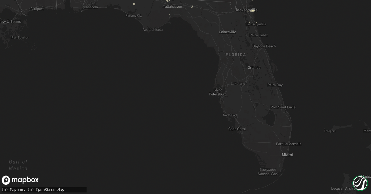
Hail Map in Florida on July 22, 2015
Get this storm
July 22 map
$229
one time, instant access
Download today. No call, no setup
Keep the $229
Bought the map and want the full workflow? Apply the entire $229 to a subscription within 7 days. None of it is wasted.
Every map, not just this one
This buys you this map. Subscription and you get every map we run, in the markets you choose from a few cities to whole states to nationwide. Plus real-time alerts the moment a storm fires.
Contact data
Name, contact info, occupancy, even credit band for addresses in the footprint. You go from where it hit to who to call.
Become the source they trust
Unlimited branding weather history reports on demand. You already have the documented answer ready for the property owner, and you are the one who showed up with it.
Property data and RoofTrace estimates
Pull up any address you have got, its value and the exact code rules for that jurisdiction, straight from One Click Code. Then RoofTrace estimates the squares, pitch, and roof value, priced the way you price.
Storm reports in Florida
Florida
| Date | Description |
|---|---|
| 07/22/20156:59 PM CDT | Tree in the right lane westbound on i-10 |
| 07/22/20156:08 PM CDT | Power lines down in havana. |
| 07/22/20155:35 PM CDT | Few trees down |
| 07/22/20155:25 PM CDT | Tree blown down onto flowers road. |
| 07/22/20155:03 PM CDT | Large tree limbs blown down in strong winds. Reported north of sneads on wjhg-tv facebook page. |
| 07/22/20154:40 PM CDT | Reports of 2 powerlines down in the city of starke one of which is near state road 100 and laura street and have caused multiple traffic lights out in the city of stark |
| 07/22/20154:40 PM CDT | Emergency manager reports tree blown down across powerlines that came down across the road near lakeshore drive and lakewood drive. The tree also took the power pole do |
| 07/22/20154:39 PM CDT | Tree fell on a power line near hwy 20 and county road 275. |
| 07/22/20154:30 PM CDT | Several trees down near wakulla gardens and dakota drive. |
| 07/22/20154:30 PM CDT | Several trees down near wakulla gardens and dakota drive. |
| 07/22/20154:25 PM CDT | A tree was blown down at the intersection of sw 160th street and sw 65th avenue on the northside of crosby lake. |
| 07/22/20154:12 PM CDT | Power lines down at hwy 77 and moss hill road. |
| 07/22/20154:00 PM CDT | 58 mph measured gust at the fire station. |
| 07/22/20154:00 PM CDT | Three power lines down along bream fountain road. |
| 07/22/20153:55 PM CDT | A spotter reported large oak limbs blown down and estimtaed wind gusts up to 55 mph. There were also several large signs and road signs blown down. |
| 07/22/20153:50 PM CDT | Top of a mcdonalds sign on beach blvd was ripped from the pole and blown about 50 feet. |
| 07/22/20153:45 PM CDT | Public report of powerline down along san jose blvd just south of i-295 beltway |
| 07/22/20152:50 PM CDT | Public twitter report and photo of a large tree down and blocking the interstate 295 southbound ramp from normandy blvd. |
All States Impacted by Hail Map on July 22, 2015
Cities Impacted by Hail Map on July 22, 2015
- Attica, KS
- Glencoe, OK
- Stillwater, OK
- Isabel, KS
- Nashville, KS
- Atwood, KS
- Box Springs, GA
- Colby, KS
- Havana, FL
- Graceville, FL
- Soddy Daisy, TN
- Thomasville, AL
- McGehee, AR
- Thomasville, GA
- Hamill, SD
- Gregory, SD
- Alberta, AL
- Bell Buckle, TN
- Perry, OK
- Albany, GA
- Atmore, AL
- Arlington, AL
- Pine Hill, AL
- Magnolia, AL
- Puposky, MN
- Bemidji, MN
- Sulligent, AL
- Valley, AL
- Stratton, NE
- Palisade, NE
- Texhoma, OK
- Stratford, TX
- Hollywood, SC
- Trenton, NE
- Anthony, KS
- Culbertson, NE
- Gordon, AL
- Skipperville, AL
- Bascom, FL
- Chipley, FL
- Notasulga, AL
- Bonifay, FL
- Burbank, OK
- Rexford, KS
- Gem, KS
- Oakley, KS
- Lance Creek, WY
- South Pittsburg, TN
- Ashland, AL
- Harper, KS
- Nashville, GA
- Lusk, WY
- Cass Lake, MN
- Wetumpka, AL
- Hilton Head Island, SC
- Pratt, KS
- Monument, KS
- Lakeland, GA
- Valdosta, GA
- Nowata, OK
- Attapulgus, GA
- Quincy, FL
- Saint Augustine, FL
- Macon, MS
- Oxford, MS
- Abbeville, MS
- Ripley, OK
- Agra, OK
- Cushing, OK
- Holt, FL
- Guthrie, OK
- Gattman, MS
- Reliance, SD
- Batesville, MS
- Courtland, MS
- Alexander City, AL
- Sardis, AL
- Fernandina Beach, FL
- Clio, AL
- Ariton, AL
- Tallahassee, FL
- Ringgold, GA
- Apison, TN
- Wadley, AL
- Waukomis, OK
- Prattville, AL
- Millbrook, AL
- Sawyer, KS
- Tallassee, AL
- Montgomery, AL
- Yale, OK
- Selma, AL
- Eddyville, NE
- Oconto, NE
- Titus, AL
- Geneva, AL
- Bald Knob, AR
- Stroud, OK
- Camp Hill, AL
- Dadeville, AL
- Chelsea, OK
- Jacksonville, FL
- Donalsonville, GA
- Crawford, NE
- Searcy, AR
- Fort Pierce, FL
- Enid, MS
- Pope, MS
- McCalla, AL
- Woodstock, AL
- Torrington, WY
- Orrville, AL
- Camden, AL
- Kellyton, AL
- Goodwater, AL
- Timberon, NM
- Cloudcroft, NM
- Tulsa, OK
- Sand Springs, OK
- Shelbyville, TN
- Medicine Lodge, KS
- Pawnee, OK
- Hayes Center, NE
- Gould, AR
- Drumright, OK
- Sylvester, GA
- Zenda, KS
- Cragford, AL
- Lineville, AL
- Neptune Beach, FL
- Jacksonville Beach, FL
- Rohwer, AR
- Perkins, OK
- Cottondale, AL
- Vance, AL
- Sedan, KS
- Samson, AL
- Kinston, AL
- Hawthorne, FL
- Augusta, AR
- Perdido, AL
- Drummond, OK
- Childersburg, AL
- Sylacauga, AL
- Merino, CO
- Ooltewah, TN
- Cohutta, GA
- Harrison, NE
- Atlantic Beach, FL
- Caledonia, MS
- Vernon, AL
- Greenville, FL
- Dozier, AL
- Andalusia, AL
- Kaw City, OK
- Shidler, OK
- Orlando, FL
- Milan, KS
- Crawfordville, FL
- Geuda Springs, KS
- Depew, OK


