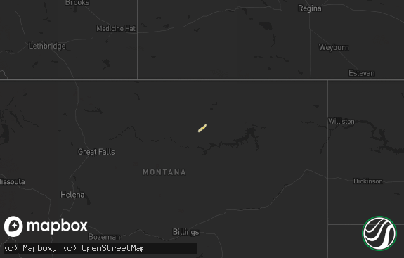
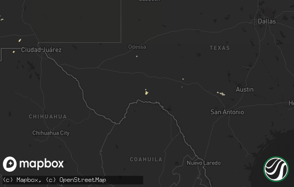
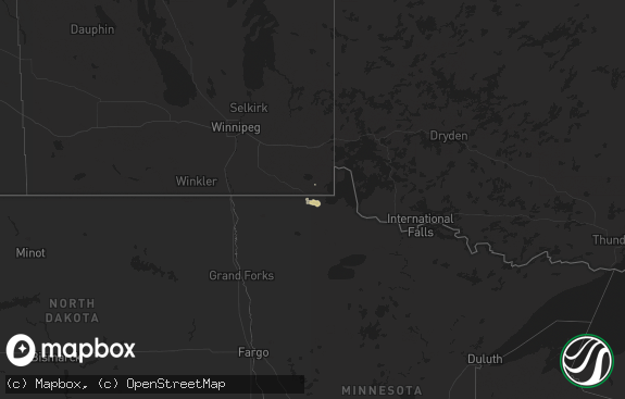
Hail Map in Montana on July 22, 2011
The weather event in Montana on July 22, 2011 includes Hail map. 22 states and 478 cities were impacted and suffered possible damage. The total estimated number of properties impacted is 0.

Hail
0
Estimated number of impacted properties by a 1.00" hail or larger0
Estimated number of impacted properties by a 1.75" hail or larger0
Estimated number of impacted properties by a 2.50" hail or largerStorm reports in Montana
Montana
| Date | Description |
|---|---|
| 07/22/20116:55 PM CDT | A local report indicates 59 MPH wind near GLENDIVE |
| 07/22/20116:45 PM CDT | A local report indicates 1.00 inch wind near 1 ENE KNOWLTON |
| 07/22/20116:45 PM CDT | A local report indicates 60 MPH wind near 17 SW ISMAY |
| 07/22/20116:12 PM CDT | Possible brief tornado toughdown. Relayed by prairie county dispatch. |
| 07/22/20116:12 PM CDT | A local report indicates 59 MPH wind near GLENDIVE |
| 07/22/20116:12 PM CDT | A local report indicates 75 MPH wind near 2 W BLOOMFIELD |
| 07/22/20116:11 PM CDT | A local report indicates 58 MPH wind near 19 NW TERRY |
| 07/22/20116:00 PM CDT | Also measured 1.78 inches of rain |
| 07/22/20115:20 PM CDT | A local report indicates 1.25 inch wind near 11 N CROW ROCK |
| 07/22/20115:15 PM CDT | A local report indicates 60 MPH wind near 5 S WOLF POINT |
| 07/22/20115:00 PM CDT | Hail still on the ground 4 hours afer the event. Crops damaged by hail. |
| 07/22/20114:46 PM CDT | A local report indicates 1.00 inch wind near FRAZER |
| 07/22/20114:46 PM CDT | A local report indicates 1.00 inch wind near 9 SSW LUSTRE |
| 07/22/20114:46 PM CDT | A local report indicates 65 MPH wind near 8 SSW WATKINS |
| 07/22/20114:45 PM CDT | A local report indicates 1.00 inch wind near 16 NNE FRAZER |
| 07/22/20114:30 PM CDT | Roof damaged by high winds. |
| 07/22/20114:05 PM CDT | A local report indicates 1.25 inch wind near 5 WNW NASHUA |
| 07/22/20114:04 PM CDT | A local report indicates 1.25 inch wind near NASHUA |
| 07/22/20113:59 PM CDT | A local report indicates 2.75 inch wind near 2 N DUCK CREEK FISHING |
| 07/22/20113:46 PM CDT | A local report indicates 1.00 inch wind near GLASGOW |
| 07/22/20113:43 PM CDT | A local report indicates 1.00 inch wind near 5 SSE GLASGOW |
| 07/22/20113:42 PM CDT | Mainly dime and quarter size hail with some half dollar size. |
| 07/22/20112:03 PM CDT | A local report indicates 1.00 inch wind near CONTENT |
| 07/22/20112:03 PM CDT | A local report indicates 1.50 inch wind near MALTA |
| 07/21/20118:30 PM CDT | A local report indicates 1.25 inch wind near 8 ESE WEBSTER |
| 07/21/20118:20 PM CDT | A local report indicates 1.25 inch wind near 7 E EKALAKA |
| 07/21/20118:00 PM CDT | A local report indicates 1.50 inch wind near EKALAKA |
| 07/21/20118:00 PM CDT | A local report indicates 1.00 inch wind near 1 NE EKALAKA |
| 07/21/20117:57 PM CDT | A local report indicates 1.75 inch wind near EKALAKA |
| 07/21/20117:30 PM CDT | Trees knocked over. |
| 07/21/20117:26 PM CDT | A local report indicates 75 MPH wind near WIBAUX |
All States Impacted by Hail Map on July 22, 2011
Cities Impacted by Hail Map on July 22, 2011
- Opheim, MT
- Hinsdale, MT
- Wharncliffe, WV
- Gilbert, WV
- Ralph, SD
- Lodgepole, SD
- Bismarck, ND
- Lambert, MT
- Circle, MT
- Clinton, MN
- Ortonville, MN
- Fort Ransom, ND
- Marion, ND
- Verona, ND
- Litchville, ND
- Lamoure, ND
- Poplar, MT
- Webster, SD
- Kinsey, MT
- Whiteville, NC
- Ezel, KY
- West Liberty, KY
- Mandan, ND
- Bloomfield, MT
- Hurdsfield, ND
- Chaseley, ND
- Watertown, SD
- Strandburg, SD
- Labolt, SD
- Revillo, SD
- Westport, SD
- Tuttle, ND
- Pawnee City, NE
- Hettinger, ND
- Richey, MT
- Ekalaka, MT
- Buffalo, SD
- Camp Crook, SD
- Frazer, MT
- Ypsilanti, ND
- Nashua, MT
- Fort Peck, MT
- Terry, MT
- Brockton, MT
- Jobstown, NJ
- Columbus, NJ
- Chesterfield, NJ
- Wrightstown, NJ
- Joint Base Mdl, NJ
- Malta, MT
- Wallingford, KY
- Maple Hill, NC
- Saint Francis, SD
- Parmelee, SD
- Forsyth, MT
- Rhame, ND
- Glenwood, MN
- Alexandria, MN
- Appleton, MN
- Wolf Point, MT
- Belfield, ND
- Blackshear, GA
- Miles City, MT
- Grassy Butte, ND
- Selfridge, ND
- Crystal City, TX
- Richland, MT
- Fort Myers, FL
- Baker, MT
- Killdeer, ND
- Chauncey, WV
- Dawson, MN
- Madison, MN
- Woodworth, ND
- Sykeston, ND
- Carrington, ND
- Aberdeen, SD
- Kingwood, TX
- Humble, TX
- Huffman, TX
- Stockholm, ME
- New Sweden, ME
- South Shore, SD
- Summit, SD
- Williston, ND
- Cartwright, ND
- Alexander, ND
- Fort Davis, TX
- Maysville, NC
- Twin Brooks, SD
- New Rockford, ND
- Holyoke, CO
- Ismay, MT
- Lisbon, ND
- Milnor, ND
- Draper, VA
- Pulaski, VA
- Wilmot, SD
- Reva, SD
- Jamestown, ND
- Montpelier, ND
- Elbow Lake, MN
- Ashby, MN
- Dalton, MN
- Bowman, ND
- Culbertson, MT
- Beulah, ND
- Hazen, ND
- Driscoll, ND
- Cleveland, ND
- Braddock, ND
- Moffit, ND
- Robinson, ND
- Tappen, ND
- Dawson, ND
- Medina, ND
- Napoleon, ND
- Gackle, ND
- Streeter, ND
- Steele, ND
- Jud, ND
- Glasgow, MT
- Ludlow, SD
- Sinclair, ME
- Linton, ND
- Wishek, ND
- Zeeland, ND
- Kintyre, ND
- Concordia, KS
- Independence, VA
- Elk Creek, VA
- Vida, MT
- Long Lake, SD
- Leola, SD
- Marietta, MN
- Dickey, ND
- Brockway, MT
- Cohagen, MT
- Bunceton, MO
- Axson, GA
- Nicholls, GA
- Woonsocket, SD
- Wessington Springs, SD
- Dickinson, ND
- New England, ND
- Regent, ND
- Grace City, ND
- Lodge Grass, MT
- Mission, SD
- Rosebud, SD
- Todd, NC
- Creston, NC
- Ozona, TX
- Crane, TX
- Lemmon, SD
- Regan, ND
- Trenton, NC
- Watford City, ND
- Wray, CO
- Lowry, MN
- Villard, MN
- Wilton, ND
- Higbee, MO
- Ashley, ND
- Aurora, KS
- Lehigh Acres, FL
- Zap, ND
- Hazel, SD
- Washburn, ND
- Quemado, TX
- Deland, FL
- Burchard, NE
- Brandon, MN
- Garfield, MN
- Parkers Prairie, MN
- Doland, SD
- Clermont, FL
- Coin, IA
- Mcville, ND
- Donnelly, MN
- Herman, MN
- Ashland, ME
- Mchenry, ND
- Lindsay, MT
- Glendive, MT
- Keene, ND
- New Town, ND
- Mandaree, ND
- Mercer, ND
- Mcclusky, ND
- White River, SD
- Mott, ND
- Morristown, SD
- Keldron, SD
- New Leipzig, ND
- Watauga, SD
- Warrensville, NC
- Savage, MT
- Brackettville, TX
- Menoken, ND
- Caribou, ME
- Plankinton, SD
- Letcher, SD
- Murdock, MN
- Corona, SD
- Scranton, ND
- Sparta, NC
- Uvalde, TX
- Steinauer, NE
- Arnegard, ND
- Niagara, ND
- Petersburg, ND
- Aneta, ND
- Hyden, KY
- Medora, ND
- Hazelton, ND
- Oakwood, VA
- Foxhome, MN
- Fergus Falls, MN
- Campbell, MN
- Alden, IA
- Radcliffe, IA
- Warrenton, NC
- Norlina, NC
- Sanderson, FL
- Glen Saint Mary, FL
- Clark, SD
- Raymond, SD
- Verdon, NE
- Shubert, NE
- Falls City, NE
- Nemaha, NE
- Houston, TX
- Amidon, ND
- South Heart, ND
- California, MO
- Latham, MO
- Golden Valley, ND
- Breckenridge, MN
- Dumont, MN
- Chokio, MN
- Chapmanville, WV
- Dingess, WV
- Johnson, NE
- Eustis, FL
- Porter, TX
- Richlands, VA
- Fort Kent, ME
- Salyersville, KY
- Royalton, KY
- Orange City, FL
- Deltona, FL
- Paisley, FL
- Lake Helen, FL
- Vincentown, NJ
- Pemberton, NJ
- Browns Mills, NJ
- Reeder, ND
- Prairie City, SD
- Cathay, ND
- Nelson, MN
- Ashton, SD
- Willmar, MN
- Spicer, MN
- New London, MN
- Evansville, MN
- Battle Lake, MN
- Crumpler, NC
- Bradley, SD
- Graceville, MN
- Beaver, WV
- Parrish, FL
- Myakka City, FL
- New Salem, ND
- Almont, ND
- Danvers, MN
- Benson, MN
- York, PA
- Red Lion, PA
- Windsor, PA
- Dallastown, PA
- Fairview, MT
- Table Rock, NE
- Elk Creek, NE
- Saint Anthony, ND
- Halliday, ND
- Clarendon, NC
- Emigrant, MT
- Beckley, WV
- Dawson, NE
- Humboldt, NE
- Eagle Pass, TX
- Richardton, ND
- Marion, VA
- Chilhowie, VA
- Santa Rosa, NM
- Northwood, ND
- Hurt, VA
- Harvey, ND
- Orange Park, FL
- Big Springs, NE
- Glade Spring, VA
- Meadowview, VA
- Sidney, MT
- Mount Hope, WV
- Wyola, MT
- Madison, WV
- Sandy Hook, KY
- New Egypt, NJ
- Bordentown, NJ
- Cookstown, NJ
- Lakehurst, NJ
- Chatsworth, NJ
- Peerless, MT
- Mountain City, TN
- Cyclone, WV
- Larimore, ND
- Dunn Center, ND
- Naples, FL
- Volborg, MT
- Wellington, KY
- Swords Creek, VA
- Honaker, VA
- Scarbro, WV
- Starbuck, MN
- Moberly, MO
- Flasher, ND
- Lexington, KY
- Arthur, NE
- Hanover, KS
- Washington, KS
- Holloway, MN
- Jackson, KY
- Dodge, ND
- Ortley, SD
- Marvin, SD
- Stockholm, SD
- Goodwin, SD
- Peever, SD
- Clear Fork, WV
- Davin, WV
- Oceana, WV
- Amherstdale, WV
- Yolyn, WV
- Edgeley, ND
- Rowe, VA
- Goodrich, ND
- Saulsville, WV
- Pekin, ND
- Kingsport, TN
- Fall Branch, TN
- Manchester Township, NJ
- Fort Stockton, TX
- Stewartstown, PA
- Correll, MN
- Nichols, SC
- Galivants Ferry, SC
- Green Sea, SC
- Logan, WV
- Lyburn, WV
- Switzer, WV
- Omar, WV
- Man, WV
- Verner, WV
- Kensington, MN
- Saint Agatha, ME
- Stanton, ND
- Frenchville, ME
- Kerkhoven, MN
- Hancock, MN
- Clontarf, MN
- Sunburg, MN
- Manning, ND
- Jeffrey, WV
- Danville, WV
- Clarksburg, MO
- Bighorn, MT
- Conde, SD
- Farwell, MN
- Felton, PA
- Lost Creek, KY
- Wing, ND
- Nahunta, GA
- La Pryor, TX
- Florence, SD
- Rock Port, MO
- Starke, FL
- Jacksonville, FL
- Saint Johns, FL
- Davenport, FL
- Harts, WV
- Morehead, KY
- Huntsville, MO
- Barrett, MN
- Underwood, MN
- Cedar Bluff, VA
- Taylor, ND
- Sorrento, FL
- Hillsboro, KY
- Iraan, TX
- Bristol, TN
- Michigan, ND
- Altavista, VA
- Pennock, MN
- Saltville, VA
- Manson, IA
- Palmer, IA
- Pomeroy, IA
- Debord, KY
- Tomahawk, KY
- Surveyor, WV
- Glen Daniel, WV
- Glen White, WV
- Crab Orchard, WV
- Slab Fork, WV
- Lester, WV
- Alpine, TX
- Saco, MT
- Cuba, MO
- Steelville, MO
- Raven, VA
- Big Stone City, SD
- Cape Coral, FL
- North Fort Myers, FL
- Milbank, SD
- Paynesville, MN
- Hoffman, MN
- Groton, SD
- Stratford, SD
- Prestonsburg, KY
- Auxier, KY
- East Point, KY
- Hagerhill, KY
- Versailles, MO
- Barnett, MO
- Conway, SC
- Center, ND
- Fairfield, ND
- Beardsley, MN
- Osakis, MN
- Johnson City, TN
- Glen Fork, WV
- Jesse, WV
- Matheny, WV
- Ravencliff, WV
- West Jefferson, NC
- Westboro, MO
- Fredonia, ND
- Frankfort, SD
- Arcadia, FL
- Bristol, SD
- Clear Creek, WV
- Garden City, SD
- Lehr, ND
- Alma, GA
- Lansing, NC
- Baldwin, ND
- Jonesborough, TN
- Wheaton, MN
- Waubay, SD
- Louisa, KY
- Del Rio, TX
- Ipswich, SD
- Canal Point, FL
- Manor, GA
- Saint George, GA
- Hiwassee, VA
- Belgrade, MN
- Cool Ridge, WV
- Willis, VA
- Waycross, GA
- Kenansville, FL
- Fairfax, MO
- Stella, NE
- Saint Augustine, FL
- Wallace, SD
- Tolna, ND
- Boonville, MO


