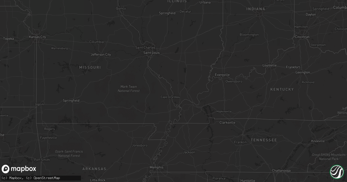
Hail Map in West Virginia on July 22, 2011
Get this storm
July 22 map
$229
one time, instant access
Download today. No call, no setup
Keep the $229
Bought the map and want the full workflow? Apply the entire $229 to a subscription within 7 days. None of it is wasted.
Every map, not just this one
This buys you this map. Subscription and you get every map we run, in the markets you choose from a few cities to whole states to nationwide. Plus real-time alerts the moment a storm fires.
Contact data
Name, contact info, occupancy, even credit band for addresses in the footprint. You go from where it hit to who to call.
Become the source they trust
Unlimited branding weather history reports on demand. You already have the documented answer ready for the property owner, and you are the one who showed up with it.
Property data and RoofTrace estimates
Pull up any address you have got, its value and the exact code rules for that jurisdiction, straight from One Click Code. Then RoofTrace estimates the squares, pitch, and roof value, priced the way you price.
Storm reports in West Virginia
West Virginia
| Date | Description |
|---|---|
| 07/22/20116:10 PM CDT | Large branches broken. Winds in area around 40 mph. |
| 07/22/20115:20 PM CDT | Trees down on rte 10 just outside of man |
| 07/22/20115:10 PM CDT | Several large trees down. |
| 07/22/20115:10 PM CDT | Several trees down on rte 1 and rte 3 in the ravencliff area...doh called out to clear them...power outages reported in the area |
| 07/22/20114:24 PM CDT | Two trees across durgan road as well as several branches on powerlines. |
| 07/22/20114:00 PM CDT | A few trees knocked down across roadway near intersection of corners road and north fork highway. |
| 07/22/20113:50 PM CDT | A local report indicates 60 MPH wind near 2 NE KLINE GAP |
| 07/22/20112:13 PM CDT | Tree onto powerlines near intersection of williamsport pike and railroad drive |
| 07/22/20112:05 PM CDT | Several branches 6 to 8 inches in diameter down. A large tree knocked down onto power lines. All near intersection of st. Andrews dr. And spring mills rd. |
| 07/22/20112:05 PM CDT | Tree branches down near grade road and vineyard road |
| 07/22/20111:51 PM CDT | Trees down on st andrews dr. Near williamsport pike and bedington rd. |
| 07/22/20111:33 PM CDT | 6-7 trees down one to two feet in diameter |
| 07/22/20111:20 PM CDT | Trees down near campbell road and springfield pike. |
| 07/22/20111:16 PM CDT | A tree was down in levels near intersection of little cacapon and levels roads. |
| 07/22/20111:16 PM CDT | A tree was down in levels. |
| 07/22/20111:12 PM CDT | Trees down on huffman road near route 220. |
| 07/22/201112:56 PM CDT | 6-7 trees down one to two feet in diameter |
All States Impacted by Hail Map on July 22, 2011
Cities Impacted by Hail Map on July 22, 2011
- Opheim, MT
- Hinsdale, MT
- Wharncliffe, WV
- Gilbert, WV
- Ralph, SD
- Lodgepole, SD
- Bismarck, ND
- Lambert, MT
- Circle, MT
- Clinton, MN
- Ortonville, MN
- Fort Ransom, ND
- Marion, ND
- Verona, ND
- Litchville, ND
- Lamoure, ND
- Poplar, MT
- Webster, SD
- Kinsey, MT
- Whiteville, NC
- Ezel, KY
- West Liberty, KY
- Mandan, ND
- Bloomfield, MT
- Hurdsfield, ND
- Chaseley, ND
- Watertown, SD
- Strandburg, SD
- Labolt, SD
- Revillo, SD
- Westport, SD
- Tuttle, ND
- Pawnee City, NE
- Hettinger, ND
- Richey, MT
- Ekalaka, MT
- Buffalo, SD
- Camp Crook, SD
- Frazer, MT
- Ypsilanti, ND
- Nashua, MT
- Fort Peck, MT
- Terry, MT
- Brockton, MT
- Jobstown, NJ
- Columbus, NJ
- Chesterfield, NJ
- Wrightstown, NJ
- Joint Base Mdl, NJ
- Malta, MT
- Wallingford, KY
- Maple Hill, NC
- Saint Francis, SD
- Parmelee, SD
- Forsyth, MT
- Rhame, ND
- Glenwood, MN
- Alexandria, MN
- Appleton, MN
- Wolf Point, MT
- Belfield, ND
- Blackshear, GA
- Miles City, MT
- Grassy Butte, ND
- Selfridge, ND
- Crystal City, TX
- Richland, MT
- Fort Myers, FL
- Baker, MT
- Killdeer, ND
- Chauncey, WV
- Dawson, MN
- Madison, MN
- Woodworth, ND
- Sykeston, ND
- Carrington, ND
- Aberdeen, SD
- Kingwood, TX
- Humble, TX
- Huffman, TX
- Stockholm, ME
- New Sweden, ME
- South Shore, SD
- Summit, SD
- Williston, ND
- Cartwright, ND
- Alexander, ND
- Fort Davis, TX
- Maysville, NC
- Twin Brooks, SD
- New Rockford, ND
- Holyoke, CO
- Ismay, MT
- Lisbon, ND
- Milnor, ND
- Draper, VA
- Pulaski, VA
- Wilmot, SD
- Reva, SD
- Jamestown, ND
- Montpelier, ND
- Elbow Lake, MN
- Ashby, MN
- Dalton, MN
- Bowman, ND
- Culbertson, MT
- Beulah, ND
- Hazen, ND
- Driscoll, ND
- Cleveland, ND
- Braddock, ND
- Moffit, ND
- Robinson, ND
- Tappen, ND
- Dawson, ND
- Medina, ND
- Napoleon, ND
- Gackle, ND
- Streeter, ND
- Steele, ND
- Jud, ND
- Glasgow, MT
- Ludlow, SD
- Sinclair, ME
- Linton, ND
- Wishek, ND
- Zeeland, ND
- Kintyre, ND
- Concordia, KS
- Independence, VA
- Elk Creek, VA
- Vida, MT
- Long Lake, SD
- Leola, SD
- Marietta, MN
- Dickey, ND
- Brockway, MT
- Cohagen, MT
- Bunceton, MO
- Axson, GA
- Nicholls, GA
- Woonsocket, SD
- Wessington Springs, SD
- Dickinson, ND
- New England, ND
- Regent, ND
- Grace City, ND
- Lodge Grass, MT
- Mission, SD
- Rosebud, SD
- Todd, NC
- Creston, NC
- Ozona, TX
- Crane, TX
- Lemmon, SD
- Regan, ND
- Trenton, NC
- Watford City, ND
- Wray, CO
- Lowry, MN
- Villard, MN
- Wilton, ND
- Higbee, MO
- Ashley, ND
- Aurora, KS
- Lehigh Acres, FL
- Zap, ND
- Hazel, SD
- Washburn, ND
- Quemado, TX
- Deland, FL
- Burchard, NE
- Brandon, MN
- Garfield, MN
- Parkers Prairie, MN
- Doland, SD
- Clermont, FL
- Coin, IA
- Mcville, ND
- Donnelly, MN
- Herman, MN
- Ashland, ME
- Mchenry, ND
- Lindsay, MT
- Glendive, MT
- Keene, ND
- New Town, ND
- Mandaree, ND
- Mercer, ND
- Mcclusky, ND
- White River, SD
- Mott, ND
- Morristown, SD
- Keldron, SD
- New Leipzig, ND
- Watauga, SD
- Warrensville, NC
- Savage, MT
- Brackettville, TX
- Menoken, ND
- Caribou, ME
- Plankinton, SD
- Letcher, SD
- Murdock, MN
- Corona, SD
- Scranton, ND
- Sparta, NC
- Uvalde, TX
- Steinauer, NE
- Arnegard, ND
- Niagara, ND
- Petersburg, ND
- Aneta, ND
- Hyden, KY
- Medora, ND
- Hazelton, ND
- Oakwood, VA
- Foxhome, MN
- Fergus Falls, MN
- Campbell, MN
- Alden, IA
- Radcliffe, IA
- Warrenton, NC
- Norlina, NC
- Sanderson, FL
- Glen Saint Mary, FL
- Clark, SD
- Raymond, SD
- Verdon, NE
- Shubert, NE
- Falls City, NE
- Nemaha, NE
- Houston, TX
- Amidon, ND
- South Heart, ND
- California, MO
- Latham, MO
- Golden Valley, ND
- Breckenridge, MN
- Dumont, MN
- Chokio, MN
- Chapmanville, WV
- Dingess, WV
- Johnson, NE
- Eustis, FL
- Porter, TX
- Richlands, VA
- Fort Kent, ME
- Salyersville, KY
- Royalton, KY
- Orange City, FL
- Deltona, FL
- Paisley, FL
- Lake Helen, FL
- Vincentown, NJ
- Pemberton, NJ
- Browns Mills, NJ
- Reeder, ND
- Prairie City, SD
- Cathay, ND
- Nelson, MN
- Ashton, SD
- Willmar, MN
- Spicer, MN
- New London, MN
- Evansville, MN
- Battle Lake, MN
- Crumpler, NC
- Bradley, SD
- Graceville, MN
- Beaver, WV
- Parrish, FL
- Myakka City, FL
- New Salem, ND
- Almont, ND
- Danvers, MN
- Benson, MN
- York, PA
- Red Lion, PA
- Windsor, PA
- Dallastown, PA
- Fairview, MT
- Table Rock, NE
- Elk Creek, NE
- Saint Anthony, ND
- Halliday, ND
- Clarendon, NC
- Emigrant, MT
- Beckley, WV
- Dawson, NE
- Humboldt, NE
- Eagle Pass, TX
- Richardton, ND
- Marion, VA
- Chilhowie, VA
- Santa Rosa, NM
- Northwood, ND
- Hurt, VA
- Harvey, ND
- Orange Park, FL
- Big Springs, NE
- Glade Spring, VA
- Meadowview, VA
- Sidney, MT
- Mount Hope, WV
- Wyola, MT
- Madison, WV
- Sandy Hook, KY
- New Egypt, NJ
- Bordentown, NJ
- Cookstown, NJ
- Lakehurst, NJ
- Chatsworth, NJ
- Peerless, MT
- Mountain City, TN
- Cyclone, WV
- Larimore, ND
- Dunn Center, ND
- Naples, FL
- Volborg, MT
- Wellington, KY
- Swords Creek, VA
- Honaker, VA
- Scarbro, WV
- Starbuck, MN
- Moberly, MO
- Flasher, ND
- Lexington, KY
- Arthur, NE
- Hanover, KS
- Washington, KS
- Holloway, MN
- Jackson, KY
- Dodge, ND
- Ortley, SD
- Marvin, SD
- Stockholm, SD
- Goodwin, SD
- Peever, SD
- Clear Fork, WV
- Davin, WV
- Oceana, WV
- Amherstdale, WV
- Yolyn, WV
- Edgeley, ND
- Rowe, VA
- Goodrich, ND
- Saulsville, WV
- Pekin, ND
- Kingsport, TN
- Fall Branch, TN
- Manchester Township, NJ
- Fort Stockton, TX
- Stewartstown, PA
- Correll, MN
- Nichols, SC
- Galivants Ferry, SC
- Green Sea, SC
- Logan, WV
- Lyburn, WV
- Switzer, WV
- Omar, WV
- Man, WV
- Verner, WV
- Kensington, MN
- Saint Agatha, ME
- Stanton, ND
- Frenchville, ME
- Kerkhoven, MN
- Hancock, MN
- Clontarf, MN
- Sunburg, MN
- Manning, ND
- Jeffrey, WV
- Danville, WV
- Clarksburg, MO
- Bighorn, MT
- Conde, SD
- Farwell, MN
- Felton, PA
- Lost Creek, KY
- Wing, ND
- Nahunta, GA
- La Pryor, TX
- Florence, SD
- Rock Port, MO
- Starke, FL
- Jacksonville, FL
- Saint Johns, FL
- Davenport, FL
- Harts, WV
- Morehead, KY
- Huntsville, MO
- Barrett, MN
- Underwood, MN
- Cedar Bluff, VA
- Taylor, ND
- Sorrento, FL
- Hillsboro, KY
- Iraan, TX
- Bristol, TN
- Michigan, ND
- Altavista, VA
- Pennock, MN
- Saltville, VA
- Manson, IA
- Palmer, IA
- Pomeroy, IA
- Debord, KY
- Tomahawk, KY
- Surveyor, WV
- Glen Daniel, WV
- Glen White, WV
- Crab Orchard, WV
- Slab Fork, WV
- Lester, WV
- Alpine, TX
- Saco, MT
- Cuba, MO
- Steelville, MO
- Raven, VA
- Big Stone City, SD
- Cape Coral, FL
- North Fort Myers, FL
- Milbank, SD
- Paynesville, MN
- Hoffman, MN
- Groton, SD
- Stratford, SD
- Prestonsburg, KY
- Auxier, KY
- East Point, KY
- Hagerhill, KY
- Versailles, MO
- Barnett, MO
- Conway, SC
- Center, ND
- Fairfield, ND
- Beardsley, MN
- Osakis, MN
- Johnson City, TN
- Glen Fork, WV
- Jesse, WV
- Matheny, WV
- Ravencliff, WV
- West Jefferson, NC
- Westboro, MO
- Fredonia, ND
- Frankfort, SD
- Arcadia, FL
- Bristol, SD
- Clear Creek, WV
- Garden City, SD
- Lehr, ND
- Alma, GA
- Lansing, NC
- Baldwin, ND
- Jonesborough, TN
- Wheaton, MN
- Waubay, SD
- Louisa, KY
- Del Rio, TX
- Ipswich, SD
- Canal Point, FL
- Manor, GA
- Saint George, GA
- Hiwassee, VA
- Belgrade, MN
- Cool Ridge, WV
- Willis, VA
- Waycross, GA
- Kenansville, FL
- Fairfax, MO
- Stella, NE
- Saint Augustine, FL
- Wallace, SD
- Tolna, ND
- Boonville, MO


