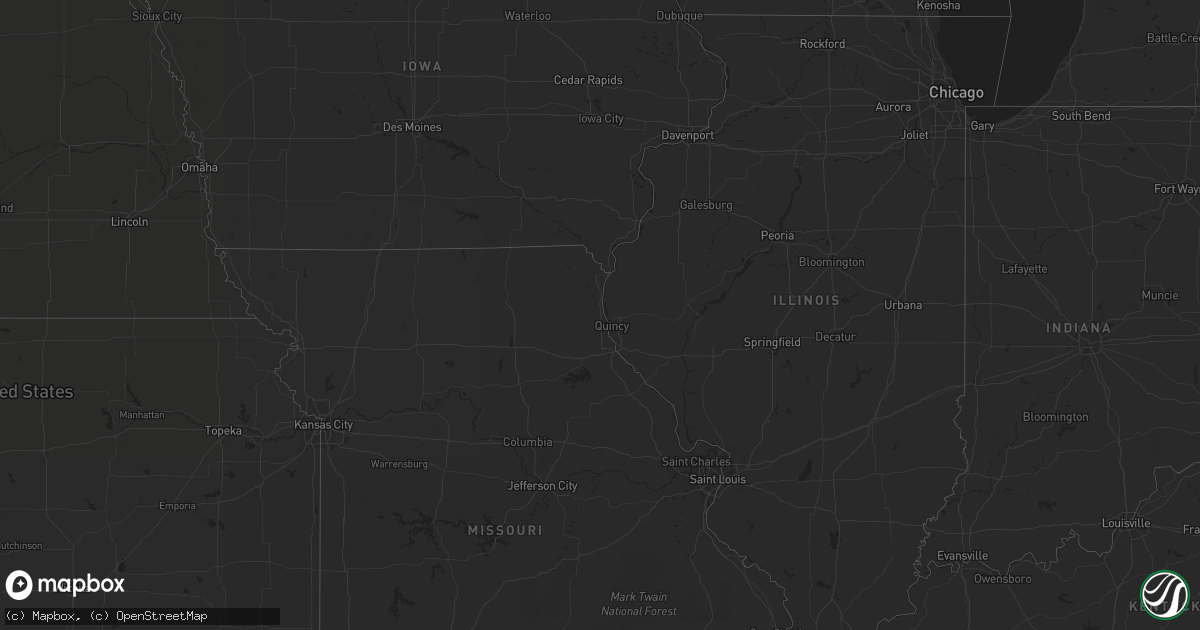
Hail Map in South Carolina on July 17, 2013
Get this storm
July 17 map
$229
one time, instant access
Download today. No call, no setup
Keep the $229
Bought the map and want the full workflow? Apply the entire $229 to a subscription within 7 days. None of it is wasted.
Every map, not just this one
This buys you this map. Subscription and you get every map we run, in the markets you choose from a few cities to whole states to nationwide. Plus real-time alerts the moment a storm fires.
Contact data
Name, contact info, occupancy, even credit band for addresses in the footprint. You go from where it hit to who to call.
Become the source they trust
Unlimited branding weather history reports on demand. You already have the documented answer ready for the property owner, and you are the one who showed up with it.
Property data and RoofTrace estimates
Pull up any address you have got, its value and the exact code rules for that jurisdiction, straight from One Click Code. Then RoofTrace estimates the squares, pitch, and roof value, priced the way you price.
Storm reports in South Carolina
South Carolina
| Date | Description |
|---|---|
| 07/17/20136:30 PM CDT | Em reports numerous trees and limbs blown down throughout the county. |
| 07/17/20136:05 PM CDT | Nws employee relayed report of quarter size hail near lake hartwell in the sandy springs community. |
| 07/17/20136:00 PM CDT | Numerous limbs down near greenville country club. Wires down on augusta rd near blythe academy. Time estimated from radar. |
| 07/17/20136:00 PM CDT | Two trees down around the city of laurens. Two more trees down near clinton. At least 3 or 4 trees down near ora. Several trees down around hickory tavern. Power lines |
| 07/17/20136:00 PM CDT | Highway patrol reports multiple trees blown down across the western part of laurens county...from gray court to boyd mill pond...to near ware shoals. |
| 07/17/20135:44 PM CDT | Law enforcement reported a tree and powerline down along mount carmel road. Vehicle hit the tree. Injuries and damages unknown. Time estimated by radar. |
| 07/17/20135:40 PM CDT | Law enforcement reported one tree down along stokes road. Time estimated by radar. |
| 07/17/20135:24 PM CDT | Tree down and two other large limbs on granite woods way. |
| 07/17/20135:16 PM CDT | Tree down on cross creek road. |
| 07/17/20135:15 PM CDT | Trees snapped off...a few trees down and numerous large limbs down on the southwest side of spartanburg near the intersection of blackstock road and hidden hill road. |
| 07/17/20135:14 PM CDT | A tree down by wind near intersection of owens road and brookdale drive. Multiple social media reports of additional trees down on the west and north side of greer. |
| 07/17/20135:14 PM CDT | Hail larger than golf ball sized fell along highway 290 south of lake robinson. Damage reported by the hail. Hail described as half the size of a mans fist. |
| 07/17/20135:08 PM CDT | Quarter sized hail on north side of greer. Location marked under core of the storm on radar. |
| 07/17/20135:06 PM CDT | Tree down at the intersection of cross swamp road connelly road. Time estimated by radar. |
| 07/17/20135:06 PM CDT | 3 trees down in walterboro near interstate 95. Time estimated by radar. |
| 07/17/20134:55 PM CDT | Numerous large limbs down in the roads in this area. |
| 07/17/20134:33 PM CDT | Minor flooding and a tree down at the intersection of highway 52 and highway 17a near moncks corner. Time estimated by radar. |
| 07/17/20134:33 PM CDT | 2 trees down on wadboo creek farm. Time estimated by radar. |
| 07/17/20134:25 PM CDT | A few trees down between rock hill and lake wylie with a few of those falling on power lines. |
| 07/17/20134:17 PM CDT | Sc highway patrol reports trees down in the 2200 block of durham dr. |
| 07/17/20134:01 PM CDT | Trees down |
| 07/17/20134:01 PM CDT | Trees down at indigo ave and 9th st. |
| 07/17/20134:00 PM CDT | Trees down on wilkinson st. At poplar st. |
| 07/17/20133:58 PM CDT | Trees down and ping pong ball size hail in jackson. |
| 07/17/20133:50 PM CDT | Sumter county dispatch reported trees and powerlines down in the city of sumter. |
| 07/17/20133:42 PM CDT | Trees down near new ellenton |
| 07/17/20133:35 PM CDT | Dispatch reported 1 inch hail and trees down |
| 07/17/20133:26 PM CDT | Public reported a tree on a home on palm drive in aiken. |
| 07/17/20133:20 PM CDT | Report of large tree in roadway near johnny boys express and sc 527. Time of event estimated by radar. |
| 07/17/20133:15 PM CDT | Several large trees reported blocking roadway near the 300 block on carvers bay road. Time of event estimated by radar. |
| 07/17/20133:00 PM CDT | Multiple trees down on hwy 11 |
| 07/17/20132:50 PM CDT | Orangeburg county dispatch reported 2 trees down on norway road. |
| 07/17/20132:49 PM CDT | Sc highway patrol reported trees down on larry jeffers road. |
| 07/17/20132:46 PM CDT | Sc highway patrol reporting trees down on sc 34 at 25 mile creek |
| 07/17/20132:15 PM CDT | Several large trees reported blocking roadway near the 300 block on carvers bay road. Time of event estimated by radar. |
| 07/17/20132:15 PM CDT | Storm survey found tree damage supportive of 60 mph thunderstorm wind gusts. A couple trees were snapped and a few small trees were downed within a half mile area. Mino |
| 07/17/20132:11 PM CDT | Public reported 1.00 inch hail and minor flooding |
| 07/17/20131:58 PM CDT | A local report indicates 1.00 inch wind near 10 W PELION |
| 07/17/20131:50 PM CDT | A local report indicates 1.00 inch wind near 10 W PELION |
| 07/16/20137:10 PM CDT | Numerous trees down in the mt. Carmel area |
All States Impacted by Hail Map on July 17, 2013
Cities Impacted by Hail Map on July 17, 2013
- Camden, SC
- Hickory, MS
- Chunky, MS
- Yemassee, SC
- Hobson, MT
- Clifton Forge, VA
- Kalispell, MT
- Brierfield, AL
- Clayton, AL
- Midway, AL
- West Jefferson, NC
- Crumpler, NC
- Laurel Springs, NC
- Jefferson, NC
- Millers Creek, NC
- Great Falls, MT
- Sand Coulee, MT
- Taylors, SC
- Greer, SC
- Winder, GA
- Dacula, GA
- Bethlehem, GA
- Auburn, GA
- Cornelius, NC
- Huntersville, NC
- Cosby, TN
- Camden, AL
- Amory, MS
- Nettleton, MS
- Seeley Lake, MT
- Ovando, MT
- Hamilton, AL
- Tremont, MS
- Cleveland, GA
- Bankston, AL
- Fayette, AL
- New Franken, WI
- Green Bay, WI
- Sobieski, WI
- Little Suamico, WI
- Suamico, WI
- Monterey, LA
- Jonesville, LA
- Squire, WV
- Rainbow City, AL
- Dorchester, SC
- Ridgeville, SC
- Springfield, GA
- Clyo, GA
- Newington, GA
- Fairburn, GA
- Avera, GA
- Stapleton, GA
- Louisville, GA
- Avon, MT
- Garrison, MT
- Rockingham, NC
- Harmony, NC
- Hamptonville, NC
- Stoney Fork, KY
- Kettle Island, KY
- Hulen, KY
- Pineville, KY
- Stephenson, WV
- Amigo, WV
- Altoona, AL
- Attalla, AL
- Dahlonega, GA
- Suches, GA
- Moyie Springs, ID
- Bonners Ferry, ID
- Ohatchee, AL
- Robinson, ND
- Enterprise, AL
- Jonesville, SC
- Pacolet, SC
- Moncks Corner, SC
- Martinsdale, MT
- Purlear, NC
- Bristol, TN
- Morganton, NC
- Reader, WV
- Paynesville, WV
- Davy, WV
- Iaeger, WV
- Raysal, WV
- War, WV
- Belt, MT
- Geyser, MT
- Rock Hill, SC
- Townsend, MT
- Reform, AL
- Saint George, SC
- Collins, GA
- Tucker, GA
- Decatur, GA
- Norcross, GA
- Atlanta, GA
- Taylorsville, KY
- Coxs Creek, KY
- Fairfield, KY
- Powder Springs, GA
- Douglasville, GA
- Brookville, PA
- Knox Dale, PA
- Hephzibah, GA
- Keller, WA
- Campobello, SC
- Virginia City, MT
- Georgetown, TN
- Houston, MS
- Grand Isle, ME
- Saint David, ME
- Madawaska, ME
- Washburn, ME
- Presque Isle, ME
- New Sweden, ME
- Caribou, ME
- Seth, WV
- Fayetteville, GA
- Tyrone, GA
- Ruffin, SC
- Proctor, WV
- Walterboro, SC
- Norway, SC
- Conway, SC
- Greenville, SC
- Duffield, VA
- Falmouth, KY
- Helen, GA
- Demorest, GA
- Sautee Nacoochee, GA
- Clarkesville, GA
- Warwick, GA
- Americus, GA
- Soap Lake, WA
- Helena, MT
- Sheboygan Falls, WI
- Oostburg, WI
- Polebridge, MT
- West Topsham, VT
- Dillon, MT
- Gibson, GA
- Arabi, GA
- Okolona, MS
- Harlem, GA
- Dearing, GA
- Pendleton, SC
- Easley, SC
- Liberty, SC
- Rexford, MT
- Woodstock, AL
- West Blocton, AL
- Flovilla, GA
- Mooresboro, NC
- Keokee, VA
- Mathews, AL
- Mount Morris, PA
- Wadesboro, NC
- Canon, GA
- Berry, AL
- Twin Bridges, MT
- Hillsboro, GA
- Monticello, GA
- Vance, AL
- Newville, AL
- Seminary, MS
- Moselle, MS
- Hattiesburg, MS
- Beatrice, AL
- Peterman, AL
- Island Falls, ME
- Patten, ME
- Dunlap, TN
- Shelby, NC
- Elmer City, WA
- Coulee Dam, WA
- Attica, MI
- Dryden, MI
- Metamora, MI
- Imlay City, MI
- New Zion, SC
- Knox, PA
- Travelers Rest, SC
- Rayle, GA
- Greenwood Springs, MS
- Sulligent, AL
- Newberry, MI
- Casar, NC
- Guyton, GA
- Whitefish, MT
- Olin, NC
- Yadkinville, NC
- Mocksville, NC
- Neeses, SC
- Orangeburg, SC
- Sparta, GA
- Deep Gap, NC
- Boone, NC
- Todd, NC
- Fleetwood, NC
- Mansfield, WA
- Coulee City, WA
- Ephrata, WA
- Andalusia, AL
- Connelly Springs, NC
- Kaplan, LA
- Crawfordville, GA
- Wrens, GA
- Danforth, ME
- Wytopitlock, ME
- Rifle, CO
- Cut Bank, MT
- Clearwater, FL
- Columbiana, AL
- Wilsonville, AL
- Sylacauga, AL
- Childersburg, AL
- Wadley, AL
- Clopton, AL
- Gold Creek, MT
- Cochran, GA
- Palmetto, GA
- Jackson, AL
- Bottineau, ND
- Dunseith, ND
- Guntersville, AL
- Tionesta, PA
- Spartanburg, SC
- Arcadia, SC
- Una, SC
- Orient, ME
- Monroe, GA
- Jeffersonville, GA
- Danville, GA
- Dry Branch, GA
- Mayesville, SC
- Sumter, SC
- Jefferson, GA
- Pendergrass, GA
- Lugoff, SC
- Grovetown, GA
- Middlebourne, WV
- New Martinsville, WV
- Clayton, GA
- Lyons, GA
- Regan, ND
- Raleigh, MS
- Louin, MS
- Bogart, GA
- Indian Trail, NC
- Winifred, MT
- Newnan, GA
- Forest, VA
- Lynchburg, VA
- Mauk, GA
- Boonville, NC
- East Bend, NC
- New Stanton, PA
- Ruffs Dale, PA
- Sligo, PA
- Rutherfordton, NC
- Union Mills, NC
- Houlka, MS
- Glenwood, GA
- Blairsville, GA
- White Sulphur Springs, MT
- Jefferson City, MT
- Clancy, MT
- Shippenville, PA
- Chesnee, SC
- Mckeesport, PA
- Elizabeth, PA
- Valier, MT
- Rochelle, GA
- Fitzgerald, GA
- Inchelium, WA
- Gate City, VA
- Aiken, SC
- New Ellenton, SC
- Georgetown, KY
- Tignall, GA
- Palmer, TN
- Lilesville, NC
- Marysville, MT
- Delta, CO
- Marienville, PA
- Hartwell, GA
- Mount Airy, NC
- Brookwood, AL
- Pine Hill, AL
- Sigel, PA
- Conyers, GA
- Mount Vernon, GA
- Tarrytown, GA
- Ailey, GA
- Vidalia, GA
- Soperton, GA
- Adrian, GA
- Leesville, SC
- Batesburg, SC
- Wagener, SC
- East Helena, MT
- Bluefield, VA
- Welch, WV
- Berwind, WV
- Essex, MT
- Daviston, AL
- Eatonton, GA
- Marion, MT
- Clarington, PA
- Randolph, AL
- Gruetli Laager, TN
- Reevesville, SC
- Branchville, SC
- Eggleston, VA
- Pearisburg, VA
- Fruitdale, AL
- Mansura, LA
- Cottonport, LA
- Cyclone, WV
- Davin, WV
- Amherstdale, WV
- Detroit, AL
- Leroy, AL
- Grove Hill, AL
- Duncanville, AL
- Cottondale, AL
- Greenwood, SC
- Cleveland, NC
- Statesville, NC
- Cameron, WV
- Graytown, OH
- Elmore, OH
- Rocky Ridge, OH
- Oak Harbor, OH
- Salley, SC
- Carrollton, AL
- Plaucheville, LA
- Statesboro, GA
- Georgetown, SC
- Underwood, ND
- Washburn, ND
- Davisboro, GA
- Bartow, GA
- Bay Springs, MS
- Paulding, MS
- Jackson, SC
- Smithville, MS
- Harrodsburg, KY
- Willisburg, KY
- Beaverton, AL
- Temple, GA
- Dallas, GA
- Stockbridge, GA
- Banner Elk, NC
- Forest, MS
- Newton, MS
- Heidelberg, MS
- Rose Hill, MS
- Hawkinsville, GA
- Piedmont, SC
- Blackey, KY
- Jeremiah, KY
- Waynesboro, GA
- Metter, GA
- Register, GA
- Waynesburg, PA
- Penhook, VA
- Union Hall, VA
- Monroeton, PA
- Towanda, PA
- Claremont, NC
- Taylorsville, NC
- Stony Point, NC
- Hiddenite, NC
- Richfield, NC
- Salisbury, NC
- Worthington, WV
- Geraldine, MT
- Newland, NC
- Macon, GA
- Kingsport, TN
- Lexington, SC
- Ford City, PA
- Vandergrift, PA
- Hiltons, VA
- Blountville, TN
- Bristol, VA
- Columbus, MI
- Richmond, MI
- Memphis, MI
- Van Buren, ME
- Central, IN
- Venus, PA
- Sandersville, GA
- Grand Coulee, WA
- Ferguson, NC
- Lake City, SC
- Cades, SC
- Lenoir, NC
- Olathe, CO
- West Columbia, SC
- Warrenville, SC
- Beech Island, SC
- Gaston, SC
- Deer Lodge, MT
- Hamilton, MT
- Vernon, AL
- Pennsboro, WV
- Ashville, AL
- Port Gibson, MS
- Hall, MT
- Nespelem, WA
- Bim, WV
- Clothier, WV
- Royston, GA
- New Bethlehem, PA
- Bluff City, TN
- Jamestown, SC
- Lucinda, PA
- Bradfordsville, KY
- Majestic, KY
- Centreville, AL
- Hopkins, SC
- Eastover, SC
- Wellford, SC
- McCalla, AL
- Olanta, SC
- China Grove, NC
- Charlotte, NC
- Matthews, NC
- Lapeer, MI
- Pamplico, SC
- Scranton, SC
- Belfry, KY
- Hardy, KY
- Stone, KY
- Estill, SC
- Garnett, SC
- Cannon, KY
- Green Road, KY
- Hinkle, KY
- Girdler, KY
- Tillman, SC
- Pineland, SC
- Herndon, WV
- Blacksville, WV
- Fairview, WV
- Tazewell, TN
- Aberdeen, MS
- Appalachia, VA
- Lawndale, NC
- Covington, GA
- Nicholson, GA
- Forsyth, GA
- Juliette, GA
- Ridgeway, SC
- Polkton, NC
- Morven, NC
- Cordova, NC
- Eufaula, AL
- Hurtsboro, AL
- Sharpsburg, GA
- Brussels, WI
- Sturgeon Bay, WI
- Cleveland, TN
- McDonald, TN
- Ooltewah, TN
- Abbeville, AL
- Rockmart, GA
- Buchanan, GA
- Cedartown, GA
- Curtis, MI
- Engadine, MI
- Hookstown, PA
- Dalzell, SC
- Rembert, SC
- Mayport, PA
- Manistique, MI
- Vina, AL
- Julian, WV
- Foster, WV
- Pittsburgh, PA
- Monroeville, PA
- Clearfield, KY
- Elizabethton, TN
- Unicoi, TN
- Johnson City, TN
- Kewaunee, WI
- Rockwell, NC
- Whitesburg, KY
- Flat Lick, KY
- Columbia, SC
- Fort Mitchell, AL
- Pittsview, AL
- Omaha, GA
- Harpersville, AL
- Lincolnton, GA
- Ikes Fork, WV
- McMillan, MI
- Springfield, SC
- Samson, AL
- Irwin, PA
- Rillton, PA
- Herminie, PA
- Rimersburg, PA
- Quincy, WA
- Alpine, AL
- Junction City, GA
- Butler, GA
- Abbeville, LA
- Dandridge, TN
- Sevierville, TN
- Lake Arthur, LA
- Jennings, LA
- Yale, MI
- Harleyville, SC
- Statham, GA
- Williston, SC
- Barnwell, SC
- Blackville, SC
- Kingstree, SC
- Catherine, AL
- Augusta, GA
- Naubinway, MI
- Gould City, MI
- Smoaks, SC
- Anderson, SC
- Rural Retreat, VA
- Petrolia, PA
- Maplesville, AL
- Northport, AL
- New Iberia, LA
- Williamson, WV
- Batchelor, LA
- Palmetto, LA
- Melville, LA
- Barbourville, KY
- Newport Center, VT
- Gadsden, AL
- Chauncey, GA
- Eastman, GA
- Butler, PA
- Wana, WV
- Mannington, WV
- Greeleyville, SC
- McIntyre, GA
- Jefferson, WI
- Granite Falls, NC
- Hickory, NC
- Hundred, WV
- Littleton, WV
- Newton, NC
- Hanover, WV
- Simon, WV
- Glenwood, AL
- Troy, AL
- Jack, AL
- Dryden, VA
- Big Stone Gap, VA
- Holmes Mill, KY
- Gaffney, SC
- Forest City, NC
- Cowpens, SC
- Franklin, PA
- Augusta, MT
- Goshen, AL
- Hemingway, SC
- Spruce Pine, NC
- Danville, WV
- Madison, WV
- Shinnston, WV
- Claxton, GA
- Reidsville, GA
- Gainesville, GA
- Sheffield, PA
- Lula, GA
- Clermont, GA
- Tallapoosa, GA
- Fort Blackmore, VA
- Sunset, SC
- Vancleave, MS
- Gretna, VA
- Clairton, PA
- Odenville, AL
- Brenton, WV
- Shawnee, OK
- Greensboro, AL
- Pulaski, WI
- Dawson, ND
- Chatham, VA
- Pittsville, VA
- Northfork, WV
- Rock, WV
- Wellsburg, WV
- Monroe, NC
- Gulliver, MI
- Tornado, WV
- Alum Creek, WV
- Lakemont, GA
- Erath, LA
- Sterrett, AL
- Collettsville, NC
- Linville, NC
- Blowing Rock, NC
- Watertown, TN
- Windsor, SC
- Wagarville, AL
- Advance, NC
- West Liberty, KY
- Valdese, NC
- Elberton, GA
- Winston, MT
- Kila, MT
- West Alexander, PA
- Valley Grove, WV
- Ellenboro, NC
- Brooklet, GA
- Acme, LA
- Gallatin Gateway, MT
- Sulphur, LA
- Lyman, SC
- Plantersville, AL
- Stanton, AL
- Vossburg, MS
- Laurel Hill, NC
- Templeton, PA
- Abbeville, GA
- Lawley, AL
- Eureka, MT
- Pinewood, SC
- Fort Atkinson, WI
- Gray, GA
- Highwood, MT
- Hallie, KY
- Bakersville, NC
- Bardstown, KY
- Waterville, WA
- Leeper, PA
- Lickingville, PA
- Sugar Grove, NC
- Tampa, FL
- Catawba, NC
- Union, SC
- Denmark, SC
- Whitmire, SC
- Stockholm, ME
- Harman, WV
- Woodleaf, NC
- Fayette, MS
- Dayton, PA
- Redfox, KY
- Vicco, KY
- Sassafras, KY
- Hammond, LA
- Slippery Rock, PA
- West Sunbury, PA
- Haddock, GA
- Sumerco, WV
- Wise, VA
- Coeburn, VA
- Verner, WV
- Kendall, NY
- Drexel, NC
- Appomattox, VA
- Dillwyn, VA
- Mount Carmel, SC
- Lodge, SC
- Guin, AL
- Roan Mountain, TN
- Lithia Springs, GA
- Austell, GA
- Waupun, WI
- Loganville, GA
- Lafayette, LA
- Pembroke, GA
- Winfield, AL
- Seminole, OK
- Sistersville, WV
- Floweree, MT
- Artemus, KY
- Clyde, OH
- Wrightsville, GA
- Gordon, GA
- Panther, WV
- Mohawk, WV
- Natchez, MS
- Lexington, GA
- Social Circle, GA
- Natural Bridge Station, VA
- Brundidge, AL
- Musella, GA
- Ridgway, PA
- Knoxville, GA
- Lizella, GA
- Blacksburg, SC
- Duncan, SC
- Hartford, TN
- Nicholasville, KY
- Omro, WI
- Lithonia, GA
- Union City, GA
- Riverdale, GA
- Bowersville, GA


