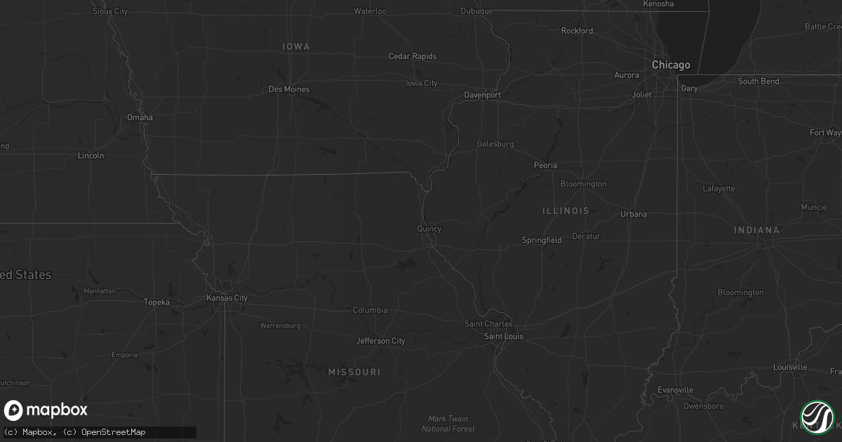
Hail Map in Montana on July 17, 2013
Get this storm
July 17 map
$229
one time, instant access
Download today. No call, no setup
Keep the $229
Bought the map and want the full workflow? Apply the entire $229 to a subscription within 7 days. None of it is wasted.
Every map, not just this one
This buys you this map. Subscription and you get every map we run, in the markets you choose from a few cities to whole states to nationwide. Plus real-time alerts the moment a storm fires.
Contact data
Name, contact info, occupancy, even credit band for addresses in the footprint. You go from where it hit to who to call.
Become the source they trust
Unlimited branding weather history reports on demand. You already have the documented answer ready for the property owner, and you are the one who showed up with it.
Property data and RoofTrace estimates
Pull up any address you have got, its value and the exact code rules for that jurisdiction, straight from One Click Code. Then RoofTrace estimates the squares, pitch, and roof value, priced the way you price.
Storm reports in Montana
Montana
| Date | Description |
|---|---|
| 07/17/20136:40 PM CDT | One half inch diameter hail remained after storm moved through the area 20 miles south of alder. Some melting possible. Nearby hills still white due to hail covering th |
| 07/17/20136:40 PM CDT | Tree fell down over highway 191...closing the road until the tree was removed. Time and exact location of event is estimated. |
| 07/17/20136:00 PM CDT | Half-dollar sized hail between helena and east helena around 5pm mdt. |
| 07/17/20135:35 PM CDT | Estimated hail up to quarter size. |
| 07/17/20135:16 PM CDT | Four to five foot tall hay crop decimated by hail. |
| 07/17/20135:10 PM CDT | Hail broke all porch windows on the east side of the house. Hail covered the ground. Hail duration 8 minutes |
| 07/17/20135:10 PM CDT | Hail of quarter size and slightly larger fell with the storm that produced flash flooding at bannack state park. Time is estimated based upon estimated time of rainfall |
| 07/17/20134:47 PM CDT | Several vehicles were damaged by hail. |
| 07/17/20134:45 PM CDT | Damage to garden. |
| 07/17/20134:43 PM CDT | Business property damage. |
| 07/17/20134:30 PM CDT | A local report indicates 1.00 inch wind near KALISPELL |
| 07/17/20134:30 PM CDT | A local report indicates 1.00 inch wind near 8 E ROLLINS |
| 07/17/20134:18 PM CDT | 30 foot tall willow tree blown down. |
| 07/17/20134:10 PM CDT | Depth was 1 inch. |
| 07/16/20137:58 PM CDT | Estimated hail up to quarter size fell a few miles northwest of sand coulee. |
| 07/16/20137:15 PM CDT | Tree fell down over highway 191...closing the road until the tree was removed. Tree diameter was 2.5 feet. Estimated wind gusts near 60 mph. |
| 07/16/20137:05 PM CDT | Quarter-sized hail measured 5 miles west of cut bank between 600 and 610 pm mdt. Small branches down. |
All States Impacted by Hail Map on July 17, 2013
Cities Impacted by Hail Map on July 17, 2013
- Camden, SC
- Hickory, MS
- Chunky, MS
- Yemassee, SC
- Hobson, MT
- Clifton Forge, VA
- Kalispell, MT
- Brierfield, AL
- Clayton, AL
- Midway, AL
- West Jefferson, NC
- Crumpler, NC
- Laurel Springs, NC
- Jefferson, NC
- Millers Creek, NC
- Great Falls, MT
- Sand Coulee, MT
- Taylors, SC
- Greer, SC
- Winder, GA
- Dacula, GA
- Bethlehem, GA
- Auburn, GA
- Cornelius, NC
- Huntersville, NC
- Cosby, TN
- Camden, AL
- Amory, MS
- Nettleton, MS
- Seeley Lake, MT
- Ovando, MT
- Hamilton, AL
- Tremont, MS
- Cleveland, GA
- Bankston, AL
- Fayette, AL
- New Franken, WI
- Green Bay, WI
- Sobieski, WI
- Little Suamico, WI
- Suamico, WI
- Monterey, LA
- Jonesville, LA
- Squire, WV
- Rainbow City, AL
- Dorchester, SC
- Ridgeville, SC
- Springfield, GA
- Clyo, GA
- Newington, GA
- Fairburn, GA
- Avera, GA
- Stapleton, GA
- Louisville, GA
- Avon, MT
- Garrison, MT
- Rockingham, NC
- Harmony, NC
- Hamptonville, NC
- Stoney Fork, KY
- Kettle Island, KY
- Hulen, KY
- Pineville, KY
- Stephenson, WV
- Amigo, WV
- Altoona, AL
- Attalla, AL
- Dahlonega, GA
- Suches, GA
- Moyie Springs, ID
- Bonners Ferry, ID
- Ohatchee, AL
- Robinson, ND
- Enterprise, AL
- Jonesville, SC
- Pacolet, SC
- Moncks Corner, SC
- Martinsdale, MT
- Purlear, NC
- Bristol, TN
- Morganton, NC
- Reader, WV
- Paynesville, WV
- Davy, WV
- Iaeger, WV
- Raysal, WV
- War, WV
- Belt, MT
- Geyser, MT
- Rock Hill, SC
- Townsend, MT
- Reform, AL
- Saint George, SC
- Collins, GA
- Tucker, GA
- Decatur, GA
- Norcross, GA
- Atlanta, GA
- Taylorsville, KY
- Coxs Creek, KY
- Fairfield, KY
- Powder Springs, GA
- Douglasville, GA
- Brookville, PA
- Knox Dale, PA
- Hephzibah, GA
- Keller, WA
- Campobello, SC
- Virginia City, MT
- Georgetown, TN
- Houston, MS
- Grand Isle, ME
- Saint David, ME
- Madawaska, ME
- Washburn, ME
- Presque Isle, ME
- New Sweden, ME
- Caribou, ME
- Seth, WV
- Fayetteville, GA
- Tyrone, GA
- Ruffin, SC
- Proctor, WV
- Walterboro, SC
- Norway, SC
- Conway, SC
- Greenville, SC
- Duffield, VA
- Falmouth, KY
- Helen, GA
- Demorest, GA
- Sautee Nacoochee, GA
- Clarkesville, GA
- Warwick, GA
- Americus, GA
- Soap Lake, WA
- Helena, MT
- Sheboygan Falls, WI
- Oostburg, WI
- Polebridge, MT
- West Topsham, VT
- Dillon, MT
- Gibson, GA
- Arabi, GA
- Okolona, MS
- Harlem, GA
- Dearing, GA
- Pendleton, SC
- Easley, SC
- Liberty, SC
- Rexford, MT
- Woodstock, AL
- West Blocton, AL
- Flovilla, GA
- Mooresboro, NC
- Keokee, VA
- Mathews, AL
- Mount Morris, PA
- Wadesboro, NC
- Canon, GA
- Berry, AL
- Twin Bridges, MT
- Hillsboro, GA
- Monticello, GA
- Vance, AL
- Newville, AL
- Seminary, MS
- Moselle, MS
- Hattiesburg, MS
- Beatrice, AL
- Peterman, AL
- Island Falls, ME
- Patten, ME
- Dunlap, TN
- Shelby, NC
- Elmer City, WA
- Coulee Dam, WA
- Attica, MI
- Dryden, MI
- Metamora, MI
- Imlay City, MI
- New Zion, SC
- Knox, PA
- Travelers Rest, SC
- Rayle, GA
- Greenwood Springs, MS
- Sulligent, AL
- Newberry, MI
- Casar, NC
- Guyton, GA
- Whitefish, MT
- Olin, NC
- Yadkinville, NC
- Mocksville, NC
- Neeses, SC
- Orangeburg, SC
- Sparta, GA
- Deep Gap, NC
- Boone, NC
- Todd, NC
- Fleetwood, NC
- Mansfield, WA
- Coulee City, WA
- Ephrata, WA
- Andalusia, AL
- Connelly Springs, NC
- Kaplan, LA
- Crawfordville, GA
- Wrens, GA
- Danforth, ME
- Wytopitlock, ME
- Rifle, CO
- Cut Bank, MT
- Clearwater, FL
- Columbiana, AL
- Wilsonville, AL
- Sylacauga, AL
- Childersburg, AL
- Wadley, AL
- Clopton, AL
- Gold Creek, MT
- Cochran, GA
- Palmetto, GA
- Jackson, AL
- Bottineau, ND
- Dunseith, ND
- Guntersville, AL
- Tionesta, PA
- Spartanburg, SC
- Arcadia, SC
- Una, SC
- Orient, ME
- Monroe, GA
- Jeffersonville, GA
- Danville, GA
- Dry Branch, GA
- Mayesville, SC
- Sumter, SC
- Jefferson, GA
- Pendergrass, GA
- Lugoff, SC
- Grovetown, GA
- Middlebourne, WV
- New Martinsville, WV
- Clayton, GA
- Lyons, GA
- Regan, ND
- Raleigh, MS
- Louin, MS
- Bogart, GA
- Indian Trail, NC
- Winifred, MT
- Newnan, GA
- Forest, VA
- Lynchburg, VA
- Mauk, GA
- Boonville, NC
- East Bend, NC
- New Stanton, PA
- Ruffs Dale, PA
- Sligo, PA
- Rutherfordton, NC
- Union Mills, NC
- Houlka, MS
- Glenwood, GA
- Blairsville, GA
- White Sulphur Springs, MT
- Jefferson City, MT
- Clancy, MT
- Shippenville, PA
- Chesnee, SC
- Mckeesport, PA
- Elizabeth, PA
- Valier, MT
- Rochelle, GA
- Fitzgerald, GA
- Inchelium, WA
- Gate City, VA
- Aiken, SC
- New Ellenton, SC
- Georgetown, KY
- Tignall, GA
- Palmer, TN
- Lilesville, NC
- Marysville, MT
- Delta, CO
- Marienville, PA
- Hartwell, GA
- Mount Airy, NC
- Brookwood, AL
- Pine Hill, AL
- Sigel, PA
- Conyers, GA
- Mount Vernon, GA
- Tarrytown, GA
- Ailey, GA
- Vidalia, GA
- Soperton, GA
- Adrian, GA
- Leesville, SC
- Batesburg, SC
- Wagener, SC
- East Helena, MT
- Bluefield, VA
- Welch, WV
- Berwind, WV
- Essex, MT
- Daviston, AL
- Eatonton, GA
- Marion, MT
- Clarington, PA
- Randolph, AL
- Gruetli Laager, TN
- Reevesville, SC
- Branchville, SC
- Eggleston, VA
- Pearisburg, VA
- Fruitdale, AL
- Mansura, LA
- Cottonport, LA
- Cyclone, WV
- Davin, WV
- Amherstdale, WV
- Detroit, AL
- Leroy, AL
- Grove Hill, AL
- Duncanville, AL
- Cottondale, AL
- Greenwood, SC
- Cleveland, NC
- Statesville, NC
- Cameron, WV
- Graytown, OH
- Elmore, OH
- Rocky Ridge, OH
- Oak Harbor, OH
- Salley, SC
- Carrollton, AL
- Plaucheville, LA
- Statesboro, GA
- Georgetown, SC
- Underwood, ND
- Washburn, ND
- Davisboro, GA
- Bartow, GA
- Bay Springs, MS
- Paulding, MS
- Jackson, SC
- Smithville, MS
- Harrodsburg, KY
- Willisburg, KY
- Beaverton, AL
- Temple, GA
- Dallas, GA
- Stockbridge, GA
- Banner Elk, NC
- Forest, MS
- Newton, MS
- Heidelberg, MS
- Rose Hill, MS
- Hawkinsville, GA
- Piedmont, SC
- Blackey, KY
- Jeremiah, KY
- Waynesboro, GA
- Metter, GA
- Register, GA
- Waynesburg, PA
- Penhook, VA
- Union Hall, VA
- Monroeton, PA
- Towanda, PA
- Claremont, NC
- Taylorsville, NC
- Stony Point, NC
- Hiddenite, NC
- Richfield, NC
- Salisbury, NC
- Worthington, WV
- Geraldine, MT
- Newland, NC
- Macon, GA
- Kingsport, TN
- Lexington, SC
- Ford City, PA
- Vandergrift, PA
- Hiltons, VA
- Blountville, TN
- Bristol, VA
- Columbus, MI
- Richmond, MI
- Memphis, MI
- Van Buren, ME
- Central, IN
- Venus, PA
- Sandersville, GA
- Grand Coulee, WA
- Ferguson, NC
- Lake City, SC
- Cades, SC
- Lenoir, NC
- Olathe, CO
- West Columbia, SC
- Warrenville, SC
- Beech Island, SC
- Gaston, SC
- Deer Lodge, MT
- Hamilton, MT
- Vernon, AL
- Pennsboro, WV
- Ashville, AL
- Port Gibson, MS
- Hall, MT
- Nespelem, WA
- Bim, WV
- Clothier, WV
- Royston, GA
- New Bethlehem, PA
- Bluff City, TN
- Jamestown, SC
- Lucinda, PA
- Bradfordsville, KY
- Majestic, KY
- Centreville, AL
- Hopkins, SC
- Eastover, SC
- Wellford, SC
- McCalla, AL
- Olanta, SC
- China Grove, NC
- Charlotte, NC
- Matthews, NC
- Lapeer, MI
- Pamplico, SC
- Scranton, SC
- Belfry, KY
- Hardy, KY
- Stone, KY
- Estill, SC
- Garnett, SC
- Cannon, KY
- Green Road, KY
- Hinkle, KY
- Girdler, KY
- Tillman, SC
- Pineland, SC
- Herndon, WV
- Blacksville, WV
- Fairview, WV
- Tazewell, TN
- Aberdeen, MS
- Appalachia, VA
- Lawndale, NC
- Covington, GA
- Nicholson, GA
- Forsyth, GA
- Juliette, GA
- Ridgeway, SC
- Polkton, NC
- Morven, NC
- Cordova, NC
- Eufaula, AL
- Hurtsboro, AL
- Sharpsburg, GA
- Brussels, WI
- Sturgeon Bay, WI
- Cleveland, TN
- McDonald, TN
- Ooltewah, TN
- Abbeville, AL
- Rockmart, GA
- Buchanan, GA
- Cedartown, GA
- Curtis, MI
- Engadine, MI
- Hookstown, PA
- Dalzell, SC
- Rembert, SC
- Mayport, PA
- Manistique, MI
- Vina, AL
- Julian, WV
- Foster, WV
- Pittsburgh, PA
- Monroeville, PA
- Clearfield, KY
- Elizabethton, TN
- Unicoi, TN
- Johnson City, TN
- Kewaunee, WI
- Rockwell, NC
- Whitesburg, KY
- Flat Lick, KY
- Columbia, SC
- Fort Mitchell, AL
- Pittsview, AL
- Omaha, GA
- Harpersville, AL
- Lincolnton, GA
- Ikes Fork, WV
- McMillan, MI
- Springfield, SC
- Samson, AL
- Irwin, PA
- Rillton, PA
- Herminie, PA
- Rimersburg, PA
- Quincy, WA
- Alpine, AL
- Junction City, GA
- Butler, GA
- Abbeville, LA
- Dandridge, TN
- Sevierville, TN
- Lake Arthur, LA
- Jennings, LA
- Yale, MI
- Harleyville, SC
- Statham, GA
- Williston, SC
- Barnwell, SC
- Blackville, SC
- Kingstree, SC
- Catherine, AL
- Augusta, GA
- Naubinway, MI
- Gould City, MI
- Smoaks, SC
- Anderson, SC
- Rural Retreat, VA
- Petrolia, PA
- Maplesville, AL
- Northport, AL
- New Iberia, LA
- Williamson, WV
- Batchelor, LA
- Palmetto, LA
- Melville, LA
- Barbourville, KY
- Newport Center, VT
- Gadsden, AL
- Chauncey, GA
- Eastman, GA
- Butler, PA
- Wana, WV
- Mannington, WV
- Greeleyville, SC
- McIntyre, GA
- Jefferson, WI
- Granite Falls, NC
- Hickory, NC
- Hundred, WV
- Littleton, WV
- Newton, NC
- Hanover, WV
- Simon, WV
- Glenwood, AL
- Troy, AL
- Jack, AL
- Dryden, VA
- Big Stone Gap, VA
- Holmes Mill, KY
- Gaffney, SC
- Forest City, NC
- Cowpens, SC
- Franklin, PA
- Augusta, MT
- Goshen, AL
- Hemingway, SC
- Spruce Pine, NC
- Danville, WV
- Madison, WV
- Shinnston, WV
- Claxton, GA
- Reidsville, GA
- Gainesville, GA
- Sheffield, PA
- Lula, GA
- Clermont, GA
- Tallapoosa, GA
- Fort Blackmore, VA
- Sunset, SC
- Vancleave, MS
- Gretna, VA
- Clairton, PA
- Odenville, AL
- Brenton, WV
- Shawnee, OK
- Greensboro, AL
- Pulaski, WI
- Dawson, ND
- Chatham, VA
- Pittsville, VA
- Northfork, WV
- Rock, WV
- Wellsburg, WV
- Monroe, NC
- Gulliver, MI
- Tornado, WV
- Alum Creek, WV
- Lakemont, GA
- Erath, LA
- Sterrett, AL
- Collettsville, NC
- Linville, NC
- Blowing Rock, NC
- Watertown, TN
- Windsor, SC
- Wagarville, AL
- Advance, NC
- West Liberty, KY
- Valdese, NC
- Elberton, GA
- Winston, MT
- Kila, MT
- West Alexander, PA
- Valley Grove, WV
- Ellenboro, NC
- Brooklet, GA
- Acme, LA
- Gallatin Gateway, MT
- Sulphur, LA
- Lyman, SC
- Plantersville, AL
- Stanton, AL
- Vossburg, MS
- Laurel Hill, NC
- Templeton, PA
- Abbeville, GA
- Lawley, AL
- Eureka, MT
- Pinewood, SC
- Fort Atkinson, WI
- Gray, GA
- Highwood, MT
- Hallie, KY
- Bakersville, NC
- Bardstown, KY
- Waterville, WA
- Leeper, PA
- Lickingville, PA
- Sugar Grove, NC
- Tampa, FL
- Catawba, NC
- Union, SC
- Denmark, SC
- Whitmire, SC
- Stockholm, ME
- Harman, WV
- Woodleaf, NC
- Fayette, MS
- Dayton, PA
- Redfox, KY
- Vicco, KY
- Sassafras, KY
- Hammond, LA
- Slippery Rock, PA
- West Sunbury, PA
- Haddock, GA
- Sumerco, WV
- Wise, VA
- Coeburn, VA
- Verner, WV
- Kendall, NY
- Drexel, NC
- Appomattox, VA
- Dillwyn, VA
- Mount Carmel, SC
- Lodge, SC
- Guin, AL
- Roan Mountain, TN
- Lithia Springs, GA
- Austell, GA
- Waupun, WI
- Loganville, GA
- Lafayette, LA
- Pembroke, GA
- Winfield, AL
- Seminole, OK
- Sistersville, WV
- Floweree, MT
- Artemus, KY
- Clyde, OH
- Wrightsville, GA
- Gordon, GA
- Panther, WV
- Mohawk, WV
- Natchez, MS
- Lexington, GA
- Social Circle, GA
- Natural Bridge Station, VA
- Brundidge, AL
- Musella, GA
- Ridgway, PA
- Knoxville, GA
- Lizella, GA
- Blacksburg, SC
- Duncan, SC
- Hartford, TN
- Nicholasville, KY
- Omro, WI
- Lithonia, GA
- Union City, GA
- Riverdale, GA
- Bowersville, GA


