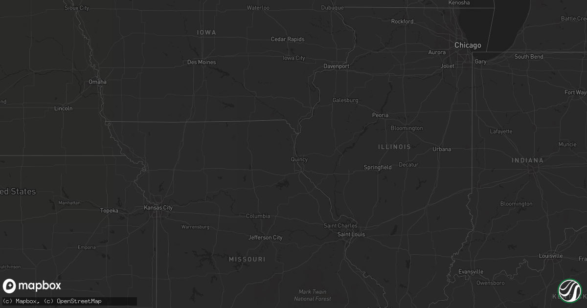
Hail Map in Georgia on July 17, 2013
Get this storm
July 17 map
$229
one time, instant access
Download today. No call, no setup
Keep the $229
Bought the map and want the full workflow? Apply the entire $229 to a subscription within 7 days. None of it is wasted.
Every map, not just this one
This buys you this map. Subscription and you get every map we run, in the markets you choose from a few cities to whole states to nationwide. Plus real-time alerts the moment a storm fires.
Contact data
Name, contact info, occupancy, even credit band for addresses in the footprint. You go from where it hit to who to call.
Become the source they trust
Unlimited branding weather history reports on demand. You already have the documented answer ready for the property owner, and you are the one who showed up with it.
Property data and RoofTrace estimates
Pull up any address you have got, its value and the exact code rules for that jurisdiction, straight from One Click Code. Then RoofTrace estimates the squares, pitch, and roof value, priced the way you price.
Storm reports in Georgia
Georgia
| Date | Description |
|---|---|
| 07/17/20136:45 PM CDT | Baldwin county sheriffs office reported numerous trees down...especially near hwy 24 and deepstep road...wavey road...and gordon highway near the baldwin-wilkinson coun |
| 07/17/20136:45 PM CDT | County 911 center reported numerous trees and powerlines down across the county beginning around 745 pm. |
| 07/17/20136:44 PM CDT | Shawnee fire department reported quarter size hail. |
| 07/17/20136:30 PM CDT | Public reported quarter size hail near dacula. |
| 07/17/20136:26 PM CDT | Public reported quarter size hail near harbin. |
| 07/17/20136:20 PM CDT | Multiple trees down in that part of hart county with many blocking roads. Cleanup still ongoing late this evening. |
| 07/17/20136:11 PM CDT | Numerous trees down.highway 278 blocked. Straight line winds. |
| 07/17/20136:11 PM CDT | Public reported nickel to quarter size hail 2 miles ene of auburn. |
| 07/17/20136:10 PM CDT | County 911 reported numerous trees and powerlines down across the county beginning around 710 pm. |
| 07/17/20135:50 PM CDT | Public reported nickel to quarter size hail 2 miles ene of auburn. |
| 07/17/20135:50 PM CDT | Public reported quarter size hail west of conyers on interstate-20. |
| 07/17/20135:45 PM CDT | County 911 center reported numerous power lines and trees down across the county starting around 645 pm. |
| 07/17/20135:23 PM CDT | A local report indicates 1.00 inch wind near CLEVELAND |
| 07/17/20135:15 PM CDT | County 911 center reported about 5 trees down in the chamblee area. One tree on a car and several powerlines down. |
| 07/17/20135:05 PM CDT | Gas station attendant on corner of brownsville road and highway 92 reported quarter sized hail around 605 pm. |
| 07/17/20134:45 PM CDT | More than a dozen trees some of them old healthy quite large trees blown down as storm came through. |
| 07/17/20134:35 PM CDT | Multiple trees down across stephens county. Many trees down on highway 123 about a mile from lake hartwell where a semi crashed into a fallen tree on the highway. Also |
| 07/17/20134:30 PM CDT | Philips arena event employee reported a portion of the arena roof sustained damage and a section of the seating space was evacuated as a result. Roof debris was reporte |
| 07/17/20134:28 PM CDT | Several trees reported down in the northern part of lumpkin county. |
| 07/17/20134:15 PM CDT | Mulberry gap mountain bike get-a-way reported 1 inch hail and several trees down about 9 miles ne of chatsworth. |
| 07/17/20134:10 PM CDT | Dispatch reported a tree down on hwy 56 north near the richmond county line in burke county. |
| 07/17/20134:00 PM CDT | Multiple trees down in tiger |
| 07/17/20133:42 PM CDT | A local report indicates 1.75 inch wind near 3 WNW FAIRBURN |
| 07/17/20133:37 PM CDT | A local report indicates 1.75 inch wind near 3 S PALMETTO |
| 07/17/20133:32 PM CDT | A local report indicates 1.00 inch wind near 3 S PALMETTO |
| 07/16/20138:55 PM CDT | Several trees and powerlines down across the south part of the county near reynolds plantation. |
| 07/16/20138:40 PM CDT | Two trees down just east of madison on hwy 441. One tree down ne of of rutledge. |
| 07/16/20138:20 PM CDT | Trees down along quail farm road |
| 07/16/20138:19 PM CDT | 8 trees down in county. |
| 07/16/20138:10 PM CDT | Trees and power lines down along hobbs mill road in dearing |
| 07/16/20138:00 PM CDT | Media passed along report from bibb county sheriff that a couple of trees were down along i-475 in macon. Additionally...powerlines were down in east macon on upper riv |
| 07/16/20137:55 PM CDT | County 911 center reported numerous trees and powerlines down across the county beginning around 855 pm. |
| 07/16/20137:55 PM CDT | Sheriff office reported several trees down east and south of farmington. |
| 07/16/20137:35 PM CDT | Numerous trees down across the county beginning around 835 pm. |
| 07/16/20137:20 PM CDT | Numerous trees and power lines down across the county |
All States Impacted by Hail Map on July 17, 2013
Cities Impacted by Hail Map on July 17, 2013
- Camden, SC
- Hickory, MS
- Chunky, MS
- Yemassee, SC
- Hobson, MT
- Clifton Forge, VA
- Kalispell, MT
- Brierfield, AL
- Clayton, AL
- Midway, AL
- West Jefferson, NC
- Crumpler, NC
- Laurel Springs, NC
- Jefferson, NC
- Millers Creek, NC
- Great Falls, MT
- Sand Coulee, MT
- Taylors, SC
- Greer, SC
- Winder, GA
- Dacula, GA
- Bethlehem, GA
- Auburn, GA
- Cornelius, NC
- Huntersville, NC
- Cosby, TN
- Camden, AL
- Amory, MS
- Nettleton, MS
- Seeley Lake, MT
- Ovando, MT
- Hamilton, AL
- Tremont, MS
- Cleveland, GA
- Bankston, AL
- Fayette, AL
- New Franken, WI
- Green Bay, WI
- Sobieski, WI
- Little Suamico, WI
- Suamico, WI
- Monterey, LA
- Jonesville, LA
- Squire, WV
- Rainbow City, AL
- Dorchester, SC
- Ridgeville, SC
- Springfield, GA
- Clyo, GA
- Newington, GA
- Fairburn, GA
- Avera, GA
- Stapleton, GA
- Louisville, GA
- Avon, MT
- Garrison, MT
- Rockingham, NC
- Harmony, NC
- Hamptonville, NC
- Stoney Fork, KY
- Kettle Island, KY
- Hulen, KY
- Pineville, KY
- Stephenson, WV
- Amigo, WV
- Altoona, AL
- Attalla, AL
- Dahlonega, GA
- Suches, GA
- Moyie Springs, ID
- Bonners Ferry, ID
- Ohatchee, AL
- Robinson, ND
- Enterprise, AL
- Jonesville, SC
- Pacolet, SC
- Moncks Corner, SC
- Martinsdale, MT
- Purlear, NC
- Bristol, TN
- Morganton, NC
- Reader, WV
- Paynesville, WV
- Davy, WV
- Iaeger, WV
- Raysal, WV
- War, WV
- Belt, MT
- Geyser, MT
- Rock Hill, SC
- Townsend, MT
- Reform, AL
- Saint George, SC
- Collins, GA
- Tucker, GA
- Decatur, GA
- Norcross, GA
- Atlanta, GA
- Taylorsville, KY
- Coxs Creek, KY
- Fairfield, KY
- Powder Springs, GA
- Douglasville, GA
- Brookville, PA
- Knox Dale, PA
- Hephzibah, GA
- Keller, WA
- Campobello, SC
- Virginia City, MT
- Georgetown, TN
- Houston, MS
- Grand Isle, ME
- Saint David, ME
- Madawaska, ME
- Washburn, ME
- Presque Isle, ME
- New Sweden, ME
- Caribou, ME
- Seth, WV
- Fayetteville, GA
- Tyrone, GA
- Ruffin, SC
- Proctor, WV
- Walterboro, SC
- Norway, SC
- Conway, SC
- Greenville, SC
- Duffield, VA
- Falmouth, KY
- Helen, GA
- Demorest, GA
- Sautee Nacoochee, GA
- Clarkesville, GA
- Warwick, GA
- Americus, GA
- Soap Lake, WA
- Helena, MT
- Sheboygan Falls, WI
- Oostburg, WI
- Polebridge, MT
- West Topsham, VT
- Dillon, MT
- Gibson, GA
- Arabi, GA
- Okolona, MS
- Harlem, GA
- Dearing, GA
- Pendleton, SC
- Easley, SC
- Liberty, SC
- Rexford, MT
- Woodstock, AL
- West Blocton, AL
- Flovilla, GA
- Mooresboro, NC
- Keokee, VA
- Mathews, AL
- Mount Morris, PA
- Wadesboro, NC
- Canon, GA
- Berry, AL
- Twin Bridges, MT
- Hillsboro, GA
- Monticello, GA
- Vance, AL
- Newville, AL
- Seminary, MS
- Moselle, MS
- Hattiesburg, MS
- Beatrice, AL
- Peterman, AL
- Island Falls, ME
- Patten, ME
- Dunlap, TN
- Shelby, NC
- Elmer City, WA
- Coulee Dam, WA
- Attica, MI
- Dryden, MI
- Metamora, MI
- Imlay City, MI
- New Zion, SC
- Knox, PA
- Travelers Rest, SC
- Rayle, GA
- Greenwood Springs, MS
- Sulligent, AL
- Newberry, MI
- Casar, NC
- Guyton, GA
- Whitefish, MT
- Olin, NC
- Yadkinville, NC
- Mocksville, NC
- Neeses, SC
- Orangeburg, SC
- Sparta, GA
- Deep Gap, NC
- Boone, NC
- Todd, NC
- Fleetwood, NC
- Mansfield, WA
- Coulee City, WA
- Ephrata, WA
- Andalusia, AL
- Connelly Springs, NC
- Kaplan, LA
- Crawfordville, GA
- Wrens, GA
- Danforth, ME
- Wytopitlock, ME
- Rifle, CO
- Cut Bank, MT
- Clearwater, FL
- Columbiana, AL
- Wilsonville, AL
- Sylacauga, AL
- Childersburg, AL
- Wadley, AL
- Clopton, AL
- Gold Creek, MT
- Cochran, GA
- Palmetto, GA
- Jackson, AL
- Bottineau, ND
- Dunseith, ND
- Guntersville, AL
- Tionesta, PA
- Spartanburg, SC
- Arcadia, SC
- Una, SC
- Orient, ME
- Monroe, GA
- Jeffersonville, GA
- Danville, GA
- Dry Branch, GA
- Mayesville, SC
- Sumter, SC
- Jefferson, GA
- Pendergrass, GA
- Lugoff, SC
- Grovetown, GA
- Middlebourne, WV
- New Martinsville, WV
- Clayton, GA
- Lyons, GA
- Regan, ND
- Raleigh, MS
- Louin, MS
- Bogart, GA
- Indian Trail, NC
- Winifred, MT
- Newnan, GA
- Forest, VA
- Lynchburg, VA
- Mauk, GA
- Boonville, NC
- East Bend, NC
- New Stanton, PA
- Ruffs Dale, PA
- Sligo, PA
- Rutherfordton, NC
- Union Mills, NC
- Houlka, MS
- Glenwood, GA
- Blairsville, GA
- White Sulphur Springs, MT
- Jefferson City, MT
- Clancy, MT
- Shippenville, PA
- Chesnee, SC
- Mckeesport, PA
- Elizabeth, PA
- Valier, MT
- Rochelle, GA
- Fitzgerald, GA
- Inchelium, WA
- Gate City, VA
- Aiken, SC
- New Ellenton, SC
- Georgetown, KY
- Tignall, GA
- Palmer, TN
- Lilesville, NC
- Marysville, MT
- Delta, CO
- Marienville, PA
- Hartwell, GA
- Mount Airy, NC
- Brookwood, AL
- Pine Hill, AL
- Sigel, PA
- Conyers, GA
- Mount Vernon, GA
- Tarrytown, GA
- Ailey, GA
- Vidalia, GA
- Soperton, GA
- Adrian, GA
- Leesville, SC
- Batesburg, SC
- Wagener, SC
- East Helena, MT
- Bluefield, VA
- Welch, WV
- Berwind, WV
- Essex, MT
- Daviston, AL
- Eatonton, GA
- Marion, MT
- Clarington, PA
- Randolph, AL
- Gruetli Laager, TN
- Reevesville, SC
- Branchville, SC
- Eggleston, VA
- Pearisburg, VA
- Fruitdale, AL
- Mansura, LA
- Cottonport, LA
- Cyclone, WV
- Davin, WV
- Amherstdale, WV
- Detroit, AL
- Leroy, AL
- Grove Hill, AL
- Duncanville, AL
- Cottondale, AL
- Greenwood, SC
- Cleveland, NC
- Statesville, NC
- Cameron, WV
- Graytown, OH
- Elmore, OH
- Rocky Ridge, OH
- Oak Harbor, OH
- Salley, SC
- Carrollton, AL
- Plaucheville, LA
- Statesboro, GA
- Georgetown, SC
- Underwood, ND
- Washburn, ND
- Davisboro, GA
- Bartow, GA
- Bay Springs, MS
- Paulding, MS
- Jackson, SC
- Smithville, MS
- Harrodsburg, KY
- Willisburg, KY
- Beaverton, AL
- Temple, GA
- Dallas, GA
- Stockbridge, GA
- Banner Elk, NC
- Forest, MS
- Newton, MS
- Heidelberg, MS
- Rose Hill, MS
- Hawkinsville, GA
- Piedmont, SC
- Blackey, KY
- Jeremiah, KY
- Waynesboro, GA
- Metter, GA
- Register, GA
- Waynesburg, PA
- Penhook, VA
- Union Hall, VA
- Monroeton, PA
- Towanda, PA
- Claremont, NC
- Taylorsville, NC
- Stony Point, NC
- Hiddenite, NC
- Richfield, NC
- Salisbury, NC
- Worthington, WV
- Geraldine, MT
- Newland, NC
- Macon, GA
- Kingsport, TN
- Lexington, SC
- Ford City, PA
- Vandergrift, PA
- Hiltons, VA
- Blountville, TN
- Bristol, VA
- Columbus, MI
- Richmond, MI
- Memphis, MI
- Van Buren, ME
- Central, IN
- Venus, PA
- Sandersville, GA
- Grand Coulee, WA
- Ferguson, NC
- Lake City, SC
- Cades, SC
- Lenoir, NC
- Olathe, CO
- West Columbia, SC
- Warrenville, SC
- Beech Island, SC
- Gaston, SC
- Deer Lodge, MT
- Hamilton, MT
- Vernon, AL
- Pennsboro, WV
- Ashville, AL
- Port Gibson, MS
- Hall, MT
- Nespelem, WA
- Bim, WV
- Clothier, WV
- Royston, GA
- New Bethlehem, PA
- Bluff City, TN
- Jamestown, SC
- Lucinda, PA
- Bradfordsville, KY
- Majestic, KY
- Centreville, AL
- Hopkins, SC
- Eastover, SC
- Wellford, SC
- McCalla, AL
- Olanta, SC
- China Grove, NC
- Charlotte, NC
- Matthews, NC
- Lapeer, MI
- Pamplico, SC
- Scranton, SC
- Belfry, KY
- Hardy, KY
- Stone, KY
- Estill, SC
- Garnett, SC
- Cannon, KY
- Green Road, KY
- Hinkle, KY
- Girdler, KY
- Tillman, SC
- Pineland, SC
- Herndon, WV
- Blacksville, WV
- Fairview, WV
- Tazewell, TN
- Aberdeen, MS
- Appalachia, VA
- Lawndale, NC
- Covington, GA
- Nicholson, GA
- Forsyth, GA
- Juliette, GA
- Ridgeway, SC
- Polkton, NC
- Morven, NC
- Cordova, NC
- Eufaula, AL
- Hurtsboro, AL
- Sharpsburg, GA
- Brussels, WI
- Sturgeon Bay, WI
- Cleveland, TN
- McDonald, TN
- Ooltewah, TN
- Abbeville, AL
- Rockmart, GA
- Buchanan, GA
- Cedartown, GA
- Curtis, MI
- Engadine, MI
- Hookstown, PA
- Dalzell, SC
- Rembert, SC
- Mayport, PA
- Manistique, MI
- Vina, AL
- Julian, WV
- Foster, WV
- Pittsburgh, PA
- Monroeville, PA
- Clearfield, KY
- Elizabethton, TN
- Unicoi, TN
- Johnson City, TN
- Kewaunee, WI
- Rockwell, NC
- Whitesburg, KY
- Flat Lick, KY
- Columbia, SC
- Fort Mitchell, AL
- Pittsview, AL
- Omaha, GA
- Harpersville, AL
- Lincolnton, GA
- Ikes Fork, WV
- McMillan, MI
- Springfield, SC
- Samson, AL
- Irwin, PA
- Rillton, PA
- Herminie, PA
- Rimersburg, PA
- Quincy, WA
- Alpine, AL
- Junction City, GA
- Butler, GA
- Abbeville, LA
- Dandridge, TN
- Sevierville, TN
- Lake Arthur, LA
- Jennings, LA
- Yale, MI
- Harleyville, SC
- Statham, GA
- Williston, SC
- Barnwell, SC
- Blackville, SC
- Kingstree, SC
- Catherine, AL
- Augusta, GA
- Naubinway, MI
- Gould City, MI
- Smoaks, SC
- Anderson, SC
- Rural Retreat, VA
- Petrolia, PA
- Maplesville, AL
- Northport, AL
- New Iberia, LA
- Williamson, WV
- Batchelor, LA
- Palmetto, LA
- Melville, LA
- Barbourville, KY
- Newport Center, VT
- Gadsden, AL
- Chauncey, GA
- Eastman, GA
- Butler, PA
- Wana, WV
- Mannington, WV
- Greeleyville, SC
- McIntyre, GA
- Jefferson, WI
- Granite Falls, NC
- Hickory, NC
- Hundred, WV
- Littleton, WV
- Newton, NC
- Hanover, WV
- Simon, WV
- Glenwood, AL
- Troy, AL
- Jack, AL
- Dryden, VA
- Big Stone Gap, VA
- Holmes Mill, KY
- Gaffney, SC
- Forest City, NC
- Cowpens, SC
- Franklin, PA
- Augusta, MT
- Goshen, AL
- Hemingway, SC
- Spruce Pine, NC
- Danville, WV
- Madison, WV
- Shinnston, WV
- Claxton, GA
- Reidsville, GA
- Gainesville, GA
- Sheffield, PA
- Lula, GA
- Clermont, GA
- Tallapoosa, GA
- Fort Blackmore, VA
- Sunset, SC
- Vancleave, MS
- Gretna, VA
- Clairton, PA
- Odenville, AL
- Brenton, WV
- Shawnee, OK
- Greensboro, AL
- Pulaski, WI
- Dawson, ND
- Chatham, VA
- Pittsville, VA
- Northfork, WV
- Rock, WV
- Wellsburg, WV
- Monroe, NC
- Gulliver, MI
- Tornado, WV
- Alum Creek, WV
- Lakemont, GA
- Erath, LA
- Sterrett, AL
- Collettsville, NC
- Linville, NC
- Blowing Rock, NC
- Watertown, TN
- Windsor, SC
- Wagarville, AL
- Advance, NC
- West Liberty, KY
- Valdese, NC
- Elberton, GA
- Winston, MT
- Kila, MT
- West Alexander, PA
- Valley Grove, WV
- Ellenboro, NC
- Brooklet, GA
- Acme, LA
- Gallatin Gateway, MT
- Sulphur, LA
- Lyman, SC
- Plantersville, AL
- Stanton, AL
- Vossburg, MS
- Laurel Hill, NC
- Templeton, PA
- Abbeville, GA
- Lawley, AL
- Eureka, MT
- Pinewood, SC
- Fort Atkinson, WI
- Gray, GA
- Highwood, MT
- Hallie, KY
- Bakersville, NC
- Bardstown, KY
- Waterville, WA
- Leeper, PA
- Lickingville, PA
- Sugar Grove, NC
- Tampa, FL
- Catawba, NC
- Union, SC
- Denmark, SC
- Whitmire, SC
- Stockholm, ME
- Harman, WV
- Woodleaf, NC
- Fayette, MS
- Dayton, PA
- Redfox, KY
- Vicco, KY
- Sassafras, KY
- Hammond, LA
- Slippery Rock, PA
- West Sunbury, PA
- Haddock, GA
- Sumerco, WV
- Wise, VA
- Coeburn, VA
- Verner, WV
- Kendall, NY
- Drexel, NC
- Appomattox, VA
- Dillwyn, VA
- Mount Carmel, SC
- Lodge, SC
- Guin, AL
- Roan Mountain, TN
- Lithia Springs, GA
- Austell, GA
- Waupun, WI
- Loganville, GA
- Lafayette, LA
- Pembroke, GA
- Winfield, AL
- Seminole, OK
- Sistersville, WV
- Floweree, MT
- Artemus, KY
- Clyde, OH
- Wrightsville, GA
- Gordon, GA
- Panther, WV
- Mohawk, WV
- Natchez, MS
- Lexington, GA
- Social Circle, GA
- Natural Bridge Station, VA
- Brundidge, AL
- Musella, GA
- Ridgway, PA
- Knoxville, GA
- Lizella, GA
- Blacksburg, SC
- Duncan, SC
- Hartford, TN
- Nicholasville, KY
- Omro, WI
- Lithonia, GA
- Union City, GA
- Riverdale, GA
- Bowersville, GA


