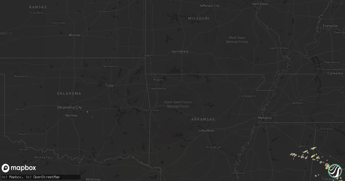
Hail Map on July 17, 2013
Get this storm
July 17 map
$229
one time, instant access
Download today. No call, no setup
Keep the $229
Bought the map and want the full workflow? Apply the entire $229 to a subscription within 7 days. None of it is wasted.
Every map, not just this one
This buys you this map. Subscription and you get every map we run, in the markets you choose from a few cities to whole states to nationwide. Plus real-time alerts the moment a storm fires.
Contact data
Name, contact info, occupancy, even credit band for addresses in the footprint. You go from where it hit to who to call.
Become the source they trust
Unlimited branding weather history reports on demand. You already have the documented answer ready for the property owner, and you are the one who showed up with it.
Property data and RoofTrace estimates
Pull up any address you have got, its value and the exact code rules for that jurisdiction, straight from One Click Code. Then RoofTrace estimates the squares, pitch, and roof value, priced the way you price.
States Impacted by Hail Map on July 17, 2013
Storm reports
Louisiana
| Date | Description |
|---|---|
| 07/17/20135:13 PM CDT | Public report through facebook of a tree down and numerous branches down. Time based on radar. |
Virginia
| Date | Description |
|---|---|
| 07/17/20134:15 PM CDT | Trees down on rt 630e. |
| 07/16/20137:30 PM CDT | Multiple trees down along rt. 460 |
Tennessee
| Date | Description |
|---|---|
| 07/17/20134:00 PM CDT | Several trees down across the county. |
| 07/17/20133:27 PM CDT | One inch hail reported at the intersection of weaver pike and old jonesboro rd. |
| 07/17/20133:15 PM CDT | Several trees and power lines down on south side of surgoinsville. |
| 07/16/20139:30 PM CDT | Several trees and power lines down around cleveland |
| 07/16/20138:20 PM CDT | Several trees down |
Texas
| Date | Description |
|---|---|
| 07/17/20136:30 PM CDT | Estimated wind gust of 60 on north side of joe pool lake |
Colorado
| Date | Description |
|---|---|
| 07/17/20136:00 PM CDT | Gust measured at the eagle snotel |
Montana
| Date | Description |
|---|---|
| 07/17/20136:40 PM CDT | Tree fell down over highway 191...closing the road until the tree was removed. Time and exact location of event is estimated. |
| 07/17/20136:40 PM CDT | One half inch diameter hail remained after storm moved through the area 20 miles south of alder. Some melting possible. Nearby hills still white due to hail covering th |
| 07/17/20136:00 PM CDT | Half-dollar sized hail between helena and east helena around 5pm mdt. |
| 07/17/20135:35 PM CDT | Estimated hail up to quarter size. |
| 07/17/20135:16 PM CDT | Four to five foot tall hay crop decimated by hail. |
| 07/17/20135:10 PM CDT | Hail broke all porch windows on the east side of the house. Hail covered the ground. Hail duration 8 minutes |
| 07/17/20135:10 PM CDT | Hail of quarter size and slightly larger fell with the storm that produced flash flooding at bannack state park. Time is estimated based upon estimated time of rainfall |
| 07/17/20134:47 PM CDT | Several vehicles were damaged by hail. |
| 07/17/20134:45 PM CDT | Damage to garden. |
| 07/17/20134:43 PM CDT | Business property damage. |
| 07/17/20134:30 PM CDT | A local report indicates 1.00 inch wind near KALISPELL |
| 07/17/20134:30 PM CDT | A local report indicates 1.00 inch wind near 8 E ROLLINS |
| 07/17/20134:18 PM CDT | 30 foot tall willow tree blown down. |
| 07/17/20134:10 PM CDT | Depth was 1 inch. |
| 07/16/20137:58 PM CDT | Estimated hail up to quarter size fell a few miles northwest of sand coulee. |
| 07/16/20137:15 PM CDT | Tree fell down over highway 191...closing the road until the tree was removed. Tree diameter was 2.5 feet. Estimated wind gusts near 60 mph. |
| 07/16/20137:05 PM CDT | Quarter-sized hail measured 5 miles west of cut bank between 600 and 610 pm mdt. Small branches down. |
North Carolina
| Date | Description |
|---|---|
| 07/17/20136:43 PM CDT | Tree down on old mill road |
| 07/17/20134:34 PM CDT | A call from a spotter for trees down around ellenboro and a public call for trees down in bostic area. Radar showed 60 knot wind as storm passed. |
| 07/17/20134:30 PM CDT | Mutiple large trees uprooted and powerlines down in casar. |
| 07/17/20133:56 PM CDT | Oak hill area has multiple trees down at intersection of highway 181 and spainhour road. Highway 181 closed. |
| 07/17/20133:36 PM CDT | Media reported trees down on power lines on knobs landing. |
| 07/17/20133:28 PM CDT | Trees four to six inches in diameter downed by thunderstorm winds. |
| 07/17/20133:10 PM CDT | Multiple trees down at intersection of north oxford street and highway 70 with highway 70 closed. |
| 07/17/20133:07 PM CDT | Few trees down and some multiple large tree limbs down near julian price park. |
| 07/17/20133:00 PM CDT | Tree down on hwy 601 and potneck rd |
| 07/17/20132:16 PM CDT | Ema relayed report of quarter size hail. |
| 07/17/20132:12 PM CDT | Trees down on power lines. |
| 07/17/20132:00 PM CDT | Numerous trees down. |
| 07/17/20132:00 PM CDT | A local report indicates 1.00 inch wind near 2 N HARMONY |
| 07/17/20132:00 PM CDT | Spotter reported trees blown down on emerald woods dr. |
| 07/17/20131:45 PM CDT | Multiple trees down near cane creek |
| 07/17/20131:25 PM CDT | A tree was reported down in unspecified central part of the county. Also hail of unknown size was also reported as storm passed. |
| 07/17/20131:18 PM CDT | Several trees blown down across haileys ferry road. Dot called out to clear the roadway. |
| 07/17/201312:50 PM CDT | Tree blown down along us-74 at the intersection of business 74. |
| 07/17/201312:45 PM CDT | A local report indicates 1.00 inch wind near 5 ESE LILESVILLE |
| 07/17/201312:30 PM CDT | Multiple trees down and some street flooding. |
| 07/17/20137:00 AM CDT | Few trees down |
| 07/16/20137:17 PM CDT | Tree down on white laurel road and elk creek road |
| 07/16/20137:15 PM CDT | Hail up to dime size fell. |
| 07/16/20137:00 PM CDT | Few trees down |
South Carolina
| Date | Description |
|---|---|
| 07/17/20136:30 PM CDT | Em reports numerous trees and limbs blown down throughout the county. |
| 07/17/20136:05 PM CDT | Nws employee relayed report of quarter size hail near lake hartwell in the sandy springs community. |
| 07/17/20136:00 PM CDT | Numerous limbs down near greenville country club. Wires down on augusta rd near blythe academy. Time estimated from radar. |
| 07/17/20136:00 PM CDT | Highway patrol reports multiple trees blown down across the western part of laurens county...from gray court to boyd mill pond...to near ware shoals. |
| 07/17/20136:00 PM CDT | Two trees down around the city of laurens. Two more trees down near clinton. At least 3 or 4 trees down near ora. Several trees down around hickory tavern. Power lines |
| 07/17/20135:44 PM CDT | Law enforcement reported a tree and powerline down along mount carmel road. Vehicle hit the tree. Injuries and damages unknown. Time estimated by radar. |
| 07/17/20135:40 PM CDT | Law enforcement reported one tree down along stokes road. Time estimated by radar. |
| 07/17/20135:24 PM CDT | Tree down and two other large limbs on granite woods way. |
| 07/17/20135:16 PM CDT | Tree down on cross creek road. |
| 07/17/20135:15 PM CDT | Trees snapped off...a few trees down and numerous large limbs down on the southwest side of spartanburg near the intersection of blackstock road and hidden hill road. |
| 07/17/20135:14 PM CDT | A tree down by wind near intersection of owens road and brookdale drive. Multiple social media reports of additional trees down on the west and north side of greer. |
| 07/17/20135:14 PM CDT | Hail larger than golf ball sized fell along highway 290 south of lake robinson. Damage reported by the hail. Hail described as half the size of a mans fist. |
| 07/17/20135:08 PM CDT | Quarter sized hail on north side of greer. Location marked under core of the storm on radar. |
| 07/17/20135:06 PM CDT | 3 trees down in walterboro near interstate 95. Time estimated by radar. |
| 07/17/20135:06 PM CDT | Tree down at the intersection of cross swamp road connelly road. Time estimated by radar. |
| 07/17/20134:55 PM CDT | Numerous large limbs down in the roads in this area. |
| 07/17/20134:33 PM CDT | 2 trees down on wadboo creek farm. Time estimated by radar. |
| 07/17/20134:33 PM CDT | Minor flooding and a tree down at the intersection of highway 52 and highway 17a near moncks corner. Time estimated by radar. |
| 07/17/20134:25 PM CDT | A few trees down between rock hill and lake wylie with a few of those falling on power lines. |
| 07/17/20134:17 PM CDT | Sc highway patrol reports trees down in the 2200 block of durham dr. |
| 07/17/20134:01 PM CDT | Trees down |
| 07/17/20134:01 PM CDT | Trees down at indigo ave and 9th st. |
| 07/17/20134:00 PM CDT | Trees down on wilkinson st. At poplar st. |
| 07/17/20133:58 PM CDT | Trees down and ping pong ball size hail in jackson. |
| 07/17/20133:50 PM CDT | Sumter county dispatch reported trees and powerlines down in the city of sumter. |
| 07/17/20133:42 PM CDT | Trees down near new ellenton |
| 07/17/20133:35 PM CDT | Dispatch reported 1 inch hail and trees down |
| 07/17/20133:26 PM CDT | Public reported a tree on a home on palm drive in aiken. |
| 07/17/20133:20 PM CDT | Report of large tree in roadway near johnny boys express and sc 527. Time of event estimated by radar. |
| 07/17/20133:15 PM CDT | Several large trees reported blocking roadway near the 300 block on carvers bay road. Time of event estimated by radar. |
| 07/17/20133:00 PM CDT | Multiple trees down on hwy 11 |
| 07/17/20132:50 PM CDT | Orangeburg county dispatch reported 2 trees down on norway road. |
| 07/17/20132:49 PM CDT | Sc highway patrol reported trees down on larry jeffers road. |
| 07/17/20132:46 PM CDT | Sc highway patrol reporting trees down on sc 34 at 25 mile creek |
| 07/17/20132:15 PM CDT | Several large trees reported blocking roadway near the 300 block on carvers bay road. Time of event estimated by radar. |
| 07/17/20132:15 PM CDT | Storm survey found tree damage supportive of 60 mph thunderstorm wind gusts. A couple trees were snapped and a few small trees were downed within a half mile area. Mino |
| 07/17/20132:11 PM CDT | Public reported 1.00 inch hail and minor flooding |
| 07/17/20131:58 PM CDT | A local report indicates 1.00 inch wind near 10 W PELION |
| 07/17/20131:50 PM CDT | A local report indicates 1.00 inch wind near 10 W PELION |
| 07/16/20137:10 PM CDT | Numerous trees down in the mt. Carmel area |
Florida
| Date | Description |
|---|---|
| 07/17/20133:30 PM CDT | Numerous branches and small trees down in the vicinity of south tampa. Time estimated by radar. |
| 07/17/20133:20 PM CDT | Power lines down on park blvd in pinellas park. Time estimated by radar. |
| 07/17/20133:20 PM CDT | Tree down in the vicinity...of the intersection of riga blvd and east mlk blvd. |
| 07/17/20133:20 PM CDT | Several large trees down near intersection of east mlk jr blvd and i-75. |
| 07/17/20133:20 PM CDT | Power lines down on bryan dairy road in pinellas park. Time estimated by radar. |
| 07/17/20133:15 PM CDT | Large tree down in vicinity of intersection of north falkenburg road and east martin luther king jr blvd. |
| 07/17/20133:12 PM CDT | Numerous reports of large oak trees down. Some trees down on homes. |
| 07/17/20133:05 PM CDT | Numerous trees down in the seffner city limits |
| 07/17/20133:05 PM CDT | Damage to a mobile home located in the shady oaks mobile home park. Time estimated by radar. |
| 07/17/20133:00 PM CDT | Tree branches and power lines down in the westchase area. |
Michigan
| Date | Description |
|---|---|
| 07/17/20132:55 PM CDT | A local report indicates 1.00 inch wind near 2 S MCMILLAN |
Kentucky
| Date | Description |
|---|---|
| 07/17/20133:23 PM CDT | Several trees down on hwy 119 between mile marker 0 and 5. |
| 07/17/20133:10 PM CDT | Large tree down. Report via social media. |
| 07/17/20133:10 PM CDT | Hail so heavy cannot see. Has been ongoing for 5 mins. |
| 07/16/20137:35 PM CDT | Several trees down. |
Washington
| Date | Description |
|---|---|
| 07/17/20139:50 AM CDT | A local report indicates 1.00 inch wind near 6 N COULEE DAM |
| 07/17/20139:00 AM CDT | Along highway 2 and st andrews road. |
| 07/17/20137:00 AM CDT | A local report indicates 1.75 inch wind near 9 N WILBUR |
Pennsylvania
| Date | Description |
|---|---|
| 07/17/20133:30 PM CDT | Quarter sized hail in greenock |
| 07/17/20133:20 PM CDT | Several large tree limbs broken off of trees on second street |
| 07/17/20133:18 PM CDT | Trees and wires down on marion ave. In forest hills |
| 07/17/20133:15 PM CDT | Trees and wires down on center ave and fifth |
| 07/17/20133:12 PM CDT | Trees and wires down on walmart drive |
| 07/17/20132:25 PM CDT | Trees down blocking the passing lane on i-80 at mile marker 84.8 |
| 07/17/20132:10 PM CDT | Trees down on wires |
Idaho
| Date | Description |
|---|---|
| 07/17/20135:36 PM CDT | Mesonet station leodore creek /ldoi1/ elevation 6000 feet. |
| 07/17/20132:50 PM CDT | Large tree blown down onto highway 95 at milepost 533 |
Mississippi
| Date | Description |
|---|---|
| 07/17/20136:40 AM CDT | Reports of a tree and powerline down in laurel. |
| 07/17/20132:30 AM CDT | Reports of three trees down on a house. |
| 07/17/20131:30 AM CDT | Several large trees blown down in a small area south of amory. |
Alabama
| Date | Description |
|---|---|
| 07/17/20135:59 PM CDT | Several trees were blown down near highway 231 and shoal creek road. |
| 07/17/20135:55 PM CDT | A local report indicates 1.00 inch wind near ASHVILLE |
| 07/17/20135:13 PM CDT | One tree snapped off in rainbow city. Winds estimated around 40 mph. |
| 07/17/201312:34 AM CDT | Trees reported down blocking the roadway at mile marker 2 on alabama highway 107. Winds estimated 40-50 mph from radar. Time estimated from radar. Reported through soci |
| 07/16/201310:55 PM CDT | One tree down blocking both lanes of county road 305. |
| 07/16/20138:54 PM CDT | A few trees blown down near highway 30 between clayton and eufaula. Winds estimated at 50 mph. |
| 07/16/20138:10 PM CDT | Tree down on solomon road. |
| 07/16/20138:08 PM CDT | Tree down on broad street. |
| 07/16/20137:38 PM CDT | A few trees blown down near highway 280 in chelsea. Winds estimated at 50 mph. |
West Virginia
| Date | Description |
|---|---|
| 07/17/20134:36 PM CDT | Tree down blocking rt 218 in northern marion county |
New Hampshire
| Date | Description |
|---|---|
| 07/17/20136:57 PM CDT | Multiple trees down throughout littleton...time estimated by radar |
| 07/17/20136:52 PM CDT | Multiple trees down throughout lisbon...time estimated by radar |
| 07/17/20136:50 PM CDT | Multiple trees down throughout lyman...time estimated by radar |
| 07/16/20138:35 PM CDT | Multiple trees down in wakefield |
| 07/16/20138:30 PM CDT | Tree down on wires on rte 25 near school street |
| 07/16/20138:20 PM CDT | Multiple trees down in effingham |
| 07/16/20137:50 PM CDT | Trees and wires down on bennett road...time estimated by radar |
| 07/16/20137:10 PM CDT | Multiple trees reported down in whitefield...time estimated by radar |
| 07/16/20137:05 PM CDT | Multiple trees down throughout bethlehem...time estimated by radar |
| 07/16/20137:02 PM CDT | Multiple trees down throughout franconia...time estimated by radar |
| 07/16/20137:00 PM CDT | Multiple trees down in sugar hill...time estimated by radar |
Georgia
| Date | Description |
|---|---|
| 07/17/20136:45 PM CDT | Baldwin county sheriffs office reported numerous trees down...especially near hwy 24 and deepstep road...wavey road...and gordon highway near the baldwin-wilkinson coun |
| 07/17/20136:45 PM CDT | County 911 center reported numerous trees and powerlines down across the county beginning around 745 pm. |
| 07/17/20136:44 PM CDT | Shawnee fire department reported quarter size hail. |
| 07/17/20136:30 PM CDT | Public reported quarter size hail near dacula. |
| 07/17/20136:26 PM CDT | Public reported quarter size hail near harbin. |
| 07/17/20136:20 PM CDT | Multiple trees down in that part of hart county with many blocking roads. Cleanup still ongoing late this evening. |
| 07/17/20136:11 PM CDT | Numerous trees down.highway 278 blocked. Straight line winds. |
| 07/17/20136:11 PM CDT | Public reported nickel to quarter size hail 2 miles ene of auburn. |
| 07/17/20136:10 PM CDT | County 911 reported numerous trees and powerlines down across the county beginning around 710 pm. |
| 07/17/20135:50 PM CDT | Public reported nickel to quarter size hail 2 miles ene of auburn. |
| 07/17/20135:50 PM CDT | Public reported quarter size hail west of conyers on interstate-20. |
| 07/17/20135:45 PM CDT | County 911 center reported numerous power lines and trees down across the county starting around 645 pm. |
| 07/17/20135:23 PM CDT | A local report indicates 1.00 inch wind near CLEVELAND |
| 07/17/20135:15 PM CDT | County 911 center reported about 5 trees down in the chamblee area. One tree on a car and several powerlines down. |
| 07/17/20135:05 PM CDT | Gas station attendant on corner of brownsville road and highway 92 reported quarter sized hail around 605 pm. |
| 07/17/20134:45 PM CDT | More than a dozen trees some of them old healthy quite large trees blown down as storm came through. |
| 07/17/20134:35 PM CDT | Multiple trees down across stephens county. Many trees down on highway 123 about a mile from lake hartwell where a semi crashed into a fallen tree on the highway. Also |
| 07/17/20134:30 PM CDT | Philips arena event employee reported a portion of the arena roof sustained damage and a section of the seating space was evacuated as a result. Roof debris was reporte |
| 07/17/20134:28 PM CDT | Several trees reported down in the northern part of lumpkin county. |
| 07/17/20134:15 PM CDT | Mulberry gap mountain bike get-a-way reported 1 inch hail and several trees down about 9 miles ne of chatsworth. |
| 07/17/20134:10 PM CDT | Dispatch reported a tree down on hwy 56 north near the richmond county line in burke county. |
| 07/17/20134:00 PM CDT | Multiple trees down in tiger |
| 07/17/20133:42 PM CDT | A local report indicates 1.75 inch wind near 3 WNW FAIRBURN |
| 07/17/20133:37 PM CDT | A local report indicates 1.75 inch wind near 3 S PALMETTO |
| 07/17/20133:32 PM CDT | A local report indicates 1.00 inch wind near 3 S PALMETTO |
| 07/16/20138:55 PM CDT | Several trees and powerlines down across the south part of the county near reynolds plantation. |
| 07/16/20138:40 PM CDT | Two trees down just east of madison on hwy 441. One tree down ne of of rutledge. |
| 07/16/20138:20 PM CDT | Trees down along quail farm road |
| 07/16/20138:19 PM CDT | 8 trees down in county. |
| 07/16/20138:10 PM CDT | Trees and power lines down along hobbs mill road in dearing |
| 07/16/20138:00 PM CDT | Media passed along report from bibb county sheriff that a couple of trees were down along i-475 in macon. Additionally...powerlines were down in east macon on upper riv |
| 07/16/20137:55 PM CDT | County 911 center reported numerous trees and powerlines down across the county beginning around 855 pm. |
| 07/16/20137:55 PM CDT | Sheriff office reported several trees down east and south of farmington. |
| 07/16/20137:35 PM CDT | Numerous trees down across the county beginning around 835 pm. |
| 07/16/20137:20 PM CDT | Numerous trees and power lines down across the county |
Vermont
| Date | Description |
|---|---|
| 07/17/20136:48 PM CDT | Trees down in st. Johnsbury per st. Johnsbury fire dept. Time estimated from radar. |
| 07/17/20136:48 PM CDT | St. Johnsbury fire dept also reports trees down in danville. Time estimated from radar. |
| 07/17/20136:35 PM CDT | A local report indicates 58 MPH wind near 4 N WALDEN |
| 07/17/20136:15 PM CDT | Estimated 50-60 mph wind gust in craftsbury. Time esimated by radar. |
| 07/17/20136:15 PM CDT | Large tree branch down at intersection of rt 15 and gulf road in wolcott. Time estimated from radar. |
| 07/17/20136:10 PM CDT | Trees down on shattuck hill near newport. |
| 07/17/20136:08 PM CDT | Large maple tree down on rt 15 in hardwick |
| 07/17/20135:58 PM CDT | Newport police reports trees down on powerlines on several roads in newport. |
| 07/17/20135:00 PM CDT | Tree downed on wires and on two cars in swanton. Time estimated from radar. |
| 07/16/20137:45 PM CDT | Trees down |
| 07/16/20137:35 PM CDT | Trees down |
| 07/16/20137:00 PM CDT | Trees down |
Iowa
| Date | Description |
|---|---|
| 07/17/20136:55 PM CDT | 3 foot diameter tree blown over |
Maine
| Date | Description |
|---|---|
| 07/17/20136:00 PM CDT | Numerous trees and power lines down |
| 07/17/20135:51 PM CDT | Wires down along rt 169 in danforth. Time estimated. |
| 07/17/20135:45 PM CDT | Numerous trees down along bancroft rd in weston. Time estimated. |
| 07/17/20135:06 PM CDT | Aroun 28 trees down on parsons road between presque isle and washburn. Report via facebook |
| 07/17/20135:06 PM CDT | Aroun 28 trees down on parsons road between presque isle and washburn. Report via facebook |
| 07/17/20135:04 PM CDT | 3 trees down on rt 164 between washburn and presque isle. |
| 07/17/20135:04 PM CDT | 3 trees down on rt 164 between washburn and presque isle. |
| 07/17/20135:00 PM CDT | Multiple trees down on coffin rd. Time estimated. |
| 07/17/20134:20 PM CDT | Two power lines down near connor. |
| 07/16/20138:35 PM CDT | Two trees down across the road. |
| 07/16/20137:10 PM CDT | Multiple trees reported down in whitefield...time estimated by radar |
Cities Impacted by Hail Map on July 17, 2013
- Camden, SC
- Hickory, MS
- Chunky, MS
- Yemassee, SC
- Hobson, MT
- Clifton Forge, VA
- Kalispell, MT
- Brierfield, AL
- Clayton, AL
- Midway, AL
- West Jefferson, NC
- Crumpler, NC
- Laurel Springs, NC
- Jefferson, NC
- Millers Creek, NC
- Great Falls, MT
- Sand Coulee, MT
- Taylors, SC
- Greer, SC
- Winder, GA
- Dacula, GA
- Bethlehem, GA
- Auburn, GA
- Cornelius, NC
- Huntersville, NC
- Cosby, TN
- Camden, AL
- Amory, MS
- Nettleton, MS
- Seeley Lake, MT
- Ovando, MT
- Hamilton, AL
- Tremont, MS
- Cleveland, GA
- Bankston, AL
- Fayette, AL
- New Franken, WI
- Green Bay, WI
- Sobieski, WI
- Little Suamico, WI
- Suamico, WI
- Monterey, LA
- Jonesville, LA
- Squire, WV
- Rainbow City, AL
- Dorchester, SC
- Ridgeville, SC
- Springfield, GA
- Clyo, GA
- Newington, GA
- Fairburn, GA
- Avera, GA
- Stapleton, GA
- Louisville, GA
- Avon, MT
- Garrison, MT
- Rockingham, NC
- Harmony, NC
- Hamptonville, NC
- Stoney Fork, KY
- Kettle Island, KY
- Hulen, KY
- Pineville, KY
- Stephenson, WV
- Amigo, WV
- Altoona, AL
- Attalla, AL
- Dahlonega, GA
- Suches, GA
- Moyie Springs, ID
- Bonners Ferry, ID
- Ohatchee, AL
- Robinson, ND
- Enterprise, AL
- Jonesville, SC
- Pacolet, SC
- Moncks Corner, SC
- Martinsdale, MT
- Purlear, NC
- Bristol, TN
- Morganton, NC
- Reader, WV
- Paynesville, WV
- Davy, WV
- Iaeger, WV
- Raysal, WV
- War, WV
- Belt, MT
- Geyser, MT
- Rock Hill, SC
- Townsend, MT
- Reform, AL
- Saint George, SC
- Collins, GA
- Tucker, GA
- Decatur, GA
- Norcross, GA
- Atlanta, GA
- Taylorsville, KY
- Coxs Creek, KY
- Fairfield, KY
- Powder Springs, GA
- Douglasville, GA
- Brookville, PA
- Knox Dale, PA
- Hephzibah, GA
- Keller, WA
- Campobello, SC
- Virginia City, MT
- Georgetown, TN
- Houston, MS
- Grand Isle, ME
- Saint David, ME
- Madawaska, ME
- Washburn, ME
- Presque Isle, ME
- New Sweden, ME
- Caribou, ME
- Seth, WV
- Fayetteville, GA
- Tyrone, GA
- Ruffin, SC
- Proctor, WV
- Walterboro, SC
- Norway, SC
- Conway, SC
- Greenville, SC
- Duffield, VA
- Falmouth, KY
- Helen, GA
- Demorest, GA
- Sautee Nacoochee, GA
- Clarkesville, GA
- Warwick, GA
- Americus, GA
- Soap Lake, WA
- Helena, MT
- Sheboygan Falls, WI
- Oostburg, WI
- Polebridge, MT
- West Topsham, VT
- Dillon, MT
- Gibson, GA
- Arabi, GA
- Okolona, MS
- Harlem, GA
- Dearing, GA
- Pendleton, SC
- Easley, SC
- Liberty, SC
- Rexford, MT
- Woodstock, AL
- West Blocton, AL
- Flovilla, GA
- Mooresboro, NC
- Keokee, VA
- Mathews, AL
- Mount Morris, PA
- Wadesboro, NC
- Canon, GA
- Berry, AL
- Twin Bridges, MT
- Hillsboro, GA
- Monticello, GA
- Vance, AL
- Newville, AL
- Seminary, MS
- Moselle, MS
- Hattiesburg, MS
- Beatrice, AL
- Peterman, AL
- Island Falls, ME
- Patten, ME
- Dunlap, TN
- Shelby, NC
- Elmer City, WA
- Coulee Dam, WA
- Attica, MI
- Dryden, MI
- Metamora, MI
- Imlay City, MI
- New Zion, SC
- Knox, PA
- Travelers Rest, SC
- Rayle, GA
- Greenwood Springs, MS
- Sulligent, AL
- Newberry, MI
- Casar, NC
- Guyton, GA
- Whitefish, MT
- Olin, NC
- Yadkinville, NC
- Mocksville, NC
- Neeses, SC
- Orangeburg, SC
- Sparta, GA
- Deep Gap, NC
- Boone, NC
- Todd, NC
- Fleetwood, NC
- Mansfield, WA
- Coulee City, WA
- Ephrata, WA
- Andalusia, AL
- Connelly Springs, NC
- Kaplan, LA
- Crawfordville, GA
- Wrens, GA
- Danforth, ME
- Wytopitlock, ME
- Rifle, CO
- Cut Bank, MT
- Clearwater, FL
- Columbiana, AL
- Wilsonville, AL
- Sylacauga, AL
- Childersburg, AL
- Wadley, AL
- Clopton, AL
- Gold Creek, MT
- Cochran, GA
- Palmetto, GA
- Jackson, AL
- Bottineau, ND
- Dunseith, ND
- Guntersville, AL
- Tionesta, PA
- Spartanburg, SC
- Arcadia, SC
- Una, SC
- Orient, ME
- Monroe, GA
- Jeffersonville, GA
- Danville, GA
- Dry Branch, GA
- Mayesville, SC
- Sumter, SC
- Jefferson, GA
- Pendergrass, GA
- Lugoff, SC
- Grovetown, GA
- Middlebourne, WV
- New Martinsville, WV
- Clayton, GA
- Lyons, GA
- Regan, ND
- Raleigh, MS
- Louin, MS
- Bogart, GA
- Indian Trail, NC
- Winifred, MT
- Newnan, GA
- Forest, VA
- Lynchburg, VA
- Mauk, GA
- Boonville, NC
- East Bend, NC
- New Stanton, PA
- Ruffs Dale, PA
- Sligo, PA
- Rutherfordton, NC
- Union Mills, NC
- Houlka, MS
- Glenwood, GA
- Blairsville, GA
- White Sulphur Springs, MT
- Jefferson City, MT
- Clancy, MT
- Shippenville, PA
- Chesnee, SC
- Mckeesport, PA
- Elizabeth, PA
- Valier, MT
- Rochelle, GA
- Fitzgerald, GA
- Inchelium, WA
- Gate City, VA
- Aiken, SC
- New Ellenton, SC
- Georgetown, KY
- Tignall, GA
- Palmer, TN
- Lilesville, NC
- Marysville, MT
- Delta, CO
- Marienville, PA
- Hartwell, GA
- Mount Airy, NC
- Brookwood, AL
- Pine Hill, AL
- Sigel, PA
- Conyers, GA
- Mount Vernon, GA
- Tarrytown, GA
- Ailey, GA
- Vidalia, GA
- Soperton, GA
- Adrian, GA
- Leesville, SC
- Batesburg, SC
- Wagener, SC
- East Helena, MT
- Bluefield, VA
- Welch, WV
- Berwind, WV
- Essex, MT
- Daviston, AL
- Eatonton, GA
- Marion, MT
- Clarington, PA
- Randolph, AL
- Gruetli Laager, TN
- Reevesville, SC
- Branchville, SC
- Eggleston, VA
- Pearisburg, VA
- Fruitdale, AL
- Mansura, LA
- Cottonport, LA
- Cyclone, WV
- Davin, WV
- Amherstdale, WV
- Detroit, AL
- Leroy, AL
- Grove Hill, AL
- Duncanville, AL
- Cottondale, AL
- Greenwood, SC
- Cleveland, NC
- Statesville, NC
- Cameron, WV
- Graytown, OH
- Elmore, OH
- Rocky Ridge, OH
- Oak Harbor, OH
- Salley, SC
- Carrollton, AL
- Plaucheville, LA
- Statesboro, GA
- Georgetown, SC
- Underwood, ND
- Washburn, ND
- Davisboro, GA
- Bartow, GA
- Bay Springs, MS
- Paulding, MS
- Jackson, SC
- Smithville, MS
- Harrodsburg, KY
- Willisburg, KY
- Beaverton, AL
- Temple, GA
- Dallas, GA
- Stockbridge, GA
- Banner Elk, NC
- Forest, MS
- Newton, MS
- Heidelberg, MS
- Rose Hill, MS
- Hawkinsville, GA
- Piedmont, SC
- Blackey, KY
- Jeremiah, KY
- Waynesboro, GA
- Metter, GA
- Register, GA
- Waynesburg, PA
- Penhook, VA
- Union Hall, VA
- Monroeton, PA
- Towanda, PA
- Claremont, NC
- Taylorsville, NC
- Stony Point, NC
- Hiddenite, NC
- Richfield, NC
- Salisbury, NC
- Worthington, WV
- Geraldine, MT
- Newland, NC
- Macon, GA
- Kingsport, TN
- Lexington, SC
- Ford City, PA
- Vandergrift, PA
- Hiltons, VA
- Blountville, TN
- Bristol, VA
- Columbus, MI
- Richmond, MI
- Memphis, MI
- Van Buren, ME
- Central, IN
- Venus, PA
- Sandersville, GA
- Grand Coulee, WA
- Ferguson, NC
- Lake City, SC
- Cades, SC
- Lenoir, NC
- Olathe, CO
- West Columbia, SC
- Warrenville, SC
- Beech Island, SC
- Gaston, SC
- Deer Lodge, MT
- Hamilton, MT
- Vernon, AL
- Pennsboro, WV
- Ashville, AL
- Port Gibson, MS
- Hall, MT
- Nespelem, WA
- Bim, WV
- Clothier, WV
- Royston, GA
- New Bethlehem, PA
- Bluff City, TN
- Jamestown, SC
- Lucinda, PA
- Bradfordsville, KY
- Majestic, KY
- Centreville, AL
- Hopkins, SC
- Eastover, SC
- Wellford, SC
- McCalla, AL
- Olanta, SC
- China Grove, NC
- Charlotte, NC
- Matthews, NC
- Lapeer, MI
- Pamplico, SC
- Scranton, SC
- Belfry, KY
- Hardy, KY
- Stone, KY
- Estill, SC
- Garnett, SC
- Cannon, KY
- Green Road, KY
- Hinkle, KY
- Girdler, KY
- Tillman, SC
- Pineland, SC
- Herndon, WV
- Blacksville, WV
- Fairview, WV
- Tazewell, TN
- Aberdeen, MS
- Appalachia, VA
- Lawndale, NC
- Covington, GA
- Nicholson, GA
- Forsyth, GA
- Juliette, GA
- Ridgeway, SC
- Polkton, NC
- Morven, NC
- Cordova, NC
- Eufaula, AL
- Hurtsboro, AL
- Sharpsburg, GA
- Brussels, WI
- Sturgeon Bay, WI
- Cleveland, TN
- McDonald, TN
- Ooltewah, TN
- Abbeville, AL
- Rockmart, GA
- Buchanan, GA
- Cedartown, GA
- Curtis, MI
- Engadine, MI
- Hookstown, PA
- Dalzell, SC
- Rembert, SC
- Mayport, PA
- Manistique, MI
- Vina, AL
- Julian, WV
- Foster, WV
- Pittsburgh, PA
- Monroeville, PA
- Clearfield, KY
- Elizabethton, TN
- Unicoi, TN
- Johnson City, TN
- Kewaunee, WI
- Rockwell, NC
- Whitesburg, KY
- Flat Lick, KY
- Columbia, SC
- Fort Mitchell, AL
- Pittsview, AL
- Omaha, GA
- Harpersville, AL
- Lincolnton, GA
- Ikes Fork, WV
- McMillan, MI
- Springfield, SC
- Samson, AL
- Irwin, PA
- Rillton, PA
- Herminie, PA
- Rimersburg, PA
- Quincy, WA
- Alpine, AL
- Junction City, GA
- Butler, GA
- Abbeville, LA
- Dandridge, TN
- Sevierville, TN
- Lake Arthur, LA
- Jennings, LA
- Yale, MI
- Harleyville, SC
- Statham, GA
- Williston, SC
- Barnwell, SC
- Blackville, SC
- Kingstree, SC
- Catherine, AL
- Augusta, GA
- Naubinway, MI
- Gould City, MI
- Smoaks, SC
- Anderson, SC
- Rural Retreat, VA
- Petrolia, PA
- Maplesville, AL
- Northport, AL
- New Iberia, LA
- Williamson, WV
- Batchelor, LA
- Palmetto, LA
- Melville, LA
- Barbourville, KY
- Newport Center, VT
- Gadsden, AL
- Chauncey, GA
- Eastman, GA
- Butler, PA
- Wana, WV
- Mannington, WV
- Greeleyville, SC
- McIntyre, GA
- Jefferson, WI
- Granite Falls, NC
- Hickory, NC
- Hundred, WV
- Littleton, WV
- Newton, NC
- Hanover, WV
- Simon, WV
- Glenwood, AL
- Troy, AL
- Jack, AL
- Dryden, VA
- Big Stone Gap, VA
- Holmes Mill, KY
- Gaffney, SC
- Forest City, NC
- Cowpens, SC
- Franklin, PA
- Augusta, MT
- Goshen, AL
- Hemingway, SC
- Spruce Pine, NC
- Danville, WV
- Madison, WV
- Shinnston, WV
- Claxton, GA
- Reidsville, GA
- Gainesville, GA
- Sheffield, PA
- Lula, GA
- Clermont, GA
- Tallapoosa, GA
- Fort Blackmore, VA
- Sunset, SC
- Vancleave, MS
- Gretna, VA
- Clairton, PA
- Odenville, AL
- Brenton, WV
- Shawnee, OK
- Greensboro, AL
- Pulaski, WI
- Dawson, ND
- Chatham, VA
- Pittsville, VA
- Northfork, WV
- Rock, WV
- Wellsburg, WV
- Monroe, NC
- Gulliver, MI
- Tornado, WV
- Alum Creek, WV
- Lakemont, GA
- Erath, LA
- Sterrett, AL
- Collettsville, NC
- Linville, NC
- Blowing Rock, NC
- Watertown, TN
- Windsor, SC
- Wagarville, AL
- Advance, NC
- West Liberty, KY
- Valdese, NC
- Elberton, GA
- Winston, MT
- Kila, MT
- West Alexander, PA
- Valley Grove, WV
- Ellenboro, NC
- Brooklet, GA
- Acme, LA
- Gallatin Gateway, MT
- Sulphur, LA
- Lyman, SC
- Plantersville, AL
- Stanton, AL
- Vossburg, MS
- Laurel Hill, NC
- Templeton, PA
- Abbeville, GA
- Lawley, AL
- Eureka, MT
- Pinewood, SC
- Fort Atkinson, WI
- Gray, GA
- Highwood, MT
- Hallie, KY
- Bakersville, NC
- Bardstown, KY
- Waterville, WA
- Leeper, PA
- Lickingville, PA
- Sugar Grove, NC
- Tampa, FL
- Catawba, NC
- Union, SC
- Denmark, SC
- Whitmire, SC
- Stockholm, ME
- Harman, WV
- Woodleaf, NC
- Fayette, MS
- Dayton, PA
- Redfox, KY
- Vicco, KY
- Sassafras, KY
- Hammond, LA
- Slippery Rock, PA
- West Sunbury, PA
- Haddock, GA
- Sumerco, WV
- Wise, VA
- Coeburn, VA
- Verner, WV
- Kendall, NY
- Drexel, NC
- Appomattox, VA
- Dillwyn, VA
- Mount Carmel, SC
- Lodge, SC
- Guin, AL
- Roan Mountain, TN
- Lithia Springs, GA
- Austell, GA
- Waupun, WI
- Loganville, GA
- Lafayette, LA
- Pembroke, GA
- Winfield, AL
- Seminole, OK
- Sistersville, WV
- Floweree, MT
- Artemus, KY
- Clyde, OH
- Wrightsville, GA
- Gordon, GA
- Panther, WV
- Mohawk, WV
- Natchez, MS
- Lexington, GA
- Social Circle, GA
- Natural Bridge Station, VA
- Brundidge, AL
- Musella, GA
- Ridgway, PA
- Knoxville, GA
- Lizella, GA
- Blacksburg, SC
- Duncan, SC
- Hartford, TN
- Nicholasville, KY
- Omro, WI
- Lithonia, GA
- Union City, GA
- Riverdale, GA
- Bowersville, GA