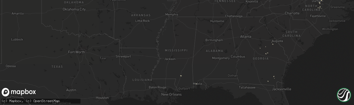
Hail Map in Mississippi on July 15, 2022
The weather event in Mississippi on July 15, 2022 includes Wind and Hail maps. 17 states and 110 cities were impacted and suffered possible damage. The total estimated number of properties impacted is 0.
Want more than just the map?
Turn this storm into a full workflow.
- Owner + property data so you know who to knock
- OnDemand branded weather history reports to win the "did we even have hail?" argument
- RoofTrace estimate so reps stop guessing numbers at the door
Bought this map? Upgrade within 7 days and we'll credit the $230. (10-15 min setup call)
Wind
Hail
0
Estimated number of impacted properties by a 1.00" hail or larger0
Estimated number of impacted properties by a 1.75" hail or larger0
Estimated number of impacted properties by a 2.50" hail or largerStorm reports in Mississippi
Mississippi
| Date | Description |
|---|---|
| 07/15/20222:46 AM CDT | At 745 PM CDT, a severe thunderstorm was located over Purvis, or 12 miles south of Hattiesburg, moving west at 10 mph. HAZARD...60 mph wind gusts and quarter size hail. SOURCE...Radar indicated. IMPACT...Hail damage to vehicles is expected. Expect wind damage to roofs, siding, and trees. This severe thunderstorm will be near... Purvis around 800 PM CDT. Pine Ridge around 810 PM CDT. |
| 07/14/20228:20 PM CDT | Small tree limbs were found towards oak rd along with wind speeds of 55-60 mph. |
All States Impacted by Hail Map on July 15, 2022
Cities Impacted by Hail Map on July 15, 2022
- Mattoon, IL
- Humboldt, IL
- Amado, AZ
- Raleigh, NC
- Morrisville, NC
- Marana, AZ
- Tucson, AZ
- Brodnax, VA
- Cartwright, ND
- Savage, MT
- Wibaux, MT
- Beach, ND
- Williamsburg, VA
- Billings, MT
- Acton, MT
- Oreana, IL
- Flagler, CO
- Willow Spring, NC
- Fuquay Varina, NC
- Henrico, NC
- Gasburg, VA
- Mcgregor, ND
- Ray, ND
- Columbus, ND
- Lignite, ND
- Tioga, ND
- Powers Lake, ND
- Richey, MT
- Bloomfield, MT
- Lambert, MT
- Island Park, ID
- Trenton, FL
- Bell, FL
- Alexander, ND
- Felton, DE
- Holly Springs, NC
- Hollister, NC
- Sells, AZ
- Cerro Gordo, IL
- Purvis, MS
- Hattiesburg, MS
- Warrenton, NC
- Harrington, DE
- Waycross, GA
- Kenmare, ND
- Glendo, WY
- Laurel, MT
- Baton Rouge, LA
- Denham Springs, LA
- Molt, MT
- Hammond, IL
- Lovington, IL
- Atwood, IL
- Tuscola, IL
- Arcola, IL
- Arthur, IL
- Gloucester, VA
- Hayes, VA
- Wrightsville, GA
- Covington, LA
- Park River, ND
- Stanley, ND
- Palermo, ND
- Flaxton, ND
- Portal, ND
- Ross, ND
- Dearing, GA
- Fargo, GA
- East Dublin, GA
- New Underwood, SD
- Newell, SD
- Camden Wyoming, DE
- Mobile, AL
- Kenney, IL
- Macon, IL
- Mt Zion, IL
- Decatur, IL
- Dalton City, IL
- Gordon, GA
- Milledgeville, GA
- Matthews, GA
- Wake Forest, NC
- Maroa, IL
- New Raymer, CO
- Musselshell, MT
- Argenta, IL
- Cisco, IL
- Culbertson, MT
- Warrensburg, IL
- Victor, MT
- Angier, NC
- Benson, NC
- Warthen, GA
- Shacklefords, VA
- Saluda, VA
- Forsyth, IL
- Hardin, MT
- Broadview, MT
- Crow Agency, MT
- Rapelje, MT
- Huntley, MT
- Pompeys Pillar, MT
- Ballantine, MT
- Colfax, WA
- Nye, MT
- Fishtail, MT
- Baker, MT
- Plevna, MT
- Milmine, IL
- Bement, IL


