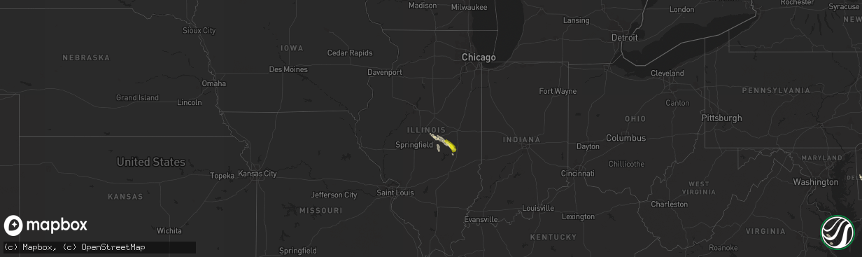
Hail Map in Illinois on July 15, 2022
The weather event in Illinois on July 15, 2022 includes Wind and Hail maps. 17 states and 110 cities were impacted and suffered possible damage. The total estimated number of properties impacted is 3,891.
Want more than just the map?
Turn this storm into a full workflow.
- Owner + property data so you know who to knock
- OnDemand branded weather history reports to win the "did we even have hail?" argument
- RoofTrace estimate so reps stop guessing numbers at the door
Bought this map? Upgrade within 7 days and we'll credit the $230. (10-15 min setup call)
Wind
Hail
3,891
Estimated number of impacted properties by a 1.00" hail or larger1,873
Estimated number of impacted properties by a 1.75" hail or larger0
Estimated number of impacted properties by a 2.50" hail or largerStorm reports in Illinois
Illinois
| Date | Description |
|---|---|
| 07/15/20226:01 AM CDT | At 1100 PM CDT, a severe thunderstorm was located near Lovington, or 11 miles north of Sullivan, moving southeast at 30 mph. HAZARD...60 mph wind gusts and quarter size hail. SOURCE...Radar indicated. IMPACT...Hail damage to vehicles is expected. Expect wind damage to roofs, siding, and trees. This severe thunderstorm will be near... Sullivan and Arthur around 1115 PM CDT.Other locations in the path of this severe thunderstorm includeAllenville, Arcola, Cooks Mill and Humboldt.This includes the following highways... Interstate 57 between mile markers 197 and 211. Interstate 72 between mile markers 135 and 152. |
| 07/14/202211:06 PM CDT | Viewer report from county road 300 e. |
All States Impacted by Hail Map on July 15, 2022
Cities Impacted by Hail Map on July 15, 2022
- Mattoon, IL
- Humboldt, IL
- Amado, AZ
- Raleigh, NC
- Morrisville, NC
- Marana, AZ
- Tucson, AZ
- Brodnax, VA
- Cartwright, ND
- Savage, MT
- Wibaux, MT
- Beach, ND
- Williamsburg, VA
- Billings, MT
- Acton, MT
- Oreana, IL
- Flagler, CO
- Willow Spring, NC
- Fuquay Varina, NC
- Henrico, NC
- Gasburg, VA
- Mcgregor, ND
- Ray, ND
- Columbus, ND
- Lignite, ND
- Tioga, ND
- Powers Lake, ND
- Richey, MT
- Bloomfield, MT
- Lambert, MT
- Island Park, ID
- Trenton, FL
- Bell, FL
- Alexander, ND
- Felton, DE
- Holly Springs, NC
- Hollister, NC
- Sells, AZ
- Cerro Gordo, IL
- Purvis, MS
- Hattiesburg, MS
- Warrenton, NC
- Harrington, DE
- Waycross, GA
- Kenmare, ND
- Glendo, WY
- Laurel, MT
- Baton Rouge, LA
- Denham Springs, LA
- Molt, MT
- Hammond, IL
- Lovington, IL
- Atwood, IL
- Tuscola, IL
- Arcola, IL
- Arthur, IL
- Gloucester, VA
- Hayes, VA
- Wrightsville, GA
- Covington, LA
- Park River, ND
- Stanley, ND
- Palermo, ND
- Flaxton, ND
- Portal, ND
- Ross, ND
- Dearing, GA
- Fargo, GA
- East Dublin, GA
- New Underwood, SD
- Newell, SD
- Camden Wyoming, DE
- Mobile, AL
- Kenney, IL
- Macon, IL
- Mt Zion, IL
- Decatur, IL
- Dalton City, IL
- Gordon, GA
- Milledgeville, GA
- Matthews, GA
- Wake Forest, NC
- Maroa, IL
- New Raymer, CO
- Musselshell, MT
- Argenta, IL
- Cisco, IL
- Culbertson, MT
- Warrensburg, IL
- Victor, MT
- Angier, NC
- Benson, NC
- Warthen, GA
- Shacklefords, VA
- Saluda, VA
- Forsyth, IL
- Hardin, MT
- Broadview, MT
- Crow Agency, MT
- Rapelje, MT
- Huntley, MT
- Pompeys Pillar, MT
- Ballantine, MT
- Colfax, WA
- Nye, MT
- Fishtail, MT
- Baker, MT
- Plevna, MT
- Milmine, IL
- Bement, IL


