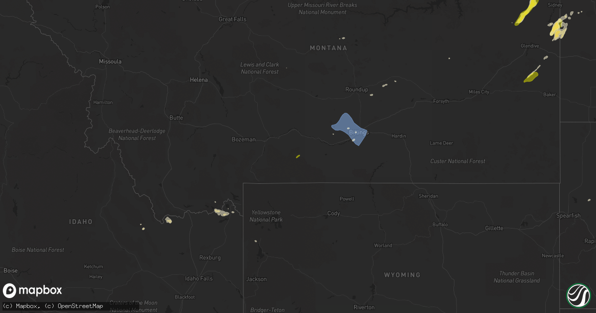
Hail Map on July 15, 2022
Get this storm
July 15 map
$229
one time, instant access
Download today. No call, no setup
Keep the $229
Bought the map and want the full workflow? Apply the entire $229 to a subscription within 7 days. None of it is wasted.
Every map, not just this one
This buys you this map. Subscription and you get every map we run, in the markets you choose from a few cities to whole states to nationwide. Plus real-time alerts the moment a storm fires.
Contact data
Name, contact info, occupancy, even credit band for addresses in the footprint. You go from where it hit to who to call.
Become the source they trust
Unlimited branding weather history reports on demand. You already have the documented answer ready for the property owner, and you are the one who showed up with it.
Property data and RoofTrace estimates
Pull up any address you have got, its value and the exact code rules for that jurisdiction, straight from One Click Code. Then RoofTrace estimates the squares, pitch, and roof value, priced the way you price.
States Impacted by Hail Map on July 15, 2022
Storm reports
Washington
| Date | Description |
|---|---|
| 07/15/20229:55 AM CDT | A local report indicates 1.00 inch wind near 3 NNE COLFAX |
Montana
| Date | Description |
|---|---|
| 07/15/20226:46 PM CDT | Mesonet station mtmqm monida pass |
| 07/15/20226:29 PM CDT | A local report indicates 67 MPH wind near 22 E WARREN |
| 07/15/20226:19 PM CDT | A local report indicates 58 MPH wind near 1 WNW INGOMAR |
| 07/15/20226:04 PM CDT | A local report indicates 65 MPH wind near 1 WNW INGOMAR |
| 07/15/20225:57 PM CDT | A local report indicates 60 MPH wind near 1 WNW INGOMAR |
| 07/15/20225:55 PM CDT | Visibility under a quarter mile in blowing dust |
| 07/15/20225:50 PM CDT | Mobile home lost roof. |
| 07/15/20225:35 PM CDT | Wind sensor on the warm springs settling pond. |
| 07/15/20225:30 PM CDT | A local report indicates 64 MPH wind near 10 N HARDIN |
| 07/15/20225:30 PM CDT | Gusts up to 64 mph produced visibility under a quarter mile in blowing dust. Major accident i-90 resulting in at least 5 fatalities. |
| 07/15/20225:30 PM CDT | A local report indicates 65 MPH wind near 16 SW ANGELA |
| 07/15/20225:05 PM CDT | Measured with handheld anemometer. |
| 07/15/20224:40 PM CDT | Tree fell over |
| 07/15/20224:25 PM CDT | A local report indicates 61 MPH wind near 3 NW BILLINGS |
| 07/15/20224:23 PM CDT | A local report indicates 64 MPH wind near 4 N BILLINGS |
| 07/15/20224:20 PM CDT | Mostly ping pong size a couple golf ball size though. |
| 07/15/20224:20 PM CDT | A local report indicates 1.50 inch wind near 4 N LAUREL |
| 07/15/20224:19 PM CDT | A local report indicates 1.00 inch wind near 1 SE NYE |
| 07/15/20224:15 PM CDT | A local report indicates 58 MPH wind near 10 E MOLT |
| 07/15/20222:06 PM CDT | A local report indicates 60 MPH wind near 2 SW TWO DOT |
| 07/15/20222:02 PM CDT | A local report indicates 60 MPH wind near 2 SW TWO DOT |
| 07/15/20221:29 PM CDT | Via ambient weather. |
| 07/15/20227:54 AM CDT | At 1253 PM MDT, severe thunderstorms were located along a line extending from 12 miles southwest of Geyser to 25 miles east of White Sulphur Springs, moving east at 25 mph. HAZARD...60 mph wind gusts. SOURCE...Radar indicated. IMPACT...Expect damage to roofs, siding, and trees. Locations impacted include... Lewistown, Stanford, Denton, Hobson, Moore, Windham, Moccasin, Martinsdale, Ackley Lake State Park, Sapphire Village, Glengarry, Utica, Garneill, Danvers, Coffee Creek, Checkerboard, Buffalo and Benchland. |
| 07/15/20227:13 AM CDT | At 1213 PM MDT, severe thunderstorms were located along a line extending from near Choteau to 14 miles north of White Sulphur Springs, moving northeast at 35 mph. HAZARD...60 mph wind gusts. SOURCE...Radar indicated. IMPACT...Expect damage to roofs, siding, and trees. Locations impacted include... Great Falls, Conrad, Choteau, Fort Benton, Stanford, Fairfield, Belt, Dutton, Geraldine, Fort Shaw, Brady, The Knees, Highwood, Black Eagle, Geyser, Fort Shaw, Power, Carter, Neihart and Floweree. |
| 07/15/20223:47 AM CDT | At 847 PM MDT, a severe thunderstorm was located 12 miles west of Bloomfield, or 18 miles east of Circle, moving northeast at 30 mph. HAZARD...60 mph wind gusts and penny size hail. SOURCE...Radar indicated. IMPACT...Expect damage to roofs, siding, and trees. Locations impacted include... Lambert, Intake, Bloomfield, Burns and Enid. |
| 07/14/202211:30 PM CDT | At 430 PM MDT, a severe thunderstorm was located over Warm Springs, or 9 miles east of Anaconda, moving east at 20 mph. HAZARD...60 mph wind gusts. SOURCE...Radar indicated. IMPACT...Expect damage to roofs, siding, and trees. Locations impacted include... Walkerville, Warm Springs and Opportunity. |
| 07/14/202210:04 PM CDT | At 302 PM MDT, severe thunderstorms were located along a line extending from 19 miles northwest of Shepherd to near Laurel, moving east at 45 mph. HAZARD...60 mph wind gusts and quarter size hail. SOURCE...Radar indicated. IMPACT...Tents and other temporary outdoor shelters could collapse. Expect wind damage to roofs, siding, and trees. Hail to quarter sized could cause minor damage to plants. Locations impacted include... Billings, Laurel, Lockwood, Shepherd, Huntley, Billings Heights, Worden, Billings West End, Ballantine, Pompeys Pillar, Acton and Comanche. |
| 07/14/20229:12 PM CDT | At 212 PM MDT, a severe thunderstorm was located 14 miles south of Big Sandy, moving northeast at 35 mph. HAZARD...60 mph wind gusts and penny size hail. SOURCE...Radar indicated. IMPACT...Expect damage to roofs, siding, and trees. Locations impacted include... Chinook, Big Sandy, Azure, Parker School, Agency, St. Pierre, Sangrey, Boneau, Rocky Boy, Cleveland, Lloyd, Iliad and Virgelle. |
| 07/14/20228:17 PM CDT | At 116 PM MDT, a severe thunderstorm was located 12 miles west of Harlowton, moving northeast at 35 mph. HAZARD...60 mph wind gusts. SOURCE...Trained weather spotters. IMPACT...Expect damage to roofs, siding, and trees. Locations impacted include... Harlowton, Deadmans Basin Reservoir, Judith Gap, Shawmut and Twodot. |
| 07/14/20228:12 PM CDT | At 111 PM MDT, severe thunderstorms were located along a line extending from 6 miles northeast of Highwood to near Geyser, moving northeast at 45 mph. HAZARD...60 mph wind gusts and penny size hail. SOURCE...Radar indicated. IMPACT...Expect damage to roofs, siding, and trees. Locations impacted include... Fort Benton, Big Sandy, Geraldine, Geyser, Boneau, Highwood, St. Pierre, Parker School, Carter, Shonkin, Loma, Square Butte, Iliad and Virgelle. |
| 07/14/20227:59 PM CDT | A local report indicates 64 MPH wind near 2 NNW FORSYTH |
| 07/14/20227:39 PM CDT | A local report indicates 64 MPH wind near 2 NW ROCK SPRINGS |
Arizona
| Date | Description |
|---|---|
| 07/15/202212:00 AM CDT | At 500 PM MST, a severe thunderstorm was located near Marana, moving northwest at 5 mph. HAZARD...60 mph wind gusts and quarter size hail. SOURCE...Radar indicated. IMPACT...Hail damage to vehicles is expected. Expect wind damage to roofs, siding, and trees. Blowing dust may also reduce visibility to one mile or less. Locations impacted include... Marana, Avra Valley, Picture Rocks and Dove Mountain. |
| 07/14/202210:58 PM CDT | At 357 PM MST, a severe thunderstorm was located 10 miles north of Kitt Peak, or 22 miles northeast of Sells, moving northwest at 10 mph. HAZARD...60 mph wind gusts and quarter size hail. SOURCE...Radar indicated. IMPACT...Hail damage to vehicles is expected. Expect wind damage to roofs, siding, and trees. Locations impacted include... San Isidro, Kitt Peak, Ali Chukson, Fresnal, San Pedro, Queens Well, Comobabi, Cababi, South Comobabi, Santa Rosa Ranch, Pan Tak and Ali Molina. |
South Dakota
| Date | Description |
|---|---|
| 07/14/20227:30 PM CDT | A local report indicates 59 MPH wind near 7 E STURGIS |
North Dakota
| Date | Description |
|---|---|
| 07/15/20226:19 AM CDT | At 1118 PM CDT/1018 PM MDT/, a severe thunderstorm was located 9 miles north of Skaar, or 15 miles south of Sidney, moving northeast at 35 mph. HAZARD...60 mph wind gusts and quarter size hail. SOURCE...Radar indicated. IMPACT...Hail damage to vehicles is expected. Expect wind damage to roofs, siding, and trees. Locations impacted include... Alexander. |
| 07/15/20225:03 AM CDT | At 1002 PM MDT, a severe thunderstorm was located near Skaar, or 23 miles north of Wibaux, moving northeast at 20 mph. HAZARD...60 mph wind gusts and quarter size hail. SOURCE...Radar indicated. IMPACT...Hail damage to vehicles is expected. Expect wind damage to roofs, siding, and trees. This severe thunderstorm will remain over mainly rural areas of northeastern Wibaux and southeastern Richland Counties. |
| 07/15/20224:33 AM CDT | At 932 PM MDT, a severe thunderstorm was located 10 miles southwest of Lambert, or 30 miles west of Sidney, moving northeast at 20 mph. HAZARD...60 mph wind gusts and half dollar size hail. SOURCE...Radar indicated. IMPACT...Hail damage to vehicles is expected. Expect wind damage to roofs, siding, and trees. Locations impacted include... Sidney, Lambert, Wooley and Enid. |
| 07/15/20224:04 AM CDT | At 904 PM MDT, a severe thunderstorm was located 25 miles west of Carlyle, or 27 miles northwest of Baker, moving northeast at 30 mph. HAZARD...60 mph wind gusts and quarter size hail. SOURCE...Radar indicated. IMPACT...Hail damage to vehicles is expected. Expect wind damage to roofs, siding, and trees. Locations impacted include... Wibaux, Carlyle, Hodges, Saint Phillip and Yates. |
Illinois
| Date | Description |
|---|---|
| 07/15/20226:01 AM CDT | At 1100 PM CDT, a severe thunderstorm was located near Lovington, or 11 miles north of Sullivan, moving southeast at 30 mph. HAZARD...60 mph wind gusts and quarter size hail. SOURCE...Radar indicated. IMPACT...Hail damage to vehicles is expected. Expect wind damage to roofs, siding, and trees. This severe thunderstorm will be near... Sullivan and Arthur around 1115 PM CDT.Other locations in the path of this severe thunderstorm includeAllenville, Arcola, Cooks Mill and Humboldt.This includes the following highways... Interstate 57 between mile markers 197 and 211. Interstate 72 between mile markers 135 and 152. |
| 07/14/202211:06 PM CDT | Viewer report from county road 300 e. |
Georgia
| Date | Description |
|---|---|
| 07/15/202212:59 AM CDT | At 559 PM EDT, a severe thunderstorm was located over Braganza, or near Waycross, moving northwest at 15 mph. HAZARD...60 mph wind gusts and penny size hail. SOURCE...Radar indicated. IMPACT...Expect damage to roofs, siding, and trees. Locations impacted include... Waycross, Blackshear, Boggy Bay, Jamestown, Pebble Hill, Braganza, Fort Mudge and Needham. |
| 07/14/202211:14 PM CDT | At 414 PM EDT, a severe thunderstorm was located near Matthews, or 15 miles southwest of Fort Gordon, moving southeast at 10 mph. HAZARD...60 mph wind gusts. SOURCE...Radar indicated. IMPACT...Expect damage to roofs, siding, and trees. Locations impacted include... Wrens, Stapleton, Matthews and Stellaville. |
| 07/14/20229:48 PM CDT | At 248 PM EDT, a severe thunderstorm was located near Warthen, or 9 miles north of Sandersville, moving east at 5 mph. HAZARD...60 mph wind gusts. SOURCE...Radar indicated. IMPACT...Expect damage to roofs, siding, and trees. Locations impacted include... Sandersville, Davisboro, Tennille, Deepstep, Riddleville, Hamburg State Park, Downs, Warthen and Linton. |
Delaware
| Date | Description |
|---|---|
| 07/14/202210:45 PM CDT | At 344 PM EDT, a severe thunderstorm was located over Viola, or 10 miles southwest of Dover, moving southeast at 15 mph. HAZARD...60 mph wind gusts. SOURCE...Radar indicated. IMPACT...Damage to roofs, siding, trees, and power lines is possible. Locations impacted include... Milford, Harrington, Camden, Woodside, Viola, Rising Sun-Lebanon, Wyoming, Felton, Frederica, Houston, Magnolia, Farmington, Riverview and Woodside East. |
Virginia
| Date | Description |
|---|---|
| 07/15/20221:40 PM CDT | Tree downed onto a powerline off of va-198. |
| 07/15/202212:30 PM CDT | Tree downed onto a power line at oakley ln. |
| 07/14/20229:23 PM CDT | At 223 PM EDT, severe thunderstorms were located along a line extending from Blakes to near Mathews to near Hayes, moving southeast at 15 mph. HAZARD...60 mph wind gusts and penny size hail. SOURCE...Radar indicated. IMPACT...Expect damage to trees and powerlines. Severe thunderstorms will be near... Mathews, Gwynn and Mobjack around 235 PM EDT. Achilles around 240 PM EDT. Bavon around 255 PM EDT.Other locations impacted by these severe thunderstorms include Ruff,Beulah, Moon, Laban, Glass, Naxera, Grafton, Harcum, Amburg and FortNonsense. |
| 07/14/20228:27 PM CDT | At 126 PM EDT, a severe thunderstorm was located over Glenns, or near Urbanna, moving east at 15 mph. HAZARD...60 mph wind gusts. SOURCE...Radar indicated. IMPACT...Expect damage to trees and powerlines. This severe thunderstorm will be near... Hartfield around 200 PM EDT.Other locations impacted by this severe thunderstorm include Pinero,Greys Point, Pampa, Harmony Village, Grafton, Harcum, Healys, Cash,Wake and Cooper. |
Wyoming
| Date | Description |
|---|---|
| 07/15/20226:49 PM CDT | Willow creek raws - tt631. |
| 07/15/20225:15 PM CDT | Awos station ku68 cowley airport. |
| 07/15/202212:43 AM CDT | At 543 PM MDT, severe thunderstorms were located along a line extending from 19 miles south of Sand Springs to 21 miles northwest of Forsyth to 6 miles northwest of Lame Deer to 7 miles east of Busby to near Ranchester, moving east at 20 mph. HAZARD...70 mph wind gusts. SOURCE...Weather station. Between 500 PM and 530 PM reports of 55 to 65 mph winds have been reported by weather station. These outflow winds have a history of damage. IMPACT...Expect considerable tree damage. Damage is likely to mobile homes, roofs, and outbuildings. Locations impacted include... Sheridan, Colstrip, Forsyth, Ranchester, Dayton, Lame Deer, Ashland, Granite Pass, Big Horn, Rosebud, Birney, Cartersville, Hathaway, Brandenberg, Kirby, Rosebud Battlefield Park, Story, Parkman, Tongue River Reservoir and Banner.This replaces the warning previously in effect for this area. |
| 07/14/202211:55 PM CDT | At 452 PM MDT, a gust front ahead of strong thunderstorms was located along a line extending from 19 miles south of Hysham to 14 miles southwest of Lodge Grass, moving east at 40 mph. HAZARD...70 mph wind gusts. SOURCE...Weather station. At 430 PM, 64 mph wind gust was reported 5 miles north of Hardin from the Hardin N MDA weather station. IMPACT...Expect considerable tree damage. Damage is likely to mobile homes, roofs, and outbuildings. Locations impacted include... Sheridan, Colstrip, Ranchester, Dayton, Lodge Grass, Lame Deer, Busby, Crow Agency, Ashland, Big Horn, Birney, Wyola, Parkman, Tongue River Reservoir, Banner, Birney Village, Brandenberg, Kirby, Muddy Cluster and Rosebud Battlefield Park. |
| 07/14/20227:53 PM CDT | Asos station kbyg buffalo airport. |
| 07/14/20227:30 PM CDT | A local report indicates 62 MPH wind near 17 WSW BIG HORN |
| 07/14/20227:17 PM CDT | Asos station kgey greybull airport. |
| 07/14/20227:16 PM CDT | A local report indicates 58 MPH wind near 6 ESE BIG HORN |
| 07/14/20227:01 PM CDT | A local report indicates 59 MPH wind near 2 SSW SHERIDAN |
Minnesota
| Date | Description |
|---|---|
| 07/15/20227:59 AM CDT | At 1258 AM CDT, a severe thunderstorm was located near Blanchard, or 33 miles northwest of Fargo, moving southeast at 15 mph. HAZARD...Quarter size hail. SOURCE...Radar indicated. IMPACT...Damage to vehicles is expected. This severe thunderstorm will be near... Kelso around 105 AM CDT. Hunter around 115 AM CDT.Other locations in the path of this severe thunderstorm includeGrandin and Gardner.This includes Interstate 29 between mile markers 80 and 104. |
| 07/15/20227:00 AM CDT | One tree down on power lines. Time estimated. |
| 07/14/202210:43 PM CDT | At 342 AM CDT, a severe thunderstorm was located near West Fargo, or near Fargo, moving southeast at 30 mph. HAZARD...60 mph wind gusts and quarter size hail. SOURCE...Radar indicated. IMPACT...Hail damage to vehicles is expected. Expect wind damage to roofs, siding, and trees. This severe thunderstorm will be near... Prairie Rose around 345 AM CDT. Horace, Frontier and Briarwood around 350 AM CDT. Wild Rice around 355 AM CDT. Rustad around 400 AM CDT.Other locations in the path of this severe thunderstorm includeHickson and Oxbow.This includes the following highways... Interstate 29 between mile markers 36 and 67. Interstate 94 in North Dakota between mile markers 340 and 352. Interstate 94 in Minnesota between mile markers 1 and 2. |
| 07/14/202210:35 PM CDT | At 335 AM CDT, a severe thunderstorm was located over Lawndale, or 25 miles northeast of Wahpeton, moving southeast at 35 mph. HAZARD...60 mph wind gusts and quarter size hail. SOURCE...Radar indicated. IMPACT...Hail damage to vehicles is expected. Expect wind damage to roofs, siding, and trees. This severe thunderstorm will be near... Rothsay around 350 AM CDT. Erhard around 355 AM CDT.Other locations in the path of this severe thunderstorm includeCarlisle, Elizabeth, Foxhome and Fergus Falls.This includes Interstate 94 in Minnesota between mile markers 23 and56. |
| 07/14/20229:38 PM CDT | At 238 AM CDT, a severe thunderstorm was located near West Fargo, or 8 miles southwest of Fargo, moving southeast at 25 mph. HAZARD...60 mph wind gusts and quarter size hail. SOURCE...Radar indicated. IMPACT...Hail damage to vehicles is expected. Expect wind damage to roofs, siding, and trees. This severe thunderstorm will be near... Frontier and Prairie Rose around 245 AM CDT. Horace, Davenport and Briarwood around 250 AM CDT. Wild Rice around 255 AM CDT.Other locations in the path of this severe thunderstorm includeKindred, Hickson and Oxbow.This includes the following highways... Interstate 29 between mile markers 35 and 72. Interstate 94 in North Dakota between mile markers 335 and 352. Interstate 94 in Minnesota between mile markers 1 and 3. |
| 07/14/20229:30 PM CDT | At 230 AM CDT, a severe thunderstorm was located near Deer Creek, or 34 miles southeast of Detroit Lakes, moving southeast at 15 mph. HAZARD...Quarter size hail. SOURCE...Radar indicated. IMPACT...Damage to vehicles is expected. This severe thunderstorm will be near... Deer Creek around 245 AM CDT. Bluffton around 250 AM CDT.Other locations in the path of this severe thunderstorm includeWadena, Verndale and Wrightstown. |
| 07/14/20228:56 PM CDT | At 156 AM CDT, a severe thunderstorm was located over Lake Park, or 13 miles west of Detroit Lakes, moving southeast at 20 mph. HAZARD...Half dollar size hail. SOURCE...Radar indicated. IMPACT...Damage to vehicles is expected. Locations impacted include... Cormorant, Shoreham, Dunvilla, Vergas and Lake Lida. |
| 07/14/20228:40 PM CDT | At 140 AM CDT, a severe thunderstorm was located near Gardner, or 22 miles northwest of Fargo, moving southeast at 20 mph. HAZARD...Two inch hail. SOURCE...Radar indicated. IMPACT...People and animals outdoors will be injured. Expect damage to roofs, siding, windows, and vehicles. This severe thunderstorm will be near... Gardner around 150 AM CDT.Other locations in the path of this severe thunderstorm includeArgusville, Georgetown, Brooktree Park, Prosper and Harwood.This includes the following highways... Interstate 29 between mile markers 61 and 95. Interstate 94 in North Dakota between mile markers 336 and 352. Interstate 94 in Minnesota between mile markers 1 and 5. |
Louisiana
| Date | Description |
|---|---|
| 07/14/202210:11 PM CDT | At 311 PM CDT, a severe thunderstorm was located over Covington, moving northwest at 5 mph. HAZARD...60 mph wind gusts and quarter size hail. SOURCE...Radar indicated. IMPACT...Hail damage to vehicles is expected. Expect wind damage to roofs, siding, and trees. Locations impacted include... Covington and Abita Springs. This includes Interstate 12 between mile markers 54 and 65. |
Nevada
| Date | Description |
|---|---|
| 07/15/20226:30 PM CDT | Mesonet station schnv 12.1 se ely |
| 07/15/20226:30 PM CDT | Ndot station us-6 schell creek |
| 07/15/20226:30 PM CDT | M |
| 07/15/202212:49 AM CDT | At 549 PM PDT, a severe thunderstorm was located 23 miles southwest of Blue Eagle Ranch, moving northeast at 10 mph. HAZARD...60 mph wind gusts and penny size hail. SOURCE...Radar indicated. IMPACT...Expect damage to roofs, siding, and trees. This severe thunderstorm will remain over mainly rural areas of southeastern Nye County. |
| 07/14/202210:39 PM CDT | At 338 PM PDT, a severe thunderstorm was located 13 miles west of Ruth, moving southeast at 15 mph. HAZARD...60 mph wind gusts and penny size hail. SOURCE...Radar indicated. IMPACT...Expect damage to roofs, siding, and trees. This severe thunderstorm will remain over mainly rural areas of central White Pine County. |
| 07/14/202210:13 PM CDT | At 313 PM PDT, a severe thunderstorm was located 8 miles northwest of Duckwater, moving southeast at 15 mph. HAZARD...60 mph wind gusts and penny size hail. SOURCE...Radar indicated. IMPACT...Expect damage to roofs, siding, and trees. Locations impacted include... Duckwater. |
| 07/14/20229:52 PM CDT | At 250 PM PDT, a severe thunderstorm was located near Gillman Springs, and is nearly stationary. HAZARD...60 mph wind gusts and penny size hail. SOURCE...Radar indicated. IMPACT...Expect damage to roofs, siding, and trees. Locations impacted include... Gillman Springs and Kingston. |
| 07/14/20228:49 PM CDT | At 147 PM PDT, a severe thunderstorm was located 15 miles southwest of Garden Pass, moving northeast at 25 mph. HAZARD...60 mph wind gusts and penny size hail. SOURCE...Radar indicated. IMPACT...Expect damage to roofs, siding, and trees. This severe thunderstorm will remain over mainly rural areas of southwestern Eureka County. |
| 07/14/20227:50 PM CDT | Salt desert shrub |
Colorado
| Date | Description |
|---|---|
| 07/15/20221:46 AM CDT | At 645 PM MDT, a severe thunderstorm was located 8 miles southwest of Seibert, moving northeast at 15 mph. HAZARD...60 mph wind gusts and nickel size hail. SOURCE...Radar indicated. IMPACT...Expect damage to roofs, siding, and trees. Locations impacted include... Seibert and Vona.This includes Interstate 70 in Colorado between mile markers 398 and419. |
| 07/14/20227:22 PM CDT | Corrects previous hail report from 9 s flagler. Public phone report of pea sized hail and 50-60 mph wind. Caller said there was heavy rain... So much that the windshiel |
Florida
| Date | Description |
|---|---|
| 07/15/20226:20 PM CDT | Marion county emergency management reports multiple downed powerlines in the vicinity of state road 200 to the south of the ocala international airport. Time of damage |
| 07/15/20227:35 AM CDT | At 1234 PM EDT, a severe thunderstorm was located 7 miles southeast of Port Everglades, or 7 miles northeast of Hallandale, moving west at 30 mph. HAZARD...60 mph wind gusts and penny size hail. SOURCE...Radar indicated. IMPACT...Expect damage to roofs, siding, and trees. Locations impacted include... Fort Lauderdale, Pembroke Pines, Hollywood, Miramar and Davie. |
| 07/15/202212:12 AM CDT | At 512 PM CDT, a severe thunderstorm was located 6 miles north of Oriole Beach, or 8 miles east of Ferry Pass, moving southwest at 10 mph. HAZARD...60 mph wind gusts and penny size hail. SOURCE...Radar indicated. IMPACT...Expect damage to roofs, siding, and trees. Locations impacted include... Pensacola, Brent, West Pensacola, Warrington, Gulf Breeze, Goulding, Myrtle Grove, Oriole Beach and Pensacola Beach. |
Mississippi
| Date | Description |
|---|---|
| 07/15/20222:46 AM CDT | At 745 PM CDT, a severe thunderstorm was located over Purvis, or 12 miles south of Hattiesburg, moving west at 10 mph. HAZARD...60 mph wind gusts and quarter size hail. SOURCE...Radar indicated. IMPACT...Hail damage to vehicles is expected. Expect wind damage to roofs, siding, and trees. This severe thunderstorm will be near... Purvis around 800 PM CDT. Pine Ridge around 810 PM CDT. |
| 07/14/20228:20 PM CDT | Small tree limbs were found towards oak rd along with wind speeds of 55-60 mph. |
Cities Impacted by Hail Map on July 15, 2022
- Mattoon, IL
- Humboldt, IL
- Amado, AZ
- Raleigh, NC
- Morrisville, NC
- Marana, AZ
- Tucson, AZ
- Brodnax, VA
- Cartwright, ND
- Savage, MT
- Wibaux, MT
- Beach, ND
- Williamsburg, VA
- Billings, MT
- Acton, MT
- Oreana, IL
- Flagler, CO
- Willow Spring, NC
- Fuquay Varina, NC
- Henrico, NC
- Gasburg, VA
- Mcgregor, ND
- Ray, ND
- Columbus, ND
- Lignite, ND
- Tioga, ND
- Powers Lake, ND
- Richey, MT
- Bloomfield, MT
- Lambert, MT
- Island Park, ID
- Trenton, FL
- Bell, FL
- Alexander, ND
- Felton, DE
- Holly Springs, NC
- Hollister, NC
- Sells, AZ
- Cerro Gordo, IL
- Purvis, MS
- Hattiesburg, MS
- Warrenton, NC
- Harrington, DE
- Waycross, GA
- Kenmare, ND
- Glendo, WY
- Laurel, MT
- Baton Rouge, LA
- Denham Springs, LA
- Molt, MT
- Hammond, IL
- Lovington, IL
- Atwood, IL
- Tuscola, IL
- Arcola, IL
- Arthur, IL
- Gloucester, VA
- Hayes, VA
- Wrightsville, GA
- Covington, LA
- Park River, ND
- Stanley, ND
- Palermo, ND
- Flaxton, ND
- Portal, ND
- Ross, ND
- Dearing, GA
- Fargo, GA
- East Dublin, GA
- New Underwood, SD
- Newell, SD
- Camden Wyoming, DE
- Mobile, AL
- Kenney, IL
- Macon, IL
- Mt Zion, IL
- Decatur, IL
- Dalton City, IL
- Gordon, GA
- Milledgeville, GA
- Matthews, GA
- Wake Forest, NC
- Maroa, IL
- New Raymer, CO
- Musselshell, MT
- Argenta, IL
- Cisco, IL
- Culbertson, MT
- Warrensburg, IL
- Victor, MT
- Angier, NC
- Benson, NC
- Warthen, GA
- Shacklefords, VA
- Saluda, VA
- Forsyth, IL
- Hardin, MT
- Broadview, MT
- Crow Agency, MT
- Rapelje, MT
- Huntley, MT
- Pompeys Pillar, MT
- Ballantine, MT
- Colfax, WA
- Nye, MT
- Fishtail, MT
- Baker, MT
- Plevna, MT
- Milmine, IL
- Bement, IL