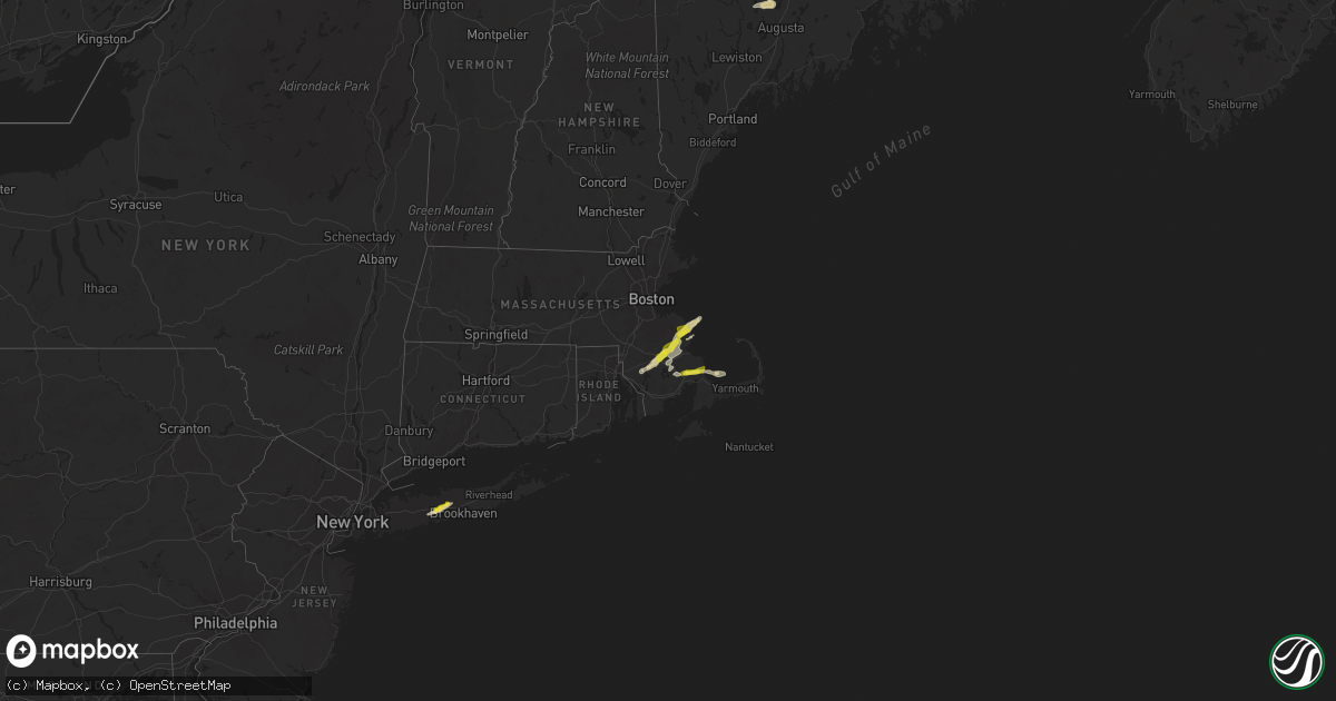
Hail Map on July 14, 2022
Get this storm
July 14 map
$229
one time, instant access
Download today. No call, no setup
Keep the $229
Bought the map and want the full workflow? Apply the entire $229 to a subscription within 7 days. None of it is wasted.
Every map, not just this one
This buys you this map. Subscription and you get every map we run, in the markets you choose from a few cities to whole states to nationwide. Plus real-time alerts the moment a storm fires.
Contact data
Name, contact info, occupancy, even credit band for addresses in the footprint. You go from where it hit to who to call.
Become the source they trust
Unlimited branding weather history reports on demand. You already have the documented answer ready for the property owner, and you are the one who showed up with it.
Property data and RoofTrace estimates
Pull up any address you have got, its value and the exact code rules for that jurisdiction, straight from One Click Code. Then RoofTrace estimates the squares, pitch, and roof value, priced the way you price.
States Impacted by Hail Map on July 14, 2022
Storm reports
Maryland
| Date | Description |
|---|---|
| 07/14/20223:33 PM CDT | Large tree limbs on power line |
| 07/13/202211:19 PM CDT | At 419 PM EDT, a severe thunderstorm was located over Dumfries, or near Quantico, moving east at 25 mph. HAZARD...60 mph wind gusts. SOURCE...Radar indicated. IMPACT...Damaging winds will cause some trees and large branches to fall. This could injure those outdoors, as well as damage homes and vehicles. Roadways may become blocked by downed trees. Localized power outages are possible. Unsecured light objects may become projectiles. Locations impacted include... Waldorf, Dale City, La Plata, Quantico, Montclair, Triangle, Dumfries, Cherry Hill, Bryans Road, Potomac Heights, Pomfret, Port Tobacco Village, Marbury, Widewater, Port Tobacco, Garrisonville, Ironsides, Ripley, Arkendale and Rison. |
Idaho
| Date | Description |
|---|---|
| 07/14/20226:21 PM CDT | Wires down and debris in the road near the intersection of yellowstone ave and ward dr. |
| 07/14/20225:39 PM CDT | Mesonet station mofi1 - moburg canyon. |
| 07/14/20225:34 PM CDT | Private weather station. Near the intersection of main st and oakley ave. Peak gust to 62.4 mph. |
| 07/14/202212:24 AM CDT | At 523 PM MDT, a severe thunderstorm was located near Lava Hot Springs, moving northeast at 25 mph. HAZARD...60 mph wind gusts and half dollar size hail. SOURCE...Radar indicated. IMPACT...Hail damage to vehicles is expected. Expect wind damage to roofs, siding, and trees. Locations impacted include... Lava Hot Springs and Bancroft. |
| 07/13/20227:49 PM CDT | Id-34 near blackfoot river rd. Wind gust to 66.2 mph. |
| 07/13/20227:33 PM CDT | Mesonet station grai1. |
| 07/13/20227:05 PM CDT | Fall river rural electric cooperative reports several trees down on power lines just southwest of macks inn resulting in a power outage. |
Colorado
| Date | Description |
|---|---|
| 07/14/20224:16 PM CDT | Awos station kaff us air force academy. |
Minnesota
| Date | Description |
|---|---|
| 07/14/20223:50 AM CDT | Nickel to quarter size hail and nearly an inch of rain. |
| 07/14/20223:00 AM CDT | A local report indicates 1.00 inch wind near 6 S DEER CREEK |
| 07/14/20222:10 AM CDT | Photo of 2 inch hail relayed via media. |
| 07/14/20222:10 AM CDT | Public report and photo posted via social media. |
| 07/14/20222:00 AM CDT | Report and photo posted via social media. Hail accumulated on the ground and broke out the rear window on a car. |
| 07/14/20222:00 AM CDT | Reoport and photo posted via social media. Hail accumulated on the ground and broke out a rear window on a car. |
Wyoming
| Date | Description |
|---|---|
| 07/14/20221:55 AM CDT | At 655 PM MDT, a severe thunderstorm was located near Echeta, or 24 miles northwest of Gillette, moving east at 30 mph. HAZARD...60 mph wind gusts and quarter size hail. SOURCE...Radar indicated. IMPACT...Hail damage to vehicles is expected. Expect wind damage to roofs, siding, and trees. Locations impacted include... Gillette, Echeta, Camplex Event Facility and Gillette Airport. This includes Interstate 90 in Wyoming between Mile Markers 113 and134. |
| 07/13/202211:27 PM CDT | At 427 PM MDT, a severe thunderstorm was located near Pryor, or 31 miles south of Billings, moving east at 35 mph. HAZARD...60 mph wind gusts and quarter size hail. SOURCE...Radar indicated. IMPACT...Hail damage to vehicles is expected. Expect wind damage to roofs, siding, and trees. Locations impacted include... Pryor, Fort Smith, St. Xavier, Bighorn Lake and Crow Indian Reservation.This replaces the warning previously in effect for this area. |
| 07/13/20228:05 PM CDT | A local report indicates 68 MPH wind near 1 NE ECHETA |
Connecticut
| Date | Description |
|---|---|
| 07/14/20225:28 PM CDT | Tree and wires down on south windham road. Relayed by amateur radio. |
| 07/14/20225:18 PM CDT | Tree and wires down at follow locations; west avenue... South street at oxbow drive... And southridge drive. Relayed by amateur radio. |
| 07/14/20225:18 PM CDT | Tree and wires down on pleasant street. Top of utility pole snapped off at intersection of pleasant and lebanon. Relayed by amateur radio. |
| 07/14/20225:08 PM CDT | Reports chimney fell into roof on west main street. |
| 07/14/20225:07 PM CDT | Tree and wires down on newberry rd and devonshire lane. Relayed by amateur radio. |
| 07/14/20225:06 PM CDT | Ema mngr reports trees and a billboard down in the vicinity of rt 66 east... Flanders river rd... Cards mill rd... Old willimantic rd... And cherry valley rd. |
Alabama
| Date | Description |
|---|---|
| 07/14/20221:19 AM CDT | At 619 PM CDT, a severe thunderstorm was located 7 miles north of Yellow Bluff, or 10 miles northwest of Camden, moving west at 10 mph. HAZARD...60 mph wind gusts. SOURCE...Radar indicated. IMPACT...Expect damage to roofs, siding, and trees. Locations impacted include... Pine Hill and Yellow Bluff. |
Arizona
| Date | Description |
|---|---|
| 07/13/202211:23 PM CDT | At 423 PM MST, a severe thunderstorm was located 7 miles west of Saguaro National Park West, or 10 miles southwest of Marana, moving west at 15 mph. HAZARD...60 mph wind gusts and quarter size hail. SOURCE...Radar indicated. IMPACT...Hail damage to vehicles is expected. Expect wind damage to roofs, siding, and trees. Locations impacted include... Marana, Avra Valley, Saguaro National Park West, Picture Rocks and Silver Bell. |
| 07/13/202210:20 PM CDT | Several palo verde trees down. Time estimated. |
| 07/13/202210:06 PM CDT | At 306 PM MST, a severe thunderstorm was located over Summit, or 8 miles south of Davis-Monthan Air Force Base, moving northwest at 10 mph. HAZARD...60 mph wind gusts and quarter size hail. SOURCE...Radar indicated. IMPACT...Hail damage to vehicles is expected. Expect wind damage to roofs, siding, and trees. Locations impacted include... Tucson, Sahuarita, Davis-Monthan Air Force Base, Drexel Heights, South Tucson, Pascua Pueblo Yaqui Reservation, East Sahuarita, Summit, Corona De Tucson, Valencia West, Tucson International Airport, Catalina Foothills, Tucson Estates, Rita Ranch and San Xavier Mission. |
| 07/13/20229:49 PM CDT | At 247 PM PDT/247 PM MST/, a severe thunderstorm was located near Boulder Beach, or near Las Vegas Bay, moving northeast at 10 mph. HAZARD...50 to 60 mph wind gusts and pea size hail. SOURCE...Radar indicated. IMPACT...Expect damage to roofs and trees. Locations impacted include... Henderson, Boulder City, Las Vegas Bay, Lake Las Vegas, Boulder Beach, Callville Bay Campground, Railroad Pass, Boulder Beach Campground, Las Vegas Bay Campground, Callville Bay and Hoover Dam. |
| 07/13/20228:51 PM CDT | At 147 PM MST, a severe thunderstorm was located near Valentine, or 28 miles northeast of Kingman, moving northwest at 30 mph. HAZARD...60 mph wind gusts and pea size hail. SOURCE...Radar indicated. IMPACT...Expect damage to roofs and trees. Locations impacted include... Valentine, Truxton, and Peach Springs. This includes Route 66 from mile marker 80 to mile marker 110. |
| 07/13/20228:44 PM CDT | Trained spotter measured 58 mph wind gusts from thunderstorm outflow. |
North Carolina
| Date | Description |
|---|---|
| 07/13/202210:25 PM CDT | At 325 AM EDT, a severe thunderstorm was located over Morehead City, moving northeast at 40 mph. HAZARD...60 mph wind gusts. SOURCE...Radar indicated. IMPACT...Expect damage to roofs, siding, and trees. Locations impacted include... Havelock, Morehead City, Newport, South River, North River, Merrimon, Pine Knoll Shores, Harlowe, Florence, Otway, Broad Creek, Janeiro, Great Neck, Wildwood, Whortonsville, Open Grounds Farm, Bogue, Maribel, Nc Pamlico and North Harlowe. |
Mississippi
| Date | Description |
|---|---|
| 07/14/20223:45 AM CDT | At 844 PM CDT, a severe thunderstorm was located over Lexington, or 13 miles west of Durant, moving southwest at 10 mph. HAZARD...60 mph wind gusts and quarter size hail. SOURCE...Radar indicated. IMPACT...Hail damage to vehicles is expected. Expect wind damage to roofs, siding, and trees. This severe thunderstorm will be near... Howard around 855 PM CDT. Franklin around 905 PM CDT. Brozville around 920 PM CDT. Ebenezer, Coxburg and Tolarville around 930 PM CDT. |
| 07/14/20222:24 AM CDT | At 724 PM CDT, a severe thunderstorm was located near Kosciusko, moving southwest at 20 mph. HAZARD...60 mph wind gusts and quarter size hail. SOURCE...Radar indicated. IMPACT...Hail damage to vehicles is expected. Expect wind damage to roofs, siding, and trees. This severe thunderstorm will be near... Kosciusko and Smyrna around 740 PM CDT. Mcadams around 755 PM CDT.Other locations impacted by this severe thunderstorm include West andEthel. |
| 07/14/20221:48 AM CDT | At 647 PM CDT, a severe thunderstorm was located near Mcmillan, or 8 miles west of Louisville, moving south at 15 mph. HAZARD...60 mph wind gusts and quarter size hail. SOURCE...Radar indicated. IMPACT...Hail damage to vehicles is expected. Expect wind damage to roofs, siding, and trees. This severe thunderstorm will remain over mainly rural areas of south central Choctaw, northeastern Attala and southwestern Winston Counties, including the following locations... Mccool. |
| 07/14/202212:23 AM CDT | At 523 PM CDT, a severe thunderstorm was located 7 miles west of Wilmer, or 11 miles southeast of Lucedale, moving northeast at 10 mph. HAZARD...60 mph wind gusts and quarter size hail. SOURCE...Radar indicated. IMPACT...Hail damage to vehicles is expected. Expect wind damage to roofs, siding, and trees. Locations impacted include... Wilmer. |
| 07/13/20227:40 PM CDT | Multiple trees down within the city limits. |
Nevada
| Date | Description |
|---|---|
| 07/14/20224:45 PM CDT | Local news outlet reported a large tree uprooted as a result of thunderstorm winds. Winds in the area at the time of occurrence were estimated to be around 40 mph. Time |
New Mexico
| Date | Description |
|---|---|
| 07/14/202212:37 AM CDT | At 537 PM MDT, a severe thunderstorm was located 9 miles southwest of Youngsville, or 15 miles northeast of Cuba, moving west at 10 mph. HAZARD...Quarter size hail. SOURCE...Radar indicated. IMPACT...Damage to vehicles is expected. Locations impacted include... La Jara. |
South Carolina
| Date | Description |
|---|---|
| 07/14/20226:10 PM CDT | Tree reported in roadway along iris drive at bay blossom drive. Time estimated from radar. |
| 07/14/20226:10 PM CDT | Tree reported blocking the roadway along colleton loop at wiley street. Time estimated from radar. |
| 07/14/202212:25 AM CDT | At 525 PM EDT, clusters of severe thunderstorms were located along a line extending from Calawassie Island to near Monteith. The storms were nearly stationary. HAZARD...60 mph wind gusts and nickel size hail. SOURCE...Radar indicated. IMPACT...Expect damage to trees and powerlines. Locations impacted include: Pooler, Bluffton, Godley Station, Savannah International Airport, Jasper, Rincon, Garden City, Port Wentworth, Hardeeville, Rose Hill, Sun City, Switzerland, Purysburgh, Calawassie Island and Meinhard.This warning includes the following interstates: I-16 between mile markers 159 and 161. I-516 near mile marker 9. I-95 in South Carolina between mile markers 2 and 19. I-95 in Georgia between mile markers 101 and 112. |
New York
| Date | Description |
|---|---|
| 07/14/20225:53 PM CDT | Tree down on clunan drive in coram. |
| 07/14/20225:44 PM CDT | Wires down and in flames on middle c |
| 07/14/20225:44 PM CDT | A local report indicates 1.25 inch wind near 1 WSW SELDEN |
| 07/14/20225:44 PM CDT | Wires down and in flames on middle country road and south coleman road in centereach. |
| 07/14/20225:42 PM CDT | Pictures of large tree limbs down on road. Power was lost. |
| 07/14/20225:42 PM CDT | Picture of quarter sized hail. |
| 07/14/20225:38 PM CDT | Tree down on powerlines near portion road and college road in farmingville. |
| 07/14/20225:36 PM CDT | Tree on house on smith street in lake ronkonkoma. |
| 07/14/20225:35 PM CDT | Numerous large tree branches and several tree tops snapped off in the area of sachem north high school and smith street. |
| 07/14/20225:35 PM CDT | Tree down on house and car on dorchester road in lake ronkonkoma. |
| 07/14/20225:30 PM CDT | Tree down on 7-eleven on corner of metzner road and smithtown blvd. |
| 07/14/20225:20 PM CDT | Tree and large limbs down near motor parkway and blydenburg road in hauppague. |
| 07/14/20221:28 AM CDT | At 628 PM EDT, a severe thunderstorm was located over Ronkonkoma, moving northeast at 25 mph. HAZARD...Quarter size hail. SOURCE...Radar indicated. IMPACT...Minor damage to vehicles is possible. This severe thunderstorm will be near... Farmingville around 635 PM EDT. Medford around 640 PM EDT. Coram and Mount Sinai around 645 PM EDT. Middle Island around 650 PM EDT. Rocky Point around 655 PM EDT. Brookhaven National Laboratory around 700 PM EDT. Wading River around 710 PM EDT. Calverton around 715 PM EDT. |
Massachusetts
| Date | Description |
|---|---|
| 07/14/20225:45 PM CDT | Fully leafed maple tree branch down on rock harbor road. Relayed by amateur radio. |
| 07/14/20224:50 PM CDT | Nickel and quarter sized hail coated the ground in the marshfield hills section of town. |
| 07/14/20224:30 PM CDT | A local report indicates 1.00 inch wind near HALIFAX |
| 07/14/20224:30 PM CDT | Top half of tree down on wapping road. Relayed by amateur radio. |
| 07/14/20224:30 PM CDT | Reported in the bryantville section of town. Relayed by amateur radio. |
| 07/14/20224:28 PM CDT | Tree down on pleasant street. |
| 07/14/20224:20 PM CDT | Relayed by amateur radio. |
| 07/14/20224:00 PM CDT | Trees and wires down on briarwood drive. Relayed by amateur radio. |
| 07/14/20224:00 PM CDT | Primary power lines down at 1500 block of new state highway |
| 07/14/20223:55 PM CDT | Wires down causing a tree fire. Relayed by amateur radio. |
| 07/14/20221:24 AM CDT | At 624 PM EDT, a severe thunderstorm was located near Brewster, moving east at 35 mph. HAZARD...60 mph wind gusts and quarter size hail. SOURCE...Radar indicated. IMPACT...Expect wind damage to trees and power lines. Minor hail damage to vehicles is possible. Locations impacted include... Brewster, Dennis, Harwich, Orleans, Eastham and Wellfleet. |
| 07/14/202212:43 AM CDT | At 543 PM EDT, a severe thunderstorm was located over Marshfield, moving northeast at 30 mph. HAZARD...60 mph wind gusts and quarter size hail. SOURCE...Public. IMPACT...Expect wind damage to trees and power lines. Minor hail damage to vehicles is possible. Locations impacted include... Marshfield, Scituate, Pembroke, Duxbury, Hanover and Norwell. |
| 07/13/202211:50 PM CDT | At 449 PM EDT, a severe thunderstorm was located near Berkley, or near Taunton, moving east at 30 mph. HAZARD...60 mph wind gusts and quarter size hail. SOURCE...Radar indicated. IMPACT...Expect wind damage to trees and power lines. Minor hail damage to vehicles is possible. Locations impacted include... Plymouth, Taunton, Bridgewater, Marshfield, Middleborough, Wareham, Pembroke, Duxbury, East Bridgewater, Raynham, Kingston, Carver, Lakeville, Hanson, Freetown, Halifax, Dighton, Berkley, Rochester and Plympton. |
Montana
| Date | Description |
|---|---|
| 07/14/20225:58 AM CDT | Awos station k1em echo. No lightning was observed at the time of gust. |
| 07/14/20224:38 AM CDT | Mesonet station mtden denton |
| 07/14/20222:00 AM CDT | At 700 PM MDT, a severe thunderstorm was located 9 miles west of Flatwillow, or 15 miles southwest of Winnett, moving northeast at 25 mph. HAZARD...60 mph wind gusts and quarter size hail. SOURCE...Radar indicated. IMPACT...Hail damage to vehicles is expected. Expect wind damage to roofs, siding, and trees. Locations impacted include... Winnett, Flatwillow and Petrolia Lake. |
| 07/14/20221:39 AM CDT | At 639 PM MDT, a severe thunderstorm was located 23 miles northwest of Roundup, moving northeast at 35 mph. HAZARD...60 mph wind gusts and quarter size hail. SOURCE...Radar indicated. IMPACT...Hail damage to vehicles is expected. Expect wind damage to roofs, siding, and trees. This severe thunderstorm will remain over mainly rural areas of northwestern Musselshell and northeastern Golden Valley Counties. |
| 07/13/202210:43 PM CDT | At 342 PM MDT, a severe thunderstorm was located near Joliet, or 19 miles southeast of Columbus, moving east at 35 mph. HAZARD...60 mph wind gusts and quarter size hail. SOURCE...Radar indicated. IMPACT...Hail damage to vehicles is expected. Expect wind damage to roofs, siding, and trees. Locations impacted include... Bridger, Joliet, Fromberg, Pryor, Edgar, Boyd and Rockvale. |
| 07/13/20228:27 PM CDT | A local report indicates 68 MPH wind near 7 NNE OTTER |
| 07/13/20228:25 PM CDT | A local report indicates 1.00 inch wind near 3 SSE WINNETT |
| 07/13/20227:59 PM CDT | A local report indicates 68 MPH wind near 7 NNE OTTER |
Texas
| Date | Description |
|---|---|
| 07/14/20226:00 PM CDT | Asos station kmaf midland. |
| 07/14/20225:25 PM CDT | Tree down on harper road. |
| 07/14/20225:16 PM CDT | Shingles off roof and tree limbs broken. |
| 07/14/20225:09 PM CDT | A local report indicates 58 MPH wind near 4 NE VICTORIA |
| 07/14/20225:01 PM CDT | Law enforcement reported fallen tree blocking road. |
| 07/14/20224:55 PM CDT | Correction of 5:12 pm july 14 report from 3 sw fredericksburg. Measured at gillespie county airport. |
| 07/14/20224:55 PM CDT | Measured at kerv. |
| 07/14/20223:36 PM CDT | Large 30ft approx. 2.5 ft diameter chinaberry tree downed along with several pecan tree limbs. |
| 07/14/20222:58 PM CDT | A local report indicates 62 MPH wind near 5 E CHAMPION |
| 07/14/202212:25 PM CDT | Delayed report: barn blown apart... Trees down... A few large trees uprooted that took power lines down off of fm 876 a mile or so down from bigham road. Time estimated |
| 07/14/202212:20 PM CDT | Quarter size hail reported near 287 and lone star rd in northeast johnson county. |
| 07/14/202212:05 PM CDT | Trained spotter reports hail from approximately 12:05 pm to 12:10 pm. Hail up to 1.25 inches |
| 07/14/202212:00 PM CDT | 5 to 6 separate 8-10 inch tree limbs broken off separate trees along fm 876 between i-35e and brigham rd in waxahachie. |
| 07/14/202211:41 AM CDT | Delayed report: measured 60 mph wind gust near lcr 752 and 755 at 11:41 am. |
| 07/14/202211:40 AM CDT | Delayed report: 600 block of bear creek various reports of fences and trees down. Time estimated based on radar. |
| 07/14/20228:39 AM CDT | Power out and tree limbs down. Recorded gust of 41 mph. |
| 07/14/20228:30 AM CDT | Widespread downed trees... Power poles... And powerlines throughout the city of tyler. |
| 07/14/20228:22 AM CDT | *** 2 inj *** numerous trees were downed in the east lake woods subdivision along the eastern shore of lake tyler east. A large tree also fell through a mobile home nea |
| 07/14/20227:15 AM CDT | At 1215 PM CDT, a severe thunderstorm was located over Midlothian, moving southwest at 10 mph. HAZARD...60 mph wind gusts and nickel size hail. SOURCE...Radar indicated. IMPACT...Expect damage to roofs, siding, and trees. Locations impacted include... Fort Worth, Arlington, Grand Prairie, Mansfield, Cedar Hill, Burleson, Waxahachie, Cleburne, Midlothian, Crowley, Kennedale, Everman, Keene, Joshua, Alvarado, Rendon, Ovilla, Venus, Itasca and Grandview.This includes the following highways... Interstate 35W between mile markers 4 and 43. Interstate 35E between mile markers 374 and 383, and between milemarkers 400 and 402. |
| 07/14/20226:20 AM CDT | At 1119 AM CDT, a severe thunderstorm was located over Red Oak, moving south at 15 mph. HAZARD...60 mph wind gusts and penny size hail. SOURCE...Radar indicated. IMPACT...Expect damage to roofs, siding, and trees. Locations impacted include... Desoto, Lancaster, Waxahachie, Ennis, Midlothian, Glenn Heights, Red Oak, Wilmer, Ovilla, Ferris, Palmer, Oak Leaf, Maypearl, Bardwell, Garrett and Pecan Hill. |
| 07/14/20222:45 AM CDT | At 745 PM CDT, a severe thunderstorm was located near Wyldwood, or 9 miles northwest of Bastrop, moving northwest at 15 mph. HAZARD...60 mph wind gusts and quarter size hail. SOURCE...Radar indicated. IMPACT...Hail damage to vehicles is expected. Expect wind damage to roofs, siding, and trees. Locations impacted include... Austin, Bastrop, Austin Bergstrom Int Airport, Cedar Creek, Wyldwood, Camp Swift, Hornsby Bend, Webberville, Phelan, Garfield and Del Valle. |
| 07/14/20221:58 AM CDT | At 657 PM CDT, a severe thunderstorm was located over Oakville, or near Three Rivers, moving southwest at 20 mph. HAZARD...60 mph wind gusts and half dollar size hail. SOURCE...Radar indicated. IMPACT...Hail damage to vehicles is expected. Expect wind damage to roofs, siding, and trees. Locations impacted include... George West, Three Rivers, Choke Canyon, Calliham, Oakville, Simmons and Ray Point.This includes the following highways... Interstate 37 between mile markers 58 and 75. US Highway 281 between mile markers 618 and 632. US Highway 59 between mile markers 720 and 726. |
| 07/14/20221:28 AM CDT | At 628 PM CDT, a severe thunderstorm was located 12 miles south of Rocksprings, moving south at 35 mph. HAZARD...60 mph wind gusts. SOURCE...Radar indicated. IMPACT...Expect damage to roofs, siding, and trees. Locations impacted include... Brackettville, Camp Wood, Laguna, Montell, Barksdale, Alamo Village, Vance, Turkey Mountain, Fort Clark Springs and Kickapoo Cavern State Park. |
| 07/14/20221:06 AM CDT | At 604 PM CDT, outflow winds associated with a severe thunderstorm was located over Midland International Air and Space Port, or 7 miles northeast of Odessa, moving west at 40 mph. HAZARD...60 mph wind gusts. SOURCE...Radar indicated. IMPACT...Expect damage to roofs, siding, and trees. Locations impacted include... Odessa, Goldsmith, West Odessa, Notrees, Odessa Schlemeyer Field, Penwell and Pleasant Farms.This includes Interstate 20 between mile markers 93 and 121. |
| 07/14/202212:44 AM CDT | At 543 PM CDT, a severe thunderstorm was located over Midland, moving southwest at 30 mph. HAZARD...60 mph wind gusts. SOURCE...Radar indicated. IMPACT...Expect damage to roofs, siding, and trees. Locations impacted include... Midland, Odessa, Greenwood, Stanton, Midland International Air and Space Port, Courtney, Cotton Flat, Warfield, Midland Airpark and Skywest Airport.This includes Interstate 20 between mile markers 123 and 157. |
| 07/14/202212:12 AM CDT | At 512 PM CDT, severe thunderstorms were located along a line extending from near Inez to Victoria Detar Hospital North to near Ander, moving south at 20 mph. HAZARD...60 mph wind gusts and penny size hail. SOURCE...Radar indicated. IMPACT...Expect damage to roofs, siding, and trees. Locations impacted include... Victoria, Guadalupe, Fannin, Victoria Colony Creek Country Club, Schroeder, Dacosta, Wood Hi, Bloomington, Victoria Detar Hospital North, Victoria Riverside Park, Placedo, Coleto Creek Park, Victoria College, Victoria Mall, Saxet Lakes, Brentwood Subdivision, Oak Village, Inez, Victoria Regional Airport and Telferner.This includes the following highways... US Highway 183 between mile markers 632 and 634. US Highway 59 between mile markers 624 and 664. US Highway 77 between mile markers 572 and 594. US Highway 87 between mile markers 804 and 830. |
| 07/14/202212:10 AM CDT | At 510 PM CDT, a severe thunderstorm was located near Willow City, or 11 miles northeast of Fredericksburg, moving southwest at 35 mph. HAZARD...60 mph wind gusts and quarter size hail. SOURCE...Radar indicated. IMPACT...Hail damage to vehicles is expected. Expect wind damage to roofs, siding, and trees. Locations impacted include... Kerrville, Fredericksburg, Comfort, Ingram, Stonewall, Camp Verde, Tivydale, Kerrville-Schreiner Park, Rocky Hill, Rocky Creek, Hye, Blumenthal, Center Point, Albert, Grapetown, Luckenbach, Cain City, Old Tunnel State Park, Willow City and LBJ State Park. |
| 07/13/202211:46 PM CDT | At 446 PM CDT, a severe thunderstorm was located 9 miles northeast of Christoval, moving southeast at 10 mph. HAZARD...60 mph wind gusts and nickel size hail. SOURCE...Radar indicated. IMPACT...Expect damage to roofs, siding, and trees. This severe thunderstorm will remain over mainly rural areas of southeastern Tom Green County. |
| 07/13/202211:36 PM CDT | At 436 PM CDT, a severe thunderstorm was located over Gainesville, or near Kingsland, moving west at 20 mph. HAZARD...60 mph wind gusts and quarter size hail. SOURCE...Radar indicated. IMPACT...Hail damage to vehicles is expected. Expect wind damage to roofs, siding, and trees. Locations impacted include... Kingsland, Gainesville, Prairie Mountain, Oxford and Enchanted Rock State Natural Area. |
| 07/13/202211:27 PM CDT | At 427 PM CDT, a severe thunderstorm was located near Arden, moving southwest at 15 mph. HAZARD...70 mph wind gusts and quarter size hail. SOURCE...Radar indicated. IMPACT...Hail damage to vehicles is expected. Expect considerable tree damage. Wind damage is also likely to mobile homes, roofs, and outbuildings. This severe thunderstorm will remain over mainly rural areas of northwestern Tom Green and northeastern Irion Counties. |
| 07/13/202210:49 PM CDT | At 348 PM CDT, a severe thunderstorm was located near Chappel, moving southwest at 35 mph. HAZARD...60 mph wind gusts and quarter size hail. SOURCE...Radar indicated. IMPACT...Hail damage to vehicles is expected. Expect wind damage to roofs, siding, and trees. This severe thunderstorm will be near... Cherokee around 400 PM CDT. |
| 07/13/20229:58 PM CDT | At 257 PM CDT, a severe thunderstorm was located near Moran, moving south at 15 mph. HAZARD...60 mph wind gusts and penny size hail. SOURCE...Radar indicated. IMPACT...Expect damage to roofs, siding, and trees. This severe thunderstorm will be near... Putnam around 325 PM CDT.Other locations impacted by this severe thunderstorm include I-20Near The Callahan-Eastland County Line.This includes Interstate 20 between Mile Markers 312 and 323. |
| 07/13/20229:57 PM CDT | At 257 PM CDT, a severe thunderstorm was located near Bronte, moving south at 25 mph. HAZARD...60 mph wind gusts and penny size hail. SOURCE...Radar indicated. IMPACT...Expect damage to roofs, siding, and trees. This severe thunderstorm will be near... Robert Lee around 305 PM CDT. Tennyson around 330 PM CDT.Other locations impacted by this severe thunderstorm include OakCreek Reservoir and The Intersection Of Highway 208 And Ranch Road2662. |
| 07/13/20229:25 PM CDT | At 225 PM CDT, a severe thunderstorm was located 10 miles southeast of Gustine, or 10 miles west of Hamilton, moving south at 25 mph. HAZARD...60 mph wind gusts and quarter size hail. SOURCE...Radar indicated. IMPACT...Hail damage to vehicles is expected. Expect wind damage to roofs, siding, and trees. This severe thunderstorm will remain over mainly rural areas of southwestern Hamilton and southeastern Comanche Counties. |
| 07/13/20228:57 PM CDT | At 157 PM CDT, a severe thunderstorm was located 7 miles southwest of Gustine, or 11 miles southeast of Comanche, moving southwest at 25 mph. HAZARD...60 mph wind gusts and quarter size hail. SOURCE...Radar indicated. IMPACT...Hail damage to vehicles is expected. Expect wind damage to roofs, siding, and trees. Locations impacted include... Goldthwaite and Mullin. |
| 07/13/20228:41 PM CDT | At 140 PM CDT, a severe thunderstorm was located near Glen Cove, moving south at 25 mph. HAZARD...60 mph wind gusts. SOURCE...Radar indicated. IMPACT...Expect damage to roofs, siding, and trees. This severe thunderstorm will be near... Glen Cove around 150 PM CDT. Talpa around 205 PM CDT. Valera around 210 PM CDT. Voss around 215 PM CDT.Other locations impacted by this severe thunderstorm include Mozelle,Fisk and Hords Creek Reservoir. |
| 07/13/20228:35 PM CDT | Part of chapel hill high schools cafeteria roof was blown off. |
| 07/13/20228:16 PM CDT | At 116 PM CDT, a severe thunderstorm was located near Echo, or near Burkett, moving south at 10 mph. HAZARD...60 mph wind gusts. SOURCE...Radar indicated. IMPACT...Expect damage to roofs, siding, and trees. This severe thunderstorm will be near... Coleman around 200 PM CDT.Other locations impacted by this severe thunderstorm include Echo andUs-283 Near The Coleman-Callahan County Line. |
Georgia
| Date | Description |
|---|---|
| 07/13/202211:26 PM CDT | At 426 PM EDT, a severe thunderstorm was located over Suwannee Springs, moving northeast at 15 mph. HAZARD...60 mph wind gusts and penny size hail. SOURCE...Radar indicated. IMPACT...Expect damage to roofs, siding, and trees. Locations impacted include... Live Oak, Jasper, White Springs and Suwannee Springs. |
Kentucky
| Date | Description |
|---|---|
| 07/14/20225:11 PM CDT | Damage reported in a mile stretch along summit road between franklin and watkins roads. Between 15 and 20 trees reported down with roof damage and a garage door blown i |
Virginia
| Date | Description |
|---|---|
| 07/14/20224:50 PM CDT | Trees blew down in the 7000 block of va-688 leeds manor road. |
| 07/14/20223:25 PM CDT | Trees blew down near the intersection of va-783 cockpit point road and va-633 possum point road. |
| 07/14/202212:40 AM CDT | At 540 PM EDT, a severe thunderstorm was located 9 miles south of Hume, or 12 miles west of Warrenton, moving east at 15 mph. HAZARD...60 mph wind gusts. SOURCE...Radar indicated. IMPACT...Damaging winds will cause some trees and large branches to fall. This could injure those outdoors, as well as damage homes and vehicles. Roadways may become blocked by downed trees. Localized power outages are possible. Unsecured light objects may become projectiles. Locations impacted include... Warrenton, Turnbull, Hackleys Crossroads, Amissville, Jeffersonton and Viewtown. |
| 07/14/202212:21 AM CDT | At 521 PM EDT, a severe thunderstorm was located near Linden, or near Front Royal, moving east at 10 mph. HAZARD...60 mph wind gusts. SOURCE...Radar indicated. IMPACT...Damaging winds will cause some trees and large branches to fall. This could injure those outdoors, as well as damage homes and vehicles. Roadways may become blocked by downed trees. Localized power outages are possible. Unsecured light objects may become projectiles. Locations impacted include... Front Royal, Linden, Markham, Blue Mountain, Howellsville and Cedarville. |
New Hampshire
| Date | Description |
|---|---|
| 07/14/20224:04 PM CDT | Thunderstorm winds knocked down a 6 inch diameter tree onto parking lot of pallaria electric. |
| 07/14/20223:28 PM CDT | Strong winds knocked down numerous large branches across rte 3 near the budweiser brewery. Storm occurred at approx 4:30pm. |
Maine
| Date | Description |
|---|---|
| 07/14/20222:30 PM CDT | Tree... Pole and wire down on car. Reported by oakland pd. Time estimated by radar. |
| 07/14/20222:26 PM CDT | Reported by oakland pd. Trees and wires down. Times estimated by radar. |
| 07/13/202210:07 PM CDT | At 307 PM EDT, a severe thunderstorm was located 8 miles west of Belgrade, or 14 miles northwest of Augusta, moving east at 30 mph. HAZARD...60 mph wind gusts and quarter size hail. SOURCE...Radar indicated. IMPACT...Hail damage to vehicles is expected. Expect wind damage to roofs, siding, and trees. Locations impacted include... Augusta, Waterville, Fairfield, Gardiner, Oakland, Jay, China, Clinton, Belgrade, Livermore Falls, Farmingdale, Manchester, Hallowell, Palermo, Winthrop, Benton, Chelsea, Albion, Chesterville and Fayette.This includes Interstate 95 between mile markers 105 and 131. |
| 07/13/20229:30 PM CDT | At 230 PM EDT, a severe thunderstorm was located 12 miles southwest of Grand Lake Stream, or near Third Machias Lake, moving east at 15 mph. HAZARD...Golf ball size hail and 60 mph wind gusts. SOURCE...Radar indicated. IMPACT...People and animals outdoors will be injured. Expect hail damage to roofs, siding, windows, and vehicles. Expect wind damage to trees and power lines. Locations impacted include... Princeton, Grand Lake Stream, Crawford Big Lake, and Little River Road. |
| 07/13/20229:09 PM CDT | At 209 PM EDT, a severe thunderstorm was located 12 miles south of Lakeville, or 27 miles southeast of Lincoln, moving northeast at 10 mph. HAZARD...60 mph wind gusts and quarter size hail. SOURCE...Radar indicated. IMPACT...Minor hail damage to vehicles is possible. Expect wind damage to trees and power lines. Locations impacted include... Grand Lake Stream. |
Utah
| Date | Description |
|---|---|
| 07/14/20226:25 PM CDT | Dugway mesonet lower cedar mountain station |
| 07/14/20226:05 PM CDT | Dugway mesonet at camel back mountain |
| 07/14/20225:40 PM CDT | Dugway mesonet station at juliet road |
| 07/14/20225:40 PM CDT | Dug |
| 07/14/20225:30 PM CDT | Utah dot weather station on i80 at mile post 40 knolls. |
| 07/14/20225:15 PM CDT | Dugway mesonet station at fish springs |
| 07/14/20221:50 AM CDT | At 649 PM MDT, a severe thunderstorm was located near Stansbury Park, or 12 miles north of Tooele, moving northeast at 20 mph. HAZARD...60 mph wind gusts. SOURCE...Radar indicated. IMPACT...Expect damage to roofs, siding, and trees. Locations impacted include... Stansbury Park, Lake Point and Antelope Island State Park.This includes Interstate 80 in Utah between mile markers 95 and 113. |
| 07/13/202211:52 PM CDT | At 450 PM MDT, a line of severe thunderstorms was located 14 miles northeast of Dugway Proving Ground Test Range, or 20 miles northwest of Dugway English Village, moving northeast at 30 mph. At 4:30 pm, a 70 mph wind was reported along I-80 at Knolls associated with these thunderstorms. HAZARD...70 mph wind gusts. SOURCE...Radar indicated. IMPACT...Damage is likely to mobile homes, roofs, and outbuildings. Locations impacted include... Dugway English Village, Dugway Proving Ground Test Range, Delle, Knolls, Skull Valley, Clive and Utah Test and Training Range South.This includes Interstate 80 in Utah between mile markers 35 and 71. |
| 07/13/202211:32 PM CDT | Asos station kcny 16 nw moab. |
North Dakota
| Date | Description |
|---|---|
| 07/14/202212:45 PM CDT | Hail to at least quarter size... Possibly a few larger. |
| 07/14/20227:36 AM CDT | At 1235 PM CDT, a severe thunderstorm was located over eastern Spirit Lake Nation, or 14 miles south of Devils Lake, moving east at 30 mph. HAZARD...60 mph wind gusts and quarter size hail. SOURCE...Radar indicated. IMPACT...Hail damage to vehicles is expected. Expect wind damage to roofs, siding, and trees. This severe thunderstorm will be near... Warwick around 1240 PM CDT. Hamar around 1255 PM CDT. Stump Lake around 110 PM CDT.Other locations in the path of this severe thunderstorm includeDoyon, Bartlett and Lakota. |
| 07/14/20224:05 AM CDT | Nickel to quarter size hail. |
| 07/14/20223:00 AM CDT | Tents blown over at the fargo street fair. |
| 07/14/20221:40 AM CDT | Several 6 to 8 inch tree branches broken down. One small tree uprooted. Wind and hail came in several waves. |
| 07/14/20221:18 AM CDT | A local report indicates 2.00 inch wind near 7 WNW GRANDIN |
| 07/14/20221:18 AM CDT | A local report indicates 2.00 inch wind near 7 WNW GRANDIN |
Kansas
| Date | Description |
|---|---|
| 07/14/20222:32 AM CDT | At 732 PM CDT, a severe thunderstorm was located 8 miles northeast of McDonald, or 10 miles west of Atwood, and is nearly stationary. HAZARD...60 mph wind gusts. SOURCE...Radar indicated. IMPACT...Expect damage to roofs, siding, and trees. This severe thunderstorm will remain over mainly rural areas of northwestern Rawlins County, including the following locations... Blakeman and Beardsley. |
| 07/13/20227:32 PM CDT | Estimated gusts of atleast 60 mph along with near zero visibility in the blowing dust. |
Florida
| Date | Description |
|---|---|
| 07/14/20225:30 PM CDT | Delayed report. Trained spotter reported thunderstorm winds knocked down a tree that took out a couple sections of a fence in the windermere area. Additional small bran |
| 07/14/20225:24 PM CDT | Video recieved via twitter of estimated quarter size hail near bay lake time esimated via radar |
| 07/14/20221:20 AM CDT | At 620 PM EDT, a severe thunderstorm was located over Bay Lake, moving northwest at 10 mph. HAZARD...60 mph wind gusts and quarter size hail. SOURCE...Radar indicated. IMPACT...Hail damage to vehicles is expected. Expect wind damage to roofs, siding, and trees. Locations impacted include... Orlando, Kissimmee, Apopka, Ocoee and Winter Garden. |
| 07/14/202212:18 AM CDT | At 517 PM EDT, a severe thunderstorm was located 9 miles southwest of Harmony, or 9 miles southwest of Holopaw, moving northwest at 15 mph. HAZARD...60 mph wind gusts and penny size hail. SOURCE...Radar indicated. IMPACT...Expect damage to roofs, siding, and trees. Locations impacted include... Saint Cloud, Narcoossee, Harmony, Alligator Lake and Pine Grove. |
| 07/13/202211:15 PM CDT | At 414 PM EDT, a severe thunderstorm was located near Blue Cypress Lake, moving northwest at 30 mph. HAZARD...60 mph wind gusts and penny size hail. SOURCE...Radar indicated. IMPACT...Expect damage to roofs, siding, and trees. Locations impacted include... Blue Cypress Lake. |
| 07/13/202210:32 PM CDT | At 331 PM EDT, a severe thunderstorm was located near Fort Drum, moving northwest at 15 mph. HAZARD...60 mph wind gusts and penny size hail. SOURCE...Radar indicated. IMPACT...Expect damage to roofs, siding, and trees. Locations impacted include... Basinger, Fort Drum, Four Seasons Estates, Whispering Pines and Country Hills Estates. |
Cities Impacted by Hail Map on July 14, 2022
- Steele, ND
- Robinson, ND
- Two Dot, MT
- Martinsdale, MT
- Reform, AL
- Millport, AL
- Lavina, MT
- Mansfield, TX
- Drake, ND
- Anamoose, ND
- Santo, TX
- Crystal River, FL
- Savannah, GA
- Port Wentworth, GA
- Bowie, TX
- Round Mountain, TX
- Willow City, TX
- Johnson City, TX
- Fredericksburg, TX
- Kissimmee, FL
- Middleboro, MA
- Vero Beach, FL
- Okeechobee, FL
- Bradenton, FL
- Oviedo, FL
- Dilley, TX
- Sheyenne, ND
- Saint Michael, ND
- San Antonio, TX
- Dublin, TX
- Gustine, TX
- Pottsville, TX
- Hamilton, TX
- Carlton, TX
- Bastrop, TX
- Bridger, MT
- Roberts, MT
- Columbus, MT
- Lodge Grass, MT
- Joliet, MT
- Fromberg, MT
- Hawthorne, FL
- Helotes, TX
- Gardner, ND
- Audubon, MN
- Lake Park, MN
- Sabin, MN
- Wolverton, MN
- Rothsay, MN
- Pelican Rapids, MN
- Barnesville, MN
- Princeton, MN
- Carver, MA
- Wareham, MA
- Plymouth, MA
- Birney, MT
- Bloomer, WI
- Cushing, MN
- Randall, MN
- Tolna, ND
- Pekin, ND
- Lafayette, AL
- Crowley, TX
- Burleson, TX
- Fort Worth, TX
- Moran, TX
- Cisco, TX
- Warwick, ND
- Oberon, ND
- Bristol, FL
- Rincon, GA
- Guyton, GA
- Bryson, TX
- Hardeeville, SC
- Brook Park, MN
- Hinckley, MN
- Hawley, MN
- Arthur, ND
- Grandin, ND
- Hillsboro, ND
- Argusville, ND
- Hunter, ND
- Harwood, ND
- Casselton, ND
- Galesburg, ND
- Blanchard, ND
- Mapleton, ND
- Goldthwaite, TX
- Park River, ND
- Comanche, TX
- Gorman, TX
- De Leon, TX
- Springfield, GA
- Walterboro, SC
- Manilla, IA
- Irwin, IA
- West, MS
- Saint Cloud, FL
- Eastland, TX
- Ranger, TX
- Comstock, WI
- Cumberland, WI
- Mullin, TX
- Lava Hot Springs, ID
- Dallas, WI
- Barron, WI
- Chetek, WI
- Cameron, WI
- Bancroft, ID
- Midlothian, TX
- Marshfield, MA
- Duxbury, MA
- Baird, TX
- Sarasota, FL
- Durant, MS
- Lexington, MS
- Early, TX
- Brownwood, TX
- Cotulla, TX
- Beatrice, NE
- Wymore, NE
- Blue Springs, NE
- Odell, NE
- Pierz, MN
- Little Falls, MN
- Fort Ripley, MN
- Vining, MN
- Parkers Prairie, MN
- Mount Pleasant, TX
- Mount Vernon, TX
- Ruffin, SC
- Winona, TX
- Kilgore, TX
- Gladewater, TX
- Mertzon, TX
- Carlsbad, TX
- Burkett, TX
- Carbon, TX
- San Saba, TX
- Foreston, MN
- Hillman, MN
- Milaca, MN
- Foley, MN
- Port Charlotte, FL
- Rotonda West, FL
- Englewood, FL
- Mount Dora, FL
- Decker, MT
- Live Oak, FL
- Bronte, TX
- Rochelle, TX
- Roundup, MT
- Cadott, WI
- Lakeville, MA
- Humarock, MA
- Berkley, MA
- Kingston, MA
- Norwell, MA
- Taunton, MA
- East Taunton, MA
- Bridgewater, MA
- Halifax, MA
- North Dighton, MA
- Hanson, MA
- Raynham, MA
- Pembroke, MA
- Dighton, MA
- Plympton, MA
- Farmingville, NY
- Centereach, NY
- Selden, NY
- Islandia, NY
- Central Islip, NY
- Bay Shore, NY
- Holtsville, NY
- Bohemia, NY
- Holbrook, NY
- Brentwood, NY
- Hauppauge, NY
- Nesconset, NY
- Ronkonkoma, NY
- Stephenville, TX
- New York Mills, MN
- Wadena, MN
- Henning, MN
- Deer Creek, MN
- Horace, ND
- Davenport, ND
- Kindred, ND
- West Fargo, ND
- Lima, MT
- Albany, TX
- Gold Creek, MT
- Brashear, TX
- Sulphur Springs, TX
- Blackwell, TX
- West Wareham, MA
- Rochester, MA
- Belgrade, ME
- Mount Vernon, ME
- Kents Hill, ME
- Grass Range, MT
- Winnett, MT
- Almena, WI
- Leesville, LA
- Crown King, AZ
- Clarendon, NC
- Tabor City, NC
- Granbury, TX
- Mora, MN
- Pine City, MN
- Grantsburg, WI
- Varnville, SC
- Apopka, FL
- Dolan Springs, AZ
- Red Oak, TX
- Lancaster, TX
- Ferris, TX
- Grand Prairie, TX
- Waxahachie, TX
- Arlington, TX
- Cedar Hill, TX
- Alvarado, TX
- Palmer, TX
- Venus, TX
- Desoto, TX
- Winter Garden, FL
- San Angelo, TX
- Coleman, TX
- Valera, TX
- Talpa, TX
- Novice, TX
- Lucedale, MS
- Orlando, FL
- Pearsall, TX
- Sweetwater, TX
- Turtle Lake, WI
- Jacksboro, TX
- Flagstaff, AZ
- Zephyr, TX
- Pisek, ND
- Buchanan Dam, TX
- Kingsland, TX
- Llano, TX
- Peach Springs, AZ
- Rowlett, TX
- Garland, TX
- Saint Croix Falls, WI
- Princeton, ME
- Onamia, MN
- Cleburne, TX
- Okatie, SC
- Bluffton, SC
- Tucson, AZ
- Ovalo, TX
- Clyde, TX
- Rush City, MN
- New Waverly, TX
- Huntsville, TX
- Hickman, NE
- Sterling, NE
- Firth, NE
- Adams, NE
- Sorrento, FL
- Beeville, TX
- Three Rivers, TX
- Robert Lee, TX
- Dalbo, MN
- McCool, MS
- Weir, MS
- Zolfo Springs, FL
- Clewiston, FL
- Labelle, FL
- Umatilla, FL
- Cedar Creek, TX
- Elgin, TX
- East Bridgewater, MA
- Lometa, TX
- Bend, TX
- Geneva, FL
- Goliad, TX
- Moore, TX
- Indiantown, FL
- Cape Coral, FL
- Falls City, TX
- Lampasas, TX
- Cross Plains, TX
- Casselberry, FL
- Lake Grove, NY
- Fort Totten, ND
- Scituate, MA
- Musselshell, MT