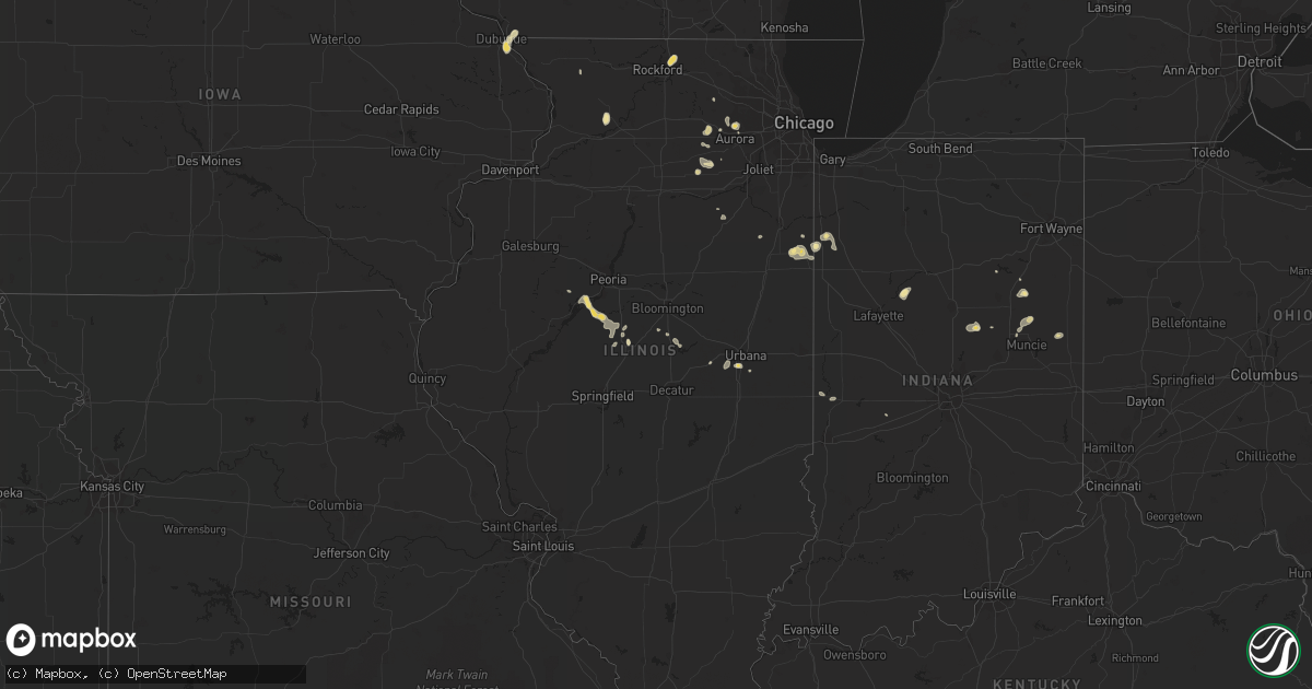
Hail Map in Illinois on July 14, 2019
Get this storm
July 14 map
$229
one time, instant access
Download today. No call, no setup
Keep the $229
Bought the map and want the full workflow? Apply the entire $229 to a subscription within 7 days. None of it is wasted.
Every map, not just this one
This buys you this map. Subscription and you get every map we run, in the markets you choose from a few cities to whole states to nationwide. Plus real-time alerts the moment a storm fires.
Contact data
Name, contact info, occupancy, even credit band for addresses in the footprint. You go from where it hit to who to call.
Become the source they trust
Unlimited branding weather history reports on demand. You already have the documented answer ready for the property owner, and you are the one who showed up with it.
Property data and RoofTrace estimates
Pull up any address you have got, its value and the exact code rules for that jurisdiction, straight from One Click Code. Then RoofTrace estimates the squares, pitch, and roof value, priced the way you price.
Storm reports in Illinois
Illinois
| Date | Description |
|---|---|
| 07/14/20195:30 PM CDT | Tree branches up to 3 inches in diameter reported down... As well as siding damage to a building. |
| 07/14/20195:28 PM CDT | A local report indicates 76 MPH wind near WILLARD AIRPORT |
| 07/14/20195:26 PM CDT | A local report indicates 60 MPH wind near WILLARD AIRPORT |
| 07/14/20192:48 AM CDT | At 748 PM CDT, a severe thunderstorm was located over Manito, or 10 miles southwest of Pekin, moving north at 5 mph. HAZARD...60 mph wind gusts and quarter size hail. SOURCE...Radar indicated. IMPACT...Hail damage to vehicles is expected. Expect wind damage to roofs, siding, and trees. This severe thunderstorm will remain over mainly rural areas of west central Tazewell County. |
| 07/14/20192:32 AM CDT | At 732 PM CDT, a severe thunderstorm was located over Green Valley, or 10 miles south of Pekin, moving northeast at 5 mph. HAZARD...60 mph wind gusts and quarter size hail. SOURCE...Radar indicated. IMPACT...Hail damage to vehicles is expected. Expect wind damage to roofs, siding, and trees. Locations impacted include... Delavan, South Pekin and Green Valley. This includes Interstate 155 near mile marker 19. |
| 07/14/20191:04 AM CDT | At 603 PM CDT, a severe thunderstorm was located near Broadlands, or 13 miles northeast of Tuscola, moving northeast at 10 mph. HAZARD...60 mph wind gusts and quarter size hail. SOURCE...Radar indicated. IMPACT...Hail damage to vehicles is expected. Expect wind damage to roofs, siding, and trees. Locations impacted include... Homer, Broadlands, Allerton and Longview. |
| 07/14/201912:36 AM CDT | At 536 PM CDT, a severe thunderstorm was located over Savoy, or near Champaign, moving northeast at 10 mph. HAZARD...60 mph wind gusts and quarter size hail. SOURCE...Radar indicated. IMPACT...Hail damage to vehicles is expected. Expect wind damage to roofs, siding, and trees. Locations impacted include... Champaign, Urbana, Savoy, Tolono, Philo, Sidney and Willard Airport.This includes the following highways... Interstate 57 between mile markers 226 and 232. Interstate 74 between mile markers 181 and 187. |
| 07/13/20197:59 PM CDT | Tree reported down on 2 cars. Time estimated by radar. |
All States Impacted by Hail Map on July 14, 2019
Cities Impacted by Hail Map on July 14, 2019
- Baldwin, ND
- Eastman, WI
- Steuben, WI
- Townsend, MT
- Little Falls, MN
- Columbus, MT
- Batavia, IL
- Isle, MN
- Ridgeville, IN
- Farmland, IN
- Winchester, IN
- New Zion, SC
- Pocatello, ID
- Mccammon, ID
- Inkom, ID
- Pine Ridge, SD
- Manderson, SD
- Alliance, NE
- Sheridan, IL
- Serena, IL
- Verona, IL
- Edinburg, ND
- Adams, ND
- Backus, MN
- Hackensack, MN
- Deadwood, SD
- Rapid City, SD
- Harrison, NE
- Crawford, NE
- Marsland, NE
- Browerville, MN
- Stockett, MT
- Elwood, IN
- Windfall, IN
- Firth, ID
- Gilman, WI
- Lublin, WI
- Thorp, WI
- Cushing, MN
- Randall, MN
- Helmville, MT
- Moore, MT
- Highwood, MT
- Dana, IN
- Whitehall, MT
- Torrington, WY
- Clear Lake, SD
- Iroquois, SD
- New Holland, IL
- Alice, TX
- Eagle Butte, SD
- Langdon, ND
- Hobson, MT
- Aitkin, MN
- Hyannis, NE
- Webster Springs, WV
- Fulton, KY
- Tucson, AZ
- Markham, TX
- Bay City, TX
- Seguin, TX
- Buffalo, MT
- Kyle, SD
- Wounded Knee, SD
- Chester, MT
- Joplin, MT
- Rudyard, MT
- Inverness, MT
- Hingham, MT
- Lake Park, MN
- Audubon, MN
- Ellsworth, NE
- Rushville, NE
- Champaign, IL
- Tolono, IL
- Savoy, IL
- Crookston, NE
- Whitman, NE
- San Jose, IL
- Delavan, IL
- Canton, IL
- Manito, IL
- Green Valley, IL
- Glasford, IL
- Emden, IL
- Mission, SD
- Cuba City, WI
- Hazel Green, WI
- Winston, MT
- Pembroke Township, IL
- White Sulphur Springs, MT
- Toston, MT
- Boulder, MT
- Hartford City, IN
- Eaton, IN
- Muncie, IN
- Cassville, WI
- Martinton, IL
- Caledonia, IL
- Loves Park, IL
- Rockford, IL
- Rockville, IN
- Montezuma, IN
- Mount Sterling, KY
- Caputa, SD
- Long Prairie, MN
- Dubuque, IA
- Otis, CO
- Akron, CO
- Big Stone City, SD
- Milbank, SD
- Bellingham, MN
- Odessa, MN
- Ramah, CO
- Sterling, IL
- Polo, IL
- Dixon, IL
- Morocco, IN
- Great Falls, MT
- Detroit Lakes, MN
- Delphi, IN
- Wood, SD
- Valentine, NE
- Box Elder, MT
- Big Sandy, MT
- Gildford, MT
- Sarles, ND
- Walker, MN
- Black Hawk, SD
- Piedmont, SD
- Swanville, MN
- Stanford, MT
- Black Canyon City, AZ
- Sheridan, WY
- Wyola, MT
- Ranchester, WY
- Parkman, WY
- Dayton, WY
- Sharpsburg, KY
- Carlisle, KY
- Hermosa, SD
- Two Dot, MT
- Nemo, SD
- Sturgis, SD
- Powell, WY
- Callaway, MN
- Cardwell, MT
- Three Forks, MT
- Luana, IA
- Monona, IA
- Richardton, ND
- Lake George, MN
- Laporte, MN
- Lavina, MT
- Roy, MT
- Estelline, SD
- Brandt, SD
- Barney, ND
- Colfax, ND
- Walcott, ND
- Joliet, MT
- Pierz, MN
- Lima, MT
- East Helena, MT
- Newark, IL
- Millington, IL
- Lindon, CO
- Cody, NE
- Brainerd, MN
- Garrison, MN
- Fergus Falls, MN
- Ponsford, MN
- Boyes, MT
- New Underwood, SD
- East Dubuque, IL
- De Smet, SD
- La Motte, IA
- Chisago City, MN
- Lindstrom, MN
- Lincoln, IL
- Bowlus, MN
- Oshkosh, NE
- Otter, MT
- Longville, MN
- Remer, MN
- Akeley, MN
- Wahpeton, ND
- Mooreton, ND
- Mcleod, ND
- Wyndmere, ND
- Avon, MT
- Munich, ND
- Rocklake, ND
- Floweree, MT
- Billings, MT
- Huntley, MT
- Hammond, MT
- Artesian, SD
- Gaston, IN
- Tipton, IN
- Camden, IN
- Marietta, OH
- Hawley, MN
- Barnesville, MN
- Sabin, MN
- Cascade, MT
- Naper, NE
- Stuart, NE
- Gardner, IL
- Dwight, IL
- Lead, SD
- Motley, MN
- Malta, ID
- Silver Star, MT
- Hilger, MT
- Absarokee, MT
- Belvidere, IL
- Forest Lake, MN
- Wyoming, MN
- Paris, KY
- Monarch, MT
- Raynesford, MT
- Belt, MT
- Geyser, MT
- Black Eagle, MT
- Milton, ND
- Livingston, MT
- Shawmut, MT
- Judith Gap, MT
- Parsons, WV
- Nisswa, MN
- Sundance, WY
- Spearfish, SD
- Beulah, WY
- Hinckley, IL
- Big Rock, IL
- Elburn, IL
- Maple Park, IL
- Beaverville, IL
- Watseka, IL
- Donovan, IL
- Fort Benton, MT
- Geraldine, MT
- Lake Preston, SD
- Lewistown, MT
- Dawson, ND
- Grass Range, MT
- Baxter, MN
- Lankin, ND
- Marion, IN
- Montpelier, IN
- Loyal, WI
- Laurel, MT
- Holy Cross, IA
- Fordville, ND
- Dalton, MN
- Wahkon, MN
- Soda Springs, ID
- Park Rapids, MN
- Pine River, MN
- Pequot Lakes, MN
- Wabash, IN
- Scandia, MN
- Sun River, MT
- Vaughn, MT
- Power, MT
- Osnabrock, ND
- Barron, WI
- Floresville, TX
- Warren, IN
- Fleming, CO
- Summitville, IN
- Clinton, IL
- Wapella, IL
- Foxhome, MN
- Pine Apple, AL
- Georgiana, AL
- Ogema, MN
- Pelican Rapids, MN
- Rothsay, MN
- Breckenridge, MN
- Fort Shaw, MT
- Peyton, CO
- Hartsburg, IL
- Princeton, MN
- Ashby, NE
- Stacy, MN
- North Branch, MN
- Greencastle, IN
- Fillmore, IN
- Mills, NE
- Staples, MN
- Emily, MN
- Stillwater, MN
- Bayport, MN
- Hudson, WI
- McLean, IL
- Decker, MT
- Yale, SD
- Cavour, SD
- Herscher, IL
- Hebron, ND
- Yorkville, IL
- Geneva, IL
- Winnett, MT
- Winner, SD
- Yuma, CO
- Ironton, MN
- Woodrow, CO
- Elkton, VA
- Ocate, NM
- Thermopolis, WY
- Sebeka, MN
- Anaconda, MT
- Sandwich, IL
- Plano, IL
- Nevis, MN
- Philo, IL
- Verndale, MN
- Osceola, WI
- Mooseheart, IL
- North Aurora, IL
- Nye, MT
- Brook, IN
- Fair Oaks, IN
- Wagon Mound, NM
- Foley, MN
- Milaca, MN
- Free Union, VA
- Rockland, ID
- Medford, WI
- Withee, WI
- Bruce, SD
- Reed Point, MT
- Pearl City, IL
- Molt, MT
- Hansboro, ND
- Sheridan, MT
- Cody, WY
- Tuttle, ND
- Menahga, MN
- Sugar Grove, IL
- Pony, MT
- Chinook, MT
- Choteau, MT
- Dutton, MT
- Bridger, MT
- Belfry, MT
- Bearcreek, MT
- Capitol, MT
- Bellevue, IA
- Wing, ND
- Deerwood, MN
- Hillman, MN
- Fort Ripley, MN
- Saint Charles, IL
- Seymour, IL
- Ivesdale, IL
- Monticello, IL
- Sherrill, IA
- Dupree, SD
- Bingham, NE
- Hemingford, NE
- Harlowton, MT
- Ledger, MT
- Conrad, MT
- Pease, MN
- Perth, ND
- McLeod, MT
- Lincoln, MT
- Heyworth, IL
- Hampshire, IL
- Van Buren, IN
- Kilgore, NE
- Aurora, IL
- Outing, MN
- Dillon, MT
- Chadron, NE
- Greenbush, ME
- Sumrall, MS
- Hattiesburg, MS
- Purvis, MS
- Lumberton, MS
- Erhard, MN
- Park City, MT
- Big Timber, MT
- Jackson, LA
- Ethel, LA
- Slaughter, LA
- Zachary, LA
- Baker, LA
- Baton Rouge, LA
- Denham Springs, LA
- Walker, LA
- Prairieville, LA
- Saint Gabriel, LA
- Greenwell Springs, LA
- Sand Springs, MT
- Forest Grove, MT
- Brusett, MT
- Mosby, MT
- Havre, MT
- Bozeman, MT
- Glasgow, MT
- Malta, MT
- Fort Peck, MT
- Nashua, MT
- Jordan, MT
- Zortman, MT
- Saint Marie, MT
- Fallon, MT
- Angela, MT
- Miles City, MT
- Rosebud, MT
- Bloomfield, MT
- Kinsey, MT
- Wibaux, MT
- Ismay, MT
- Terry, MT
- Baker, MT
- Lindsay, MT
- Willard, MT
- Cohagen, MT
- Volborg, MT
- Plevna, MT
- Glendive, MT
- Mott, ND
- Hazen, ND
- Golden Valley, ND
- New Leipzig, ND
- Lefor, ND
- Dodge, ND
- Halliday, ND
- New Salem, ND
- Medora, ND
- Glen Ullin, ND
- New England, ND
- Gladstone, ND
- Taylor, ND
- South Heart, ND
- Belfield, ND
- Dunn Center, ND
- Zap, ND
- Dickinson, ND
- Mandan, ND
- Manning, ND
- Killdeer, ND
- Amidon, ND
- Beulah, ND
- Regent, ND
- Almont, ND
- Fairfield, ND


