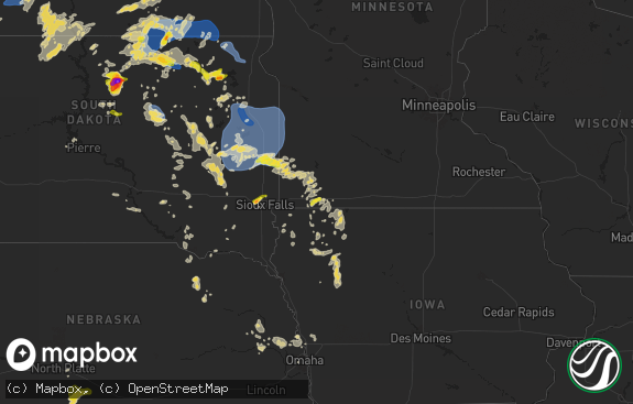
Hail Map in Indiana on July 10, 2019
The weather event in Indiana on July 10, 2019 includes Hail and Wind maps. 16 states and 560 cities were impacted and suffered possible damage. The total estimated number of properties impacted is 0.

Hail
Wind
0
Estimated number of impacted properties by a 1.00" hail or larger0
Estimated number of impacted properties by a 1.75" hail or larger0
Estimated number of impacted properties by a 2.50" hail or largerStorm reports in Indiana
Indiana
| Date | Description |
|---|---|
| 07/10/20195:38 PM CDT | Minor roof damage at the bestway inn at 4000 n broadway ave. Time is roughly estimated from radar. |
| 07/10/20195:35 PM CDT | One or more trees down and blocking a road. |
| 07/10/20195:31 PM CDT | Report received of a tree down across 6th street in lyford. |
| 07/10/20195:13 PM CDT | Multiple trees down across the selma area... With some blocking the road near 475 east and windsor road. Time roughly estimated from radar. |
| 07/10/20193:19 AM CDT | At 818 PM EDT/718 PM CDT/, a severe thunderstorm was located near Three Oaks, or 11 miles southwest of Buchanan, moving east at 25 mph. HAZARD...60 mph wind gusts and quarter size hail. SOURCE...Radar indicated. IMPACT...Hail damage to vehicles is expected. Expect wind damage to roofs, siding, and trees. Locations impacted include... Niles, Buchanan, Three Oaks, Bertrand, Dayton and Galien. This includes Interstate 80 in Indiana between mile markers 58 and69. |
| 07/10/20193:03 AM CDT | At 803 PM EDT, a severe thunderstorm was located 8 miles southeast of Frankfort, moving southeast at 15 mph. HAZARD...60 mph wind gusts and penny size hail. SOURCE...Radar indicated. IMPACT...Expect damage to roofs, siding, and trees. Locations impacted include... Sheridan and Kirklin. |
| 07/10/20191:43 AM CDT | At 642 PM EDT, severe thunderstorms were located along a line extending from 8 miles northwest of Greencastle to near Brazil to near Dennison, moving southeast at 10 mph. HAZARD...60 mph wind gusts and nickel size hail. SOURCE...Radar indicated. IMPACT...Expect damage to roofs, siding, and trees. Locations impacted include... Terre Haute, Greencastle, Brazil, West Terre Haute, Cloverdale, Seelyville, Knightsville, Harmony, Staunton, Fillmore, Carbon, Center Point, Riley, Fontanet, Bowling Green, Lena, Reelsville, Cory, Saline City and North Terre Haute.This includes Interstate 70 between mile markers 3 and 44. |
| 07/10/20191:29 AM CDT | At 629 PM EDT, a severe thunderstorm was located 11 miles southeast of Rockville, or 22 miles northeast of Terre Haute, moving east at 20 mph. HAZARD...60 mph wind gusts. SOURCE...Radar indicated. IMPACT...Expect damage to roofs, siding, and trees. Locations impacted include... Carbon and Cecil Harden Lake. |
| 07/10/20191:12 AM CDT | At 612 PM EDT, a severe thunderstorm was located over Clinton, or 11 miles north of Terre Haute, moving east at 20 mph. HAZARD...60 mph wind gusts and nickel size hail. SOURCE...Radar indicated. IMPACT...Expect damage to roofs, siding, and trees. Locations impacted include... Terre Haute, Brazil, Clinton, Fairview Park, Knightsville, Rosedale, Carbon, Universal, Mecca, Fontanet, Shepardsville, Bridgeton and North Terre Haute. |
| 07/09/201910:48 PM CDT | Large tree limbs and power lines down on goshen ave south of the intersection of goshen ave and toledo road. Power is out in the area. |
| 07/09/20198:07 PM CDT | A local report indicates 62 MPH wind near 2 NW STRAUGHN |
| 07/09/20197:15 PM CDT | Numerous trees and utility lines down across the eastern portion of the county. No specific locations were able to be provided. |
All States Impacted by Hail Map on July 10, 2019
Cities Impacted by Hail Map on July 10, 2019
- Rhome, TX
- Justin, TX
- Decatur, TX
- Haslet, TX
- Colorado City, TX
- Skellytown, TX
- Rotan, TX
- Channing, TX
- Elsmore, KS
- La Harpe, KS
- Humboldt, KS
- Kansas City, KS
- Green Ridge, MO
- Cole Camp, MO
- Ionia, MO
- Newton, KS
- Clarendon, TX
- Miami, TX
- Shallowater, TX
- Lubbock, TX
- O'Fallon, MO
- Shamrock, TX
- Circleville, KS
- Goff, KS
- Holton, KS
- Vermillion, KS
- Soldier, KS
- Centralia, KS
- Corning, KS
- Muscotah, KS
- Havensville, KS
- Onaga, KS
- Whiting, KS
- Paradise, TX
- Bridgeport, TX
- Mason, TX
- Canadian, TX
- Fayette, MS
- Hart, TX
- Butler, OK
- Hammon, OK
- Canute, OK
- Comanche, TX
- Round Mountain, TX
- Crocker, MO
- Paducah, TX
- Winnsboro, LA
- Woodlawn, IL
- Amarillo, TX
- Delphos, KS
- Elk City, OK
- Hedley, TX
- Eutaw, AL
- Chrisman, IL
- Valley Falls, KS
- Nortonville, KS
- Pampa, TX
- Elkhart, IN
- Parker City, IN
- Selma, IN
- Sandborn, IN
- Columbus Grove, OH
- Kalida, OH
- Fort Jennings, OH
- Cloverdale, OH
- Ottawa, OH
- Foss, OK
- Ponder, TX
- Krum, TX
- Millsap, TX
- Weatherford, TX
- Springville, IN
- Menard, TX
- El Dorado, KS
- Lakeview, TX
- Lelia Lake, TX
- Vega, TX
- Strang, OK
- Centerville, TX
- Steelville, MO
- Turkey, TX
- Lockney, TX
- Sunray, TX
- Rocksprings, TX
- Rockville, IN
- Carbon, IN
- Mosquero, NM
- Lewisville, TX
- Eureka, KS
- Abernathy, TX
- Russellville, MO
- Versailles, MO
- Perryton, TX
- Wildorado, TX
- Marion, LA
- Farmerville, LA
- Pilot Point, TX
- Riverside, MO
- Kansas City, MO
- Camdenton, MO
- Dimmitt, TX
- Lumberton, MS
- Easton, KS
- Winchester, KS
- Morse, TX
- Gruver, TX
- Tulia, TX
- Linn Creek, MO
- Lebanon, MO
- Mutual, OK
- Middletown, IN
- Yorktown, IN
- Muncie, IN
- Daleville, IN
- Canyon, TX
- Arnett, OK
- Dublin, TX
- Clayton, LA
- Spur, TX
- Tucumcari, NM
- Friona, TX
- Muleshoe, TX
- Stennis Space Center, MS
- Tarzan, TX
- Lenorah, TX
- Saint Peters, MO
- Girard, KS
- Sulphur, OK
- Ardmore, OK
- Kress, TX
- Llano, TX
- Nara Visa, NM
- Severy, KS
- Fall River, KS
- Littlefield, TX
- Hale Center, TX
- Springtown, TX
- Waldron, MO
- Lansing, KS
- Leavenworth, KS
- Mulberry, KS
- Dryden, TX
- Dexter, MO
- Bernie, MO
- Columbus, MS
- Macon, MS
- Burleson, TX
- Joshua, TX
- Tulsa, OK
- Bixby, OK
- Spearman, TX
- White Deer, TX
- Brady, TX
- Florence, MS
- Mclean, TX
- Bay Saint Louis, MS
- Mount Ida, AR
- Ashley, IL
- Richview, IL
- Ranger, TX
- Leeton, MO
- West Point, MS
- Aspermont, TX
- Comstock, TX
- Rudolph, OH
- Brussels, IL
- Argyle, TX
- Fort Worth, TX
- Arlington, TX
- Kennedale, TX
- Borger, TX
- Royal, AR
- San Saba, TX
- Norman, AR
- Briscoe, TX
- Marshall, TX
- Stinnett, TX
- Liberty, MO
- Windsor, MO
- Meridian, TX
- Brooksville, MS
- Granbury, TX
- Cleburne, TX
- Dumas, TX
- Alma, AR
- Santo, TX
- Eden, TX
- Bastrop, LA
- West Terre Haute, IN
- Hartford City, IN
- Dunkirk, IN
- Redkey, IN
- Chico, TX
- Mineral Wells, TX
- Lipan, TX
- La Porte, IN
- Rolling Prairie, IN
- Waltonville, IL
- Mount Vernon, IL
- Christoval, TX
- Wheeler, TX
- Russellville, AR
- Atchison, KS
- Cummings, KS
- Azle, TX
- Happy, TX
- Wayside, TX
- Ozawkie, KS
- Grapeland, TX
- Arthur City, TX
- Mayetta, KS
- Texarkana, AR
- Cygnet, OH
- Eldorado, TX
- Dana, IN
- Ridge Farm, IL
- Petersburg, TX
- Fairfield, IL
- Barnhill, IL
- Rattan, OK
- Berryville, AR
- Marlow, OK
- Aberdeen, MS
- Beckville, TX
- Aimwell, LA
- Olla, LA
- Harrisonburg, LA
- Jena, LA
- Bloomington, IN
- Franklin, TN
- Winfield, MO
- Golden Eagle, IL
- Saint Charles, MO
- Old Monroe, MO
- Mountain Grove, MO
- Gravois Mills, MO
- Fletcher, OK
- Stephenville, TX
- Amity, AR
- Glenwood, AR
- De Kalb, MS
- Meriden, KS
- Clarksville, TX
- Anson, TX
- Rosedale, IN
- Howard, KS
- Piedmont, KS
- Reydon, OK
- Panhandle, TX
- Amite, LA
- Aledo, TX
- Oskaloosa, KS
- Stover, MO
- Athens, TX
- Saint Paul, KS
- Parsons, KS
- Nazareth, TX
- Goldthwaite, TX
- Bloomingdale, IN
- Rosalia, KS
- Welch, OK
- Farwell, TX
- Sontag, MS
- Brookhaven, MS
- Tipton, IN
- Oswego, KS
- Durham, OK
- Crawford, OK
- Canton, MS
- Minneapolis, KS
- Leesburg, AL
- Cedar Bluff, AL
- Euless, TX
- Sylvester, TX
- Merkel, TX
- Caro, MI
- Vassar, MI
- Drexel, MO
- Adrian, MO
- Canton, KS
- Chester, AR
- Mountainburg, AR
- Rudy, AR
- Bridgeton, IN
- Manilla, IN
- Rushville, IN
- Okmulgee, OK
- Karnak, IL
- Greenwood Springs, MS
- Amory, MS
- Newberry, IN
- Valley View, TX
- Wesson, MS
- Hamilton, MS
- Millstadt, IL
- East Carondelet, IL
- Taylor, AR
- Clarks Hill, IN
- Linwood, KS
- Tonganoxie, KS
- Longton, KS
- Oakwood, TX
- Michigan City, IN
- Erie, KS
- Independence, KS
- Pride, LA
- Clinton, LA
- Greenwell Springs, LA
- Mcalester, OK
- Garden City, MO
- Butler, MO
- Archie, MO
- Cisco, TX
- Pearlington, MS
- Pearl River, LA
- Slidell, LA
- Idalou, TX
- Lorenzo, TX
- Mora, MO
- San Jon, NM
- Fieldon, IL
- Grafton, IL
- Montezuma, IN
- Clinton, IN
- Terre Haute, IN
- Hillsdale, IN
- Lone Wolf, OK
- Louisburg, KS
- Barnett, MO
- Walnut Grove, MS
- Deridder, LA
- Leesville, LA
- Flora, MS
- Silverton, TX
- Quitaque, TX
- Hext, TX
- Dill City, OK
- Cordell, OK
- Sentinel, OK
- Jonesville, LA
- Amistad, NM
- Iberia, MO
- North Richland Hills, TX
- Keller, TX
- Fritch, TX
- Ledbetter, KY
- Cooper, TX
- Crosbyton, TX
- Leedey, OK
- Metairie, LA
- Paris, IL
- Pemberville, OH
- Ozona, TX
- Loranger, LA
- Hammond, LA
- Independence, LA
- Tickfaw, LA
- Tolar, TX
- Dalhart, TX
- Poolville, TX
- Memphis, TX
- Effingham, KS
- Wetmore, KS
- Climax Springs, MO
- Burns, KS
- Nowata, OK
- Wiggins, MS
- Masterson, TX
- Osceola, IN
- Frankfort, IN
- Kirklin, IN
- Michigantown, IN
- Kempton, IN
- Potosi, MO
- Blue Springs, MO
- Independence, MO
- Reeds Spring, MO
- Kimberling City, MO
- Ubly, MI
- Snover, MI
- Cedar Vale, KS
- Sedan, KS
- Glenpool, OK
- Wellington, TX
- Boyd, TX
- Boyce, LA
- Deford, MI
- Brumley, MO
- Bonnerdale, AR
- Roachdale, IN
- Ladoga, IN
- Texico, NM
- Bowling Green, OH
- Weston, OH
- Frontenac, KS
- Pittsburg, KS
- Shuqualak, MS
- Walnut Springs, TX
- Boswell, OK
- Soper, OK
- Burnt Prairie, IL
- Golden Gate, IL
- East Saint Louis, IL
- Saint Louis, MO
- Pawhuska, OK
- Texline, TX
- Glen Rose, TX
- Sylvan Grove, KS
- Williamsburg, MI
- Taloga, OK
- Olean, MO
- Eldon, MO
- Richland, MS
- Pearl, MS
- Selmer, TN
- Birmingham, AL
- Mulga, AL
- Hazlehurst, MS
- Georgetown, MS
- Iola, KS
- Cheyenne, OK
- Sallis, MS
- Camden, MS
- Albany, IN
- Farmland, IN
- Oak Grove, MO
- Bates City, MO
- Tecumseh, KS
- Berryton, KS
- Springhill, LA
- Godley, TX
- Tremont, MS
- Buffalo, MO
- Grenville, NM
- Preston, MS
- Broken Bow, OK
- Grain Valley, MO
- Lees Summit, MO
- Crowley, TX
- Troup, TX
- Antlers, OK
- Spencerville, OH
- Vinita, OK
- Plainview, AR
- Beaverton, AL
- Charlottesville, IN
- Hamburg, AR
- Westbrook, TX
- De Leon, TX
- Leakesville, MS
- Mooreland, OK
- Chester, OK
- Nashville, AR
- Crockett, TX
- Rapid City, MI
- Clayton, OK
- Springer, OK
- Carthage, MO
- Jasper, MO
- Savonburg, KS
- Mountain Home, AR
- Tuscaloosa, AL
- Brookwood, AL
- Fort Stockton, TX
- Newark, TX
- Montrose, MI
- Clio, MI
- Phillipsburg, MO
- Lincoln, MO
- Mound Valley, KS
- De Soto, KS
- Franklin, NE
- Orleans, NE
- Oxford, NE
- Bartley, NE
- Bloomington, NE
- Republican City, NE
- Edison, NE
- Naponee, NE
- Arapahoe, NE
- Cambridge, NE
- Eustis, NE
- Moorefield, NE
- Holbrook, NE
- Alma, NE
- Ruskin, NE
- Nelson, NE
- Reynolds, NE
- Hubbell, NE
- Fairbury, NE
- Morrowville, KS
- Hebron, NE
- Waldron, AR
- Alden, MI
- Greenwood, MO
- Belton, MO
- Buckner, MO
- Odessa, MO
- Lone Jack, MO
- Basehor, KS
- Fort Leavenworth, KS
- Levasy, MO
- Henrietta, MO
- Concordia, MO
- Raymore, MO
- Orrick, MO
- Denison, KS
- Wellington, MO
- Napoleon, MO
- Corder, MO
- Pleasant Hill, MO
- Higginsville, MO
- Camden, MO
- Hoyt, KS
- Platte City, MO
- Shawnee, KS
- Leawood, KS
- Mayview, MO
- Stilwell, KS
- Topeka, KS
- Mission, KS
- Lenexa, KS
- Sibley, MO
- Bonner Springs, KS
- Farley, MO
- McLouth, KS
- Grandview, MO
- Prairie Village, KS
- Overland Park, KS
- Lexington, MO
- Olathe, KS
- Naval Air Station Jrb, TX
- Haltom City, TX
- Hurst, TX
- Mansfield, TX
- Irving, TX
- Roanoke, TX
- Grand Prairie, TX
- Keene, TX
- Bedford, TX
- Dallas, TX
- Grapevine, TX
- Alvarado, TX
- Lillian, TX
- Lake Dallas, TX
- Denton, TX
- Flower Mound, TX
- The Colony, TX
- Venus, TX
- Sanger, TX
- Little Elm, TX
- Coppell, TX
- Aubrey, TX
- Colleyville, TX
- Southlake, TX
- Midlothian, TX
- Claude, TX
- Gravette, AR
- Fort Smith, AR
- Van Buren, AR


