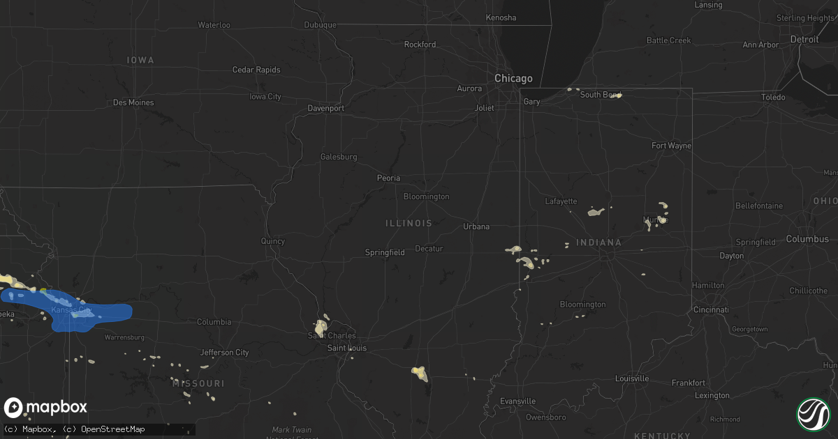
Hail Map in Illinois on July 10, 2019
Get this storm
July 10 map
$229
one time, instant access
Download today. No call, no setup
Keep the $229
Bought the map and want the full workflow? Apply the entire $229 to a subscription within 7 days. None of it is wasted.
Every map, not just this one
This buys you this map. Subscription and you get every map we run, in the markets you choose from a few cities to whole states to nationwide. Plus real-time alerts the moment a storm fires.
Contact data
Name, contact info, occupancy, even credit band for addresses in the footprint. You go from where it hit to who to call.
Become the source they trust
Unlimited branding weather history reports on demand. You already have the documented answer ready for the property owner, and you are the one who showed up with it.
Property data and RoofTrace estimates
Pull up any address you have got, its value and the exact code rules for that jurisdiction, straight from One Click Code. Then RoofTrace estimates the squares, pitch, and roof value, priced the way you price.
Storm reports in Illinois
Illinois
| Date | Description |
|---|---|
| 07/10/20194:02 PM CDT | Intense and highly localized damage reported near the intersection of imbs station road and wagner road between columbia and millstadt. Firefighter reports several powe |
| 07/10/20193:02 PM CDT | Delayed report from a trained spotter. Large trees and tree limbs down. Some trees on homes. Tree limbs on roofs. Snapped power poles. Damage was noted along imbs stati |
| 07/10/20193:02 PM CDT | Corrects previous tstm wnd dmg report from 3 e dupo. Corrects estimated time of damage. The correct damage time was 302pm cdt. Intense and highly localized damage repor |
| 07/10/20192:08 AM CDT | At 708 PM CDT, a severe thunderstorm was located near St. Paul, moving south at 10 mph. HAZARD...60 mph wind gusts and penny size hail. SOURCE...Radar indicated. IMPACT...Expect damage to roofs, siding, and trees. Locations impacted include... O'Fallon, St. Charles, St. Peters, Maryland Heights, Lake St. Louis, Dardenne Prairie, Weldon Spring, Cottleville, St. Paul, Harvester, Golden Eagle and Kampville.This includes Interstate 70 in Missouri between exits 216 and 229. |
| 07/10/20191:29 AM CDT | At 629 PM CDT, a severe thunderstorm was located 7 miles northwest of Orchard Farms, moving southeast at 10 mph. HAZARD...60 mph wind gusts and penny size hail. SOURCE...Radar indicated. IMPACT...Expect damage to roofs, siding, and trees. Locations impacted include... St. Charles, St. Peters, Florissant, Maryland Heights, Hazelwood, Overland, St. Ann, Bridgeton, Berkeley, St. John, Woodson Terrace, Kinloch, Lambert Field, Lambert-St. Louis International Airport, Breckenridge Hills, Calverton Park, Edmundson, Grafton, Elsah and West Alton.This includes Interstate 70 in Missouri near exit 231. This also includes First Missouri State Capitol Historic Site andPere Marquette State Park. |
| 07/09/20199:57 PM CDT | At 256 PM CDT, a severe thunderstorm was located over Dupo, moving east at 20 mph. HAZARD...60 mph wind gusts. SOURCE...Radar indicated. IMPACT...Expect damage to roofs, siding, and trees. Locations impacted include... Belleville, O'Fallon, East St. Louis, Fairview Heights, Cahokia, Swansea, Shiloh, Columbia, Centreville, Dupo, Millstadt, Cahokia Parks Airport, Alorton, East Carondelet, Barr, Sauget and Floraville. |
All States Impacted by Hail Map on July 10, 2019
Cities Impacted by Hail Map on July 10, 2019
- Rhome, TX
- Justin, TX
- Decatur, TX
- Haslet, TX
- Colorado City, TX
- Skellytown, TX
- Rotan, TX
- Channing, TX
- Elsmore, KS
- La Harpe, KS
- Humboldt, KS
- Kansas City, KS
- Green Ridge, MO
- Cole Camp, MO
- Ionia, MO
- Newton, KS
- Clarendon, TX
- Miami, TX
- Shallowater, TX
- Lubbock, TX
- O'Fallon, MO
- Shamrock, TX
- Circleville, KS
- Goff, KS
- Holton, KS
- Vermillion, KS
- Soldier, KS
- Centralia, KS
- Corning, KS
- Muscotah, KS
- Havensville, KS
- Onaga, KS
- Whiting, KS
- Paradise, TX
- Bridgeport, TX
- Mason, TX
- Canadian, TX
- Fayette, MS
- Hart, TX
- Butler, OK
- Hammon, OK
- Canute, OK
- Comanche, TX
- Round Mountain, TX
- Crocker, MO
- Paducah, TX
- Winnsboro, LA
- Woodlawn, IL
- Amarillo, TX
- Delphos, KS
- Elk City, OK
- Hedley, TX
- Eutaw, AL
- Chrisman, IL
- Valley Falls, KS
- Nortonville, KS
- Pampa, TX
- Elkhart, IN
- Parker City, IN
- Selma, IN
- Sandborn, IN
- Columbus Grove, OH
- Kalida, OH
- Fort Jennings, OH
- Cloverdale, OH
- Ottawa, OH
- Foss, OK
- Ponder, TX
- Krum, TX
- Millsap, TX
- Weatherford, TX
- Springville, IN
- Menard, TX
- El Dorado, KS
- Lakeview, TX
- Lelia Lake, TX
- Vega, TX
- Strang, OK
- Centerville, TX
- Steelville, MO
- Turkey, TX
- Lockney, TX
- Sunray, TX
- Rocksprings, TX
- Rockville, IN
- Carbon, IN
- Mosquero, NM
- Lewisville, TX
- Eureka, KS
- Abernathy, TX
- Russellville, MO
- Versailles, MO
- Perryton, TX
- Wildorado, TX
- Marion, LA
- Farmerville, LA
- Pilot Point, TX
- Riverside, MO
- Kansas City, MO
- Camdenton, MO
- Dimmitt, TX
- Lumberton, MS
- Easton, KS
- Winchester, KS
- Morse, TX
- Gruver, TX
- Tulia, TX
- Linn Creek, MO
- Lebanon, MO
- Mutual, OK
- Middletown, IN
- Yorktown, IN
- Muncie, IN
- Daleville, IN
- Canyon, TX
- Arnett, OK
- Dublin, TX
- Clayton, LA
- Spur, TX
- Tucumcari, NM
- Friona, TX
- Muleshoe, TX
- Stennis Space Center, MS
- Tarzan, TX
- Lenorah, TX
- Saint Peters, MO
- Girard, KS
- Sulphur, OK
- Ardmore, OK
- Kress, TX
- Llano, TX
- Nara Visa, NM
- Severy, KS
- Fall River, KS
- Littlefield, TX
- Hale Center, TX
- Springtown, TX
- Waldron, MO
- Lansing, KS
- Leavenworth, KS
- Mulberry, KS
- Dryden, TX
- Dexter, MO
- Bernie, MO
- Columbus, MS
- Macon, MS
- Burleson, TX
- Joshua, TX
- Tulsa, OK
- Bixby, OK
- Spearman, TX
- White Deer, TX
- Brady, TX
- Florence, MS
- Mclean, TX
- Bay Saint Louis, MS
- Mount Ida, AR
- Ashley, IL
- Richview, IL
- Ranger, TX
- Leeton, MO
- West Point, MS
- Aspermont, TX
- Comstock, TX
- Rudolph, OH
- Brussels, IL
- Argyle, TX
- Fort Worth, TX
- Arlington, TX
- Kennedale, TX
- Borger, TX
- Royal, AR
- San Saba, TX
- Norman, AR
- Briscoe, TX
- Marshall, TX
- Stinnett, TX
- Liberty, MO
- Windsor, MO
- Meridian, TX
- Brooksville, MS
- Granbury, TX
- Cleburne, TX
- Dumas, TX
- Alma, AR
- Santo, TX
- Eden, TX
- Bastrop, LA
- West Terre Haute, IN
- Hartford City, IN
- Dunkirk, IN
- Redkey, IN
- Chico, TX
- Mineral Wells, TX
- Lipan, TX
- La Porte, IN
- Rolling Prairie, IN
- Waltonville, IL
- Mount Vernon, IL
- Christoval, TX
- Wheeler, TX
- Russellville, AR
- Atchison, KS
- Cummings, KS
- Azle, TX
- Happy, TX
- Wayside, TX
- Ozawkie, KS
- Grapeland, TX
- Arthur City, TX
- Mayetta, KS
- Texarkana, AR
- Cygnet, OH
- Eldorado, TX
- Dana, IN
- Ridge Farm, IL
- Petersburg, TX
- Fairfield, IL
- Barnhill, IL
- Rattan, OK
- Berryville, AR
- Marlow, OK
- Aberdeen, MS
- Beckville, TX
- Aimwell, LA
- Olla, LA
- Harrisonburg, LA
- Jena, LA
- Bloomington, IN
- Franklin, TN
- Winfield, MO
- Golden Eagle, IL
- Saint Charles, MO
- Old Monroe, MO
- Mountain Grove, MO
- Gravois Mills, MO
- Fletcher, OK
- Stephenville, TX
- Amity, AR
- Glenwood, AR
- De Kalb, MS
- Meriden, KS
- Clarksville, TX
- Anson, TX
- Rosedale, IN
- Howard, KS
- Piedmont, KS
- Reydon, OK
- Panhandle, TX
- Amite, LA
- Aledo, TX
- Oskaloosa, KS
- Stover, MO
- Athens, TX
- Saint Paul, KS
- Parsons, KS
- Nazareth, TX
- Goldthwaite, TX
- Bloomingdale, IN
- Rosalia, KS
- Welch, OK
- Farwell, TX
- Sontag, MS
- Brookhaven, MS
- Tipton, IN
- Oswego, KS
- Durham, OK
- Crawford, OK
- Canton, MS
- Minneapolis, KS
- Leesburg, AL
- Cedar Bluff, AL
- Euless, TX
- Sylvester, TX
- Merkel, TX
- Caro, MI
- Vassar, MI
- Drexel, MO
- Adrian, MO
- Canton, KS
- Chester, AR
- Mountainburg, AR
- Rudy, AR
- Bridgeton, IN
- Manilla, IN
- Rushville, IN
- Okmulgee, OK
- Karnak, IL
- Greenwood Springs, MS
- Amory, MS
- Newberry, IN
- Valley View, TX
- Wesson, MS
- Hamilton, MS
- Millstadt, IL
- East Carondelet, IL
- Taylor, AR
- Clarks Hill, IN
- Linwood, KS
- Tonganoxie, KS
- Longton, KS
- Oakwood, TX
- Michigan City, IN
- Erie, KS
- Independence, KS
- Pride, LA
- Clinton, LA
- Greenwell Springs, LA
- Mcalester, OK
- Garden City, MO
- Butler, MO
- Archie, MO
- Cisco, TX
- Pearlington, MS
- Pearl River, LA
- Slidell, LA
- Idalou, TX
- Lorenzo, TX
- Mora, MO
- San Jon, NM
- Fieldon, IL
- Grafton, IL
- Montezuma, IN
- Clinton, IN
- Terre Haute, IN
- Hillsdale, IN
- Lone Wolf, OK
- Louisburg, KS
- Barnett, MO
- Walnut Grove, MS
- Deridder, LA
- Leesville, LA
- Flora, MS
- Silverton, TX
- Quitaque, TX
- Hext, TX
- Dill City, OK
- Cordell, OK
- Sentinel, OK
- Jonesville, LA
- Amistad, NM
- Iberia, MO
- North Richland Hills, TX
- Keller, TX
- Fritch, TX
- Ledbetter, KY
- Cooper, TX
- Crosbyton, TX
- Leedey, OK
- Metairie, LA
- Paris, IL
- Pemberville, OH
- Ozona, TX
- Loranger, LA
- Hammond, LA
- Independence, LA
- Tickfaw, LA
- Tolar, TX
- Dalhart, TX
- Poolville, TX
- Memphis, TX
- Effingham, KS
- Wetmore, KS
- Climax Springs, MO
- Burns, KS
- Nowata, OK
- Wiggins, MS
- Masterson, TX
- Osceola, IN
- Frankfort, IN
- Kirklin, IN
- Michigantown, IN
- Kempton, IN
- Potosi, MO
- Blue Springs, MO
- Independence, MO
- Reeds Spring, MO
- Kimberling City, MO
- Ubly, MI
- Snover, MI
- Cedar Vale, KS
- Sedan, KS
- Glenpool, OK
- Wellington, TX
- Boyd, TX
- Boyce, LA
- Deford, MI
- Brumley, MO
- Bonnerdale, AR
- Roachdale, IN
- Ladoga, IN
- Texico, NM
- Bowling Green, OH
- Weston, OH
- Frontenac, KS
- Pittsburg, KS
- Shuqualak, MS
- Walnut Springs, TX
- Boswell, OK
- Soper, OK
- Burnt Prairie, IL
- Golden Gate, IL
- East Saint Louis, IL
- Saint Louis, MO
- Pawhuska, OK
- Texline, TX
- Glen Rose, TX
- Sylvan Grove, KS
- Williamsburg, MI
- Taloga, OK
- Olean, MO
- Eldon, MO
- Richland, MS
- Pearl, MS
- Selmer, TN
- Birmingham, AL
- Mulga, AL
- Hazlehurst, MS
- Georgetown, MS
- Iola, KS
- Cheyenne, OK
- Sallis, MS
- Camden, MS
- Albany, IN
- Farmland, IN
- Oak Grove, MO
- Bates City, MO
- Tecumseh, KS
- Berryton, KS
- Springhill, LA
- Godley, TX
- Tremont, MS
- Buffalo, MO
- Grenville, NM
- Preston, MS
- Broken Bow, OK
- Grain Valley, MO
- Lees Summit, MO
- Crowley, TX
- Troup, TX
- Antlers, OK
- Spencerville, OH
- Vinita, OK
- Plainview, AR
- Beaverton, AL
- Charlottesville, IN
- Hamburg, AR
- Westbrook, TX
- De Leon, TX
- Leakesville, MS
- Mooreland, OK
- Chester, OK
- Nashville, AR
- Crockett, TX
- Rapid City, MI
- Clayton, OK
- Springer, OK
- Carthage, MO
- Jasper, MO
- Savonburg, KS
- Mountain Home, AR
- Tuscaloosa, AL
- Brookwood, AL
- Fort Stockton, TX
- Newark, TX
- Montrose, MI
- Clio, MI
- Phillipsburg, MO
- Lincoln, MO
- Mound Valley, KS
- De Soto, KS
- Franklin, NE
- Orleans, NE
- Oxford, NE
- Bartley, NE
- Bloomington, NE
- Republican City, NE
- Edison, NE
- Naponee, NE
- Arapahoe, NE
- Cambridge, NE
- Eustis, NE
- Moorefield, NE
- Holbrook, NE
- Alma, NE
- Ruskin, NE
- Nelson, NE
- Reynolds, NE
- Hubbell, NE
- Fairbury, NE
- Morrowville, KS
- Hebron, NE
- Waldron, AR
- Alden, MI
- Greenwood, MO
- Belton, MO
- Buckner, MO
- Odessa, MO
- Lone Jack, MO
- Basehor, KS
- Fort Leavenworth, KS
- Levasy, MO
- Henrietta, MO
- Concordia, MO
- Raymore, MO
- Orrick, MO
- Denison, KS
- Wellington, MO
- Napoleon, MO
- Corder, MO
- Pleasant Hill, MO
- Higginsville, MO
- Camden, MO
- Hoyt, KS
- Platte City, MO
- Shawnee, KS
- Leawood, KS
- Mayview, MO
- Stilwell, KS
- Topeka, KS
- Mission, KS
- Lenexa, KS
- Sibley, MO
- Bonner Springs, KS
- Farley, MO
- McLouth, KS
- Grandview, MO
- Prairie Village, KS
- Overland Park, KS
- Lexington, MO
- Olathe, KS
- Naval Air Station Jrb, TX
- Haltom City, TX
- Hurst, TX
- Mansfield, TX
- Irving, TX
- Roanoke, TX
- Grand Prairie, TX
- Keene, TX
- Bedford, TX
- Dallas, TX
- Grapevine, TX
- Alvarado, TX
- Lillian, TX
- Lake Dallas, TX
- Denton, TX
- Flower Mound, TX
- The Colony, TX
- Venus, TX
- Sanger, TX
- Little Elm, TX
- Coppell, TX
- Aubrey, TX
- Colleyville, TX
- Southlake, TX
- Midlothian, TX
- Claude, TX
- Gravette, AR
- Fort Smith, AR
- Van Buren, AR


