Hail Map on July 8, 2022
Get this storm
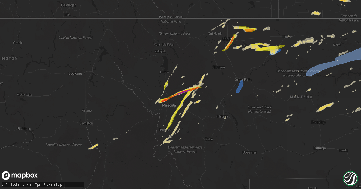
July 8 map
$229
one time, instant access
Download today. No call, no setup
Keep the $229
Bought the map and want the full workflow? Apply the entire $229 to a subscription within 7 days. None of it is wasted.
Every map, not just this one
This buys you this map. Subscription and you get every map we run, in the markets you choose from a few cities to whole states to nationwide. Plus real-time alerts the moment a storm fires.
Contact data
Name, contact info, occupancy, even credit band for addresses in the footprint. You go from where it hit to who to call.
Become the source they trust
Unlimited branding weather history reports on demand. You already have the documented answer ready for the property owner, and you are the one who showed up with it.
Property data and RoofTrace estimates
Pull up any address you have got, its value and the exact code rules for that jurisdiction, straight from One Click Code. Then RoofTrace estimates the squares, pitch, and roof value, priced the way you price.
States Impacted by Hail Map on July 8, 2022
Storm reports
Georgia
| Date | Description |
|---|---|
| 07/08/20226:45 PM CDT | Tree and powerlines reported down near the intersection of wheeler rd and gordon st. |
| 07/08/20225:05 PM CDT | Tree down on powerline along souter road. |
| 07/08/20224:05 PM CDT | Tree down on milan cemetery rd at temperance rd |
| 07/08/20223:12 PM CDT | Tree down at orianna and georgia hwy 15 |
| 07/08/20223:02 PM CDT | Tree down at norris rd and crooked run rd |
| 07/08/20222:41 PM CDT | Two reports of trees down in dublin. One tree down near intersection of telfair st and grady st. |
| 07/08/20225:04 AM CDT | At 1004 PM EDT, a severe thunderstorm was located over Doraville, or 8 miles north of Decatur, moving southeast at 20 mph. HAZARD...60 mph wind gusts and quarter size hail. SOURCE...Radar indicated. IMPACT...Hail damage to vehicles is expected. Expect wind damage to roofs, siding, and trees. Locations impacted include... Decatur, Sandy Springs, Dunwoody, Lilburn, Chamblee, Norcross, Doraville, Clarkston, Stone Mountain, Avondale Estates, Pine Lake, Tucker, Belvedere Park, North Decatur, North Atlanta, Candler-Mcafee, North Druid Hills, Druid Hills, Mountain Park and Belmont. |
| 07/08/20224:26 AM CDT | At 926 PM EDT, severe thunderstorms were located along a line extending from Ball Ground to near Buffington to Lebanon, moving southeast at 30 mph. HAZARD...60 mph wind gusts. SOURCE...Radar indicated. IMPACT...Expect damage to roofs, siding, and trees. Locations impacted include... Canton, Cumming, Sandy Springs, Roswell, Alpharetta, Milton, Woodstock, Holly Springs, Ball Ground, Free Home, Buffington, Hickory Flat, Drew, Hightower, Matt, Lathemtown, Hobgood Park, Union Hill, Sweat Mountain and Birmingham. |
| 07/08/20222:52 AM CDT | At 751 PM EDT, a severe thunderstorm was located near Hemp, or 9 miles west of Blairsville, moving southeast at 10 mph. HAZARD...60 mph wind gusts and quarter size hail. SOURCE...Radar indicated. IMPACT...Hail damage to vehicles is expected. Expect wind damage to roofs, siding, and trees. Locations impacted include... Blairsville, Hemp, Nottely Dam, Ivy Log, Loving and Jones Creek. |
| 07/08/20222:32 AM CDT | At 732 PM EDT, a severe thunderstorm was located 11 miles south of Newton, moving south at 10 mph. HAZARD...60 mph wind gusts and nickel size hail. SOURCE...Radar indicated. IMPACT...Expect damage to roofs, siding, and trees. Locations impacted include... Vada, Hoggard Mill, Branchville, Hopeful and Harrells Still. |
| 07/08/202212:43 AM CDT | At 543 PM EDT, severe thunderstorms were located along a line extending from near Arabi to 9 miles southeast of Rochelle, moving southeast at 10 mph. HAZARD...60 mph wind gusts and penny size hail. SOURCE...Radar indicated. IMPACT...Expect damage to roofs, siding, and trees. Locations impacted include... Fitzgerald, Ashburn, Worth, Terrell, Sycamore, Rebecca, Lulaville, Amboy, Sibley, Inaha, Coverdale, Irwinville, Fitzgerald Municipal A/P, Hobby, Turner Co Airport, Irwinville Airport, Bowens Mill, Dakota, Doles and Arp. |
| 07/08/202212:00 AM CDT | At 500 PM EDT, severe thunderstorms were located along a line extending from near Antioch Church to near Milan to near Little Ocmulgee State Park, moving east at 10 mph. HAZARD...60 mph wind gusts and penny size hail. SOURCE...Radar indicated. IMPACT...Expect damage to roofs, siding, and trees. Locations impacted include... McRae, Abbeville, Alamo, Helena, Rochelle, Milan, Rhine, Scotland, Antioch Church, Temperance, Browning, Little Ocmulgee State Park and Workmore. |
| 07/07/202211:01 PM CDT | At 401 PM EDT, severe thunderstorms were located along a line extending from Norristown to Covena to near Swainsboro, moving east at 5 mph. HAZARD...60 mph wind gusts and penny size hail. SOURCE...Radar indicated. IMPACT...Expect damage to roofs, siding, and trees. Locations impacted include... Swainsboro, Twin City, Stillmore, Oak Park, Nunez, Covena, Lexsy, Norristown, George L Smith State Park and Gillis Springs. |
| 07/07/202210:46 PM CDT | At 346 PM EDT, a severe thunderstorm was located over East Dublin, or over Dublin, moving east at 20 mph. HAZARD...60 mph wind gusts and penny size hail. SOURCE...Radar indicated. IMPACT...Expect damage to roofs, siding, and trees. Locations impacted include... Dublin, Soperton, East Dublin, Adrian, Lothair, Orland, Rockledge, Orianna, Barnhill, Minter, Harlow, Brewton, Blackville and Scott. |
| 07/07/202210:32 PM CDT | At 331 PM EDT, a severe thunderstorm was located over Charing, or 8 miles southwest of Butler, moving east at 5 mph. HAZARD...60 mph wind gusts and penny size hail. SOURCE...Radar indicated. IMPACT...Expect damage to roofs, siding, and trees. Locations impacted include... Butler, Ideal, Rupert, Charing and Mauk. |
| 07/07/20229:30 PM CDT | Tree reported down on prince ave between n milledge ave to n chase st. |
| 07/07/20228:39 PM CDT | Over a dozen trees down and extensive... Tree related... Structural damage in neighborhood of victoria station |
| 07/07/20228:24 PM CDT | Tree down at sequoyah circle |
| 07/07/20228:16 PM CDT | Multiple trees and powerlines down. |
| 07/07/20227:29 PM CDT | Multiple trees down around carter's dam |
| 07/07/20227:15 PM CDT | Tree down on independent street. |
Illinois
| Date | Description |
|---|---|
| 07/08/20226:50 PM CDT | Large tree came down on power line. Several limbs down throughout town. |
| 07/08/20226:45 PM CDT | 50 to 60 mph wind gusts. Multiple small branches 1 to 3 inch in diameter down. |
| 07/08/20226:25 PM CDT | Thunderstorm outflow winds snapped a tree which fell into a home in gorham causing structural damage. |
| 07/08/20225:30 PM CDT | Damage to large trees... Siding... Windows... A roof and a barn. |
| 07/08/20224:12 AM CDT | At 912 PM CDT, severe thunderstorms were located along a line extending from Farina to Omega to near Salem, moving southeast at 35 mph. HAZARD...60 mph wind gusts. SOURCE...Radar indicated. IMPACT...Expect damage to roofs, siding, and trees. Severe thunderstorms will be near... Iola around 920 PM CDT. Xenia around 930 PM CDT.Other locations in the path of these severe thunderstorms includeLouisville and Flora.This includes Interstate 57 near mile marker 142. |
| 07/08/20224:11 AM CDT | At 911 PM CDT, severe thunderstorms were located along a line extending from near Iola to near Omega to near Odin, moving southeast at 50 mph. HAZARD...60 mph wind gusts. SOURCE...Radar indicated. IMPACT...Expect damage to roofs, siding, and trees. Severe thunderstorms will be near... Helm around 925 PM CDT.This includes Interstate 57 in Illinois near exit 109. |
| 07/08/20223:40 AM CDT | At 840 PM CDT, severe thunderstorms were located along a line extending from near Brownstown to near Shobonier to near Beaver Creek, moving southeast at 45 mph. HAZARD...60 mph wind gusts. SOURCE...Radar indicated. IMPACT...Expect damage to roofs, siding, and trees. Severe thunderstorms will be near... Patoka around 850 PM CDT. Fairman and Boulder around 855 PM CDT. Sandoval, Odin, Farina and Shattuc around 900 PM CDT.Other locations in the path of these severe thunderstorms includeSalem, Kinmundy, Centralia, Wamac, Central City, Stephen ForbesStation, Centralia and Omega.This includes the following highways... Interstate 70 in Illinois between exits 41 and 45, and between exits63 and 76. Interstate 57 in Illinois between exits 116 and 135.This also includes Carlyle Lake Recreational Area. |
| 07/08/20223:05 AM CDT | At 805 PM CDT, severe thunderstorms were located along a line extending from 6 miles east of Nokomis to near Coffeen to Reno, moving southeast at 25 mph. HAZARD...60 mph wind gusts. SOURCE...Radar indicated. IMPACT...Expect damage to roofs, siding, and trees. Severe thunderstorms will be near... Van Burensburg around 815 PM CDT. Woburn around 820 PM CDT. Greenville and Ramsey around 825 PM CDT.Other locations in the path of these severe thunderstorms includeMulberry Grove, Vandalia and Beaver Creek.This includes Interstate 70 in Illinois between exits 41 and 63. This also includes Ramsey Lake State Park. |
| 07/08/20222:40 AM CDT | At 740 PM CDT, severe thunderstorms were located along a line extending from 7 miles south of Wayne City to 9 miles northeast of Thompsonville, moving east at 35 mph. HAZARD...60 mph wind gusts and penny size hail. SOURCE...Radar indicated. IMPACT...Expect damage to roofs, siding, and trees. These severe thunderstorms will remain over mainly rural areas of southwestern Wayne and Hamilton Counties, including the following locations... Broughton, Belle Prairie City and Dahlgren.This includes Interstate 64 in Illinois between Mile Markers 93 and109. |
| 07/08/20222:22 AM CDT | At 722 PM CDT, a severe thunderstorm was located near Galatia, or 10 miles east of Johnston City, moving east at 35 mph. HAZARD...60 mph wind gusts and penny size hail. SOURCE...Radar indicated. IMPACT...Expect damage to roofs, siding, and trees. This severe thunderstorm will be near... Galatia around 730 PM CDT. Harrisburg around 740 PM CDT.Other locations in the path of this severe thunderstorm includeEldorado. |
| 07/08/20222:11 AM CDT | At 710 PM CDT, a severe thunderstorm was located over Pittsburg, or near Johnston City, moving east at 35 mph. HAZARD...60 mph wind gusts and penny size hail. SOURCE...Radar indicated. IMPACT...Expect damage to roofs, siding, and trees. This severe thunderstorm will remain over mainly rural areas of northeastern Williamson and southeastern Franklin Counties, including the following locations... Spillertown. |
| 07/08/20221:52 AM CDT | At 652 PM CDT, a severe thunderstorm was located near Bogota, or 8 miles south of Newton, moving southeast at 25 mph. HAZARD...60 mph wind gusts and quarter size hail. SOURCE...Radar indicated. IMPACT...Hail damage to vehicles is expected. Expect wind damage to roofs, siding, and trees. This severe thunderstorm will be near... Dundas and West Liberty around 705 PM CDT.Other locations in the path of this severe thunderstorm include Olneyand Claremont. |
| 07/08/20221:47 AM CDT | At 646 PM CDT, severe thunderstorms were located along a line extending from near Ashley to 7 miles northeast of Tamaroa, moving east at 35 mph. HAZARD...60 mph wind gusts and penny size hail. SOURCE...Radar indicated. IMPACT...Expect damage to roofs, siding, and trees. Severe thunderstorms will be near... Woodlawn around 655 PM CDT.Other locations in the path of these severe thunderstorms includeMount Vernon and Bluford.This includes the following highways... Interstate 57 in Illinois between Mile Markers 84 and 105. Interstate 64 in Illinois between Mile Markers 63 and 90. |
| 07/08/20221:38 AM CDT | At 638 PM CDT, a severe thunderstorm was located near De Soto, or near Murphysboro, moving southeast at 35 mph. HAZARD...60 mph wind gusts and nickel size hail. SOURCE...Radar indicated. IMPACT...Expect damage to roofs, siding, and trees. This severe thunderstorm will be near... Carbondale and De Soto around 645 PM CDT. Royalton and Hurst around 650 PM CDT. Cambria around 655 PM CDT.Other locations in the path of this severe thunderstorm includeHerrin, Carterville, Crainville, Energy, Johnston City and Marion.This includes Interstate 57 in Illinois between Mile Markers 49 and66. |
| 07/07/202211:31 PM CDT | At 431 PM CDT, a severe thunderstorm was located near Bloomsdale, moving east at 20 mph. HAZARD...60 mph wind gusts and penny size hail. SOURCE...Radar indicated. IMPACT...Expect damage to roofs, siding, and trees. This severe thunderstorm will be near... Bloomsdale around 440 PM CDT.This includes Interstate 55 in Missouri between exits 154 and 162. |
| 07/07/202210:40 PM CDT | *** 1 inj *** at least one person was hurt after a tree fell onto their vehicle while driving... According to illinois state police. Isp says it happened on route 146 j |
| 07/07/202210:30 PM CDT | Rows on corn blown down. Time estimated from radar. |
| 07/07/202210:12 PM CDT | Numerous trees snapped and large limbs downed. Winds were estimated to be greater than 60 mph. Time estimated from radar. |
| 07/07/202210:06 PM CDT | At 305 AM CDT, a severe thunderstorm was located near Vermont, or 8 miles northeast of Rushville, moving east at 40 mph. HAZARD...60 mph wind gusts and quarter size hail. SOURCE...Radar indicated. IMPACT...Hail damage to vehicles is expected. Expect wind damage to roofs, siding, and trees. This severe thunderstorm will be near... Vermont around 310 AM CDT. Astoria around 315 AM CDT. Ipava around 320 AM CDT.Other locations in the path of this severe thunderstorm include Bath,Lewistown and Havana. |
| 07/07/20228:30 PM CDT | Power poles snapped on highway 185. Time estimated. |
| 07/07/20227:38 PM CDT | Delayed report via social media. Time estimated from radar. |
| 07/07/20227:30 PM CDT | Tree limbs and fences blown down. Time estimated. |
| 07/07/20227:05 PM CDT | A local report indicates 1.00 inch wind near 4 E WAKEFIELD |
| 07/07/20227:05 PM CDT | 50-60 mph winds |
Kentucky
| Date | Description |
|---|---|
| 07/08/20225:15 PM CDT | Reported a tree down on olmstead road off clarksville road. Time estimated from radar. |
| 07/08/20224:50 PM CDT | Reported a tree down on joe montgomery road off clarksville road. Time estimated from radar. |
| 07/08/20224:27 PM CDT | Call center reported one call from a driver who saw a tree fall off old glasgow road... Just off of hwy 98. It may have hit a structure there... But he was not certain. |
| 07/08/20223:42 PM CDT | Report from ky mesonet official of tree down on house on boatlanding rd. Time estimated from radar data. |
| 07/08/20223:15 PM CDT | Em reported major power outage across the county from multiple power lines and trees down. Time estimated from radar... For when the line went through morgantown. |
| 07/08/20223:10 PM CDT | Ema reports that they are closing hwy 738 in albany down due to 3 phase power lines and trees down on the roadway. Time estimated from radar. |
| 07/08/20222:49 PM CDT | Report of trees down in cumberland city... Ky. |
| 07/08/20222:44 PM CDT | Report of a tree that fell onto a powerline which fell onto a house along the 800 block of w 4th street in beaver dam... Ky. |
| 07/08/20222:35 PM CDT | Several tree tops broken off along haddox ferry road south of hwy 453. |
| 07/08/20222:30 PM CDT | Tree damage to a garage. Time estimated. |
| 07/08/20222:11 PM CDT | Reports of a couple trees down along cedar flat curtis rd and subtle rd. |
| 07/08/20225:06 AM CDT | At 1005 PM CDT, a severe thunderstorm was located near Olney, or 8 miles southwest of Providence, moving southeast at 15 mph. HAZARD...60 mph wind gusts and quarter size hail. SOURCE...Radar indicated. IMPACT...Hail damage to vehicles is expected. Expect wind damage to roofs, siding, and trees. This severe thunderstorm will be near... Olney around 1025 PM CDT.Other locations in the path of this severe thunderstorm includeDawson Springs.This includes Interstate 69 in Kentucky between Mile Markers 86 and94. |
| 07/08/20224:35 AM CDT | At 934 PM CDT, a severe thunderstorm was located near Clay, or near Providence, moving southeast at 15 mph. HAZARD...60 mph wind gusts and quarter size hail. SOURCE...Radar indicated. IMPACT...Hail damage to vehicles is expected. Expect wind damage to roofs, siding, and trees. Locations impacted include... Providence. |
| 07/08/20223:53 AM CDT | At 851 PM CDT, a severe thunderstorm was located over Chandler, moving southeast at 25 mph. HAZARD...60 mph wind gusts and quarter size hail. SOURCE...Radar indicated. IMPACT...Hail damage to vehicles is expected. Expect wind damage to roofs, siding, and trees. This severe thunderstorm will be near... Chandler around 855 PM CDT. Boonville and Newburgh around 905 PM CDT.This includes Interstate 69 in Indiana between Mile Markers 10 and11. |
| 07/08/20223:51 AM CDT | At 851 PM CDT, a severe thunderstorm was located over Chandler, moving southeast at 25 mph. HAZARD...60 mph wind gusts and quarter size hail. SOURCE...Radar indicated. IMPACT...Hail damage to vehicles is expected. Expect wind damage to roofs, siding, and trees. This severe thunderstorm will be near... Chandler around 855 PM CDT. Boonville and Newburgh around 905 PM CDT.This includes Interstate 69 in Indiana between Mile Markers 10 and11. |
| 07/08/202212:25 AM CDT | 1300 customers without power in calloway county. Also numerous trees down. |
| 07/08/202212:04 AM CDT | Tree limb down and corn flattened. Time estimated from radar. |
| 07/08/202212:01 AM CDT | Wall bowed in on a metal workshop. Time estimated from radar. |
| 07/07/202211:55 PM CDT | Trees down and corn flattened. Time estimated by radar. |
| 07/07/202211:55 PM CDT | At 455 PM CDT, a severe thunderstorm was located near Elkton, moving east at 20 mph. HAZARD...60 mph wind gusts and nickel size hail. SOURCE...Radar indicated. IMPACT...Expect damage to roofs, siding, and trees. This severe thunderstorm will remain over mainly rural areas of southeastern Todd County, including the following locations... Allensville. |
| 07/07/202211:38 PM CDT | At 438 PM CDT, a severe thunderstorm was located near Pembroke, or near Elkton, moving east at 20 mph. HAZARD...60 mph wind gusts and nickel size hail. SOURCE...Radar indicated. IMPACT...Expect damage to roofs, siding, and trees. This severe thunderstorm will be near... Elkton around 450 PM CDT. |
| 07/07/202211:08 PM CDT | At 407 PM CDT, a severe thunderstorm was located near Mount Victor, moving southeast at 25 mph. HAZARD...60 mph wind gusts and penny size hail. SOURCE...Radar indicated. IMPACT...Expect damage to roofs, siding, and trees. Locations impacted include... Scottsville. |
| 07/07/202210:39 PM CDT | At 339 PM CDT, a severe thunderstorm was located 9 miles southeast of Morgantown, moving southeast at 30 mph. HAZARD...60 mph wind gusts and penny size hail. SOURCE...Radar indicated. IMPACT...Expect damage to roofs, siding, and trees. Locations impacted include... Crestmoor, Plum Springs, Mount Victor and Bowling Green. |
| 07/07/202210:22 PM CDT | Large tree snapped. Time estimated from radar. |
| 07/07/202210:19 PM CDT | Large tree snapped by the ball fields in noble park. Time estimated from radar. |
| 07/07/202210:19 PM CDT | Large tree snapped off brookfield drive in paducah. Time estimated. |
| 07/07/202210:06 PM CDT | Tree uprooted. |
| 07/07/20229:58 PM CDT | At 258 PM CDT, a severe thunderstorm was located 10 miles west of Morgantown, moving east at 20 mph. HAZARD...60 mph wind gusts and penny size hail. SOURCE...Radar indicated. IMPACT...Expect damage to roofs, siding, and trees. Locations impacted include... Morgantown. |
| 07/07/20229:50 PM CDT | Large tree limbs down and a large tree was uprooted. Time estimated from radar. |
| 07/07/20229:34 PM CDT | At 234 PM CDT, a severe thunderstorm was located 8 miles south of Hartford, moving east at 20 mph. HAZARD...60 mph wind gusts and penny size hail. SOURCE...Radar indicated. IMPACT...Expect damage to roofs, siding, and trees. This severe thunderstorm will remain over mainly rural areas of northwestern Butler and southern Ohio Counties, including the following locations... Prentiss, Shultztown, Rochester, Centertown, Nineteen, Scottown, Cromwell, Logansport, Cool Springs and Pleasant Hill. |
| 07/07/20229:24 PM CDT | At 224 PM CDT, a severe thunderstorm was located near Graham, or 9 miles east of Madisonville, moving southeast at 25 mph. HAZARD...60 mph wind gusts and quarter size hail. SOURCE...Radar indicated. IMPACT...Hail damage to vehicles is expected. Expect wind damage to roofs, siding, and trees. This severe thunderstorm will be near... Graham around 235 PM CDT.This includes Western Kentucky Parkway between Mile Markers 43 and53. |
| 07/07/20229:11 PM CDT | At 211 PM CDT, a severe thunderstorm was located 9 miles southeast of Edmonton, moving east at 25 mph. HAZARD...60 mph wind gusts and quarter size hail. SOURCE...Radar indicated. IMPACT...Hail damage to vehicles is expected. Expect wind damage to roofs, siding, and trees. This severe thunderstorm will be near... Burkesville around 230 PM CDT. |
| 07/07/20228:19 PM CDT | At 119 PM CDT, a severe thunderstorm was located 12 miles east of Scottsville, moving east at 15 mph. HAZARD...60 mph wind gusts. SOURCE...Radar indicated. IMPACT...Expect damage to roofs, siding, and trees. This severe thunderstorm will remain over mainly rural areas of western Monroe, southern Allen and southeastern Barren Counties, including the following locations... Oak Forest, Gum Tree, Maynard, Gamaliel, Austin, Lamb, Alonzo, Flippin, Emberton and New Roe. |
Texas
| Date | Description |
|---|---|
| 07/08/20225:44 PM CDT | Measured by the ttu mesonet |
| 07/08/20223:41 PM CDT | Corrects previous hail report from 7 wsw morse. Corrected for time. Report sent with photo using quarter as reference object. Report received via social media. |
| 07/08/20223:20 PM CDT | A local report indicates 1.00 inch wind near FRITCH |
| 07/08/20223:00 PM CDT | Report sent with photo using quarter as reference object. Report received via social media. |
| 07/07/202210:27 PM CDT | At 326 PM CDT, a severe thunderstorm was located 4 miles west of Morse, or 21 miles southwest of Spearman, and is nearly stationary. HAZARD...60 mph wind gusts and quarter size hail. SOURCE...Radar indicated. IMPACT...Minor damage to roofs, siding, and trees is possible. Hail damage to vehicles is expected. Locations impacted include... Pringle and Morse. |
| 07/07/202210:02 PM CDT | At 302 PM CDT, a severe thunderstorm was located 11 miles west of Gruver, or 22 miles west of Spearman, and is nearly stationary. HAZARD...60 mph wind gusts and quarter size hail. SOURCE...Radar indicated. IMPACT...Minor damage to roofs, siding, and trees is possible. Hail damage to vehicles is expected. This severe thunderstorm will remain over mainly rural areas of southwestern Hansford and east central Sherman Counties. |
| 07/07/20227:50 PM CDT | Wet microburst resulted in minor tree damage. |
Missouri
| Date | Description |
|---|---|
| 07/08/20226:30 PM CDT | Tree fell onto police vehicle. |
| 07/08/20225:45 PM CDT | A few trees and many tree limbs down on highway d. Time estimated. |
| 07/08/20225:35 PM CDT | Multiple instances of tree damage reported in the area of bonne terre... Mo. Photos included large limbs and one small tree snapped at the trunk. |
| 07/08/20224:12 PM CDT | Large tree limb blown down... Damage to roof shingles. Photo included. Time estimated using radar. |
| 07/08/20227:49 AM CDT | At 1248 AM CDT, a severe thunderstorm was located near Maud, moving east at 25 mph. HAZARD...60 mph wind gusts and quarter size hail. SOURCE...Radar indicated. IMPACT...Hail damage to vehicles is expected. Expect wind damage to roofs, siding, and trees. This severe thunderstorm will be near... Shelbina around 105 AM CDT.Other locations in the path of this severe thunderstorm includeShelbyville and Emden. |
| 07/08/20227:38 AM CDT | At 1238 AM CDT, severe thunderstorms were located along a line extending from 6 miles south of Pattonsburg to 7 miles southwest of Gallatin to near Cameron, moving east at 45 mph. HAZARD...60 mph wind gusts and nickel size hail. SOURCE...Law enforcement. IMPACT...Expect damage to roofs, siding, and trees. Locations impacted include... Cameron, Chillicothe, Trenton, Hamilton, Gallatin, Jamesport, Breckenridge, Kingston, Pattonsburg, Wheeling, Utica, Kidder, Winston, Chula, Altamont, Laredo, Turney, Ludlow, Jameson and Weatherby.This includes Interstate 35 in Missouri between mile markers 45 and75. |
| 07/08/20227:25 AM CDT | Four to six inch tree limbs blown down. |
| 07/08/20227:05 AM CDT | At 1205 AM CDT, severe thunderstorms were located along a line extending from near Union Star to near Clarksdale to near Stewartsville to near Gower to near Dearborn, moving east at 35 mph. HAZARD...60 mph wind gusts and penny size hail. SOURCE...Automated Surface Observing System. IMPACT...Expect damage to roofs, siding, and trees. Locations impacted include... Cameron, Plattsburg, Lathrop, Gower, Maysville, Stewartsville, Agency, Trimble, Edgerton, Dearborn, Union Star, Osborn, Clarksdale, Kidder, Winston, Easton, Altamont, Turney, Cosby and Weatherby.This includes the following highways... Interstate 35 in Missouri between mile markers 36 and 71. Interstate 29 between mile markers 29 and 42. |
| 07/08/20221:29 AM CDT | At 629 PM CDT, a severe thunderstorm was located near Iron Mountain Lake, moving east at 30 mph. HAZARD...60 mph wind gusts and penny size hail. SOURCE...Radar indicated. IMPACT...Expect damage to roofs, siding, and trees. This severe thunderstorm will be near... Knob Lick around 645 PM CDT.Other locations in the path of this severe thunderstorm includeFredericktown, Junction City and Cobalt. |
| 07/08/20221:08 AM CDT | At 608 PM CDT, a severe thunderstorm was located near Bismarck, moving east at 25 mph. HAZARD...60 mph wind gusts and penny size hail. SOURCE...Radar indicated. IMPACT...Expect damage to roofs, siding, and trees. This severe thunderstorm will be near... Bismarck, Pilot Knob and Iron Mountain around 620 PM CDT. Iron Mountain Lake around 625 PM CDT.Other locations in the path of this severe thunderstorm include ParkHills.This also includes St. Joe State Park, Fort Davidson Historic Site,and Elephant Rocks State Park. |
| 07/07/202211:49 PM CDT | At 448 PM CDT, a severe thunderstorm was located 7 miles south of Olympian Village, moving east at 20 mph. HAZARD...60 mph wind gusts and penny size hail. SOURCE...Radar indicated. IMPACT...Expect damage to roofs, siding, and trees. This severe thunderstorm will remain over mainly rural areas of south central Jefferson, northwestern Ste. Genevieve and northwestern St. Francois Counties, including the following locations... Valles Mill and French Village. |
| 07/07/20229:57 PM CDT | Scattered 4 inch limb downed around town along with some power outages. Time estimated from radar. |
Oklahoma
| Date | Description |
|---|---|
| 07/08/20226:20 PM CDT | A local report indicates 65 MPH wind near 6 WSW FITTSTOWN |
| 07/08/20226:00 PM CDT | Broken tree limbs |
| 07/08/20226:00 PM CDT | Power poles damaged on southern part of town. Time estimated by radar. |
| 07/08/20225:55 PM CDT | A local report indicates 70 MPH wind near OKLAHOMA CITY |
| 07/08/20225:55 PM CDT | Mesonet station bess bessie. |
| 07/08/20225:45 PM CDT | Measured at 100 feet. Surface winds likely less. |
| 07/08/20225:45 PM CDT | Along grand blvd. East of western...damage to power pole and tree limb damage. |
| 07/08/20225:45 PM CDT | Wind damage to construction materials/framing at new senior wellness campus @ ne 36/lincoln in okc. Signage blown out at wendy’s. |
| 07/08/20225:40 PM CDT | Tree damage around se 34th and santa fe. |
| 07/08/20225:40 PM CDT | Building damage around se 30th and durland ave. |
| 07/08/20225:40 PM CDT | Mesonet station bess bessie. |
| 07/08/20225:38 PM CDT | Blown down metal fence. |
| 07/08/20225:04 PM CDT | Also nickel size hail. |
| 07/08/20224:55 PM CDT | A local report indicates 1.25 inch wind near 4 W YUKON |
| 07/08/20224:53 PM CDT | Power pole down. |
| 07/08/20224:50 PM CDT | Building damaged near evans rd east of el reno. |
| 07/08/20222:42 AM CDT | At 742 PM CDT, a severe thunderstorm was located 6 miles north of Roll, moving south at 5 mph. HAZARD...70 mph wind gusts and half dollar size hail. SOURCE...Radar indicated. IMPACT...Hail damage to vehicles is expected. Expect considerable tree damage. Wind damage is also likely to mobile homes, roofs, and outbuildings. Locations impacted include... Cheyenne, Arnett, Hammon, Reydon, Strong City, Crawford, Roll, Durham and Angora. |
| 07/08/20222:02 AM CDT | At 702 PM CDT, a severe thunderstorm was located near Corum, moving west at 5 mph. HAZARD...60 mph wind gusts and quarter size hail. SOURCE...Radar indicated. IMPACT...Hail damage to vehicles is expected. Expect wind damage to roofs, siding, and trees. Locations impacted include... Duncan, Comanche, Temple, Corum, Waurika Lake, Empire City and Hulen. |
| 07/08/20221:57 AM CDT | At 657 PM CDT, a severe thunderstorm was located 6 miles north of Angora, moving west at 10 mph. HAZARD...60 mph wind gusts and quarter size hail. SOURCE...Radar indicated. IMPACT...Hail damage to vehicles is expected. Expect wind damage to roofs, siding, and trees. Locations impacted include... Arnett, Leedey, Crawford, Durham and Angora. |
| 07/08/20221:17 AM CDT | At 616 PM CDT, a severe thunderstorm was located 6 miles north of Durham, and is nearly stationary. HAZARD...60 mph wind gusts and half dollar size hail. SOURCE...Radar indicated. IMPACT...Hail damage to vehicles is expected. Expect wind damage to roofs, siding, and trees. Locations impacted include... Crawford and Durham. |
| 07/08/20221:07 AM CDT | At 607 PM CDT, a severe thunderstorm was located 9 miles east of Camargo, moving southeast at 5 mph. HAZARD...70 mph wind gusts and quarter size hail. SOURCE...Radar indicated. IMPACT...Hail damage to vehicles is expected. Expect considerable tree damage. Wind damage is also likely to mobile homes, roofs, and outbuildings. Locations impacted include... Taloga, Leedey, Camargo and Putnam. |
| 07/08/202212:50 AM CDT | At 550 PM CDT, a severe thunderstorm was located over northern Oklahoma City, or near Nichols Hills, and is nearly stationary. HAZARD...60 mph wind gusts and nickel size hail. SOURCE...Radar indicated. IMPACT...Expect damage to roofs, siding, and trees. Locations impacted include... Oklahoma City, Edmond, Midwest City, Warr Acres, The Village, Spencer, Nichols Hills, Forest Park and Lake Aluma. |
| 07/08/202212:49 AM CDT | At 549 PM CDT, a severe thunderstorm was located 4 miles west of Bessie, and is moving very slowly north. HAZARD...60 mph wind gusts. SOURCE...Radar indicated. IMPACT...Expect damage to roofs, siding, and trees. Locations impacted include... Clinton, Burns Flat, Bessie, Foss, Foss Reservoir and Stafford. |
| 07/08/202212:28 AM CDT | At 528 PM CDT, a severe thunderstorm was located over southwestern Oklahoma City, or near The Fairgrounds, and is nearly stationary. HAZARD...70 mph wind gusts and quarter size hail. SOURCE...Radar indicated. IMPACT...Hail damage to vehicles is expected. Expect considerable tree damage. Wind damage is also likely to mobile homes, roofs, and outbuildings. Locations impacted include... Oklahoma City, Moore, Midwest City, Del City, Bethany, Spencer, Valley Brook, Tinker Air Force Base, Forest Park, Lake Aluma and Smith Village. |
| 07/08/202212:25 AM CDT | At 525 PM CDT, severe thunderstorms were located along a line extending from 4 miles east of Cordell to 6 miles northwest of Sentinel, and are nearly stationary. HAZARD...60 mph wind gusts and quarter size hail. SOURCE...Radar indicated. IMPACT...Hail damage to vehicles is expected. Expect wind damage to roofs, siding, and trees. Locations impacted include... Cordell, Burns Flat, Sentinel, Dill City, Corn, Bessie, Rocky, Cloud Chief, Retrop and Cowden. |
| 07/07/202211:51 PM CDT | At 450 PM CDT, a severe thunderstorm was located over western Oklahoma City, or 4 miles southwest of Yukon, and is nearly stationary. Another storm was rapidly developing over central Oklahoma City. HAZARD...70 mph wind gusts and half dollar size hail. SOURCE...Radar indicated. IMPACT...Hail damage to vehicles is expected. Expect considerable tree damage. Wind damage is also likely to mobile homes, roofs, and outbuildings. Locations impacted include... Oklahoma City, southern Edmond, Moore, Midwest City, Del City, El Reno, Yukon, Bethany, Mustang, Warr Acres, The Village, Tuttle, Spencer, Nichols Hills, Nicoma Park, Valley Brook, Tinker Air Force Base, Forest Park, Woodlawn Park and Lake Aluma. |
| 07/07/202211:45 PM CDT | At 445 PM CDT, a severe thunderstorm was located 4 miles southwest of Retrop, and is nearly stationary. HAZARD...60 mph wind gusts and quarter size hail. SOURCE...Radar indicated. IMPACT...Hail damage to vehicles is expected. Expect wind damage to roofs, siding, and trees. Locations impacted include... Granite, Lone Wolf, Carter, Willow, Retrop, Brinkman and northwestern Altus-Lugert Lake. |
| 07/07/202211:44 PM CDT | At 444 PM CDT, a severe thunderstorm was located 7 miles northwest of Perryton, and is nearly stationary. HAZARD...Ping pong ball size hail and 60 mph wind gusts. SOURCE...Radar indicated. IMPACT...Minor damage to roofs, siding, and trees is possible. People and animals outdoors will be injured. Expect hail damage to roofs, siding, windows, and vehicles. Locations impacted include... Perryton, Spearman, Waka, Bryans Corner and Farnsworth. |
| 07/07/202211:29 PM CDT | At 429 PM CDT, severe thunderstorms were located along a line extending from near Hinton to near Colony, moving southeast at 5 mph. HAZARD...60 mph wind gusts and quarter size hail. SOURCE...Radar indicated. IMPACT...Hail damage to vehicles is expected. Expect wind damage to roofs, siding, and trees. Locations impacted include... Hinton, Binger, Corn, Eakly, Lookeba, Colony, Fort Cobb Reservoir, Alfalfa, Albert and Cowden. |
| 07/07/202211:25 PM CDT | At 425 PM CDT, a severe thunderstorm was located 5 miles south of Calumet, moving south at 15 mph. HAZARD...70 mph wind gusts and ping pong ball size hail. SOURCE...Radar indicated. IMPACT...People and animals outdoors will be injured. Expect hail damage to roofs, siding, windows, and vehicles. Expect considerable tree damage. Wind damage is also likely to mobile homes, roofs, and outbuildings. Locations impacted include... El Reno, Union City, Minco, Cogar and Cedar Lake. |
| 07/07/202210:48 PM CDT | At 348 PM CDT, severe thunderstorms were located along a line extending from 3 miles southwest of Okarche to 4 miles south of Geary to 4 miles southeast of Hydro, and are nearly stationary. HAZARD...60 mph wind gusts and quarter size hail. SOURCE...Radar indicated. IMPACT...Hail damage to vehicles is expected. Expect wind damage to roofs, siding, and trees. Locations impacted include... El Reno, Hinton, Geary, Okarche, Hydro, Calumet, Bridgeport and Concho. |
| 07/07/202210:46 PM CDT | At 345 PM CDT, a severe thunderstorm was located near Willow, and is nearly stationary. HAZARD...70 mph wind gusts and quarter size hail. SOURCE...Radar indicated. IMPACT...Hail damage to vehicles is expected. Expect considerable tree damage. Wind damage is also likely to mobile homes, roofs, and outbuildings. Locations impacted include... Mangum, Willow and Brinkman. |
Montana
| Date | Description |
|---|---|
| 07/08/20226:42 PM CDT | Photo on social media shows ground covering hail with up to quarter sized stones. Time estimated from radar. |
| 07/08/20226:25 PM CDT | Hail up to quarter size. |
| 07/08/20226:10 PM CDT | Near lake helena... Via ambient weather. |
| 07/08/20225:45 PM CDT | A local report indicates 2.00 inch wind near SEELEY LAKE |
| 07/08/20225:36 PM CDT | A local report indicates 1.75 inch wind near SEELEY LAKE |
| 07/08/20225:21 PM CDT | A local report indicates 1.00 inch wind near 1 WSW FORT CONNAH |
| 07/08/20224:55 PM CDT | A local report indicates 2.00 inch wind near 6 SSW EVARO |
| 07/08/20224:50 PM CDT | A local report indicates 1.75 inch wind near 1 SW EVARO |
| 07/08/20224:48 PM CDT | A local report indicates 1.75 inch wind near 3 SSW EVARO |
| 07/08/20224:45 PM CDT | A local report indicates 2.50 inch wind near 5 SSW EVARO |
| 07/08/20224:45 PM CDT | A local report indicates 1.25 inch wind near 2 W FRENCHTOWN |
| 07/08/20227:49 AM CDT | At 1249 AM MDT, a severe thunderstorm was located 7 miles southwest of Hell Creek Rec Area, or 16 miles north of Jordan, moving east at 25 mph. HAZARD...60 mph wind gusts and quarter size hail. SOURCE...Radar indicated. IMPACT...Hail damage to vehicles is expected. Expect wind damage to roofs, siding, and trees. Locations impacted include... Hell Creek Rec Area. |
| 07/08/20226:30 AM CDT | At 1130 PM MDT, a severe thunderstorm was located 7 miles southeast of Roy, or 29 miles northwest of Winnett, moving northeast at 45 mph. HAZARD...Half dollar size hail. SOURCE...Radar indicated. IMPACT...Damage to vehicles is expected. Locations impacted include... Valentine. |
| 07/08/20225:48 AM CDT | At 1047 PM MDT, severe thunderstorms were located along a line extending from near Opheim to 10 miles northwest of Rock Creek Rec Area, moving east at 40 mph. HAZARD...70 mph wind gusts and penny size hail. SOURCE...Radar indicated. IMPACT...Expect damage to roofs, siding, and trees. Locations impacted include... Glasgow, Wolf Point, Scobey, Poplar, Opheim, Richland, Nashua, Fort Peck, Flaxville, Duck Creek Rec Area, St. Marie, Peerless, The Pines Rec Area, Tampico, Port Of Whitetail, Lustre, Madoc, Fort Peck Marina, Bredette and Port Of Scobey. |
| 07/08/20225:41 AM CDT | At 1040 PM MDT, severe thunderstorms were located along a line extending from 12 miles east of Hell Creek Rec Area to 6 miles southeast of Cohagen, moving east at 55 mph. HAZARD...70 mph wind gusts and penny size hail. SOURCE...Radar indicated. IMPACT...Expect considerable tree damage. Damage is likely to mobile homes, roofs, and outbuildings. Locations impacted include... Circle, Jordan, Brockway, Hillside, Hell Creek Rec Area, Flowing Wells Rest Area, Vida, Cohagen, Nelson Creek Rec Area, Rock Creek Rec Area, Van Norman, Mccloud, Haxby, Weldon, Crow Rock and Watkins. |
| 07/08/20225:07 AM CDT | At 1004 PM MDT, severe thunderstorms were located along a line extending from near Hinsdale to 12 miles west of The Pines Rec Area, moving east at 65 mph. THESE ARE DESTRUCTIVE STORMS FOR CENTRAL VALLEY COUNTY INCLUDING THE CITY OF GLASGOW AND HINSDALE . HAZARD...80 mph wind gusts and penny size hail. SOURCE...Radar indicated. IMPACT...Flying debris will be dangerous to those caught without shelter. Mobile homes will be heavily damaged. Expect considerable damage to roofs, windows, and vehicles. Extensive tree damage and power outages are likely. Locations impacted include... Glasgow, Wolf Point, Richland, Nashua, Fort Peck, Saco, Duck Creek Rec Area, St. Marie, Peerless, The Pines Rec Area, Tampico, Hinsdale, Lustre, Fort Peck Marina, Frazer, Vida, Rock Creek Rec Area, Vandalia, Park Grove and West Fork. |
| 07/08/20224:52 AM CDT | At 951 PM MDT, severe thunderstorms were located along a line extending from near Brusett to 12 miles southwest of Sand Springs, moving east at 25 mph. HAZARD...60 mph wind gusts and penny size hail. SOURCE...Trained weather spotters. IMPACT...Expect damage to roofs, siding, and trees. Locations impacted include... Jordan, Sand Springs, Hell Creek Rec Area, Edwards, Brusett and Steve Fork. |
| 07/08/20224:17 AM CDT | At 917 PM MDT, a severe thunderstorm was located 17 miles northwest of Augusta, or 25 miles southwest of Choteau, moving northeast at 30 mph. HAZARD...Ping pong ball size hail. SOURCE...Radar indicated. IMPACT...People and animals outdoors will be injured. Expect damage to roofs, siding, windows, and vehicles. Locations impacted include... Pishkun Reservoir. |
| 07/08/20224:15 AM CDT | At 914 PM MDT, a severe thunderstorm was located 8 miles northwest of Dodson, or 24 miles northwest of Malta, moving east at 50 mph. THIS IS A DESTRUCTIVE STORM FOR DODSON AND SURROUNDING AREAS. HAZARD...80 mph wind gusts and nickel size hail. SOURCE...Radar indicated. IMPACT...Flying debris will be dangerous to those caught without shelter. Mobile homes will be heavily damaged. Expect considerable damage to roofs, windows, and vehicles. Extensive tree damage and power outages are likely. Locations impacted include... Whitewater, Saco, Dodson, Loring, Sleeping Buffalo and Wagner. |
| 07/08/20224:11 AM CDT | At 910 PM MDT, a severe thunderstorm was located near Fourchette, or 28 miles east of Zortman, moving east at 50 mph. HAZARD...60 mph wind gusts and quarter size hail. SOURCE...Radar indicated. IMPACT...Hail damage to vehicles is expected. Expect wind damage to roofs, siding, and trees. Locations impacted include... Saco, Fourchette, Devils Creek Rec Area, U L Bend Rec Area, Hell Creek Rec Area, Hinsdale, Crooked Creek Rec Area, Phillips, Content, Sun Prairie and The Bentonite Plant. |
| 07/08/20224:09 AM CDT | At 908 PM MDT, a severe thunderstorm was located 13 miles south of Seeley Lake, or 26 miles northwest of Drummond, moving northeast at 35 mph. HAZARD...Tennis ball size hail and 60 mph wind gusts. SOURCE...Radar indicated. IMPACT...People and animals outdoors will be injured. Expect hail damage to roofs, siding, windows, and vehicles. Expect wind damage to roofs, siding, and trees. Locations impacted include... Seeley Lake, Greenough, Woodworth and Clearwater. |
| 07/08/20224:08 AM CDT | At 908 PM MDT, a severe thunderstorm was located near Fort Belknap, or 29 miles east of Chinook, moving east at 65 mph. THIS IS A DESTRUCTIVE STORM FOR Fort Belknap and Harlem. HAZARD...80 mph wind gusts and quarter size hail. SOURCE...Radar indicated. IMPACT...Flying debris will be dangerous to those caught without shelter. Mobile homes will be heavily damaged. Expect considerable damage to roofs, windows, and vehicles. Extensive tree damage and power outages are likely. Locations impacted include... Harlem and Fort Belknap. |
| 07/08/20223:58 AM CDT | At 857 PM MDT, severe thunderstorms were located along a line extending from 8 miles south of Fort Belknap to 6 miles northeast of Zortman to 18 miles west of Fourchette, moving northeast at 45 mph. HAZARD...70 mph wind gusts. SOURCE...Radar indicated. IMPACT...Expect considerable tree damage. Damage is likely to mobile homes, roofs, and outbuildings. Locations impacted include... Hays and Lodge Pole. |
| 07/08/20223:55 AM CDT | At 854 PM MDT, a severe thunderstorm was located near Flatwillow, or 13 miles south of Winnett, moving east at 30 mph. HAZARD...60 mph wind gusts and quarter size hail. SOURCE...Radar indicated. IMPACT...Hail damage to vehicles is expected. Expect wind damage to roofs, siding, and trees. Locations impacted include... Winnett, Flatwillow, Mosby, Petrolia Lake and Cat Creek. |
| 07/08/20223:50 AM CDT | At 850 PM MDT, a severe thunderstorm was located 12 miles east of Bonner-West Riverside, or 19 miles east of Missoula, moving northeast at 30 mph. HAZARD...Two inch hail and 60 mph wind gusts. SOURCE...Radar indicated. IMPACT...People and animals outdoors will be injured. Expect hail damage to roofs, siding, windows, and vehicles. Expect wind damage to roofs, siding, and trees. Locations impacted include... Potomac, Greenough and Clearwater. |
| 07/08/20223:41 AM CDT | At 840 PM MDT, severe thunderstorms were located along a line extending from 7 miles northwest of Beaver Creek to 13 miles south of Chinook to 23 miles southwest of Fort Belknap, moving northeast at 40 mph. HAZARD...70 mph wind gusts and ping pong ball size hail. SOURCE...Radar indicated. IMPACT...People and animals outdoors will be injured. Expect hail damage to roofs, siding, windows, and vehicles. Expect considerable tree damage. Wind damage is also likely to mobile homes, roofs, and outbuildings. Locations impacted include... Havre, Chinook, Harlem, Beaver Creek, Fort Belknap, Turner, Lohman, Lloyd, Kremlin, Hogeland, Cleveland and Zurich. |
| 07/08/20223:26 AM CDT | At 826 PM MDT, severe thunderstorms were located along a line extending from 19 miles east of Parker School to 16 miles southwest of Hays to 22 miles southwest of Zortman to 11 miles southeast of Grass Range, moving east at 40 mph. HAZARD...70 mph wind gusts and nickel size hail. SOURCE...Radar indicated. IMPACT...Expect considerable tree damage. Damage is likely to mobile homes, roofs, and outbuildings. Locations impacted include... Grass Range, Hays, Roy, Valentine, Lodge Pole and Fred Robinson Bridge. |
| 07/08/20223:23 AM CDT | At 823 PM MDT, a severe thunderstorm was located 14 miles south of Bonner-West Riverside, or 18 miles southeast of Missoula, moving northeast at 35 mph. HAZARD...Golf ball size hail and 60 mph wind gusts. SOURCE...Radar indicated. IMPACT...People and animals outdoors will be injured. Expect hail damage to roofs, siding, windows, and vehicles. Expect wind damage to roofs, siding, and trees. Locations impacted include... Clinton, Potomac and Twin Creeks. |
| 07/08/20223:22 AM CDT | At 821 PM MDT, severe thunderstorms were located along a line extending from 26 miles southeast of Parker School to 13 miles east of Roy, moving northeast at 30 mph. HAZARD...70 mph wind gusts and nickel size hail. SOURCE...Radar indicated. IMPACT...Expect considerable tree damage. Damage is likely to mobile homes, roofs, and outbuildings. Locations impacted include... Malta, Winnett, Zortman, Dodson, Sand Springs, Fourchette, U L Bend Rec Area, Crooked Creek Rec Area, Devils Creek Rec Area, Edwards, Brusett, Mosby, Phillips, Wagner, Fred Robinson Bridge, Steve Fork, Tiegen, Landusky, Sun Prairie and Cat Creek. |
| 07/08/20223:22 AM CDT | At 821 PM MDT, a severe thunderstorm was located near Havre, moving northeast at 25 mph. HAZARD...70 mph wind gusts and quarter size hail. SOURCE...Radar indicated. In addition, the Havre Airport recorded a 77 mph wind gust with this storm. IMPACT...Hail damage to vehicles is expected. Expect considerable tree damage. Wind damage is also likely to mobile homes, roofs, and outbuildings. Locations impacted include... Havre, Chinook and Lohman. |
| 07/08/20222:56 AM CDT | At 756 PM MDT, a severe thunderstorm was located 7 miles northeast of Ovando, or 29 miles north of Drummond, moving north at 25 mph. HAZARD...Half dollar size hail. SOURCE...Radar indicated. IMPACT...Damage to vehicles is expected. Locations impacted include... Ovando. |
| 07/08/20222:54 AM CDT | At 753 PM MDT, severe thunderstorms were located along a line extending from 10 miles southwest of Gildford to 6 miles southwest of Big Sandy, moving northeast at 45 mph. HAZARD...Two inch hail and 70 mph wind gusts. SOURCE...Radar indicated. IMPACT...People and animals outdoors will be injured. Expect hail damage to roofs, siding, windows, and vehicles. Expect considerable tree damage. Wind damage is also likely to mobile homes, roofs, and outbuildings. Locations impacted include... Havre, Big Sandy, Azure, Parker School, Beaver Creek, Agency, St. Pierre, Gildford, Sangrey, Boneau, Box Elder, Hingham, Rocky Boy, Laredo, Lloyd, Kremlin and Virgelle. |
| 07/08/20222:28 AM CDT | At 728 PM MDT, a severe thunderstorm was located 7 miles southwest of Ovando, or 18 miles north of Drummond, moving north at 25 mph. HAZARD...Golf ball size hail and 60 mph wind gusts. SOURCE...Radar indicated. IMPACT...People and animals outdoors will be injured. Expect hail damage to roofs, siding, windows, and vehicles. Expect wind damage to roofs, siding, and trees. Locations impacted include... Ovando, Greenough, Helmville, Woodworth and Clearwater. |
| 07/08/20222:23 AM CDT | At 723 PM MDT, severe thunderstorms were located along a line extending from near Joplin to 21 miles northeast of The Knees, moving east at 35 mph. HAZARD...Golf ball size hail and 60 mph wind gusts. SOURCE...Radar indicated. IMPACT...People and animals outdoors will be injured. Expect hail damage to roofs, siding, windows, and vehicles. Expect wind damage to roofs, siding, and trees. Locations impacted include... Inverness, Gildford, Hingham, Rudyard and Kenilworth. |
| 07/08/20222:21 AM CDT | At 721 PM MDT, a severe thunderstorm was located over Hamilton, moving north at 25 mph. HAZARD...60 mph wind gusts and quarter size hail. SOURCE...Radar indicated. IMPACT...Hail damage to vehicles is expected. Expect wind damage to roofs, siding, and trees. Locations impacted include... Hamilton, Victor, Woodside, Pinesdale, Grantsdale, Bell Crossing and Corvallis. |
| 07/08/20222:13 AM CDT | At 713 PM MDT, a severe thunderstorm was located 13 miles north of Gildford, or 31 miles northwest of Havre, moving east at 35 mph. HAZARD...60 mph wind gusts and half dollar size hail. SOURCE...Radar indicated. IMPACT...Hail damage to vehicles is expected. Expect wind damage to roofs, siding, and trees. This severe thunderstorm will remain over mainly rural areas of northeastern Hill County. |
| 07/08/20222:08 AM CDT | At 707 PM MDT, a severe thunderstorm was located over Geraldine, or 26 miles southeast of Fort Benton, moving northeast at 30 mph. HAZARD...60 mph wind gusts. SOURCE...Radar indicated. IMPACT...Expect damage to roofs, siding, and trees. Locations impacted include... Geraldine and Square Butte. |
| 07/08/20222:07 AM CDT | At 707 PM MDT, a severe thunderstorm was located near Darby, or 17 miles south of Hamilton, moving north at 25 mph. HAZARD...60 mph wind gusts and quarter size hail. SOURCE...Radar indicated. IMPACT...Hail damage to vehicles is expected. Expect wind damage to roofs, siding, and trees. Locations impacted include... Darby, Conner, Charlos Heights and Como. |
| 07/08/20222:05 AM CDT | At 705 PM MDT, a severe thunderstorm was located near Denton, or 16 miles northeast of Stanford, moving east at 30 mph. HAZARD...60 mph wind gusts and quarter size hail. SOURCE...Radar indicated. IMPACT...Hail damage to vehicles is expected. Expect wind damage to roofs, siding, and trees. Locations impacted include... Danvers, Suffolk, Hilger and Christina. |
| 07/08/20222:03 AM CDT | At 702 PM MDT, a severe thunderstorm was located 12 miles south of Chester, moving northeast at 45 mph. HAZARD...60 mph wind gusts and half dollar size hail. SOURCE...Radar indicated. IMPACT...Hail damage to vehicles is expected. Expect wind damage to roofs, siding, and trees. Locations impacted include... Chester, Joplin, Inverness, Tiber Dam and Rudyard. |
| 07/08/20222:00 AM CDT | At 700 PM MDT, a severe thunderstorm was located 15 miles west of Drummond, moving north at 25 mph. HAZARD...60 mph wind gusts and quarter size hail. SOURCE...Radar indicated. IMPACT...Hail damage to vehicles is expected. Expect wind damage to roofs, siding, and trees. Locations impacted include... Garnet, Nimrod and Bearmouth. |
| 07/08/20221:56 AM CDT | At 656 PM MDT, a severe thunderstorm was located 13 miles southeast of Inverness, or 21 miles southeast of Chester, moving east at 30 mph. HAZARD...60 mph wind gusts and quarter size hail. SOURCE...Radar indicated. IMPACT...Hail damage to vehicles is expected. Expect wind damage to roofs, siding, and trees. This severe thunderstorm will remain over mainly rural areas of southwestern Hill and north central Chouteau Counties. |
| 07/08/20221:54 AM CDT | Sioux pass mt dot site. |
| 07/08/20221:49 AM CDT | At 648 PM MDT, a severe gust front associated with thunderstorms were located along a line extending from 12 miles north of Black Eagle to 11 miles northwest of Highwood, moving north at 55 mph. HAZARD...60 mph wind gusts. SOURCE...Radar indicated. IMPACT...Expect damage to roofs, siding, and trees. Locations impacted include... Carter and Floweree. |
| 07/08/20221:31 AM CDT | Mesonet observation. |
| 07/08/20221:14 AM CDT | At 613 PM MDT, a severe thunderstorm was located 13 miles north of Chester, moving southeast at 30 mph. HAZARD...Tennis ball size hail. SOURCE...Radar indicated. IMPACT...People and animals outdoors will be injured. Expect damage to roofs, siding, windows, and vehicles. Locations impacted include... Joplin and Inverness. |
| 07/08/20221:13 AM CDT | At 613 PM MDT, severe thunderstorms were located along a line extending from near Cascade to 13 miles south of Belt, moving north at 45 mph. HAZARD...60 mph wind gusts. SOURCE...Radar indicated. IMPACT...Expect damage to roofs, siding, and trees. Locations impacted include... Great Falls, Cascade, Belt, Black Eagle, Fort Shaw, Fort Shaw, Portage, Eden, Sluice Boxes State Park, Malmstrom Afb, Stockett, Tracy, Vaughn, First Peoples Buffalo Jump State Park, Centerville, Sun River, Tower Rock State Park, Armington, Ulm and Sand Coulee. |
| 07/08/20221:06 AM CDT | Via navajo mt dot site. |
| 07/08/20221:06 AM CDT | Via navajo mt dot site. Correction for wind speed. |
| 07/08/202212:56 AM CDT | At 556 PM MDT, a severe thunderstorm was located 13 miles south of Wolf Creek, or 17 miles northwest of Helena, moving northeast at 30 mph. HAZARD...60 mph wind gusts and quarter size hail. SOURCE...Radar indicated. IMPACT...Hail damage to vehicles is expected. Expect wind damage to roofs, siding, and trees. Locations impacted include... Wolf Creek, Marysville and Canyon Creek. |
| 07/08/202212:41 AM CDT | At 541 PM MDT, severe thunderstorms were located along a line extending from 25 miles east of Sunburst to 14 miles northwest of Lothair, moving northeast at 50 mph. HAZARD...Tennis ball size hail and 70 mph wind gusts. SOURCE...Radar indicated. IMPACT...People and animals outdoors will be injured. Expect hail damage to roofs, siding, windows, and vehicles. Expect considerable tree damage. Wind damage is also likely to mobile homes, roofs, and outbuildings. These severe thunderstorms will remain over mainly rural areas of northern Liberty and east central Toole Counties. |
| 07/08/202212:29 AM CDT | At 529 PM MDT, a severe thunderstorm was located 18 miles southwest of Lothair, or 18 miles southeast of Shelby, moving east at 20 mph. HAZARD...Tennis ball size hail and 60 mph wind gusts. SOURCE...Radar indicated. IMPACT...People and animals outdoors will be injured. Expect hail damage to roofs, siding, windows, and vehicles. Expect wind damage to roofs, siding, and trees. Locations impacted include... Tiber Dam. |
| 07/08/202212:29 AM CDT | Reported via asos site. |
| 07/08/202212:22 AM CDT | At 522 PM MDT, a severe thunderstorm was located 15 miles east of Sunburst, or 25 miles northeast of Shelby, moving east at 30 mph. HAZARD...Two inch hail and 60 mph wind gusts. SOURCE...Radar indicated. IMPACT...People and animals outdoors will be injured. Expect hail damage to roofs, siding, windows, and vehicles. Expect wind damage to roofs, siding, and trees. This severe thunderstorm will remain over mainly rural areas of northwestern Liberty and northeastern Toole Counties. |
| 07/08/202212:16 AM CDT | At 516 PM MDT, a severe thunderstorm was located 20 miles north of Ovando, or 44 miles north of Drummond, moving east at 35 mph. HAZARD...60 mph wind gusts and quarter size hail. SOURCE...Radar indicated. IMPACT...Hail damage to vehicles is expected. Expect wind damage to roofs, siding, and trees. Locations impacted include... Augusta, Bowmans Corner, Nilan Reservoir and Bean Lake. |
| 07/08/202212:10 AM CDT | A local report indicates 60 MPH wind near 5 S VOLT |
| 07/08/202212:01 AM CDT | At 500 PM MDT, a severe thunderstorm was located over East Helena, or near Helena, moving northeast at 25 mph. HAZARD...60 mph wind gusts and quarter size hail. Localized flash flooding possible. SOURCE...Radar indicated. IMPACT...Hail damage to vehicles is expected. Expect wind damage to roofs, siding, and trees. Locations impacted include... Helena, East Helena, Montana City, Black Sandy State Park, York and Goose Bay. |
| 07/07/202211:54 PM CDT | At 454 PM MDT, a severe thunderstorm was located near Conrad, moving northeast at 35 mph. HAZARD...60 mph wind gusts and half dollar size hail. SOURCE...Radar indicated. IMPACT...Hail damage to vehicles is expected. Expect wind damage to roofs, siding, and trees. Locations impacted include... Conrad, Devon, Dunkirk, Galata and Ledger. |
| 07/07/202211:37 PM CDT | At 437 PM MDT, a severe thunderstorm was located 8 miles east of Turtle Lake, or 12 miles east of Polson, moving north at 20 mph. HAZARD...60 mph wind gusts and quarter size hail. SOURCE...Radar indicated. IMPACT...Hail damage to vehicles is expected. Expect wind damage to roofs, siding, and trees. This severe thunderstorm will remain over mainly rural areas of northeastern Lake County. |
| 07/07/202211:31 PM CDT | Observed at asos station. |
| 07/07/202211:29 PM CDT | Observed at asos site. |
| 07/07/202211:16 PM CDT | At 416 PM MDT, a severe thunderstorm was located 11 miles west of Seeley Lake, or 26 miles northeast of Missoula, moving northeast at 20 mph. HAZARD...60 mph wind gusts and quarter size hail. SOURCE...Radar indicated. IMPACT...Hail damage to vehicles is expected. Expect wind damage to roofs, siding, and trees. Locations impacted include... Seeley Lake. |
| 07/07/202211:12 PM CDT | At 412 PM MDT, a severe thunderstorm was located near St. Ignatius, or 19 miles south of Polson, moving north at 20 mph. HAZARD...60 mph wind gusts and quarter size hail. SOURCE...Radar indicated. IMPACT...Hail damage to vehicles is expected. Expect wind damage to roofs, siding, and trees. Locations impacted include... Ronan, Pablo, Allentown, Kicking Horse, Round Butte, Charlo and Fort Connah. |
| 07/07/202211:10 PM CDT | Limbs down reported. |
| 07/07/202211:08 PM CDT | At 407 PM MDT, a severe thunderstorm was located over Sunburst, or 25 miles northeast of Cut Bank, moving northeast at 30 mph. HAZARD...Ping pong ball size hail and 60 mph wind gusts. SOURCE...Radar indicated. IMPACT...People and animals outdoors will be injured. Expect hail damage to roofs, siding, windows, and vehicles. Expect wind damage to roofs, siding, and trees. Locations impacted include... Sunburst and Sweet Grass. |
| 07/07/202210:55 PM CDT | At 355 PM MDT, a severe thunderstorm was located over Ravalli, or 25 miles north of Missoula, moving northeast at 15 mph. HAZARD...60 mph wind gusts and quarter size hail. SOURCE...Radar indicated. IMPACT...Hail damage to vehicles is expected. Expect wind damage to roofs, siding, and trees. Locations impacted include... Ravalli, St. Ignatius and Arlee. |
| 07/07/202210:45 PM CDT | Via mt dot observation site. |
| 07/07/202210:33 PM CDT | At 332 PM MDT, a severe thunderstorm was located near Frenchtown, or 11 miles northwest of Missoula, moving northeast at 15 mph. HAZARD...Golf ball size hail and 60 mph wind gusts. Gusty outflow winds are expected to produce 60 mph or strong winds downtown Missoula in the next half hour. SOURCE...Radar indicated. IMPACT...People and animals outdoors will be injured. Expect hail damage to roofs, siding, windows, and vehicles. Expect wind damage to roofs, siding, and trees. Locations impacted include... Missoula and Wye. |
| 07/07/202210:32 PM CDT | Via raws site. |
| 07/07/202210:30 PM CDT | A local report indicates 1.00 inch wind near 4 W WOODWORTH |
| 07/07/202210:26 PM CDT | A local report indicates 1.75 inch wind near 5 WSW WOODWORTH |
| 07/07/202210:18 PM CDT | At 318 PM MDT, a severe thunderstorm was located near Alberton, or 18 miles west of Missoula, moving northeast at 15 mph. HAZARD...60 mph wind gusts and quarter size hail. SOURCE...Radar indicated. IMPACT...Hail damage to vehicles is expected. Expect wind damage to roofs, siding, and trees. Locations impacted include... Alberton, Huson and Ninemile. |
| 07/07/202210:04 PM CDT | A local report indicates 1.00 inch wind near 1 NW POTOMAC |
| 07/07/202210:03 PM CDT | A local report indicates 60 MPH wind near 9 SSW PHILLIPS |
| 07/07/20229:49 PM CDT | At 248 PM MDT, a severe thunderstorm was located near Conner, or 18 miles south of Hamilton, moving northeast at 20 mph. HAZARD...60 mph wind gusts and quarter size hail. SOURCE...Radar indicated. IMPACT...Hail damage to vehicles is expected. Expect wind damage to roofs, siding, and trees. Locations impacted include... Darby, Conner and Como. |
| 07/07/20229:48 PM CDT | At 247 PM MDT, a severe thunderstorm was located near Dillon, moving northeast at 30 mph. HAZARD...60 mph wind gusts and penny size hail. SOURCE...Radar indicated. IMPACT...Expect damage to roofs, siding, and trees. Locations impacted include... Dillon and Beaverhead Rock State Park. |
| 07/07/20229:45 PM CDT | Via raws observation. |
| 07/07/20229:45 PM CDT | Awos station ks71 chinook apt. |
| 07/07/20229:42 PM CDT | 61 mph wind gust. |
| 07/07/20229:40 PM CDT | A local report indicates 1.00 inch wind near CLINTON |
| 07/07/20229:33 PM CDT | Corrects previous tstm wnd gst report from 11 nne geraldine. Via ambient weather. |
| 07/07/20229:15 PM CDT | 81 mph wind gust in havre. |
| 07/07/20229:06 PM CDT | 77 mph wind gust at the havre airport. |
| 07/07/20228:55 PM CDT | Sustained 77g91 mph. Unconfirmed 103mph gust. Recorded pressure drop of 11mb in 5 min. Recorded via ambient weather. |
| 07/07/20228:49 PM CDT | Reported lightning... Pea sized hail... With a rain rate of 3-5 in/hr. Sustained winds of 70 mph... With a 90 mph gust. |
| 07/07/20228:49 PM CDT | At 148 AM MDT, a severe thunderstorm was located over Ronan, or 14 miles south of Polson, moving northeast at 30 mph. HAZARD...Half dollar size hail and gusts to 40 mph along with very heavy rain . SOURCE...Radar indicated. IMPACT...Damage to vehicles is expected. Locations impacted include... Polson, Ronan, Pablo, Turtle Lake, Allentown, Kicking Horse, Charlo, Fort Connah, Finley Point and Salmon Prairie. |
| 07/07/20228:47 PM CDT | Via ambient weather. |
| 07/07/20228:40 PM CDT | A local report indicates 1.00 inch wind near 1 ENE CORVALLIS |
| 07/07/20228:35 PM CDT | A local report indicates 1.50 inch wind near CORVALLIS |
| 07/07/20228:30 PM CDT | 72 mph wind gust. Some tree damage. Time estimated via radar. |
| 07/07/20227:58 PM CDT | Awos station k1am alpha. |
| 07/07/20227:37 PM CDT | Mesonet station mtgys geyser |
| 07/07/20227:37 PM CDT | Measured via ambient weather. |
| 07/07/20227:30 PM CDT | A local report indicates 1.00 inch wind near MARYSVILLE |
| 07/07/20227:28 PM CDT | Measured via ambient weather. |
| 07/07/20227:20 PM CDT | 58 mph wind gust. Ambient weather station. |
| 07/07/20227:15 PM CDT | A local report indicates 1.00 inch wind near 14 NNW JOPLIN |
| 07/07/20227:15 PM CDT | Reported 1.00 to 1.50 inch hail... With 30 mph winds. |
Colorado
| Date | Description |
|---|---|
| 07/08/20226:34 PM CDT | A local report indicates 1.50 inch wind near 8 S PLATNER |
| 07/08/20222:25 AM CDT | At 725 PM MDT, a severe thunderstorm was located 13 miles southwest of Thurman, or 20 miles northeast of Limon, moving southwest at 20 mph. HAZARD...Ping pong ball size hail and 60 mph wind gusts. SOURCE...Radar indicated. IMPACT...Expect damage to roofs, siding, and trees. People and animals outdoors will be injured. Expect hail damage to roofs, siding, windows, and vehicles. This severe thunderstorm will remain over mainly rural areas of north central Lincoln County. |
| 07/08/20221:53 AM CDT | At 653 PM MDT, a severe thunderstorm was located near Thurman, or 24 miles northwest of Flagler, moving south at 15 mph. HAZARD...Ping pong ball size hail and 60 mph wind gusts. SOURCE...Radar indicated. IMPACT...Expect damage to roofs, siding, and trees. People and animals outdoors will be injured. Expect hail damage to roofs, siding, windows, and vehicles. This severe thunderstorm will remain over mainly rural areas of northeastern Lincoln County. |
| 07/08/20221:25 AM CDT | At 625 PM MDT, a severe thunderstorm was located near Anton, or 30 miles north of Flagler, moving south at 15 mph. HAZARD...Ping pong ball size hail and 60 mph wind gusts. SOURCE...Radar indicated. IMPACT...Expect damage to roofs, siding, and trees. People and animals outdoors will be injured. Expect hail damage to roofs, siding, windows, and vehicles. Locations impacted include... Thurman. |
| 07/08/20221:00 AM CDT | At 600 PM MDT, a severe thunderstorm was located 7 miles north of Anton, or 22 miles south of Akron, moving south at 10 mph. HAZARD...Ping pong ball size hail and 60 mph wind gusts. SOURCE...Radar indicated. IMPACT...Expect damage to roofs, siding, and trees. People and animals outdoors will be injured. Expect hail damage to roofs, siding, windows, and vehicles. Locations impacted include... Anton and Arickaree School. |
| 07/08/202212:41 AM CDT | At 540 PM MDT, a severe thunderstorm was located over Floyd Hill, or 25 miles west of Denver, moving south at 10 mph. HAZARD...Quarter size hail. SOURCE...Radar indicated. IMPACT...Damage to vehicles is expected. Locations impacted include... Idaho Springs, Blue Valley and Floyd Hill. |
| 07/08/202212:41 AM CDT | At 540 PM MDT, a severe thunderstorm was located 10 miles southeast of Victor, or 19 miles southwest of Colorado Springs, moving southwest at 15 mph. HAZARD...60 mph wind gusts and half dollar size hail. SOURCE...Radar indicated. IMPACT...Hail damage to vehicles is expected. Expect wind damage to roofs, siding, and trees. This severe thunderstorm will be near... Penrose around 610 PM MDT. Florence and Canon City around 630 PM MDT. |
| 07/08/202212:38 AM CDT | At 538 PM MDT, a severe thunderstorm was located 4 miles south of Arapahoe Park, or 17 miles southeast of Denver, and is nearly stationary. HAZARD...Quarter size hail. SOURCE...Radar indicated. IMPACT...Damage to vehicles is expected. This severe thunderstorm will be near... Parker around 545 PM MDT. |
| 07/08/202212:35 AM CDT | At 535 PM MDT, a severe thunderstorm was located 8 miles south of Platner, or 10 miles southeast of Akron, moving south at 10 mph. HAZARD...Ping pong ball size hail and 60 mph wind gusts. SOURCE...Trained weather spotters. IMPACT...Expect damage to roofs, siding, and trees. People and animals outdoors will be injured. Expect hail damage to roofs, siding, windows, and vehicles. This severe thunderstorm will remain over mainly rural areas of east central Washington County. |
| 07/08/202212:27 AM CDT | At 527 PM MDT, a severe thunderstorm was located near Elba, or 18 miles south of Akron, moving southwest at 5 mph. HAZARD...60 mph wind gusts and quarter size hail. SOURCE...Radar indicated. IMPACT...Expect damage to roofs, siding, and trees. Hail damage to vehicles is expected. Locations impacted include... Elba. |
| 07/08/202212:05 AM CDT | At 505 PM MDT, a severe thunderstorm was located 8 miles east of Victor, or 13 miles southwest of Colorado Springs, moving southwest at 10 mph. HAZARD...60 mph wind gusts and quarter size hail. SOURCE...Radar indicated. IMPACT...Hail damage to vehicles is expected. Expect wind damage to roofs, siding, and trees. This severe thunderstorm will remain over mainly rural areas of northeastern Fremont and southeastern Teller Counties. |
| 07/07/202210:16 PM CDT | At 315 PM MDT, a severe thunderstorm was located near Black Forest, or 19 miles northeast of Colorado Springs, and is moving slowly southwestward. HAZARD...60 mph wind gusts and quarter size hail. SOURCE...Radar indicated. IMPACT...Hail damage to vehicles is expected. Expect wind damage to roofs, siding, and trees. Locations impacted include... Black Forest. |
| 07/07/20228:36 PM CDT | At 136 PM MDT, a severe thunderstorm was located 16 miles northwest of Raton Crews Airport, or 16 miles west of Raton, moving east at 15 mph. HAZARD...60 mph wind gusts and half dollar size hail. SOURCE...Radar indicated. IMPACT...Hail damage to vehicles is expected. Expect wind damage to roofs, siding, and trees. Locations impacted include... Raton, Raton Crews Airport and Raton Pass. This includes the following highways... Interstate 25 between Mile Markers 440 and 460. Highway 64 between Mile Markers 337 and 351. |
South Dakota
| Date | Description |
|---|---|
| 07/08/20225:42 PM CDT | A local report indicates 1.50 inch wind near 5 SSE BROWNSVILLE |
| 07/08/20225:25 PM CDT | A local report indicates 1.50 inch wind near 3 WSW HILL CITY |
| 07/08/20225:20 PM CDT | A local report indicates 1.50 inch wind near HILL CITY |
| 07/08/20225:20 PM CDT | Quarter to ping pong ball size hail started at 420 pm mdt and lasted around 20 minutes. Hail ended around 445 pm mdt. |
| 07/08/20222:06 AM CDT | At 705 PM MDT, a severe thunderstorm was located 8 miles west of Newcastle, moving northeast at 30 mph. HAZARD...60 mph wind gusts and quarter size hail. SOURCE...Radar indicated. IMPACT...Hail damage to vehicles is expected. Expect wind damage to roofs, siding, and trees. Locations impacted include... Newcastle, Osage, Moon, Four Corners and Redbank Spring Campground. |
| 07/08/202212:20 AM CDT | At 520 PM MDT, a severe thunderstorm was located over Roubaix Lake, or 12 miles southeast of Lead, moving southeast at 15 mph. HAZARD...60 mph wind gusts and quarter size hail. SOURCE...Radar indicated. IMPACT...Hail damage to vehicles is expected. Expect wind damage to roofs, siding, and trees. Locations impacted include... Summerset, Black Hawk, Johnson Siding, Nemo, Silver City, Brownsville, Pactola Reservoir, Dalton Lake and Roubaix Lake.This includes Interstate 90 in South Dakota between Mile Markers 48and 51. |
| 07/07/202211:36 PM CDT | At 436 PM MDT, a severe thunderstorm was located 3 miles southeast of Roubaix Lake, or 14 miles southeast of Lead, moving southeast at 15 mph. HAZARD...60 mph wind gusts and quarter size hail. SOURCE...Radar indicated. IMPACT...Hail damage to vehicles is expected. Expect wind damage to roofs, siding, and trees. Locations impacted include... Johnson Siding, Nemo, Silver City, Pactola Reservoir and Roubaix Lake. |
| 07/07/202211:22 PM CDT | At 422 PM MDT, a severe thunderstorm was located over Hill City, moving southeast at 15 mph. HAZARD...Ping pong ball size hail and 60 mph wind gusts. SOURCE...Public reported ping pong size hail in Hill City at 415 PM MDT. IMPACT...People and animals outdoors will be injured. Expect hail damage to roofs, siding, windows, and vehicles. Expect wind damage to roofs, siding, and trees. Locations impacted include... Custer, Hill City, Keystone, Hayward, Mount Rushmore National Memorial, Stockade Lake, Legion Lake, Crazy Horse Memorial, Sylvan Lake, Center Lake, Mount Coolidge, Black Elk Peak, Black Hills Playhouse, Palmer Gulch Resort, Horse Thief Lake and northern Custer State Park. |
Wyoming
| Date | Description |
|---|---|
| 07/08/20225:35 PM CDT | A local report indicates 1.75 inch wind near 1 N TORRINGTON |
| 07/08/20225:28 PM CDT | A local report indicates 1.00 inch wind near TORRINGTON |
| 07/08/20225:20 PM CDT | A local report indicates 1.75 inch wind near 2 WNW TORRINGTON |
| 07/08/20225:10 PM CDT | A local report indicates 1.00 inch wind near 5 W TORRINGTON |
| 07/08/20224:45 PM CDT | A local report indicates 1.75 inch wind near 11 NW VETERAN |
| 07/08/20221:24 AM CDT | At 624 PM MDT, a severe thunderstorm was located 3 miles west of Clareton, or 29 miles west of Newcastle, moving northeast at 30 mph. HAZARD...60 mph wind gusts and quarter size hail. SOURCE...Radar indicated. IMPACT...Hail damage to vehicles is expected. Expect wind damage to roofs, siding, and trees. Locations impacted include... Clareton. |
| 07/07/20228:30 PM CDT | A local report indicates 1.50 inch wind near 3 NNE NEWCASTLE |
| 07/07/20228:24 PM CDT | A local report indicates 1.25 inch wind near NEWCASTLE |
Florida
| Date | Description |
|---|---|
| 07/08/20224:44 PM CDT | Shingles blown off house. 1 inch tree branches down. |
Ohio
| Date | Description |
|---|---|
| 07/08/20222:10 PM CDT | Tree down in the road. |
| 07/08/20222:07 PM CDT | Tree down blocking the road. |
| 07/07/202210:05 PM CDT | At 305 PM EDT, a severe thunderstorm was located over Proctorville, moving east at 30 mph. HAZARD...60 mph wind gusts and penny size hail. SOURCE...Radar indicated. IMPACT...Expect damage to roofs, siding, and trees. Locations impacted include... Huntington, Nitro, Winfield, Chesapeake, Proctorville, Hurricane, Barboursville, Milton, Eleanor, Buffalo, Poca, Ona, Culloden, Teays Valley, Burlington, Aid, Bancroft, Crown City, Athalia and Scottown.This includes Interstate 64 in West Virginia between mile markers 10and 45. |
Idaho
| Date | Description |
|---|---|
| 07/08/202212:55 AM CDT | At 555 PM PDT, a severe thunderstorm was located near Grangeville, moving east at 30 mph. HAZARD...Ping pong ball size hail and 60 mph wind gusts. SOURCE...Radar indicated. IMPACT...People and animals outdoors will be injured. Expect hail damage to roofs, siding, windows, and vehicles. Expect wind damage to roofs, siding, and trees. Locations impacted include... Grangeville, Kooskia, Clearwater, Stites and Harpster. |
| 07/08/202212:21 AM CDT | At 520 PM PDT, a severe thunderstorm was located 9 miles northwest of White Bird, or 16 miles west of Grangeville, moving east at 30 mph. HAZARD...60 mph wind gusts and quarter size hail. SOURCE...Radar indicated. IMPACT...Hail damage to vehicles is expected. Expect wind damage to roofs, siding, and trees. Locations impacted include... Grangeville, Stites, Harpster, Canfield and Fenn. |
| 07/07/20227:45 PM CDT | A local report indicates 1.00 inch wind near 2 W GRANGEVILLE |
Alabama
| Date | Description |
|---|---|
| 07/08/20226:43 PM CDT | Crenshaw county ema reports trees down on burgamy swamp rd. |
| 07/08/20224:54 PM CDT | Metal roof structure of a pole barn was blown off and a couple trees also downed at the country club of alabama. Photos submitted by the ema. Time estimated from radar. |
| 07/08/20221:34 AM CDT | At 633 PM CDT, a severe thunderstorm was located near Highland Home, or 13 miles north of Luverne, moving south at 10 mph. HAZARD...60 mph wind gusts and penny size hail. SOURCE...Radar indicated. IMPACT...Expect damage to roofs, siding, and trees. Locations impacted include... Rutledge, Petrey and Highland Home. |
| 07/07/20227:03 PM CDT | Crenshaw county ema reports trees down on petrey hwy just northeast of luverne. |
North Dakota
| Date | Description |
|---|---|
| 07/08/20226:41 AM CDT | At 1140 PM MDT, severe thunderstorms were located along a line extending from 11 miles north of Peerless to 12 miles west of Vida, moving east at 60 mph. HAZARD...70 mph wind gusts and penny size hail. SOURCE...Radar indicated. IMPACT...Expect considerable tree damage. Damage is likely to mobile homes, roofs, and outbuildings. Locations impacted include... Sidney, Wolf Point, Plentywood, Scobey, Poplar, Culbertson, Richland, Fairview, Brockton, Medicine Lake, Bainville, Froid, Richey, Westby, Flaxville, Peerless, Lustre, Lambert, Port Of Scobey and Redstone. |
| 07/08/20222:20 AM CDT | Ndawn station 5 nw charbonneau. |
Indiana
| Date | Description |
|---|---|
| 07/08/20223:12 AM CDT | At 812 PM CDT, a severe thunderstorm was located over Lancaster, or 11 miles north of Mount Carmel, moving southeast at 20 mph. HAZARD...60 mph wind gusts and quarter size hail. SOURCE...Radar indicated. IMPACT...Hail damage to vehicles is expected. Expect wind damage to roofs, siding, and trees. Locations impacted include... Mount Carmel. |
| 07/08/20222:35 AM CDT | At 735 PM CDT, a severe thunderstorm was located over Claremont, or near Olney, moving southeast at 15 mph. HAZARD...60 mph wind gusts and quarter size hail. SOURCE...Radar indicated. IMPACT...Hail damage to vehicles is expected. Expect wind damage to roofs, siding, and trees. This severe thunderstorm will be near... Sumner around 745 PM CDT.Other locations in the path of this severe thunderstorm include St.Francisville. |
| 07/07/20228:10 PM CDT | Public report of 1.25 to 1.5 inch hail near darmstadt. Time estimated from radar. |
Maine
| Date | Description |
|---|---|
| 07/07/202211:53 PM CDT | At 453 PM EDT, a severe thunderstorm was located over Licoln Township, or over Lincoln, moving east at 30 mph. HAZARD...60 mph wind gusts and quarter size hail. SOURCE...Radar indicated. IMPACT...Minor hail damage to vehicles is possible. Expect wind damage to trees and power lines. Locations impacted include... Lincoln, Howland, Springfield, Lakeville, Licoln Township, Grand Falls, Enfield, Lee, Chester, Passadumkeag, Burlington, Lowell, Carroll and Saponac. |
Nebraska
| Date | Description |
|---|---|
| 07/07/202211:29 PM CDT | At 428 PM MDT, a severe thunderstorm was located over Torrington, moving east at 15 mph. HAZARD...Golf ball size hail. SOURCE...Emergency management. IMPACT...People and animals outdoors will be injured. Expect damage to roofs, siding, windows, and vehicles. Locations impacted include... Torrington and Henry. |
| 07/07/202210:40 PM CDT | At 339 PM MDT, a severe thunderstorm was located 9 miles northwest of Veteran, or 17 miles west of Torrington, moving northeast at 20 mph. HAZARD...60 mph wind gusts and quarter size hail. SOURCE...Radar indicated. IMPACT...Hail damage to vehicles is expected. Expect wind damage to roofs, siding, and trees. Locations impacted include... Torrington, Lingle, Fort Laramie, Veteran and Fort Laramie National Historic Site. |
Kansas
| Date | Description |
|---|---|
| 07/07/20228:50 PM CDT | Site kkstribu27. |
North Carolina
| Date | Description |
|---|---|
| 07/08/20226:32 PM CDT | 2 trees down at intersection of shiloh church road and windsor road. Time estimated from radar. |
| 07/08/20226:22 PM CDT | Tree down on addison road.time estimated from radar. |
| 07/08/20226:15 PM CDT | A tree knocked down two other trees and fell on house. Roof of house was punctured. |
| 07/08/20226:15 PM CDT | Trees down numerous places across county...some on power lines. |
| 07/08/20224:16 AM CDT | At 916 PM EDT, severe thunderstorms were located along a line extending from 6 miles south of Boomer to 7 miles west of Hickory, moving southeast at 20 mph. HAZARD...60 mph wind gusts and quarter size hail. SOURCE...Radar indicated. IMPACT...Minor hail damage to vehicles is expected. Expect wind damage to trees and power lines. Locations impacted include... Hickory, Newton, Taylorsville, St. Stephens, Conover, Longview, Sawmills, Granite Falls, Valdese and Bethlehem. |
| 07/08/20223:41 AM CDT | At 841 PM EDT, a severe thunderstorm was located over Wilkesboro Reservoir, or near Boomer, moving south at 15 mph. HAZARD...60 mph wind gusts and quarter size hail. SOURCE...Radar indicated. IMPACT...Hail damage to vehicles is expected. Expect wind damage to roofs, siding, and trees. Locations impacted include... North Wilkesboro... Wilkesboro... Boomer... Mulberry... Cricket... Wilkesboro Reservoir... and Buck. |
| 07/08/20222:24 AM CDT | At 723 PM EDT, a severe thunderstorm was located 10 miles southeast of Ronda, or near Buck Shoals, moving south at 20 mph. HAZARD...60 mph wind gusts and half-inch hail. SOURCE...Radar indicated. IMPACT...Expect damage to trees and power lines. Locations impacted include... Harmony, Love Valley, Turnersburg, Olin, Union Grove, Cool Springs and Scotts. |
| 07/08/20222:18 AM CDT | At 717 PM EDT, a severe thunderstorm was located over Buck Shoals, or 8 miles south of Jonesville, moving south at 20 mph. HAZARD...60 mph wind gusts and quarter size hail. SOURCE...Radar indicated. IMPACT...Hail damage to vehicles is expected. Expect wind damage to roofs, siding, and trees. Locations impacted include... Buck Shoals... Clingman... Swancreek... Brooks Crossroads... and Windy Gap. |
| 07/08/20221:56 AM CDT | At 655 PM EDT, a severe thunderstorm was located 6 miles northwest of Rutherfordton, moving south at 15 mph. HAZARD...60 mph wind gusts and quarter size hail. SOURCE...Radar indicated. IMPACT...Minor hail damage to vehicles is expected. Expect wind damage to trees and power lines. Locations impacted include... Forest City, Rutherfordton, Spindale, Bostic, Shingle Hollow, Green Hill, Thermal City, Union Mills and Caroleen. |
| 07/08/20221:26 AM CDT | At 625 PM EDT, a severe thunderstorm was located near Clayton, or 13 miles southeast of Raleigh, moving southeast at 5 mph. HAZARD...60 mph wind gusts. SOURCE...Radar indicated. IMPACT...Expect damage to roofs, siding, and trees. Locations impacted include... Smithfield, Clayton, Zebulon, Knightdale, Selma, Wendell, Emit, Flowers and Buckhorn Reservoir. |
| 07/07/20228:45 PM CDT | Small maple tree toppled...time estimated from radar |
| 07/07/20228:30 PM CDT | 911 call center reported powerlines down on blue star rd and george pitts rd |
| 07/07/20227:51 PM CDT | Multiple trees down along walsh road in boomer. |
| 07/07/20227:35 PM CDT | Multiple trees down along hw 421... Near 6705 block. |
South Carolina
| Date | Description |
|---|---|
| 07/08/20225:25 PM CDT | Schp reported tree in roadway near intersection of midway rd and hopewell rd. |
| 07/08/20225:15 PM CDT | Trained spotter reported multiple trees down with one on house on bowen rd |
| 07/08/20225:10 PM CDT | Tree down on house on walker rd. A couple other trees down on houses further north in the county. |
| 07/08/20225:05 PM CDT | Schp reported trees down on six and twenty rd |
| 07/08/20225:04 PM CDT | South carolina highway patrol reported a tree down near the intersection of peirce road and miller williams lane. |
| 07/08/20224:54 PM CDT | Colleton county dispatch reported a tree down near the intersection of coolers dairy road and round o road. |
| 07/08/20224:15 PM CDT | 911 call center reported powerlines down on w 2nd ave |
| 07/08/20223:44 AM CDT | At 844 PM EDT, severe thunderstorms were located along a line extending from near Blackstock to 7 miles southwest of Lake Wateree State Park to near Goodale State Park, moving southwest at 15 mph. HAZARD...60 mph wind gusts. SOURCE...Radar indicated. IMPACT...Expect damage to trees and powerlines. Locations impacted include... Columbia, Forest Acres, Camden, Winnsboro, Lake Wateree Dam, VC Summer Nuclear Station, Dentsville, Arcadia Lakes, Lugoff, Fairfield County Airport, Villages at Sandhill, Columbia International University, Jenkinsville, Elgin, Killian, Blackstock, Harbison State Forest, Woodfield, Sesquicentennial State Park and Lake Carolina.This includes the following highways... Interstate 20 in South Carolina between mile markers 68 and 101. Interstate 77 between mile markers 14 and 46. |
| 07/08/20221:00 AM CDT | At 600 PM EDT, a severe thunderstorm was located 8 miles east of Clemson, or 5 miles north of Northlake, moving southeast at 10 mph. HAZARD...60 mph wind gusts and quarter size hail. SOURCE...Radar indicated. IMPACT...Minor hail damage to vehicles is expected. Expect wind damage to trees and power lines. Locations impacted include... Anderson, Williamston, Northlake, Pendleton, Anderson Airport, Sandy Springs, Belton and West Pelzer. |
| 07/08/202212:48 AM CDT | At 548 PM EDT, a severe thunderstorm was located near Walterboro, moving northeast at 25 mph. HAZARD...60 mph wind gusts. SOURCE...Radar indicated. IMPACT...Expect damage to trees and powerlines. Locations impacted include: Summerville, Walterboro, Givhans Ferry State Park, Dorchester, Ridgeville, Cottageville, Round O, Givhans, Jedburg, Jacksonboro, Ashepoo and Knightsville.This warning includes the following interstates: I-26 between mile markers 185 and 192. I-95 in South Carolina between mile markers 55 and 59. |
| 07/08/202212:33 AM CDT | At 532 PM EDT, a severe thunderstorm was located 12 miles southwest of Gaston, or 18 miles south of Red Bank, moving south at 5 mph. HAZARD...60 mph wind gusts and penny size hail. SOURCE...Radar indicated. IMPACT...Expect damage to trees and powerlines. Locations impacted include... Swansea, Wagener, North, Pelion, Springfield, Salley, Perry, Woodford, Perry Airport, Thor and Lexington County Airport At Pelion. |
| 07/07/202211:59 PM CDT | At 459 PM EDT, a severe thunderstorm was located near Pickens, moving southeast at 10 mph. HAZARD...60 mph wind gusts and quarter size hail. SOURCE...Radar indicated. IMPACT...Minor hail damage to vehicles is expected. Expect wind damage to trees and power lines. Locations impacted include... Easley, Pickens, Liberty, Norris and Six Mile. |
| 07/07/202211:27 PM CDT | At 426 PM EDT, a severe thunderstorm was located 10 miles south of Gaston, or 17 miles northwest of Orangeburg, moving southwest at 5 mph. HAZARD...60 mph wind gusts. SOURCE...Radar indicated. IMPACT...Expect damage to trees and powerlines. Locations impacted include... Orangeburg, Brookdale, Claflin College, Edisto Gardens, South Carolina State University, North, Springfield, Salley, Neeses, Norway, Perry, Woodford, Cordova, Livingston, Cope, Perry Airport, Prince of Orange Mall and Edisto.This includes Interstate 26 between mile markers 141 and 145. |
| 07/07/202211:23 PM CDT | At 423 PM EDT, a severe thunderstorm was located over Luray, moving east at 30 mph. HAZARD...60 mph wind gusts and nickel size hail. SOURCE...Radar indicated. IMPACT...Expect damage to trees and powerlines. Locations impacted include: Hampton, Lake Warren State Park, Varnville, Estill, Brunson, Gifford, Luray, Crocketville, Lena, Cummings, Barton and Almeda Intersection. |
| 07/07/202211:21 PM CDT | At 420 PM EDT, a severe thunderstorm was located over Williston, or 10 miles northwest of Barnwell, moving west at 10 mph. HAZARD...60 mph wind gusts. SOURCE...Radar indicated. IMPACT...Expect damage to trees and powerlines. Locations impacted include... Barnwell, Williston, New Ellenton, Snelling, Kline, Elko and Barnwell County Airport. |
| 07/07/20228:12 PM CDT | Highway patrol reported a tree down at us 21 and longleaf road near ridgeway. |
West Virginia
| Date | Description |
|---|---|
| 07/08/20223:42 PM CDT | Tree down 60 block of edelweiss lane. |
| 07/08/20223:38 PM CDT | Tree down on e dupont avenue. Time is radar estimated. |
| 07/08/20223:32 PM CDT | Tree down on e dupont avenue. Time is radar estimated. |
| 07/08/20223:25 PM CDT | Tree down at intersection of lens creek road and four mile hollow road. |
| 07/08/20223:22 PM CDT | Tree and powerlines down on 2nd avenue in dupont city. |
| 07/08/20223:09 PM CDT | Tree down blocking the road. |
| 07/08/20223:09 PM CDT | Tree down at intersection of kanawha terrace and s drew street. |
| 07/08/20223:07 PM CDT | Tree down at intersection winfield rd/ tompkins crossing rd. |
| 07/08/20223:00 PM CDT | Tree down at intersection. |
| 07/08/20223:00 PM CDT | Tree down 400 block of 2nd avenue. |
| 07/08/20222:59 PM CDT | Tree down at simms street and maccorkle ave sw. |
| 07/08/20222:58 PM CDT | Tree down west side charleston. |
| 07/08/20222:45 PM CDT | Tree down blocking the road. Time is radar estimated. |
| 07/08/20222:40 PM CDT | Tree down in the road about a mile east of milton. |
| 07/08/20222:27 PM CDT | Tree down at s dew street. Time estimated by radar. |
| 07/08/20222:15 PM CDT | Tree fell onto power lines on route 501. |
| 07/07/202211:23 PM CDT | At 422 PM EDT, a severe thunderstorm was located over Tornado, or near Nitro, moving east at 25 mph. HAZARD...60 mph wind gusts. SOURCE...Radar indicated. IMPACT...Expect damage to roofs, siding, and trees. Locations impacted include... Charleston, Nitro, Winfield, Jefferson, South Charleston, St. Albans, Dunbar, Sissonville, Poca, Cross Lanes, Institute, Tornado, Teays Valley, Alum Creek and Bancroft.This includes the following highways... Interstate 77 in West Virginia between mile markers 100 and 102, andbetween mile markers 104 and 112. Interstate 64 in West Virginia between mile markers 38 and 57. Route 119 between mile markers 72 and 80. |
| 07/07/202210:59 PM CDT | At 359 PM EDT, a severe thunderstorm was located over St. Albans, or over Nitro, moving east at 55 mph. HAZARD...60 mph wind gusts. SOURCE...Radar indicated. IMPACT...Expect damage to roofs, siding, and trees. Locations impacted include... Charleston, Nitro, Winfield, Hamlin, Jefferson, South Charleston, St. Albans, Dunbar, Hurricane, Sissonville, Milton, Chesapeake, Marmet, Belle, Cedar Grove, Poca, East Bank, Culloden, Institute and Tornado.This includes the following highways... Interstate 79 between mile markers 1 and 9. Interstate 77 in West Virginia between mile markers 96 and 112. Interstate 64 in West Virginia between mile markers 28 and 57. West Virginia Turnpike between mile markers 85 and 95. Route 119 between mile markers 65 and 80. |
New Mexico
| Date | Description |
|---|---|
| 07/08/20223:36 PM CDT | Mostly pea to dime sized but a few quarter sized hailstones. Heavy downpour... But no rainfall estimate. |
| 07/08/20223:07 AM CDT | At 806 PM MDT, a severe thunderstorm was located 7 miles east of Bueyeros, or 22 miles west of Amistad, moving southeast at 15 mph. HAZARD...60 mph wind gusts and half dollar size hail. SOURCE...Radar indicated. IMPACT...Hail damage to vehicles is expected. Expect wind damage to roofs, siding, and trees. Locations impacted include... Rosebud. |
| 07/08/202212:36 AM CDT | At 535 PM MDT, a severe thunderstorm was located 9 miles northwest of Wagon Mound, and is nearly stationary. HAZARD...60 mph wind gusts and half dollar size hail. SOURCE...Radar indicated. IMPACT...Hail damage to vehicles is expected. Expect wind damage to roofs, siding, and trees. Locations impacted include... Wagon Mound.This includes Interstate 25 between Mile Markers 377 and 392. |
| 07/07/202211:37 PM CDT | At 436 PM MDT, a severe thunderstorm was located 9 miles south of Philmont Scout Ranch, or 22 miles west of Springer, moving south at 10 mph. This storm will move directly over the Cooks Peak burn scar. HAZARD...60 mph wind gusts and half dollar size hail. SOURCE...Radar indicated. IMPACT...Hail damage to vehicles is expected. Expect wind damage to roofs, siding, and trees. Locations impacted include... Ocate and Rayado. |
| 07/07/202210:38 PM CDT | At 337 PM MDT, a severe thunderstorm was located 16 miles east of Maxwell, or 22 miles southeast of Raton, moving southeast at 15 mph. HAZARD...60 mph wind gusts and quarter size hail. SOURCE...Radar indicated. IMPACT...Hail damage to vehicles is expected. Expect wind damage to roofs, siding, and trees. Locations impacted include... Farley. |
| 07/07/20229:34 PM CDT | At 234 PM MDT, a severe thunderstorm was located over Raton, moving southeast at 10 mph. HAZARD...60 mph wind gusts and quarter size hail. SOURCE...Radar indicated. IMPACT...Hail damage to vehicles is expected. Expect wind damage to roofs, siding, and trees. Locations impacted include... Raton, Sugarite and Sugarite Canyon State Park. This includes the following highways... Interstate 25 between Mile Markers 444 and 459. Highway 64 between Mile Markers 342 and 369. |
Tennessee
| Date | Description |
|---|---|
| 07/08/20225:40 PM CDT | Reports of several trees down across the area near and south of whitwell. Time is estimated from radar. |
| 07/08/20224:45 PM CDT | Reports of trees across the region and also towards hwy 25. |
| 07/08/20224:18 PM CDT | Trees reported down around sparta. Turntable rd @ white county middle school... And breeding drive. |
| 07/08/20224:15 PM CDT | Tree down at golden mountain rd and charles hennessee road... Blocking the road. Time estimated via radar. |
| 07/08/20224:05 PM CDT | Social media relay of several trees down via local broadcast media. Time is estimated from radar. |
| 07/08/20224:05 PM CDT | Reports and photos of trees down in the area. Time estimated from radar. |
| 07/08/20223:59 PM CDT | Tree down blocking jones lane in vines ridge community. Time estimated via radar. |
| 07/08/20223:57 PM CDT | ***sub severe report*** tree down on hanging limb rd |
| 07/08/20223:00 AM CDT | 2 trees and a fence were blown down along gladeville rd. |
| 07/08/20222:40 AM CDT | At 740 PM EDT, severe thunderstorms were located along a line extending from near Ooltewah to Boynton to Chickamauga, moving east at 15 mph. HAZARD...60 mph wind gusts and quarter size hail. SOURCE...Radar indicated. IMPACT...Hail damage to vehicles is expected. Expect wind damage to roofs, siding, and trees. Locations impacted include... Ringgold, Fort Oglethorpe, Chickamauga, Varnell, Tunnel Hill, Cohutta, Wood Station, Indian Springs, Graysville, Blue Spring, Boynton, Beaumont, Rock Spring, East Ridge, Apison and Fairview. |
| 07/08/202212:25 AM CDT | At 524 PM CDT, a severe thunderstorm was located near Whitwell, or 12 miles north of Jasper, moving southeast at 10 mph. HAZARD...60 mph wind gusts. SOURCE...Radar indicated. IMPACT...Expect damage to roofs, siding, and trees. Locations impacted include... Whitwell, Powells Crossroads, Martin Springs, Chimneys State Park, Lone Oak and Griffith Creek. |
| 07/08/202212:22 AM CDT | At 522 PM EDT, a severe thunderstorm was located over Rutledge, moving southeast at 20 mph. HAZARD...60 mph wind gusts. SOURCE...Radar indicated. IMPACT...Expect damage to roofs, siding, and trees. Locations impacted include... Morristown, Rutledge, Bean Station, Thorn Hill, Panther Creek State Park, Alpha, Joppa and Buffalo Springs. |
| 07/08/202212:05 AM CDT | At 505 PM CDT, a severe thunderstorm was located near Elkton, moving east at 20 mph. HAZARD...60 mph wind gusts and penny size hail. SOURCE...Radar indicated. IMPACT...Expect damage to roofs, siding, and trees. This severe thunderstorm will remain over mainly rural areas of southwestern Logan County, including the following locations... Cave Springs, Keysburg, Dot, Old Volney, Lickskillet, Schley and Olmstead. |
| 07/07/202211:59 PM CDT | At 459 PM EDT, a severe thunderstorm was located 8 miles south of Plainview, or 11 miles northeast of Knoxville, moving east at 30 mph. HAZARD...60 mph wind gusts. SOURCE...Radar indicated. IMPACT...Expect damage to roofs, siding, and trees. Locations impacted include... Knoxville, Sevierville, Jefferson City, Dandridge, New Market, Strawberry Plains, Blaine, House Mountain State Park, Maloneyville and Mascot.This includes the following highways... Interstate 40 in Tennessee between mile markers 392 and 423. Interstate 81 in Tennessee between mile markers 1 and 2. |
| 07/07/202211:20 PM CDT | At 419 PM CDT, a severe thunderstorm was located near Spencer, moving southeast at 20 mph. HAZARD...60 mph wind gusts and nickel size hail. SOURCE...Radar indicated. IMPACT...Expect damage to roofs, siding, and trees. Locations impacted include... Spencer, Doyle, Virgin Falls State Natural Area and Fall Creek Falls State Park. |
| 07/07/202210:47 PM CDT | At 346 PM CDT, a severe thunderstorm was located near Smithville, moving east at 15 mph. HAZARD...60 mph wind gusts and penny size hail. SOURCE...Radar indicated. IMPACT...Expect damage to roofs, siding, and trees. Locations impacted include... Cookeville, Sparta, Burgess Falls State Park, Hamptons Crossroads and Bakers Crossroads.This includes Interstate 40 between mile markers 272 and 276. |
| 07/07/20229:22 PM CDT | At 222 PM CDT, a severe thunderstorm was located 8 miles south of Red Boiling Springs, or near Willette, moving east at 15 mph. HAZARD...60 mph wind gusts and penny size hail. SOURCE...Radar indicated. IMPACT...Expect damage to roofs, siding, and trees. Locations impacted include... Gainesboro, Pleasant Shade and Whitleyville. |
Cities Impacted by Hail Map on July 8, 2022
- Hilger, MT
- Box Elder, MT
- Havre, MT
- Sunburst, MT
- Valier, MT
- Hinsdale, MT
- Whitewater, MT
- Saco, MT
- Forsyth, MT
- Brusett, MT
- Ledger, MT
- Conrad, MT
- Shelby, MT
- Veteran, WY
- Yoder, WY
- Wheatland, WY
- Torrington, WY
- Harrison, NE
- Lingle, WY
- De Soto, MO
- Denton, MT
- Dodson, MT
- Malta, MT
- Gildford, MT
- Chinook, MT
- Hays, MT
- Harlem, MT
- Vergennes, IL
- Elkville, IL
- Cisne, IL
- Cimarron, NM
- Robards, KY
- Henderson, KY
- Bonne Terre, MO
- Ridgway, IL
- Junction, IL
- Edmond, OK
- Belknap, IL
- Fillmore, IL
- Irving, IL
- Alberton, MT
- Frenchtown, MT
- Missoula, MT
- Huson, MT
- Victor, MT
- Grand Junction, TN
- Hickory Valley, TN
- Eufaula, OK
- Canadian, OK
- Bowling Green, KY
- Oakland, KY
- Balko, OK
- Ekron, KY
- Vine Grove, KY
- Ava, IL
- Valles Mines, MO
- Rutledge, TN
- Pulaski, IL
- Broseley, MO
- Poplar Bluff, MO
- Essex, MO
- Parma, MO
- Dexter, MO
- Cairo, IL
- Obion, TN
- Ridgely, TN
- Gainesville, GA
- Galata, MT
- Oilmont, MT
- Chester, MT
- Whitlash, MT
- Joplin, MT
- Kevin, MT
- Bethalto, IL
- Magnolia, KY
- Summersville, KY
- Colorado Springs, CO
- Gillette, WY
- Douglas, WY
- Raton, NM
- Perryton, TX
- Stevensville, MT
- Clinton, MT
- Ovando, MT
- Choteau, MT
- Seeley Lake, MT
- Hamilton, MT
- Augusta, MT
- Lincoln, MT
- Corvallis, MT
- Bonner, MT
- Taloga, OK
- Akron, CO
- Shawmut, MT
- Judith Gap, MT
- Durham, OK
- Amarillo, TX
- East Helena, MT
- Clancy, MT
- Hillsboro, IL
- Cheyenne, WY
- Ashley, IL
- Oakdale, IL
- Nashville, IL
- Central City, KY
- Florissant, CO
- Penrose, CO
- Cottonwood, ID
- Imnaha, OR
- Ramsey, IL
- Vandalia, IL
- Bingham, IL
- Mulberry Grove, IL
- Evansville, IN
- Sparta, IL
- Baldwin, IL
- Hydro, OK
- Colony, OK
- Elgin, ND
- Almont, ND
- Glen Ullin, ND
- Carson, ND
- Louisville, IL
- Flora, IL
- Smiths Grove, KY
- Brownsville, KY
- Bigfork, MT
- Big Sandy, MT
- Inverness, MT
- Fort Benton, MT
- Hingham, MT
- Rudyard, MT
- Piedmont, SD
- Deadwood, SD
- Nemo, SD
- Jordan, MT
- Winnett, MT
- Roundup, MT
- Roy, MT
- Stanford, MT
- Helmville, MT
- Ravalli, MT
- Arlee, MT
- Philipsburg, MT
- Lewistown, MT
- Saint Ignatius, MT
- Charlo, MT
- Ronan, MT
- Charleston, MO
- Bertrand, MO
- Graham, KY
- Greenville, KY
- Walters, OK
- Oklahoma City, OK
- Atlanta, GA
- Canadian, TX
- Sikeston, MO
- Morgantown, KY
- Fritch, TX
- Cleveland, TN
- Granite, OK
- Castalian Springs, TN
- Lebanon, TN
- Mount Juliet, TN
- Gallatin, TN
- Fort Rucker, AL
- Piedmont, SC
- Easley, SC
- Dalton, GA
- Chatsworth, GA
- Turkey, TX
- Quitaque, TX
- Toomsboro, GA
- Hollis, OK
- Vinson, OK
- Salem, AL
- Levelland, TX
- Roaring Springs, TX
- Silverton, TX
- La Fayette, GA
- Sugar Valley, GA
- Resaca, GA
- Reynolds, GA
- Ideal, GA
- Butler, GA
- Wadley, AL
- Geary, OK
- Hinton, OK
- Sumner, IL
- Claremont, IL
- Evergreen, CO
- Unadilla, GA
- Elko, GA
- Hawkinsville, GA
- Arnett, OK
- Leedey, OK
- Crawford, OK
- Cheyenne, OK
- Bloomsdale, MO
- Festus, MO
- Mauk, GA
- Pine, CO
- Union City, OK
- El Reno, OK
- Newcastle, WY
- Upton, WY
- Roff, OK
- Allendale, IL
- Mount Carmel, IL
- Drummond, MT
- Spearman, TX
- Highland Home, AL
- Loring, MT
- Whitwell, TN
- Tracy City, TN
- Friendsville, TN
- Goodlettsville, TN
- Higgins, TX
- Columbia, KY
- Russell Springs, KY
- Smithville, TN
- Camilla, GA
- Wetumpka, AL
- Cordell, OK
- Sentinel, OK
- Carter, OK
- Lone Wolf, OK
- Dill City, OK
- Foss, OK
- Olney, IL
- Stinnett, TX
- Dawson Springs, KY
- Princeton, KY
- Mcminnville, TN
- Hastings, OK
- Waurika, OK
- Lafayette, AL
- McRae Helena, GA
- Alamo, GA
- Omaha, GA
- Pitts, GA
- Rochelle, GA
- Goshen, AL
- Grady, AL
- Luverne, AL
- Lapine, AL
- Ullin, IL
- Dundas, IL
- Newton, IL
- Ingraham, IL
- Calumet, OK
- Walling, TN
- Silver Point, TN
- Hickman, TN
- Sparta, TN
- Baxter, TN
- Lancaster, TN
- Quebeck, TN
- Hill City, SD
- Comanche, OK
- Bragg City, MO
- Holcomb, MO
- Drakesboro, KY
- Beaver Dam, KY
- Edmonton, KY
- Chestnut Mound, TN
- Buffalo Valley, TN
- Elmwood, TN
- Williamson, GA
- Zebulon, GA
- Conner, MT
- Sula, MT
- Darby, MT
- Texico, NM
- Farwell, TX
- Sylvania, GA
- Swainsboro, GA
- Providence, KY
- Clay, KY
- Marion, KY
- Dittmer, MO
- Lonedell, MO
- Grubville, MO
- Belleville, IL
- Millstadt, IL
- East Saint Louis, IL
- Custer, SD
- Goreville, IL
- Buncombe, IL
- Sturgis, KY
- Richland, IN
- Haubstadt, IN
- Rockport, IN
- Newburgh, IN
- Boonville, IN
- Cynthiana, IN
- Elberfeld, IN
- Chandler, IN
- Owensboro, KY
- Poseyville, IN
- Newbern, TN
- Wilkesboro, NC
- Boomer, NC
- Ferguson, NC
- Purlear, NC
- Cunningham, KY
- Kevil, KY
- Matthews, MO
- Luray, TN
- Jacks Creek, TN
- Huron, TN
- Reagan, TN
- Lexington, TN
- Knoxville, TN
- Corryton, TN
- Richburg, SC
- Arcadia, OK
- Potosi, MO
- Rumsey, KY
- Franklin, KY
- Scottsville, KY
- Bethel Springs, TN
- Finger, TN
- Enville, TN
- Allons, TN
- Chattanooga, TN
- Yukon, OK
- Greensburg, KY
- Lead, SD
- Sunray, TX
- Morse, TX
- New Madrid, MO
- Lilbourn, MO
- Catron, MO
- Marston, MO
- Wickliffe, KY
- Williston, SC
- Anderson, SC
- Central, SC
- Liberty, SC
- Williamston, SC
- Pendleton, SC
- North, SC
- Neeses, SC
- Flintstone, GA
- Fort Oglethorpe, GA
- Ringgold, GA
- Rock Spring, GA
- Rossville, GA
- Chickamauga, GA
- Albertville, AL
- Boaz, AL
- Crossville, AL
- Duncan, OK
- Abernathy, TX
- Shallowater, TX
- Ariton, AL
- New Brockton, AL
- Gould, OK
- Beaumont, KY
- Burkesville, KY
- Breeding, KY
- Summer Shade, KY
- Sacramento, KY
- Bremen, KY
- Doyle, TN
- Spencer, TN
- Rock Island, TN
- Shobonier, IL
- Maryville, TN
- Belgrade, MO
- Alvaton, KY
- Rockport, KY
- Tamms, IL
- Thompsonville, IL
- Macedonia, IL
- Bethpage, TN
- Westmoreland, TN
- Portland, TN
- Anna, IL
- Brownstown, IL
- Bloomfield, MO
- Nicholls, GA
- Eufaula, AL
- Barnesville, GA
- Meansville, GA
- Simpson, IL
- Healdton, OK
- Graham, OK
- Milan, GA
- Channing, TX
- Okarche, OK
- Union City, TN
- Hickman, KY
- Fulton, KY
- Anton, CO
- Arriba, CO
- Genoa, CO
- Lindon, CO
- Sequatchie, TN
- Louisville, GA
- Rupert, GA
- Bismarck, MO
- Ironton, MO
- Centertown, KY
- Fort Branch, IN
- Dowelltown, TN
- Jamestown, KY
- Albany, KY
- Greenback, TN
- Allensville, KY
- Trenton, KY
- Guthrie, KY
- Elkton, KY
- Pembroke, KY
- Hopkinsville, KY
- Livingston, TN
- East Prairie, MO
- Loco, OK
- Irondale, MO
- Caledonia, MO
- Rinard, IL
- Clay City, IL
- Johnsonville, IL
- Athens, TN
- Riceville, TN
- Toccoa, GA
- Blaine, TN
- Powder Springs, TN
- Washburn, TN
- Hilham, TN
- Celina, TN
- White Plains, KY
- Whitleyville, TN
- Red Boiling Springs, TN
- Pleasant Shade, TN
- Carthage, TN
- Booker, TX
- Adrian, GA
- Soperton, GA
- Madisonville, KY
- Bardwell, KY
- McLeansboro, IL
- Brandenburg, KY
- Panama, IL
- Sorento, IL
- Donnellson, IL
- Walshville, IL
- Norris City, IL
- Omaha, IL
- Cope, CO
- Cypress, IL
- Dongola, IL
- West Paducah, KY
- Paducah, KY
- Millers Creek, NC
- Gradyville, KY
- Mosquero, NM
- Miami, TX
- Morganton, GA
- Blairsville, GA
- Rhine, GA
- Abbeville, GA
- Millen, GA
- Vienna, IL
- Stonefort, IL
- Ozark, IL
- Kooskia, ID
- Stites, ID
- Davis, OK
- Adolphus, KY
- La Center, KY
- Mound City, IL
- Barlow, KY
- Hickory, KY
- Mayfield, KY
- Fancy Farm, KY
- Villa Ridge, IL
- Clinton, KY
- Grand Chain, IL
- Mounds, IL
- Arlington, KY
- Brookport, IL
- Metropolis, IL
- Greenville, IL
- Coffeen, IL
- Glens Fork, KY
- Cookeville, TN
- Tazewell, TN
- Jasper, TN
- Harrogate, TN
- Cumberland Gap, TN
- Pickens, SC
- Georgiana, AL
- Rebecca, GA
- Livermore, CO
- Corydon, KY
- Karnak, IL
- Sturgis, SD
- Marysville, MT
- Canyon Creek, MT
- Shields, ND
- Gainesboro, TN
- Clayton, NM
- Park Hills, MO
- Leadwood, MO
- Willow, OK
- Fountain Run, KY
- Moss, TN
- Goodwell, OK
- Texhoma, OK
- Forsyth, GA
- Trinidad, CO
- Guild, TN
- Gruver, TX
- Yemassee, SC
- Kellyton, AL
- Rockford, AL
- Ranger, GA
- Noble, IL
- Wheeler, IL
- Wildwood, GA
- Hayti, MO
- Wardell, MO
- Vonore, TN
- Philadelphia, TN
- Sweetwater, TN
- Loudon, TN
- Ramer, AL
- Mathews, AL
- Ellijay, GA
- Mill Creek, OK
- Wadley, GA
- Kinmundy, IL
- Saint Peter, IL
- Cowden, IL
- Brush Creek, TN
- Pocahontas, IL
- Roundhill, KY
- Jetson, KY
- Columbia, IL
- East Carondelet, IL
- Xenia, IL
- Muldraugh, KY
- Ozark, AL
- Hennepin, OK
- Wadesville, IN
- Calhoun, IL
- Dieterich, IL
- Saint Francisville, IL
- West Salem, IL
- Walhalla, SC
- Tamassee, SC
- Glasgow, KY
- Anniston, MO
- Columbus, KY
- Granville, TN
- Bloomington Springs, TN
- Fairview, TN
- Kingston Springs, TN
- White Bluff, TN
- Pegram, TN
- Lenoir, NC
- Granite Falls, NC
- Dahlonega, GA
- Childress, TX
- Salley, SC
- Summerville, GA
- Bailey, CO
- Conifer, CO
- Reed, KY
- Spottsville, KY
- Hartsville, TN
- Holland, KY
- Tompkinsville, KY
- Honoraville, AL
- Irwinton, GA
- Cut Bank, MT
- French Village, MO
- Union Mills, NC
- Rutherfordton, NC
- Hudson, NC
- Red Level, AL
- Cumming, GA
- Goodwater, AL
- Fairfax, SC
- Luray, SC
- Ridgeland, SC
- Coosawhatchie, SC
- Bessie, OK
- Great Falls, MT
- Cascade, MT
- Reserve, MT
- Larslan, MT
- Poplar, MT
- Wolf Point, MT
- Plentywood, MT
- Peerless, MT
- Zortman, MT
- Dagmar, MT
- Scobey, MT
- Nashua, MT
- Saint Marie, MT
- Grenora, ND
- Westby, MT
- Glasgow, MT
- Redstone, MT
- Frazer, MT
- Winifred, MT
- Fort Peck, MT
- Outlook, MT
- Antelope, MT
- Flaxville, MT
- Fort Laramie, WY