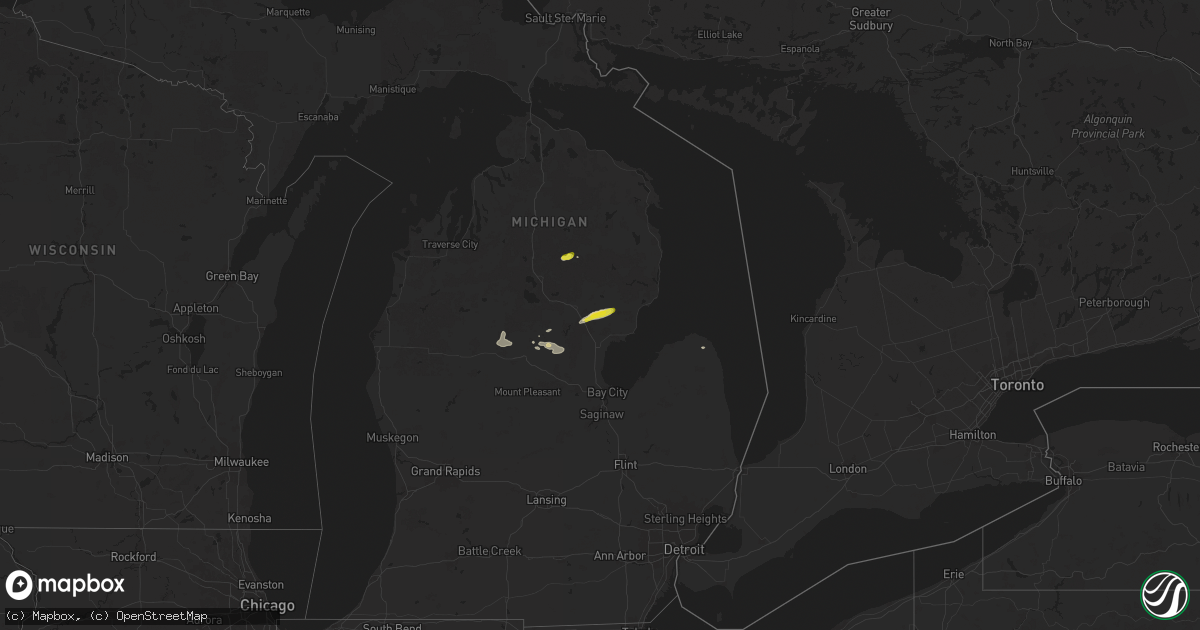
Hail Map on July 5, 2024
Get this storm
July 5 map
$229
one time, instant access
Download today. No call, no setup
Keep the $229
Bought the map and want the full workflow? Apply the entire $229 to a subscription within 7 days. None of it is wasted.
Every map, not just this one
This buys you this map. Subscription and you get every map we run, in the markets you choose from a few cities to whole states to nationwide. Plus real-time alerts the moment a storm fires.
Contact data
Name, contact info, occupancy, even credit band for addresses in the footprint. You go from where it hit to who to call.
Become the source they trust
Unlimited branding weather history reports on demand. You already have the documented answer ready for the property owner, and you are the one who showed up with it.
Property data and RoofTrace estimates
Pull up any address you have got, its value and the exact code rules for that jurisdiction, straight from One Click Code. Then RoofTrace estimates the squares, pitch, and roof value, priced the way you price.
States Impacted by Hail Map on July 5, 2024
Storm reports
Kentucky
| Date | Description |
|---|---|
| 07/05/20241:47 PM CDT | Trees down in the pinsonfork community. Time estimated via radar. |
| 07/05/20241:30 PM CDT | Trees down on ky 194 at dry branch. Time estimated via radar. |
| 07/05/20241:23 PM CDT | Trees down at indian fork rd at anderson fork. Time estimated via radar. |
| 07/05/20241:01 PM CDT | Public reported that a tree fell onto power lines at right fork penhook branch rd in the harold area. Time estimated from radar. |
| 07/05/202412:40 PM CDT | Tree down across stonecoal rd |
| 07/05/202412:02 PM CDT | A public report via social media of utility poles broken and trees down on lick branch road in the noctor community. The time of the event is radar estimated. |
| 07/05/202411:57 AM CDT | A tree was downed on riley branch blocking the roadway. This was a social media report with picture. |
| 07/05/202411:40 AM CDT | Reports of trees down in the polly hollow area of middlesboro... Including one tree on fire. Time estimated via radar. Report passed along via social media. |
| 07/05/202411:02 AM CDT | A tree was reported down in the robinson creek community near burning springs in northern clay county. The event time is radar estimated. |
| 07/05/202410:30 AM CDT | A tree was blown down on little arthur ridge road near east bernstadt. The event time is radar estimated. |
| 07/05/202410:24 AM CDT | A large limb was blown down onto us 25s blacking the roadway. |
Indiana
| Date | Description |
|---|---|
| 07/05/20247:45 AM CDT | Another tree down. |
| 07/05/20247:30 AM CDT | Tree down and brought down power lines with it. |
North Carolina
| Date | Description |
|---|---|
| 07/05/20245:19 PM CDT | Thunderstorm winds blew down a tree blocking both lanes of traffic on brim road near mount herman church road. |
| 07/05/20245:11 PM CDT | Thunderstorm winds blew down a tree onto a powerline causing a fire on east pine street. |
| 07/05/20245:10 PM CDT | Thunderstorm winds blew down a tree and powerlines on slate mountain road near westfield road. |
| 07/05/20245:09 PM CDT | Thunderstorm winds blew down a tree blocking the whole roadway on mathis road near hills presbyterian church road. |
| 07/05/20245:05 PM CDT | Tree blocking road at snody road and simmons road intersection. |
| 07/05/20245:04 PM CDT | Thunderstorm winds blew down a tree blocking both lanes of traffic on old westfield road. |
| 07/05/20245:04 PM CDT | Thunderstorm winds blew down a tree crossing the road and power lines were blown down into a yard on lovill circle. |
| 07/05/20245:01 PM CDT | Small tree blown down on spring street. |
| 07/05/20245:01 PM CDT | Thunderstorm winds blew down a tree blocking one lane of travel on highland drive. |
| 07/05/20244:55 PM CDT | Thunderstorm winds blew down a tree on park drive near i-74 east. |
| 07/05/20244:55 PM CDT | Thunderstorm winds blew down a large tree blocking lanes of traffic on reeves mill road. |
| 07/05/20244:45 PM CDT | Thunderstorm winds blew down a tree blocking the whole roadway on old u.s 601. |
| 07/05/20244:41 PM CDT | Thunderstorm winds blew down and snapped at least 10 to 20 trees and threw a 10 by 12 foot playhouse off the ground. |
| 07/05/20244:39 PM CDT | Thunderstorm winds blew down a tree blocking both lanes of traffic on george chandler road near beechnut lane. |
| 07/05/20244:35 PM CDT | Thunderstorm winds blew down a tree blocking the whole roadway on red hill creek road near haystack road. |
| 07/05/20244:31 PM CDT | Thunderstorm winds blew down at least one tree on nc 268 near friendship motor speedway. Tree is blocking whole roadway. |
| 07/05/20244:15 PM CDT | Tree blocking road at old quarry road and muddy flats road. |
| 07/05/20244:15 PM CDT | Thunderstorm winds blew down a tree on fax welborn road. Tree fell on power line. |
| 07/05/20244:13 PM CDT | Thunderstorm winds blew down a tree in the roadway on pine swamp road. Report came from social media. |
| 07/05/20244:05 PM CDT | Trees and power lines down across the city of morganton... Including on ervin rd and burkemont ave. |
| 07/05/20243:48 PM CDT | Trees down in 5000 block of patton rd and in 4800 block of elmore dr... Both southwest of morganton. Time estimated. |
| 07/05/20243:44 PM CDT | Thunderstorm winds destroyed two barns and blew down several trees on brown mountain road. |
| 07/05/20243:30 PM CDT | Thunderstorm winds blew down several trees on cook road. |
| 07/05/20243:25 PM CDT | A few trees down in vicinity of duncans creek rd and bostic sunshine hwy. Time estimated. |
| 07/05/20243:25 PM CDT | Large 10 inch diameter tree limbs blown down. |
| 07/05/20243:20 PM CDT | Tree down and power outage in highlands. Another tree down on flat mtn rd north of highlands. Time estimated. |
| 07/05/20243:11 PM CDT | Power outage attributed to fallen trees or limbs reported at 4:20 pm. Time of damage estimated based on radar. |
| 07/05/20243:04 PM CDT | Tree down on tessentee rd. Time estimated. |
| 07/05/20242:52 PM CDT | Tree down on standing indian campground rd. Time estimated. |
Montana
| Date | Description |
|---|---|
| 07/05/20246:36 PM CDT | Glendive... Dawson community airport... Mt |
| 07/05/20245:35 PM CDT | Awos station kpo1 poplar. |
| 07/05/20245:03 PM CDT | A local report indicates 63 MPH wind near Wolf Point |
| 07/05/20244:15 PM CDT | Spotter estimated gusts to 60 mph. |
| 07/05/202412:32 PM CDT | Delayed report from trained spotter. |
| 07/04/20247:10 PM CDT | Beaver hill i-94 mt dot. |
South Carolina
| Date | Description |
|---|---|
| 07/05/20243:54 PM CDT | Power outage on western shores of lake keowee north of hwy 11 attributed to fallen trees or limbs. |
| 07/05/20243:54 PM CDT | Power outage on eastern shores of lake keowee north of hwy 11 attributed to fallen trees or limbs. |
Texas
| Date | Description |
|---|---|
| 07/05/20246:52 PM CDT | First responders reported power lines down on houses. |
Michigan
| Date | Description |
|---|---|
| 07/05/20244:54 PM CDT | Tree down on m18 just south of town. |
| 07/05/20244:52 PM CDT | A local report indicates 1.00 inch wind near Gladwin |
| 07/05/20244:48 PM CDT | A local report indicates 1.00 inch wind near 1 SSW Red Oak |
| 07/05/20244:34 PM CDT | Local emergency management officials report multiple trees down... Including possibly a tree fallen onto a house... In the lake george area. Numerous power outages in t |
| 07/05/20244:17 PM CDT | Trees and wires down. |
| 07/05/20244:09 PM CDT | The first indications of tornado damage were near bringold avenue about one-third of a mile south of mannsiding road. The tornado traveled east/northeast across lake ge |
| 07/05/20243:40 PM CDT | Trees down over roadway. |
| 07/05/20243:35 PM CDT | Delayed report. Tree damage not associated with the funnel cloud. |
| 07/05/20243:04 PM CDT | Multiple trees down. |
| 07/05/20242:30 PM CDT | Barn roof partially torn off... Uprooted pine tree and an old barn blown down. |
| 07/05/20242:23 PM CDT | Multiple public reports of numerous downed trees and powerlines in the area of dyer lake. |
| 07/05/20241:36 PM CDT | Camper blown over. |
| 07/05/20241:36 PM CDT | Camper |
| 07/05/20241:25 PM CDT | Several trees reported down to local law enforcement. |
Virginia
| Date | Description |
|---|---|
| 07/05/20246:54 PM CDT | Corrects previous marine tstm wind report from 4 sw raleigh terrace. Mesonet station domv2 dominion terminal gusted to 59 kt. |
| 07/05/20246:46 PM CDT | Corrects previous tstm wnd dmg report from 1 ene carrollton. Trees and wires down on reynolds drive in carrollton. |
| 07/05/20245:57 PM CDT | Spotter knows of fire department communication and response to a limb down on a power line and a limb across a road... Both in wylliesburg. Time estimated by radar. |
| 07/05/20245:24 PM CDT | Thunderstorm winds blew down a large tree on bethel road near north terrys bridge road. |
| 07/05/20245:12 PM CDT | Tree blown down across holly tree road. |
| 07/05/20244:38 PM CDT | Large limbs down on ayers orchard road. |
| 07/05/20244:35 PM CDT | Thunderstorm winds blew down a tree at the steel ridge campground. |
| 07/05/20244:33 PM CDT | Thunderstorm winds blew down a tree on peaceful valley road. |
| 07/05/20244:10 PM CDT | Thunderstorm winds blew down tree onto a powerline on cedar spring road. Report came from social media. |
| 07/05/20243:46 PM CDT | Thunderstorm winds blew down a tree. |
| 07/05/20243:46 PM CDT | Thunderstorm winds blew down at least one tree on harborwood road. |
| 07/05/20243:42 PM CDT | Corrects previous tstm wnd dmg report from 1 n newport. Tree down along winding way drive. |
| 07/05/20243:42 PM CDT | Tree down along wind way drive. |
| 07/05/20243:39 PM CDT | Thunderstorm winds blew down one tree on thomas bridge road... Near the intersection of scratch gravel road. This tree blocked one lane of thomas bridge road. |
| 07/05/20243:38 PM CDT | Thunderstorm winds downed one tree on winding way drive. Time estimated using radar data. |
| 07/05/20243:30 PM CDT | Thunderstorm winds blew a few trees down in the blacksburg area. |
| 07/05/20243:17 PM CDT | Thunderstorm winds blew down tree down on forest hill drive. |
| 07/05/20243:15 PM CDT | Corrects previous tstm wnd dmg report from 4 sw boones mill. Thunderstorm winds blew a few trees down. |
| 07/05/20243:15 PM CDT | Thunderstorm winds blew a few trees down in the riner area. |
| 07/05/20243:12 PM CDT | Thunderstorm winds took down several limbs... At least 6 inches in diameter on yeager avenue ne. |
| 07/05/20243:11 PM CDT | Thunderstorm winds blew at least one tree down on fleming avenue. |
| 07/05/20243:11 PM CDT | Thunderstorm winds blew down at least one tree on whittle street ne. |
| 07/05/20242:18 PM CDT | Thunderstorm winds blew down a large tree on foxfire road. |
| 07/05/20242:00 PM CDT | Thunderstorm winds brought down power lines in the baptist valley area. |
| 07/05/20241:49 PM CDT | Thunderstorm winds blew down a large tree across lawndale road. |
| 07/05/20241:33 PM CDT | Power lines and tree down in a driveway. |
| 07/05/20241:25 PM CDT | Thunderstorm winds blew down a tree on pleasent view road. |
New York
| Date | Description |
|---|---|
| 07/04/20249:12 PM CDT | A local report indicates 60 MPH wind near 3 NE Kirkwood |
| 07/04/20248:10 PM CDT | Large tree snapped at tioga county fairgrounds. Recieved with photos on social media. Time estimated by radar. |
| 07/04/20247:23 PM CDT | Trees and powerlines down. |
| 07/04/20247:18 PM CDT | Power line down on shed. |
| 07/04/20247:15 PM CDT | Trees down. |
| 07/04/20247:13 PM CDT | Trees & wires down. |
Maine
| Date | Description |
|---|---|
| 07/05/202412:20 PM CDT | Several large trees down; large birch tree snapped in half. |
| 07/05/202412:20 PM CDT | Large trees down around campgrounds. |
| 07/05/202411:30 AM CDT | Tree down on power lines. |
Georgia
| Date | Description |
|---|---|
| 07/05/20244:19 PM CDT | Trees down in clayton and on southeast outskirts. Several power lines reported down across the county. |
| 07/05/20244:19 PM CDT | Tree down at intersection of warwoman rd and earls ford rd. Time estimated from radar. |
| 07/05/20244:01 PM CDT | Trees down on hwy 246 and crusher run rd. Time estimated from radar. |
| 07/05/20243:19 PM CDT | Corrects time of previous tstm wnd dmg report from 5 wsw pine mountain. Tree down at intersection of warwoman rd and earls ford rd. Time estimated from radar. |
| 07/05/20243:19 PM CDT | Corrects time of previous tstm wnd dmg report from clayton. Trees down in clayton and on southeast outskirts. Several power lines reported down across the county. |
| 07/05/20243:01 PM CDT | Corrects time of previous tstm wnd dmg report from 2 ne dillard. Trees down on hwy 246 and crusher run rd. Time estimated from radar. |
West Virginia
| Date | Description |
|---|---|
| 07/05/20246:35 PM CDT | Lines down along west little kanawha highway between creston and grantsville. |
| 07/05/20246:32 PM CDT | Treed down across the road between haddox run and burton run. |
| 07/05/20246:30 PM CDT | Tree down on mountain drive. |
| 07/05/20245:45 PM CDT | Tree down blocking roadway at 179 spruce st. Davisville... Wv. |
| 07/05/20245:45 PM CDT | Tree down across triplett road. Time estimated by radar. |
| 07/05/20245:45 PM CDT | Tree down on ivy road. Power lines involved. |
| 07/05/20245:42 PM CDT | Numerous tree and power line damage in the mineral wells area. |
| 07/05/20245:40 PM CDT | Tree down on power lines across 469 dutch ridge rd... Parkersburg... Wv. |
| 07/05/20245:38 PM CDT | Numerous downed trees in the parkersburg area. Time estimated from radar. |
| 07/05/20245:38 PM CDT | Tree down near statts mills. |
| 07/05/20245:31 PM CDT | Tree down on zion ridge rd and wilbern rd. |
| 07/05/20243:56 PM CDT | Thunderstorm winds blew down a tree on indian mills road near route 12. |
Arizona
| Date | Description |
|---|---|
| 07/05/20245:45 PM CDT | Multiple reports from nws employee... Public... And fire department of 5 power lines down in the intersection of ina and shannon road. Traffic accidents occurred. |
| 07/05/20245:45 PM CDT | *** 2 inj *** corrects previous tstm wnd dmg report from 7 ssw oro valley. Corrects previous tstm wnd dmg report from 7 ssw oro valley. Multiple reports from nws employ |
Alabama
| Date | Description |
|---|---|
| 07/05/20249:05 AM CDT | A tree was knocked down onto power lines causing an outage in the area of bishop road and south view drive. Time estimated by radar. |
| 07/05/20248:12 AM CDT | A power pole was knocked over at 1205 bethlehem church road. Time estimated by radar. |
| 07/05/20247:45 AM CDT | A large tree limb was knocked down onto a residence and power lines on seymore avenue. Time estimated by nearby observations. |
| 07/05/20247:29 AM CDT | A tree was knocked down at the intersection of underwood mountain road and new cut road. Time estimated by radar. |
New Mexico
| Date | Description |
|---|---|
| 07/05/20246:40 PM CDT | A local report indicates 1.00 inch wind near Tecolotito |
| 07/05/20246:15 PM CDT | A local report indicates 1.00 inch wind near 1 SSE Dilia |
| 07/05/20246:12 PM CDT | A local report indicates 1.75 inch wind near 2 ENE Glencoe |
| 07/05/20244:50 PM CDT | Very brief and ragged touchdown over rural countryside for 30 to 45 seconds. |
| 07/05/20243:54 PM CDT | A local report indicates 1.50 inch wind near Rainsville |
| 07/05/20243:52 PM CDT | A local report indicates 60 MPH wind near Rainsville |
| 07/05/20243:52 PM CDT | A local report indicates 1.75 inch wind near Rainsville |
| 07/04/20249:36 PM CDT | Mesonet station dunn5 dunken 2 ne |
Cities Impacted by Hail Map on July 5, 2024
- Altamont, KS
- Oswego, KS
- Parsons, KS
- Scottsville, KY
- Glasgow, KY
- Smiths Grove, KY
- Fountain Run, KY
- Austin, KY
- Lucas, KY
- Eighty Eight, KY
- Summer Shade, KY
- Etoile, KY
- Anton, CO
- Whitleyville, TN
- Cope, CO
- Moss, TN
- Celina, TN
- Hilham, TN
- Oakland, KY
- Somerset, KY
- Macon, MS
- Pineville, KY
- Athens, TN
- Miracle, KY
- Patten, ME
- Scooba, MS
- Shuqualak, MS
- Riceville, TN
- Rocky Face, GA
- Decatur, TN
- Knoxville, TN
- Houlton, ME
- Hogeland, MT
- Harlem, MT
- Dalton, GA
- Bulan, KY
- Vest, KY
- Cross Plains, TX
- Hueysville, KY
- Prestonsburg, KY
- Gunlock, KY
- Leburn, KY
- Garrett, KY
- Mousie, KY
- Fall Branch, TN
- Kingsport, TN
- Drift, KY
- Printer, KY
- Langley, KY
- Alger, MI
- Raven, KY
- Wayland, KY
- Garner, KY
- Granbury, TX
- Cleburne, TX
- Dema, KY
- Prescott, MI
- Whittemore, MI
- Surgoinsville, TN
- Stephenville, TX
- Bluff Dale, TX
- Sterling, MI
- Hays, MT
- Fountain, MI
- Custer, MI
- Rogersville, TN
- Greeneville, TN
- Guadalupita, NM
- Tolar, TX
- Harrison, MI
- Lake, MI
- Murphy, NC
- Marion, MI
- Canton, TX
- Brasstown, NC
- Hayesville, NC
- Falmouth, MI
- Malta, MT
- West Forks, ME
- New Boston, TX
- McBain, MI
- Pineville, WV
- Ocate, NM
- Rutherfordton, NC
- Ranger, TX
- Gouldbusk, TX
- Rainbow, TX
- Lakemont, GA
- Doole, TX
- Toccoa, GA
- Glasgow, MT
- Power, MT
- Mora, NM
- Rainsville, NM
- Zortman, MT
- Filion, MI
- Port Hope, MI
- Hico, TX
- Iredell, TX
- Plentywood, MT
- Smithdale, MS
- Liberty, MS
- Summit, MS
- Buena Vista, NM
- Magnolia, MS
- Newellton, LA
- Fort Peck, MT
- Tallulah, LA
- Hamburg, AR
- Gladwin, MI
- Mio, MI
- Luzerne, MI
- Sikes, LA
- Capitan, NM
- Lewiston, MI
- Las Cruces, NM
- Chocowinity, NC
- Grimesland, NC
- Sapello, NM
- Las Vegas, NM
- Beaverton, MI
- Clare, MI
- Aquilla, TX
- Waco, TX
- West, TX
- Nogales, AZ
- Livonia, LA
- Oscar, LA
- Elm Mott, TX
- Lincoln, NM
- Bastrop, LA
- Ripley, WV
- Natchitoches, LA
- Given, WV
- Kenna, WV
- Tucson, AZ
- Evans, WV
- Gay, WV
- Reedy, WV
- Montgomery, LA
- Gandeeville, WV
- Le Roy, WV
- Mart, TX
- Groesbeck, TX
- Hondo, NM
- San Patricio, NM
- Glencoe, NM
- Cimarron, NM
- Notasulga, AL
- Spencer, WV
- Tinnie, NM
- Santa Rosa, NM
- Anton Chico, NM
- Sandyville, WV
- Vaughn, NM
- Smithfield, VA
- Carrollton, VA
- Sherwood, ND
- Trinidad, CO
- Bainville, MT
- Halliday, ND
- Robeline, LA
- Auburn, AL
- Ryder, ND
- Lovelady, TX
- Mayhill, NM
- Lockwood, NY
- Waverly, NY
- Roswell, NM
- Crockett, TX
- Mescalero, NM
- Del Rio, TX
- Wing, ND
- Barton, NY
- Yeso, NM
- El Paso, TX
- Midland, GA
- Fortson, GA
- Mauk, GA
- Glenmora, LA
- Effie, LA
- Hineston, LA
- Comstock, TX
- Box Springs, GA
- Columbus, GA
- Upatoi, GA
- Weed, NM
- Cloudcroft, NM
- Pinon, NM
- Marble, NC
- Albany, GA
- Solano, NM
- Conchas Dam, NM
- Erin, NY
- Sierra Blanca, TX
- Folsom, NM
- Grenville, NM
- Springer, NM
- Wharton, NJ
- Lake Hopatcong, NJ
- Wagon Mound, NM
- Oak Ridge, NJ
- Newfoundland, NJ
- Rockaway, NJ
- Boonton, NJ
- West Milford, NJ
- Butler, NJ
- Pompton Plains, NJ
- Riverdale, NJ
- Bloomingdale, NJ
- Bard, NM
- Adrian, TX
- San Jon, NM
- Turner, MT
- Medford, WI