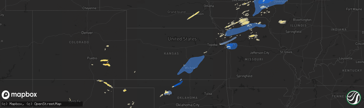
Hail Map in Kansas on July 2, 2024
The weather event in Kansas on July 2, 2024 includes Hail, Wind, and Tornado maps. 12 states and 523 cities were impacted and suffered possible damage. The total estimated number of properties impacted is 0.
Want more than just the map?
Turn this storm into a full workflow.
- Owner + property data so you know who to knock
- OnDemand branded weather history reports to win the "did we even have hail?" argument
- RoofTrace estimate so reps stop guessing numbers at the door
Bought this map? Upgrade within 7 days and we'll credit the $230. (10-15 min setup call)
Hail
Wind
Tornado
0
Estimated number of impacted properties by a 1.00" hail or larger0
Estimated number of impacted properties by a 1.75" hail or larger0
Estimated number of impacted properties by a 2.50" hail or largerStorm reports in Kansas
Kansas
| Date | Description |
|---|---|
| 07/02/20246:44 PM CDT | A local report indicates 63 MPH wind near 3 SE Matfield Green |
| 07/02/20246:20 PM CDT | A local report indicates 60 MPH wind near 5 ENE Peabody |
| 07/02/20246:19 PM CDT | A local report indicates 70 MPH wind near Burns |
| 07/02/20246:12 PM CDT | 2 inch diameter tree limbs dow |
| 07/02/20246:12 PM CDT | 2 inch diameter tree limbs down. |
| 07/02/20246:12 PM CDT | Reports of power lines down. |
| 07/02/20246:01 PM CDT | A local report indicates 58 MPH wind near 1 ENE Whitewater |
| 07/02/20245:59 PM CDT | A local report indicates 59 MPH wind near 2 WSW Towanda |
| 07/02/20245:58 PM CDT | Awos station kaao 2 ese bel aire. |
| 07/02/20245:58 PM CDT | A local report indicates 65 MPH wind near 1 NNW Newton |
| 07/02/20245:55 PM CDT | Reported several large tree limbs down in riverside park. |
| 07/02/20245:55 PM CDT | A local report indicates 62 MPH wind near 2 W Whitewater |
| 07/02/20245:54 PM CDT | A local report indicates 70 MPH wind near Andover |
| 07/02/20245:53 PM CDT | *** 3 inj *** report of a fireworks tent blown over with 3 injuries. Report was received via local tv. |
| 07/02/20245:50 PM CDT | Tree blocking road near 21st and tyler. |
| 07/02/20245:50 PM CDT | Trees down. Report came in via social media. |
| 07/02/20245:49 PM CDT | Reported by kake broadcast media. |
| 07/02/20245:47 PM CDT | A local report indicates 63 MPH wind near Newton Airport |
| 07/02/20245:46 PM CDT | Large tree down on home near 13th and west. Report came in via social media. |
| 07/02/20245:46 PM CDT | A local report indicates 68 MPH wind near 1 NW Derby |
| 07/02/20245:45 PM CDT | A local report indicates 60 MPH wind near 1 SE Wichita Eisenhower |
| 07/02/20245:32 PM CDT | A local report indicates 65 MPH wind near 3 NW Wichita Eisenhower |
| 07/02/20245:32 PM CDT | A local report indicates 59 MPH wind near 1 SE Wichita Eisenhower |
| 07/02/20245:22 PM CDT | A local report indicates 60 MPH wind near 1 W Andale |
| 07/02/20245:20 PM CDT | A local report indicates 67 MPH wind near 6 NNE Viola |
| 07/02/20244:45 PM CDT | A local report indicates 65 MPH wind near 5 NW Harper |
| 07/02/20244:39 PM CDT | A local report indicates 60 MPH wind near 5 NW Harper |
| 07/01/20248:42 PM CDT | Multiple social media and utility company reports of trees and wires down near and east of paola. Time estimated from radar. |
| 07/01/20248:20 PM CDT | Downed wires and power outages near 100th place. Time estimated from radar. |
| 07/01/20248:15 PM CDT | Downed tree and wires near wedd drive. Time estimated from radar. |
| 07/01/20248:11 PM CDT | Downed tree and wires near 56th terrace. Time estimated from radar. |
| 07/01/20247:37 PM CDT | Downed tree and wires near parkwood blvd. Time estimated from radar. |
| 07/01/20247:30 PM CDT | Downed trees and wires near edith avenue. Time estimated from radar. |
| 07/01/20247:30 PM CDT | Downed tree and wires near 72nd street. Time estimated from radar. |
| 07/01/20247:28 PM CDT | Downed tree and wires near 76th street. Time estimated from radar. |
| 07/01/20247:05 PM CDT | Delayed report: numerous trees damaged with limbs as large as 12 to 18 inches in diameter downed on homes... Cars and power lines. Relayed by kvoe. |
All States Impacted by Hail Map on July 2, 2024
Cities Impacted by Hail Map on July 2, 2024
- New Salem, ND
- Hazen, ND
- Beulah, ND
- Center, ND
- Stanton, ND
- Washburn, ND
- Exeter, NE
- Milligan, NE
- Friend, NE
- Geneva, NE
- Dorchester, NE
- Milford, NE
- Palmyra, NE
- Walton, NE
- Elmwood, NE
- Eagle, NE
- Bennet, NE
- Lincoln, NE
- Denton, NE
- Roca, NE
- Crete, NE
- Martell, NE
- Pleasant Dale, NE
- Malcolm, NE
- Davey, NE
- Raymond, NE
- Hogeland, MT
- Monticello, NM
- Hillsboro, NM
- Los Alamos, NM
- Benson, AZ
- Winterset, IA
- Griswold, IA
- Prole, IA
- Stanberry, MO
- Albany, MO
- Milo, IA
- Ackworth, IA
- Indianola, IA
- Knoxville, IA
- Pleasantville, IA
- Osceola, IA
- Swan, IA
- Humeston, IA
- Corydon, IA
- Saint Charles, IA
- Chariton, IA
- New Virginia, IA
- Murray, IA
- Otley, IA
- Pella, IA
- Darlington, MO
- King City, MO
- Raton, NM
- Truro, IA
- Laguna, NM
- San Simon, AZ
- Bowie, AZ
- Princeton, MO
- Mercer, MO
- Russell, IA
- Harvey, IA
- Cainsville, MO
- Sully, IA
- McFall, MO
- Martinsville, MO
- Bethany, MO
- New Hampton, MO
- Attica, KS
- Spivey, KS
- Harper, KS
- Kingman, KS
- Rea, MO
- Union Star, MO
- Ridgeway, MO
- Magdalena, NM
- Promise City, IA
- Allerton, IA
- Lineville, IA
- New Sharon, IA
- Savannah, MO
- Melrose, IA
- Montezuma, IA
- Barnes City, IA
- Deep River, IA
- Gibson, IA
- Murdock, KS
- Norwich, KS
- Milton, KS
- Cheney, KS
- Keswick, IA
- What Cheer, IA
- Webster, IA
- Folsom, NM
- Seymour, IA
- Plano, IA
- Albia, IA
- North English, IA
- Viola, KS
- Garden Plain, KS
- Goddard, KS
- Andale, KS
- Mount Hope, KS
- Gilman City, MO
- Mystic, IA
- Centerville, IA
- Oskaloosa, IA
- Rose Hill, IA
- Cedar, IA
- Fremont, IA
- Hedrick, IA
- Delta, IA
- Ottumwa, IA
- Bloomfield, IA
- Drakesville, IA
- Moulton, IA
- Hayesville, IA
- Agency, IA
- Martinsburg, IA
- Eldon, IA
- Floris, IA
- Sigourney, IA
- Guernsey, IA
- Marengo, IA
- Ladora, IA
- Williamsburg, IA
- Victor, IA
- South English, IA
- Millersburg, IA
- Keota, IA
- Wellman, IA
- Parnell, IA
- Harper, IA
- Packwood, IA
- Ollie, IA
- Batavia, IA
- Atchison, KS
- Rushville, MO
- Haven, KS
- Moravia, IA
- Powersville, MO
- Lucerne, MO
- Clearwater, KS
- Conway Springs, KS
- Wellington, KS
- Wichita, KS
- Colwich, KS
- Belle Plaine, KS
- Peck, KS
- Haysville, KS
- Pretty Prairie, KS
- Valley Center, KS
- Maize, KS
- Sedgwick, KS
- Mulvane, KS
- Kechi, KS
- Derby, KS
- Carmen, OK
- Cherokee, OK
- Helena, OK
- Jet, OK
- Childress, TX
- Faucett, MO
- De Kalb, MO
- Saint Joseph, MO
- Tucson, AZ
- Unionville, MO
- Spickard, MO
- Manchester, OK
- Anthony, KS
- Galata, MT
- Kalona, IA
- Clarksdale, MO
- Oxford, IA
- Council Grove, KS
- Jarales, NM
- Richland, IA
- Newtown, MO
- Pollock, MO
- Wakita, OK
- Nash, OK
- Halstead, KS
- Newton, KS
- Bentley, KS
- Burrton, KS
- North Newton, KS
- Walton, KS
- Mcconnell Afb, KS
- Benton, KS
- Andover, KS
- Greenwich, KS
- Augusta, KS
- Rose Hill, KS
- Douglass, KS
- Whitewater, KS
- Hesston, KS
- Moundridge, KS
- Elbing, KS
- Potwin, KS
- Peabody, KS
- Towanda, KS
- El Dorado, KS
- Leon, KS
- Burns, KS
- Florence, KS
- Marion, KS
- Hillsboro, KS
- Selma, IA
- Brighton, IA
- Libertyville, IA
- Douds, IA
- Washington, IA
- West Chester, IA
- Fairfield, IA
- Riverside, IA
- Iowa City, IA
- Tiffin, IA
- North Liberty, IA
- Coralville, IA
- Solon, IA
- West Branch, IA
- Ainsworth, IA
- Hills, IA
- Tipton, IA
- West Liberty, IA
- Lone Tree, IA
- Harris, MO
- Galt, MO
- Pattonsburg, MO
- Americus, KS
- Maysville, MO
- Amity, MO
- Arenas Valley, NM
- Agency, MO
- Gower, MO
- Nichols, IA
- Columbus Junction, IA
- Conesville, IA
- Mechanicsville, IA
- Atalissa, IA
- Wilton, IA
- Moscow, IA
- Crawfordsville, IA
- Wayland, IA
- Mount Pleasant, IA
- Grandview, IA
- Muscatine, IA
- Wapello, IA
- Columbus City, IA
- Letts, IA
- Illinois City, IL
- Fruitland, IA
- Durant, IA
- Grenville, NM
- Milan, MO
- Admire, KS
- Allen, KS
- Weatherby, MO
- Cedar Point, KS
- Cassoday, KS
- Dacoma, OK
- Strong City, KS
- Elmdale, KS
- Lincolnville, KS
- Cottonwood Falls, KS
- Matfield Green, KS
- Taylor Ridge, IL
- Davenport, IA
- Stockton, IA
- Bennett, IA
- Buffalo, IA
- Walcott, IA
- Blue Grass, IA
- Clarence, IA
- Montpelier, IA
- New Liberty, IA
- Lowden, IA
- Stanwood, IA
- Lisbon, IA
- Wheatland, IA
- Oxford Junction, IA
- Dixon, IA
- Emporia, KS
- Birmingham, IA
- Humphreys, MO
- Milton, IA
- Keosauqua, IA
- Dearborn, MO
- Platte City, MO
- Camden Point, MO
- Green City, MO
- Rock Island, IL
- Milan, IL
- Reynolds, IL
- Andalusia, IL
- New Boston, IL
- Joy, IL
- Calamus, IA
- Osco, IL
- Moline, IL
- Donahue, IA
- Sherrard, IL
- Eldridge, IA
- Orion, IL
- East Moline, IL
- Coal Valley, IL
- Bettendorf, IA
- Silvis, IL
- Delmar, IA
- Lost Nation, IA
- Carbon Cliff, IL
- Hampton, IL
- Pleasant Valley, IA
- Colona, IL
- Grand Mound, IA
- Long Grove, IA
- Maquoketa, IA
- De Witt, IA
- Geneseo, IL
- Port Byron, IL
- Rapids City, IL
- Princeton, IA
- Le Claire, IA
- Hillsdale, IL
- Stockport, IA
- Trenton, MO
- Olpe, KS
- Osborn, MO
- Easton, MO
- Stewartsville, MO
- Plattsburg, MO
- Turney, MO
- Cameron, MO
- Kingston, MO
- Winston, MO
- Kidder, MO
- Hamilton, MO
- Jameson, MO
- Altamont, MO
- Gallatin, MO
- Ludlow, MO
- Breckenridge, MO
- Utica, MO
- Lock Springs, MO
- Chillicothe, MO
- Mooresville, MO
- Jamesport, MO
- Camanche, IA
- McCausland, IA
- Goose Lake, IA
- Charlotte, IA
- Welton, IA
- Cordova, IL
- Clinton, IA
- Bryant, IA
- Low Moor, IA
- Fulton, IL
- Albany, IL
- Erie, IL
- Prophetstown, IL
- Hingham, MT
- New London, IA
- Hillsboro, IA
- Salem, IA
- Linwood, KS
- Tonganoxie, KS
- Clayton, NM
- Fenton, IL
- Lyndon, IL
- Morrison, IL
- Chula, MO
- Laredo, MO
- Wheeling, MO
- Linneus, MO
- Meadville, MO
- Laclede, MO
- Brookfield, MO
- Browning, MO
- Purdin, MO
- Edgerton, MO
- Trimble, MO
- Lathrop, MO
- Polo, MO
- Cowgill, MO
- Braymer, MO
- Sterling, IL
- Thomson, IL
- Chadwick, IL
- Sabula, IA
- Winigan, MO
- Novinger, MO
- Ethel, MO
- Green Castle, MO
- Elmer, MO
- La Plata, MO
- Kirksville, MO
- New Boston, MO
- Holt, MO
- Aline, OK
- Lawson, MO
- Brashear, MO
- Gibbs, MO
- Greentop, MO
- Hurdland, MO
- Baring, MO
- Edina, MO
- Novelty, MO
- Mutual, OK
- Nortonville, KS
- Cummings, KS
- Basehor, KS
- Bonner Springs, KS
- Leavenworth, KS
- Kansas City, KS
- Shawnee, KS
- Kansas City, MO
- Waldron, MO
- Riverside, MO
- Liberty, MO
- Excelsior Springs, MO
- Rayville, MO
- Richmond, MO
- Knox City, MO
- La Belle, MO
- Lewistown, MO
- Monticello, MO
- Mooreland, OK
- Valley Falls, KS
- Overland Park, KS
- Arnett, OK
- Rutledge, MO
- Memphis, MO
- Olathe, KS
- Williamstown, MO
- Vici, OK
- Prairie Village, KS
- Leawood, KS
- Grandview, MO
- Bucklin, MO
- Dawn, MO
- Lees Summit, MO
- Independence, MO
- Blue Springs, MO
- Greenwood, MO
- Pleasant Hill, MO
- Belton, MO
- Raymore, MO
- Lone Jack, MO
- Kingsville, MO
- Grain Valley, MO
- Buckner, MO
- Napoleon, MO
- Sibley, MO
- Bates City, MO
- Wellington, MO
- Oak Grove, MO
- Odessa, MO
- New Cambria, MO
- Weston, MO
- Holden, MO
- Seiling, OK
- Taloga, OK
- Chester, OK
- Fairview, OK
- Lexington, MO
- Mayview, MO
- Centerview, MO
- Amarillo, TX
- Sharon, OK
- Troy, KS
- Sedan, NM
- Fritch, TX
- Macomb, IL
- Industry, IL
- Brunswick, MO
- Denton, KS
- Bendena, KS
- Colchester, IL
- Littleton, IL
- Callao, MO
- Keytesville, MO
- Marceline, MO
- Salisbury, MO
- Vermont, IL
- Adair, IL
- Table Grove, IL
- Astoria, IL
- Rushville, IL
- Walsenburg, CO
- Cumberland, IA
- Ipava, IL
- Clifton Hill, MO
- Lewistown, IL
- Smithfield, IL
- Huntsville, MO
- Dalton, MO
- Cosby, MO
- Helena, MO
- Excello, MO
- Jacksonville, MO
- Cairo, MO
- Macon, MO
- Moberly, MO
- Dalhart, TX
- Higbee, MO
- Clark, MO
- Madison, MO
- Sturgeon, MO
- Centralia, MO
- Stratford, TX
- Texhoma, OK
- Masterson, TX
- Rocky Ford, CO
- Ulysses, KS
- La Junta, CO
- Karval, CO
- Hugo, CO
- Manzanola, CO
- Fowler, CO
- Olney Springs, CO
- Ordway, CO
- Sugar City, CO
- Cheraw, CO


