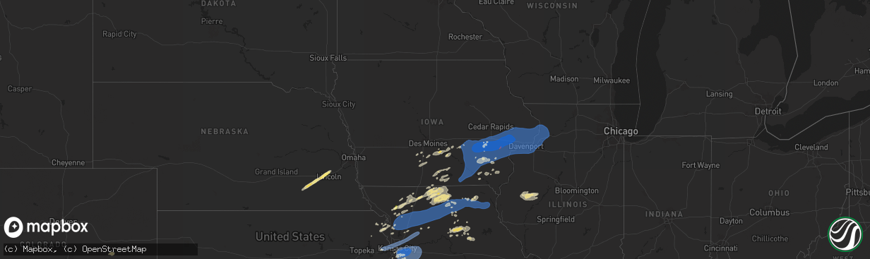
Hail Map in Iowa on July 2, 2024
The weather event in Iowa on July 2, 2024 includes Hail, Wind, and Tornado maps. 12 states and 523 cities were impacted and suffered possible damage. The total estimated number of properties impacted is 0.
Want more than just the map?
Turn this storm into a full workflow.
- Owner + property data so you know who to knock
- OnDemand branded weather history reports to win the "did we even have hail?" argument
- RoofTrace estimate so reps stop guessing numbers at the door
Bought this map? Upgrade within 7 days and we'll credit the $230. (10-15 min setup call)
Hail
Wind
Tornado
0
Estimated number of impacted properties by a 1.00" hail or larger0
Estimated number of impacted properties by a 1.75" hail or larger0
Estimated number of impacted properties by a 2.50" hail or largerStorm reports in Iowa
Iowa
| Date | Description |
|---|---|
| 07/02/20246:43 PM CDT | Small flag pole bent over and medium tree branch down. |
| 07/02/20246:25 PM CDT | A local report indicates 60 MPH wind near Ainsworth |
| 07/02/20246:22 PM CDT | Report from mping: 3-inch tree limbs broken;. |
| 07/02/20246:15 PM CDT | Measured wind gust from washington municipal airport. |
| 07/02/20246:10 PM CDT | Neighbors fence blown over as well as a weighted basketball hoop. Time estimated using radar. |
| 07/02/20246:08 PM CDT | 2 fruit trees blown over and another large tree split. Time of the event estimated using radar. |
| 07/02/20246:07 PM CDT | Tornado on the ground 2.5 w of nichols... Ia. |
| 07/02/20246:05 PM CDT | Relayed by a spotter. Time estimated. |
| 07/02/20246:00 PM CDT | Updated report. An nws storm survey team was unable to confirm a tornado at this location. There was isolated tree limb damage at the location... But no observed path o |
| 07/02/20246:00 PM CDT | Tornado on the ground at ia 1 and phebe ln... Heading towards iowa city... Le cruiser hit with debris and heavy rain... Lost visual contact. |
| 07/02/20246:00 PM CDT | Large oak tree snapped near the base... Was about 30 inches in diameter. Time was estimated by radar. |
| 07/02/20245:51 PM CDT | Measured on davis weather station. |
| 07/02/20245:50 PM CDT | Update to previous 81 mph wind gust report. Several large tree branches downed by the winds... With some trees snapped in half. One tree fell on their neighbors house.. |
| 07/02/20245:49 PM CDT | A local report indicates 60 MPH wind near 1 WNW Amish |
| 07/02/20245:43 PM CDT | Trailer blown over on highway 22 near kalona. Time estimated by radar. |
| 07/02/20245:20 PM CDT | There was one tree in n. English that was snapped off 12 to 15 feet up then fell on a house and garage and damaged them. Another tree was broken off and fell on a deck |
| 07/02/20245:18 PM CDT | Keokuk county em relayed a photo of damage to a house and also noted a large tree down on the same property. |
| 07/02/20245:10 PM CDT | Estimated 70 mph gusts and getting stronger. Relayed by emergency management. Time estimated by radar. |
| 07/02/20245:04 PM CDT | Corrects time of previous report. Large oak tree snapped near the base... Was about 30 inches in diameter. Time was estimated by radar. |
| 07/02/20245:19 AM CDT | Several reports of smaller tree limbs down in n. English. |
| 07/01/20247:22 PM CDT | Limbs down in town. Time estimated. |
| 07/01/20247:06 PM CDT | 2 to 4 inch tree limb down in meier park-park staff. |
All States Impacted by Hail Map on July 2, 2024
Cities Impacted by Hail Map on July 2, 2024
- New Salem, ND
- Hazen, ND
- Beulah, ND
- Center, ND
- Stanton, ND
- Washburn, ND
- Exeter, NE
- Milligan, NE
- Friend, NE
- Geneva, NE
- Dorchester, NE
- Milford, NE
- Palmyra, NE
- Walton, NE
- Elmwood, NE
- Eagle, NE
- Bennet, NE
- Lincoln, NE
- Denton, NE
- Roca, NE
- Crete, NE
- Martell, NE
- Pleasant Dale, NE
- Malcolm, NE
- Davey, NE
- Raymond, NE
- Hogeland, MT
- Monticello, NM
- Hillsboro, NM
- Los Alamos, NM
- Benson, AZ
- Winterset, IA
- Griswold, IA
- Prole, IA
- Stanberry, MO
- Albany, MO
- Milo, IA
- Ackworth, IA
- Indianola, IA
- Knoxville, IA
- Pleasantville, IA
- Osceola, IA
- Swan, IA
- Humeston, IA
- Corydon, IA
- Saint Charles, IA
- Chariton, IA
- New Virginia, IA
- Murray, IA
- Otley, IA
- Pella, IA
- Darlington, MO
- King City, MO
- Raton, NM
- Truro, IA
- Laguna, NM
- San Simon, AZ
- Bowie, AZ
- Princeton, MO
- Mercer, MO
- Russell, IA
- Harvey, IA
- Cainsville, MO
- Sully, IA
- McFall, MO
- Martinsville, MO
- Bethany, MO
- New Hampton, MO
- Attica, KS
- Spivey, KS
- Harper, KS
- Kingman, KS
- Rea, MO
- Union Star, MO
- Ridgeway, MO
- Magdalena, NM
- Promise City, IA
- Allerton, IA
- Lineville, IA
- New Sharon, IA
- Savannah, MO
- Melrose, IA
- Montezuma, IA
- Barnes City, IA
- Deep River, IA
- Gibson, IA
- Murdock, KS
- Norwich, KS
- Milton, KS
- Cheney, KS
- Keswick, IA
- What Cheer, IA
- Webster, IA
- Folsom, NM
- Seymour, IA
- Plano, IA
- Albia, IA
- North English, IA
- Viola, KS
- Garden Plain, KS
- Goddard, KS
- Andale, KS
- Mount Hope, KS
- Gilman City, MO
- Mystic, IA
- Centerville, IA
- Oskaloosa, IA
- Rose Hill, IA
- Cedar, IA
- Fremont, IA
- Hedrick, IA
- Delta, IA
- Ottumwa, IA
- Bloomfield, IA
- Drakesville, IA
- Moulton, IA
- Hayesville, IA
- Agency, IA
- Martinsburg, IA
- Eldon, IA
- Floris, IA
- Sigourney, IA
- Guernsey, IA
- Marengo, IA
- Ladora, IA
- Williamsburg, IA
- Victor, IA
- South English, IA
- Millersburg, IA
- Keota, IA
- Wellman, IA
- Parnell, IA
- Harper, IA
- Packwood, IA
- Ollie, IA
- Batavia, IA
- Atchison, KS
- Rushville, MO
- Haven, KS
- Moravia, IA
- Powersville, MO
- Lucerne, MO
- Clearwater, KS
- Conway Springs, KS
- Wellington, KS
- Wichita, KS
- Colwich, KS
- Belle Plaine, KS
- Peck, KS
- Haysville, KS
- Pretty Prairie, KS
- Valley Center, KS
- Maize, KS
- Sedgwick, KS
- Mulvane, KS
- Kechi, KS
- Derby, KS
- Carmen, OK
- Cherokee, OK
- Helena, OK
- Jet, OK
- Childress, TX
- Faucett, MO
- De Kalb, MO
- Saint Joseph, MO
- Tucson, AZ
- Unionville, MO
- Spickard, MO
- Manchester, OK
- Anthony, KS
- Galata, MT
- Kalona, IA
- Clarksdale, MO
- Oxford, IA
- Council Grove, KS
- Jarales, NM
- Richland, IA
- Newtown, MO
- Pollock, MO
- Wakita, OK
- Nash, OK
- Halstead, KS
- Newton, KS
- Bentley, KS
- Burrton, KS
- North Newton, KS
- Walton, KS
- Mcconnell Afb, KS
- Benton, KS
- Andover, KS
- Greenwich, KS
- Augusta, KS
- Rose Hill, KS
- Douglass, KS
- Whitewater, KS
- Hesston, KS
- Moundridge, KS
- Elbing, KS
- Potwin, KS
- Peabody, KS
- Towanda, KS
- El Dorado, KS
- Leon, KS
- Burns, KS
- Florence, KS
- Marion, KS
- Hillsboro, KS
- Selma, IA
- Brighton, IA
- Libertyville, IA
- Douds, IA
- Washington, IA
- West Chester, IA
- Fairfield, IA
- Riverside, IA
- Iowa City, IA
- Tiffin, IA
- North Liberty, IA
- Coralville, IA
- Solon, IA
- West Branch, IA
- Ainsworth, IA
- Hills, IA
- Tipton, IA
- West Liberty, IA
- Lone Tree, IA
- Harris, MO
- Galt, MO
- Pattonsburg, MO
- Americus, KS
- Maysville, MO
- Amity, MO
- Arenas Valley, NM
- Agency, MO
- Gower, MO
- Nichols, IA
- Columbus Junction, IA
- Conesville, IA
- Mechanicsville, IA
- Atalissa, IA
- Wilton, IA
- Moscow, IA
- Crawfordsville, IA
- Wayland, IA
- Mount Pleasant, IA
- Grandview, IA
- Muscatine, IA
- Wapello, IA
- Columbus City, IA
- Letts, IA
- Illinois City, IL
- Fruitland, IA
- Durant, IA
- Grenville, NM
- Milan, MO
- Admire, KS
- Allen, KS
- Weatherby, MO
- Cedar Point, KS
- Cassoday, KS
- Dacoma, OK
- Strong City, KS
- Elmdale, KS
- Lincolnville, KS
- Cottonwood Falls, KS
- Matfield Green, KS
- Taylor Ridge, IL
- Davenport, IA
- Stockton, IA
- Bennett, IA
- Buffalo, IA
- Walcott, IA
- Blue Grass, IA
- Clarence, IA
- Montpelier, IA
- New Liberty, IA
- Lowden, IA
- Stanwood, IA
- Lisbon, IA
- Wheatland, IA
- Oxford Junction, IA
- Dixon, IA
- Emporia, KS
- Birmingham, IA
- Humphreys, MO
- Milton, IA
- Keosauqua, IA
- Dearborn, MO
- Platte City, MO
- Camden Point, MO
- Green City, MO
- Rock Island, IL
- Milan, IL
- Reynolds, IL
- Andalusia, IL
- New Boston, IL
- Joy, IL
- Calamus, IA
- Osco, IL
- Moline, IL
- Donahue, IA
- Sherrard, IL
- Eldridge, IA
- Orion, IL
- East Moline, IL
- Coal Valley, IL
- Bettendorf, IA
- Silvis, IL
- Delmar, IA
- Lost Nation, IA
- Carbon Cliff, IL
- Hampton, IL
- Pleasant Valley, IA
- Colona, IL
- Grand Mound, IA
- Long Grove, IA
- Maquoketa, IA
- De Witt, IA
- Geneseo, IL
- Port Byron, IL
- Rapids City, IL
- Princeton, IA
- Le Claire, IA
- Hillsdale, IL
- Stockport, IA
- Trenton, MO
- Olpe, KS
- Osborn, MO
- Easton, MO
- Stewartsville, MO
- Plattsburg, MO
- Turney, MO
- Cameron, MO
- Kingston, MO
- Winston, MO
- Kidder, MO
- Hamilton, MO
- Jameson, MO
- Altamont, MO
- Gallatin, MO
- Ludlow, MO
- Breckenridge, MO
- Utica, MO
- Lock Springs, MO
- Chillicothe, MO
- Mooresville, MO
- Jamesport, MO
- Camanche, IA
- McCausland, IA
- Goose Lake, IA
- Charlotte, IA
- Welton, IA
- Cordova, IL
- Clinton, IA
- Bryant, IA
- Low Moor, IA
- Fulton, IL
- Albany, IL
- Erie, IL
- Prophetstown, IL
- Hingham, MT
- New London, IA
- Hillsboro, IA
- Salem, IA
- Linwood, KS
- Tonganoxie, KS
- Clayton, NM
- Fenton, IL
- Lyndon, IL
- Morrison, IL
- Chula, MO
- Laredo, MO
- Wheeling, MO
- Linneus, MO
- Meadville, MO
- Laclede, MO
- Brookfield, MO
- Browning, MO
- Purdin, MO
- Edgerton, MO
- Trimble, MO
- Lathrop, MO
- Polo, MO
- Cowgill, MO
- Braymer, MO
- Sterling, IL
- Thomson, IL
- Chadwick, IL
- Sabula, IA
- Winigan, MO
- Novinger, MO
- Ethel, MO
- Green Castle, MO
- Elmer, MO
- La Plata, MO
- Kirksville, MO
- New Boston, MO
- Holt, MO
- Aline, OK
- Lawson, MO
- Brashear, MO
- Gibbs, MO
- Greentop, MO
- Hurdland, MO
- Baring, MO
- Edina, MO
- Novelty, MO
- Mutual, OK
- Nortonville, KS
- Cummings, KS
- Basehor, KS
- Bonner Springs, KS
- Leavenworth, KS
- Kansas City, KS
- Shawnee, KS
- Kansas City, MO
- Waldron, MO
- Riverside, MO
- Liberty, MO
- Excelsior Springs, MO
- Rayville, MO
- Richmond, MO
- Knox City, MO
- La Belle, MO
- Lewistown, MO
- Monticello, MO
- Mooreland, OK
- Valley Falls, KS
- Overland Park, KS
- Arnett, OK
- Rutledge, MO
- Memphis, MO
- Olathe, KS
- Williamstown, MO
- Vici, OK
- Prairie Village, KS
- Leawood, KS
- Grandview, MO
- Bucklin, MO
- Dawn, MO
- Lees Summit, MO
- Independence, MO
- Blue Springs, MO
- Greenwood, MO
- Pleasant Hill, MO
- Belton, MO
- Raymore, MO
- Lone Jack, MO
- Kingsville, MO
- Grain Valley, MO
- Buckner, MO
- Napoleon, MO
- Sibley, MO
- Bates City, MO
- Wellington, MO
- Oak Grove, MO
- Odessa, MO
- New Cambria, MO
- Weston, MO
- Holden, MO
- Seiling, OK
- Taloga, OK
- Chester, OK
- Fairview, OK
- Lexington, MO
- Mayview, MO
- Centerview, MO
- Amarillo, TX
- Sharon, OK
- Troy, KS
- Sedan, NM
- Fritch, TX
- Macomb, IL
- Industry, IL
- Brunswick, MO
- Denton, KS
- Bendena, KS
- Colchester, IL
- Littleton, IL
- Callao, MO
- Keytesville, MO
- Marceline, MO
- Salisbury, MO
- Vermont, IL
- Adair, IL
- Table Grove, IL
- Astoria, IL
- Rushville, IL
- Walsenburg, CO
- Cumberland, IA
- Ipava, IL
- Clifton Hill, MO
- Lewistown, IL
- Smithfield, IL
- Huntsville, MO
- Dalton, MO
- Cosby, MO
- Helena, MO
- Excello, MO
- Jacksonville, MO
- Cairo, MO
- Macon, MO
- Moberly, MO
- Dalhart, TX
- Higbee, MO
- Clark, MO
- Madison, MO
- Sturgeon, MO
- Centralia, MO
- Stratford, TX
- Texhoma, OK
- Masterson, TX
- Rocky Ford, CO
- Ulysses, KS
- La Junta, CO
- Karval, CO
- Hugo, CO
- Manzanola, CO
- Fowler, CO
- Olney Springs, CO
- Ordway, CO
- Sugar City, CO
- Cheraw, CO


