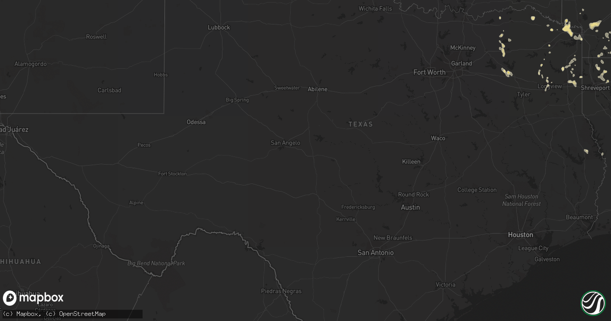
Hail Map in Texas on June 30, 2011
Get this storm
June 30 map
$229
one time, instant access
Download today. No call, no setup
Keep the $229
Bought the map and want the full workflow? Apply the entire $229 to a subscription within 7 days. None of it is wasted.
Every map, not just this one
This buys you this map. Subscription and you get every map we run, in the markets you choose from a few cities to whole states to nationwide. Plus real-time alerts the moment a storm fires.
Contact data
Name, contact info, occupancy, even credit band for addresses in the footprint. You go from where it hit to who to call.
Become the source they trust
Unlimited branding weather history reports on demand. You already have the documented answer ready for the property owner, and you are the one who showed up with it.
Property data and RoofTrace estimates
Pull up any address you have got, its value and the exact code rules for that jurisdiction, straight from One Click Code. Then RoofTrace estimates the squares, pitch, and roof value, priced the way you price.
Storm reports in Texas
Texas
| Date | Description |
|---|---|
| 06/30/20116:59 PM CDT | Two trees down |
| 06/30/20116:50 PM CDT | Trees down on hwy 271. |
| 06/30/20116:38 PM CDT | At east texas medical center. |
| 06/30/20116:30 PM CDT | Heavy wind damage was reported to a sconic drive in and to the tefteller law office in the town of gilmer. |
| 06/30/20116:30 PM CDT | Several trees were downed north of town. Two trees fell across mobile homes. There were no report of injuries. |
| 06/30/20116:25 PM CDT | Trees and power lines down |
| 06/30/20116:15 PM CDT | Sheet metal roofing was removed from a local best western inn located on main street. A motorcycle also received damage from the downed sheet metal. |
| 06/30/20116:05 PM CDT | *** 1 inj *** tornado removed roof of mobile home...debris damaged a car with minor injuries to female occupant...semi flipped over...minor damage to several homes |
| 06/30/20116:05 PM CDT | Turned over a truck near 7724 south cage in pharr... Tornado was seen near the state farm arena in hidalgo. |
| 06/30/20116:00 PM CDT | Large tree across hwy 155. |
| 06/30/20115:57 PM CDT | *** 1 inj *** ef1 tornado damaged mobile home...debris damaged a car with minor injuries to female occupant...several semis flipped over damage...minor damage to severa |
| 06/29/20118:08 PM CDT | 2 trees down across farm market road in northwest rusk county. |
| 06/29/20117:44 PM CDT | Multiple trees and power lines down. |
| 06/29/20117:30 PM CDT | Siding was removed from a car wash at west marshall and pine tree road. Wind damage also reported to the roof of an auto remair shop. Several vehicles were damaged as w |
| 06/29/20117:06 PM CDT | Hwy 80 and fm 1799 intersection multiple trees blown down. |
All States Impacted by Hail Map on June 30, 2011
Cities Impacted by Hail Map on June 30, 2011
- Homer, LA
- Pineland, SC
- Tillman, SC
- Ovid, CO
- Crook, CO
- Chappell, NE
- Sedgwick, CO
- Valparaiso, IN
- Preston, GA
- East Carbon, UT
- Deadwood, SD
- Sturgis, SD
- Piedmont, SD
- Lodge Grass, MT
- Momence, IL
- Hodgen, OK
- Heavener, OK
- Lemoyne, NE
- Thomasville, GA
- Watson, OK
- Newton, GA
- Colquitt, GA
- Merriman, NE
- El Dorado, AR
- Junction City, AR
- Spencer, NE
- Green River, UT
- Muse, OK
- Whitesboro, OK
- Chesterton, IN
- Portage, IN
- Booneville, AR
- Mulberry, AR
- Chicago, IL
- Dolton, IL
- Riverdale, IL
- Evergreen Park, IL
- Cicero, IL
- Evanston, IL
- Blue Island, IL
- Longview, TX
- Oglala, SD
- Pine Ridge, SD
- Pentwater, MI
- Fleming, CO
- Sterling, CO
- Alsip, IL
- Markham, IL
- South Holland, IL
- Harvey, IL
- Glenwood, IL
- Posen, IL
- Homewood, IL
- Hazel Crest, IL
- Calumet City, IL
- Thornton, IL
- Hamlet, IN
- Arthur, NE
- Cameron, OK
- Clarksville, TX
- Bagwell, TX
- Soperton, GA
- Adrian, GA
- Merino, CO
- Padroni, CO
- Atwood, CO
- Spiro, OK
- Lewellen, NE
- Tallahassee, FL
- Crawford, NE
- Foreman, AR
- Hooks, TX
- Ashdown, AR
- New Boston, TX
- Grovertown, IN
- Walkerton, IN
- Lamont, FL
- Haynesville, LA
- Emerson, AR
- Sheridan, WY
- Torrington, WY
- Bradley, AR
- Maybell, CO
- Jay Em, WY
- Fort Laramie, WY
- Benton, LA
- Vernal, UT
- Grant Park, IL
- Buckner, AR
- Stamps, AR
- Banner, WY
- Big Horn, WY
- Story, WY
- Texarkana, AR
- Texarkana, TX
- Franktown, CO
- Elizabeth, CO
- Parker, CO
- Rushville, NE
- Beecher, IL
- Peotone, IL
- Grand Saline, TX
- Alba, TX
- Richton Park, IL
- Bivins, TX
- Newhope, AR
- Dubach, LA
- Gilmer, TX
- Dinosaur, CO
- Wister, OK
- Marshall, TX
- Stephens, AR
- Haxtun, CO
- Fort Lauderdale, FL
- Decker, MT
- Clyo, GA
- Mena, AR
- Brule, NE
- Big Springs, NE
- Crete, IL
- Steger, IL
- Olympia Fields, IL
- Monee, IL
- University Park, IL
- Park Forest, IL
- Chicago Heights, IL
- Whigham, GA
- Pelham, GA
- Camilla, GA
- Porcupine, SD
- Alamo, GA
- Stoneham, CO
- Emory, TX
- De Beque, CO
- Rifle, CO
- Hackett, AR
- Chadron, NE
- Gordon, NE
- Greenville, FL
- Ridgeland, SC
- Eufaula, OK
- Stigler, OK
- Quinton, OK
- Checotah, OK
- Magnolia, AR
- Chester, AR
- Whiting, IN
- Robbins, IL
- Kenilworth, IL
- Wilmette, IL
- Oak Lawn, IL
- Hometown, IL
- Lansing, IL
- Skokie, IL
- Hammond, IN
- Lincolnwood, IL
- Chatsworth, IL
- Forrest, IL
- Waskom, TX
- Karnack, TX
- Crawfordville, FL
- Mount Holly, AR
- Smithville, OK
- Honobia, OK
- Haughton, LA
- Princeton, LA
- Hemingford, NE
- Parmelee, SD
- Norris, SD
- Clearmont, WY
- De Kalb, TX
- Alzada, MT
- Hobart, IN
- Crown Point, IN
- Merrillville, IN
- Honey Grove, TX
- Sumner, TX
- Matteson, IL
- Cody, NE
- Nenzel, NE
- Arcadia, LA
- Sierra Vista, AZ
- Fort Huachuca, AZ
- Linden, TX
- Jefferson, TX
- Sidney, NE
- Umpire, AR
- Alma, AR
- Mountainburg, AR
- Pompano Beach, FL
- Julesburg, CO
- Berryville, AR
- Eureka Springs, AR
- Talihina, OK
- Rangely, CO
- Taylor, AR
- Yemassee, SC
- Coosawhatchie, SC
- Climax, GA
- Bainbridge, GA
- Pecan Gap, TX
- Cooper, TX
- Ludington, MI
- Gibsland, LA
- Red Oak, OK
- Thompson, UT
- Swainsboro, GA
- Plain Dealing, LA
- Moorcroft, WY
- Hulett, WY
- Weston, WY
- Algoma, WI
- Kewaunee, WI
- Lockesburg, AR
- Oak Forest, IL
- Peetz, CO
- Somerset, CO
- Garfield, GA
- Twin City, GA
- Price, UT
- Langley, AR
- Hardeeville, SC
- Okatie, SC
- Elgin, AZ
- Mooringsport, LA
- Weldona, CO
- Casco, WI
- Dry Branch, GA
- Alliance, NE
- Gary, IN
- Sundance, WY
- Devils Tower, WY
- Heflin, LA
- Dubberly, LA
- Sibley, LA
- Pineland, TX
- Omaha, TX
- Mcalester, OK
- Lamar, OK
- Sulphur Springs, TX
- Snyder, CO
- Lowell, IN
- Hebron, IN
- Demotte, IN
- Gloster, MS
- Liberty, MS
- Wyola, MT
- Frankfort, MI
- Holyoke, CO
- Guyton, GA
- Manteno, IL
- Macon, GA
- Wrightsville, GA
- East Dublin, GA
- Atkinson, NE
- Fulton, AR
- Hope, AR
- Albany, GA
- Stuart, NE
- Gypsum, CO
- Hemphill, TX
- Bronson, TX
- Mccurtain, OK
- Fruita, CO
- Grand Junction, CO
- Lewisville, AR
- White River, SD
- Okaton, SD
- Saint Francis, SD
- Lake Station, IN
- Meeker, CO
- Saint John, IN
- Dyer, IN
- Schererville, IN
- Fort Collins, CO
- Loveland, CO
- Brashear, TX
- Cumby, TX
- Florien, LA
- Pittsburg, TX
- Porum, OK
- Kinta, OK
- Hay Springs, NE
- Rosston, AR
- Manderson, SD
- Lake Village, IN
- Schneider, IN
- Havana, FL
- Hanna, WY
- Kilgore, NE
- Oelrichs, SD
- Charleston, AR
- Dyer, AR
- Waldo, AR
- Whitman, NE
- Hyannis, NE
- Montague, MI
- New Era, MI
- Simsboro, LA
- Castle Rock, CO
- Avery, TX
- Wilburton, OK
- Oshkosh, NE
- Pagosa Springs, CO
- Bokoshe, OK
- Keota, OK
- East Chicago, IN
- Munster, IN
- Flossmoor, IL
- Midlothian, IL
- Murdo, SD
- Poteau, OK
- Huntington, UT
- Pocola, OK
- Wheatfield, IN
- Bentonville, AR
- Hart, MI
- Shelby, MI
- Mears, MI
- Monticello, FL
- Jeffersonville, GA
- Bangor, MI
- Port Wentworth, GA
- Daingerfield, TX
- Naples, TX
- Larkspur, CO
- Shongaloo, LA
- Mineral Springs, AR
- Bethel, OK
- Whitney, NE
- Hollywood, FL
- Pembroke Township, IL
- Beaverville, IL
- Morocco, IN
- Atlanta, TX
- Roxton, TX
- Kilgore, TX
- Lisbon, LA
- Manistee, MI
- Free Soil, MI
- Rockledge, GA
- Kite, GA
- Mineola, TX
- Newington, GA
- Springfield, GA
- Bernice, LA
- Summerfield, LA
- Waldron, AR
- Klondike, TX
- Moncks Corner, SC
- Ferron, UT
- Paris, MI
- Valley, AL
- Salem, AL
- Smackover, AR
- Minden, LA
- Columbia, AL
- Fort Morgan, CO
- Cedar Lake, IN
- Kouts, IN
- Bennett, CO
- Watkins, CO
- Garnett, SC
- Kirby, AR
- Valentine, NE


