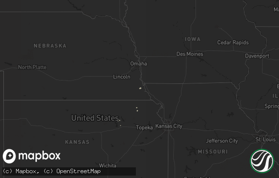
Hail Map in Indiana on June 28, 2012
The weather event in Indiana on June 28, 2012 includes Hail map. 15 states and 520 cities were impacted and suffered possible damage. The total estimated number of properties impacted is 0.

Hail
0
Estimated number of impacted properties by a 1.00" hail or larger0
Estimated number of impacted properties by a 1.75" hail or larger0
Estimated number of impacted properties by a 2.50" hail or largerStorm reports in Indiana
Indiana
| Date | Description |
|---|---|
| 06/27/20129:29 PM CDT | 3 to 5 inch large limbs down and dime sized hail |
| 06/27/20129:20 PM CDT | Multiple reports of trees and power lines down in and around the town. |
| 06/27/20129:20 PM CDT | Barn blown off foundation and destroyed in 7000 block of east cr 800 n |
| 06/27/20129:10 PM CDT | Tree down on sr 17 and sr 114 |
| 06/27/20129:05 PM CDT | Power line down on tree causing sparking on 300 n |
| 06/27/20129:00 PM CDT | A local report indicates 1.00 inch wind near KEWANNA |
| 06/27/20129:00 PM CDT | Tree down on park st |
| 06/27/20128:58 PM CDT | 1400 n near wheatfield |
| 06/27/20128:40 PM CDT | Numerous reports of trees and power lines down across the northern portion of the county |
| 06/27/20128:32 PM CDT | Trees and power lines down. |
| 06/27/20128:32 PM CDT | A local report indicates 1.00 inch wind near 1 NW CEDAR LAKE |
| 06/27/20128:27 PM CDT | 50 to 60 mph wind gusts with pea sized hail |
| 06/27/20128:25 PM CDT | 15 trees down in and south of town |
| 06/27/20128:25 PM CDT | A local report indicates 60 MPH wind near NORTH JUDSON |
| 06/27/20128:18 PM CDT | Indiana route 8 2 mi e of hebron tree limbs down |
| 06/27/20128:10 PM CDT | 3 telephone poles down on us 421 just north of sr 8 |
| 06/27/20127:56 PM CDT | Trees down |
| 06/27/20127:43 PM CDT | Interstate 65 exit 249. |
| 06/27/20127:41 PM CDT | I-80 and cline avenue |
| 06/27/20127:36 PM CDT | Ridge avenue and cline avenue. |
| 06/27/20127:36 PM CDT | A local report indicates 1.75 inch wind near DYER |
| 06/27/20127:31 PM CDT | Mostly quarter-sized hail. 109 court and northgate. |
| 06/27/20127:30 PM CDT | Car dents. |
| 06/27/20127:30 PM CDT | Estimated tennis ball sized hail. Largest hail was just under baseball size. |
| 06/27/20127:30 PM CDT | Reported at a fire station in munster. |
| 06/27/20127:28 PM CDT | Nickel to quarter sized hail. |
| 06/27/20127:25 PM CDT | A local report indicates 1.75 inch wind near MUNSTER |
| 06/27/20127:20 PM CDT | Largest was 2.25 inches |
| 06/27/20127:20 PM CDT | Quarter-size to golf ball size. Hail occurred in the munster in/lansing il area. |
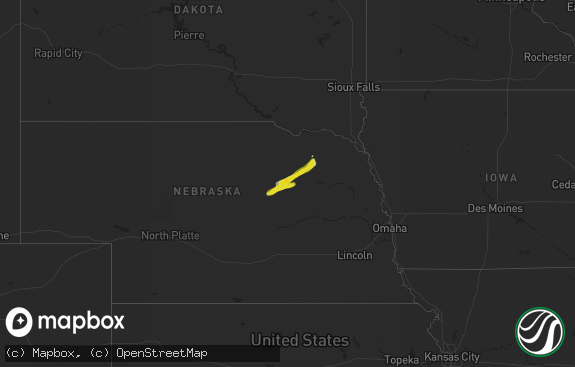
All States Impacted by Hail Map on June 28, 2012
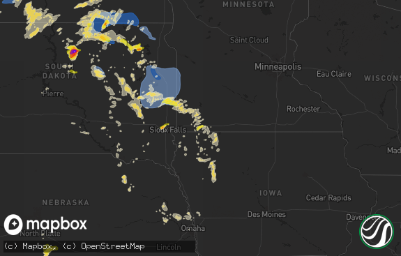
Cities Impacted by Hail Map on June 28, 2012
- Haigler, NE
- Herndon, PA
- Dornsife, PA
- Klingerstown, PA
- Mission, SD
- Hayes Center, NE
- Kennerdell, PA
- Cranberry, PA
- Franklin, PA
- Cockeysville, MD
- Parkville, MD
- Perry Hall, MD
- White Marsh, MD
- Lutherville Timonium, MD
- Towson, MD
- Middle River, MD
- Phoenix, MD
- Baldwin, MD
- Upper Falls, MD
- Sparks Glencoe, MD
- Rosedale, MD
- Glen Arm, MD
- Joppa, MD
- Hydes, MD
- Kingsville, MD
- Nottingham, MD
- Fallston, MD
- Fork, MD
- Huntingdon, PA
- McDonald, KS
- Saint Francis, SD
- Elgin, AZ
- Sonoita, AZ
- Monroeville, NJ
- Elmer, NJ
- Mullica Hill, NJ
- Swedesboro, NJ
- Woodstown, NJ
- Max, NE
- Stratton, NE
- Trenton, NE
- Titusville, PA
- Centerville, PA
- Wellsboro, PA
- Tionesta, PA
- Oil City, PA
- Pleasantville, PA
- Coatesville, PA
- West Grove, PA
- Lockport, IL
- Winterset, IA
- Earlham, IA
- Knox, PA
- Emlenton, PA
- Fortescue, NJ
- Lucerne, IN
- Kewanna, IN
- Twelve Mile, IN
- Rochester, IN
- Moorefield, NE
- Orwell, OH
- Elgin, IL
- Bartlett, IL
- South Elgin, IL
- Smethport, PA
- Gifford, PA
- Rockton, PA
- Penfield, PA
- Du Bois, PA
- Hammonton, NJ
- Atco, NJ
- Waterford Works, NJ
- Springview, NE
- Calumet City, IL
- South Holland, IL
- Lansing, IL
- Chappell, NE
- Gunpowder, MD
- Edgewood, MD
- Colon, NE
- Grand Valley, PA
- Haxtun, CO
- Sedgwick, CO
- Conneaut Lake, PA
- Upperstrasburg, PA
- Fannettsburg, PA
- Fort Loudon, PA
- Willow Hill, PA
- Salix, IA
- Parmelee, SD
- Fleming, CO
- Cambridge Springs, PA
- Guys Mills, PA
- Townville, PA
- Penns Grove, NJ
- Salem, NJ
- Cape May, NJ
- Wildwood, NJ
- Garland, PA
- Spring Creek, PA
- Spartansburg, PA
- Corry, PA
- Pittsfield, PA
- Beaver Crossing, NE
- Philadelphia, PA
- Roca, NE
- Julian, PA
- Bellefonte, PA
- Warren, PA
- Youngsville, PA
- Irvine, PA
- Nogales, AZ
- Blue Island, IL
- Posen, IL
- Harvey, IL
- Crosby, PA
- Palisade, NE
- Frankfort, IL
- Orland Park, IL
- Mokena, IL
- Tinley Park, IL
- Conneautville, PA
- Saegertown, PA
- Jamestown, PA
- Midlothian, IL
- Palos Heights, IL
- Crestwood, IL
- Shippensburg, PA
- Biglerville, PA
- Fayetteville, PA
- Orrtanna, PA
- Vowinckel, PA
- Cooksburg, PA
- Leeper, PA
- Holyoke, CO
- Crown Point, IN
- Wallace, NE
- Dickens, NE
- Amado, AZ
- Pennsville, NJ
- Oxford, PA
- Kirkwood, PA
- Nottingham, PA
- Peach Bottom, PA
- Quarryville, PA
- Atwood, KS
- Bridgeton, NJ
- Alloway, NJ
- Saint John, IN
- Dyer, IN
- Morrisdale, PA
- Rio Rico, AZ
- Andover, OH
- Jefferson, OH
- Williamsfield, OH
- Bear Lake, PA
- Valparaiso, IN
- Oak Lawn, IL
- Hammond, IN
- Griffith, IN
- Markham, IL
- Evergreen Park, IL
- Hometown, IL
- Hobart, IN
- Burbank, IL
- Schererville, IN
- Chicago, IL
- East Chicago, IN
- Merrillville, IN
- Highland, IN
- Steger, IL
- Hebron, IN
- Gary, IN
- Munster, IN
- Cedar Lake, IN
- Thornton, IL
- Dolton, IL
- Chicago Heights, IL
- Robbins, IL
- Alsip, IL
- Lowell, IN
- Crete, IL
- Riverdale, IL
- Ovid, CO
- Carrolltown, PA
- Curwensville, PA
- New Millport, PA
- Olanta, PA
- Matteson, IL
- Chambersburg, PA
- Gettysburg, PA
- Burwell, NE
- Elkton, MD
- Port Allegany, PA
- Roulette, PA
- Mohrsville, PA
- Leesport, PA
- Bernville, PA
- Three Springs, PA
- Mapleton Depot, PA
- Seneca, PA
- Shippenville, PA
- Clarion, PA
- Sligo, PA
- New Bethlehem, PA
- Fairmount City, PA
- Clarendon, PA
- Sugar Grove, PA
- Russell, PA
- Columbus, PA
- Lickingville, PA
- Richland, PA
- Lebanon, PA
- Newmanstown, PA
- Myerstown, PA
- Macy, IN
- Houston, TX
- Missouri City, TX
- Stafford, TX
- Orrstown, PA
- Kouts, IN
- Martinsburg, PA
- Saxton, PA
- North Bloomfield, OH
- Tower City, PA
- Valley View, PA
- Muir, PA
- Hegins, PA
- Pine Grove, PA
- Sacramento, PA
- Bethel, PA
- Gallitzin, PA
- Ashville, PA
- Loretto, PA
- Rossiter, PA
- Oliveburg, PA
- Glen Campbell, PA
- Mahaffey, PA
- Summerville, PA
- Coolspring, PA
- Anita, PA
- Reynoldsville, PA
- Brookville, PA
- De Lancey, PA
- Punxsutawney, PA
- Marienville, PA
- Hunt Valley, MD
- Abingdon, MD
- Pierpont, OH
- Fontanelle, IA
- Glenmoore, PA
- Elverson, PA
- Hazel Crest, IL
- Country Club Hills, IL
- Glenwood, IL
- Homewood, IL
- Flossmoor, IL
- Aurora, NE
- Sigel, PA
- Adamsville, PA
- Atlantic, PA
- Greenville, PA
- Indianola, NE
- Stockville, NE
- Curtis, NE
- Reading, PA
- Bradford, PA
- Chestertown, MD
- Rock Hall, MD
- Yuma, CO
- Benkelman, NE
- Harsens Island, MI
- Linesville, PA
- Cochranton, PA
- Meadville, PA
- Deerfield, IL
- Highland Park, IL
- Wellfleet, NE
- Alexandria, PA
- Dorset, OH
- Sparrows Point, MD
- Essex, MD
- Dundalk, MD
- Kennett Square, PA
- Polk, NE
- Malmo, NE
- Kinzers, PA
- New Holland, PA
- Gap, PA
- Gordonville, PA
- Mayport, PA
- Birdsboro, PA
- Maywood, NE
- Winner, SD
- Pottstown, PA
- Spring City, PA
- Phoenixville, PA
- Hanover, PA
- Spring Grove, PA
- Rensselaer, IN
- Wheatfield, IN
- Kirk, CO
- Joes, CO
- Rollinsville, CO
- Farmdale, OH
- Kinsman, OH
- Hawk Run, PA
- Philipsburg, PA
- Munson, PA
- Chadds Ford, PA
- Temple, PA
- Winamac, IN
- Knox, IN
- La Crosse, IN
- Monterey, IN
- San Pierre, IN
- North Judson, IN
- Denver, PA
- Ephrata, PA
- Stevens, PA
- Genesee, PA
- Ebensburg, PA
- Duncansville, PA
- Altoona, PA
- Schuyler, NE
- Streamwood, IL
- Hanover Park, IL
- Leola, PA
- Bird In Hand, PA
- Lititz, PA
- Manheim, PA
- Lancaster, PA
- Narvon, PA
- Hershey, PA
- East Earl, PA
- Elizabethtown, PA
- Palmyra, PA
- East Petersburg, PA
- Ronks, PA
- Reinholds, PA
- Adamstown, PA
- Mohnton, PA
- Newtown Square, PA
- Berwyn, PA
- Parsippany, NJ
- Norristown, PA
- Collegeville, PA
- Patagonia, AZ
- Frenchville, PA
- Chester Springs, PA
- Malvern, PA
- Tyrone, PA
- Westminster, MD
- Manchester, MD
- Hampstead, MD
- Eustis, NE
- Eckley, CO
- Wernersville, PA
- Akron, PA
- Mount Gretna, PA
- Intercourse, PA
- Morgantown, PA
- Hummelstown, PA
- Harrisburg, PA
- Brownstown, PA
- Callaway, NE
- Broken Bow, NE
- Pleasant Hall, PA
- North Platte, NE
- Lansdale, PA
- Harleysville, PA
- Hydetown, PA
- West Decatur, PA
- Allport, PA
- Wallaceton, PA
- Woodland, PA
- Coudersport, PA
- Newville, PA
- Carlisle, PA
- David City, NE
- Linwood, NE
- Lykens, PA
- Williamstown, PA
- Spring Glen, PA
- Warriors Mark, PA
- Osceola Mills, PA
- Denver, IN
- Douglassville, PA
- Oley, PA
- Womelsdorf, PA
- Boyertown, PA
- Galeton, PA
- Sprankle Mills, PA
- Walston, PA
- Boulder, CO
- Cooperstown, PA
- Schwenksville, PA
- Rome, OH
- Springboro, PA
- Kingsville, OH
- Conneaut, OH
- Park Forest, IL
- Olympia Fields, IL
- Richton Park, IL
- Oshkosh, NE
- Culbertson, NE
- Waterford, PA
- Hartstown, PA
- Edinboro, PA
- Strattanville, PA
- Utica, PA
- Hadley, PA
- Union City, PA
- Lucinda, PA
- Venus, PA
- Sandy Lake, PA
- Carlton, PA
- Rouseville, PA
- Polk, PA
- Fryburg, PA
- Venango, PA
- Kossuth, PA
- Marble, PA
- Crescent, IA
- Parks, NE
- Littlestown, PA
- Wray, CO
- Oak Forest, IL
- Pennsylvania Furnace, PA
- Spruce Creek, PA
- Palos Park, IL
- Homer Glen, IL
- Maxwell, NE
- Kearney, NE
- Albion, PA
- Corsica, PA
- Sandy Ridge, PA
- Newark, DE
- West Chester, PA
- Downingtown, PA
- Wilmington, DE
- New Castle, DE
- Ridgway, PA
- Comstock, NE
- Washington Boro, PA
- Columbia, PA
- Clarington, PA
- Cyclone, PA
- Lewis Run, PA
- Bainbridge, PA
- Mount Wolf, PA
- Lemont, IL
- Tumacacori, AZ
- Beecher, IL
- Bridgeview, IL
- Peru, IN
- Chicago Ridge, IL
- Star City, IN
- Demotte, IN
- Boone Grove, IN
- Logansport, IN
- Worth, IL
- White River, SD
- Sargent, NE
- Pedricktown, NJ
- Hollidaysburg, PA
- Williamstown, NJ
- Pitman, NJ
- Blackwood, NJ
- Sewell, NJ
- Glassboro, NJ
- Columbus, NE
- Hillsdale, PA
- Commodore, PA
- Marion Center, PA
- Cherry Tree, PA
- Clearfield, PA
- Luthersburg, PA
- Tidioute, PA
- Timblin, PA
- Wauneta, NE
- Austin, PA
- Somerdale, NJ
- Berlin, NJ
- Stratford, NJ
- West Berlin, NJ
- Magnolia, NJ
- Voorhees, NJ
- Mount Ephraim, NJ
- Gibbsboro, NJ
- Runnemede, NJ
- Clementon, NJ
- Barrington, NJ
- Bellmawr, NJ
- Woodbury, NJ
- Gloucester City, NJ
- Westville, NJ
- Haddon Heights, NJ
- Glendora, NJ
- Lincoln, NE
- Falls Creek, PA
- Monkton, MD
- Parkton, MD
- Aberdeen Proving Ground, MD
- Baltimore, MD
- Fort Howard, MD
- Bolingbrook, IL
- Darien, IL
- Naperville, IL
- Woodridge, IL
- Downers Grove, IL
- Hoxie, KS
- Port Norris, NJ
- Cedarville, NJ
- Millville, NJ
- Mauricetown, NJ
- Exton, PA
- State College, PA
- Spring Mills, PA
- Centre Hall, PA


