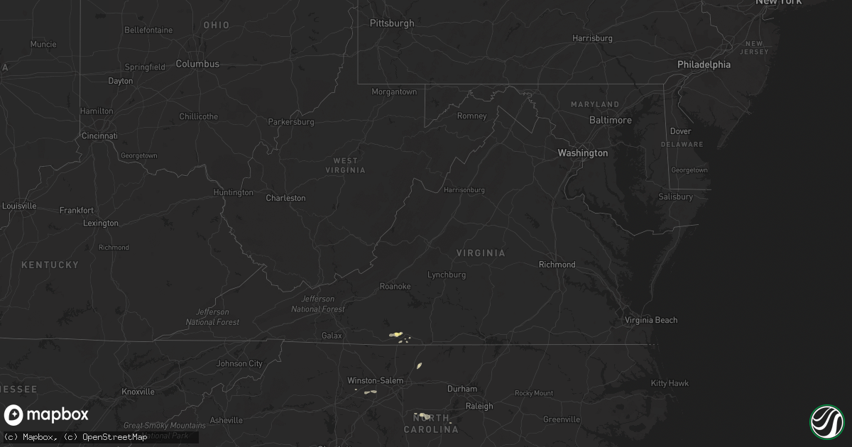
Hail Map in Virginia on June 27, 2015
Get this storm
June 27 map
$229
one time, instant access
Download today. No call, no setup
Keep the $229
Bought the map and want the full workflow? Apply the entire $229 to a subscription within 7 days. None of it is wasted.
Every map, not just this one
This buys you this map. Subscription and you get every map we run, in the markets you choose from a few cities to whole states to nationwide. Plus real-time alerts the moment a storm fires.
Contact data
Name, contact info, occupancy, even credit band for addresses in the footprint. You go from where it hit to who to call.
Become the source they trust
Unlimited branding weather history reports on demand. You already have the documented answer ready for the property owner, and you are the one who showed up with it.
Property data and RoofTrace estimates
Pull up any address you have got, its value and the exact code rules for that jurisdiction, straight from One Click Code. Then RoofTrace estimates the squares, pitch, and roof value, priced the way you price.
Storm reports in Virginia
Virginia
| Date | Description |
|---|---|
| 06/27/20156:41 PM CDT | A few tree limbs down on power lines along trents ferry road in the northern part of the city of lynchburg knocking power out to the area. |
| 06/27/20156:29 PM CDT | County 911 center reports tree down at 60 elijah circle. |
| 06/27/20156:23 PM CDT | Several limbs down near the smith river sports complex on the u.s. 220 bypass near axton. Time estimated by radar. |
| 06/27/20156:17 PM CDT | 911 center reported that a tree was down in the 2000 block of meadowview lane. Time estimated by radar. |
| 06/27/20156:15 PM CDT | 911 center reports that a tree was down in the 1200 block of spruce street within the city of martinsville. The tree fell on a power line and set the associated transmi |
| 06/27/20156:12 PM CDT | Public reports half-dollar sized hail fell along the 58 bypass near 220 south of martinsville... Va. |
| 06/27/20156:10 PM CDT | 911 center reports that a tree was down on a power line in the 700 block of perdue street within the city of martinsville. Time estimated from radar. |
| 06/27/20156:05 PM CDT | Tree fell on a parked vehicle on spring road in collinsville. Time estimated by radar. |
| 06/27/20156:02 PM CDT | County 911 center reported tree down at 8060 old d and w road on the west side of martinsville. Time estimated by radar. |
| 06/27/20155:01 PM CDT | Trained spotter reports tree down on a power line in the 2000 block of overstreet creek road just down the mountain from peaks of otter state park. |
| 06/27/20152:27 PM CDT | Tornado reported near the hanover county airport |
| 06/27/20152:14 PM CDT | Trees down near intersection of river road and bragg road. |
| 06/27/20151:30 PM CDT | Multiple trees down south of i-264. One tree on a residence. |
All States Impacted by Hail Map on June 27, 2015
Cities Impacted by Hail Map on June 27, 2015
- Walhalla, ND
- Currie, MN
- Westbrook, MN
- Walnut Grove, MN
- Reynolds, ND
- Northwood, ND
- Hatton, ND
- Mayville, ND
- Dumont, MN
- Arvilla, ND
- Emerado, ND
- Larimore, ND
- Cubero, NM
- Dulce, NM
- Walcott, ND
- Sharon, ND
- Gallina, NM
- Jemez Springs, NM
- Adams, ND
- Lankin, ND
- Fordville, ND
- Wheaton, MN
- Graceville, MN
- Farwell, MN
- Starbuck, MN
- Kensington, MN
- Kearny, AZ
- Ramseur, NC
- Mekinock, ND
- Forest River, ND
- Grand Forks Afb, ND
- Gilby, ND
- Inkster, ND
- Placitas, NM
- Show Low, AZ
- Thompson, ND
- Chokio, MN
- Mora, NM
- Saint Matthews, SC
- Cameron, SC
- San Ysidro, NM
- Jemez Pueblo, NM
- Westport, SD
- Leola, SD
- Madison, MN
- Odessa, MN
- Fairmount, ND
- Hankinson, ND
- Bellingham, MN
- Wahpeton, ND
- Tintah, MN
- Ortonville, MN
- Lidgerwood, ND
- Rosholt, SD
- Mantador, ND
- Wyndmere, ND
- Clinton, MN
- Mooreton, ND
- Cummings, ND
- Katy, TX
- Enderlin, ND
- Wolsey, SD
- Alpena, SD
- Huron, SD
- Tracy, MN
- Catarina, TX
- Asherton, TX
- Milton, ND
- Langdon, ND
- Park River, ND
- Grafton, ND
- Pisek, ND
- Cavalier, ND
- Hoople, ND
- Edinburg, ND
- Mountain, ND
- Osnabrock, ND
- Hawley, MN
- Fort Pierre, SD
- Galesburg, ND
- Hunter, ND
- Hoffman, NC
- Pinebluff, NC
- Oracle, AZ
- Kindred, ND
- Sanford, NC
- Pembina, ND
- Bathgate, ND
- Sapello, NM
- Las Vegas, NM
- Rociada, NM
- Vallecitos, NM
- Mcleod, ND
- Lisbon, ND
- Sheldon, ND
- Valley City, ND
- Milnor, ND
- Fingal, ND
- Nome, ND
- Bear Creek, NC
- Siler City, NC
- Ipswich, SD
- Mapleton, ND
- Eagle Butte, SD
- Warren, MN
- Fairmont, NC
- Aberdeen, SD
- Fredonia, ND
- Brentford, SD
- Mansfield, SD
- Mellette, SD
- Frederick, SD
- Ashley, ND
- Warner, SD
- Forbes, ND
- Hitchcock, SD
- Axton, VA
- Alvarado, MN
- Euclid, MN
- Medina, TX
- Finley, ND
- Martinsville, VA
- Bernalillo, NM
- Hillsboro, ND
- Clifford, ND
- Jud, ND
- Kulm, ND
- Edgeley, ND
- Pelican Rapids, MN
- Ribera, NM
- Youngsville, LA
- Lafayette, LA
- Minneota, MN
- Boyd, MN
- Barry, MN
- Correll, MN
- Barney, ND
- Oriska, ND
- Dawson, MN
- Hope, ND
- Uvalde, TX
- Gibsonville, NC
- Browns Summit, NC
- Reidsville, NC
- Leonard, ND
- Cotulla, TX
- Wheatland, ND
- Thomaston, GA
- Riviera, TX
- Holloway, MN
- Canby, MN
- Campbell, MN
- Sisseton, SD
- Reserve, NM
- Globe, AZ
- Culloden, GA
- Musella, GA
- Mitchell, SD
- Ethan, SD
- Mount Vernon, SD
- Laredo, TX
- Macon, GA
- Dry Branch, GA
- Aneta, ND
- Casselton, ND
- Amenia, ND
- Davenport, ND
- Letcher, SD
- Woonsocket, SD
- Redfield, SD
- Dimock, SD
- Tulare, SD
- Reno, NV
- Cleveland, NM
- Cuba, NM
- Dalton, MN
- Elbow Lake, MN
- Ashby, MN
- Wedowee, AL
- Lineville, AL
- Portland, ND
- Fergus Falls, MN
- Shorterville, AL
- Clemmons, NC
- Advance, NC
- Yatesville, GA
- Troy, SC
- Houston, TX
- Tijeras, NM
- Mocksville, NC
- Cedar Crest, NM
- Leakey, TX
- Rio Frio, TX
- Cresbard, SD
- Port Saint Lucie, FL
- Durango, CO
- Big Falls, MN
- Eagar, AZ
- Glorieta, NM
- Sumter, SC
- Dalzell, SC
- Humble, TX
- Erie, ND
- Litchville, ND
- Rowland, NC
- Lumberton, NC
- Hoffman, MN
- Barrett, MN
- Evansville, MN
- Algodones, NM
- White Castle, LA
- Goliad, TX
- Pie Town, NM
- Pecos, NM
- Arthur, ND
- Roanoke, AL
- Jay, FL
- Cottonwood, MN
- Hanley Falls, MN
- Clarkfield, MN
- Montezuma, NM
- Tererro, NM
- Horace, ND
- Marana, AZ
- Clewiston, FL
- Wadley, AL
- Colfax, ND
- Union Springs, AL
- Abbeville, AL
- Ridgeway, VA
- Franklin, GA
- Buena Vista, CO
- Niagara, ND
- Molena, GA
- Big Wells, TX
- Crystal, ND
- Argyle, MN
- Winston Salem, NC
- Lexington, NC
- Scott, LA
- Monte Vista, CO
- Sandia Park, NM
- Darlington, SC
- Brenham, TX
- Newville, AL
- Headland, AL
- Blanchard, ND
- Argusville, ND
- Tierra Amarilla, NM
- Schulenburg, TX
- Freeport, TX
- Ashland, AL
- Ocate, NM
- Collinsville, VA
- Canal Point, FL
- Tomball, TX
- Stratford, SD
- Appleton, MN
- Fieldale, VA
- Ponderosa, NM
- Buxton, ND
- Hensel, ND
- Absaraka, ND
- Ayr, ND


