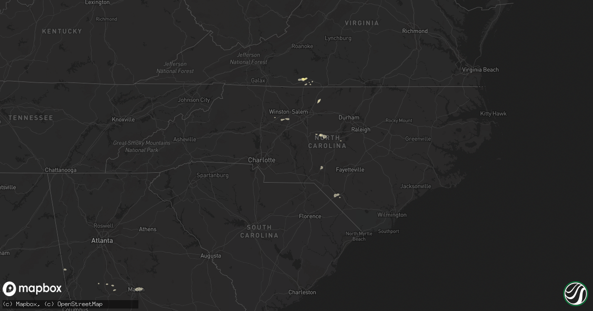
Hail Map in North Carolina on June 27, 2015
Get this storm
June 27 map
$229
one time, instant access
Download today. No call, no setup
Keep the $229
Bought the map and want the full workflow? Apply the entire $229 to a subscription within 7 days. None of it is wasted.
Every map, not just this one
This buys you this map. Subscription and you get every map we run, in the markets you choose from a few cities to whole states to nationwide. Plus real-time alerts the moment a storm fires.
Contact data
Name, contact info, occupancy, even credit band for addresses in the footprint. You go from where it hit to who to call.
Become the source they trust
Unlimited branding weather history reports on demand. You already have the documented answer ready for the property owner, and you are the one who showed up with it.
Property data and RoofTrace estimates
Pull up any address you have got, its value and the exact code rules for that jurisdiction, straight from One Click Code. Then RoofTrace estimates the squares, pitch, and roof value, priced the way you price.
Storm reports in North Carolina
North Carolina
| Date | Description |
|---|---|
| 06/27/20156:53 PM CDT | Tree down at 1706 nc highway 50. Time estimated by radar... |
| 06/27/20156:50 PM CDT | Multiple trees down blocking one lane of hwy 42. |
| 06/27/20156:40 PM CDT | Trees down at the intersection of nc 50/210. |
| 06/27/20156:37 PM CDT | Trees down near the intersection of nc 50/210.. |
| 06/27/20156:30 PM CDT | Tree down on a car along nc 27 between holder road and peach farm road. |
| 06/27/20155:50 PM CDT | Multiple trees reported down in sanford. |
| 06/27/20155:42 PM CDT | Multiple trees down in southern pines. |
| 06/27/20155:06 PM CDT | Five or six trees and numerous small branches down near intersection of hwy 51 and carmel rd. Time estimated from radar. |
| 06/27/20155:05 PM CDT | Tree down on a mobile home in new hope mobile home park. |
| 06/27/20154:46 PM CDT | Tornado on the ground at the 421/421 business interchange. Tornado resulted in a couple trees down and minor shingle damage. |
| 06/27/20154:46 PM CDT | Multiple trees down from possible tornado near cotten road. |
| 06/27/20154:30 PM CDT | A brief ef0 tornado touched down just off us highway 74 near sandy creek. The tornado caused roof damage...moved a farm tractor...and a large tree fell and broke a fenc |
| 06/27/20154:12 PM CDT | One tree down on edwards hill church road near providence church road. |
| 06/27/20154:05 PM CDT | Several reports of trees down in the clemmons area. |
| 06/27/20154:05 PM CDT | 911 call center reports multiple limbs greater than 4 inches in diameter down along route 158 near the intersection of bethesda church road. |
| 06/27/20154:00 PM CDT | 911 call center reports 1 tree down along nc 150 just outside of cherry gove... Nc. |
| 06/27/20153:56 PM CDT | One tree down on airport road near oakley church road. |
| 06/26/201510:05 PM CDT | Tree down on jasper rd near rocky run rd. |
| 06/26/20159:50 PM CDT | Tree down on highway near the intersection of burgaw highway and holly shelter rd. |
| 06/26/20159:28 PM CDT | Tree down near hwy 24 in kenansville. |
| 06/26/20158:55 PM CDT | One tree reported down |
| 06/26/20158:45 PM CDT | Tree knocked into power lines |
| 06/26/20158:16 PM CDT | Emergency manager reports 3 to 4 trees down around the city of bladenboro. Numerous reports of power outages across the county as well. Time estimated by radar. |
| 06/26/20158:13 PM CDT | A few trees down in the city of elizabethtown. Time estimated by radar. |
| 06/26/20157:47 PM CDT | Two large trees down. |
| 06/26/20157:45 PM CDT | Tornado downed 3 ft diameter pecan tree and other large trees. Pecan tree damaged the roof of a home in the allenton community on nc highway 211. |
| 06/26/20157:38 PM CDT | Tree blown down on highway. |
| 06/26/20157:31 PM CDT | 2 pine trees snapped that fell onto home and damaged roof. |
| 06/26/20157:29 PM CDT | Several pine trees were snapped and or uprooted. |
| 06/26/20157:28 PM CDT | Several pine trees were uprooted. |
| 06/26/20157:24 PM CDT | Several trees uprooted and snapped. |
| 06/26/20157:23 PM CDT | Trees down at bizzell grove chruch rd and lowell mill rd. Radar estimated time. |
| 06/26/20157:23 PM CDT | Report of roof off barn along with trees and powerlines in the roadway at the intersection of hwy 301 s and chicken rd near i-95. Possible tornado damage. Time estimate |
| 06/26/20157:23 PM CDT | Nws storm survey confirms ef-1 tornado touched down. |
All States Impacted by Hail Map on June 27, 2015
Cities Impacted by Hail Map on June 27, 2015
- Walhalla, ND
- Currie, MN
- Westbrook, MN
- Walnut Grove, MN
- Reynolds, ND
- Northwood, ND
- Hatton, ND
- Mayville, ND
- Dumont, MN
- Arvilla, ND
- Emerado, ND
- Larimore, ND
- Cubero, NM
- Dulce, NM
- Walcott, ND
- Sharon, ND
- Gallina, NM
- Jemez Springs, NM
- Adams, ND
- Lankin, ND
- Fordville, ND
- Wheaton, MN
- Graceville, MN
- Farwell, MN
- Starbuck, MN
- Kensington, MN
- Kearny, AZ
- Ramseur, NC
- Mekinock, ND
- Forest River, ND
- Grand Forks Afb, ND
- Gilby, ND
- Inkster, ND
- Placitas, NM
- Show Low, AZ
- Thompson, ND
- Chokio, MN
- Mora, NM
- Saint Matthews, SC
- Cameron, SC
- San Ysidro, NM
- Jemez Pueblo, NM
- Westport, SD
- Leola, SD
- Madison, MN
- Odessa, MN
- Fairmount, ND
- Hankinson, ND
- Bellingham, MN
- Wahpeton, ND
- Tintah, MN
- Ortonville, MN
- Lidgerwood, ND
- Rosholt, SD
- Mantador, ND
- Wyndmere, ND
- Clinton, MN
- Mooreton, ND
- Cummings, ND
- Katy, TX
- Enderlin, ND
- Wolsey, SD
- Alpena, SD
- Huron, SD
- Tracy, MN
- Catarina, TX
- Asherton, TX
- Milton, ND
- Langdon, ND
- Park River, ND
- Grafton, ND
- Pisek, ND
- Cavalier, ND
- Hoople, ND
- Edinburg, ND
- Mountain, ND
- Osnabrock, ND
- Hawley, MN
- Fort Pierre, SD
- Galesburg, ND
- Hunter, ND
- Hoffman, NC
- Pinebluff, NC
- Oracle, AZ
- Kindred, ND
- Sanford, NC
- Pembina, ND
- Bathgate, ND
- Sapello, NM
- Las Vegas, NM
- Rociada, NM
- Vallecitos, NM
- Mcleod, ND
- Lisbon, ND
- Sheldon, ND
- Valley City, ND
- Milnor, ND
- Fingal, ND
- Nome, ND
- Bear Creek, NC
- Siler City, NC
- Ipswich, SD
- Mapleton, ND
- Eagle Butte, SD
- Warren, MN
- Fairmont, NC
- Aberdeen, SD
- Fredonia, ND
- Brentford, SD
- Mansfield, SD
- Mellette, SD
- Frederick, SD
- Ashley, ND
- Warner, SD
- Forbes, ND
- Hitchcock, SD
- Axton, VA
- Alvarado, MN
- Euclid, MN
- Medina, TX
- Finley, ND
- Martinsville, VA
- Bernalillo, NM
- Hillsboro, ND
- Clifford, ND
- Jud, ND
- Kulm, ND
- Edgeley, ND
- Pelican Rapids, MN
- Ribera, NM
- Youngsville, LA
- Lafayette, LA
- Minneota, MN
- Boyd, MN
- Barry, MN
- Correll, MN
- Barney, ND
- Oriska, ND
- Dawson, MN
- Hope, ND
- Uvalde, TX
- Gibsonville, NC
- Browns Summit, NC
- Reidsville, NC
- Leonard, ND
- Cotulla, TX
- Wheatland, ND
- Thomaston, GA
- Riviera, TX
- Holloway, MN
- Canby, MN
- Campbell, MN
- Sisseton, SD
- Reserve, NM
- Globe, AZ
- Culloden, GA
- Musella, GA
- Mitchell, SD
- Ethan, SD
- Mount Vernon, SD
- Laredo, TX
- Macon, GA
- Dry Branch, GA
- Aneta, ND
- Casselton, ND
- Amenia, ND
- Davenport, ND
- Letcher, SD
- Woonsocket, SD
- Redfield, SD
- Dimock, SD
- Tulare, SD
- Reno, NV
- Cleveland, NM
- Cuba, NM
- Dalton, MN
- Elbow Lake, MN
- Ashby, MN
- Wedowee, AL
- Lineville, AL
- Portland, ND
- Fergus Falls, MN
- Shorterville, AL
- Clemmons, NC
- Advance, NC
- Yatesville, GA
- Troy, SC
- Houston, TX
- Tijeras, NM
- Mocksville, NC
- Cedar Crest, NM
- Leakey, TX
- Rio Frio, TX
- Cresbard, SD
- Port Saint Lucie, FL
- Durango, CO
- Big Falls, MN
- Eagar, AZ
- Glorieta, NM
- Sumter, SC
- Dalzell, SC
- Humble, TX
- Erie, ND
- Litchville, ND
- Rowland, NC
- Lumberton, NC
- Hoffman, MN
- Barrett, MN
- Evansville, MN
- Algodones, NM
- White Castle, LA
- Goliad, TX
- Pie Town, NM
- Pecos, NM
- Arthur, ND
- Roanoke, AL
- Jay, FL
- Cottonwood, MN
- Hanley Falls, MN
- Clarkfield, MN
- Montezuma, NM
- Tererro, NM
- Horace, ND
- Marana, AZ
- Clewiston, FL
- Wadley, AL
- Colfax, ND
- Union Springs, AL
- Abbeville, AL
- Ridgeway, VA
- Franklin, GA
- Buena Vista, CO
- Niagara, ND
- Molena, GA
- Big Wells, TX
- Crystal, ND
- Argyle, MN
- Winston Salem, NC
- Lexington, NC
- Scott, LA
- Monte Vista, CO
- Sandia Park, NM
- Darlington, SC
- Brenham, TX
- Newville, AL
- Headland, AL
- Blanchard, ND
- Argusville, ND
- Tierra Amarilla, NM
- Schulenburg, TX
- Freeport, TX
- Ashland, AL
- Ocate, NM
- Collinsville, VA
- Canal Point, FL
- Tomball, TX
- Stratford, SD
- Appleton, MN
- Fieldale, VA
- Ponderosa, NM
- Buxton, ND
- Hensel, ND
- Absaraka, ND
- Ayr, ND


