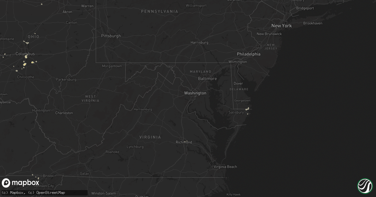
Hail Map in Maryland on June 26, 2025
Get this storm
June 26 map
$229
one time, instant access
Download today. No call, no setup
Keep the $229
Bought the map and want the full workflow? Apply the entire $229 to a subscription within 7 days. None of it is wasted.
Every map, not just this one
This buys you this map. Subscription and you get every map we run, in the markets you choose from a few cities to whole states to nationwide. Plus real-time alerts the moment a storm fires.
Contact data
Name, contact info, occupancy, even credit band for addresses in the footprint. You go from where it hit to who to call.
Become the source they trust
Unlimited branding weather history reports on demand. You already have the documented answer ready for the property owner, and you are the one who showed up with it.
Property data and RoofTrace estimates
Pull up any address you have got, its value and the exact code rules for that jurisdiction, straight from One Click Code. Then RoofTrace estimates the squares, pitch, and roof value, priced the way you price.
Storm reports in Maryland
Maryland
| Date | Description |
|---|---|
| 06/26/20256:39 PM CDT | Multiple trees down in rising sun including on route 1. |
| 06/26/20256:26 PM CDT | Tree down near the intersection of court house drive and martha bush drive. |
| 06/26/20256:26 PM CDT | Numerous trees down near conowingo... Md. |
| 06/26/20256:00 PM CDT | Power lines down onto two unoccupied vehicles at the intersection of gregory st. And snure rd. |
| 06/26/20255:57 PM CDT | Multiple trees reported down between pylesville ant the state line. |
| 06/26/20255:50 PM CDT | One foot diameter tree branch snapped off... Blocking the road... On the 13000 block of overton ln. |
| 06/26/20255:35 PM CDT | Tree down near the intersection of norrisville rd and harford creamery rd. |
| 06/26/20255:06 PM CDT | Tree down near the 16800 block of ridge road. |
| 06/26/20254:51 PM CDT | Tree down near the intersection of brickstore rd and upper beckleysville rd. |
| 06/26/20254:50 PM CDT | Tree down near the intersection of falls rd and grave run rd. |
| 06/26/20254:21 PM CDT | Tree down near the intersection of bankard rd and grand valley road. |
| 06/26/20252:30 PM CDT | Tree downed at intersection of campbelltown road and pitts rd. Time is radar-estimated. |
| 06/25/20259:00 PM CDT | Tree down near the intersection of deep cove rd and central ave. |
| 06/25/20259:00 PM CDT | Tree do |
| 06/25/20258:57 PM CDT | Tree down near the intersection of friendship rd and old solomons island rd. |
| 06/25/20258:57 PM CDT | Tree down near the intersection of friendship rd and old sol |
| 06/25/20258:05 PM CDT | Wires down. Time estimated from radar. |
All States Impacted by Hail Map on June 26, 2025
Cities Impacted by Hail Map on June 26, 2025
- Waynesboro, TN
- Church Hill, TN
- Kingsport, TN
- Gate City, VA
- Duffield, VA
- Clayton, GA
- Tiger, GA
- Lakemont, GA
- Long Creek, SC
- Hays, NC
- Jonesville, MI
- McGrady, NC
- Washington Court House, OH
- Jerome, MI
- Clarksburg, OH
- New Holland, OH
- Springfield, OH
- Cement City, MI
- Addison, MI
- Orient, OH
- Circleville, OH
- Frankford, DE
- Selbyville, DE
- Williamsport, OH
- Albert Lea, MN
- Garner, IA
- Columbus, OH
- Bishopville, MD
- Whaleyville, MD
- Hanover, NM
- Bloomingburg, OH
- Ashville, OH
- Archbold, OH
- Wauseon, OH
- Natchez, MS
- Roxie, MS
- Thurmond, NC
- Eastanollee, GA
- Lula, GA
- Gainesville, GA
- Clermont, GA
- Amanda, OH
- Lancaster, OH
- Murrayville, GA
- Lockbourne, OH
- Groveport, OH
- Elkin, NC
- Dahlonega, GA
- Canal Winchester, OH
- Willow, OK
- Port Saint Joe, FL
- Louisville, NE
- Springfield, NE
- Williamsburg, KY
- Stinnett, TX
- Bayard, NM
- Dawsonville, GA
- Wewahitchka, FL
- Fayette, MS
- Valdosta, GA
- Delaware, OH
- Hahira, GA
- Eastpoint, FL
- Galena, OH
- Sunbury, OH
- La Farge, WI
- Hillsboro, WI
- Hamilton, OH
- Wakarusa, IN
- Goshen, IN
- Elkhart, IN
- Nappanee, IN
- Syracuse, IN
- Millersburg, IN
- New Paris, IN
- Berlin, MD
- Brookshire, TX
- Inman, SC
- Houston, TX
- Ligonier, IN
- Rochester, MN
- Elgin, MN
- Eyota, MN
- Plainview, MN
- Dover, MN
- Saint Charles, MN
- Fredericktown, OH
- Starke, FL
- Wakeman, OH
- Saint Henry, OH
- Celina, OH
- Cumming, GA
- Gotebo, OK
- Cherryville, NC
- Canton, GA
- Richmond, VA
- Quitman, GA
- Ball Ground, GA
- Alpharetta, GA
- Maria Stein, OH
- Paulding, OH
- Greenville, SC
- Travelers Rest, SC
- Taylors, SC
- Greer, SC
- Liberty, SC
- Pickens, SC
- Easley, SC
- Roswell, GA
- Columbia City, IN
- Churubusco, IN
- Monroeville, IN
- Woodburn, IN
- Farmersville, OH
- New Lebanon, OH
- Miamisburg, OH
- Germantown, OH
- Woodstock, GA
- Live Oak, FL
- Payne, OH
- Gould, OK
- Cordell, OK
- Naples, FL
- Lanesboro, MN
- Beaver, OK
- Balko, OK
- Kutztown, PA
- Hamburg, PA
- Fleetwood, PA
- Morrow, OH
- Lebanon, OH
- Atlanta, GA
- Peachtree Corners, GA
- Six Mile, SC
- Binger, OK
- Gate, OK
- Fort Cobb, OK
- Hydro, OK
- Lockhart, TX
- Henrico, VA
- Mechanicsville, VA
- Central, SC
- Carnegie, OK
- Oregonia, OH
- Oakwood, GA
- Winchester, KS
- Easton, KS
- Atchison, KS
- Leavenworth, KS
- Jasper, FL
- Sledge, MS
- Hanover, PA
- Jennings, FL
- Minco, OK
- Weston, MO
- Rushville, MO
- Norris, SC
- Ashley, MI
- Lake Park, GA
- Calumet, OK
- Louisville, KY
- De Kalb, MO
- Dearborn, MO
- Winterset, IA
- Van Meter, IA
- Prole, IA
- Waukee, IA
- Cumming, IA
- Booneville, IA
- Clive, IA
- West Des Moines, IA
- Urbandale, IA
- Windsor Heights, IA
- Adel, GA
- Sparks, GA
- Lenox, GA
- Norman Park, GA
- Faucett, MO
- Fairdale, KY
- Shubert, NE
- Yorkshire, OH
- Prestonsburg, KY
- Gracemont, OK
- Roosevelt, OK
- Marietta, GA
- Edmond, OK
- Cornelius, NC
- Agency, MO
- Gower, MO
- Buckhorn, NM
- Huntersville, NC
- Zolfo Springs, FL
- Fort Peck, MT
- Lee, FL
- Denver, NC
- Lincolnton, NC
- Maiden, NC
- Iron Station, NC
- West Union, SC
- Red Oak, GA
- Union City, OK
- El Reno, OK
- Yukon, OK
- Mustang, OK
- Nemaha, NE
- Ochopee, FL
- Greenville, FL
- Perry, FL
- Scobey, MT
- Westminster, SC
- Wolf Point, MT
- Mableton, GA
- Winona, MN
- Dakota, MN
- Trempealeau, WI
- Holmen, WI
- Chiefland, FL
- Newberry, FL
- Winter Garden, FL
- Apopka, FL
- Ocoee, FL
- Marks, MS
- Martin, GA
- Waldron, MO
- Platte City, MO
- Smithville, MO
- Kansas City, MO
- Kearney, MO
- Trimble, MO
- Edgerton, MO
- Lamesa, TX
- Ackerly, TX
- Toccoa, GA
- Westminster, MD
- Okarche, OK
- Whitetail, MT
- Nashville, GA
- Albion, IN
- Lenhartsville, PA
- Inglis, FL
- Smyrna, GA
- Coxs Creek, KY
- Seneca, SC
- Austell, GA
- Greensboro, NC
- Reading, PA
- Wernersville, PA
- Laotto, IN
- Bardstown, KY
- Arkansas City, KS
- Clermont, KY
- Shepherdsville, KY
- Coyle, OK
- Stillwater, OK
- Newkirk, OK
- Burlington Junction, MO
- Orlando, OK
- Elgin, OK
- Apache, OK
- Bloomfield, KY
- Lenexa, KS
- Overland Park, KS
- Leawood, KS
- Prairie Village, KS
- Cement, OK
- Berlin Heights, OH
- Fort Myers, FL
- Independence, MO
- Mission, KS
- Chickasha, OK
- Miami, TX
- Dale, TX
- Mohnton, PA
- Lamont, FL
- Leesport, PA
- Bernville, PA
- Vernon, TX
- Brooks, KY
- Dawson, IA
- Ninnekah, OK
- Alva, FL
- Lake City, FL
- Willisburg, KY
- Morse, TX
- Lehigh Acres, FL
- Luling, TX
- North Fort Myers, FL
- Punta Gorda, FL
- Saint Joseph, MO
- Burlington, KY
- Union, KY
- Alapaha, GA
- Pembroke, VA
- Ripplemead, VA
- Narrows, VA
- Peterstown, WV
- Iaeger, WV
- Du Bois, NE
- Narvon, PA
- Peerless, MT
- Richland, MT
- Froid, MT
- Pearisburg, VA
- Union City, GA
- Fort White, FL
- Sanford, NC
- Pylesville, MD
- White Hall, MD
- Morgantown, PA
- East Earl, PA
- Honey Brook, PA
- Rantoul, KS
- Ottawa, KS
- Gap, PA
- Aurora, IL
- Plano, IL
- Big Rock, IL
- Sugar Grove, IL
- Elburn, IL
- Maple Park, IL
- Geneva, IL
- Saint Charles, IL
- Batavia, IL
- North Aurora, IL
- Holden, WV
- Paola, KS
- Osawatomie, KS
- Humboldt, NE
- Coatesville, PA
- Atglen, PA
- New Holland, PA
- Christiana, PA
- Parkesburg, PA
- Kinzers, PA
- Pawnee City, NE
- Spring Hill, KS
- Indiahoma, OK
- Mountain Park, OK
- Corwith, IA
- Mooseheart, IL
- West Chicago, IL
- Bartlett, IL
- Elgin, IL
- Wayne, IL
- South Elgin, IL
- Wasco, IL
- Hampshire, IL
- Dundee, IL
- Gilberts, IL
- Huntley, IL
- New Hill, NC
- Boston, GA
- Moncure, NC
- Chapmanville, WV
- Stollings, WV
- Logan, WV
- Trenton, FL
- Valley Park, MS
- Aurora, IN
- Troutville, VA
- Blue Ridge, VA
- Roanoke, VA
- Quarryville, PA
- Kirkwood, PA
- Dubuque, IA
- Peosta, IA
- East Dubuque, IL
- Hazel Green, WI
- Cuba City, WI
- Kieler, WI
- Whiting, KS
- Clearmont, MO
- Pickering, MO
- Skidmore, MO
- Maryville, MO
- Floral City, FL
- Brooksville, FL
- Inverness, FL
- Louisburg, KS
- Platteville, WI
- Jamaica, IA
- Bern, KS
- Chaplin, KY
- Braman, OK
- Roundup, MT
- Apex, NC
- Thomasville, GA
- Craig, MO
- Moultrie, GA
- Monticello, FL
- Coolidge, GA
- Snyder, OK
- Anadarko, OK
- Hinton, OK
- Faxon, OK
- Lambert, MT
- Nardin, OK
- Guthrie, OK
- Briceville, TN
- Mulhall, OK
- Perry, IA
- Seneca, KS
- Brooksville, KY
- Alkol, WV
- Griffithsville, WV
- Moores Hill, IN
- Spurlockville, WV
- Lexington, KY
- Walhalla, SC
- Oneida, KS
- Clifton, VA
- Fairfax Station, VA
- Manassas, VA
- Mcdonough, GA
- Collins, OH
- Sidney, MT
- Dunkirk, MD
- Lothian, MD
- Upper Marlboro, MD
- Brandywine, MD
- Hartsfield, GA
- Locust Grove, GA
- Hampton, GA
- Harts, WV
- Ochlocknee, GA
- Rising Sun, IN
- Meigs, GA
- Larslan, MT
- Harwood, MD
- Ranger, WV
- Granger, TX
- Taylor, TX
- Stevenson, AL
- Pelham, GA
- Thaxton, VA
- Bedford, VA
- Cairo, GA
- Vicksburg, MS
- Midkiff, WV
- Kiahsville, WV
- Springer, NM
- Oxford, NC
- Bullock, NC
- Independence, KY
- Morning View, KY
- Walton, KY
- Gilman, IA
- Whigham, GA
- Sunray, TX
- Alexandria, KY
- De Mossville, KY
- Butler, KY
- Falmouth, KY
- Foster, KY
- Urbana, IN
- Mundelein, IL
- Corning, KS
- Homerville, GA
- Sewanee, TN
- Lawton, OK
- Chattanooga, OK
- Nathalie, VA
- Gretna, VA
- Java, VA
- Texico, NM
- Bovina, TX
- Dumfries, VA
- Triangle, VA
- Carlisle, KY
- Tuttle, OK
- Genoa, WV
- Wayne, WV
- Hillsboro, TN
- Latty, OH
- Goff, KS
- Soldier, KS
- Arcadia, OK
- Ewing, KY
- Williamson, WV
- Wagon Mound, NM
- Wetmore, KS
- Balmorhea, TX
- Augusta, KY
- Flemingsburg, KY
- Fort Davis, TX
- Birdsboro, PA
- Dingess, WV
- Andrews, NC
- Oxford, PA
- Netawaka, KS
- Davy, WV
- Poplar, MT
- Westboro, MO
- Friona, TX
- Germantown, KY
- Mount Olivet, KY
- Dalton, OH
- Mount Eaton, OH
- Dundee, OH
- Navarre, OH
- Apple Creek, OH
- Walters, OK
- Airville, PA
- Fawn Grove, PA
- Delta, PA
- Hinckley, IL
- Sandwich, IL
- Independence, KS
- Elk City, KS
- Adrian, TX
- Hillsboro, KY
- Brockton, MT
- Marshalltown, IA
- Haverhill, IA
- Laurel, IA
- East Lynn, WV
- Climax, GA
- Blue Mound, KS
- Cache, OK
- Mountain View, OK
- Hollis, OK
- Petersburg, KY
- Young Harris, GA
- Healy, KS
- Montour, IA
- Paradise, PA
- Cochranville, PA
- Dumas, TX
- Falls City, NE
- Sherwood, TN
- Tonganoxie, KS
- Fort Sill, OK
- Eskdale, WV
- Cherryvale, KS
- Forsyth, MT
- Liberty, KS
- Homestead, MT
- Rising Sun, MD
- Colora, MD
- Conowingo, MD
- Blackwell, OK
- Rockwood, TN
- Spring City, TN
- Dodgeville, WI
- Belle Fourche, SD
- Geronimo, OK
- Hanna, IN
- Huntingdon, PA
- Branchland, WV
- Denton, GA
- West Green, GA
- Sedan, KS
- Mapleton Depot, PA
- Ansted, WV
- Kanawha Falls, WV
- Fayetteville, WV
- Gauley Bridge, WV
- Warne, NC
- Victor, WV
- Summersville, WV
- Drennen, WV
- Opheim, MT
- Flaxville, MT
- Onaga, KS
- La Junta, CO
- San Jon, NM
- Sedan, NM
- Clayton, NM
- Mosquero, NM
- Texline, TX
- Newell, SD
- Coffeyville, KS
- Pecks Mill, WV
- Broaddus, TX
- Mud Butte, SD
- Faith, SD
- Fairview, MT
- Havana, KS
- Miami, WV
- Hansford, WV
- Gallagher, WV
- Prichard, WV
- Fort Gay, WV
- Tucumcari, NM
- La Porte, IN
- Seymour, TX
- Little Birch, WV
- Birch River, WV
- Erbacon, WV
- Sutton, WV
- Belva, WV
- Montgomery, WV
- Neodesha, KS
- Cowen, WV
- Havensville, KS
- Denver City, TX
- Plains, TX
- Higginsville, MO
- Diana, WV
- Okeechobee, FL
- Nunica, MI
- Rothbury, MI
- Hesperia, MI
- Wanatah, IN
- Rosedale, LA
- La Crosse, IN
- Hamlet, IN
- Union Mills, IN
- Berrien Center, MI
- Lane, KS
- Maringouin, LA
- South Haven, KS
- Alzada, MT
- Fowler, IN
- Nottingham, PA
- Mill Creek, PA
- Blandon, PA
- Belle Plaine, KS
- Wellington, KS
- Medford, OK
- Mayview, MO
- Sunset, SC
- Troy, KS
- Wathena, KS


