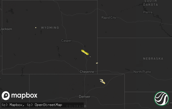
Hail Map in Wyoming on June 26, 2020
The weather event in Wyoming on June 26, 2020 includes Hail and Wind maps. 19 states and 788 cities were impacted and suffered possible damage. The total estimated number of properties impacted is 13,008.

Hail
Wind
13,008
Estimated number of impacted properties by a 1.00" hail or larger5,580
Estimated number of impacted properties by a 1.75" hail or larger0
Estimated number of impacted properties by a 2.50" hail or largerStorm reports in Wyoming
Wyoming
| Date | Description |
|---|---|
| 06/26/20205:56 PM CDT | A local report indicates 1.25 inch wind near CARPENTER |
| 06/26/20205:45 PM CDT | A local report indicates 1.00 inch wind near 2 WNW CARPENTER |
| 06/26/20205:45 PM CDT | A local report indicates 1.25 inch wind near 5 S BURNS |
| 06/26/20205:14 PM CDT | Via twitter. |
| 06/26/20205:08 PM CDT | A local report indicates 1.25 inch wind near 2 NNE CHEYENNE |
| 06/26/20205:03 PM CDT | Near anderson elementary school. |
| 06/26/20204:53 PM CDT | A local report indicates 1.00 inch wind near 3 NE CHEYENNE |
| 06/26/20204:50 PM CDT | Crest ridge subdivision. |
| 06/26/20204:50 PM CDT | A local report indicates 1.25 inch wind near 2 NNE CHEYENNE |
| 06/26/20204:48 PM CDT | A local report indicates 1.25 inch wind near 2 NNW CHEYENNE |
| 06/26/20204:28 PM CDT | A local report indicates 1.25 inch wind near FEDERAL |
| 06/26/202012:10 AM CDT | At 510 PM MDT, a severe thunderstorm was located 11 miles northwest of Lakeview North, or 14 miles northwest of Wheatland, moving east at 15 mph. HAZARD...60 mph wind gusts and quarter size hail. SOURCE...Radar indicated. IMPACT...Hail damage to vehicles is expected. Expect wind damage to roofs, siding, and trees. This severe thunderstorm will be near... Lakeview North around 545 PM MDT.This includes Interstate 25 in Wyoming between mile markers 85 and96. |
| 06/25/202011:07 PM CDT | At 407 PM MDT, a severe thunderstorm was located 8 miles east of Cheyenne, moving east at 30 mph. HAZARD...Golf ball size hail and 60 mph wind gusts. SOURCE...Radar indicated. IMPACT...People and animals outdoors will be injured. Expect hail damage to roofs, siding, windows, and vehicles. Expect wind damage to roofs, siding, and trees. This severe thunderstorm will be near... Hillsdale around 420 PM MDT. Burns around 435 PM MDT. Carpenter around 440 PM MDT.This includes Interstate 80 in Wyoming between mile markers 367 and397. |
| 06/25/202010:28 PM CDT | At 327 PM MDT, a severe thunderstorm was located near Warren Af Base, or 7 miles northwest of Cheyenne, moving east at 25 mph. HAZARD...Ping pong ball size hail and 60 mph wind gusts. SOURCE...Radar indicated. IMPACT...People and animals outdoors will be injured. Expect hail damage to roofs, siding, windows, and vehicles. Expect wind damage to roofs, siding, and trees. This severe thunderstorm will be near... Warren Af Base around 335 PM MDT. Warren AFB and Frontier Park around 340 PM MDT. North Cheyenne around 345 PM MDT. Ranchettes around 350 PM MDT. Cheyenne around 400 PM MDT.Other locations impacted by this severe thunderstorm include FoxFarm-College.This includes the following highways... Interstate 25 in Wyoming between mile markers 10 and 19. Interstate 80 in Wyoming between mile markers 362 and 373. |
| 06/25/20209:30 PM CDT | At 229 PM MDT, a severe thunderstorm was located over North Crow Campground, or 18 miles east of Laramie, moving east at 15 mph. HAZARD...60 mph wind gusts and quarter size hail. SOURCE...Radar indicated. IMPACT...Hail damage to vehicles is expected. Expect wind damage to roofs, siding, and trees. This severe thunderstorm will be near... Granite Springs Reservoir around 235 PM MDT. Crystal Lake Reservoir and Crystal Lake Campground around 240 PM MDT. Federal around 250 PM MDT. Ranchettes around 330 PM MDT.This includes Interstate 80 in Wyoming between mile markers 345 and355. |
All States Impacted by Hail Map on June 26, 2020
Cities Impacted by Hail Map on June 26, 2020
- Olney Springs, CO
- Garden Prairie, IL
- Genoa, IL
- Marengo, IL
- Oshkosh, NE
- Lewellen, NE
- Belleville, KS
- Republic, KS
- Aurora, CO
- Cleveland, OH
- Maple Heights, OH
- Goodland, KS
- Akron, CO
- Presque Isle, ME
- Sedalia, CO
- Castle Rock, CO
- Whitman, NE
- Cody, NE
- Belvidere, IL
- Clifton, KS
- Morganville, KS
- Concordia, KS
- Cuba, KS
- Aurora, KS
- Scandia, KS
- Miltonvale, KS
- Clay Center, KS
- Clyde, KS
- Munden, KS
- Agenda, KS
- Grover, CO
- Cheyenne, WY
- Carpenter, WY
- Fe Warren Afb, WY
- Glasco, KS
- Watseka, IL
- Palmer Lake, CO
- Franktown, CO
- Peyton, CO
- Usaf Academy, CO
- Monument, CO
- Colorado Springs, CO
- Elbert, CO
- Larkspur, CO
- Sidney, NE
- Deshler, NE
- Kanorado, KS
- Burlington, CO
- Weskan, KS
- Fleming, CO
- Phillipsburg, KS
- Burlington, IL
- Sycamore, IL
- Elgin, IL
- Maple Park, IL
- Hampshire, IL
- Saint Charles, IL
- Sugar City, CO
- Arlington, CO
- Arthur, NE
- Lemoyne, NE
- Sheridan Lake, CO
- Haswell, CO
- Padroni, CO
- Plainville, KS
- Palco, KS
- Scott City, KS
- Leoti, KS
- Lakin, KS
- Deerfield, KS
- Marienthal, KS
- Pueblo, CO
- Golden, CO
- Rush, CO
- Yoder, CO
- Crook, CO
- Grady, NM
- Ashby, NE
- Imperial, NE
- Jewell, KS
- Fort Collins, CO
- Laporte, CO
- Bellvue, CO
- Narka, KS
- Sedgwick, CO
- Haxtun, CO
- Grinnell, KS
- Oakley, KS
- Davenport, NE
- Karval, CO
- La Rue, OH
- Guide Rock, NE
- Donnellson, IA
- Calhan, CO
- Holyoke, CO
- Paoli, CO
- Brookville, KS
- Salina, KS
- Hertford, NC
- Belvidere, NC
- Wakeeney, KS
- Collyer, KS
- Quinter, KS
- Sterling, NE
- Hasty, CO
- Richland, IA
- Grand Ridge, IL
- Marseilles, IL
- Eads, CO
- Knoxville, IA
- Hamilton, IA
- Bussey, IA
- Logan, KS
- Zwingle, IA
- Bernard, IA
- Cook, NE
- Piedmont, KS
- Eureka, KS
- Severy, KS
- Dunkirk, OH
- Kenton, OH
- New Bloomington, OH
- Forest, OH
- Rochelle, IL
- Chana, IL
- Franklin Grove, IL
- Ashton, IL
- Dixon, IL
- Polo, IL
- Oregon, IL
- Nemaha, NE
- Auburn, NE
- Brownville, NE
- Peru, NE
- Model, CO
- Grainfield, KS
- Lorimor, IA
- Afton, IA
- Wallace, NE
- Hayes Center, NE
- Loveland, CO
- Bloomington, NE
- Franklin, NE
- Riverton, NE
- Bedford, OH
- Independence, OH
- Lakewood, OH
- Rocky River, OH
- Craig, MO
- Superior, NE
- Hardy, NE
- Peetz, CO
- Seneca, IL
- Verona, IL
- Bethune, CO
- Vona, CO
- Stratton, CO
- Beloit, KS
- La Crosse, KS
- Idalia, CO
- Wray, CO
- Cullom, IL
- Kempton, IL
- Ashkum, IL
- Piper City, IL
- Courtland, KS
- Webber, KS
- Ellsworth, KS
- Lincoln, KS
- Douds, IA
- Milton, IA
- Keosauqua, IA
- Bloomfield, IA
- Rushville, NE
- Hay Springs, NE
- Frazeysburg, OH
- Glen Elder, KS
- Edgar, NE
- Minneapolis, KS
- Wiley, CO
- Champion, NE
- Brush, CO
- Winona, KS
- Red Oak, IA
- Barnard, KS
- Littleton, CO
- Hyannis, NE
- Sheldon, IL
- Palmyra, NE
- Unadilla, NE
- Delphos, KS
- Milan, IL
- Sherrard, IL
- Altoona, KS
- Fredonia, KS
- Benedict, KS
- Sedan, NM
- Tarkio, MO
- Mapleton, ME
- Patten, ME
- Garden City, KS
- Clovis, NM
- Simpson, KS
- Cresco, IA
- Diller, NE
- Odell, NE
- Shannon, IL
- Lanark, IL
- Denver, CO
- Agra, KS
- Kensington, KS
- Inavale, NE
- Hoxie, KS
- Morland, KS
- Burr Oak, KS
- Mankato, KS
- Macedonia, IA
- Henderson, IA
- Emerson, IA
- Vernon, CO
- Harvey, IA
- Leighton, IA
- Pella, IA
- Syracuse, NE
- Chester, NE
- Byron, NE
- Chappell, NE
- Morris, IL
- Ellston, IA
- Grand River, IA
- Kellerton, IA
- Thayer, IA
- Wellington, CO
- Lamar, CO
- Elk Falls, KS
- Moline, KS
- Fremont, IA
- Kirkville, IA
- Eddyville, IA
- Ottumwa, IA
- Joes, CO
- Norway, KS
- Sharon Springs, KS
- Lawrence, NE
- Melcher Dallas, IA
- Hallam, NE
- Firth, NE
- Martell, NE
- Cortland, NE
- Hill City, KS
- Melrose, IA
- Moravia, IA
- Kirksville, MO
- Greentop, MO
- Clayton, NM
- Esbon, KS
- Downs, KS
- Glenwood, MO
- Worthington, MO
- Unionville, MO
- Livonia, MO
- Green Castle, MO
- Novinger, MO
- Queen City, MO
- Wheatland, WY
- Pine Bluffs, WY
- Fredericksburg, IA
- Lawler, IA
- Byron, IL
- Wilber, NE
- Glade, KS
- Kirwin, KS
- Stockton, KS
- Sarasota, FL
- Mount Carroll, IL
- Sylvan Grove, KS
- Portis, KS
- Jamestown, KS
- Hunter, KS
- Gaylord, KS
- Cawker City, KS
- Amboy, IL
- Rock Falls, IL
- Deer Grove, IL
- Tampico, IL
- Prophetstown, IL
- Harmon, IL
- Cheyenne Wells, CO
- Las Animas, CO
- Shickley, NE
- Carleton, NE
- Sheridan, IL
- Serena, IL
- Newark, IL
- Dix, NE
- Cascade, CO
- Henry, IL
- Beverly, KS
- Nebraska City, NE
- Dunbar, NE
- Glenwood, IA
- Liebenthal, KS
- Pleasantville, IA
- Milo, IA
- Tescott, KS
- South Elgin, IL
- Arapahoe, CO
- Bogue, KS
- Elsie, NE
- Wauneta, NE
- Dickens, NE
- Baileyville, IL
- Manitou Springs, CO
- Bonaparte, IA
- Braddyville, IA
- Hamburg, IA
- Burlington Junction, MO
- Clarinda, IA
- Farragut, IA
- Blanchard, IA
- Coin, IA
- Westboro, MO
- Elmo, MO
- Shenandoah, IA
- Northboro, IA
- Crete, NE
- Ruskin, NE
- Nelson, NE
- Lime Springs, IA
- Cincinnati, IA
- Monument, KS
- Farmington, IA
- Bagley, WI
- Bloomington, WI
- Glen Haven, WI
- Park, KS
- Gove, KS
- Bruning, NE
- Union, IL
- Hebron, NE
- Otoe, NE
- Avoca, NE
- Keota, IA
- Sigourney, IA
- Harper, IA
- Cedar, KS
- Stockbridge, MI
- Munith, MI
- Gregory, MI
- Grass Lake, MI
- Chelsea, MI
- Champaign, IL
- Urbana, IL
- Ansley, NE
- Malvern, IA
- Prairie View, KS
- Rock Port, MO
- Humboldt, NE
- Adams, NE
- Fairfax, MO
- Tecumseh, NE
- Talmage, NE
- Lorton, NE
- Johnson, NE
- Elk Creek, NE
- Maitland, MO
- Watson, MO
- Douglas, NE
- Shubert, NE
- Mound City, MO
- Julian, NE
- Bennet, NE
- Brock, NE
- Stella, NE
- Burr, NE
- Skidmore, MO
- Walnut, IL
- Ohio, IL
- Forreston, IL
- Clio, IA
- Lineville, IA
- Garden Grove, IA
- Allerton, IA
- Leon, IA
- Tribune, KS
- Ann Arbor, MI
- Kimball, NE
- Cainsville, MO
- Davis City, IA
- Mercer, MO
- Fairbury, NE
- Reynolds, NE
- Iron River, MI
- Watersmeet, MI
- Nederland, CO
- McIntosh, AL
- Selden, KS
- Crown Point, IN
- Hebron, IN
- Creston, IA
- Granite Canon, WY
- Livermore, CO
- Tie Siding, WY
- Pecatonica, IL
- Winnebago, IL
- Ogden, IL
- Armstrong, IL
- Saint Joseph, IL
- Fithian, IL
- Royal, IL
- Hubbell, NE
- Mahaska, KS
- Chester, IA
- Argyle, IA
- Fort Madison, IA
- Montrose, IA
- Lenora, KS
- Kirk, CO
- Sterling, IL
- Packwood, IA
- Hedrick, IA
- Ollie, IA
- Riceville, IA
- McCracken, KS
- Davis Junction, IL
- Monroe Center, IL
- Sterling, CO
- Valparaiso, IN
- Laramie, WY
- Yuma, CO
- Chariton, IA
- Beaverville, IL
- Longford, KS
- New Sharon, IA
- Illinois City, IL
- Batavia, IA
- Fairfield, IA
- Ordway, CO
- Mount Pleasant, IA
- Winfield, IA
- Wayland, IA
- Newtown, MO
- Lucerne, MO
- Ransom, IL
- Ottawa, IL
- Mazon, IL
- Kinsman, IL
- Tobias, NE
- Harrison, NE
- Crawford, NE
- Eldena, IL
- Oskaloosa, IA
- Herington, KS
- Dwight, IL
- Taylor Ridge, IL
- Fort Morgan, CO
- Deer Park, AL
- Chipley, FL
- Youngstown, FL
- Princeton, MO
- Potter, NE
- Springfield, ME
- Smith Center, KS
- Hays, KS
- Schoenchen, KS
- Catharine, KS
- Columbus Junction, IA
- Lone Tree, IA
- Ainsworth, IA
- Nichols, IA
- Riverside, IA
- Boulder, CO
- Broomfield, CO
- Eldorado Springs, CO
- Drakesville, IA
- Morrison, IL
- Newark, OH
- Nashport, OH
- Columbia, IA
- Waycross, GA
- Roberts, IL
- Mount Morris, IL
- Tracy, IA
- Merriman, NE
- Iliff, CO
- Mystic, IA
- Harvard, IL
- Buffalo, KS
- Holly, CO
- Fall River, KS
- New Boston, IL
- Joy, IL
- Reynolds, IL
- Dorchester, NE
- Hartley, TX
- Elliott, IA
- Griswold, IA
- Parker, CO
- Danforth, IL
- Gilman, IL
- Crescent City, IL
- Donovan, IL
- Red Cloud, NE
- Dexter, MI
- Randall, KS
- Albia, IA
- Unionville, IA
- Blakesburg, IA
- Waucoma, IA
- New Hampton, IA
- Leaf River, IL
- Brashear, MO
- Lancaster, MO
- Exline, IA
- Arvada, CO
- Hemingford, NE
- Peosta, IA
- Dubuque, IA
- La Motte, IA
- Wallace, KS
- Heath, OH
- Zanesville, OH
- Hopewell, OH
- Washington, IA
- Dighton, KS
- Healy, KS
- Lindenwood, IL
- Milledgeville, IL
- Woosung, IL
- Malta, IL
- Clare, IL
- Dekalb, IL
- Kirkland, IL
- Esmond, IL
- Putnam, IL
- Wellman, IA
- Kalona, IA
- Clifton, IL
- Lamoni, IA
- Lebanon, KS
- Council Grove, KS
- Wilsey, KS
- Red Feather Lakes, CO
- Pollock, MO
- Cherry Valley, IL
- Kingston, IL
- Russell, IA
- Lovilia, IA
- Sherrill, IA
- Colby, KS
- Harmony, MN
- Chatsworth, IL
- Streator, IL
- Wenona, IL
- Dana, IL
- Endicott, NE
- Eldon, IA
- Libertyville, IA
- Moulton, IA
- Floris, IA
- Selma, IA
- Pulaski, IA
- Nauvoo, IL
- Cantril, IA
- Mount Sterling, IA
- Channahon, IL
- La Moille, IL
- Sublette, IL
- Falls City, NE
- Hillsdale, WY
- Potosi, WI
- Martinsburg, IA
- Clermont, FL
- Grenville, NM
- Eastlake, OH
- Wickliffe, OH
- Willoughby, OH
- Euclid, OH
- Tryon, NE
- Alton, KS
- Stanton, IA
- Blackstone, IL
- Oak, NE
- Swanton, NE
- Western, NE
- Hartford, KS
- Moultrie, GA
- Wagarville, AL
- Martinton, IL
- Cope, CO
- Yates Center, KS
- Clatonia, NE
- Athol, KS
- McIntire, IA
- Naponee, NE
- Toronto, KS
- Chenoa, IL
- Mabel, MN
- Decorah, IA
- Canton, MN
- Ionia, IA
- Nashua, IA
- Birmingham, IA
- Stockport, IA
- Salem, IA
- New London, IA
- Lockridge, IA
- Atchison, KS
- Easton, KS
- Lawrence, MI
- Watervliet, MI
- Decatur, MI
- Hartford, MI
- Coloma, MI
- Benton Harbor, MI
- Saint Joseph, MI
- Buchanan, MI
- Niles, MI
- Granger, IN
- Lakeside, MI
- Three Oaks, MI
- Harbert, MI
- Galien, MI
- Sawyer, MI
- Bridgman, MI
- Stevensville, MI
- Berrien Springs, MI
- Baroda, MI
- Dalhart, TX
- German Valley, IL
- Rockford, IL
- Ridott, IL
- Rock City, IL
- Bristol, IL
- Aurora, IL
- Plano, IL
- Hinckley, IL
- Earlville, IL
- Steward, IL
- Lee, IL
- Shabbona, IL
- Somonauk, IL
- West Brooklyn, IL
- Sandwich, IL
- Montgomery, IL
- Compton, IL
- Big Rock, IL
- Paw Paw, IL
- Sugar Grove, IL
- Waterman, IL
- Bartlett, IL
- Itasca, IL
- Bensenville, IL
- Chicago, IL
- Addison, IL
- Franklin Park, IL
- Medinah, IL
- Bloomingdale, IL
- Schiller Park, IL
- Roselle, IL
- Wood Dale, IL
- Hanover Park, IL
- Culver, IN
- Hobart, IN
- Grovertown, IN
- Knox, IN
- Hamlet, IN
- Tinley Park, IL
- Mokena, IL
- Thornton, IL
- Park Forest, IL
- Merrillville, IN
- Joliet, IL
- Union Mills, IN
- Olympia Fields, IL
- Dyer, IN
- Etna Green, IN
- Elwood, IL
- North Judson, IN
- Minooka, IL
- Schererville, IN
- Tippecanoe, IN
- Plymouth, IN
- New Lenox, IL
- Chicago Heights, IL
- Hazel Crest, IL
- Flossmoor, IL
- La Crosse, IN
- Frankfort, IL
- Bourbon, IN
- Richton Park, IL
- Homewood, IL
- Highland, IN
- Monee, IL
- Yorkville, IL
- Lansing, IL
- Kouts, IN
- Gary, IN
- Argos, IN
- Manhattan, IL
- Country Club Hills, IL
- Hanna, IN
- Griffith, IN
- Warsaw, IN
- Atwood, IN
- Matteson, IL
- Wanatah, IN
- Shorewood, IL
- Munster, IN
- Glenwood, IL
- Whiting, IN
- Blue Island, IL
- New Paris, IN
- Hickory Hills, IL
- Hometown, IL
- La Porte, IN
- Oak Lawn, IL
- North Liberty, IN
- Rolling Prairie, IN
- Lakeville, IN
- Bridgeview, IL
- Syracuse, IN
- Lake Station, IN
- Bremen, IN
- Michigan City, IN
- Walkerton, IN
- East Chicago, IN
- Hammond, IN
- Riverdale, IL
- Mill Creek, IN
- Justice, IL
- South Bend, IN
- Nappanee, IN
- New Carlisle, IN
- Portage, IN
- Burbank, IL
- Milford, IN
- Evergreen Park, IL
- Westville, IN
- Chesterton, IN
- Chicago Ridge, IL
- Wakarusa, IN
- Alsip, IL
- Cedar Lake, IN
- Lowell, IN
- Boone Grove, IN
- Crete, IL
- Beecher, IL
- Peotone, IL
- Albion, IN
- Kendallville, IN
- Ligonier, IN
- Wawaka, IN
- Rome City, IN
- Corunna, IN
- Avilla, IN
- Auburn, IN
- Millersburg, IN
- Ashley, IN
- Hamilton, IN
- Hudson, IN
- Wolcottville, IN
- Pleasant Lake, IN
- Edon, OH
- Angola, IN
- Montpelier, OH
- Alvordton, OH
- West Unity, OH
- Pioneer, OH
- Columbia City, IN
- Arcola, IN
- New Haven, IN
- Fort Wayne, IN
- Monroeville, IN
- Edgerton, MO
- Elwood, KS
- Agency, MO
- Troy, KS
- Gower, MO
- Dearborn, MO
- Wathena, KS
- Saint Joseph, MO
- Faucett, MO
- Tonganoxie, KS
- Oregon, MO
- Amazonia, MO
- Burns, WY
- Venango, NE


