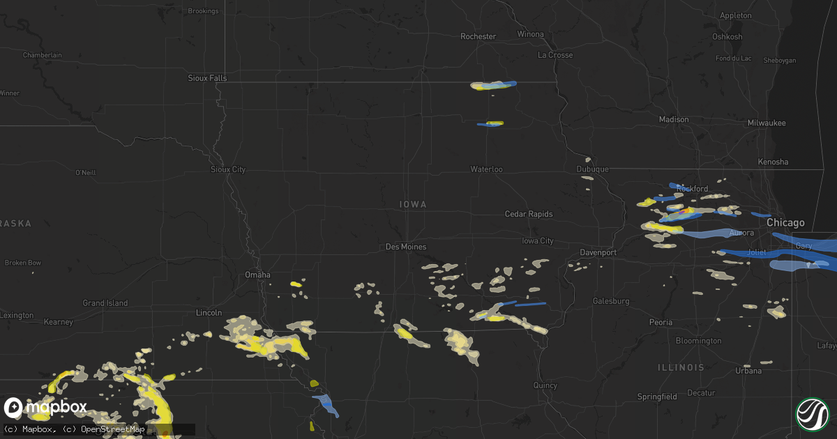
Hail Map in Iowa on June 26, 2020
Get this storm
June 26 map
$229
one time, instant access
Download today. No call, no setup
Keep the $229
Bought the map and want the full workflow? Apply the entire $229 to a subscription within 7 days. None of it is wasted.
Every map, not just this one
This buys you this map. Subscription and you get every map we run, in the markets you choose from a few cities to whole states to nationwide. Plus real-time alerts the moment a storm fires.
Contact data
Name, contact info, occupancy, even credit band for addresses in the footprint. You go from where it hit to who to call.
Become the source they trust
Unlimited branding weather history reports on demand. You already have the documented answer ready for the property owner, and you are the one who showed up with it.
Property data and RoofTrace estimates
Pull up any address you have got, its value and the exact code rules for that jurisdiction, straight from One Click Code. Then RoofTrace estimates the squares, pitch, and roof value, priced the way you price.
Storm reports in Iowa
Iowa
| Date | Description |
|---|---|
| 06/26/20206:35 PM CDT | Heavy wooden outdoor dog crate that was blown across the yard. Estimated winds at 60-65 mph. |
| 06/26/20201:44 PM CDT | Corrects previous non-tstm wnd gst report from waucoma. Private weather station reported a 67 mph wind gust. Time estimate. |
| 06/26/202012:25 PM CDT | Public reports tree damage just north of lime springs and broadcast media reports power outage outside of lime springs. |
| 06/26/202012:25 PM CDT | A local report indicates 1.00 inch wind near LIME SPRINGS |
| 06/26/202012:25 PM CDT | Trained spotter reported 60 to 70 mph wind gusts and quarter size hail. |
| 06/26/20207:29 AM CDT | At 1228 PM CDT, a severe thunderstorm was located near Harmony, or 7 miles north of Cresco, moving east at 35 mph. HAZARD...60 mph wind gusts and quarter size hail. SOURCE...Trained weather spotters reported quarter sized hail and 60 mph winds in Lime Springs. IMPACT...Hail damage to vehicles is expected. Expect wind damage to roofs, siding, and trees. This severe thunderstorm will be near... Harmony around 1240 PM CDT. Canton around 1245 PM CDT. Mabel around 100 PM CDT.Other locations impacted by this severe thunderstorm includeHenrytown, Choice, Hesper, Hutton, Burr Oak, Chimney Rock Campgroundand Locust. |
| 06/26/20207:12 AM CDT | At 1212 PM CDT, a severe thunderstorm was located over Lime Springs, or 11 miles northwest of Cresco, moving east at 35 mph. HAZARD...60 mph wind gusts and quarter size hail. SOURCE...Radar indicated. IMPACT...Hail damage to vehicles is expected. Expect wind damage to roofs, siding, and trees. This severe thunderstorm will be near... Cresco around 1230 PM CDT.Other locations impacted by this severe thunderstorm include Chester,Granger, York, Bristol, Bonair, Cherry Grove and County Roads A 23And V 58. |
| 06/26/20204:08 AM CDT | At 907 PM CDT, a severe thunderstorm was located 8 miles north of Rathbun Lake, or 12 miles west of Albia, moving southeast at 15 mph. HAZARD...Quarter size hail. SOURCE...Radar indicated. IMPACT...Damage to vehicles is expected. Locations impacted include... Melrose. |
| 06/26/20204:00 AM CDT | At 900 PM CDT, a severe thunderstorm was located near Rome, or near Mount Pleasant, moving southeast at 25 mph. HAZARD...60 mph wind gusts. SOURCE...Radar indicated. IMPACT...Expect damage to roofs, siding, and trees. Locations impacted include... Mount Pleasant, Rome, Westwood, Henry County Fairgrounds, Water Works Park, Oakland Mills, Oakland Mills Park, Mount Pleasant Municipal Arpt and Trenton. |
| 06/26/20202:07 AM CDT | At 707 PM CDT, a severe thunderstorm was located near Milton, or 10 miles west of Keosauqua, moving east at 30 mph. HAZARD...60 mph wind gusts and quarter size hail. SOURCE...Radar indicated. IMPACT...Hail damage to vehicles is expected. Expect wind damage to roofs, siding, and trees. Locations impacted include... Keosauqua, Birmingham, Milton, Bonaparte, Stockport, Douds, Bentonsport/Vernon, Leando, Van Buren County Fairgrounds, Keosauqua Airport, Morris Park, Mount Zion, Utica, Lebanon, Lacey Keosauqua State Park and Kilbourn. |
| 06/26/20202:05 AM CDT | At 705 PM CDT, a severe thunderstorm was located over New London, or 7 miles southeast of Mount Pleasant, moving east at 40 mph. HAZARD...60 mph wind gusts. SOURCE...Radar indicated. IMPACT...Expect damage to roofs, siding, and trees. Locations impacted include... Burlington, Mount Pleasant, West Burlington, New London, Mediapolis, Danville, Middletown, Lowell, Kossuth, Geode State Park, Mount Pleasant Municipal Arpt, Starr's Cave Park and Preserve, Sperry, Prairie Grove, Big Hollow Recreation Area, Stephenson Park, Pleasant Grove, Dodgeville, Beaverdale and Des Moines County Fairgrounds. |
| 06/26/20201:56 AM CDT | At 655 PM CDT, a severe thunderstorm was located 7 miles southeast of Macedonia, or 22 miles southwest of Atlantic, moving east at 15 mph. HAZARD...Half dollar size hail. SOURCE...Radar indicated. IMPACT...Damage to vehicles is expected. Locations impacted include... Elliott. |
| 06/26/20201:32 AM CDT | At 631 PM CDT, a severe thunderstorm was located near Macedonia, or 25 miles southwest of Atlantic, moving east at 15 mph. HAZARD...Quarter size hail. SOURCE...Radar indicated. IMPACT...Damage to vehicles is expected. Locations impacted include... Henderson. |
| 06/26/20201:21 AM CDT | At 621 PM CDT, a severe thunderstorm was located near Libertyville, or near Fairfield, moving east at 40 mph. HAZARD...60 mph wind gusts and quarter size hail. SOURCE...Radar indicated. IMPACT...Hail damage to vehicles is expected. Expect wind damage to roofs, siding, and trees. This severe thunderstorm will be near... Stockport around 630 PM CDT. Lockridge around 640 PM CDT.Other locations impacted by this severe thunderstorm includeJefferson County Park, Glasgow, Morris Park, Collett, Round PrairiePark and Beckwith. |
| 06/26/202012:53 AM CDT | At 552 PM CDT, a severe thunderstorm was located 7 miles northwest of Bloomfield, moving northeast at 25 mph. HAZARD...60 mph wind gusts and quarter size hail. SOURCE...Radar indicated. IMPACT...Hail damage to vehicles is expected. Expect wind damage to roofs, siding, and trees. Locations impacted include... Bloomfield, Eldon, Agency, Drakesville, Floris, Lake Wapello State Park and Bloomfield Municipal Airport. |
| 06/25/202010:14 PM CDT | At 314 PM CDT, a severe thunderstorm was located over Bloomington, or 10 miles west of Lancaster, moving east at 40 mph. HAZARD...60 mph wind gusts. SOURCE...Radar indicated. IMPACT...Expect damage to roofs, siding, and trees. This severe thunderstorm will be near... Lancaster around 335 PM CDT. Fennimore around 340 PM CDT.Other locations impacted by this severe thunderstorm include Preston,Arthur, Montfort, Mount Ida, Beetown, Union and Porters Bridge. |
| 06/25/20208:24 PM CDT | At 123 PM CDT, a severe thunderstorm was located over Lawler, or 7 miles east of New Hampton, moving east at 40 mph. HAZARD...60 mph wind gusts and quarter size hail. SOURCE...Radar indicated. IMPACT...Hail damage to vehicles is expected. Expect wind damage to roofs, siding, and trees. This severe thunderstorm will be near... Waucoma around 135 PM CDT. Fort Atkinson around 145 PM CDT. West Union and Ossian around 155 PM CDT.Other locations impacted by this severe thunderstorm include Festina,Eldorado, Boyd, Lake Meyer County Park, Richfield, St. Lucas andCounty Roads B 54 And V 56. |
| 06/25/20207:13 PM CDT | Corrects previous tstm wnd dmg report from new london. 4-6 inch limbs down and power is out. Called back around 7:55pm to report that there was at least a 12 inch tree |
All States Impacted by Hail Map on June 26, 2020
Cities Impacted by Hail Map on June 26, 2020
- Olney Springs, CO
- Garden Prairie, IL
- Genoa, IL
- Marengo, IL
- Oshkosh, NE
- Lewellen, NE
- Belleville, KS
- Republic, KS
- Aurora, CO
- Cleveland, OH
- Maple Heights, OH
- Goodland, KS
- Akron, CO
- Presque Isle, ME
- Sedalia, CO
- Castle Rock, CO
- Whitman, NE
- Cody, NE
- Belvidere, IL
- Clifton, KS
- Morganville, KS
- Concordia, KS
- Cuba, KS
- Aurora, KS
- Scandia, KS
- Miltonvale, KS
- Clay Center, KS
- Clyde, KS
- Munden, KS
- Agenda, KS
- Grover, CO
- Cheyenne, WY
- Carpenter, WY
- Fe Warren Afb, WY
- Glasco, KS
- Watseka, IL
- Palmer Lake, CO
- Franktown, CO
- Peyton, CO
- Usaf Academy, CO
- Monument, CO
- Colorado Springs, CO
- Elbert, CO
- Larkspur, CO
- Sidney, NE
- Deshler, NE
- Kanorado, KS
- Burlington, CO
- Weskan, KS
- Fleming, CO
- Phillipsburg, KS
- Burlington, IL
- Sycamore, IL
- Elgin, IL
- Maple Park, IL
- Hampshire, IL
- Saint Charles, IL
- Sugar City, CO
- Arlington, CO
- Arthur, NE
- Lemoyne, NE
- Sheridan Lake, CO
- Haswell, CO
- Padroni, CO
- Plainville, KS
- Palco, KS
- Scott City, KS
- Leoti, KS
- Lakin, KS
- Deerfield, KS
- Marienthal, KS
- Pueblo, CO
- Golden, CO
- Rush, CO
- Yoder, CO
- Crook, CO
- Grady, NM
- Ashby, NE
- Imperial, NE
- Jewell, KS
- Fort Collins, CO
- Laporte, CO
- Bellvue, CO
- Narka, KS
- Sedgwick, CO
- Haxtun, CO
- Grinnell, KS
- Oakley, KS
- Davenport, NE
- Karval, CO
- La Rue, OH
- Guide Rock, NE
- Donnellson, IA
- Calhan, CO
- Holyoke, CO
- Paoli, CO
- Brookville, KS
- Salina, KS
- Hertford, NC
- Belvidere, NC
- Wakeeney, KS
- Collyer, KS
- Quinter, KS
- Sterling, NE
- Hasty, CO
- Richland, IA
- Grand Ridge, IL
- Marseilles, IL
- Eads, CO
- Knoxville, IA
- Hamilton, IA
- Bussey, IA
- Logan, KS
- Zwingle, IA
- Bernard, IA
- Cook, NE
- Piedmont, KS
- Eureka, KS
- Severy, KS
- Dunkirk, OH
- Kenton, OH
- New Bloomington, OH
- Forest, OH
- Rochelle, IL
- Chana, IL
- Franklin Grove, IL
- Ashton, IL
- Dixon, IL
- Polo, IL
- Oregon, IL
- Nemaha, NE
- Auburn, NE
- Brownville, NE
- Peru, NE
- Model, CO
- Grainfield, KS
- Lorimor, IA
- Afton, IA
- Wallace, NE
- Hayes Center, NE
- Loveland, CO
- Bloomington, NE
- Franklin, NE
- Riverton, NE
- Bedford, OH
- Independence, OH
- Lakewood, OH
- Rocky River, OH
- Craig, MO
- Superior, NE
- Hardy, NE
- Peetz, CO
- Seneca, IL
- Verona, IL
- Bethune, CO
- Vona, CO
- Stratton, CO
- Beloit, KS
- La Crosse, KS
- Idalia, CO
- Wray, CO
- Cullom, IL
- Kempton, IL
- Ashkum, IL
- Piper City, IL
- Courtland, KS
- Webber, KS
- Ellsworth, KS
- Lincoln, KS
- Douds, IA
- Milton, IA
- Keosauqua, IA
- Bloomfield, IA
- Rushville, NE
- Hay Springs, NE
- Frazeysburg, OH
- Glen Elder, KS
- Edgar, NE
- Minneapolis, KS
- Wiley, CO
- Champion, NE
- Brush, CO
- Winona, KS
- Red Oak, IA
- Barnard, KS
- Littleton, CO
- Hyannis, NE
- Sheldon, IL
- Palmyra, NE
- Unadilla, NE
- Delphos, KS
- Milan, IL
- Sherrard, IL
- Altoona, KS
- Fredonia, KS
- Benedict, KS
- Sedan, NM
- Tarkio, MO
- Mapleton, ME
- Patten, ME
- Garden City, KS
- Clovis, NM
- Simpson, KS
- Cresco, IA
- Diller, NE
- Odell, NE
- Shannon, IL
- Lanark, IL
- Denver, CO
- Agra, KS
- Kensington, KS
- Inavale, NE
- Hoxie, KS
- Morland, KS
- Burr Oak, KS
- Mankato, KS
- Macedonia, IA
- Henderson, IA
- Emerson, IA
- Vernon, CO
- Harvey, IA
- Leighton, IA
- Pella, IA
- Syracuse, NE
- Chester, NE
- Byron, NE
- Chappell, NE
- Morris, IL
- Ellston, IA
- Grand River, IA
- Kellerton, IA
- Thayer, IA
- Wellington, CO
- Lamar, CO
- Elk Falls, KS
- Moline, KS
- Fremont, IA
- Kirkville, IA
- Eddyville, IA
- Ottumwa, IA
- Joes, CO
- Norway, KS
- Sharon Springs, KS
- Lawrence, NE
- Melcher Dallas, IA
- Hallam, NE
- Firth, NE
- Martell, NE
- Cortland, NE
- Hill City, KS
- Melrose, IA
- Moravia, IA
- Kirksville, MO
- Greentop, MO
- Clayton, NM
- Esbon, KS
- Downs, KS
- Glenwood, MO
- Worthington, MO
- Unionville, MO
- Livonia, MO
- Green Castle, MO
- Novinger, MO
- Queen City, MO
- Wheatland, WY
- Pine Bluffs, WY
- Fredericksburg, IA
- Lawler, IA
- Byron, IL
- Wilber, NE
- Glade, KS
- Kirwin, KS
- Stockton, KS
- Sarasota, FL
- Mount Carroll, IL
- Sylvan Grove, KS
- Portis, KS
- Jamestown, KS
- Hunter, KS
- Gaylord, KS
- Cawker City, KS
- Amboy, IL
- Rock Falls, IL
- Deer Grove, IL
- Tampico, IL
- Prophetstown, IL
- Harmon, IL
- Cheyenne Wells, CO
- Las Animas, CO
- Shickley, NE
- Carleton, NE
- Sheridan, IL
- Serena, IL
- Newark, IL
- Dix, NE
- Cascade, CO
- Henry, IL
- Beverly, KS
- Nebraska City, NE
- Dunbar, NE
- Glenwood, IA
- Liebenthal, KS
- Pleasantville, IA
- Milo, IA
- Tescott, KS
- South Elgin, IL
- Arapahoe, CO
- Bogue, KS
- Elsie, NE
- Wauneta, NE
- Dickens, NE
- Baileyville, IL
- Manitou Springs, CO
- Bonaparte, IA
- Braddyville, IA
- Hamburg, IA
- Burlington Junction, MO
- Clarinda, IA
- Farragut, IA
- Blanchard, IA
- Coin, IA
- Westboro, MO
- Elmo, MO
- Shenandoah, IA
- Northboro, IA
- Crete, NE
- Ruskin, NE
- Nelson, NE
- Lime Springs, IA
- Cincinnati, IA
- Monument, KS
- Farmington, IA
- Bagley, WI
- Bloomington, WI
- Glen Haven, WI
- Park, KS
- Gove, KS
- Bruning, NE
- Union, IL
- Hebron, NE
- Otoe, NE
- Avoca, NE
- Keota, IA
- Sigourney, IA
- Harper, IA
- Cedar, KS
- Stockbridge, MI
- Munith, MI
- Gregory, MI
- Grass Lake, MI
- Chelsea, MI
- Champaign, IL
- Urbana, IL
- Ansley, NE
- Malvern, IA
- Prairie View, KS
- Rock Port, MO
- Humboldt, NE
- Adams, NE
- Fairfax, MO
- Tecumseh, NE
- Talmage, NE
- Lorton, NE
- Johnson, NE
- Elk Creek, NE
- Maitland, MO
- Watson, MO
- Douglas, NE
- Shubert, NE
- Mound City, MO
- Julian, NE
- Bennet, NE
- Brock, NE
- Stella, NE
- Burr, NE
- Skidmore, MO
- Walnut, IL
- Ohio, IL
- Forreston, IL
- Clio, IA
- Lineville, IA
- Garden Grove, IA
- Allerton, IA
- Leon, IA
- Tribune, KS
- Ann Arbor, MI
- Kimball, NE
- Cainsville, MO
- Davis City, IA
- Mercer, MO
- Fairbury, NE
- Reynolds, NE
- Iron River, MI
- Watersmeet, MI
- Nederland, CO
- McIntosh, AL
- Selden, KS
- Crown Point, IN
- Hebron, IN
- Creston, IA
- Granite Canon, WY
- Livermore, CO
- Tie Siding, WY
- Pecatonica, IL
- Winnebago, IL
- Ogden, IL
- Armstrong, IL
- Saint Joseph, IL
- Fithian, IL
- Royal, IL
- Hubbell, NE
- Mahaska, KS
- Chester, IA
- Argyle, IA
- Fort Madison, IA
- Montrose, IA
- Lenora, KS
- Kirk, CO
- Sterling, IL
- Packwood, IA
- Hedrick, IA
- Ollie, IA
- Riceville, IA
- McCracken, KS
- Davis Junction, IL
- Monroe Center, IL
- Sterling, CO
- Valparaiso, IN
- Laramie, WY
- Yuma, CO
- Chariton, IA
- Beaverville, IL
- Longford, KS
- New Sharon, IA
- Illinois City, IL
- Batavia, IA
- Fairfield, IA
- Ordway, CO
- Mount Pleasant, IA
- Winfield, IA
- Wayland, IA
- Newtown, MO
- Lucerne, MO
- Ransom, IL
- Ottawa, IL
- Mazon, IL
- Kinsman, IL
- Tobias, NE
- Harrison, NE
- Crawford, NE
- Eldena, IL
- Oskaloosa, IA
- Herington, KS
- Dwight, IL
- Taylor Ridge, IL
- Fort Morgan, CO
- Deer Park, AL
- Chipley, FL
- Youngstown, FL
- Princeton, MO
- Potter, NE
- Springfield, ME
- Smith Center, KS
- Hays, KS
- Schoenchen, KS
- Catharine, KS
- Columbus Junction, IA
- Lone Tree, IA
- Ainsworth, IA
- Nichols, IA
- Riverside, IA
- Boulder, CO
- Broomfield, CO
- Eldorado Springs, CO
- Drakesville, IA
- Morrison, IL
- Newark, OH
- Nashport, OH
- Columbia, IA
- Waycross, GA
- Roberts, IL
- Mount Morris, IL
- Tracy, IA
- Merriman, NE
- Iliff, CO
- Mystic, IA
- Harvard, IL
- Buffalo, KS
- Holly, CO
- Fall River, KS
- New Boston, IL
- Joy, IL
- Reynolds, IL
- Dorchester, NE
- Hartley, TX
- Elliott, IA
- Griswold, IA
- Parker, CO
- Danforth, IL
- Gilman, IL
- Crescent City, IL
- Donovan, IL
- Red Cloud, NE
- Dexter, MI
- Randall, KS
- Albia, IA
- Unionville, IA
- Blakesburg, IA
- Waucoma, IA
- New Hampton, IA
- Leaf River, IL
- Brashear, MO
- Lancaster, MO
- Exline, IA
- Arvada, CO
- Hemingford, NE
- Peosta, IA
- Dubuque, IA
- La Motte, IA
- Wallace, KS
- Heath, OH
- Zanesville, OH
- Hopewell, OH
- Washington, IA
- Dighton, KS
- Healy, KS
- Lindenwood, IL
- Milledgeville, IL
- Woosung, IL
- Malta, IL
- Clare, IL
- Dekalb, IL
- Kirkland, IL
- Esmond, IL
- Putnam, IL
- Wellman, IA
- Kalona, IA
- Clifton, IL
- Lamoni, IA
- Lebanon, KS
- Council Grove, KS
- Wilsey, KS
- Red Feather Lakes, CO
- Pollock, MO
- Cherry Valley, IL
- Kingston, IL
- Russell, IA
- Lovilia, IA
- Sherrill, IA
- Colby, KS
- Harmony, MN
- Chatsworth, IL
- Streator, IL
- Wenona, IL
- Dana, IL
- Endicott, NE
- Eldon, IA
- Libertyville, IA
- Moulton, IA
- Floris, IA
- Selma, IA
- Pulaski, IA
- Nauvoo, IL
- Cantril, IA
- Mount Sterling, IA
- Channahon, IL
- La Moille, IL
- Sublette, IL
- Falls City, NE
- Hillsdale, WY
- Potosi, WI
- Martinsburg, IA
- Clermont, FL
- Grenville, NM
- Eastlake, OH
- Wickliffe, OH
- Willoughby, OH
- Euclid, OH
- Tryon, NE
- Alton, KS
- Stanton, IA
- Blackstone, IL
- Oak, NE
- Swanton, NE
- Western, NE
- Hartford, KS
- Moultrie, GA
- Wagarville, AL
- Martinton, IL
- Cope, CO
- Yates Center, KS
- Clatonia, NE
- Athol, KS
- McIntire, IA
- Naponee, NE
- Toronto, KS
- Chenoa, IL
- Mabel, MN
- Decorah, IA
- Canton, MN
- Ionia, IA
- Nashua, IA
- Birmingham, IA
- Stockport, IA
- Salem, IA
- New London, IA
- Lockridge, IA
- Atchison, KS
- Easton, KS
- Lawrence, MI
- Watervliet, MI
- Decatur, MI
- Hartford, MI
- Coloma, MI
- Benton Harbor, MI
- Saint Joseph, MI
- Buchanan, MI
- Niles, MI
- Granger, IN
- Lakeside, MI
- Three Oaks, MI
- Harbert, MI
- Galien, MI
- Sawyer, MI
- Bridgman, MI
- Stevensville, MI
- Berrien Springs, MI
- Baroda, MI
- Dalhart, TX
- German Valley, IL
- Rockford, IL
- Ridott, IL
- Rock City, IL
- Bristol, IL
- Aurora, IL
- Plano, IL
- Hinckley, IL
- Earlville, IL
- Steward, IL
- Lee, IL
- Shabbona, IL
- Somonauk, IL
- West Brooklyn, IL
- Sandwich, IL
- Montgomery, IL
- Compton, IL
- Big Rock, IL
- Paw Paw, IL
- Sugar Grove, IL
- Waterman, IL
- Bartlett, IL
- Itasca, IL
- Bensenville, IL
- Chicago, IL
- Addison, IL
- Franklin Park, IL
- Medinah, IL
- Bloomingdale, IL
- Schiller Park, IL
- Roselle, IL
- Wood Dale, IL
- Hanover Park, IL
- Culver, IN
- Hobart, IN
- Grovertown, IN
- Knox, IN
- Hamlet, IN
- Tinley Park, IL
- Mokena, IL
- Thornton, IL
- Park Forest, IL
- Merrillville, IN
- Joliet, IL
- Union Mills, IN
- Olympia Fields, IL
- Dyer, IN
- Etna Green, IN
- Elwood, IL
- North Judson, IN
- Minooka, IL
- Schererville, IN
- Tippecanoe, IN
- Plymouth, IN
- New Lenox, IL
- Chicago Heights, IL
- Hazel Crest, IL
- Flossmoor, IL
- La Crosse, IN
- Frankfort, IL
- Bourbon, IN
- Richton Park, IL
- Homewood, IL
- Highland, IN
- Monee, IL
- Yorkville, IL
- Lansing, IL
- Kouts, IN
- Gary, IN
- Argos, IN
- Manhattan, IL
- Country Club Hills, IL
- Hanna, IN
- Griffith, IN
- Warsaw, IN
- Atwood, IN
- Matteson, IL
- Wanatah, IN
- Shorewood, IL
- Munster, IN
- Glenwood, IL
- Whiting, IN
- Blue Island, IL
- New Paris, IN
- Hickory Hills, IL
- Hometown, IL
- La Porte, IN
- Oak Lawn, IL
- North Liberty, IN
- Rolling Prairie, IN
- Lakeville, IN
- Bridgeview, IL
- Syracuse, IN
- Lake Station, IN
- Bremen, IN
- Michigan City, IN
- Walkerton, IN
- East Chicago, IN
- Hammond, IN
- Riverdale, IL
- Mill Creek, IN
- Justice, IL
- South Bend, IN
- Nappanee, IN
- New Carlisle, IN
- Portage, IN
- Burbank, IL
- Milford, IN
- Evergreen Park, IL
- Westville, IN
- Chesterton, IN
- Chicago Ridge, IL
- Wakarusa, IN
- Alsip, IL
- Cedar Lake, IN
- Lowell, IN
- Boone Grove, IN
- Crete, IL
- Beecher, IL
- Peotone, IL
- Albion, IN
- Kendallville, IN
- Ligonier, IN
- Wawaka, IN
- Rome City, IN
- Corunna, IN
- Avilla, IN
- Auburn, IN
- Millersburg, IN
- Ashley, IN
- Hamilton, IN
- Hudson, IN
- Wolcottville, IN
- Pleasant Lake, IN
- Edon, OH
- Angola, IN
- Montpelier, OH
- Alvordton, OH
- West Unity, OH
- Pioneer, OH
- Columbia City, IN
- Arcola, IN
- New Haven, IN
- Fort Wayne, IN
- Monroeville, IN
- Edgerton, MO
- Elwood, KS
- Agency, MO
- Troy, KS
- Gower, MO
- Dearborn, MO
- Wathena, KS
- Saint Joseph, MO
- Faucett, MO
- Tonganoxie, KS
- Oregon, MO
- Amazonia, MO
- Burns, WY
- Venango, NE


