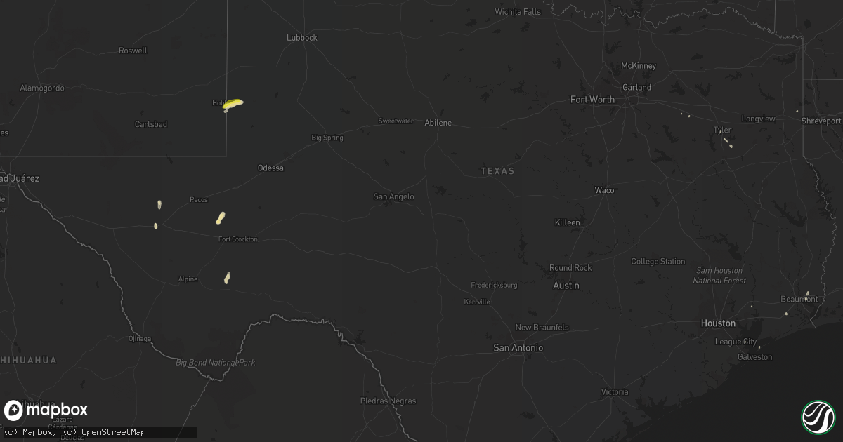
Hail Map in Texas on June 25, 2019
Get this storm
June 25 map
$229
one time, instant access
Download today. No call, no setup
Keep the $229
Bought the map and want the full workflow? Apply the entire $229 to a subscription within 7 days. None of it is wasted.
Every map, not just this one
This buys you this map. Subscription and you get every map we run, in the markets you choose from a few cities to whole states to nationwide. Plus real-time alerts the moment a storm fires.
Contact data
Name, contact info, occupancy, even credit band for addresses in the footprint. You go from where it hit to who to call.
Become the source they trust
Unlimited branding weather history reports on demand. You already have the documented answer ready for the property owner, and you are the one who showed up with it.
Property data and RoofTrace estimates
Pull up any address you have got, its value and the exact code rules for that jurisdiction, straight from One Click Code. Then RoofTrace estimates the squares, pitch, and roof value, priced the way you price.
Storm reports in Texas
Texas
| Date | Description |
|---|---|
| 06/25/20196:45 PM CDT | Third round of nickel to quarter size hail in gruver began at 645pm and continued until 650pm. |
| 06/25/20196:03 PM CDT | Second round of nickel to quarter size hail in gruver began at 603pm and continued until 610pm. |
| 06/25/20195:46 PM CDT | A local report indicates 1.00 inch wind near GRUVER |
| 06/25/20195:42 PM CDT | Late report from trained spotter of 60 mph wind gust. |
| 06/25/20194:38 PM CDT | A local report indicates 1.75 inch wind near 1 ESE PANHANDLE |
| 06/25/20194:14 PM CDT | Accumulating hail up to the size of quarters. |
| 06/25/20194:09 PM CDT | Facebook report of quarter size hail in panhandle. |
| 06/25/20194:01 PM CDT | A local report indicates 1.00 inch wind near 2 SW PANHANDLE |
| 06/25/20197:02 AM CDT | At 1202 AM CDT, severe thunderstorms were located along a line extending from Los Indios to Brownsville, moving northeast at 30 mph. HAZARD...60 mph wind gusts. SOURCE...Radar indicated. IMPACT...Expect damage to roofs, siding, and trees. Locations impacted include... San Benito, Los Fresnos, Rancho Viejo, Los Indios, Southmost, Olmito, La Paloma, Cameron Park, Laureles and Downtown Brownsville.This includes the following highways... Interstate Highway 69 E between mile markers 1 and 23. US Highway 281 between mile markers 820 and 838. |
| 06/25/20194:43 AM CDT | At 942 PM CDT, a severe thunderstorm was located 6 miles north of Amarillo, moving east at 15 mph. HAZARD...60 mph wind gusts and half dollar size hail. SOURCE...Radar indicated. IMPACT...Minor damage to roofs, siding, and trees is possible. Hail damage to vehicles is expected. Locations impacted include... Amarillo, Washburn and Pantex. |
| 06/25/20194:15 AM CDT | At 915 PM CDT, a severe thunderstorm was located 7 miles northwest of South Plains, or 14 miles southwest of Silverton, moving east at 15 mph. HAZARD...Golf ball size hail and 60 mph wind gusts. SOURCE...Radar indicated. IMPACT...People and animals outdoors will be injured. Expect hail damage to roofs, siding, windows, and vehicles. Expect wind damage to roofs, siding, and trees. Locations impacted include... South Plains. |
| 06/25/20193:22 AM CDT | At 821 AM CDT, a severe thunderstorm was located near Port Bolivar, or 7 miles north of Galveston Pier 21, moving east at 20 mph. HAZARD...60 mph wind gusts. SOURCE...Radar indicated. IMPACT...Expect damage to roofs, siding, and trees. Locations impacted include... Gilchrist, Rollover Pass, Port Bolivar, Bolivar Peninsula and Crystal Beach. |
| 06/25/20193:14 AM CDT | At 814 PM CDT, a severe thunderstorm was located 6 miles east of Claytonville, or 9 miles southwest of Silverton, moving southeast at 20 mph. HAZARD...60 mph wind gusts and quarter size hail. SOURCE...Radar indicated. IMPACT...Hail damage to vehicles is expected. Expect wind damage to roofs, siding, and trees. Locations impacted include... Silverton, Caprock Canyon State Park, Happy, Quitaque, Claytonville and Mackenzie Reservoir. |
| 06/25/20192:31 AM CDT | At 731 PM CDT, a severe thunderstorm was located 8 miles northeast of Happy, or 15 miles southeast of Canyon, moving north at 15 mph. HAZARD...60 mph wind gusts and half dollar size hail. SOURCE...Radar indicated. IMPACT...Minor damage to roofs, siding, and trees is possible. Hail damage to vehicles is expected. Locations impacted include... Canyon, Wayside and Palo Duro Canyon. |
| 06/25/20192:13 AM CDT | At 713 PM CDT, a severe thunderstorm was located 5 miles northwest of Caprock Canyon State Park, moving southeast at 25 mph. HAZARD...70 mph wind gusts and quarter size hail. SOURCE...Radar indicated. IMPACT...Hail damage to vehicles is expected. Expect considerable tree damage. Wind damage is also likely to mobile homes, roofs, and outbuildings. Locations impacted include... Tulia, Silverton, Turkey, Caprock Canyon State Park, Happy, Quitaque, Valley Schools, Claytonville, Mackenzie Reservoir, Brice, Lakeview and Plaska Community. |
| 06/25/20191:17 AM CDT | At 616 PM CDT, a severe thunderstorm was located 15 miles west of Brice, or 16 miles northeast of Silverton, moving southeast at 35 mph. HAZARD...Two inch hail and 70 mph wind gusts. SOURCE...Radar indicated. IMPACT...People and animals outdoors will be injured. Expect hail damage to roofs, siding, windows, and vehicles. Expect considerable tree damage. Wind damage is also likely to mobile homes, roofs, and outbuildings. Locations impacted include... Silverton, Turkey, Caprock Canyon State Park, Quitaque, Valley Schools, Mackenzie Reservoir and Brice. |
| 06/25/20191:03 AM CDT | At 603 PM CDT, a severe thunderstorm was located 19 miles southwest of Grandfalls, or 25 miles southeast of Pecos, moving north at 25 mph. HAZARD...60 mph wind gusts and half dollar size hail. SOURCE...Radar indicated. IMPACT...Hail damage to vehicles is expected. Expect wind damage to roofs, siding, and trees. Locations impacted include... Coyanosa and B F Goodrich Testing Track. |
| 06/25/20191:02 AM CDT | At 602 PM CDT, a severe thunderstorm was located over Gruver, or 12 miles west of Spearman, moving southeast at 25 mph. HAZARD...60 mph wind gusts and quarter size hail. SOURCE...Radar indicated. IMPACT...Minor damage to roofs, siding, and trees is possible. Hail damage to vehicles is expected. Locations impacted include... Spearman, Gruver, Waka and Morse. |
| 06/25/201912:45 AM CDT | At 544 PM CDT, a severe thunderstorm was located 12 miles southwest of Goodnight, or 14 miles south of Claude, moving southeast at 20 mph. HAZARD...60 mph wind gusts and half dollar size hail. SOURCE...Radar indicated. IMPACT...Minor damage to roofs, siding, and trees is possible. Hail damage to vehicles is expected. Locations impacted include... Clarendon, Wayside and Goodnight. |
| 06/25/201912:32 AM CDT | At 531 PM CDT, a severe thunderstorm was located 5 miles southeast of Claude, moving southeast at 20 mph. HAZARD...60 mph wind gusts and half dollar size hail. SOURCE...Radar indicated. IMPACT...Minor damage to roofs, siding, and trees is possible. Hail damage to vehicles is expected. Locations impacted include... Claude and Goodnight. |
| 06/24/201911:57 PM CDT | At 457 PM CDT, a severe thunderstorm was located near Goodnight, or 10 miles east of Claude, moving northeast at 20 mph. HAZARD...60 mph wind gusts and half dollar size hail. SOURCE...Radar indicated. IMPACT...Minor damage to roofs, siding, and trees is possible. Hail damage to vehicles is expected. Locations impacted include... Groom and Goodnight. |
| 06/24/201910:57 PM CDT | At 357 PM CDT, a severe thunderstorm was located 5 miles southeast of Panhandle, moving east at 10 mph. HAZARD...60 mph wind gusts and quarter size hail. SOURCE...Radar indicated. IMPACT...Minor damage to roofs, siding, and trees is possible. Hail damage to vehicles is expected. Locations impacted include... Panhandle, White Deer, Groom and Kingsmill. |
| 06/24/20199:45 PM CDT | A local report indicates 1.50 inch wind near 7 N AMARILLO |
| 06/24/20199:44 PM CDT | Late report via facebook of golf ball size hail with time estimated from radar. |
| 06/24/20199:44 PM CDT | Late report from facebook of half dollar size hail. |
| 06/24/20199:40 PM CDT | Sporadic half dollar size hail reported at kfda studio. |
| 06/24/20197:40 PM CDT | Time estimated from radar |
| 06/24/20197:35 PM CDT | Time estimated from radar |
| 06/24/20197:14 PM CDT | Sustained wind was 47 mph from the north-northwest. |
All States Impacted by Hail Map on June 25, 2019
Cities Impacted by Hail Map on June 25, 2019
- Benedict, KS
- Fredonia, KS
- Eunice, NM
- Hemingford, NE
- Veteran, WY
- Lingle, WY
- Torrington, WY
- Harrison, NE
- Morrill, NE
- Selma, AL
- Marion Junction, AL
- Farwell, NE
- Van Tassell, WY
- Panhandle, TX
- Amarillo, TX
- Sargent, NE
- Burwell, NE
- Toronto, KS
- Lost Springs, WY
- Shawnee, WY
- Manville, WY
- Marion, AL
- Centreville, AL
- Lawley, AL
- Lockney, TX
- Tulia, TX
- Silverton, TX
- Kress, TX
- Knoxville, IA
- Otley, IA
- Centerville, IA
- Mystic, IA
- Aladdin, WY
- Naponee, NE
- Exline, IA
- Moulton, IA
- Glenwood, MO
- Cincinnati, IA
- Unionville, MO
- Coatsville, MO
- Livonia, MO
- Weston, WY
- Spearfish, SD
- Moorcroft, WY
- Hulett, WY
- Alva, WY
- Belle Fourche, SD
- Saint Onge, SD
- Beulah, WY
- Sundance, WY
- Prescott, IA
- Gruver, TX
- Beloit, WI
- Lusk, WY
- Yates Center, KS
- Wann, OK
- Elliott, IA
- Sylvan Grove, KS
- Albia, IA
- Peoria Heights, IL
- Trivoli, IL
- Hanna City, IL
- Brimfield, IL
- Farmington, IL
- Peoria, IL
- Edwards, IL
- Elmwood, IL
- Conehatta, MS
- Lodge Grass, MT
- Claude, TX
- Wayside, TX
- Delaware, OK
- Donaldsonville, LA
- Genoa, NE
- Douds, IA
- Selma, IA
- La Harpe, IL
- Dallas City, IL
- Palmer, NE
- Wolbach, NE
- Argenta, IL
- Quitaque, TX
- Skellytown, TX
- Burr Oak, KS
- Guide Rock, NE
- Crete, NE
- Lewis, IA
- Brodhead, WI
- Afton, WI
- Durand, IL
- Rockton, IL
- Janesville, WI
- Hamshire, TX
- Winnie, TX
- Happy, TX
- Coyanosa, TX
- Liberty, MS
- Alexander, KS
- Bazine, KS
- Heartwell, NE
- Beloit, KS
- Blue Hill, NE
- Nelson, NE
- Bladen, NE
- Kenesaw, NE
- Glasco, KS
- Holstein, NE
- Campbell, NE
- Hardy, NE
- Jamestown, KS
- Courtland, KS
- Superior, NE
- Esbon, KS
- Scandia, KS
- Ayr, NE
- Jewell, KS
- Red Cloud, NE
- Concordia, KS
- Roseland, NE
- Inavale, NE
- Republic, KS
- Belleville, KS
- Juniata, NE
- Minden, NE
- Formoso, KS
- Webber, KS
- Norway, KS
- Glenvil, NE
- Lawrence, NE
- Lebanon, KS
- Mankato, KS
- Hastings, NE
- Riverton, NE
- Edgar, MT
- Bridger, MT
- Joliet, MT
- Corning, IA
- Green, KS
- Clyde, KS
- Clifton, KS
- Bradshaw, NE
- York, NE
- Garryowen, MT
- Saint Xavier, MT
- Brownville, NE
- Watson, MO
- Rock Port, MO
- Peru, NE
- Van Horn, TX
- Hamilton, KS
- Virgil, KS
- Bingham, NE
- Blandinsville, IL
- Albion, NE
- Petersburg, NE
- Turpin, OK
- Hugoton, KS
- Liberal, KS
- Everglades City, FL
- Humeston, IA
- Osceola, IA
- Corydon, IA
- Woodburn, IA
- Weldon, IA
- Osceola, NE
- Copan, OK
- Caney, KS
- Forgan, OK
- Primrose, NE
- Spalding, NE
- Howard, KS
- Red Oak, IA
- Griswold, IA
- Shannon City, IA
- Villisca, IA
- Diagonal, IA
- Cumberland, IA
- Massena, IA
- Grant, IA
- Orient, IA
- Lenox, IA
- Fontanelle, IA
- Creston, IA
- Bridgewater, IA
- South Bend, IN
- Macomb, IL
- Sciota, IL
- Bardolph, IL
- Adair, IL
- Saint Paul, NE
- Cedar Point, KS
- Dickinson, TX
- Greensboro, AL
- Gallion, AL
- Orlando, FL
- Oviedo, FL
- Murray, IA
- Thayer, IA
- Broken Bow, NE
- Sturgis, SD
- Fort Davis, TX
- Kellerton, IA
- Mount Ayr, IA
- Golden City, MO
- Grapevine, AR
- Sheridan, AR
- White Hall, AR
- Solomon, KS
- Bennington, KS
- Miltonvale, KS
- Minneapolis, KS
- Seminole, TX
- Elba, NE
- Greeley, NE
- Archer, NE
- Clarks, NE
- Central City, NE
- Fullerton, NE
- Cedar Rapids, NE
- Scotia, NE
- Ericson, NE
- Ord, NE
- Comstock, NE
- Brock, NE
- Julian, NE
- Nebraska City, NE
- Talmage, NE
- Auburn, NE
- Leon, IA
- Port Barre, LA
- Palmetto, LA
- Memphis, MO
- Cantril, IA
- Milton, IA
- Marathon, TX
- Fort Stockton, TX
- Chicago, IL
- Chelsea, OK
- Melrose, IA
- Russell, IA
- Moravia, IA
- Plano, IA
- Longton, KS
- Elk City, KS
- Deadwood, SD
- Whitewood, SD
- Canton, IL
- Glasford, IL
- Glenrock, WY
- Danvers, IL
- Carlock, IL
- Bloomington, IL
- Hudson, IL
- Normal, IL
- Alma, KS
- Wamego, KS
- Whitehouse, TX
- Sanford, FL
- Osyka, MS
- Edgemont, SD
- Hattiesburg, MS
- Geneva, NE
- Davenport, NE
- Edgar, NE
- Sutton, NE
- Ong, NE
- Shickley, NE
- Assaria, KS
- Tampa, KS
- Vidor, TX
- Carthage, IL
- Colchester, IL
- Anita, IA
- Wiota, IA
- Chariton, IA
- Kahoka, MO
- Farmington, IA
- Luray, MO
- Mount Sterling, IA
- Bonaparte, IA
- Eckerman, MI
- Shelby, NE
- Rising City, NE
- Swanton, NE
- De Witt, NE
- Wilber, NE
- Piedmont, KS
- Melrose Park, IL
- Fairbury, NE
- Aurora, CO
- Hillsboro, IA
- Diller, NE
- Steele City, NE
- Odell, NE
- Jay Em, WY
- Benedict, NE
- Stromsburg, NE
- Polk, NE
- Hampton, NE
- Goodwell, OK
- Miami, TX
- Rolling Prairie, IN
- New Carlisle, IN
- Baton Rouge, LA
- Western, NE
- Denton, NE
- Plymouth, NE
- Hordville, NE
- McCool Junction, NE
- Anselmo, NE
- Taylor, NE
- Milford, NE
- Elyria, NE
- Daykin, NE
- Tobias, NE
- Milligan, NE
- Seward, NE
- Saint Edward, NE
- Friend, NE
- Lindsay, NE
- Surprise, NE
- Silver Creek, NE
- Pleasant Dale, NE
- Cordova, NE
- Newman Grove, NE
- Waco, NE
- Marquette, NE
- Fairmont, NE
- Dorchester, NE
- Beaver Crossing, NE
- Belgrade, NE
- Martell, NE
- Utica, NE
- North Loup, NE
- Hallam, NE
- Dunning, NE
- Columbus, NE
- Ashton, NE
- Arcadia, NE
- Bartlett, NE
- Exeter, NE
- Roca, NE
- Goehner, NE
- Neodesha, KS
- Altoona, KS
- Mercer, MO
- Lineville, IA
- West Point, IL
- Bowen, IL
- Ellsworth, NE
- London Mills, IL
- Canton, KS
- S Coffeyville, OK
- Coffeyville, KS
- Canton, TX
- Lorimor, IA
- Nauvoo, IL
- Argyle, IA
- Keokuk, IA
- Wayland, MO
- Hamilton, IL
- Montrose, IA
- Clinton, LA
- Marysville, KS
- Bloomfield, IA
- Floris, IA
- Independence, KS
- Enterprise, KS
- Abilene, KS
- Marietta, IL
- Molino, FL
- Humboldt, KS
- Savonburg, KS
- Erie, KS
- Norwalk, IA
- Baker, FL
- Metamora, IL
- Elk Falls, KS
- Michigan City, IN
- Burns, KS
- Laurel Hill, FL
- Larned, KS
- Agra, KS
- Republican City, NE
- Kensington, KS
- Phillipsburg, KS
- Bloomington, NE
- El Dorado, KS
- Morganville, KS
- Salina, KS
- Lindsborg, KS
- New Cambria, KS
- Gypsum, KS
- Tescott, KS
- Clay Center, KS
- Glendo, WY
- Ewing, NE
- Ness City, KS
- Petal, MS
- Greensburg, LA
- Lead, SD
- Herington, KS
- Balko, OK
- Beaver, OK
- Spearman, TX
- Manhattan, KS
- Riley, KS
- Carbon, IA
- Van Wert, IA
- Seymour, IA
- Benton, IA
- Udell, IA
- Unionville, IA
- Drakesville, IA
- Ellston, IA
- Tingley, IA
- Cromwell, IA
- Powersville, MO
- Derby, IA
- Promise City, IA
- Afton, IA
- Davis City, IA
- Truro, IA
- Decatur, IA
- New Virginia, IA
- Lamoni, IA
- Clio, IA
- Redding, IA
- Allerton, IA
- Garden Grove, IA
- Millerton, IA
- Clearfield, IA
- Grand River, IA
- Blythedale, MO
- Cainsville, MO
- Marengo, IA
- Amana, IA
- New Sharon, IA
- Chambers, NE
- Gresham, NE
- Ulysses, NE
- Chanute, KS
- Agenda, KS
- Canyon, TX
- Cumming, IA
- Sedgwick, CO
- Baldwin City, KS
- Grove, OK
- Palmer, KS
- La Porte, IN
- Oelrichs, SD
- Hot Springs, SD
- Nowata, OK
- Helena, AR
- Clarendon, TX
- Groom, TX
- East Peoria, IL
- Donnellson, IA
- Mendon, IL
- Sutter, IL
- Eureka, IL
- Stanton, IA
- Denham Springs, LA
- Augusta, IL
- Plymouth, IL
- Basco, IL
- Raymond, NE
- Valparaiso, NE
- Niota, IL
- North Liberty, IN
- Randolph, KS
- Devils Tower, WY
- Mill Creek, IN
- Oak Park, IL
- Otter, MT
- Worthington, MO
- Burdett, KS
- Greenfield, IA
- Saint Francisville, LA
- Carson, IA
- Tyler, TX
- Carencro, LA
- Smithfield, IL
- Thayer, KS
- Covington, LA
- Haddam, KS
- West Blocton, AL
- Brierfield, AL
- Three Oaks, MI
- Lakeville, IN
- New Buffalo, MI
- Bremen, IN
- Forest, MS
- Lake, MS
- Decatur, MS
- Piedmont, SD
- Good Hope, IL
- Westmoreland, KS
- Eureka, KS
- Casey, IA
- Adair, IA
- Loraine, IL
- Avon, IL
- Industry, IL
- Bushnell, IL
- Crestview, FL
- Douglas, WY
- Natchez, MS
- Ursa, IL
- Grinnell, KS
- Decker, MT
- Leonardville, KS
- Springfield, LA
- Naples, FL
- Tennessee, IL
- Lomax, IL
- Ainsworth, IA
- Cuba, KS
- Fromberg, MT
- Gloster, MS
- Saint James, LA
- Fort Scott, KS
- Morrowville, KS
- Grenola, KS
- Lancaster, MO
- Hope, KS
- Magnolia, MS
- Amite, LA
- Prairie City, IL
- Nappanee, IN
- Columbia, MS
- Narka, KS
- Vinita, OK
- Eglin Afb, FL
- Newcastle, WY
- Chapman, KS
- Randall, KS
- Laverne, OK
- Joplin, MO
- Garland, NE
- Birmingham, IA
- Keosauqua, IA
- Iola, KS
- Washington, KS
- Liberty, KS
- Wahoo, NE
- Independence, LA
- Holden, LA
- Newberry, MI
- Lucas, IA
- Pulaski, IA
- Blockton, IA
- Nodaway, IA
- Sharpsburg, IA
- Emerson, IA
- Paola, KS
- Monticello, MS
- Monroe, IA
- Follett, TX
- Frostproof, FL
- Carthage, MO
- Perryton, TX
- Atlantic, IA
- Home, KS
- Fall River, KS
- Sherrill, AR
- Plattsmouth, NE
- Durham, KS
- Hermanville, MS
- Plainville, KS
- Barnes City, IA
- Washington, IL
- Hollywood, FL
- Franklin, NE
- Oak, NE
- Fairfield, NE
- Foxworth, MS
- Lettsworth, LA
- Mapleton, IL
- Woodbine, KS
- Gillett, AR
- Purvis, MS
- Wever, IA
- Karnack, TX
- Ellis, KS
- Dayton, TX
- Woodville, MS
- Sedan, KS
- Uniontown, AL
- Safford, AL
- Hammond, LA
- Prairieville, LA
- Gonzales, LA
- Morton, MS
- De Witt, AR
- Inland, NE
- Trumbull, NE
- Benton, AR
- Prattsville, AR
- Carterville, MO
- Webb City, MO
- La Harpe, KS
- Thomaston, AL
- Dewey, OK
- Port Charlotte, FL
- Quitman, MS
- Stinnett, TX
- Dundee, MS
- New Market, IA
- Bay Minette, AL
- Lonoke, AR
- Carlisle, AR
- Westville, FL
- Broadus, MT
- Miami, FL
- Faunsdale, AL
- Linden, AL
- Morganza, LA
- Batchelor, LA
- Kenansville, FL
- Merriman, NE
- Kissimmee, FL
- Marion, KS
- Hobbs, NM
- Alliance, NE
- Angora, NE
- Richton, MS
- Port Bolivar, TX
- Defuniak Springs, FL
- Exira, IA
- Saint Gabriel, LA
- Troup, TX
- Deltona, FL
- Seneca, MO
- Table Grove, IL
- Angola, LA
- La Cygne, KS
- McCune, KS
- Pittsburg, KS
- Halstead, KS
- Zolfo Springs, FL
- Havana, KS
- Cherryvale, KS
- Franklinton, LA
- Jasper, MO
- Fairview, IL
- Yates City, IL
- Uniontown, KS
- Redfield, KS
- Zachary, LA
- Maurepas, LA
- Clinton, IL
- Maroa, IL
- Pella, IA
- Pleasantville, IA
- Casper, WY
- Arbela, MO
- Fort Madison, IA
- Cuba, IL
- Warsaw, IL
- Omaha, NE
- Olsburg, KS
- Elmdale, KS
- Orange, TX
- Bremen, KS
- Oketo, KS
- Lake Wales, FL
- Roanoke, IL
- Sunray, TX
- England, AR
- Humnoke, AR
- Wabbaseka, AR
- Jansen, NE
- Columbus, KS
- Indianola, IA
- Haines City, FL
- Gove, KS
- Piqua, KS
- Borger, TX
- Kismet, KS
- Rolla, KS
- Guymon, OK
- Lance Creek, WY
- Lucas, KS
- Crawfordville, FL
- Aurora, KS
- Ipava, IL
- Elvaston, IL
- Peru, IA


